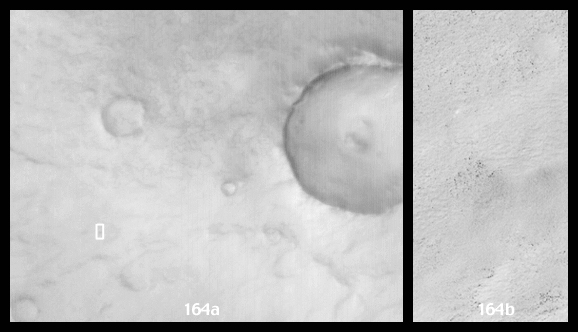
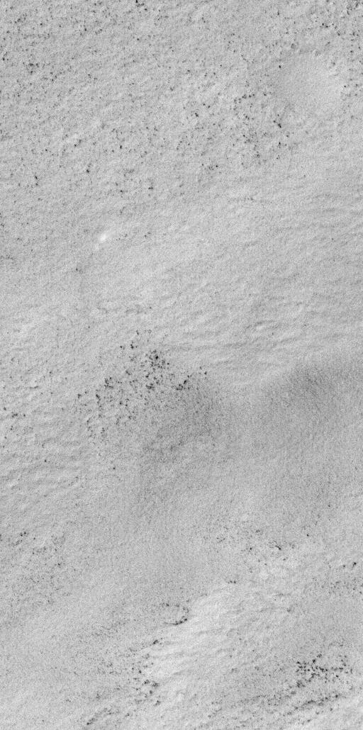
July 1999--Spring is rapidly approaching for the martian southern hemisphere. Over the past month, much of the high southern latitudes of Mars have emerged from nearly 5 months of wintertime darkness, revealing a bright, frost-covered surface that presently extends from about 57°S to the south pole. Frosts at this time of year can consist of both frozen carbon dioxide ("dry ice") and frozen water. The above images are interpreted to show surfaces covered by water frost, because the temperature of the surface at the time the images were acquired was about -184°F or -120°C (visit the Thermal Emission Spectrometer to see an example of their data). This temperature is above the freezing point of carbon dioxide (around -200°F = -130°C).
The pair of Mars Global Surveyor Mars Orbiter Camera (MOC) images presented here show a snow-covered surface located on Malea Planum, south of the giant Hellas impact basin. These pictures were taken simultaneously on July 18, 1999. The first image (left) is a MOC red camera wide angle context view showing the location of the higher-resolution narrow angle camera view (right). The white box in the context image indicates the location of the high-resolution view. Small black dots in the narrow angle image (right) are boulders and other surfaces from which the snow has been defrosted. The large crater in the wide angle (left) image is about 36 km (22 mi.) across. The narrow angle (right) image covers an area 3 km (1.9 mi) wide at a resolution of 3 meters (10 feet) per pixel. Illumination in each image is from the upper left.
Malin Space Science Systems and the California Institute of Technology built the MOC using spare hardware from the Mars Observer mission. MSSS operates the camera from its facilities in San Diego, CA. The Jet Propulsion Laboratory's Mars Surveyor Operations Project operates the Mars Global Surveyor spacecraft with its industrial partner, Lockheed Martin Astronautics, from facilities in Pasadena, CA and Denver, CO.
