PIA02054: Mars Gravity Map (RS)
 Target Name:  Mars
 Is a satellite of:  Sol (our sun)
 Mission:  Mars Global Surveyor (MGS)
 Spacecraft:  Mars Global Surveyor Orbiter
 Instrument:  Imaging Radar
 Product Size:  2871 x 2520 pixels (w x h)
 Produced By:  Goddard Space Flight Center
 Addition Date:  1999-06-23
 Primary Data Set:  MGS EDRs
 Full-Res TIFF:  PIA02054.tif (4.572 MB)
 Full-Res JPEG:  PIA02054.jpg (618.1 kB)

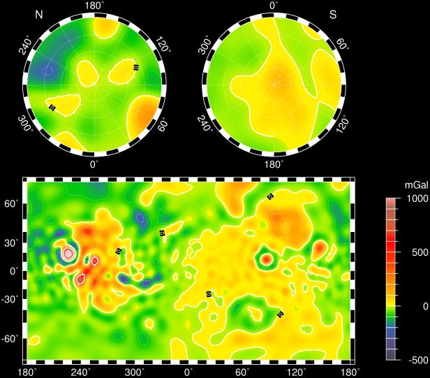
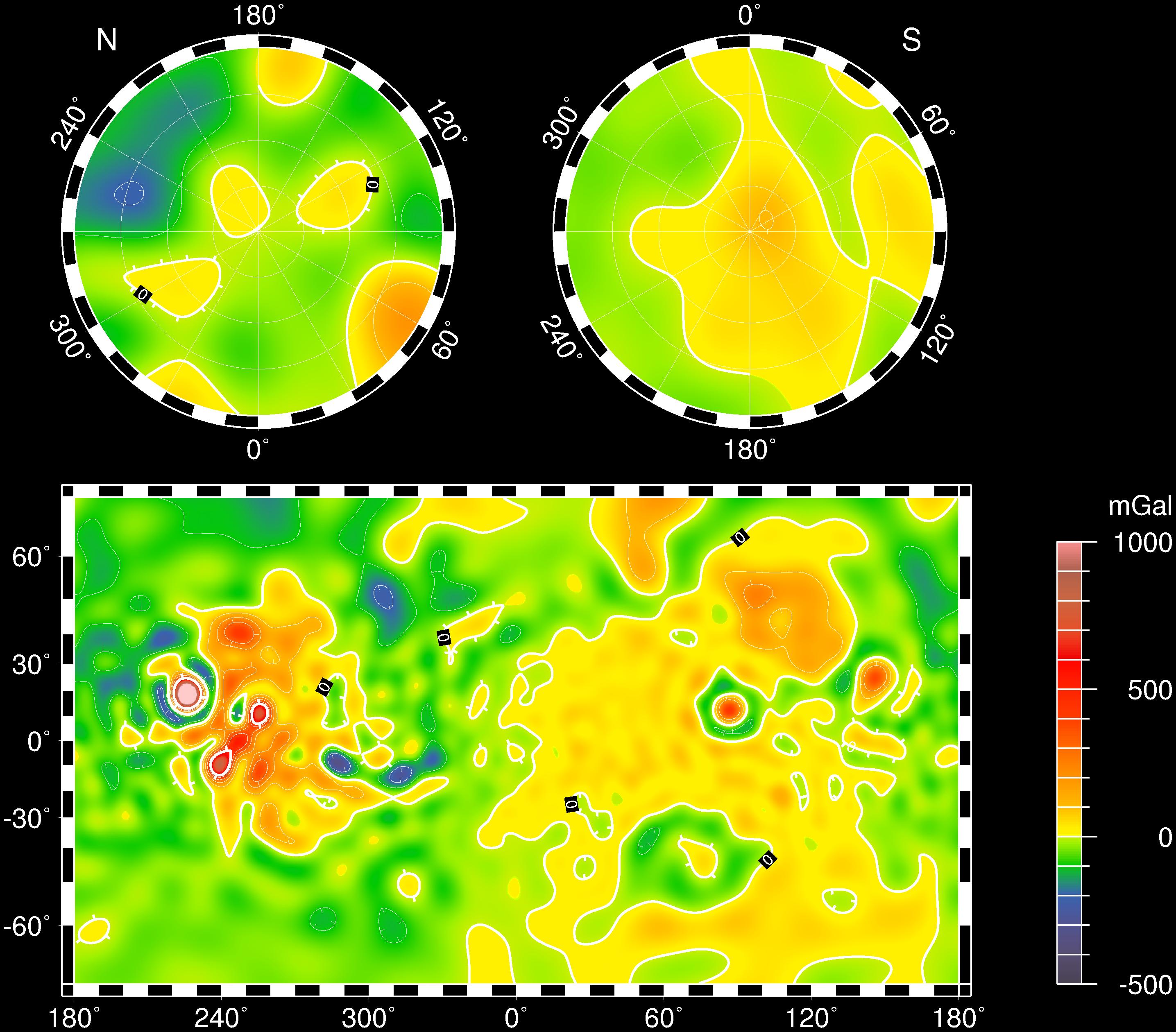
Click on the image above to download a moderately sized image in JPEG format (possibly reduced in size from original)

Original Caption Released with Image:

Vertical gravity map of Mars color-coded in mgals based on radio tracking. Note correlations and lack of correlations with the global topography.

Image Credit:
NASA/JPL/GSFC

Image Addition Date:
1999-06-23