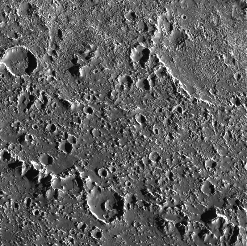
This fascinating region of Jupiter's icy moon, Callisto, shows the transition from the inner part of an enormous impact basin, Asgard, to the outer "surrounding plains." Small, bright, fine textured, closely spaced bumps appear throughout the inner part of the basin (top of image) and create a more fine textured appearance than that seen on many of the other inter-crater plains on Callisto. At low resolution, these icy bumps make Asgard's center brighter than the surrounding terrain. What caused the bumps to form is still unknown, but they are associated clearly with the impact that formed Asgard.
The ridge that cuts diagonally across the lower left corner is one of many giant concentric rings that extend for hundreds of kilometers outside Asgard's center. Exterior to the ring (lower left corner), Callisto's surface changes significantly. Still peppered with craters, the number of icy bumps decreases while their average size increases. The fine texture is not as visible in the middle of the image. One explanation is that material from raised features (such as the ridge) may slide down slope and cover small scale features. Such images of Callisto help us understand the dynamics of giant impacts into icy surfaces, and how the large structures change with time.
North is to the top of the picture. The image, centered at 27.1 degrees north latitude and 142.3 degrees west longitude, covers an area approximately 80 kilometers (50 miles) by 90 kilometers (55 miles). The resolution is about 90 meters (295 feet) per picture element. The image was taken on September 17th, 1997 at a range of 9200 kilometers (5700 miles) by the Solid State Imaging (SSI) system on NASA's Galileo spacecraft during its tenth orbit of Jupiter.
The Jet Propulsion Laboratory, Pasadena, CA manages the Galileo mission for NASA's Office of Space Science, Washington, DC.
This image and other images and data received from Galileo are posted on the World Wide Web, on the Galileo mission home page at URL http://solarsystem.nasa.gov/galileo/. Background information and educational context for the images can be found at URL http://www.jpl.nasa.gov/galileo/sepo
 Planetary Data System


