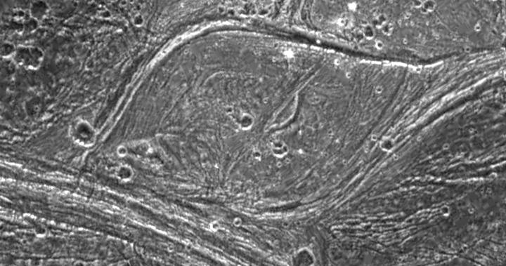
Complex tectonism is evident in these images of Ganymede's surface. The solid state imaging camera on NASA's Galileo spacecraft imaged this region as it passed Ganymede during its second orbit through the Jovian system. The 80 kilometer (50 mile) wide lens-shaped feature in the center of the image is located at 32 degrees latitude and 188 degrees longitude along the border of a region of ancient dark terrain known as Marius Regio, and is near an area of younger bright terrain named Nippur Sulcus. The tectonism that created the structures in the bright terrain nearby has strongly affected the local dark terrain to form unusual structures such as the one shown here. The lens-like appearance of this feature is probably due to shearing of the surface, where areas have slid past each other and also rotated slightly. Note that in several places in these images, especially around the border of the lens-shaped feature, bright ridges appear to turn into dark grooves. Analysis of the geologic structures in areas like this are helping scientists to understand the complex tectonic history of Ganymede.
North is to the top-left of the image, and the sun illuminates the surface from the southeast. The image covers an area about 63 kilometers (39 miles) by 120 kilometers (75 miles) across at a resolution of 188 meters (627 feet) per picture element. The images were taken on September 6, 1996 at a range of 18,522 kilometers (11,576 miles) by the solid state imaging (CCD) system on NASA's Galileo spacecraft.
The Jet Propulsion Laboratory, Pasadena, CA manages the Galileo mission for NASA's Office of Space Science, Washington, DC. JPL is an operating division of California Institute of Technology (Caltech).
This image and other images and data received from Galileo are posted on the World Wide Web, on the Galileo mission home page at URL http://galileo.jpl.nasa.gov.
