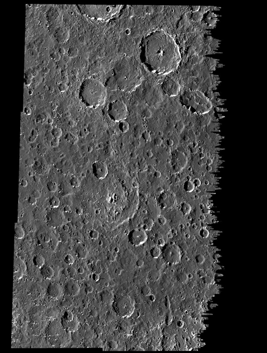
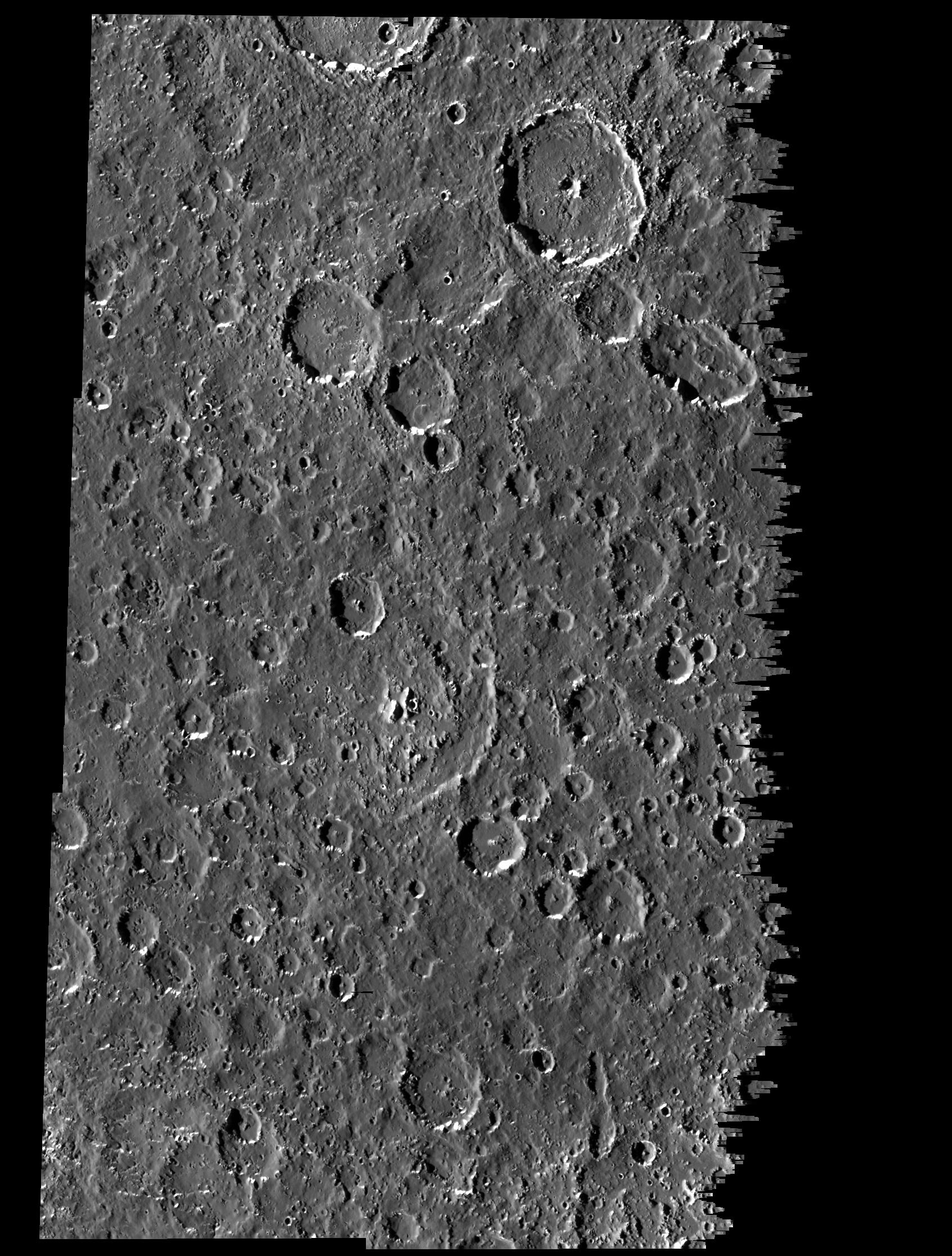
This mosaic covers part of the equatorial region of Jupiter's moon, Callisto. The mosaic combines six separate image frames obtained by the solid state imaging (CCD) system on NASA's Galileo spacecraft during its ninth orbit around Jupiter. North is to the top of the picture. The mosaic shows several new features and characteristics of the surface revealed by Galileo. These include deposits that may represent landslides in the southern and southwestern floors of many craters. Two such deposits are seen in a 12 kilometer (7.3 mile) crater in the west-central part of the image, and in a 23 kilometer (14 mile) crater just north of the center of the image. Also notable are several sinuous valleys emanating from the southern rims of 10 to 15 kilometer (6.2 to 9.3 mile) irregular craters in the west-central part of the image. The pervasive local smoothing of Callisto's surface is well represented in the plains between the craters in the southeastern part of the image. Possible oblique impacts are suggested by the elongated craters in the northeastern and southeastern parts of the image.
The mosaic, centered at 7.4 degrees south latitude and 6.6 degrees west longitude, covers an area of approximately 315 by 215 kilometers (192 by 131 miles). The sun illuminates the scene from the west (left). The smallest features that can be seen are about 300 meters (993 feet) across. The images were obtained on June 25, 1997, when the spacecraft was at a range of 15,200 kilometers (8,207 miles) from Callisto.
The Jet Propulsion Laboratory, Pasadena, CA manages the Galileo mission for NASA's Office of Space Science, Washington, DC.
This image and other images and data received from Galileo are posted on the World Wide Web, on the Galileo mission home page at URL http://galileo.jpl.nasa.gov. Background information and educational context for the images can be found at http://www.jpl.nasa.gov/galileo/sepo.
 Planetary Data System


