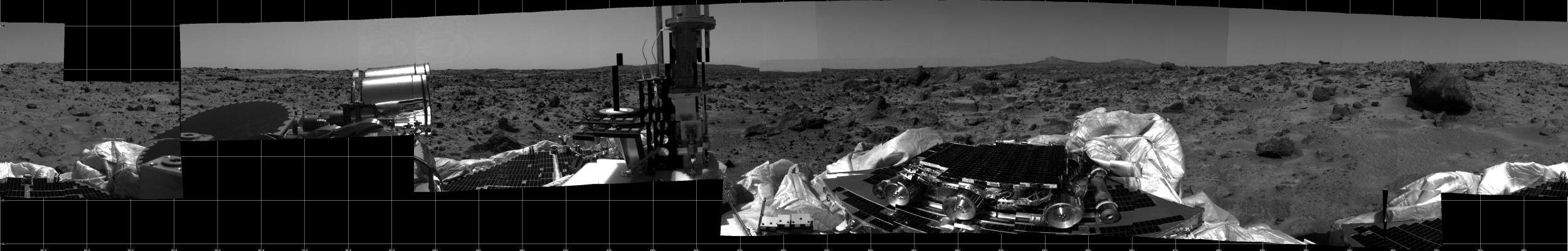
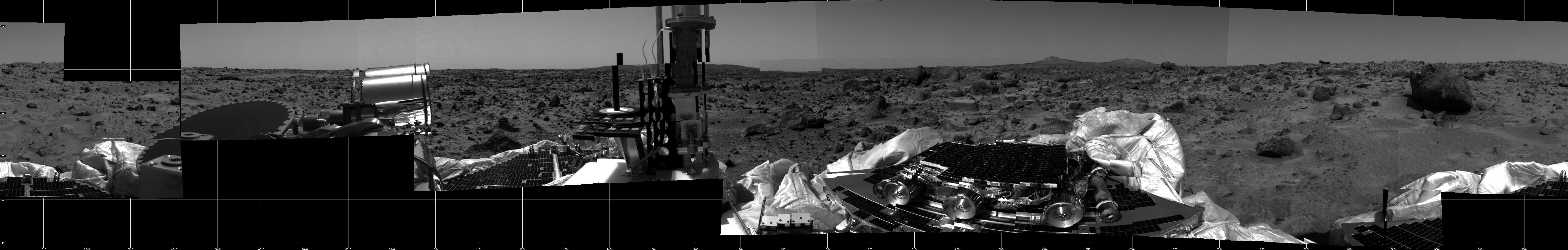
This photomosaic was taken by the Imager for Mars Pathfinder (IMP) camera on July 4, 1997 between 4:00-4:30 p.m. PDT. The foreground is dominated by the lander, newly renamed the Sagan Memorial Station after the late Dr. Carl Sagan. All three petals have been fully deployed. Upon one of the petals is the Sojourner microrover in its stowed position. The metallic cylinders at either end of Sojourner are the rover deployment ramps. Visible at the rear end (right) of the rover is the Alpha Proton X-Ray Spectrometer (APXS) instrument. Located to the right of the center petal is a dark, circular object and a bright, metallic object. Both are components of the high gain antenna. The black post, bull's-eye rings, and small shaded blocks in the far right portion of the image are components of the calibration targets.
Terrain of the Ares Vallis region of Mars is in the background. The sections of soil and the large rocks surrounding the lander will provide the rover with numerous opportunities to employ the APXS. The prominent hills in the background will aid scientists in determining the exact site of the spacecraft.
The dark blocks at the lower and upper left of the panorama represent gaps in the data transmission to Earth.
Mars Pathfinder is the second in NASA's Discovery program of low-cost spacecraft with highly focused science goals. The Jet Propulsion Laboratory, Pasadena, CA, developed and manages the Mars Pathfinder mission for NASA's Office of Space Science, Washington, D.C. The Imager for Mars Pathfinder (IMP) was developed by the University of Arizona Lunar and Planetary Laboratory under contract to JPL. Peter Smith is the Principal Investigator.
Photojournal note: Sojourner spent 83 days of a planned seven-day mission exploring the Martian terrain, acquiring images, and taking chemical, atmospheric and other measurements. The final data transmission received from Pathfinder was at 10:23 UTC on September 27, 1997. Although mission managers tried to restore full communications during the following five months, the successful mission was terminated on March 10, 1998.
 Planetary Data System


