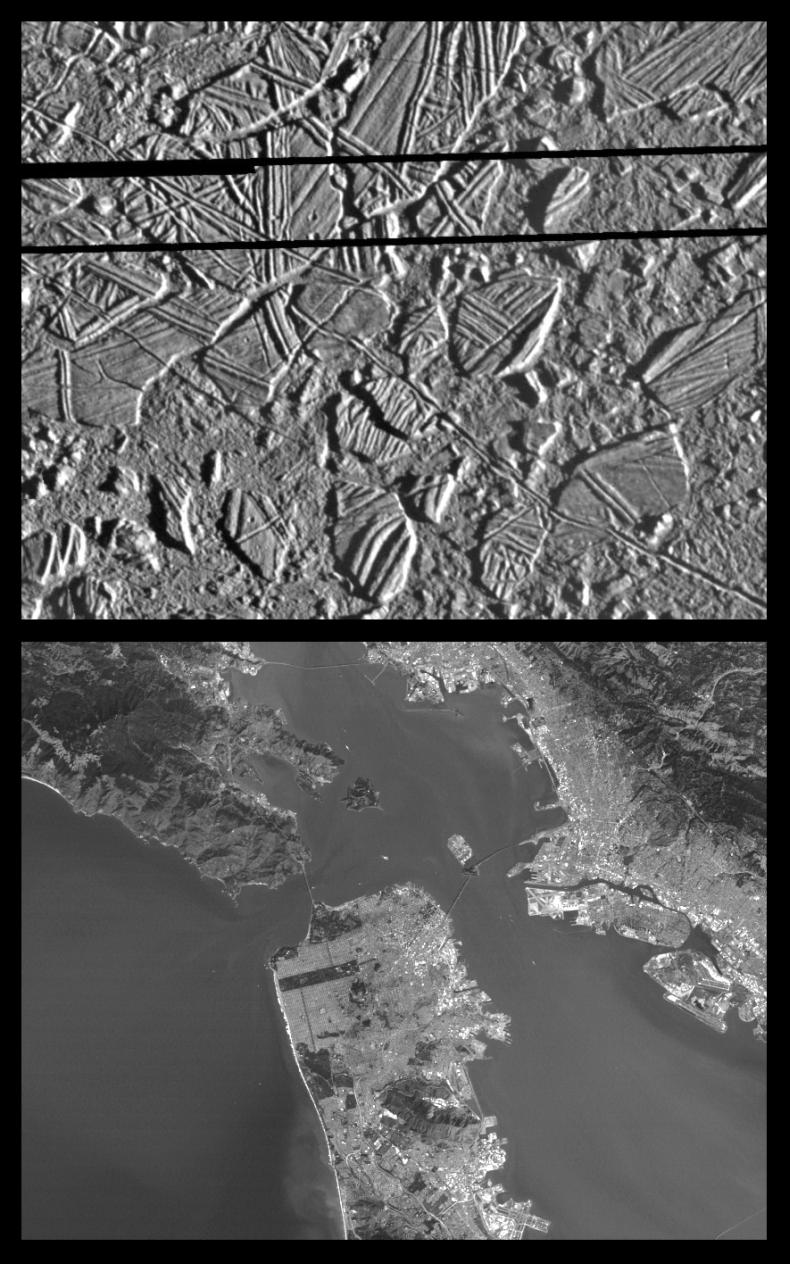
This is the third in a series of five products at increasing resolutions that compare images of various areas on Jupiter's moon Europa (top frame) to the same location on Earth, the San Francisco Bay area of California (bottom frame). Both images show areas of equal size, 34 by 42 kilometers (21 by 26 miles), and resolution, 54 meters (59 yards). North is to the top of the picture.
This high resolution image shows Europa's ice-rich crust with crustal plates ranging up to 13 kilometers (8 miles) across, which have been broken apart and "rafted" into new positions, superficially resembling the disruption of pack-ice on polar seas during spring thaws on Earth. The size and geometry of these features suggest that motion was enabled by ice-crusted water or soft ice close to the surface at the time of disruption. This Europa image is centered at 9.4 degrees north latitude, 274 degrees west longitude,
The San Francisco Bay portion of this image pair helps to give the viewer some sense of scale as it relates to the size of the Europa "ice rafts." Look, for example, at the cratered "ice raft" in the lower left hand portion of the Europa image. Compare that to such features in the Bay area image as Treasure Island Naval Station, (center frame) and the San Francisco International Airport (bottom right). Also in this image, at 54 meters resolution, structural features such as the Golden Gate Bridge and the Bay Bridge are clearly visible.
The Europa image was obtained from a range of 5,340 kilometers (3,320 miles) by the Solid State Imaging (CCD) system aboard NASA's Galileo spacecraft on February 20th, 1997 (Universal Time). The San Francisco Bay area image, from the LandSat Thematic Mapper, has been reprocessed to match Galileo's resolution so as to offer a sense of the size of the features visible on Europa's surface.
The Jet Propulsion Laboratory, Pasadena, CA manages the mission for NASA's Office of Space Science, Washington, DC.
This image and other images and data received from Galileo are posted on the World Wide Web, on the Galileo mission home page at URL http://galileo.jpl.nasa.gov. Background information and educational context for the images can be found at http://www.jpl.nasa.gov/galileo/sepo.
 Planetary Data System


