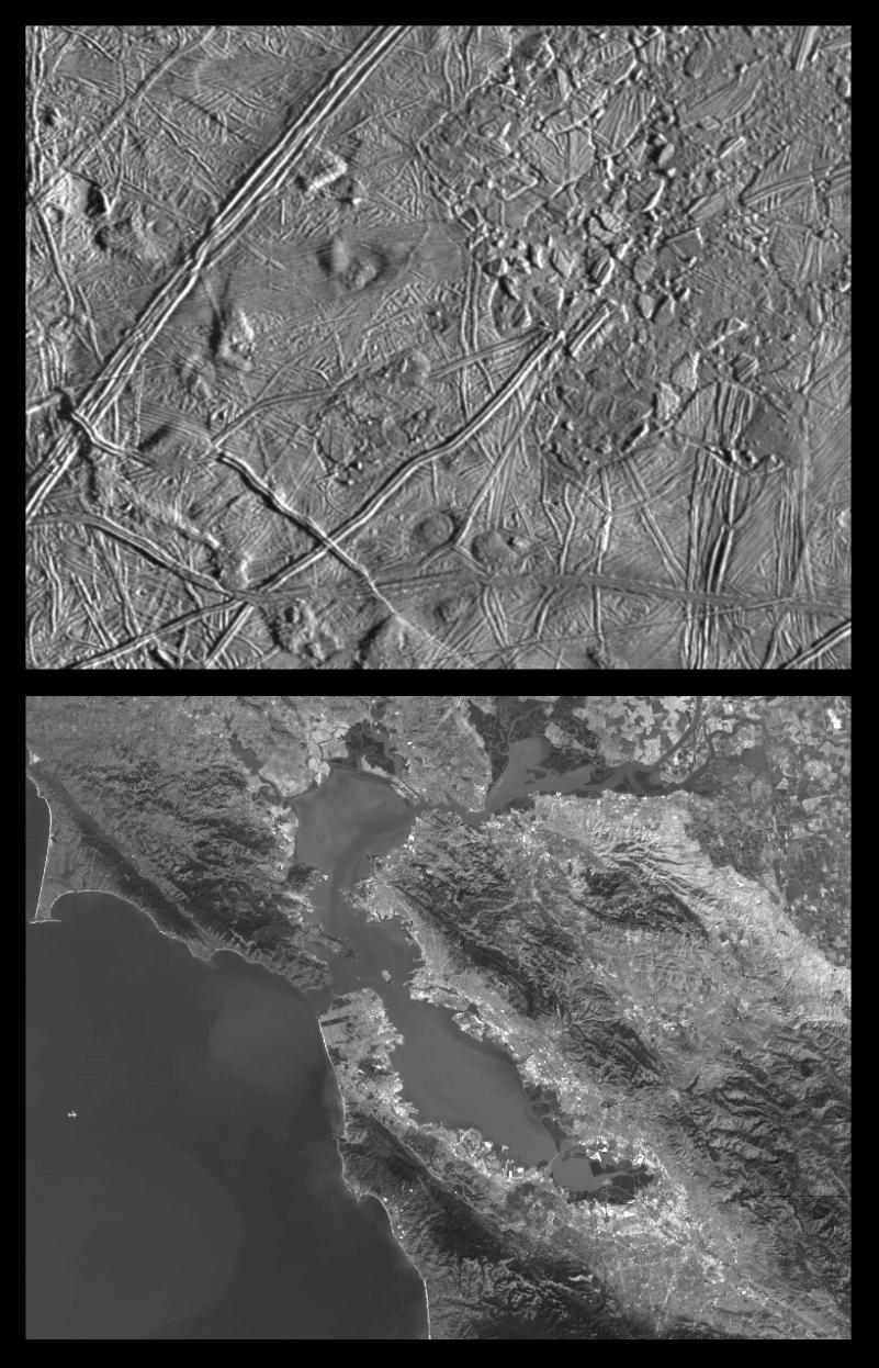
This is the second in a series of five products at increasing resolutions that compare images of various areas on Jupiter's icy moon Europa (top frame) to the same location on Earth, the San Francisco Bay area of California (bottom frame). Both images show areas of equal size, 100 by 140 kilometers (62 by 87 miles), and resolution, 180 meters (200 yards). This means that the smallest visible object is about a quarter of a mile across. North is to the top of the picture.
This complex terrain shows an area centered at 8 degrees north latitude, 275.4 degrees west longitude, in the trailing hemisphere. As Europa moves in its orbit around Jupiter, the trailing hemisphere is the portion which is always on the moon's backside opposite to its direction of motion. The complex ridge crossing the picture in the upper left corner is part of a feature that can be traced hundreds of miles across the surface of Europa, extending beyond the edge of the picture. The upper right part of the picture shows terrain that has been disrupted by an unknown process, superficially resembling blocks of sea ice during a springtime thaw. Also visible are semicircular mounds surrounded by shallow depressions. These might represent the intrusion of material punching through the surface from below and partial melting of Europa's icy crust.
In the San Francisco Bay area image, the level of detail is such that jigsaw puzzle like patterns of agricultural fields can be seen in the upper right corner and some levels of physical relief can be detected in the coastal mountain ranges. Also discernible at this resolution are the vast urban areas along the shores of the bay. Alcatraz Island appears as a tiny speck at center frame.
The Europa image was obtained from a range of 17,900 kilometers (11,100 miles) by the Solid State Imaging (CCD) system aboard NASA's Galileo spacecraft on February 20th, 1997 (Universal Time). The San Francisco Bay area image, from the LandSat Thematic Mapper, has been reprocessed to match Galileo's resolution so as to offer a sense of the size of the features visible on Europa's surface.
The Jet Propulsion Laboratory, Pasadena, CA manages the mission for NASA's Office of Space Science, Washington, DC.
This image and other images and data received from Galileo are posted on the World Wide Web, on the Galileo mission home page at URL http://galileo.jpl.nasa.gov. Background information and educational context for the images can be found at http://www.jpl.nasa.gov/galileo/sepo.
 Planetary Data System


