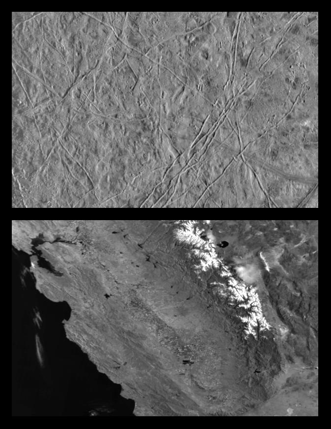
This is the first in a series of products that compare images at increasing resolutions of various areas on Jupiter's icy moon Europa (top frame) to the same location on Earth, the San Francisco Bay area of California (bottom frame). Both images show areas of roughly equal size, 252 by 393 kilometers (157 by 244 miles), and resolution, 630 meters (690 yards). This means that the smallest identifiable feature is less than a mile across (2 pixels wide). North is to the top of the picture.
The sun illumination from the right in the Europa image reveals several ridges crossing the scene, plateaus commonly several miles (10 km) across, and patches of smooth, low-lying darker materials. No prominent impact craters are visible, indicating the surface in this location is not geologically ancient. Some ridges have gaps, and subtle textural differences in these areas indicate that missing ridge segments probably were swept away by volcanic flows. The flow deposits are probably composed mainly of water ice, the chief constituent of the surface of Europa.
The Earth based image (lower frame) covers an area stretching from San Francisco Bay (top left) to the Nevada border (top right) and from Mono Lake in (top center) to the Mojave Desert (bottom right). Other predominant geographic features include the snow capped Sierra Nevada Mountains and California's Great Central Valley (center frame).
The Europa image was obtained from a range of 62089 kilometers (39028 miles) by the Solid State Imaging (CCD) system aboard NASA's Galileo spacecraft on December 19th, 1996 (Universal Time). The San Francisco Bay area image, from the NOAA satellite's Advanced Very High Resolution Radiometer (AVHRR) instrument, has been reprocessed to roughly match Galileo's resolution so as to offer a sense of the size of the features visible on Europa's surface.
The Jet Propulsion Laboratory, Pasadena, CA, manages the mission for NASA's Office of Space Science, Washington D.C. This image and other images and data received from Galileo are posted on the World Wide Web Galileo mission home page at: http://galileo.jpl.nasa.gov.
 Planetary Data System


