- Original Caption Released with Image:
-
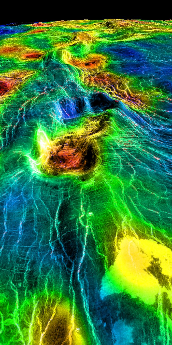
This perspective view of Venus, generated by computer from Magellan data and color-coded with emissivity, shows part of the lowland plains in Sedna Planitia. Circular depressions with associated fracture patterns, called 'coronae,' are apparently unique to the lowlands of Venus, and tend to occur in linear clusters along the planet's major tectonic belts, as seen in this image. Coronae differ greatly in size and detailed morphology: the central depression may or may not lie below the surrounding plains, and may or may not be surrounded by a raised rim or a moat outside the rim. Coronae are thought to be caused by localized 'hot spot' magmatic activity in Venus' subsurface. Intrusion of magma into the crust first pushes up the surface, after which cooling and contraction create the central depression and generate a pattern of concentric fractures. In some cases, lava may be extruded onto the surface, as seen here as bright flows in the foreground. This image is the left member of a synthetic stereo pair; the other image is PIA00314. To view the region in stereo, download the two images, arrange them side by side on the screen or in hardcopy, and view this image with the left eye and the other with the right. For best viewing, use a stereoscope or size the images so that their width is close to the interpupillary distance, about 6.6 cm (2.6 inches). Magellan MIDR quadrangle* containing this image: C1-45N011. Image resolution (m): 225. Size of region shown (E-W x N-S, in km): 1900 x 120 at front edge. Range of emissivities from violet to red: 0.82 -- 0.88. Vertical exaggeration: 20. Azimuth of viewpoint (deg clockwise from East): 13. Elevation of viewpoint (km): 300. *Quadrangle name indicates approximate center latitude (N=north, S=south) and center longitude (East).
- Image Credit:
-
NASA/JPL/USGS
Image Addition Date: -
1998-06-04
|
