- Original Caption Released with Image:
-
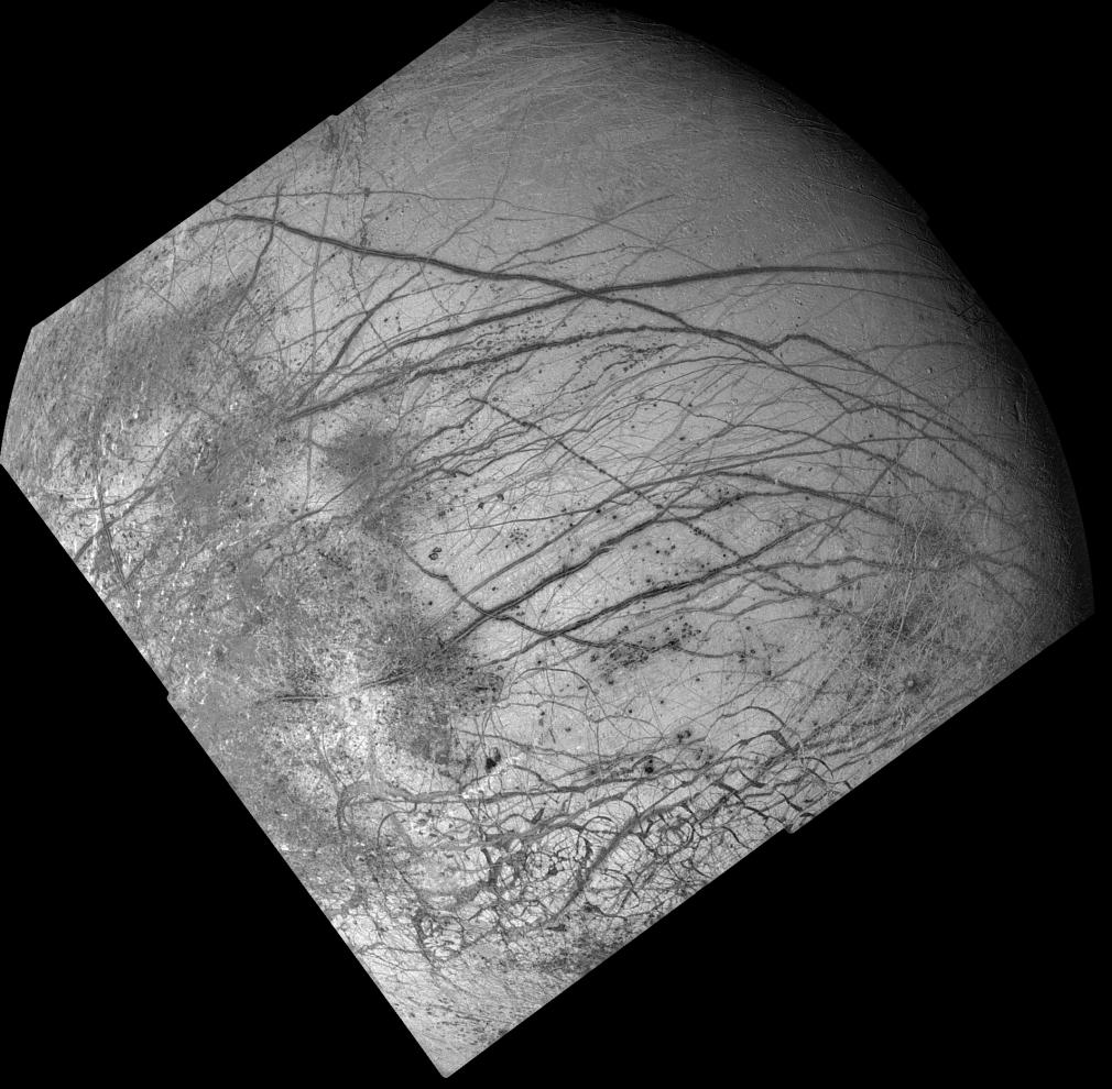
Dark crisscrossing bands on Jupiter's moon Europa represent widespread disruption from fracturing and the possible eruption of gases and rocky material from the moon's interior in this four-frame mosaic of images from NASA's Galileo spacecraft. These and other features suggest that soft ice or liquid water was present below the ice crust at the time of disruption. The data do not rule out the possibility that such conditions exist on Europa today. The pictures were taken from a distance of 156,000 kilometers (about 96,300 miles) on June 27, 1996. Many of the dark bands are more than 1,600 kilometers (1,000 miles) long, exceeding the length of the San Andreas fault of California. Some of the features seen on the mosaic resulted from meteoritic impact, including a 30- kilometer (18.5 mile) diameter crater visible as a bright scar in the lower third of the picture. In addition, dozens of shallow craters seen in some terrains along the sunset terminator zone (upper right shadowed area of the image) are probably impact craters. Other areas along the terminator lack craters, indicating relatively youthful surfaces, suggestive of recent eruptions of icy slush from the interior. The lower quarter of the mosaic includes highly fractured terrain where the icy crust has been broken into slabs as large as 30 kilometers (18.5 miles) across. The mosaic covers a large part of the northern hemisphere and includes the north pole at the top of the image. The sun illuminates the surface from the left. The area shown is centered on 20 degrees north latitude and 220 degrees west longitude and is about as wide as the United States west of the Mississippi River. The Galileo mission is managed by NASA's Jet Propulsion Laboratory.
- Image Credit:
-
NASA/JPL/USGS
Image Addition Date: -
1998-03-26
|