- Original Caption Released with Image:
-
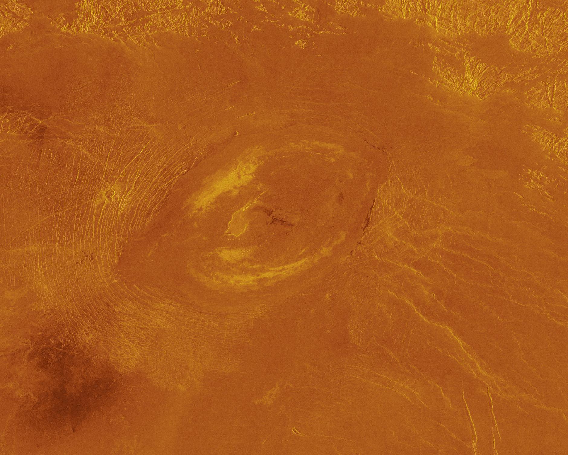
This Magellan image reveals Sacajawea Patera, a large, elongate caldera located in western Ishtar Terra on the smooth plateau of Lakshmi Planum. The image is centered at 64.5 degrees north latitude and 337 degrees east longitude. It is approximately 420 kilometers (252 miles) wide at the base. Sacajawea is a depression approximately 1.2 km (0.6 1.2 miles) deep and 120 by 215 km (74 by 133 miles) in diameter; it is elongate in a southwest northeast direction. The depression is bounded by a zone of circumferential curvilinear structures interpreted to be graben and fault scarps. These structures are space 0.5 to 4 km (0.3 to 2.5 miles) apart, are 0.6 to 4 km (0.4 to 2.5 miles) in width and up to 100 km (62 miles) in length. Extending up to 140 km (87 miles) in length from the southeast of the patera is a system of linear structures thought to represent a flanking rift zone along which the lateral injection and eruption of magma may have occurred. A shield edifice 12 km (7 miles) in diameter with a prominent central pit lies along the trend of one of these features. The impact crater Zlata, approximately 6 km (4 miles) in diameter is located within the zone of graben to the northwest of the patera. Few flow features are observed in association with Sacajawea, possibly due to age and state of degradation of the flows. Mottled bright deposits 4 to 20 km (2.5 to 12 miles) in width are located near the periphery and in the center of the patera floor within local topographic lows. Diffuse patches of dark material approximately 40 km (25 miles) in width are observed southwest of the patera, superimposed on portions of the surrounding graben. The formation of Sacajawea is thought to be related to the drainage and collapse of a large magma chamber. Gravitational relaxation may have caused the resultant caldera to sag, producing the numerous faults and graben that circumscribe the patera. Regions of complex, highly deformed tessera like terrain are located north and east of the patera and are seen in the upper portion of the image. Color has been added to this image to simulate the appearance of the Venus surface.
- Image Credit:
-
NASA/JPL
Image Addition Date: -
1996-02-01
|
 Planetary Data System


