- Original Caption Released with Image:
-
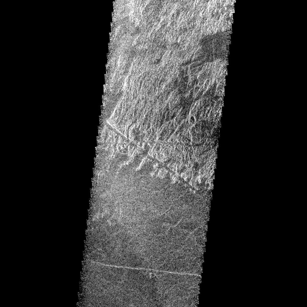
This Magellan radar image is of part of the Phoebe region of Venus. It is a mosaic of parts of revolutions 146 and 147 acquired in the first radar test on Aug. 16, 1990. The area in the image is located at 291 degrees east longitude, 19 degrees south latitude. The image shows an area 30 kilometers (19.6 miles) wide and 76 km (47 miles) long. On the basis of Pioneer Venus and Arecibo data, it is known that two major rift zones occur in southern Phoebe Regio and that they terminate at about 20 to 25 degrees south latitude, about 2,000 km (1,240 miles) apart. This image is of an area just north of the southern end of the western rift zone. The region is characterized by a complex geologic history involving both volcanism and faulting. Several of the geologic units show distinctive overlapping or cross cutting relationships that permit identification and separation of geologic events and construction of the geologic history of the region. The oldest rocks in this image form the complexly deformed and faulted, radar bright, hilly terrain in the northern half. Faults of a variety of orientations are observed. A narrow fault trough (about one-half to one km (three tenths to six tenths of a mile) wide is seen crossing the bright hills near the lower part in the middle of the image. This is one of the youngest faults in the faulted, hilly unit as it is seen to cut across many other structures. The fault trough in turn appears to be embayed and flooded by the darker plains that appear in the south half of the image. These plains are interpreted to be of volcanic origin. The dark plains may be formed of a complex of overlapping volcanic flows. For example, the somewhat darker region of plains in the lower left (southwest) corner of the image may be a different age series of plains forming volcanic lava flows. Finally, the narrow bright line crossing the image in its lower part is interpreted to be a fault which cross cuts both plains units and is thus the youngest event in the sequence. These relationships show the interplay of volcanic activity and faulting that have influenced this region and a number of other regions on Venus.
- Image Credit:
-
NASA/JPL
Image Addition Date: -
1996-02-05
|
