Your search criteria found
12731
images
Target is mars (and available satellites)
Go to PIAxxxxx:
Refine this list of images by:
Target:
Deimos
Mars
Phobos
Mission:
2001 Mars Odyssey
Antarctic Meteorite Location and Mapping Project (AMLAMP)
Dawn
ExoMars
Hubble Space Telescope
InSight
MAVEN
Mariner Mars 1964 (Mariner 4)
Mariner Mars 1969 (Mariner 7)
Mariner Mars 1971 (Mariner 9)
Mars 2020
Mars 2020 Rover
Mars Atmosphere and Volatile Evolution MissioN (MAVEN)
Mars Climate Orbiter
Mars Cube One (MarCO)
Mars Exploration Rover (MER)
Mars Express (MEX)
Mars Global Surveyor (MGS)
Mars Helicopter
Mars Pathfinder (MPF)
Mars Reconnaissance Orbiter (MRO)
Mars Sample Return
Mars Sample Return (MSR)
Mars Science Laboratory (MSL)
Phoenix
Rosetta
Viking
Spacecraft:
2001 Mars Odyssey
Curiosity
Dawn
InSight Mars Lander
Ingenuity
MAVEN
MarCO-B
Mariner 4
Mariner 7
Mariner 9
Mars Climate Orbiter
Mars Express (MEX)
Mars Express (MEX) Orbiter
Mars Global Surveyor Orbiter
Mars Pathfinder Lander
Mars Pathfinder Rover
Mars Reconnaissance Orbiter (MRO)
Mars Sample Return
Mars Science Laboratory (MSL)
NASA's Mars Pathfinder Lander
Opportunity
Perseverance
Philae Lander
Phoenix Lander
Phoenix Mars Lander
Spirit
Viking Lander 1
Viking Lander 2
Viking Orbiter 1
Viking Orbiter 2
Instrument:
Alpha Particle X-ray Spectrometer
Alpha Particle X-ray Spectrometer (MSL)
Atmospheric Structure / Meteorology Instrument
CHIMRA
Camera 1
Camera 2
Chemistry & Mineralogy (CheMin)
Chemistry and Camera (ChemCam)
Comet Infrared and Visible Analyser (CIVA
Compact Reconnaissance Imaging Spectrometer for Mars (CRISM)
Context Camera (CTX)
Deep Space Network
Descent Image Motion Estimation System (DIMES)
Dynamic Albedo of Neutrons
Dynamic Albedo of Neutrons (DAN)
Gamma Ray Spectrometer - Neutron Spectrometer
Gamma Ray Spectrometer Suite
Hazard Avoidance Camera
Hazard Avoidance Camera (M2020)
Hazard Avoidance Camera (MSL)
Heat and Physical Properties Package (HP3)
High Resolution Imaging Science Experiment (HiRISE)
High Resolution Instrument (HRI)
High Resolution Stereo Camera
Imager for Mars Pathfinder
Imaging Ultraviolet Spectrograph
Imaging Ultraviolet Spectrograph (IUVS)
Instrument Context Camera (ICC)
Instrument Deployment Camera (IDC)
Lander Vision System Camera (LCAM)
Magnetometer
Mars Advanced Radar for Subsurface and Ionosphere Sounding (MARSIS)
Mars Advanced Radar for Subsurface and Ionospheric Sounding (MARSIS)
Mars Climate Sounder (MCS)
Mars Color Imager (MARCI)
Mars Descent Imager
Mars Environmental Dynamics Analyzer (MEDA)
Mars Hand Lens Imager (MAHLI)
Mars Horizon Sensor Assembly
Mars Orbiter Camera (MOC)
Mars Orbiter Laser Altimeter
Mars Radiation Experiment
Mastcam
Mastcam-Z
Microscopic Imager
Microscopy Electrochemistry and Conductivity Analyzer (MECA)
Miniature Thermal Emission Spectrometer
Moessbauer Spectrometer
Navigation Camera
Navigation Camera (M2020)
Navigation Camera (MSL)
Neutral Gas and Ion Mass Spectrometer
Neutron Spectrometer
Optical Microscope
Optical Navigation Camera
Panoramic Camera
Planetary Instrument for X-ray Lithochemistry (PIXL)
Radar System
Radiation Assessment Detector (RAD)
Radio Science Subsystem
Robotic Arm
Robotic Arm (MSL)
Robotic Arm Camera (RAC)
Rock Abrasion Tool (RAT)
Rover Cameras
Rover Environmental Monitoring Station (REMS)
Sample Analysis at Mars (SAM)
Scanning Habitable Environments with Raman & Luminescence for Organics and Chemicals (SHERLOC)
Seismic Experiment for Interior Structure (SEIS)
Shallow Subsurface Radar (SHARAD)
Stereo Imager (SSI)
SuperCam
Surface Stereo Imager (SSI)
Thermal Emission Imaging System
Thermal Emission Spectrometer
Thermal and Electrical Conductivity Probe
Thermal and Evolved Gas Analyzer
Trace Gas Orbiter
Visual Imaging Subsystem
Visual Imaging Subsystem - Camera A
Visual Imaging Subsystem - Camera B
Wide Field Planetary Camera 2
Click on an image for detailed information
Click on a column heading to sort in ascending or descending order
My
List
Addition Date
Target
Mission
Instrument
Size
2000-09-16
Mars
Mars Global Surveyor (MGS)
Mars Orbiter Camera (MOC)
683x1138x1
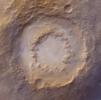
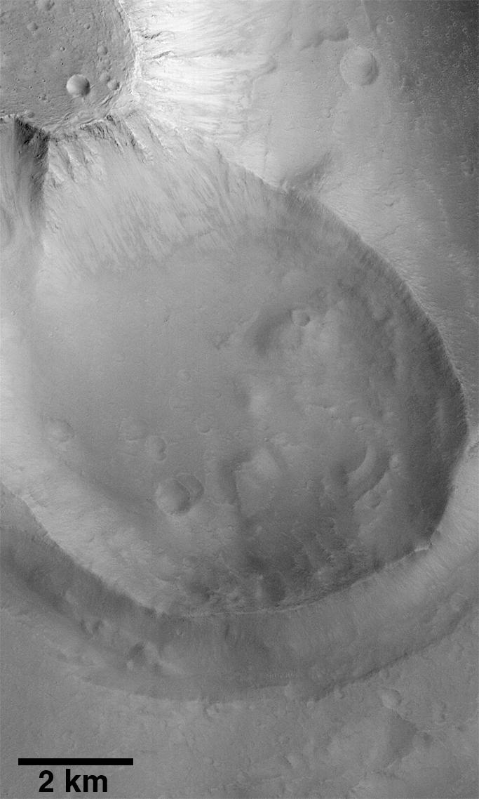
PIA01475:
Exhumed Crater in Kasei Valles
Full Resolution:
TIFF
(692.1 kB)
JPEG
(86.29 kB)
2000-09-16
Mars
Mars Global Surveyor (MGS)
Mars Orbiter Camera (MOC)
1872x1036x1
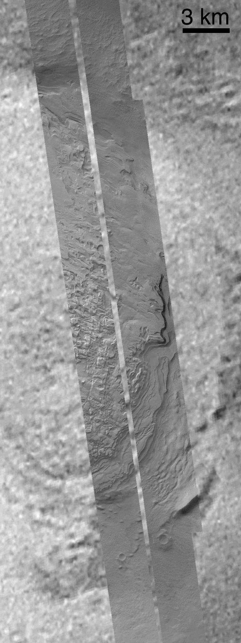
PIA01479:
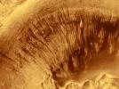
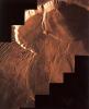
Detailed View of Cliff-face in the North Polar Layered Deposits
Full Resolution:
TIFF
(1.101 MB)
JPEG
(259.6 kB)
2000-09-16
Mars
Mars Global Surveyor (MGS)
Mars Orbiter Camera (MOC)
502x1138x1
PIA01494:
Ancient Lakes on Mars? Results for Elysium Basin
Full Resolution:
TIFF
(582.1 kB)
JPEG
(141.6 kB)
2000-09-16
Mars
Mars Global Surveyor (MGS)
Mars Orbiter Camera (MOC)
443x746x1
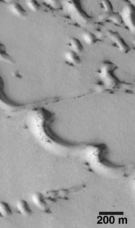
PIA01495:
Evidence for Recent Wind Action on Martian Sand Dunes
Full Resolution:
TIFF
(257.5 kB)
JPEG
(39.56 kB)
2000-09-16
Mars
Mars Global Surveyor (MGS)
Mars Orbiter Camera (MOC)
512x1488x1
PIA01501:
Mars Volcanism: Large, Fluid Lava Flows
Full Resolution:
TIFF
(943.9 kB)
JPEG
(263.4 kB)
2000-09-16
Mars
Mars Global Surveyor (MGS)
Mars Orbiter Camera (MOC)
776x779x1
PIA01670:
MOC Focus Test Images
Full Resolution:
TIFF
(628.2 kB)
JPEG
(127.6 kB)
2000-09-16
Mars
Mars Global Surveyor (MGS)
Mars Orbiter Camera (MOC)
597x238x1
PIA01671:
North Polar Region Dunes Focus Test Image
Full Resolution:
TIFF
(110.4 kB)
JPEG
(16.19 kB)
2000-09-16
Mars
Mars Global Surveyor (MGS)
Mars Orbiter Camera (MOC)
1512x828x3
PIA01673:
Early MOC Global Color Mosaics
Full Resolution:
TIFF
(2.521 MB)
JPEG
(86.82 kB)
2000-09-16
Mars
Mars Global Surveyor (MGS)
Mars Orbiter Camera (MOC)
668x513x1
PIA01674:
1.5 Meter Per Pixel View of Boulders in Ganges Chasma
Full Resolution:
TIFF
(321.5 kB)
JPEG
(58.38 kB)
2000-09-16
Mars
Mars Global Surveyor (MGS)
Mars Orbiter Camera (MOC)
1024x768x1
PIA01677:
High Resolution View of Northern Plains Surface
Full Resolution:
TIFF
(874.7 kB)
JPEG
(248.3 kB)
2000-09-16
Mars
Mars Global Surveyor (MGS)
Mars Orbiter Camera (MOC)
990x1540x1
PIA01678:
Craters and Bright Dunes of Isidis Planitia
Full Resolution:
TIFF
(1.365 MB)
JPEG
(274.1 kB)
2000-09-16
Mars
Mars Global Surveyor (MGS)
Mars Orbiter Camera (MOC)
1323x1975x1
PIA01680:
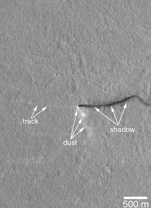
Boulder Tracks on Schiaparelli Basin South Wall
Full Resolution:
TIFF
(1.978 MB)
JPEG
(321.9 kB)
2000-09-16
Mars
Mars Global Surveyor (MGS)
Mars Orbiter Camera (MOC)
928x609x1
PIA01681:
Eroded Layered Material in Southwest Utopia Planitia
Full Resolution:
TIFF
(381.5 kB)
JPEG
(62.5 kB)
2000-09-16
Mars
Mars Global Surveyor (MGS)
Mars Orbiter Camera (MOC)
837x762x1
PIA01684:
Hot Dog and Butterfly, Nereidum Montes
Full Resolution:
TIFF
(465.4 kB)
JPEG
(97.42 kB)
2000-09-16
Mars
Mars Global Surveyor (MGS)
Mars Orbiter Camera (MOC)
1001x1454x1
PIA01685:
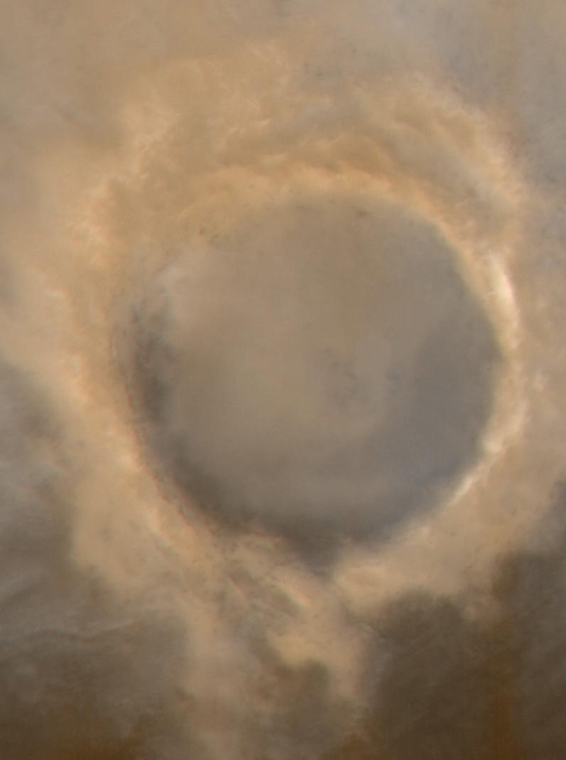
Mariner 4 Meets Mars Global Surveyor -- Mariner Crater 1965 and 1999
Full Resolution:
TIFF
(1.4 MB)
JPEG
(227.6 kB)
2000-09-18
Mars
Mars Global Surveyor (MGS)
Mars Orbiter Camera (MOC)
1024x512x1
PIA01331:
Spring Time View of North Polar Sand Dunes
Full Resolution:
TIFF
(364.3 kB)
JPEG
(81.27 kB)
2000-09-18
Mars
Mars Global Surveyor (MGS)
Mars Orbiter Camera (MOC)
512x512x1
PIA01456:
Elysium Mons Volcano - Detail of Southern Caldera Wall and Floor
Full Resolution:
TIFF
(247 kB)
JPEG
(37.07 kB)
2000-09-18
Mars
Mars Global Surveyor (MGS)
Mars Orbiter Camera (MOC)
512x512x1
PIA01459:
Western Candor Chasma - Layers Exposed near the Middle
Full Resolution:
TIFF
(275.5 kB)
JPEG
(60.23 kB)
2000-09-18
Mars
Mars Global Surveyor (MGS)
Mars Orbiter Camera (MOC)
512x512x1
PIA01460:
Candor Chasma - Massive (non-layered) Material Expos
Full Resolution:
TIFF
(247.5 kB)
JPEG
(46.76 kB)
2000-09-18
Mars
Mars Global Surveyor (MGS)
Mars Orbiter Camera (MOC)
542x256x1
PIA01470:
Giant "Polygon" Troughs, Elysium Planitia at Full Resolution
Full Resolution:
TIFF
(126.2 kB)
JPEG
(28.23 kB)
2000-09-18
Mars
Mars Global Surveyor (MGS)
Mars Orbiter Camera (MOC)
1586x459x3
PIA01471:
Martian North Polar Cap on September 12, 1998 (color)
Full Resolution:
TIFF
(1.444 MB)
JPEG
(45.56 kB)
2000-09-18
Mars
Mars Global Surveyor (MGS)
Mars Orbiter Camera (MOC)
692x1448x3
PIA01476:
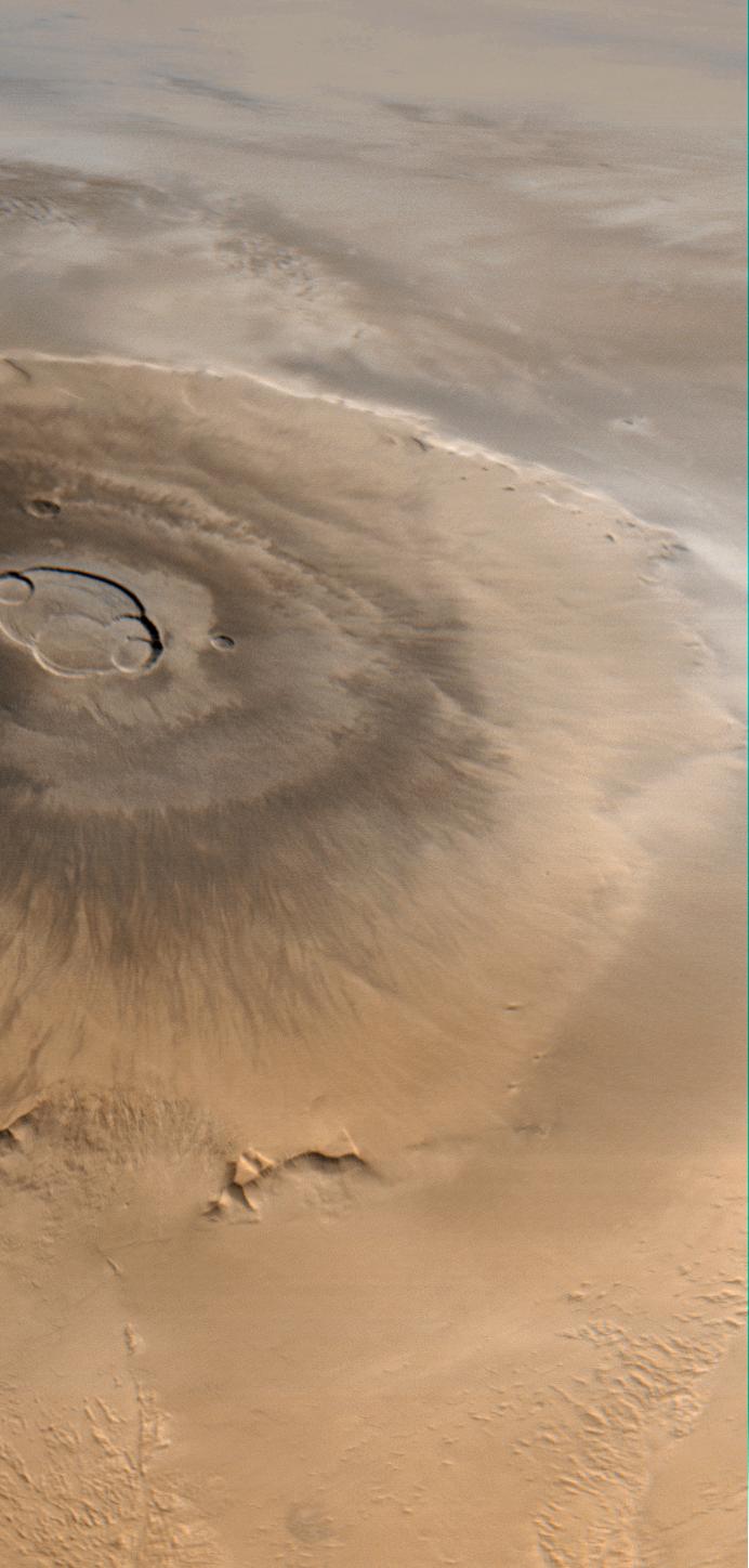
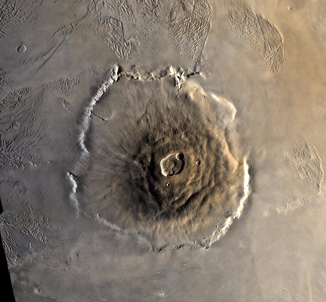
Olympus Mons, 1998 (Color)
Full Resolution:
TIFF
(2.4 MB)
JPEG
(91.12 kB)
2000-09-18
Mars
Mars Global Surveyor (MGS)
Mars Orbiter Camera (MOC)
690x1017x1
PIA01500:
Mars Boulders: On a Hill in Utopia Planitia
Full Resolution:
TIFF
(711.1 kB)
JPEG
(149.8 kB)
2000-09-18
Mars
Mars Global Surveyor (MGS)
Mars Orbiter Camera (MOC)
421x1634x1
PIA01502:
Mars Fretted Terrain: Lineated Valley Fill
Full Resolution:
TIFF
(661.3 kB)
JPEG
(128.5 kB)
2000-09-18
Mars
Mars Global Surveyor (MGS)
Mars Orbiter Camera (MOC)
788x1048x1
PIA01672:
Mars Surfaces at 15.6�N Latitude, March 1999
Full Resolution:
TIFF
(755 kB)
JPEG
(141.3 kB)
2000-09-18
Mars
Mars Global Surveyor (MGS)
Mars Orbiter Camera (MOC)
714x609x1
PIA01675:
Sand Dunes of Nili Patera, Syrtis Major
Full Resolution:
TIFF
(420.8 kB)
JPEG
(77.16 kB)
2000-09-18
Mars
Mars Global Surveyor (MGS)
Mars Orbiter Camera (MOC)
669x1254x1
PIA01679:
Valleys on Northwest Flank of Alba Patera Volcano
Full Resolution:
TIFF
(824.4 kB)
JPEG
(171 kB)
2000-09-18
Mars
Mars Global Surveyor (MGS)
Mars Orbiter Camera (MOC)
1204x650x1
PIA01682:
Layers in Cratered Highland Crust Exposed by Tagus Vallis
Full Resolution:
TIFF
(631 kB)
JPEG
(92.22 kB)
2000-09-18
Mars
Mars Global Surveyor (MGS)
Mars Orbiter Camera (MOC)
720x944x1
PIA01683:
Small Impact Craters with Dark Ejecta Deposits
Full Resolution:
TIFF
(674.7 kB)
JPEG
(150.9 kB)
2000-10-06
Mars
Mars Global Surveyor (MGS)
MOLA
669x441x3
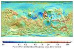
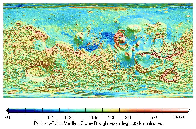
PIA02808:
MOLA Global Roughness Map of Mars
Full Resolution:
TIFF
(248.3 kB)
JPEG
(114.3 kB)
2000-10-06
Mars
Mars Global Surveyor (MGS)
MOLA
669x441x3
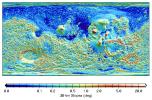
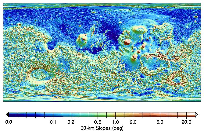
PIA02809:
MOLA Global Map of Surface Gradients on Mars
Full Resolution:
TIFF
(254.8 kB)
JPEG
(128.2 kB)
2000-10-06
Mars
Mars Global Surveyor (MGS)
Mars Orbiter Camera (MOC)
1637x1062x3
PIA02810:
Looking Out Across Dao, Niger, and Harmakhis Valles
Full Resolution:
TIFF
(4.302 MB)
JPEG
(171.7 kB)
2000-10-16
Mars
Mars Global Surveyor (MGS)
Mars Orbiter Camera (MOC)
2068x2512x3
PIA02811:
Frosted Southern Plains in Early Spring
Full Resolution:
TIFF
(11.42 MB)
JPEG
(234.1 kB)
2000-10-16
Mars
Mars Global Surveyor (MGS)
Mars Orbiter Camera (MOC)
451x2375x3
PIA02812:
Spring Thaw in Northwestern Planum Australe
Full Resolution:
TIFF
(2.155 MB)
JPEG
(75.1 kB)
2000-10-16
Mars
Mars Global Surveyor (MGS)
Mars Orbiter Camera (MOC)
672x2603x1
PIA02813:
Groovy Terrain in Mangala Valles
Full Resolution:
TIFF
(1.84 MB)
JPEG
(368 kB)
2000-10-16
Mars
Mars Global Surveyor (MGS)
Mars Orbiter Camera (MOC)
672x1242x1
PIA02814:
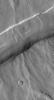
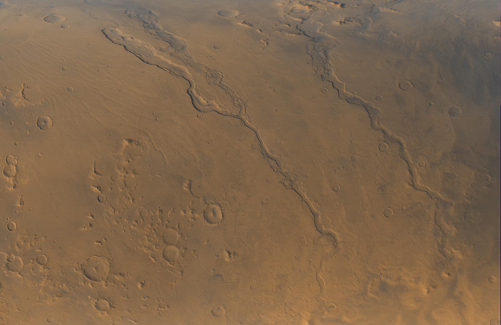
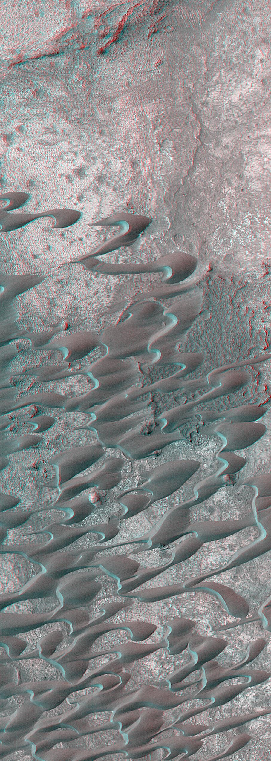
Channels and Gullies in Nirgal Vallis--The Work of Water?
Full Resolution:
TIFF
(732 kB)
JPEG
(172.3 kB)
2000-10-16
Mars
Mars Global Surveyor (MGS)
Mars Orbiter Camera (MOC)
1010x1010x3
PIA02815:
South Polar Terrain in 3-D
Full Resolution:
TIFF
(3.018 MB)
JPEG
(209.5 kB)
2000-11-01
Mars
Mars Global Surveyor (MGS)
Mars Orbiter Camera (MOC)
3047x2279x3
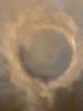
PIA02824:
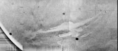
Evidence for Recent Liquid Water on Mars: Channeled Aprons in a Small Crater within Newton Crater
Full Resolution:
TIFF
(5.505 MB)
JPEG
(1.132 MB)
2000-11-03
Mars
Galileo
Mars Global Surveyor (MGS)
Mars Orbiter Camera (MOC)
Solid-State Imaging
2800x1824x3
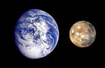
PIA02570:
Earth Mars Comparison
Full Resolution:
TIFF
(5.946 MB)
JPEG
(269.4 kB)
2000-11-04
Mars
Mariner Mars 1971 (Mariner 9)
2701x2116x1
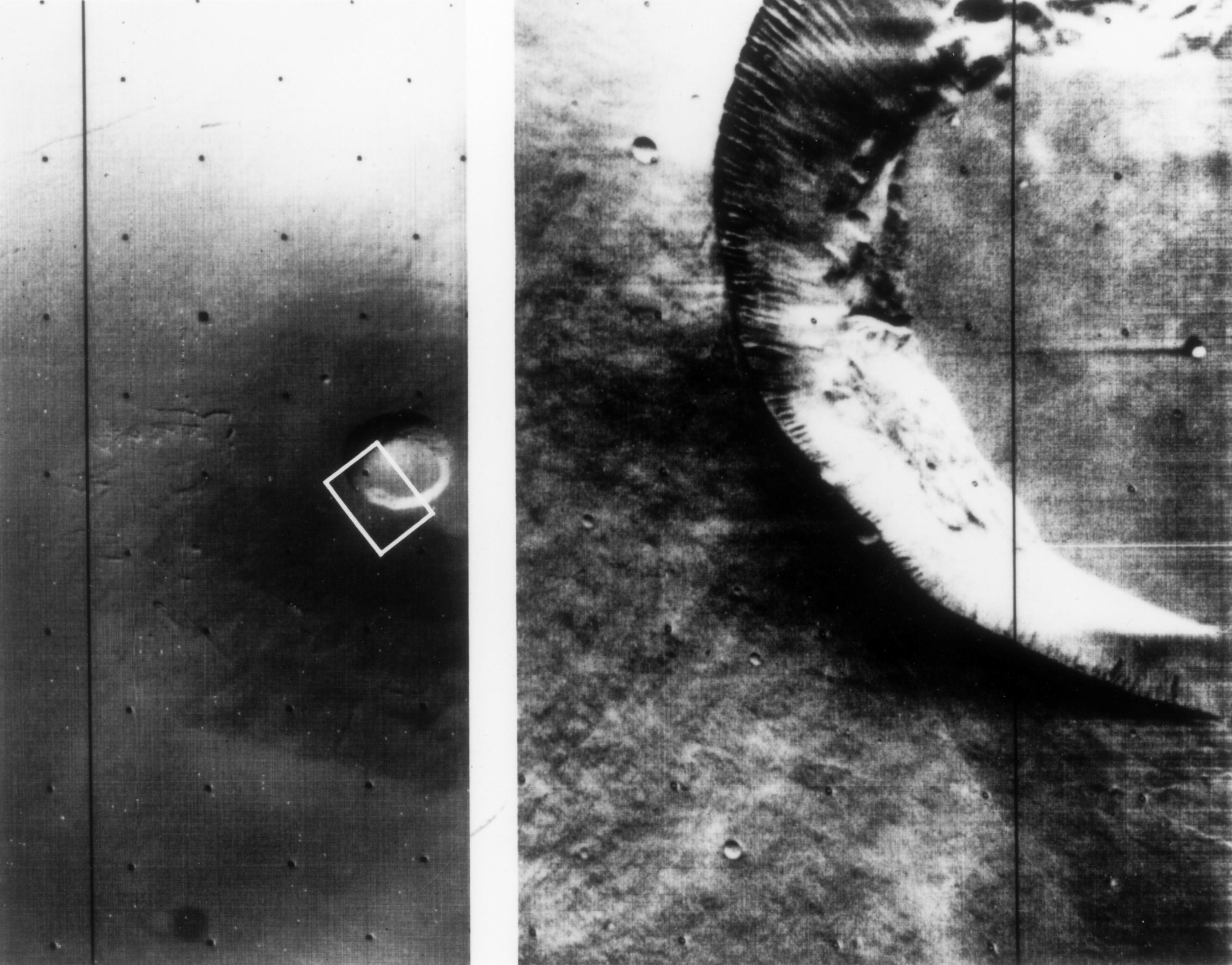
PIA02983:
Mariner 9 views of shield volcano
Full Resolution:
TIFF
(4.705 MB)
JPEG
(516.3 kB)
2000-11-04
Mars
Viking
1124x1040x3
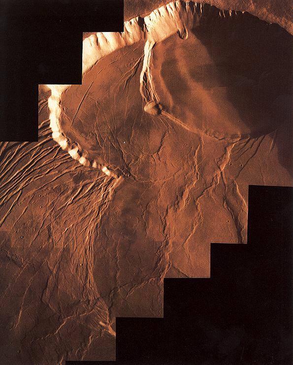
PIA02982:
Color Mosaic of Olympus Mons
Full Resolution:
TIFF
(3.086 MB)
JPEG
(192.7 kB)
2000-11-04
Mars
Viking
595x742x3
PIA02984:
Photomosiac of Olympus Mons
Full Resolution:
TIFF
(1.244 MB)
JPEG
(94.69 kB)
2000-11-04
Mars
Mariner Mars 1969 (Mariner 7)
640x360x1
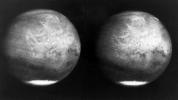
PIA02981:
Mars full disk approach view from Mariner 7
Full Resolution:
TIFF
(108.3 kB)
JPEG
(29.53 kB)
2000-11-04
Mars
Mariner Mars 1964 (Mariner 4)
479x450x1
PIA02980:
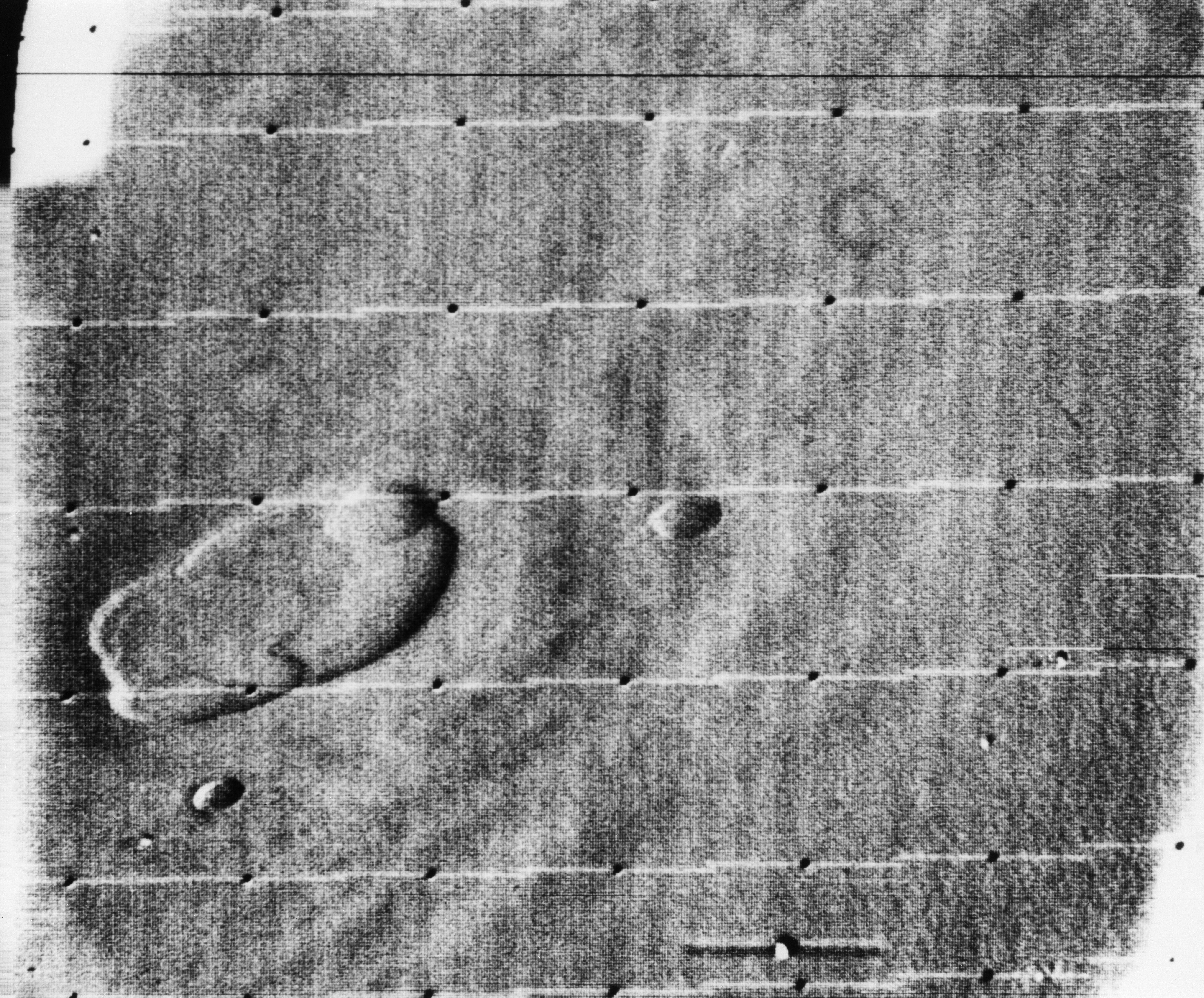
Atlantis Region on Mars - Mariner 4
Full Resolution:
TIFF
(180.5 kB)
JPEG
(43.25 kB)
2000-11-04
Mars
Mariner Mars 1964 (Mariner 4)
600x550x1
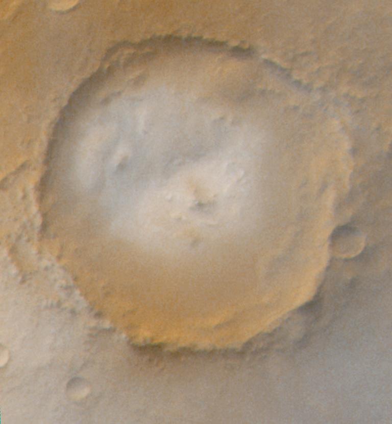
PIA02979:
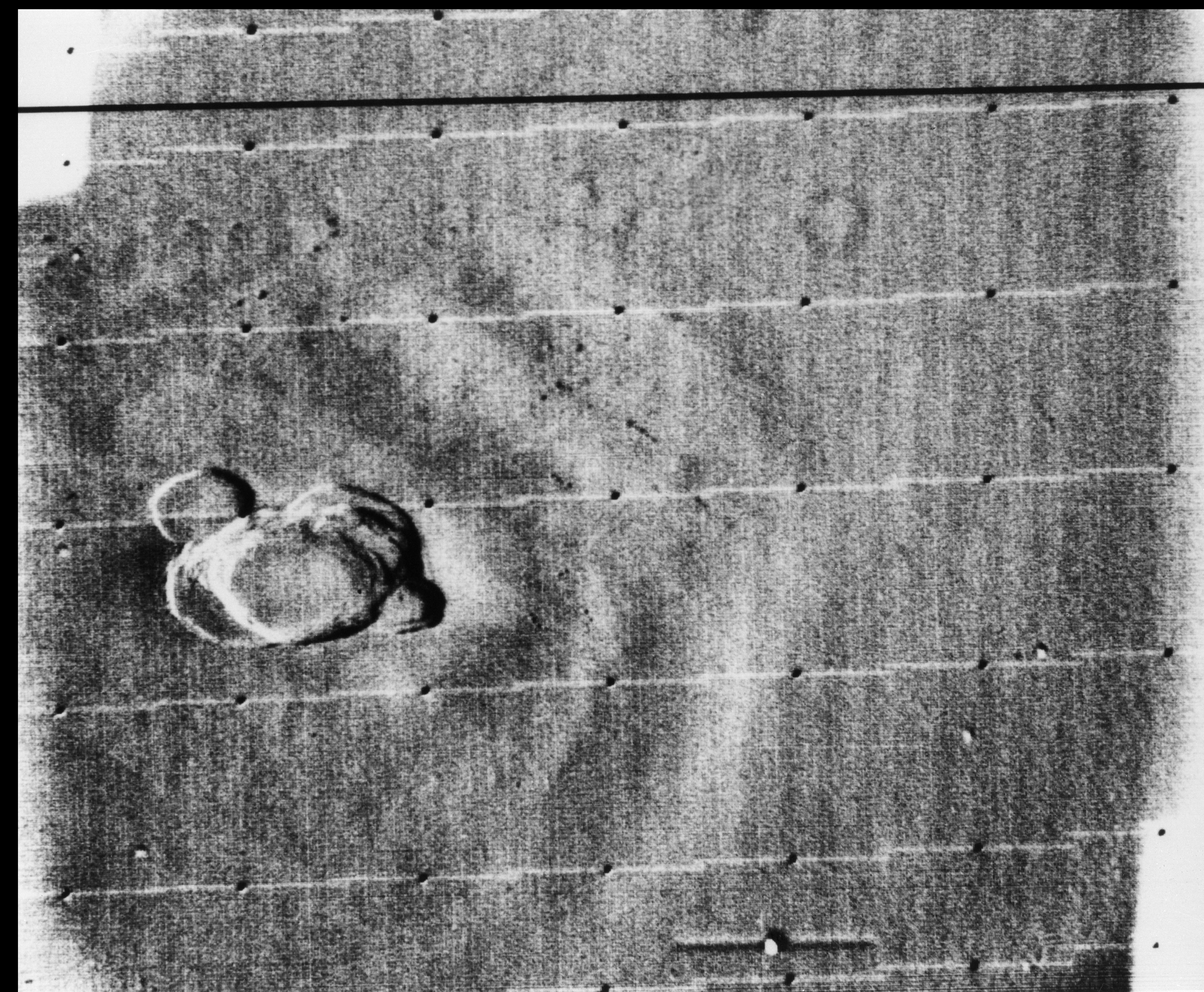
Mariner Crater
Full Resolution:
TIFF
(405.6 kB)
JPEG
(102.7 kB)
2000-11-04
Mars
Viking
1169x1055x1
PIA02985:
Dust storm in the Thaumasia region of Mars
Full Resolution:
TIFF
(384.9 kB)
JPEG
(152.2 kB)
2000-11-07
Mars
Viking
600x600x3
PIA02987:
Photomosiac of the Tharsis Region
Full Resolution:
TIFF
(827.6 kB)
JPEG
(47.71 kB)
2000-11-10
Mars
Viking
Visual Imaging Subsystem - Camera A
11649x5721x3
PIA02992:
Mars Digital Image Mosaic Globe
Full Resolution:
TIFF
(120 MB)
JPEG
(8.664 MB)
2000-11-10
Mars
Mars Global Surveyor (MGS)
MOLA
11649x5723x3
PIA02993:
Mars Orbiter Laser Altimiter (MOLA) Globe
Full Resolution:
TIFF
(158.6 MB)
JPEG
(11 MB)
2000-11-11
Mars
Mars Global Surveyor (MGS)
Mars Orbiter Camera (MOC)
1340x510x3
PIA02827:
A 3-D Look at Wind-Sculpted Ridges in Aeolis
Full Resolution:
TIFF
(2.174 MB)
JPEG
(118.7 kB)
2000-11-18
Mars
Mars Global Surveyor (MGS)
Mars Orbiter Camera (MOC)
1024x2816x1
PIA02828:
Autumn Afternoon in Hale Crater
Full Resolution:
TIFF
(2.212 MB)
JPEG
(333.9 kB)
2000-11-22
Mars
Mariner Mars 1971 (Mariner 9)
5484x4461x1
PIA02995:
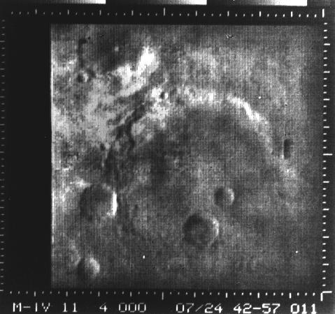
Nix Olympica Identified by Mariner 9 on Mars Approach
Full Resolution:
TIFF
(9.878 MB)
JPEG
(1.116 MB)
2000-11-22
Mars
Mariner Mars 1971 (Mariner 9)
4967x3860x1
PIA02996:
South Pole as viewed by Mariner 9 on Mars Approach
Full Resolution:
TIFF
(7.276 MB)
JPEG
(568 kB)
2000-11-22
Mars
Mariner Mars 1971 (Mariner 9)
5925x4847x1
PIA02997:
Mariner 9 View of Arsia Silva
Full Resolution:
TIFF
(29.36 MB)
JPEG
(4.353 MB)
2000-11-22
Mars
Mariner Mars 1971 (Mariner 9)
5360x4419x1
PIA02999:
Mariner 9 views Ascraeus Mons standing above the Martian Dust Storm
Full Resolution:
TIFF
(23.15 MB)
JPEG
(3.465 MB)
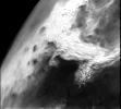
2000-11-22
Mars
Mariner Mars 1971 (Mariner 9)
5287x4384x1
PIA03100:
Mariner 9 views Ascraeus Lacus above the Martian Dust Storm
Full Resolution:
TIFF
(23.33 MB)
JPEG
(3.518 MB)
2000-11-22
Mars
Mariner Mars 1971 (Mariner 9)
4288x6265x1
PIA02989:
South Polar Cap of Mars as seen by Mariners 9 & 7
Full Resolution:
TIFF
(23.13 MB)
JPEG
(3.019 MB)
2000-11-22
Mars
Mariner Mars 1971 (Mariner 9)
7278x3159x1
PIA02998:
Mariner 9 views Canyon System emerging from Martian Dust Storm
Full Resolution:
TIFF
(16.73 MB)
JPEG
(2.845 MB)
2000-11-27
Mars
Mars Global Surveyor (MGS)
Mars Orbiter Camera (MOC)
797x1069x3
PIA02833:
The Frosted Craters of Northern Spring and Southern Autumn - Lomonosov Crater
Full Resolution:
TIFF
(1.51 MB)
JPEG
(38.46 kB)
2000-11-27
Mars
Mars Global Surveyor (MGS)
Mars Orbiter Camera (MOC)
768x829x3
PIA02834:
The Frosted Craters of Northern Spring and Southern Autumn - Unnamed Crater
Full Resolution:
TIFF
(1.635 MB)
JPEG
(49.11 kB)
2000-11-27
Mars
Mars Global Surveyor (MGS)
Mars Orbiter Camera (MOC)
393x395x3
PIA02835:
The Frosted Craters of Northern Spring and Southern Autumn - Barnard Crater
Full Resolution:
TIFF
(326.4 kB)
JPEG
(10.34 kB)
2000-11-27
Mars
Mars Global Surveyor (MGS)
Mars Orbiter Camera (MOC)
893x891x3
PIA02836:
The Frosted Craters of Northern Spring and Southern Autumn - Lowell Crater
Full Resolution:
TIFF
(2.421 MB)
JPEG
(74.91 kB)
2000-12-04
Mars
Mars Global Surveyor (MGS)
Mars Orbiter Camera (MOC)
1024x1322x3
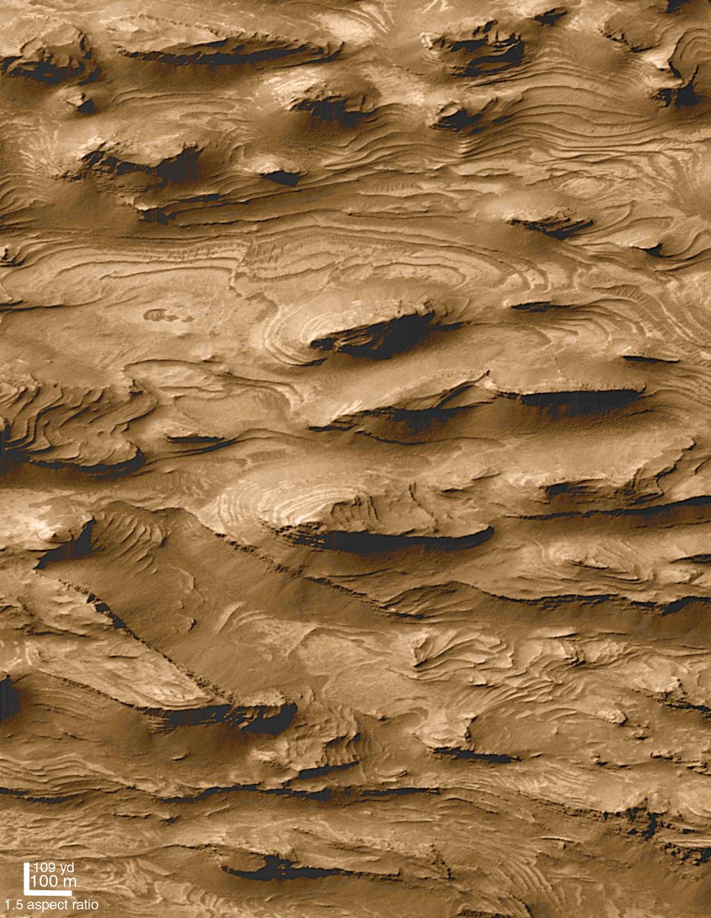
PIA02839:
Layered Outcrops of Far West Candor Chasma
Full Resolution:
TIFF
(4.395 MB)
JPEG
(241.8 kB)
2000-12-04
Mars
Mars Global Surveyor (MGS)
Mars Orbiter Camera (MOC)
512x875x3
PIA02840:
Layered Material in West Arabia Terra Crater
Full Resolution:
TIFF
(1.261 MB)
JPEG
(135.4 kB)
2000-12-05
Mars
Mars Global Surveyor (MGS)
Mars Orbiter Camera (MOC)
512x875x3
PIA02841:
Layered Material in West Arabia Terra Crater
Full Resolution:
TIFF
(1.283 MB)
JPEG
(114 kB)
2000-12-05
Mars
Mars Global Surveyor (MGS)
Mars Orbiter Camera (MOC)
512x875x3
PIA02842:
Layered Material in West Arabia Terra Crater
Full Resolution:
TIFF
(1.12 MB)
JPEG
(111.5 kB)
2000-12-05
Mars
Mars Global Surveyor (MGS)
Mars Orbiter Camera (MOC)
835x7367x1
PIA02843:
Sediment History Preserved in Gale Crater Central Mound
Full Resolution:
TIFF
(5.051 MB)
JPEG
(734.4 kB)
2000-12-05
Mars
Mars Global Surveyor (MGS)
Mars Orbiter Camera (MOC)
781x1073x1
PIA02844:
Sediment History Preserved in Gale Crater Central Mound
Full Resolution:
TIFF
(845.7 kB)
JPEG
(140.4 kB)
2000-12-05
Mars
Mars Global Surveyor (MGS)
Mars Orbiter Camera (MOC)
780x1173x1
PIA02845:
Sediment History Preserved in Gale Crater Central Mound
Full Resolution:
TIFF
(874.7 kB)
JPEG
(139.1 kB)
2000-12-05
Mars
Mars Global Surveyor (MGS)
Mars Orbiter Camera (MOC)
836x916x3
PIA02846:
Sediment History Preserved in Gale Crater Central Mound
Full Resolution:
TIFF
(2.273 MB)
JPEG
(155.6 kB)
2000-12-05
Mars
Mars Global Surveyor (MGS)
Mars Orbiter Camera (MOC)
512x1642x1
PIA02847:
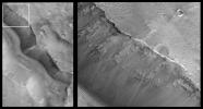
Light-toned Layered Outcrops in Valles Marineris Walls
Full Resolution:
TIFF
(848.8 kB)
JPEG
(172.5 kB)
2000-12-05
Mars
Mars Global Surveyor (MGS)
Mars Orbiter Camera (MOC)
836x3158x1
PIA02848:
'White Rock' of Pollack Crater
Full Resolution:
TIFF
(2.816 MB)
JPEG
(603.9 kB)
2000-12-05
Mars
Mars Global Surveyor (MGS)
Mars Orbiter Camera (MOC)
518x894x1
PIA02849:
'White Rock' of Pollack Crater
Full Resolution:
TIFF
(453.8 kB)
JPEG
(96.46 kB)
2001-01-13
Mars
Mars Global Surveyor (MGS)
Mars Orbiter Camera (MOC)
2003x601x1
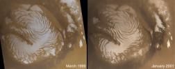
PIA02897:
North Polar Cap Layers and Frost on the First Day of Summer
Full Resolution:
TIFF
(886.7 kB)
JPEG
(209.9 kB)
2001-01-13
Mars
Mars Global Surveyor (MGS)
Mars Orbiter Camera (MOC)
2003x601x1
PIA02898:
North Polar Ice Cap Surface
Full Resolution:
TIFF
(1.247 MB)
JPEG
(404.5 kB)
2001-01-13
Mars
Mars Global Surveyor (MGS)
Mars Orbiter Camera (MOC)
2003x601x1
PIA02899:
Complex exposures of North Polar layered material
Full Resolution:
TIFF
(1.13 MB)
JPEG
(239 kB)
2001-01-17
Mars
Mars Global Surveyor (MGS)
Thermal Emission Spectrometer
4000x2769x3
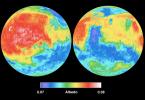
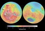
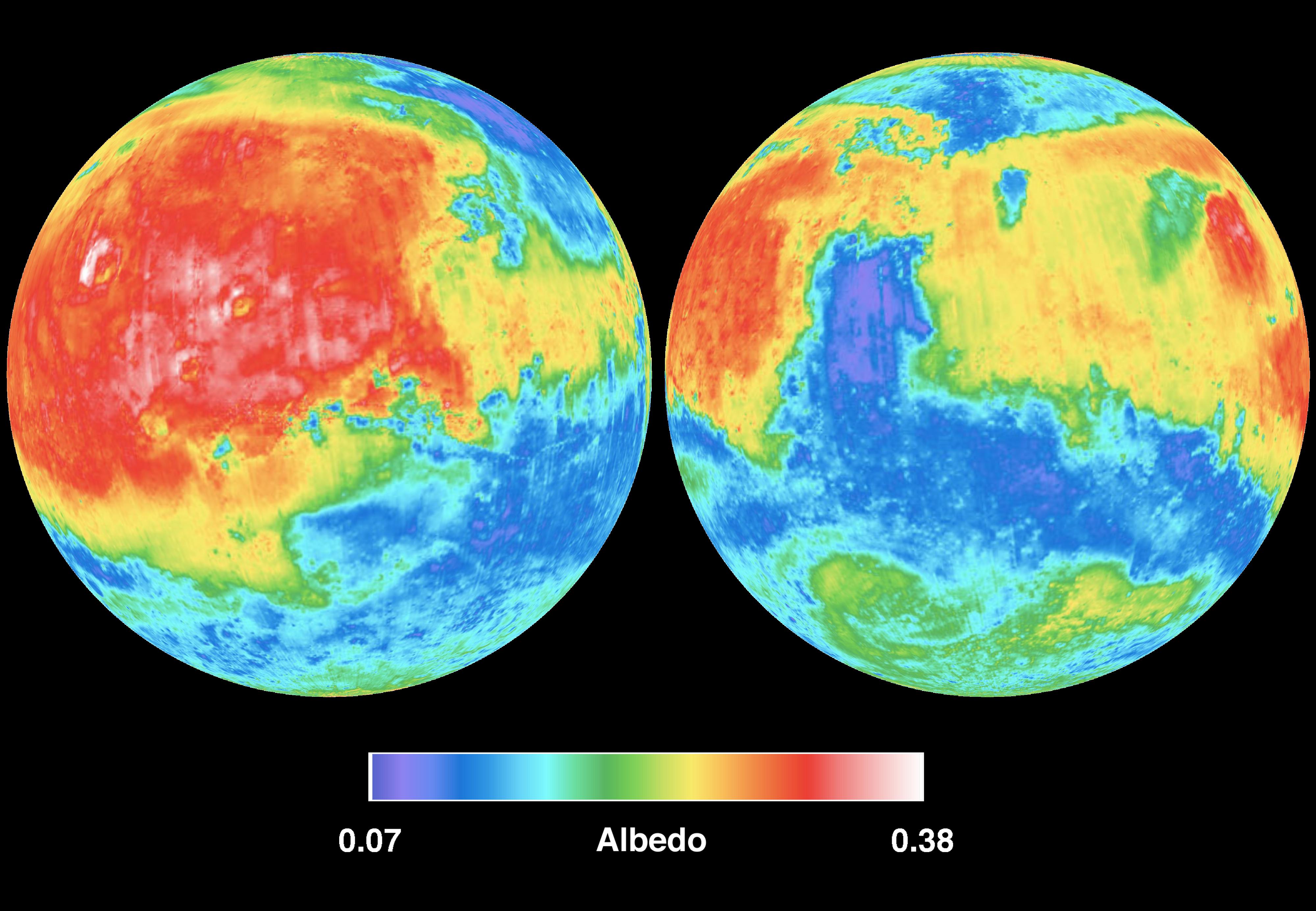
PIA02816:
Mars Albedo
Full Resolution:
TIFF
(20.01 MB)
JPEG
(715.4 kB)
2001-01-17
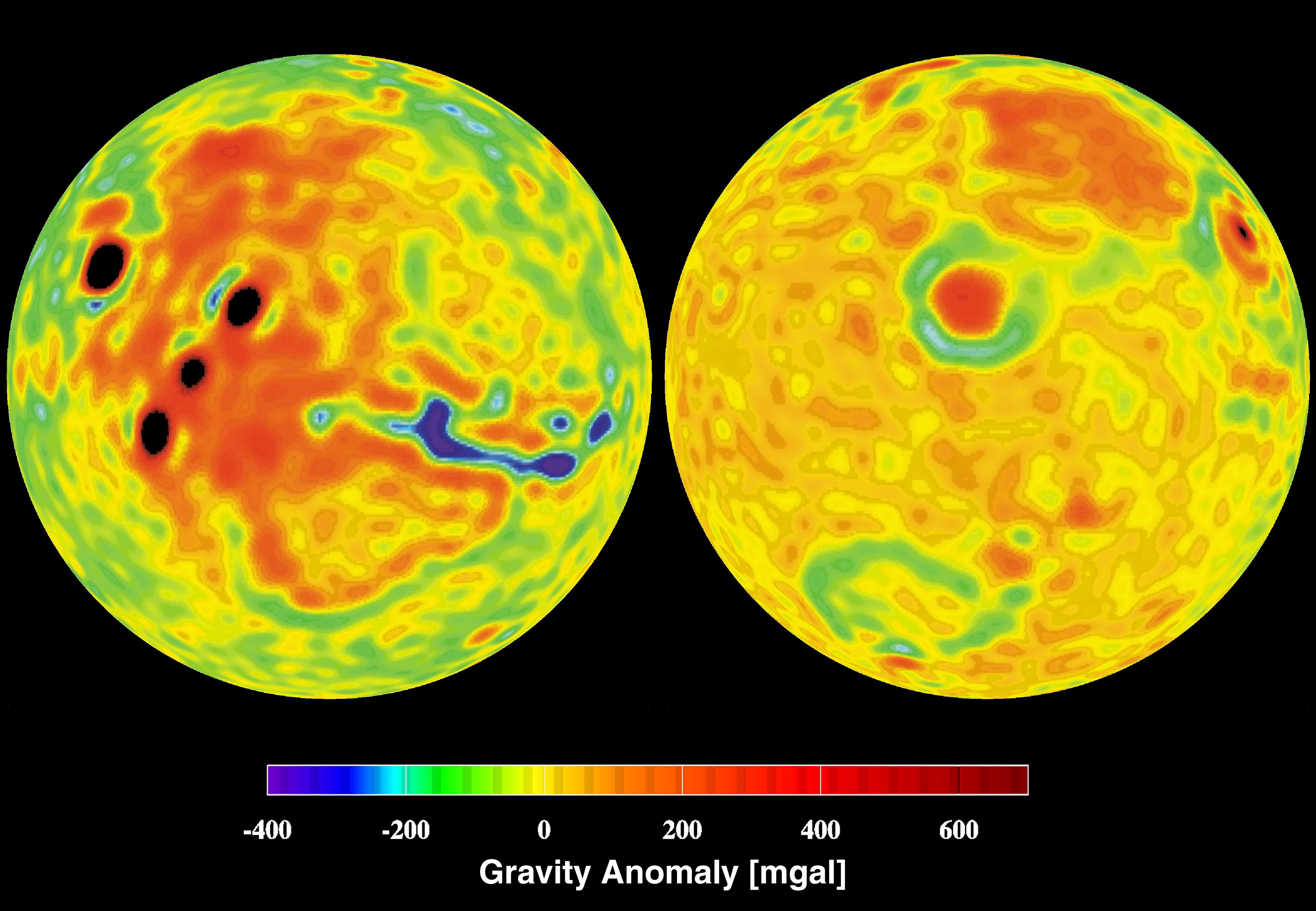
Mars
Mars Global Surveyor (MGS)
4000x2769x3
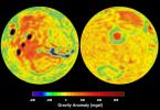
PIA02817:
Mars Gravity Anomoly Map
Full Resolution:
TIFF
(16.6 MB)
JPEG
(619.8 kB)
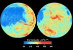
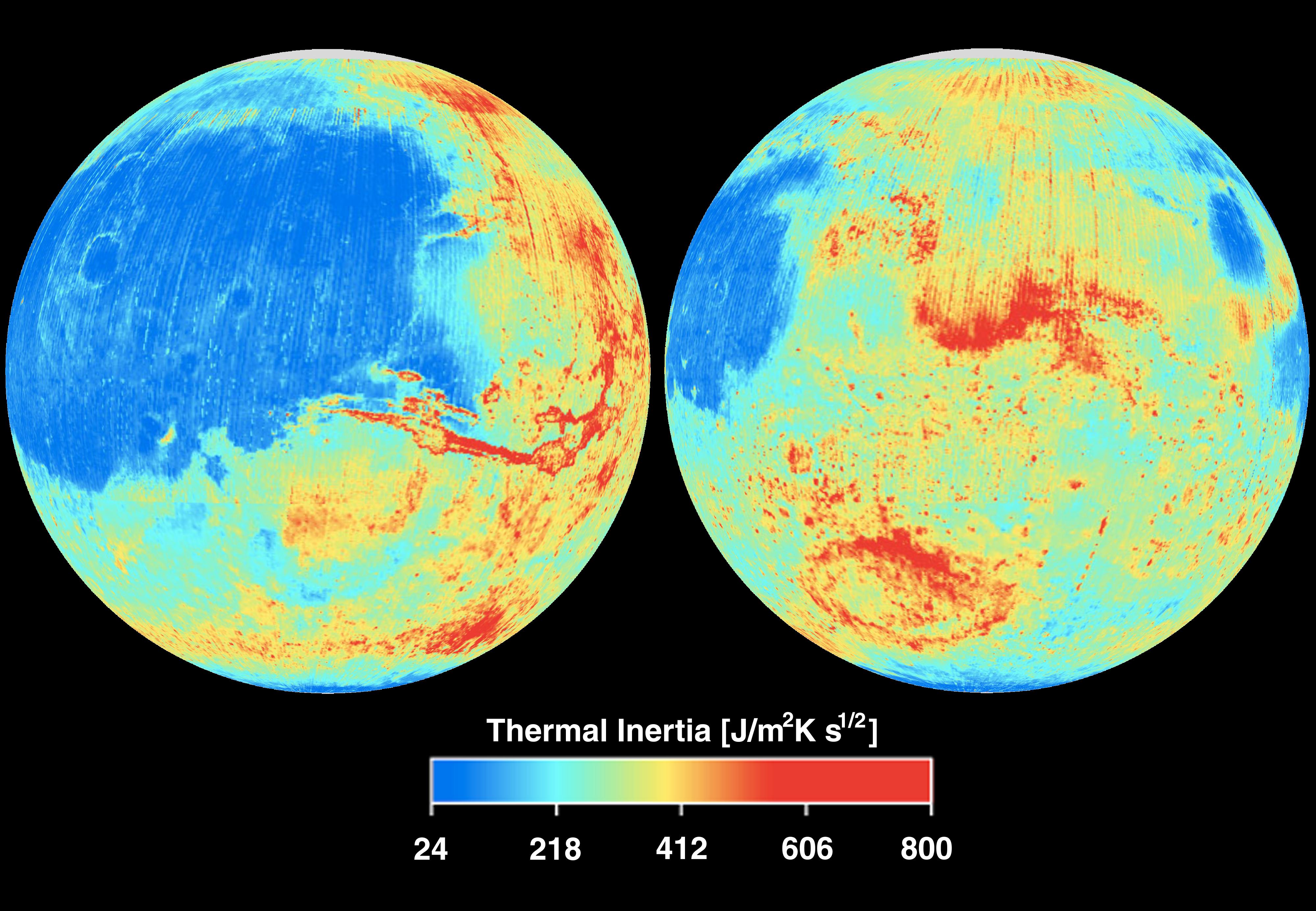
2001-01-17
Mars
Mars Global Surveyor (MGS)
Thermal Emission Spectrometer
4000x2769x3
PIA02818:
Mars Thermal Inertia
Full Resolution:
TIFF
(21.3 MB)
JPEG
(883.2 kB)
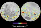
2001-01-17
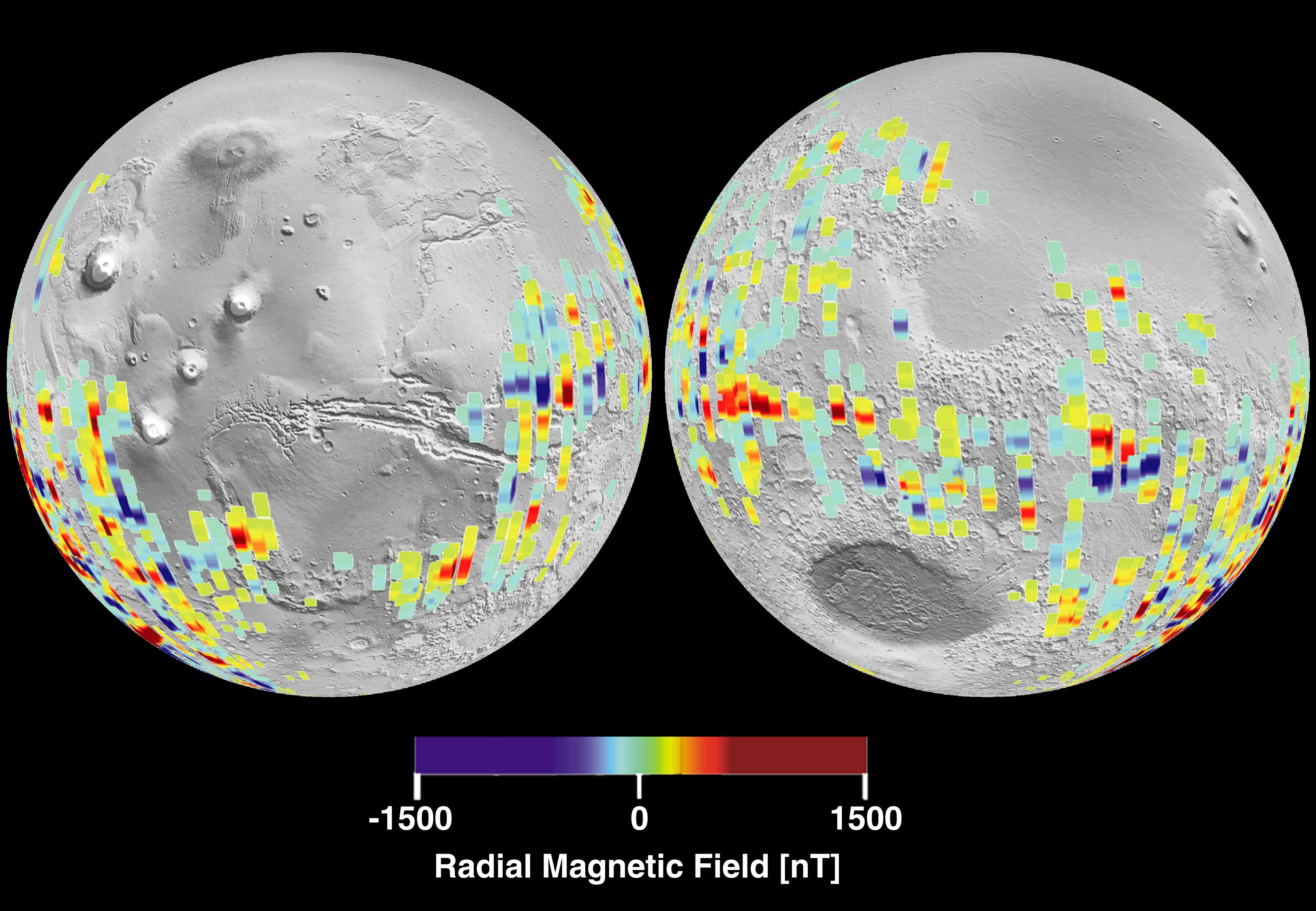
Mars
Mars Global Surveyor (MGS)
Magnetometer
4000x2769x3
PIA02819:
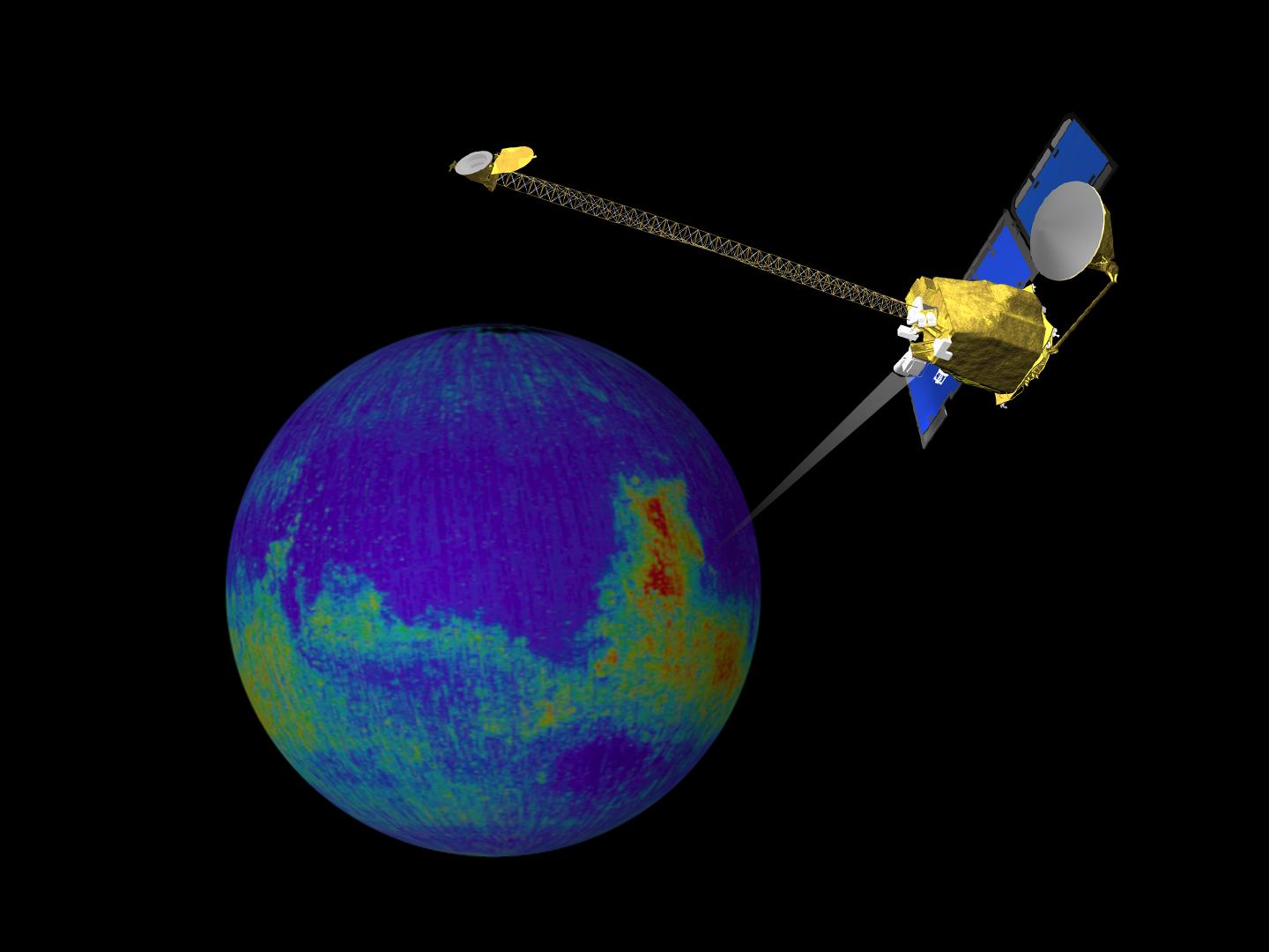
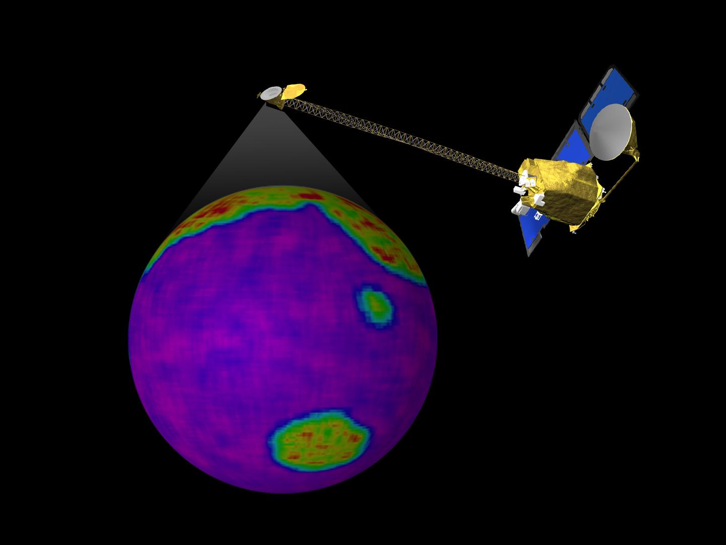
Mars Crustal Magnetic Field Remnants
Full Resolution:
TIFF
(11.85 MB)
JPEG
(959.2 kB)
2001-01-17
Mars
Mars Global Surveyor (MGS)
MOLA
4000x2769x3
PIA02820:
Mars Topography
Full Resolution:
TIFF
(21.78 MB)
JPEG
(1.109 MB)
2001-02-08
Mars
Mars Global Surveyor (MGS)
Mars Orbiter Camera (MOC)
768x2048x1
PIA03203:
Mid-Latitude Sedimentary Rock: Spallanzani Crater
Full Resolution:
TIFF
(1.025 MB)
JPEG
(161.8 kB)
2001-02-08
Mars
Mars Global Surveyor (MGS)
Mars Orbiter Camera (MOC)
1409x561x3
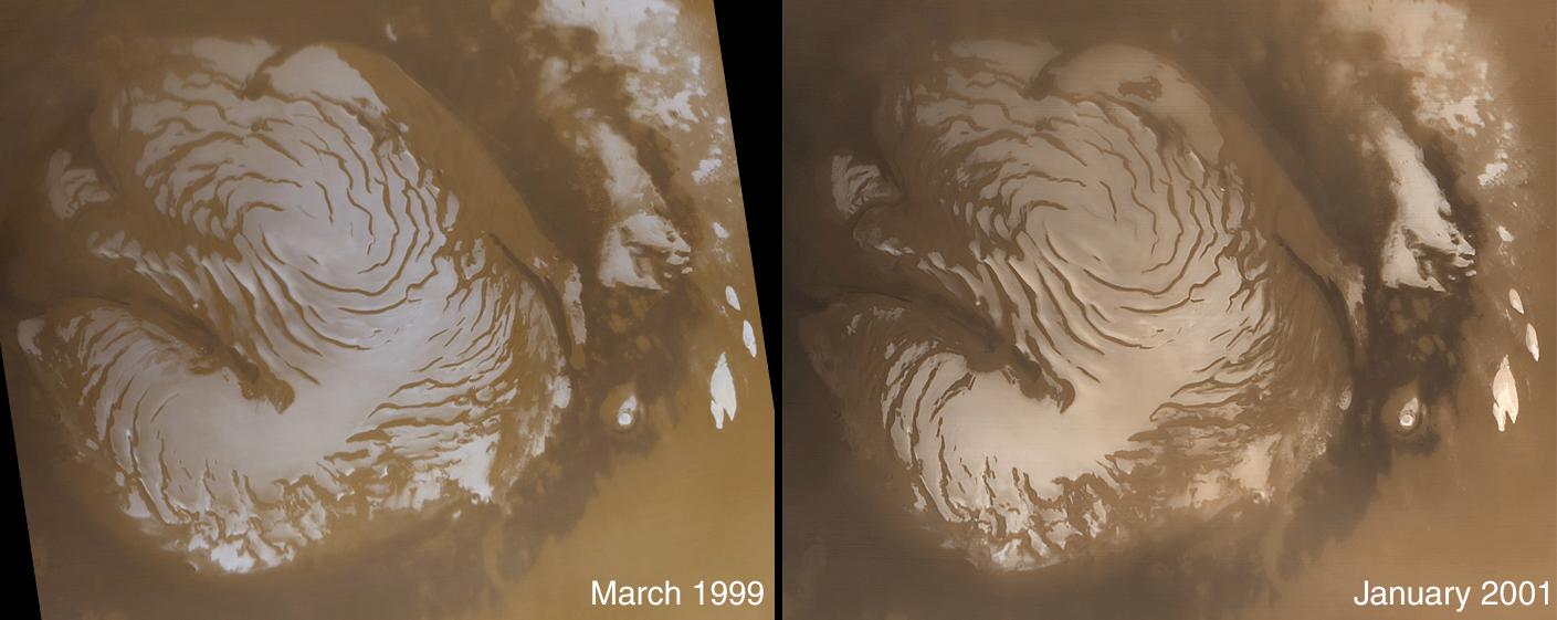
PIA03204:
The Martian North Polar Cap in Summer - One Year Later
Full Resolution:
TIFF
(2.124 MB)
JPEG
(80.98 kB)
2001-02-08
Mars
Mars Global Surveyor (MGS)
Mars Orbiter Camera (MOC)
1970x1010x1
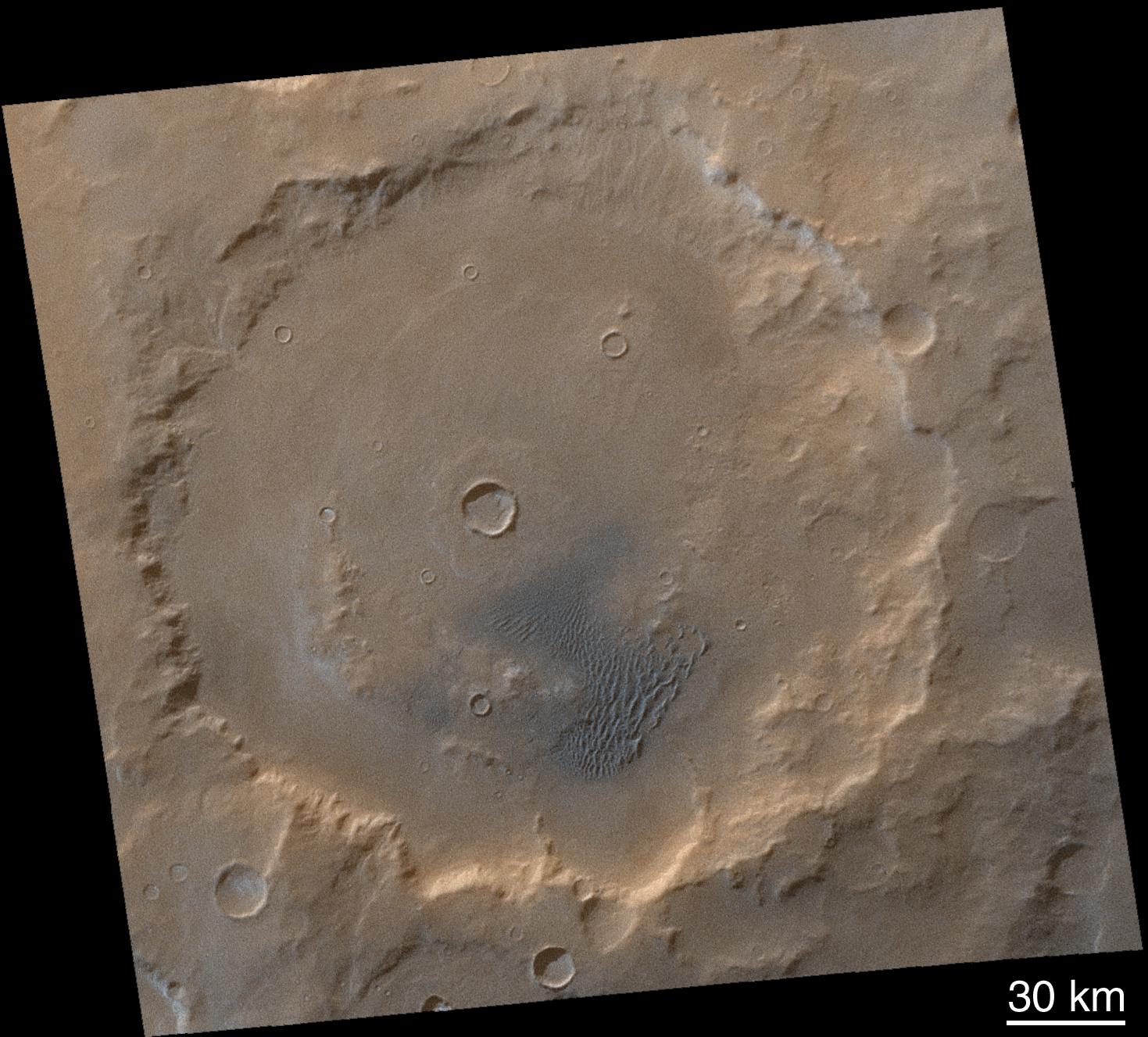
PIA03205:
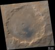
Secrets of the Noachian Highlands: Pit Craters
Full Resolution:
TIFF
(2.092 MB)
JPEG
(399 kB)
2001-02-08
Mars
Mars Global Surveyor (MGS)
Mars Orbiter Camera (MOC)
1469x1327x3
PIA03206:
Winter Frosted Dunes in Kaiser Crater
Full Resolution:
TIFF
(4.536 MB)
JPEG
(245.8 kB)
2001-02-08
Mars
Mars Global Surveyor (MGS)
Mars Orbiter Camera (MOC)
1029x909x1
PIA03207:
The Martian Prime Meridian -- Longitude "Zero"
Full Resolution:
TIFF
(876.3 kB)
JPEG
(181.6 kB)
2001-02-08
Mars
Mars Global Surveyor (MGS)
Mars Orbiter Camera (MOC)
836x2021x1
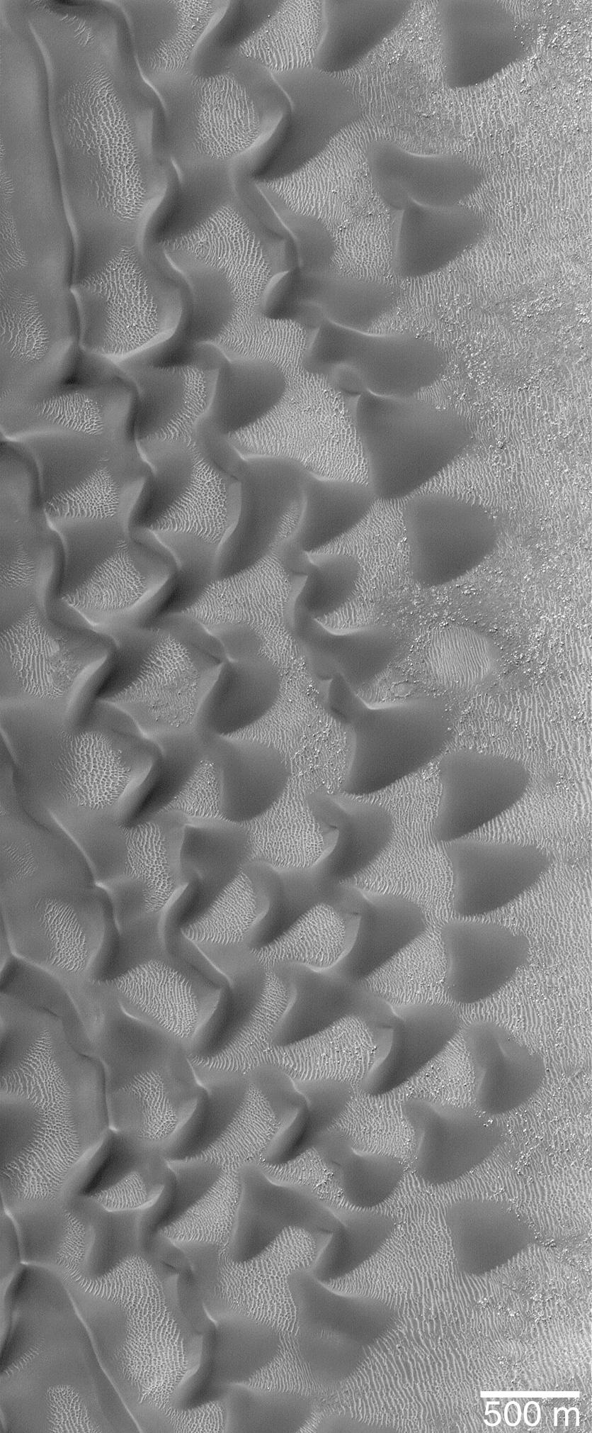
PIA03208:
"Sharks Teeth" -- Sand Dunes in Proctor Crater
Full Resolution:
TIFF
(1.747 MB)
JPEG
(314.3 kB)
2001-02-08
Mars
Mars Global Surveyor (MGS)
Mars Orbiter Camera (MOC)
1752x3553x3
PIA03209:
Lyot Crater and Northern Deuteronilus Mensae
Full Resolution:
TIFF
(10.9 MB)
JPEG
(512.9 kB)
2001-02-08
Mars
Mars Global Surveyor (MGS)
Mars Orbiter Camera (MOC)
640x917x1
PIA03210:
Strange Surfaces of Hellas Planitia
Full Resolution:
TIFF
(664.2 kB)
JPEG
(171.8 kB)
2001-02-08
Mars
Mars Global Surveyor (MGS)
Mars Orbiter Camera (MOC)
3124x512x1
PIA03211:
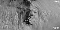
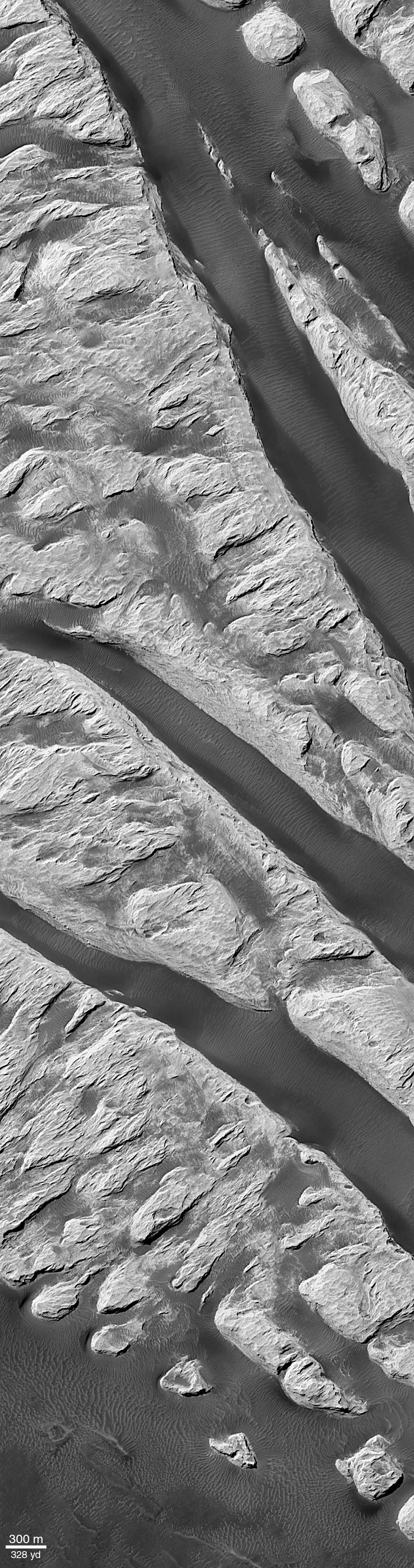
Spectacular Layers Exposed in Becquerel Crater
Full Resolution:
TIFF
(1.678 MB)
JPEG
(369.5 kB)
2001-02-21
Mars
Viking
Visual Imaging Subsystem
5072x4499x3
PIA03213:
Noctis Labyrinthus
Full Resolution:
TIFF
(81.9 MB)
JPEG
(4.397 MB)
2001-03-27
Mars
2001 Mars Odyssey
Mars Orbiter Camera (MOC)
THEMIS
1440x1080x3
PIA03219:
Still From Odyssey Clip 1
Full Resolution:
TIFF
(997.2 kB)
JPEG
(53.55 kB)
2001-03-27
Mars
2001 Mars Odyssey
Mars Orbiter Camera (MOC)
THEMIS
1440x1080x3
PIA03220:
Still From Odyssey Clip 2
Full Resolution:
TIFF
(1.256 MB)
JPEG
(77.47 kB)
2001-03-27
Mars
2001 Mars Odyssey
Mars Orbiter Camera (MOC)
THEMIS
1440x1080x3
PIA03221:
Still From Odyssey Clip 3
Full Resolution:
TIFF
(977.6 kB)
JPEG
(61.99 kB)
2001-05-24
Mars
Mars Global Surveyor (MGS)
Mars Orbiter Camera (MOC)
1460x1000x3
PIA03222:
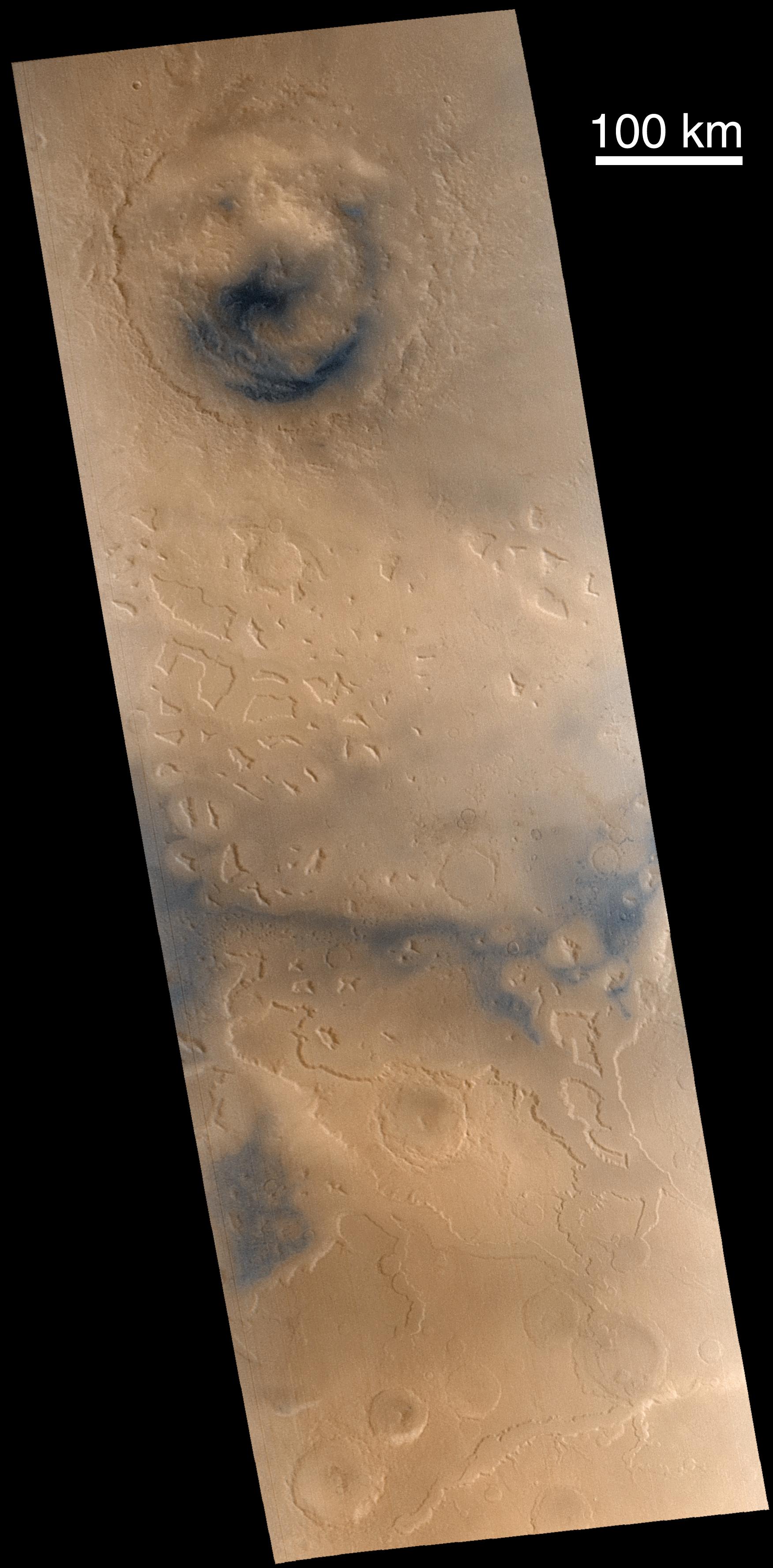
Mid-Winter Dust Storms Near Hellas Planitia
Full Resolution:
TIFF
(2.467 MB)
JPEG
(106.9 kB)
2001-05-24
Mars
Mars Global Surveyor (MGS)
Mars Orbiter Camera (MOC)
512x703x1
PIA03223:
A Mid-Summer's Dust Devil
Full Resolution:
TIFF
(386.1 kB)
JPEG
(97.34 kB)
2001-05-24
Mars
Mars Global Surveyor (MGS)
Mars Orbiter Camera (MOC)
907x2547x3
PIA03224:
Sand Dunes of Nili Patera in 3-D
Full Resolution:
TIFF
(7.497 MB)
JPEG
(540.1 kB)
2001-05-24
Mars
Mars Global Surveyor (MGS)
Mars Orbiter Camera (MOC)
2400x2400x1
PIA03225:
Highest-Resolution View of "Face on Mars"
Full Resolution:
TIFF
(5.586 MB)
JPEG
(902 kB)
2001-05-24
Mars
Mars Global Surveyor (MGS)
Mars Orbiter Camera (MOC)
1044x1506x1
PIA03226:
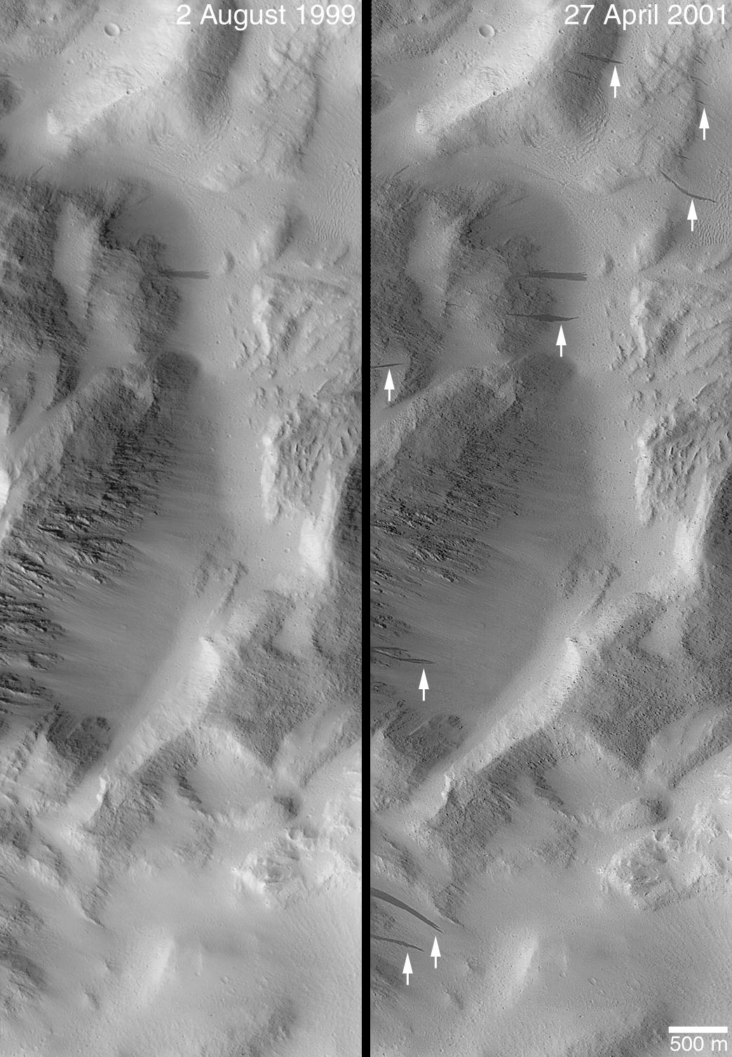
Changes Over a Martian Year -- New Dark Slope Streaks in Lycus Sucli
Full Resolution:
TIFF
(1.586 MB)
JPEG
(256.2 kB)
2001-06-18
Mars
Mars Global Surveyor (MGS)
Mars Orbiter Camera (MOC)
1505x5404x1
PIA03227:
Defrosting Sand Dunes in Late Southern Winter
Full Resolution:
TIFF
(3.104 MB)
JPEG
(513.9 kB)
1-100
101-200
201-300
301-400
401-500
501-600
601-700
701-800
801-900
901-1000
Currently displaying images:
801 - 900
of 12731


