Click on an image for detailed information
Click on a column heading to sort in ascending or descending order

My
List |
Addition Date
|
Target
|
Mission
|
Instrument
|
Size
|

|
2000-05-16 |
Mars
|
Mars Global Surveyor (MGS)
|
Mars Orbiter Camera (MOC)
|
726x489x1 |
|
-
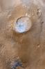
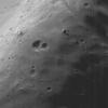
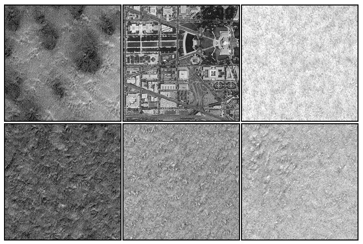
PIA02313:
-
Mars Polar Lander Site Compared With Washington, D.C.
Full Resolution:
TIFF
(365.8 kB)
JPEG
(98.56 kB)
|
|
|
2000-05-16 |
Mars
|
Mars Global Surveyor (MGS)
|
Mars Orbiter Camera (MOC)
|
913x831x3 |
|
-
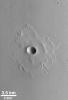
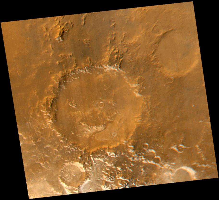
PIA02325:
-
Have a Nice Spring! MOC Revisits "Happy Face" Crater
Full Resolution:
TIFF
(1.933 MB)
JPEG
(80.21 kB)
|
|
|
2000-05-22 |
Mars
|
Mars Global Surveyor (MGS)
|
Mars Orbiter Camera (MOC)
|
800x7000x3 |

|
-
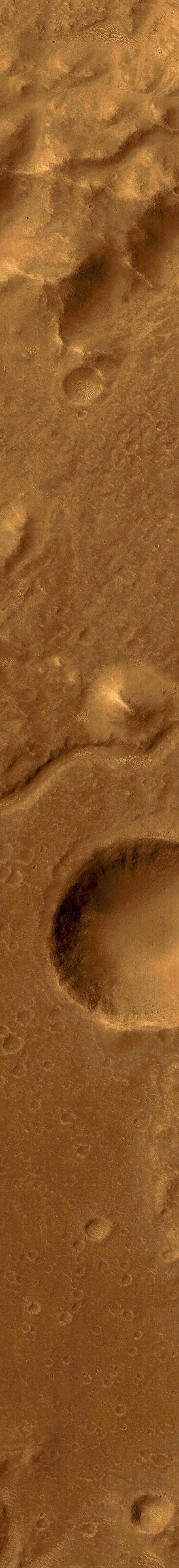
PIA02395:
-
A Valley in the Libya Montes
Full Resolution:
TIFF
(10.34 MB)
JPEG
(706.3 kB)
|
|
|
2000-05-22 |
Mars
|
Mars Global Surveyor (MGS)
|
Mars Orbiter Camera (MOC)
|
2174x987x3 |
|
-
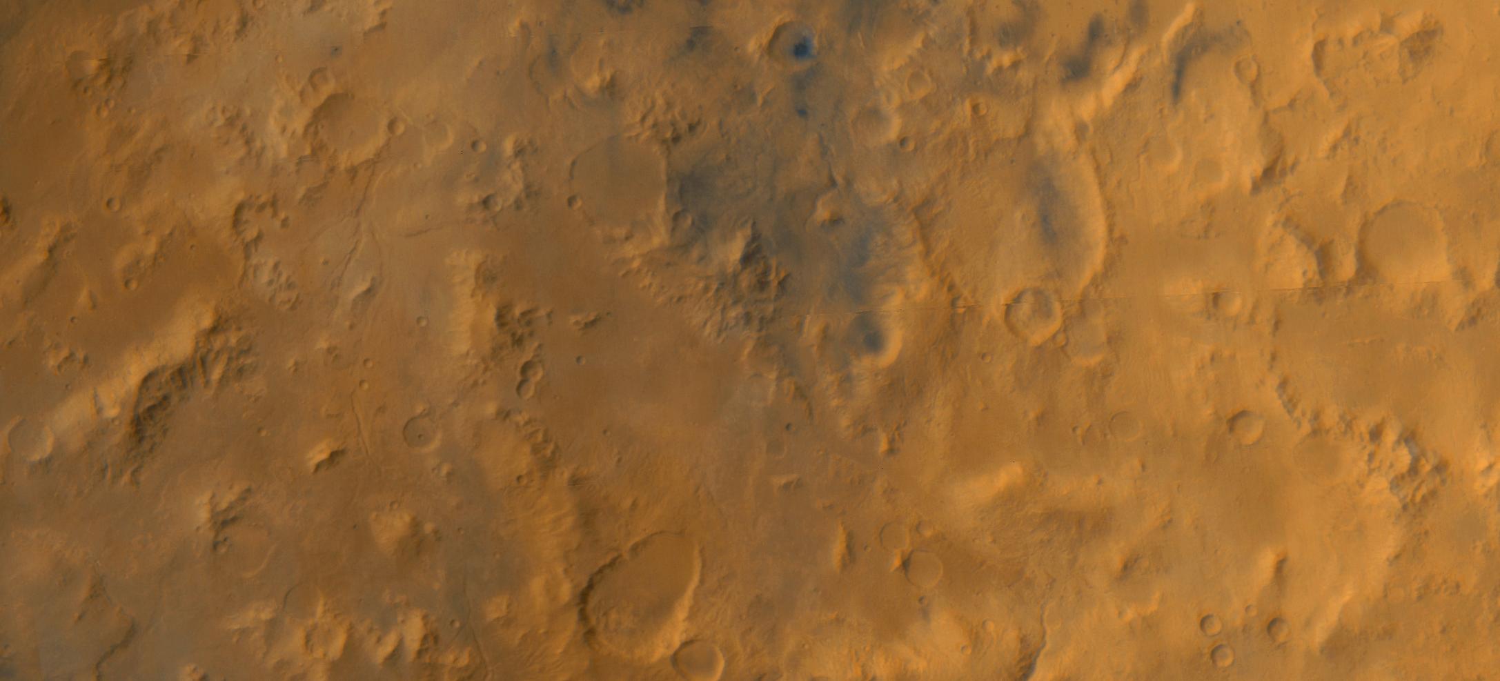
PIA02396:
-
A Regional View of the Libya Montes
Full Resolution:
TIFF
(4.827 MB)
JPEG
(153.5 kB)
|
|
|
2000-05-22 |
Mars
|
Mars Global Surveyor (MGS)
|
Mars Orbiter Camera (MOC)
|
800x7000x1 |

|
-
PIA02397:
-
The Plains of Central Terra Meridiani
Full Resolution:
TIFF
(4.047 MB)
JPEG
(836.7 kB)
|
|
|
2000-05-22 |
Mars
|
Mars Global Surveyor (MGS)
|
Mars Orbiter Camera (MOC)
|
512x1381x1 |
|
-
PIA02398:
-
Layers and a Dust Devil in Melas Chasma
Full Resolution:
TIFF
(692.5 kB)
JPEG
(191.1 kB)
|
|
|
2000-05-22 |
Mars
|
Mars Global Surveyor (MGS)
|
Mars Orbiter Camera (MOC)
|
1368x1319x3 |
|
-
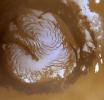
PIA02800:
-
The Martian North Polar Cap in Summer
Full Resolution:
TIFF
(4.691 MB)
JPEG
(162 kB)
|
|
|
2000-05-22 |
Mars
|
Mars Global Surveyor (MGS)
|
Mars Orbiter Camera (MOC)
|
836x3919x1 |
|
-
PIA02801:
-
Ridged Terrain on the Floor Melas Chasma
Full Resolution:
TIFF
(3.129 MB)
JPEG
(558.5 kB)
|
|
|
2000-05-22 |
Mars
|
Mars Global Surveyor (MGS)
|
Mars Orbiter Camera (MOC)
|
512x1837x1 |

|
-
PIA02802:
-
Hot-Cross-Bun' on the Northern Plains
Full Resolution:
TIFF
(841.6 kB)
JPEG
(166 kB)
|
|
|
2000-05-26 |
Mars
|
Mars Global Surveyor (MGS)
|
Mars Orbiter Camera (MOC)
|
549x921x1 |
|
-
PIA02300:
-
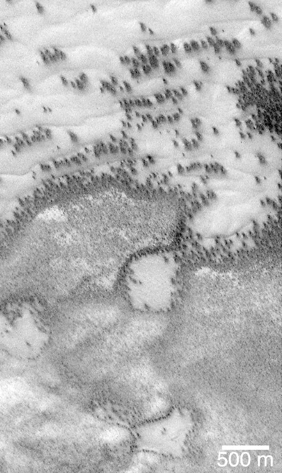
Defrosting Polar Dunes--"They Look Like Bushes!"
Full Resolution:
TIFF
(421.2 kB)
JPEG
(118.9 kB)
|
|
|
2000-05-27 |
Mars
|
Mars Global Surveyor (MGS)
|
Mars Orbiter Camera (MOC)
|
836x1169x1 |
|
-
PIA02306:
-
A Typical Martian Scene: Boulders and Slopes in a Crater in Aeolis
Full Resolution:
TIFF
(760.1 kB)
JPEG
(127.2 kB)
|
|
|
2000-06-01 |
Mars
|
Mars Global Surveyor (MGS)
|
Mars Orbiter Camera (MOC)
|
2304x1152x3 |
|
-
PIA02066:
-
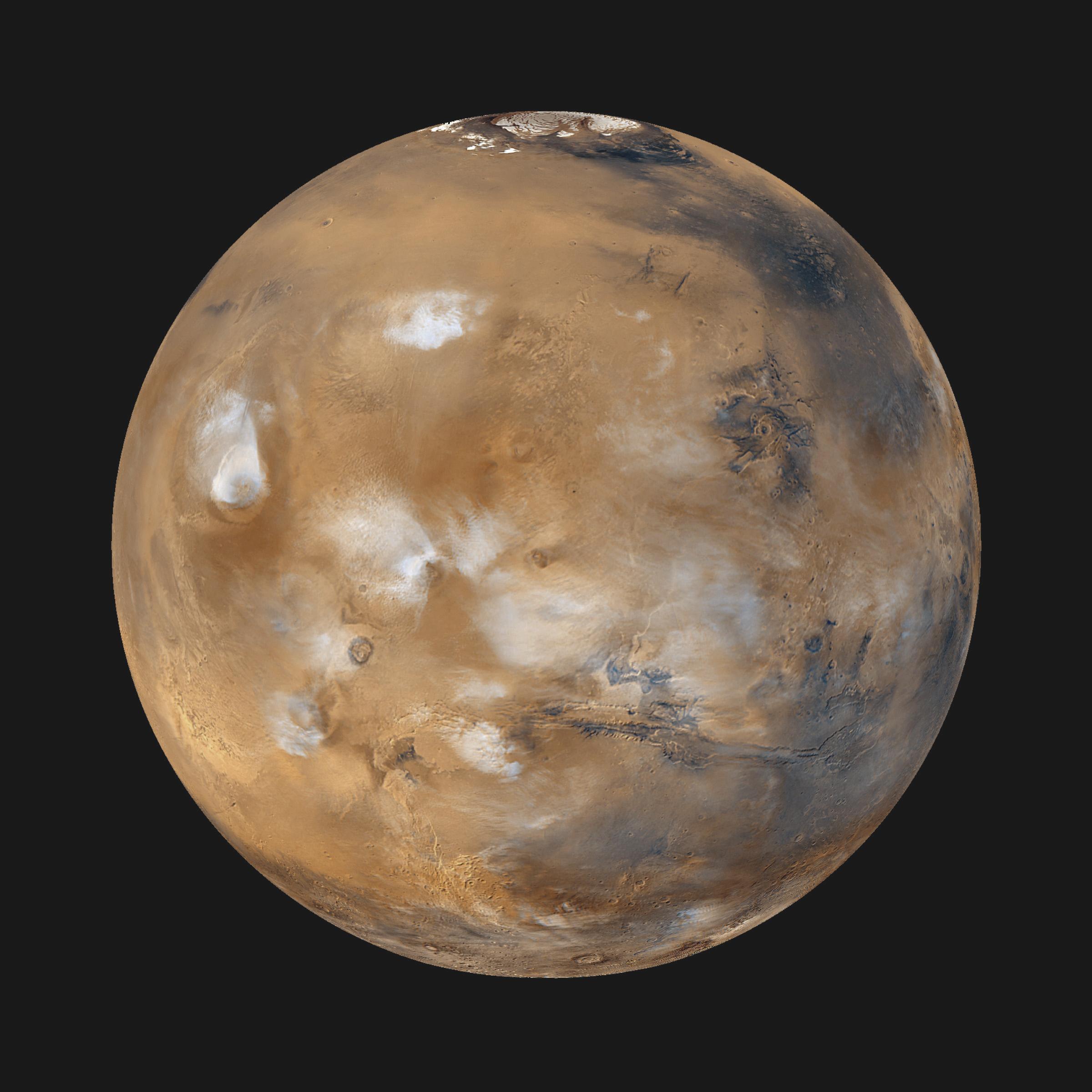
Global Weather
Full Resolution:
TIFF
(6.258 MB)
JPEG
(327.8 kB)
|
|
|
2000-06-01 |
Mars
|
Mars Global Surveyor (MGS)
|
Mars Orbiter Camera (MOC)
|
706x1544x1 |
|
-
PIA02069:
-
Frost-covered Dunes
Full Resolution:
TIFF
(874.8 kB)
JPEG
(139.1 kB)
|
|
|
2000-06-01 |
Mars
|
Mars Global Surveyor (MGS)
|
Mars Orbiter Camera (MOC)
|
1631x2076x1 |

|
-
PIA02070:
-
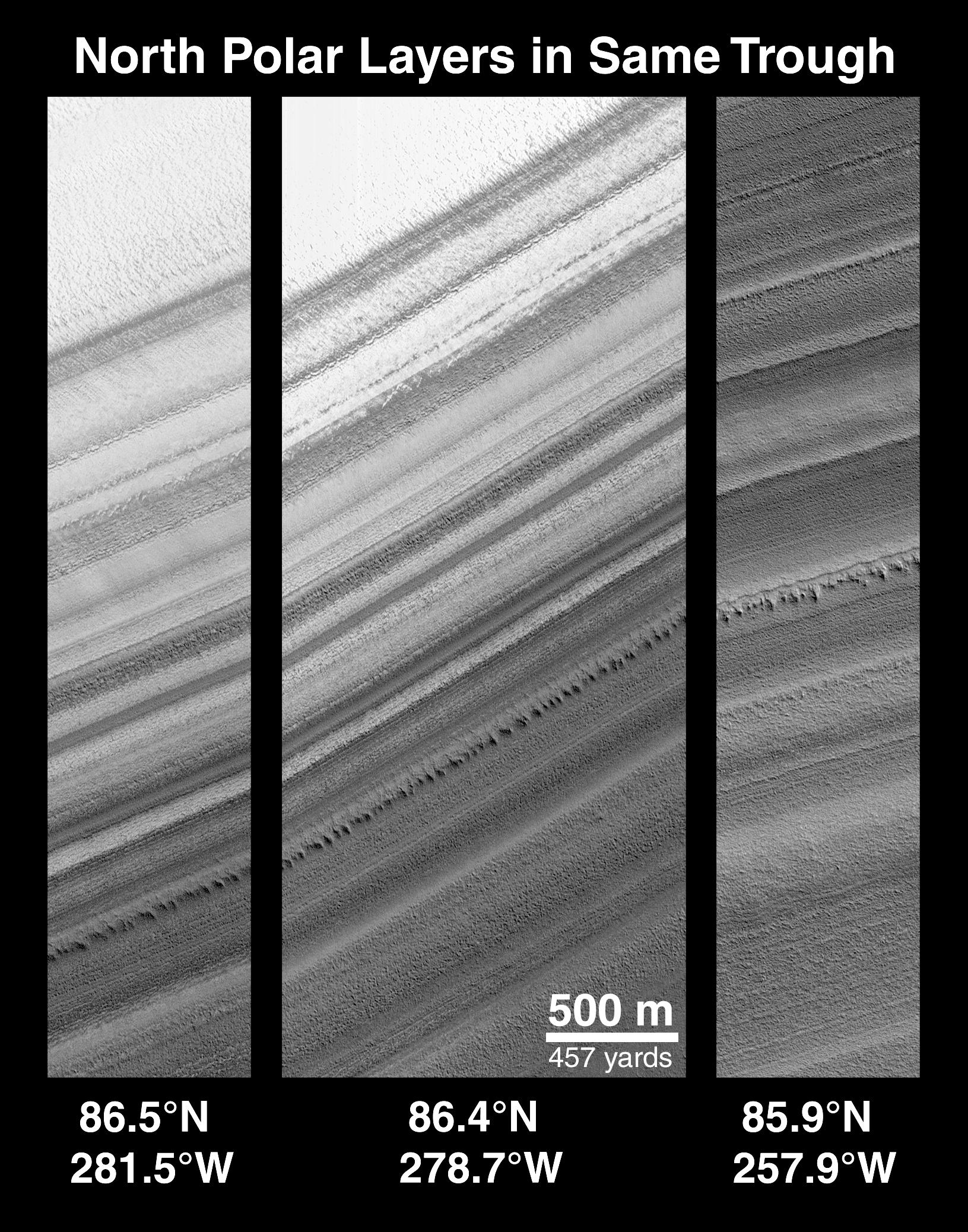
Polar Stratigraphy
Full Resolution:
TIFF
(2.355 MB)
JPEG
(578.6 kB)
|
|
|
2000-06-01 |
Mars
|
Mars Global Surveyor (MGS)
|
Mars Orbiter Camera (MOC)
|
1024x812x1 |
|
-
PIA02072:
-
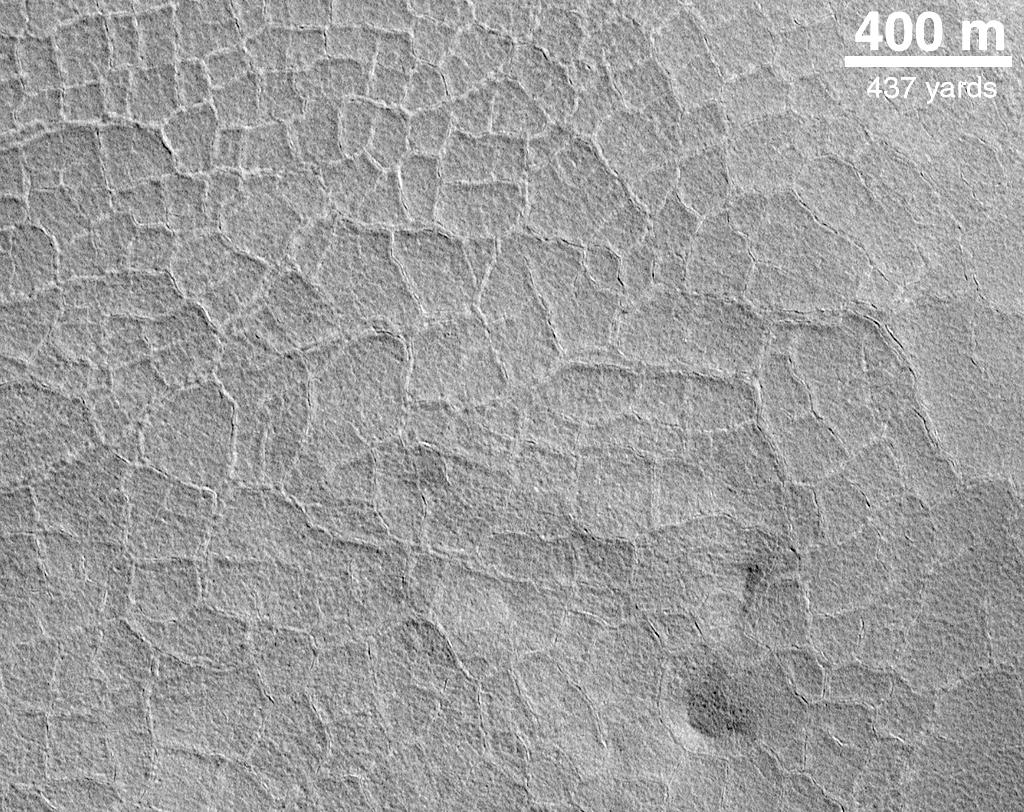
Indications of Subsurface Ice: Polygons on the Northern Plains
Full Resolution:
TIFF
(867.6 kB)
JPEG
(236.7 kB)
|
|
|
2000-06-01 |
Mars
|
Mars Global Surveyor (MGS)
|
Mars Orbiter Camera (MOC)
|
1024x1514x1 |
|
-
PIA02074:
-
Fretted Terrain Crater
Full Resolution:
TIFF
(1.521 MB)
JPEG
(324.6 kB)
|
|
|
2000-06-01 |
Mars
|
Mars Global Surveyor (MGS)
|
Mars Orbiter Camera (MOC)
|
737x1510x1 |
|
-
PIA02075:
-
Lineated Valley Floor
Full Resolution:
TIFF
(1.293 MB)
JPEG
(306.4 kB)
|
|
|
2000-06-01 |
Mars
|
Mars Global Surveyor (MGS)
|
Mars Orbiter Camera (MOC)
|
717x1400x1 |
|
-
PIA02076:
-
Hrad Vallis
Full Resolution:
TIFF
(970.4 kB)
JPEG
(169 kB)
|
|
|
2000-06-01 |
Mars
|
Mars Global Surveyor (MGS)
|
Mars Orbiter Camera (MOC)
|
717x1399x1 |
|
-
PIA02077:
-
Valley Networks
Full Resolution:
TIFF
(1.014 MB)
JPEG
(188.2 kB)
|
|
|
2000-06-01 |
Mars
|
Mars Global Surveyor (MGS)
|
Mars Orbiter Camera (MOC)
|
672x1125x1 |
|
-
PIA02078:
-
Olympica Fossae
Full Resolution:
TIFF
(642.4 kB)
JPEG
(124.6 kB)
|
|
|
2000-06-01 |
Mars
|
Mars Global Surveyor (MGS)
|
Mars Orbiter Camera (MOC)
|
1241x803x3 |
|
-
PIA02079:
-
Tharsis and Marineris
Full Resolution:
TIFF
(2.895 MB)
JPEG
(150.1 kB)
|
|
|
2000-06-01 |
Mars
|
Mars Global Surveyor (MGS)
|
Mars Orbiter Camera (MOC)
|
717x1059x1 |
|
-
PIA02080:
-
Olympus Lava Flows
Full Resolution:
TIFF
(750 kB)
JPEG
(156.4 kB)
|
|
|
2000-06-01 |
Mars
|
Mars Global Surveyor (MGS)
|
Mars Orbiter Camera (MOC)
|
672x993x1 |
|
-
PIA02081:
-
Daedalia Lava Flow
Full Resolution:
TIFF
(642.9 kB)
JPEG
(137.4 kB)
|
|
|
2000-06-01 |
Mars
|
Mars Global Surveyor (MGS)
|
Mars Orbiter Camera (MOC)
|
614x813x1 |
|
-
PIA02082:
-
Alba Patera Surface
Full Resolution:
TIFF
(566.4 kB)
JPEG
(127 kB)
|
|
|
2000-06-01 |
Mars
|
Mars Global Surveyor (MGS)
|
Mars Orbiter Camera (MOC)
|
819x1211x1 |
|
-
PIA02085:
-
Pedestal Crater
Full Resolution:
TIFF
(838.2 kB)
JPEG
(146.8 kB)
|
|
|
2000-06-01 |
Mars
|
Mars Global Surveyor (MGS)
|
Mars Orbiter Camera (MOC)
|
376x1790x1 |
|
-
PIA02093:
-
Detail of an Impact Crater, Acidalia Planitia
Full Resolution:
TIFF
(689.6 kB)
JPEG
(164.8 kB)
|
|
|
2000-06-01 |
Mars
|
Mars Global Surveyor (MGS)
|
Mars Orbiter Camera (MOC)
|
831x2367x1 |
|
-
PIA02094:
-
Water: Sustained Flow
Full Resolution:
TIFF
(2.177 MB)
JPEG
(456 kB)
|
|
|
2000-06-01 |
Mars
|
Mars Global Surveyor (MGS)
|
Mars Orbiter Camera (MOC)
|
512x1030x1 |
|
-
PIA02095:
-
Winter Frosts of the Retreating South Polar Cap
Full Resolution:
TIFF
(402.7 kB)
JPEG
(111.2 kB)
|
|
|
2000-06-01 |
Mars
|
Mars Global Surveyor (MGS)
|
Mars Orbiter Camera (MOC)
|
552x1012x3 |
|
-
PIA02096:
-
Southern Mars: It's Spring!
Full Resolution:
TIFF
(1.177 MB)
JPEG
(38.04 kB)
|
|
|
2000-06-02 |
Mars
|
Mars Global Surveyor (MGS)
|
Mars Orbiter Camera (MOC)
|
1024x1375x1 |
|
-
PIA02068:
-
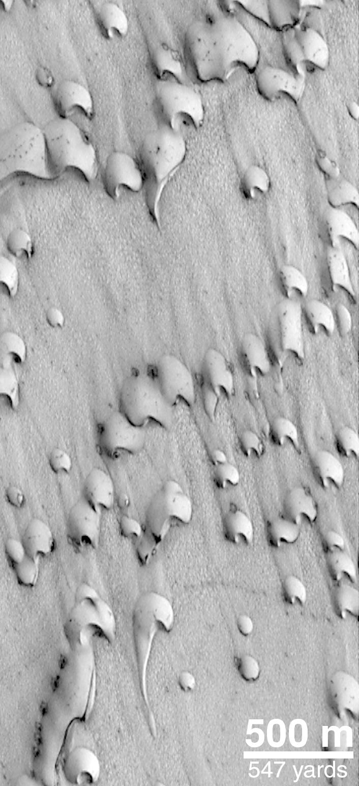
North Polar Sand Dunes
Full Resolution:
TIFF
(1.305 MB)
JPEG
(284.4 kB)
|
|
|
2000-06-07 |
Mars
|
Mars Global Surveyor (MGS)
|
Mars Orbiter Camera (MOC)
|
502x2347x1 |
|
-
PIA02043:
-
Eroded, Layered Cratered Highlands of Eastern Arabia Terra
Full Resolution:
TIFF
(1.162 MB)
JPEG
(210.9 kB)
|
|
|
2000-06-07 |
Mars
|
Mars Global Surveyor (MGS)
|
Mars Orbiter Camera (MOC)
|
559x1820x1 |

|
-
PIA02046:
-
A Martian "Monument Valley" -- Mesas on the Elysium Plains
Full Resolution:
TIFF
(866.8 kB)
JPEG
(144.5 kB)
|
|
|
2000-06-07 |
Mars
|
Mars Global Surveyor (MGS)
|
Mars Orbiter Camera (MOC)
|
512x1265x1 |
|
-
PIA02047:
-
Big, Dark Dunes Northeast of Syrtis Major
Full Resolution:
TIFF
(607.5 kB)
JPEG
(116.8 kB)
|
|
|
2000-06-07 |
Mars
|
Mars Global Surveyor (MGS)
|
Mars Orbiter Camera (MOC)
|
672x1135x1 |
|
-
PIA02048:
-
North Nilosyrtis Mensae
Full Resolution:
TIFF
(707.1 kB)
JPEG
(145.2 kB)
|
|
|
2000-06-07 |
Mars
|
Mars Global Surveyor (MGS)
|
Mars Orbiter Camera (MOC)
|
836x1330x1 |
|
-
PIA02063:
-
MOC Providing Clues For Future Landing Site Selection
Full Resolution:
TIFF
(867.9 kB)
JPEG
(227.9 kB)
|
|
|
2000-06-07 |
Mars
|
Mars Global Surveyor (MGS)
|
Mars Orbiter Camera (MOC)
|
836x1329x1 |
|
-
PIA02064:
-
MOC Providing Clues For Future Landing Site Selection
Full Resolution:
TIFF
(1.088 MB)
JPEG
(270.6 kB)
|
|
|
2000-06-07 |
Mars
|
Mars Global Surveyor (MGS)
|
Mars Orbiter Camera (MOC)
|
781x1677x3 |
|
-
PIA02045:
-
May 1999 Dust Storm in Valles Marineris
Full Resolution:
TIFF
(2.463 MB)
JPEG
(93.21 kB)
|
|
|
2000-06-07 |
Mars
|
Mars Global Surveyor (MGS)
|
Mars Orbiter Camera (MOC)
|
768x640x3 |
|
-
PIA02049:
-
Regional View of the Tharsis Volcanoes
Full Resolution:
TIFF
(1.379 MB)
JPEG
(60.17 kB)
|
|
|
2000-06-14 |
Mars
|
Mars Global Surveyor (MGS)
|
Mars Orbiter Camera (MOC)
|
724x1926x1 |
|
-
PIA01697:
-
Northern Plains Textures Visible Near the Terminator
Full Resolution:
TIFF
(1.286 MB)
JPEG
(375.6 kB)
|
|
|
2000-06-14 |
Mars
|
Mars Global Surveyor (MGS)
|
Mars Orbiter Camera (MOC)
|
836x1057x1 |
|
-
PIA01699:
-
A Complex, Ridged Terrain in North Terra Cimmeria
Full Resolution:
TIFF
(612 kB)
JPEG
(96.2 kB)
|
|
|
2000-06-14 |
Mars
|
Mars Global Surveyor (MGS)
|
Mars Orbiter Camera (MOC)
|
910x910x3 |
|
-
PIA02000:
-
Acidalia and Chryse Plains, Mars
Full Resolution:
TIFF
(1.02 MB)
JPEG
(32.77 kB)
|
|
|
2000-06-14 |
Mars
|
Mars Global Surveyor (MGS)
|
Mars Orbiter Camera (MOC)
|
1024x772x1 |
|
-
PIA02002:
-
Layers of Cratered Highland Bedrock Exposed in Amenthes Slope
Full Resolution:
TIFF
(679.6 kB)
JPEG
(129.8 kB)
|
|
|
2000-06-14 |
Mars
|
Mars Global Surveyor (MGS)
|
Mars Orbiter Camera (MOC)
|
863x827x1 |
|
-
PIA02003:
-
On the Edge: The Retreating Mars Polar Ice Cap
Full Resolution:
TIFF
(701.8 kB)
JPEG
(146.4 kB)
|
|
|
2000-06-14 |
Mars
|
Mars Global Surveyor (MGS)
|
Mars Orbiter Camera (MOC)
|
910x910x3 |
|
-
PIA02004:
-
Syrtis Major and Arabia Terra, Mars
Full Resolution:
TIFF
(909.1 kB)
JPEG
(32.2 kB)
|
|
|
2000-06-14 |
Mars
|
Mars Global Surveyor (MGS)
|
Mars Orbiter Camera (MOC)
|
910x910x3 |
|
-
PIA02005:
-
Tharsis Volcanoes and Valles Marineris, Mars
Full Resolution:
TIFF
(977.4 kB)
JPEG
(31.85 kB)
|
|
|
2000-06-14 |
Mars
|
Mars Global Surveyor (MGS)
|
Mars Orbiter Camera (MOC)
|
429x669x3 |
|
-
PIA02006:
-
Apollinaris Patera, Mars
Full Resolution:
TIFF
(954.3 kB)
JPEG
(66.37 kB)
|
|
|
2000-06-14 |
Mars
|
Mars Global Surveyor (MGS)
|
Mars Orbiter Camera (MOC)
|
836x1683x1 |
|
-
PIA02007:
-
Once Pitted, Twice Spied: A New High Resolution View Inside Escalante Crater
Full Resolution:
TIFF
(1.337 MB)
JPEG
(235.6 kB)
|
|
|
2000-06-14 |
Mars
|
Mars Global Surveyor (MGS)
|
Mars Orbiter Camera (MOC)
|
614x1013x1 |

|
-
PIA02011:
-
Look Out Below! Rough Terrain In the Warrego Valles Region
Full Resolution:
TIFF
(631 kB)
JPEG
(161.9 kB)
|
|
|
2000-06-14 |
Mars
|
Mars Global Surveyor (MGS)
|
Mars Orbiter Camera (MOC)
|
512x2115x1 |
|
-
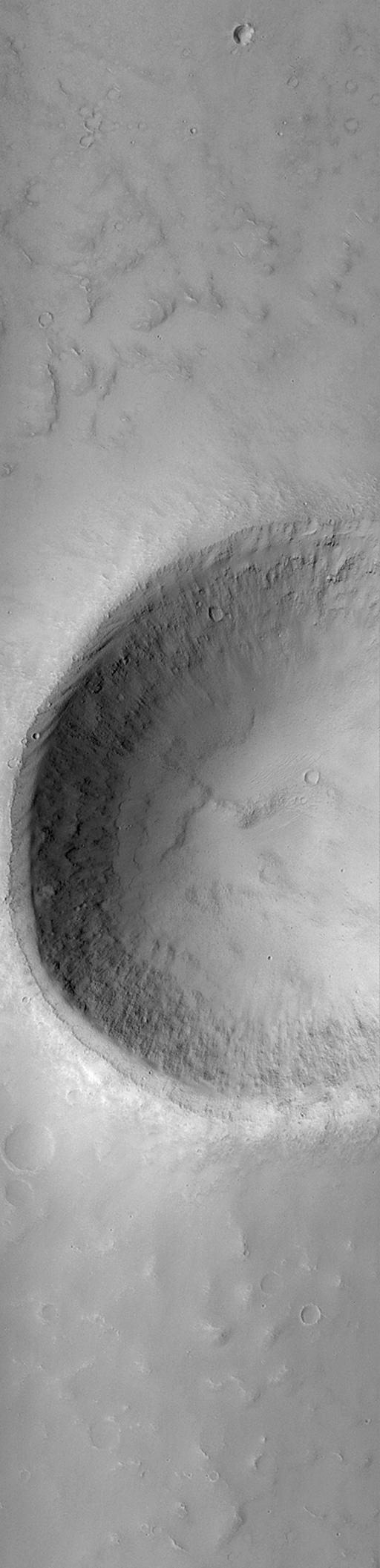
PIA02018:
-
MOC "Looking Into" Martian Craters
Full Resolution:
TIFF
(811.8 kB)
JPEG
(109.5 kB)
|
|
|
2000-06-14 |
Mars
|
Mars Global Surveyor (MGS)
|
Mars Orbiter Camera (MOC)
|
512x2115x1 |
|
-
PIA02019:
-
MOC "Looking Into" Martian Craters
Full Resolution:
TIFF
(835.5 kB)
JPEG
(145 kB)
|
|
|
2000-06-14 |
Mars
|
Mars Global Surveyor (MGS)
|
Mars Orbiter Camera (MOC)
|
233x449x1 |
|
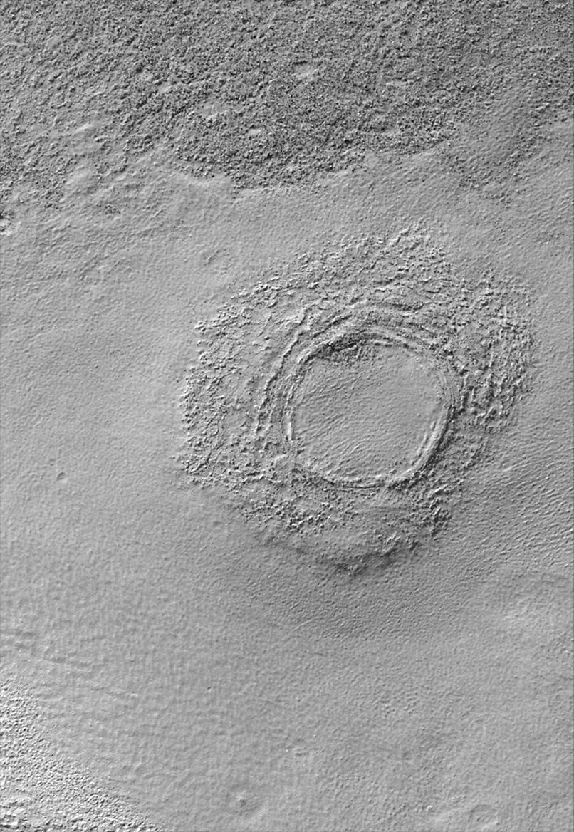
-
PIA02020:
-
South Melea Planum, By The Dawn's Early Light
Full Resolution:
TIFF
(79.2 kB)
JPEG
(17.16 kB)
|
|
|
2000-06-14 |
Mars
|
Mars Global Surveyor (MGS)
|
Mars Orbiter Camera (MOC)
|
233x449x1 |
|
-
PIA02021:
-
South Melea Planum, By The Dawn's Early Light
Full Resolution:
TIFF
(60.38 kB)
JPEG
(9.541 kB)
|
|
|
2000-06-14 |
Mars
|
Mars Global Surveyor (MGS)
|
Mars Orbiter Camera (MOC)
|
540x954x1 |
|
-
PIA01698:
-
Pedestal Craters and Wind Streaks, South Medusae Fossae
Full Resolution:
TIFF
(458.7 kB)
JPEG
(84.24 kB)
|
|
|
2000-06-14 |
Mars
|
Mars Global Surveyor (MGS)
|
Mars Orbiter Camera (MOC)
|
965x824x1 |

|
-
PIA02001:
-
Polar Dunes In Summer Exhibit Frost Patches, Wind Streaks
Full Resolution:
TIFF
(631.3 kB)
JPEG
(82.96 kB)
|
|
|
2000-06-14 |
Mars
|
Mars Global Surveyor (MGS)
|
Mars Orbiter Camera (MOC)
|
512x2113x1 |

|
-
PIA02017:
-
MOC "Looking Into" Martian Craters
Full Resolution:
TIFF
(841.4 kB)
JPEG
(113.2 kB)
|
|
|
2000-06-17 |
Mars
|
Mars Global Surveyor (MGS)
|
Mars Orbiter Camera (MOC)
|
659x740x1 |
|
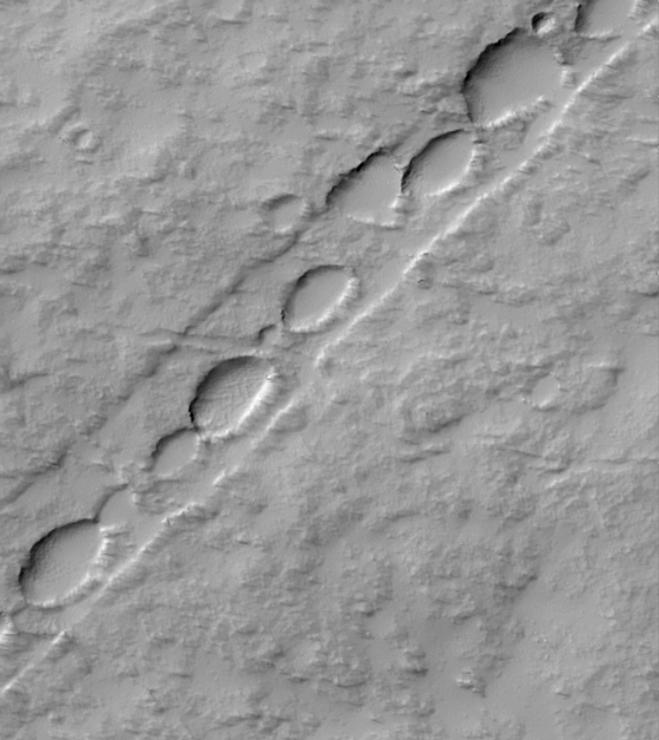
-
PIA01686:
-
Chain of Pits on Pavonis Mons
Full Resolution:
TIFF
(344.8 kB)
JPEG
(52.37 kB)
|
|
|
2000-06-17 |
Mars
|
Mars Global Surveyor (MGS)
|
Mars Orbiter Camera (MOC)
|
806x1168x1 |
|
-
PIA01687:
-
Floor of Alexey Tolstoy Crater
Full Resolution:
TIFF
(954.1 kB)
JPEG
(213.9 kB)
|
|
|
2000-06-17 |
Mars
|
Mars Global Surveyor (MGS)
|
Mars Orbiter Camera (MOC)
|
914x1282x1 |
|
-
PIA01688:
-
Patches of Remnant Frost/Snow on Crater Rim in Northern Summer
Full Resolution:
TIFF
(725.4 kB)
JPEG
(103.4 kB)
|
|
|
2000-06-17 |
Mars
|
Mars Global Surveyor (MGS)
|
Mars Orbiter Camera (MOC)
|
850x1387x1 |
|
-
PIA01689:
-
Valleys and Lava Flows near Olympus Mons
Full Resolution:
TIFF
(1.057 MB)
JPEG
(177.5 kB)
|
|
|
2000-06-17 |
Mars
|
Mars Global Surveyor (MGS)
|
Mars Orbiter Camera (MOC)
|
836x1196x1 |
|
-
PIA01691:
-
Melas Chasma Floor
Full Resolution:
TIFF
(885.3 kB)
JPEG
(136.5 kB)
|
|
|
2000-06-17 |
Mars
|
Mars Global Surveyor (MGS)
|
Mars Orbiter Camera (MOC)
|
836x1115x1 |
|
-
PIA01693:
-
Margin of Lava Flow in Daedalia Planum
Full Resolution:
TIFF
(715.5 kB)
JPEG
(116.4 kB)
|
|
|
2000-06-17 |
Mars
|
Mars Global Surveyor (MGS)
|
Mars Orbiter Camera (MOC)
|
1024x1025x1 |
|
-
PIA01694:
-
Ripples on Cratered Terrain North of Hesperia Planum
Full Resolution:
TIFF
(955.1 kB)
JPEG
(180.5 kB)
|
|
|
2000-06-17 |
Mars
|
Mars Global Surveyor (MGS)
|
Mars Orbiter Camera (MOC)
|
512x2392x1 |
|
-
PIA01695:
-
Martian Variety Exhibited by the Olympica Fossae
Full Resolution:
TIFF
(1.288 MB)
JPEG
(218.2 kB)
|
|
|
2000-06-17 |
Mars
|
Mars Global Surveyor (MGS)
|
Mars Orbiter Camera (MOC)
|
819x1993x1 |
|
-
PIA01696:
-
East Tithonium Chasma Wall, Valles Marineris
Full Resolution:
TIFF
(1.32 MB)
JPEG
(222.8 kB)
|
|
|
2000-06-17 |
Mars
|
Mars Global Surveyor (MGS)
|
Mars Orbiter Camera (MOC)
|
802x2137x3 |
|
-
PIA01692:
-
Western Melas and Candor Chasms, Valles Marineris
Full Resolution:
TIFF
(4.175 MB)
JPEG
(210 kB)
|
|
|
2000-06-22 |
Mars
|
Mars Global Surveyor (MGS)
|
Mars Orbiter Camera (MOC)
|
892x668x3 |
|
-
PIA01031:
-
Evidence for Recent Liquid Water on Mars: Basic Features of Martian Gullies
Full Resolution:
TIFF
(1.896 MB)
JPEG
(136.2 kB)
|
|
|
2000-06-22 |
Mars
|
Mars Global Surveyor (MGS)
|
Mars Orbiter Camera (MOC)
|
712x534x1 |
|
-
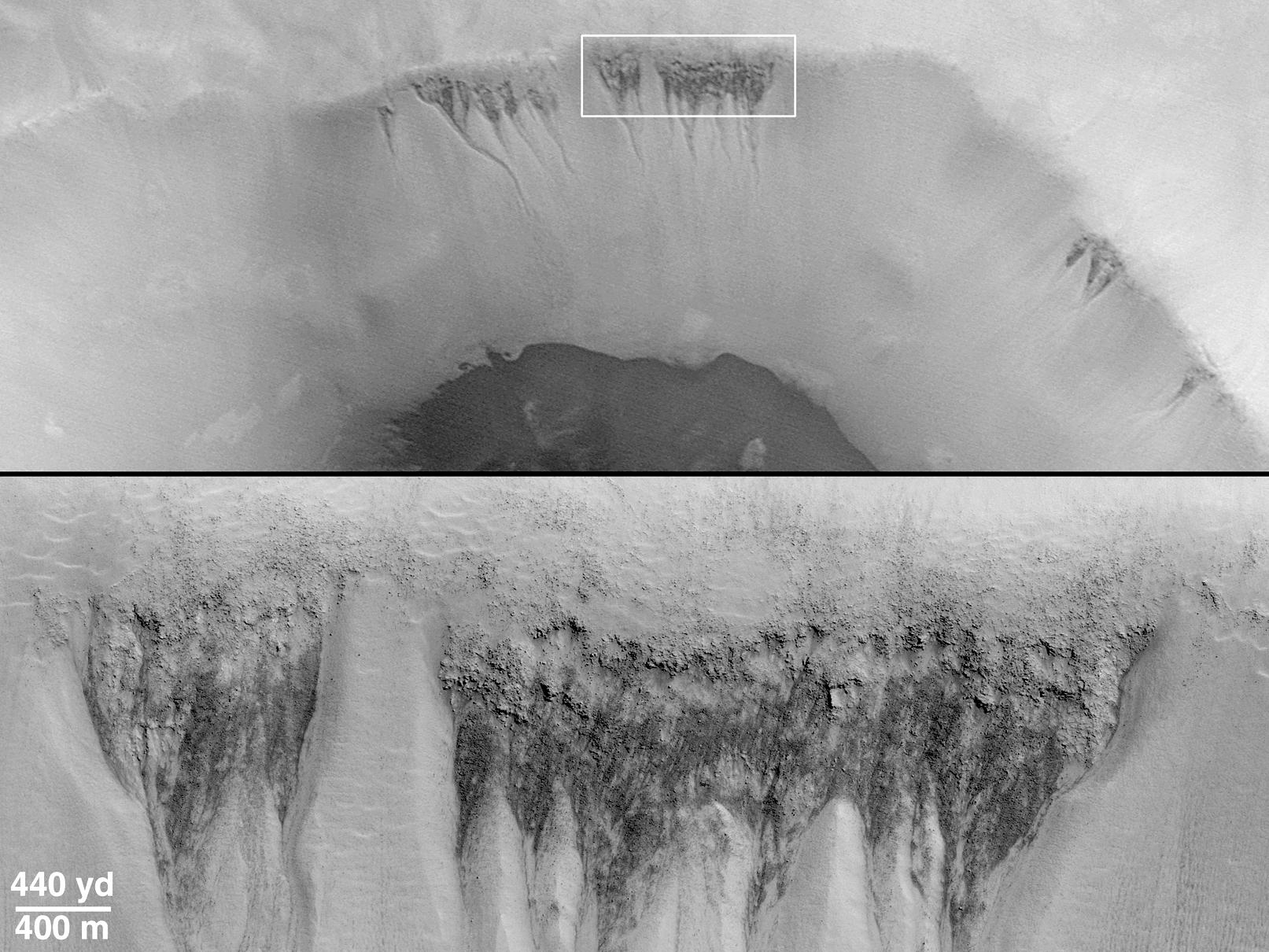
PIA01032:
-
Evidence for Recent Liquid Water on Mars:"Weeping" Layer in Gorgonum Chaos
Full Resolution:
TIFF
(301.9 kB)
JPEG
(51.97 kB)
|
|
|
2000-06-22 |
Mars
|
Mars Global Surveyor (MGS)
|
Mars Orbiter Camera (MOC)
|
1080x810x1 |
|
-
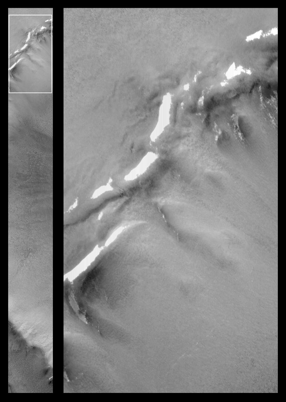
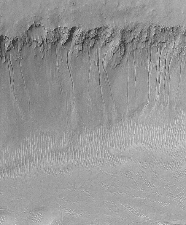
PIA01034:
-
Evidence for Recent Liquid Water on Mars: Gullies at 70�S in Polar Pit Walls
Full Resolution:
TIFF
(765.9 kB)
JPEG
(134.8 kB)
|
|
|
2000-06-22 |
Mars
|
Mars Global Surveyor (MGS)
|
Mars Orbiter Camera (MOC)
|
857x1285x3 |
|
-
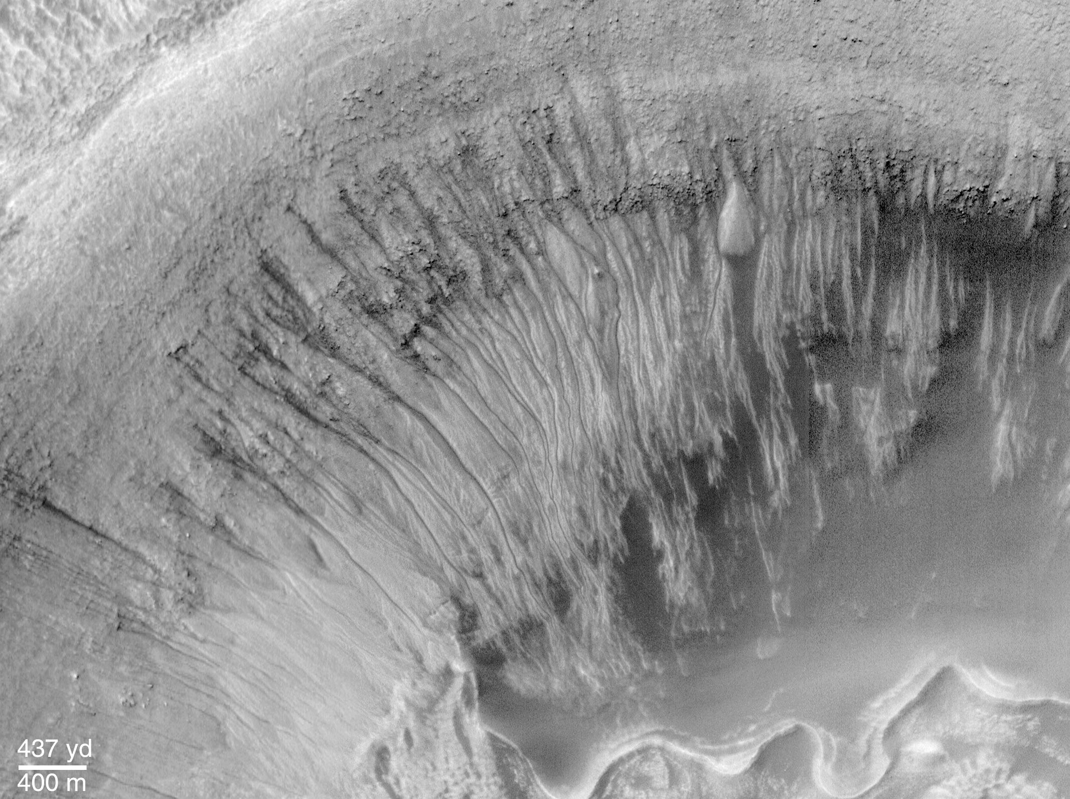
PIA01035:
-
Evidence for Recent Liquid Water on Mars: Gullies in Crater Wall, Noachis Terra
Full Resolution:
TIFF
(2.867 MB)
JPEG
(152.3 kB)
|
|
|
2000-06-22 |
Mars
|
Mars Global Surveyor (MGS)
|
Mars Orbiter Camera (MOC)
|
1613x1210x1 |
|
-
PIA01036:
-
Evidence for Recent Liquid Water on Mars: Seepage Sites in "Aerobraking Crater" Revisited
Full Resolution:
TIFF
(1.626 MB)
JPEG
(301.9 kB)
|
|
|
2000-06-22 |
Mars
|
Mars Global Surveyor (MGS)
|
Mars Orbiter Camera (MOC)
|
627x760x1 |
|
-
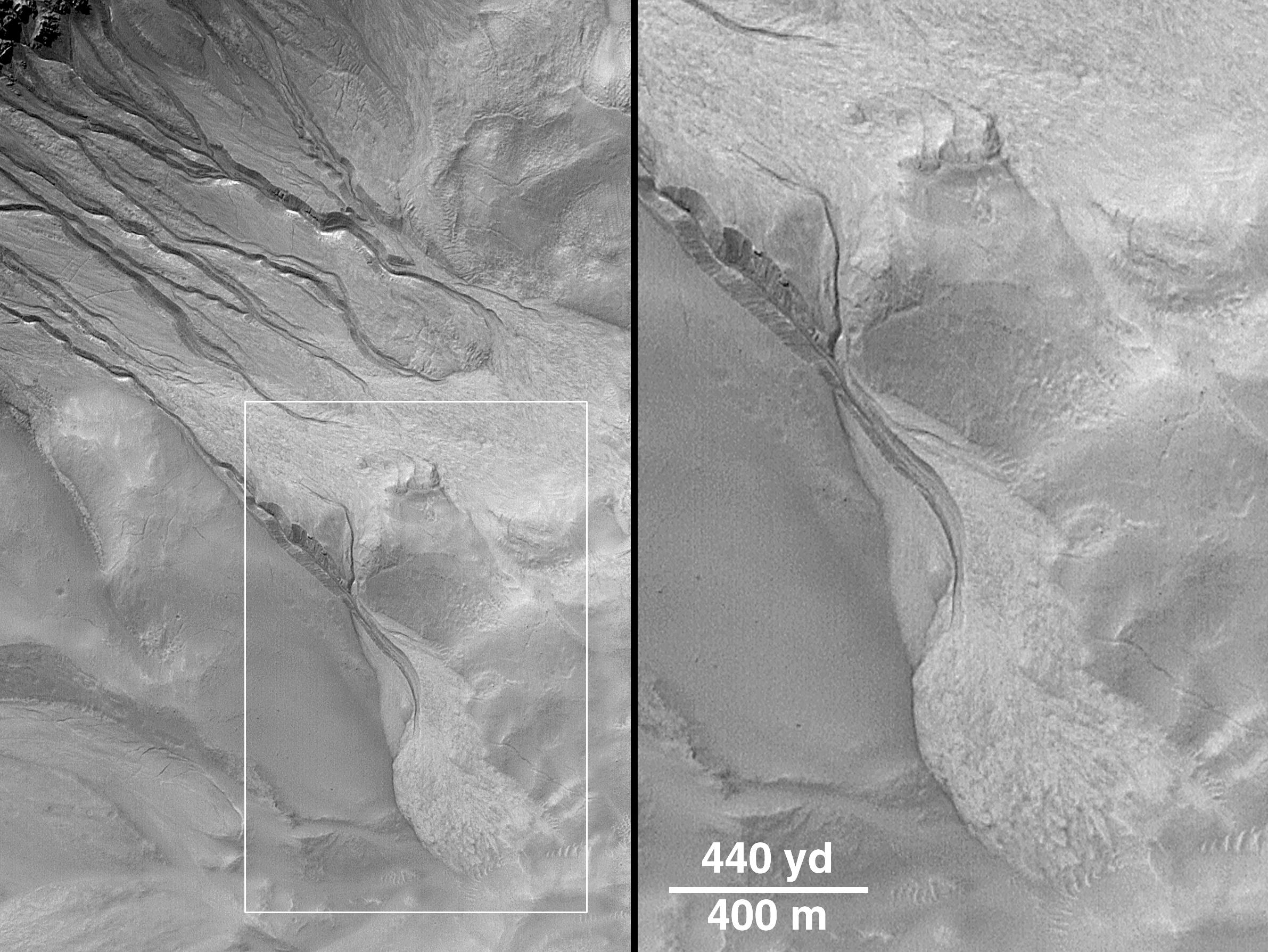
PIA01037:
-
Evidence for Recent Liquid Water on Mars: South-facing Walls of Nirgal Vallis
Full Resolution:
TIFF
(404.8 kB)
JPEG
(84.61 kB)
|
|
|
2000-06-22 |
Mars
|
Mars Global Surveyor (MGS)
|
Mars Orbiter Camera (MOC)
|
2382x1788x1 |
|
-
PIA01038:
-
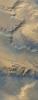
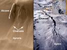
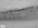
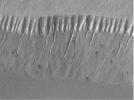
Evidence for Recent Liquid Water on Mars: Channels and Aprons in East Gorgonum Crater
Full Resolution:
TIFF
(3.538 MB)
JPEG
(610 kB)
|
|
|
2000-06-22 |
Mars
|
Mars Global Surveyor (MGS)
|
Mars Orbiter Camera (MOC)
|
2133x1593x1 |

|
-
PIA01039:
-
Evidence for Recent Liquid Water on Mars: Channeled Aprons in a Small Crater within Newton Crater
Full Resolution:
TIFF
(3.16 MB)
JPEG
(523.8 kB)
|
|
|
2000-06-22 |
Mars
|
Mars Global Surveyor (MGS)
|
Mars Orbiter Camera (MOC)
|
2609x2346x3 |
|
-
PIA01040:
-
Evidence for Recent Liquid Water on Mars: Gullies in Sirenum Fossae Trough
Full Resolution:
TIFF
(11.75 MB)
JPEG
(702.4 kB)
|
|
|
2000-06-22 |
Mars
|
Mars Global Surveyor (MGS)
|
Mars Orbiter Camera (MOC)
|
2100x1357x1 |

|
-
PIA01041:
-
Evidence for Recent Liquid Water on Mars: Clues Regarding the Relative Youth of Martian Gullies
Full Resolution:
TIFF
(2.211 MB)
JPEG
(379.4 kB)
|
|
|
2000-06-22 |
Mars
|
Mars Global Surveyor (MGS)
|
Mars Orbiter Camera (MOC)
|
858x643x1 |
|
-
PIA01042:
-
Evidence for Recent Liquid Water on Mars: "Dry" Processes on One Slope; "Wet" Processes on Another
Full Resolution:
TIFF
(528.3 kB)
JPEG
(87.08 kB)
|
|
|
2000-06-22 |
Mars
|
Mars Global Surveyor (MGS)
|
Mars Orbiter Camera (MOC)
|
1424x1233x3 |
|
-
PIA01033:
-
Evidence for Recent Liquid Water on Mars: Gullies in Gorgonum Chaos
Full Resolution:
TIFF
(3.675 MB)
JPEG
(186.3 kB)
|
|
|
2000-08-02 |
Mars
|
Mars Global Surveyor (MGS)
|
Mars Orbiter Camera (MOC)
|
512x1279x1 |
|
-
PIA01043:
-
MGS MOC Returns to Service Following Solar Conjunction Hiatus
Full Resolution:
TIFF
(620.3 kB)
JPEG
(148.4 kB)
|
|
|
2000-08-02 |
Mars
|
Mars Global Surveyor (MGS)
|
Mars Orbiter Camera (MOC)
|
512x1279x1 |
|
-
PIA01044:
-
MGS MOC Returns to Service Following Solar Conjunction Hiatus
Full Resolution:
TIFF
(462.1 kB)
JPEG
(78.99 kB)
|
|
|
2000-08-02 |
Mars
|
Mars Global Surveyor (MGS)
|
Mars Orbiter Camera (MOC)
|
768x2556x1 |
|
-
PIA01045:
-
Frosted North Polar Sand Dunes in Early Spring
Full Resolution:
TIFF
(1.581 MB)
JPEG
(238.6 kB)
|
|
|
2000-08-02 |
Mars
|
Mars Global Surveyor (MGS)
|
Mars Orbiter Camera (MOC)
|
768x1536x1 |
|
-
PIA01046:
-
Sirenum Fossae Trough
Full Resolution:
TIFF
(1.072 MB)
JPEG
(130.6 kB)
|
|
|
2000-09-05 |
Mars
|
Mars Pathfinder (MPF)
|
Imager for Mars Pathfinder
|
4096x4096x3 |

|
-
PIA02652:
-
Mars Pathfinder "Filled Donut" Mosaic
Full Resolution:
TIFF
(43.45 MB)
JPEG
(1.781 MB)
|
|
|
2000-09-07 |
Mars
|
Mars Global Surveyor (MGS)
|
MOLA
|
524x462x1 |
|
-
PIA02803:
-
Major Martian Volcanoes from MOLA - Alba Patera
Full Resolution:
TIFF
(239.9 kB)
JPEG
(52.87 kB)
|
|
|
2000-09-07 |
Mars
|
Mars Global Surveyor (MGS)
|
MOLA
|
524x462x1 |
|
-
PIA02804:
-
Major Martian Volcanoes from MOLA - Arsia Mons
Full Resolution:
TIFF
(231.1 kB)
JPEG
(52.9 kB)
|
|
|
2000-09-07 |
Mars
|
Mars Global Surveyor (MGS)
|
MOLA
|
2100x900x1 |
|
-
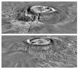
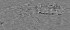
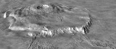
PIA02805:
-
Major Martian Volcanoes from MOLA - Olympus Mons
Full Resolution:
TIFF
(1.538 MB)
JPEG
(270.9 kB)
|
|
|
2000-09-07 |
Mars
|
Mars Global Surveyor (MGS)
|
MOLA
|
2100x900x1 |
|
-
PIA02806:
-
Major Martian Volcanoes from MOLA - Olympus Mons
Full Resolution:
TIFF
(1.451 MB)
JPEG
(205 kB)
|
|
|
2000-09-08 |
Mars
|
Mars Global Surveyor (MGS)
|
Mars Orbiter Camera (MOC)
|
2400x2400x3 |
|
-
PIA02653:
-
Mars Daily Global Image from April 1999
Full Resolution:
TIFF
(9.058 MB)
JPEG
(341.5 kB)
|
|
|
2000-09-08 |
Mars
|
Mars Global Surveyor (MGS)
|
MOLA
|
757x995x3 |
|
-
PIA01049:
-
Regional Topographic Views of Mars from MOLA
Full Resolution:
TIFF
(1.717 MB)
JPEG
(157.5 kB)
|
|
|
2000-09-12 |
Mars
|
Mars Global Surveyor (MGS)
|
Mars Orbiter Camera (MOC)
|
885x1369x3 |
|
-
PIA02807:
-
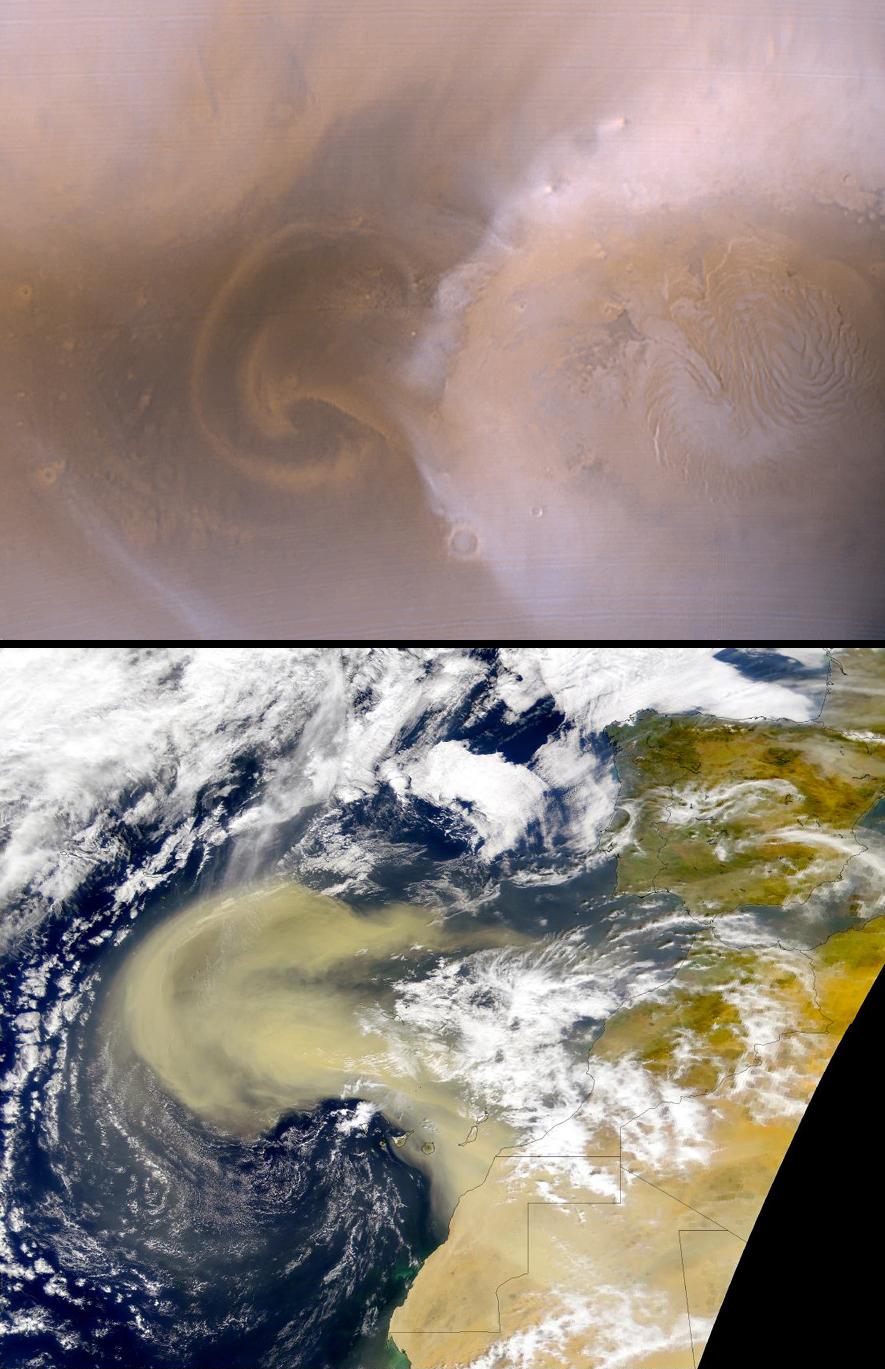
Recent Mars and Earth Dust Storms Compared
Full Resolution:
TIFF
(3.507 MB)
JPEG
(164.4 kB)
|
|
|
2000-09-16 |
Mars
|
Mars Global Surveyor (MGS)
|
Mars Orbiter Camera (MOC)
|
1024x1024x1 |
|
-
PIA01330:
-
Fluidized Crater Ejecta Deposit
Full Resolution:
TIFF
(1.011 MB)
JPEG
(185.8 kB)
|
|
|
2000-09-16 |
Phobos
|
Mars Global Surveyor (MGS)
|
Mars Orbiter Camera (MOC)
|
462x394x1 |

|
-
PIA01332:
-
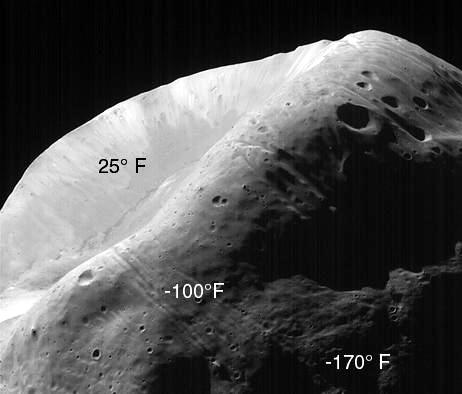
MOC Image of Phobos with TES Temperature Overlay
Full Resolution:
TIFF
(134.5 kB)
JPEG
(21.32 kB)
|
|
|
2000-09-16 |
Phobos
|
Mars Global Surveyor (MGS)
|
Mars Orbiter Camera (MOC)
|
683x1000x1 |

|
-
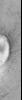
PIA01333:
-
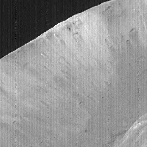
High-Resolution MOC Image of Phobos
Full Resolution:
TIFF
(544.4 kB)
JPEG
(68.3 kB)
|
|
|
2000-09-16 |
Phobos
|
Mars Global Surveyor (MGS)
|
Mars Orbiter Camera (MOC)
|
273x400x1 |

|
-
PIA01334:
-
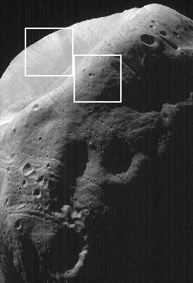
High-Resolution MOC Image of Phobos with Graphics Overlay
Full Resolution:
TIFF
(91.1 kB)
JPEG
(16.87 kB)
|
|
|
2000-09-16 |
Phobos
|
Mars Global Surveyor (MGS)
|
Mars Orbiter Camera (MOC)
|
480x480x1 |
|
-
PIA01335:
-
High-Resolution MOC Image of Phobos' Stickney Crater
Full Resolution:
TIFF
(209.2 kB)
JPEG
(32.95 kB)
|
|
|
2000-09-16 |
Phobos
|
Mars Global Surveyor (MGS)
|
Mars Orbiter Camera (MOC)
|
480x480x1 |
|
-
PIA01336:
-
High-Resolution MOC Image of Phobos' Face
Full Resolution:
TIFF
(231.9 kB)
JPEG
(31.12 kB)
|
|
|
2000-09-16 |
Mars
|
Mars Global Surveyor (MGS)
|
Mars Orbiter Camera (MOC)
|
802x804x1 |

|
-
PIA01454:
-
Moon/Mars Landing Commemorative Release: Gusev Crater and Ma'adim Vallis
Full Resolution:
TIFF
(561.2 kB)
JPEG
(88.35 kB)
|
|
|
2000-09-16 |
Mars
|
Mars Global Surveyor (MGS)
|
Mars Orbiter Camera (MOC)
|
512x512x1 |

|
-
PIA01458:
-
Western Candor Chasma, Valles Marineris
Full Resolution:
TIFF
(139.4 kB)
JPEG
(33.9 kB)
|
|
|
2000-09-16 |
Mars
|
Mars Global Surveyor (MGS)
|
Mars Orbiter Camera (MOC)
|
837x2350x1 |
|
-
PIA01467:
-
Seeing Mars' Northern Plains Through Springtime Haze
Full Resolution:
TIFF
(1.486 MB)
JPEG
(408.3 kB)
|
|
|
2000-09-16 |
Mars
|
Mars Global Surveyor (MGS)
|
Mars Orbiter Camera (MOC)
|
400x400x1 |
|
-
PIA01469:
-
Giant "Polygon" Troughs, Elysium Planitia
Full Resolution:
TIFF
(140.4 kB)
JPEG
(33.37 kB)
|
|
|
2000-09-16 |
Mars
|
Mars Global Surveyor (MGS)
|
Mars Orbiter Camera (MOC)
|
492x227x1 |
|
-
PIA01472:
-
Martian North Polar Cap on September 12, 1998
Full Resolution:
TIFF
(72.89 kB)
JPEG
(9.976 kB)
|


