Your search criteria found 134 images
Target is Venus
Go to PIAxxxxx:
Refine this list of images by:
Instrument:
Click on an image for detailed information
Click on a column heading to sort in ascending or descending order
My
List
Addition DateSort Ascending Target Mission Instrument Size
Add Image to Favorite List 2010-04-08 Venus Magellan
Venus Express
VIRTIS
1920x1080x3
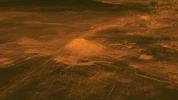
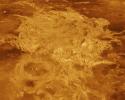
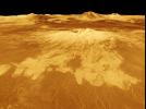
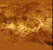
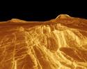
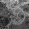
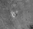
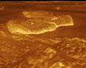
This figure shows the volcanic peak Idunn Mons in the Imdr Regio area of Venus. The topographic backbone (brown color) was derived from data obtained by NASA's Magellan spacecraft and the overlay was derived from data from ESA's Venus Express Spacecraft.
PIA13001:
Surface Warmth on a Venus Volcano
Full Resolution:     TIFF (6.23 MB)     JPEG (185.9 kB)
Add Image to Favorite List 2001-08-27 Venus Magellan
Arecibo Radar Data
Radar System
15464x9249x3
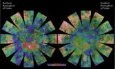
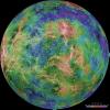
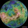
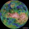
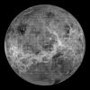
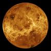
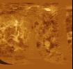
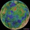
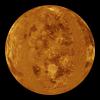
The images used for the base of this globe show the northern and southern hemispheres of Venus as revealed by more than a decade of radar investigations culminating in the 1990-1994 NASA Magellan mission.
PIA03167:
Venus Hemispherical Globes (with place names)
Full Resolution:     TIFF (229.5 MB)     JPEG (26.36 MB)
Add Image to Favorite List 2001-03-15 Venus Magellan
Arecibo Radar Data
Radar System
13966x8887x3
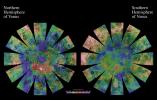
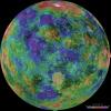
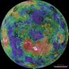
The images used for the base of this globe show the northern and southern hemispheres of Venus as revealed by more than a decade of radar investigations culminating in the 1990-1994 NASA Magellan mission.
PIA03151:
Venus Hemispherical Globes
Full Resolution:     TIFF (196.7 MB)     JPEG (17.89 MB)
Add Image to Favorite List 1998-06-04 Venus Magellan
Imaging Radar
700x1400x3
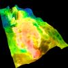
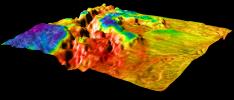
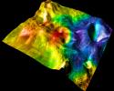
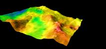
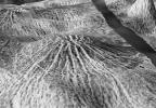
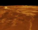
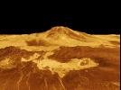
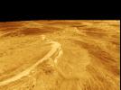
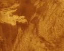
This perspective view of Venus, generated by computer from NASA's Magellan data and color-coded with emissivity, is a look westward across the Fortuna Tessera toward the slopes of Maxwell Montes.
PIA00316:
Looking Westward Across the Fortuna Tessera (Right Member of a Synthetic Stereo Pair)
Full Resolution:     TIFF (2.614 MB)     JPEG (283.7 kB)
Add Image to Favorite List 1998-06-04 Venus Magellan
Imaging Radar
700x1400x3
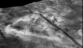
This perspective view of Venus, generated by computer from NASA's Magellan data and color-coded with emissivity, is a look westward across the Fortuna Tessera toward the slopes of Maxwell Montes.
PIA00315:
Looking Westward Across the Fortuna Tessera (Left Member of a Synthetic Stereo Pair)
Full Resolution:     TIFF (2.643 MB)     JPEG (283.3 kB)
Add Image to Favorite List 1998-06-04 Venus Magellan
Imaging Radar
700x1400x3
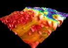
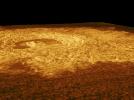
This perspective view of Venus, generated by computer from NASA's Magellan data and color-coded with emissivity, shows part of the lowland plains in Sedna Planitia.
PIA00314:
Sedna Planitia (Right Member of a Synthetic Stereo Pair)
Full Resolution:     TIFF (2.571 MB)     JPEG (265.6 kB)
Add Image to Favorite List 1998-06-04 Venus Magellan
Imaging Radar
700x1400x3
This perspective view of Venus, generated by computer from NASA's Magellan data and color-coded with emissivity, shows part of the lowland plains in Sedna Planitia. Circular depressions with associated fracture patterns, called 'coronae.'
PIA00313:
Sedna Planitia (Left Member of a Synthetic Stereo Pair)
Full Resolution:     TIFF (2.568 MB)     JPEG (270.1 kB)
Add Image to Favorite List 1998-06-04 Venus Magellan
Imaging Radar
1500x1500x3
This perspective view of Venus, generated by computer from NASA's Magellan data and color-coded with emissivity, shows the impact crater Markham, named after the English aviator Beryl Markham.
PIA00312:
Magellan's View of Crater Markham, 0° N, 163° E
Full Resolution:     TIFF (3.378 MB)     JPEG (348.9 kB)
Add Image to Favorite List 1998-06-04 Venus Magellan
Imaging Radar
2100x900x3
This perspective view of Venus, generated by computer from NASA's Magellan data and color-coded with emissivity, shows the boundary between the lowland plains and characteristic Venusian highland terrain in Ovda Region.
PIA00311:
Magellan's Perspective View of Ovda Regio, 0° S, 129° E
Full Resolution:     TIFF (2.63 MB)     JPEG (343.7 kB)
Add Image to Favorite List 1998-06-04 Venus Magellan
Imaging Radar
2100x1500x3
This perspective view of Venus, generated by computer from NASA's Magellan data and color-coded with emissivity, shows the boundary between the lowland plains and characteristic Venusian highland terrain in Ovda Regio.
PIA00310:
Magellan's Perspective View of Ovda Regio, 0° N, 129° E
Full Resolution:     TIFF (4.734 MB)     JPEG (606.2 kB)
Add Image to Favorite List 1998-06-04 Venus Magellan
Imaging Radar
1500x1500x3
This perspective view of Venus, generated by computer from NASA's Magellan data and color-coded with emissivity, shows the boundary between the lowland plains and characteristic Venusian highland terrain in Ovda Regio.
PIA00309:
Magellan's Perspective View of Ovda Regio, 0° N, 77° E
Full Resolution:     TIFF (5.144 MB)     JPEG (581.7 kB)
Add Image to Favorite List 1998-06-04 Venus Magellan
Imaging Radar
1500x1500x3
This perspective view of Venus, generated by computer from NASA's Magellan data and color-coded with emissivity, shows part of the lowlands to the north of Ovda Regio. The prominent topographic feature is a shield volcano.
PIA00308:
Magellan's Perspective View of Ovda Regio, 15° N, 77° E
Full Resolution:     TIFF (3.113 MB)     JPEG (469.6 kB)
Add Image to Favorite List 1998-06-04 Venus Magellan
Imaging Radar
2000x1600x3
This perspective view of Venus, generated by computer from NASA's Magellan data and color-coded with emissivity, shows part of the lowland plains in Sedna Planitia.
PIA00307:
Magellan's Perspective View of Sedna Planitia, 45° N, 11° E
Full Resolution:     TIFF (4.943 MB)     JPEG (693.5 kB)
Add Image to Favorite List 1998-06-04 Venus Magellan
Imaging Radar
2000x940x3
This perspective view of Venus, generated by computer from NASA's Magellan data and color-coded with emissivity, shows part of Sedna Planitia and illustrates a common phenomenon of the lowland plains of Venus.
PIA00306:
Magellan's Perspective View of Sedna Planitia, 45° N, 350° E
Full Resolution:     TIFF (2 MB)     JPEG (294.6 kB)
Add Image to Favorite List 1998-06-04 Venus Magellan
Imaging Radar
4064x4064x3
The view of Venus, after more than a decade of radar investigations culminating in the 1990-1994 NASA Magellan mission, is centered at 270 degrees east longitude.
PIA00160:
Hemispheric View of Venus Centered at 270° East Longitude
Full Resolution:     TIFF (40.74 MB)     JPEG (4.371 MB)
Add Image to Favorite List 1998-06-04 Venus Magellan
Imaging Radar
4064x4064x3
The view of Venus, after more than a decade of radar investigations culminating in the 1990-1994 NASA Magellan mission, is centered at 180 degrees east longitude.
PIA00159:
Hemispheric View of Venus Centered at 180° East Longitude
Full Resolution:     TIFF (41.1 MB)     JPEG (4.518 MB)
Add Image to Favorite List 1998-06-04 Venus Magellan
Imaging Radar
4064x4064x3
The hemispheric view of Venus, as revealed by more than a decade of radar investigations culminating in NASA's 1990-1994 Magellan mission, is centered at 90 degrees east longitude.
PIA00158:
Hemispheric View of Venus Centered at 90 Degrees East Longitude
Full Resolution:     TIFF (41.14 MB)     JPEG (4.713 MB)
Add Image to Favorite List 1998-06-04 Venus Magellan
Imaging Radar
4064x4064x3
The hemispheric view of Venus, as revealed by more than a decade of radar investigations culminating in NASA's 1990-1994 Magellan mission, is centered at 0 degrees east longitude.
PIA00157:
Hemispheric View of Venus Centered at 0 Degrees East Longitude
Full Resolution:     TIFF (39.63 MB)     JPEG (4.282 MB)
Add Image to Favorite List 1998-06-04 Venus Magellan
Imaging Radar
576x400x1
The view from NASA's Magellan spacecraft shows a 100-km-wide nova superposed on Yavine Corona. Coronae are roughly circular, volcanic features believed to form over hot upwellings of magma within the Venusian mantle.
PIA00150:
Nova Superposed on Yavine Corona
Full Resolution:     TIFF (260.4 kB)     JPEG (62.85 kB)
Add Image to Favorite List 1998-06-03 Venus Magellan
Imaging Radar
723x425x1
The view from NASA's Magellan spacecraft shows Yavine Corona, looking northeast. Coronae are roughly circular, volcanic features believed to form over hot upwellings of magma within the Venusian mantle.
PIA00098:
Close-up View of Yavine Corona
Full Resolution:     TIFF (325.3 kB)     JPEG (83.16 kB)
Add Image to Favorite List 1998-06-03 Venus Magellan
Imaging Radar
647x425x1
This view from NASA's Magellan spacecraft is a close-up of Atete Corona, a 600-km-long and 450-km-wide feature at latitude 16 degrees S., longitude 244 degrees; looking north.
PIA00097:
Close-up View of Atete Corona
Full Resolution:     TIFF (324.3 kB)     JPEG (86.92 kB)
Add Image to Favorite List 1998-06-03 Venus Magellan
Imaging Radar
723x425x1
The view from NASA's Magellan spacecraft shows most of Galindo (V-40) quadrangle looking east; Atete Corona, in the foreground, is a 600-km-long and about 450-km-wide, circular volcano-tectonic feature.
PIA00096:
Three-dimensional perspective views of Venusian Terrains composed of reduced resolution left-looking synthetic-aperture radar images merged with altimetry data from the Magellan spacecraft.
Full Resolution:     TIFF (225.6 kB)     JPEG (63.99 kB)
Add Image to Favorite List 1998-06-03 Venus Magellan
Imaging Radar
647x425x1
The view from NASA's Magellan spacecraft shows part of Galindo (V40) quadrangle looking north; Nagavonyi Corona is in the foreground. Coronae are roughly circular, volcanic features believed to form over hot upwellings of magma within the Venusian mantle.
PIA00095:
Three-dimensional perspective views of Venusian Terrains composed of reduced resolution left-looking synthetic-aperture radar images merged with altimetry data from the Magellan spacecraft.
Full Resolution:     TIFF (268.7 kB)     JPEG (68.45 kB)
Add Image to Favorite List 1997-01-16 Venus Magellan
Imaging Radar
8131x7169x1
This composite image was created by inserting approximately 70 orbits of NASA's Magellan data into an image obtained at the Arecibo, Puerto Rico radiotelescope and shows a geologically complex region in the southern hemisphere of Venus.
PIA00217:
Arecibo/Magellan Composite of Quetzalpetlatl Corona
Full Resolution:     TIFF (34.49 MB)     JPEG (9.458 MB)
Add Image to Favorite List 1996-12-02 Venus Magellan
Imaging Radar
5000x4000x3
A portion of Alpha Regio is displayed in this three-dimensional perspective view of the surface of Venus from NASA's Magellan spacecraft. In 1963, Alpha Regio was the first feature on Venus to be identified from Earth-based radar.
PIA00481:
Venus - Three-Dimensional Perspective View of Alpha Region
Full Resolution:     TIFF (18.02 MB)     JPEG (4.56 MB)
Add Image to Favorite List 1996-11-26 Venus Magellan
Imaging Radar
5475x5341x1
Crater Isabella is seen in this radar image from NASA's Magellan spacecraft. The second largest impact crater on Venus, the crater is named in honor of the 15th Century queen of Spain, Isabella of Castile.
PIA00480:
Venus - Impact Crater 'Isabella
Full Resolution:     TIFF (24.35 MB)     JPEG (7.659 MB)
Add Image to Favorite List 1996-11-26 Venus Magellan
Imaging Radar
2500x2950x1
This image from NASA's Magellan spacecraft is from the northeastern Atalanta Region of Venus. The image shows the complex impact crater, Dickinson, characterized by a partial central ring and a floor flooded by radar-dark and radar-bright materials.
PIA00479:
Venus - Complex Crater 'Dickinson' in NE Atalanta Region
Full Resolution:     TIFF (6.043 MB)     JPEG (1.881 MB)
Add Image to Favorite List 1996-11-26 Venus Magellan
Imaging Radar
10240x10240x1
This synthetic aperture radar mosaic from NASA's Magellan spacecraft is a global view of the surface of Venus.
PIA00478:
Venus - Global View Centered at 180 degrees
Full Resolution:     TIFF (44.9 MB)     JPEG (8.515 MB)
Add Image to Favorite List 1996-11-26 Venus Magellan
Imaging Radar
1633x1392x1
This full resolution mosaiced image from NASA's Magellan spacecraft is located in the Lakshmi region of Venus at 47 degrees north latitude and 334 east longitude.
PIA00477:
Venus - Possible Remnants of a Meteoroid in Lakshmi Region
Full Resolution:     TIFF (1.833 MB)     JPEG (1.037 MB)
Add Image to Favorite List 1996-11-22 Venus Magellan
Imaging Radar
517x592x1
This image from NASA's Magellan spacecraft shows an irregular crater of approximately 14- kilometer (8.7-mile) mean diameter. The crater is actually a cluster of four separate craters that are in rim contact.
PIA00476:
Venus - Multi-Floor Irregular Crater
Full Resolution:     TIFF (294.2 kB)     JPEG (109.8 kB)
Add Image to Favorite List 1996-11-20 Venus Magellan
Imaging Radar
880x850x1
This image from NASA's Magellan spacecraft is of Crater Stephania in northern Sedna Planitia on Venus. It is one of the smaller craters on Venus.
PIA00475:
Venus - Crater 'Stefania' in N. Sedna Planitia
Full Resolution:     TIFF (539 kB)     JPEG (265.2 kB)
Add Image to Favorite List 1996-11-20 Venus Magellan
Imaging Radar
530x572x1
This image from NASA's Magellan spacecraft is of the eastern Navka Region of Venus. The crater, which is approximately 8 kilometers (5 miles) in diameter, displays a butterfly symmetry pattern.
PIA00474:
Venus - Impact Crater in Eastern Navka Region
Full Resolution:     TIFF (274.6 kB)     JPEG (118.9 kB)
Add Image to Favorite List 1996-11-20 Venus Magellan
Imaging Radar
480x591x1
This image from NASA's Magellan spacecraft is of Sachs Patera on Venus. Defined as a sag-caldera, Sachs is an elliptical depression 130 meters (81 feet) in depth, spanning 40 kilometers (25 miles) in width along its longest axis.
PIA00473:
Venus - Sag Caldera 'Sachs Patera
Full Resolution:     TIFF (208 kB)     JPEG (116.5 kB)
Add Image to Favorite List 1996-11-20 Venus Magellan
Imaging Radar
975x1024x1
This full-resolution image from NASA's Magellan spacecraft shows an impact crater named Jeanne. The distinctive triangular shape of the ejecta indicates that the impacting body probably hit obliquely, traveling from southwest to northeast.
PIA00472:
Venus - Impact Crater 'Jeanne
Full Resolution:     TIFF (682.4 kB)     JPEG (398.1 kB)
Add Image to Favorite List 1996-11-14 Venus Magellan
Imaging Radar
1126x1015x1
This image from NASA's Magellan spacecraft is from the eastern Ovda region of Venus. The image shows some small volcanic domes on the flank of the volcano Maat.
PIA00487:
Venus - Volcanic Domes on Flank of Volcanic Maat in East Ovda Region
Full Resolution:     TIFF (1.139 MB)     JPEG (398.8 kB)
Add Image to Favorite List 1996-11-14 Venus Magellan
Imaging Radar
1880x1504x1
This image from NASA's Magellan spacecraft reveals Sacajawea Patera, a large, elongate caldera located in Western Ishtar Terra on the smooth plateau of Lakshmi Planum.
PIA00485:
Venus - A Large Elongated Caldera 'Sacajawea Patera
Full Resolution:     TIFF (2.22 MB)     JPEG (712.6 kB)
Add Image to Favorite List 1996-11-14 Venus Magellan
Imaging Radar
2510x3072x1
This radar image mosaic of Venus from NASA's Magellan spacecraft, is in the Lada region. The mosaic shows a system of east-trending radar-bright and dark lava flows encountering and breaching a north-trending ridge belt (left of center).
PIA00486:
Venus - System of Lava Flows and Ridge Belt
Full Resolution:     TIFF (6.288 MB)     JPEG (2.243 MB)
Add Image to Favorite List 1996-11-14 Venus Magellan
Imaging Radar
2560x1024x1
This image from NASA's Magellan spacecraft is from the southern portion of Navka. In the center of this image are two bright deposits running north to south.
PIA00483:
Venus - Outflow Channel in South Navka
Full Resolution:     TIFF (2.171 MB)     JPEG (825.6 kB)
Add Image to Favorite List 1996-11-12 Venus Magellan
Imaging Radar
4000x3000x3
Sapas Mons is displayed in the center of this computer-generated three-dimensional perspective view from NASA's Magellan spacecraft of the surface of Venus.
PIA00107:
Venus - 3-D Perspective View of Sapas Mons
Full Resolution:     TIFF (6.277 MB)     JPEG (1.445 MB)
Add Image to Favorite List 1996-11-12 Venus Magellan
Imaging Radar
2930x3664x3
This false color image from NASA's Magellan spacecraft shows a portion of Leda Planitia (plains) in the northern hemisphere of Venus, centered at 41 degrees north latitude, 52 degrees east longitude.
PIA00105:
Venus - Simulated Color of Leda Planitia
Full Resolution:     TIFF (10.15 MB)     JPEG (2.634 MB)
Add Image to Favorite List 1996-11-12 Venus Magellan
Imaging Radar
4096x4096x3
This global view from NASA's Magellan spacecraft is of the surface of Venus is centered at 180 degrees east longitude.
PIA00104:
Venus - Computer Simulated Global View Centered at 180 Degrees East Longitude
Full Resolution:     TIFF (8.169 MB)     JPEG (1.681 MB)
Add Image to Favorite List 1996-11-12 Venus Magellan
Imaging Radar
5000x4000x3
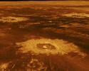
Three impact craters are displayed in this three-dimensional perspective view from NASA's Magellan spacecraft of the surface of Venus. The center of the image is located in the northwestern portion of Lavinia Planitia.
PIA00103:
Venus - 3-D Perspective View of Lavinia Planitia
Full Resolution:     TIFF (10.28 MB)     JPEG (2.193 MB)
Add Image to Favorite List 1996-11-12 Venus Magellan
Imaging Radar
5000x4000x3
A portion of western Eistla Regio is displayed in this three-dimensional perspective view from NASA's Magellan spacecraft of the surface of Venus.
PIA00102:
Venus - 3-D Perspective View of Estla Regio
Full Resolution:     TIFF (8.759 MB)     JPEG (1.965 MB)
Add Image to Favorite List 1996-11-07 Venus Magellan
Imaging Radar
1000x1000x1
This image from NASA's Magellan spacecraft shows an area of dark volcanic lava flows overlying the brighter surrounding plains which are thought to have been formed from older flows.
PIA00482:
Venus - Dark Volcanic Lava Flows
Full Resolution:     TIFF (540.1 kB)     JPEG (278.4 kB)
Add Image to Favorite List 1996-10-23 Venus Magellan
Imaging Radar
2082x1736x1
This is a full resolution mosaic from NASA's Magellan spacecraft showing a series of complex lava flows which emerge from the northern flank of Sif Mons, a large volcano just to the south.
PIA00471:
Venus - Complex Lava Flows at Sif Mons
Full Resolution:     TIFF (2.88 MB)     JPEG (1.538 MB)
Add Image to Favorite List 1996-10-23 Venus Magellan
Imaging Radar
1737x818x1
This image from NASA's Magellan spacecraft covers region near Hestia Rupes on the northwestern corner of Aphrodite Terra. This complex network exhibits tributary-like branches similar to those observed in river systems on Earth.
PIA00469:
Venus - Complex Network of Narrow Fractures Near Hestia Rupes Region
Full Resolution:     TIFF (1.342 MB)     JPEG (475.7 kB)
Add Image to Favorite List 1996-10-23 Venus Magellan
Imaging Radar
1024x1024x1
This crater in the Navka region of Venus was mapped by NASA's Magellan on Sept. 26-27, 1990 during orbits 459 and 460. It has the terraced walls, flat radar-dark floor, and central peak that are characteristic of craters classified as complex.
PIA00470:
Venus - Complex Crater 'Buck' in Navka Region
Full Resolution:     TIFF (826.2 kB)     JPEG (346.5 kB)
Add Image to Favorite List 1996-10-23 Venus Magellan
Imaging Radar
730x1024x1
In September 1990, Magellan imaged this impact crater that is representative of Venusian craters that are of the proper diameter (about 15 kilometers) to be 'transitional' in their morphology between 'complex' and irregular' craters.
PIA00468:
Venus - 'Transitional' Crater
Full Resolution:     TIFF (519.5 kB)     JPEG (248.4 kB)
Add Image to Favorite List 1996-10-23 Venus Magellan
Imaging Radar
480x1022x1
This image from NASA's Magellan spacecraft is in the Lavinia Region of Venus. Volcanic vent areas in this part of the plains west of Alpha Regio consist of domes and pits up to nearly 3 kilometers across.
PIA00467:
Venus - Lavinia Region
Full Resolution:     TIFF (304.7 kB)     JPEG (113.7 kB)
Add Image to Favorite List 1996-09-30 Venus Magellan
Imaging Radar
6519x6258x3
The eastern half of the planet is displayed in this simple cylindrical map of the surface of Venus obtained by NASA's Magellan spacecraft.
PIA00256:
Venus - Simple Cylindrical Map of Surface (Eastern Half)
Full Resolution:     TIFF (24.03 MB)     JPEG (4.955 MB)
Add Image to Favorite List 1996-09-30 Venus Magellan
Imaging Radar
6519x6258x3
The western half of the planet is displayed in this simple cylindrical map of the surface of Venus obtained by NASA's Magellan spacecraft.
PIA00255:
Venus - Simple Cylindrical Map of Surface (Western Half)
Full Resolution:     TIFF (21.83 MB)     JPEG (4.354 MB)
Add Image to Favorite List 1996-09-26 Venus Magellan
Imaging Radar
390x600x1
This image from NASA's Magellan spacecraft shows an impact crater in the central Eistla Region of the equatorial highlands of Venus. The crater is slightly irregular in platform and its walls appear terraced.
PIA00466:
Venus - Large Impact Crater in the Eistla Region
Full Resolution:     TIFF (224.1 kB)     JPEG (76.46 kB)
Add Image to Favorite List 1996-09-26 Venus Magellan
Imaging Radar
3640x2213x1
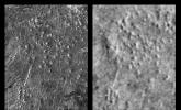
These radar images show an identical area on Venus as imaged by the NASA's Magellan spacecraft in 1991 (left) and the U.S.S.R. Venera 15/16 spacecraft in the early 1980's (right).
PIA00465:
Venus - Comparison of Venera and Magellan Resolutions
Full Resolution:     TIFF (5.626 MB)     JPEG (1.445 MB)
Add Image to Favorite List 1996-09-26 Venus Magellan
Imaging Radar
8180x7150x1
This image covers part of a deep valley on Venus called Devana Chasma. The image is a composite of the first two orbits recorded by NASA's Magellan spacecraft in August 1990 superimposed on Pioneer Venus topography.
PIA00464:
Venus - Magellan Data Superimposed on Pioneer Venus Data - Devana Chasma and Phoebe Regio
Full Resolution:     TIFF (10.45 MB)     JPEG (2.287 MB)
Add Image to Favorite List 1996-09-26 Venus Magellan
Imaging Radar
1620x1620x1
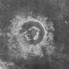
During orbits 404 through 414 on 19-20 September 1990, NASA's Magellan spacecraft imaged a peak-ring crater.
PIA00463:
Venus - Barton Crater
Full Resolution:     TIFF (2.543 MB)     JPEG (797.4 kB)
Add Image to Favorite List 1996-09-26 Venus Magellan
Imaging Radar
1024x1024x1
NASA's Magellan spacecraft imaged this multiple-floored, irregular impact crater at latitude 16.4 degrees north, longitude 352.1 degrees east, during orbits 481 and 482 on 27 September 1990.
PIA00462:
Venus - Multiple-Floored, Irregular Impact Crater
Full Resolution:     TIFF (577.5 kB)     JPEG (195.2 kB)
Add Image to Favorite List 1996-09-26 Venus Magellan
Imaging Radar
6940x5940x1
This mosaic of NASA's Magellan data in the Fortuna region of Venus. Shown here are Bahet Corona on the left, Onatah Corona on the right. Coronae are thought to form due to the upwelling of hot material from deep in the interior of Venus.
PIA00461:
Venus - Mosaic of Bahet and Onatah Coronae
Full Resolution:     TIFF (35.51 MB)     JPEG (15.1 MB)
Add Image to Favorite List 1996-09-26 Venus Magellan
Imaging Radar
8192x7168x1
This image from NASA's Magellan spacecraft is a mosaic of 24 orbits of the Navka region of Venus. Volcanic domes and flows are seen throughout the region.
PIA00460:
Venus - Venera 8 Landing Site in Navka Region
Full Resolution:     TIFF (45.16 MB)     JPEG (17.72 MB)
Add Image to Favorite List 1996-09-23 Venus Magellan
Imaging Radar
4096x4096x3
The northern hemisphere is displayed in this global view of the surface of Venus as seen by NASA's Magellan spacecraft.
PIA00270:
Venus - Computer Simulated Global View Centered at 90 Degrees East Longitude
Full Resolution:     TIFF (7.793 MB)     JPEG (1.615 MB)
Add Image to Favorite List 1996-09-23 Venus Magellan
Imaging Radar
1700x2500x1
This full resolution radar mosaic from NASA's Magellan spacecraft shows a 200 kilometer (124 mile) segment of a sinuous channel on Venus.
PIA00253:
Venus - Sinuous Channel
Full Resolution:     TIFF (3.499 MB)     JPEG (1.11 MB)
Add Image to Favorite List 1996-09-20 Venus Magellan
Imaging Radar
3072x2048x1
This image from NASA's Magellan shows part of the interior of Ovda Regio, one of the large highlands ringing the equator of Venus. Several tectonic events formed this complex block fractured terrain.
PIA00218:
Venus - Interior of Ovda Regio
Full Resolution:     TIFF (6.544 MB)     JPEG (1.953 MB)
Add Image to Favorite List 1996-09-13 Venus Magellan
Imaging Radar
8192x7168x1
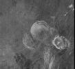
This mosaic from NASA's Magellan data is in the Lavinia region of Venus. Three large impact craters can be seen located in a region of fractured plains.
PIA00086:
Mosaic of Large Impact Craters
Full Resolution:     TIFF (41.86 MB)     JPEG (12.35 MB)
Add Image to Favorite List 1996-08-16 Venus Magellan
Imaging Radar
5000x4000x3
A portion of western Eistla Regio is shown in this three dimensional, computer-generated view of the surface of Venus. This NASA Magellan image was released on April 22, 1992.
PIA00200:
Venus - False Color Perspective of Sif and Gula Mons
Full Resolution:     TIFF (6.993 MB)     JPEG (1.282 MB)
Add Image to Favorite List 1996-08-13 Venus Magellan
Imaging Radar
13650x9556x1
This image covers much of Ovda Regio, which forms the western part of Aphrodite Terra captured by NASA's Magellan spacecraft.
PIA00146:
Venus - Ovda Regio
Full Resolution:     TIFF (32.32 MB)     JPEG (5.985 MB)
Add Image to Favorite List 1996-08-13 Venus Magellan
Imaging Radar
5120x5120x1
This spectacular image from NASA's Magellan spacecraft is centered on 30 degrees south latitude, 135 degrees east longitude, spans 3500 kilometers (2170 miles) from east to west (left to right), and shows the near-circular trough of Artemis Chasma.
PIA00101:
Artemis Corona (C2-MIDR)
Full Resolution:     TIFF (21.06 MB)     JPEG (5.318 MB)
Add Image to Favorite List 1996-08-01 Venus Magellan
Imaging Radar
4000x3000x3
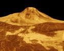
Maat Mons is displayed in this computer generated three-dimensional perspective of the surface of Venus. This NASA Magellan image was released on April 22, 1992.
PIA00106:
Venus - 3-D Perspective View of Maat Mons
Full Resolution:     TIFF (4.791 MB)     JPEG (1.141 MB)
Add Image to Favorite List 1996-07-19 Venus Magellan
Imaging Radar
4096x5120x3
Ushas Mons, a volcano in the southern hemisphere of Venus is shown in this radar image from NASA's Magellan spacecraft. The volcano is marked by numerous bright lava flows and a set of north-south trending fractures.
PIA00272:
Venus - Simulated Color of Ushas Mons
Full Resolution:     TIFF (18.64 MB)     JPEG (5.424 MB)
Add Image to Favorite List 1996-07-18 Venus Magellan
Imaging Radar
4096x4096x3
The northern hemisphere is displayed in this global view of the surface of Venus as seen by NASA's Magellan spacecraft.
PIA00271:
Venus - Computer Simulated Global View of the Northern Hemisphere
Full Resolution:     TIFF (8.283 MB)     JPEG (1.764 MB)
Add Image to Favorite List 1996-06-03 Venus Magellan
Imaging Radar
4064x4064x3
This hemispheric view of Venus, as revealed by more than a decade of radar investigations culminating in the 1990-1994 Magellan mission, is centered on the North Pole. NASA's Magellan spacecraft imaged more than 98% of Venus.
PIA00008:
Hemispheric View of Venus Centered at the South Pole
Full Resolution:     TIFF (37.66 MB)     JPEG (3.971 MB)
Add Image to Favorite List 1996-06-03 Venus Magellan
Imaging Radar
4064x4064x3
This hemispheric view of Venus, as revealed by more than a decade of radar investigations culminating in the 1990-1994 Magellan mission, is centered on the North Pole. NASA's Magellan spacecraft imaged more than 98% of Venus.
PIA00007:
Hemispheric View of Venus Centered at the North Pole
Full Resolution:     TIFF (41.83 MB)     JPEG (4.592 MB)
Add Image to Favorite List 1996-03-14 Venus Magellan
Imaging Radar
1860x2048x1
This is a stereo image pair of crater Goeppert-Mayer obtained by NASA's Magellan radar mapping mission.
PIA00269:
Venus - Stereo Image Pair of Crater Goeppert-Mayer
Full Resolution:     TIFF (3.228 MB)     JPEG (811.6 kB)
Add Image to Favorite List 1996-03-14 Venus Magellan
Imaging Radar
4000x3000x3
This computer-generated perspective view of Latona Corona and Dali Chasma on Venus shows NASA's Magellan radar data superimposed on topography.
PIA00268:
Venus - 3-D Perspective View of Latona Corona and Dali Chasma
Full Resolution:     TIFF (7.17 MB)     JPEG (1.692 MB)
Add Image to Favorite List 1996-03-14 Venus Magellan
Imaging Radar
6416x5800x1
This set of three images from NASA's Magellan spacecraft, shows a small volcano, lava plains distorted into 'wrinkle ridges,' and some unusual wispy-appearing surface deposits.
PIA00267:
Venus - Cycle 1, 2, and 3 Images of Imdr Region
Full Resolution:     TIFF (18.82 MB)     JPEG (6.044 MB)
Add Image to Favorite List 1996-03-14 Venus Magellan
Imaging Radar
1600x1200x3
This full resolution radar mosaic from NASA's Magellan spacecraftshows an oblique view of the impact crater Riley, named for Margaretta Riley, a 19th Century botanist.
PIA00266:
Venus - Oblique View of Crater Riley
Full Resolution:     TIFF (862.1 kB)     JPEG (214.2 kB)
Add Image to Favorite List 1996-03-14 Venus Magellan
Imaging Radar
3306x2114x3
This full-resolution mosaic of Venus, obtained by NASA's Magellan spacecraft, shows an area replete with diverse volcanic features.
PIA00265:
Venus - False Color of Volcanic Plains
Full Resolution:     TIFF (5.705 MB)     JPEG (1.635 MB)
Add Image to Favorite List 1996-03-14 Venus Magellan
Imaging Radar
1896x1944x1
This is full-resolution mosaic from NASA's Magellan spacecraft. The bright feature, slightly south of center is interpreted to be a volcano with a large apron of blocky debris to its right and some smaller aprons to its left.
PIA00264:
Venus - Volcano With Massive Landslides
Full Resolution:     TIFF (3.237 MB)     JPEG (964.2 kB)
Add Image to Favorite List 1996-03-14 Venus Magellan
Imaging Radar
1812x1716x1
NASA's Magellan spacecraft has observed remnant landslide deposits apparently resulting from the collapse of volcanic structures.
PIA00263:
Venus - Landslide Deposits
Full Resolution:     TIFF (2.555 MB)     JPEG (747.4 kB)
Add Image to Favorite List 1996-03-14 Venus Magellan
Imaging Radar
1452x1314x1
NASA's Magellan spacecraft observed remnant landslide deposits apparently resulting from the collapse of volcanic structures. This radar image is centered in the southwestern Navka Region of Venus.
PIA00262:
Venus - Landslide in Navka Region
Full Resolution:     TIFF (1.638 MB)     JPEG (587.3 kB)
Add Image to Favorite List 1996-03-14 Venus Magellan
Imaging Radar
2600x2400x1
This image from NASA's Magellan spacecraft, with radar illumination from west to east, shows three unusual volcanoes located in the Guinevere Planitia lowland.
PIA00261:
Venus - Volcanos in Guinevere Planitia
Full Resolution:     TIFF (5.305 MB)     JPEG (2.441 MB)
Add Image to Favorite List 1996-03-14 Venus Magellan
Imaging Radar
2558x4190x1
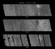
As NASA's Magellan mission progressed, areas of Venus became accessible for a second look. During Magellan's second 243-day global mapping cycle, the spacecraft was rotated 180 degrees to view the surface from the opposite direction.
PIA00260:
Venus - Comparison of Left and Right Looking Views of Imdr Region
Full Resolution:     TIFF (8.021 MB)     JPEG (2.766 MB)
Add Image to Favorite List 1996-03-14 Venus Magellan
Imaging Radar
3520x4400x3
This false color image from NASA's Magellan spacecraft shows a portion of Bereghinya Planitia (plains) in the northern hemisphere of Venus.
PIA00259:
Venus - False Color of Bereghinya Planitia
Full Resolution:     TIFF (15.43 MB)     JPEG (4.199 MB)
Add Image to Favorite List 1996-03-14 Venus Magellan
Imaging Radar
2943x2354x3
This false color Magellan image shows a portion of Eistla Regio (region) in the northern hemisphere of Venus, centered at 1 degrees south latitude, 37 degrees east longitude.
PIA00258:
Venus - False Color of Eistla Regio
Full Resolution:     TIFF (6.606 MB)     JPEG (1.88 MB)
Add Image to Favorite List 1996-03-14 Venus Magellan
Imaging Radar
4096x4096x3
This global view of the surface of Venus is centered at 0 degrees east longitude. NASA's Magellan synthetic aperture radar mosaics from the first cycle of Magellan mapping were mapped onto a computer-simulated globe to create this image.
PIA00257:
Venus - Computer Simulated Global View Centered at 0 Degrees East Longitude
Full Resolution:     TIFF (6.884 MB)     JPEG (1.366 MB)
Add Image to Favorite List 1996-03-14 Venus Magellan
Imaging Radar
5000x4000x3
Maat Mons is displayed in this 3-dimensional perspective view of the surface of Venus taken by NASA Magellan. The viewpoint is located north of Maat Mons.
PIA00254:
Venus - 3-D Perspective View of Maat Mons
Full Resolution:     TIFF (7.594 MB)     JPEG (1.611 MB)
Add Image to Favorite List 1996-03-14 Venus Magellan
Imaging Radar
4096x4096x3
The northern hemisphere is displayed in this global view of the surface of Venus. NASA's Magellan synthetic aperture radar mosaics from the first cycle of Magellan mapping were mapped onto a computer-simulated globe to create this image.
PIA00252:
Venus - Computer Simulated Global View of Northern Hemisphere
Full Resolution:     TIFF (7.686 MB)     JPEG (1.608 MB)
Add Image to Favorite List 1996-03-14 Venus Magellan
Imaging Radar
1280x1024x1
NASA's Magellan image depicts a stereoscopic pair of an area on Venus with small volcanic domes. Stereoscopic images of Venus offer exciting new possibilities for scientific analysis of Venusian landforms.
PIA00251:
Venus - Stereoscopic Images of Volcanic Domes
Full Resolution:     TIFF (984.3 kB)     JPEG (312.8 kB)
Add Image to Favorite List 1996-03-14 Venus Magellan
Imaging Radar
1694x2817x1
This full-resolution image from NASA's Magellan spacecraft shows the northern part of the Akna Montes (mountains) of Venus.
PIA00250:
Venus - Wanda Crater in Akna Montes
Full Resolution:     TIFF (3.933 MB)     JPEG (1.142 MB)
Add Image to Favorite List 1996-03-14 Venus Magellan
Imaging Radar
1000x1000x1
Southwest Lakshmi Planum (plains) is bounded on the south by the Danu Montes (mountains) as shown by NASA's Magellan spacecraft.
PIA00249:
Venus - Danu Montes and Lakshmi Planum
Full Resolution:     TIFF (819.3 kB)     JPEG (266.2 kB)
Add Image to Favorite List 1996-03-14 Venus Magellan
Imaging Radar
1280x1024x1
Landslides on Venus! The image on the left was taken in late November of 1990 during Magellan's first trip around Venus. The image on the right was taken July 23, as the Magellan spacecraft passed over the region for the second time.
PIA00248:
Venus - Aphrodite Terra
Full Resolution:     TIFF (797.9 kB)     JPEG (294.6 kB)
Add Image to Favorite List 1996-03-13 Venus Magellan
Imaging Radar
1750x3100x1
These two radar images from NASA's Magellan spacecraft are centered about 60.5 degrees south latitude and 348.8 degrees east longitude in the eastern Lavinia Region of Venus.
PIA00247:
Venus - Left and Right Looking Images of Lavinia Region
Full Resolution:     TIFF (3.795 MB)     JPEG (1.644 MB)
Add Image to Favorite List 1996-03-13 Venus Magellan
Imaging Radar
5000x4000x3
A portion of the eastern edge of Alpha Regio is displayed in this three-dimensional perspective view of the surface of Venus from NASA's Magellan spacecraft.
PIA00246:
Venus - 3-D Perspective View of Eastern Edge of Alpha Regio
Full Resolution:     TIFF (6.562 MB)     JPEG (1.222 MB)
Add Image to Favorite List 1996-03-13 Venus Magellan
Imaging Radar
2048x2048x1
This compressed resolution radar mosaic from NASA's Magellan spacecraft shows a 600 kilometers (360 mile) segment of the longest channel discovered on Venus in 1990.
PIA00245:
Venus - 600 Kilometer Segment of Longest Channel on Venus
Full Resolution:     TIFF (3.233 MB)     JPEG (1.415 MB)
Add Image to Favorite List 1996-03-13 Venus Magellan
Imaging Radar
3280x2470x1
Two unusual volcanic domes are shown in this full-resolution mosaic obtained by NASA's Magellan spacecraft.
PIA00244:
Venus - Volcanic Domes East of Beta Regio
Full Resolution:     TIFF (6.937 MB)     JPEG (1.36 MB)
Add Image to Favorite List 1996-03-08 Venus Magellan
Imaging Radar
4789x4682x1
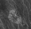
This image from the Atla region of Venus obtained by NASA's Magellan spacecraft shows several types of volcanic features and superimposed surface fractures.
PIA00201:
Venus - Volcanic features in Atla Region
Full Resolution:     TIFF (21.68 MB)     JPEG (7.23 MB)
Add Image to Favorite List 1996-03-07 Venus Magellan
Imaging Radar
1020x1016x1
This comet-like tail, trending northeast from the volcanic structure, is a relatively radar-bright deposit. The volcano, with a base diameter of about 3 miles, is a local topographic high point that has slowed down northeast trending winds.
PIA00243:
Venus - Volcano in Parga Chasma
Full Resolution:     TIFF (917.6 kB)     JPEG (332.1 kB)
Add Image to Favorite List 1996-03-07 Venus Magellan
Imaging Radar
4096x3072x1
This image rom NASA's Magellan spacecraft shows part of the northern boundary of Ovda Regio, one of the large highlands ringing the equator of Venus.
PIA00242:
Venus - Ovda Regio
Full Resolution:     TIFF (12.06 MB)     JPEG (4.525 MB)
Add Image to Favorite List 1996-03-07 Venus Magellan
Imaging Radar
3663x4603x1
This full resolution radar image from NASA's Magellan spacecraft is centered along the eastern edge of Lakshmi Planum and the western edge of Maxwell Montes.
PIA00241:
Venus - Lakshmi Planum and Maxwell Montes
Full Resolution:     TIFF (14.62 MB)     JPEG (3.818 MB)
Add Image to Favorite List 1996-03-07 Venus Magellan
Imaging Radar
3633x3633x1
This image is a full-resolution mosaic of several images from NASA's Magellan spacecraft. The radar smooth region in the northern part of the image is Lakshmi Planum, a high plateau region above the mean planetary radius.
PIA00240:
Venus - Lakshmi Planum
Full Resolution:     TIFF (9.378 MB)     JPEG (3.592 MB)
Add Image to Favorite List 1996-03-07 Venus Magellan
Imaging Radar
2048x2048x1
This image from NASA's Magellan spacecraft shows a complex crater with a circular rim, terraced walls, and central peaks.
PIA00239:
Venus - Crater Aurelia
Full Resolution:     TIFF (3.282 MB)     JPEG (998.5 kB)
Add Image to Favorite List 1996-03-07 Venus Magellan
Imaging Radar
8192x7168x1
Three large meteorite impact craters are seen in this image obtained by NASA's Magellan spacecraft of the Lavinia region of Venus.
PIA00214:
Venus - Lavinia Region Impact Craters
Full Resolution:     TIFF (40.25 MB)     JPEG (13.2 MB)
 Current Set   Jump to a Following Set   Retrieve Next Set 
 1-100   101-200 
Currently displaying images: 1 - 100 of 134