Your search criteria found
20
images
Target is Mars (and available satellites)
Go to PIAxxxxx:
Click on an image for detailed information
Click on a column heading to sort in ascending or descending order
My
List
Addition Date
Target
Mission
Instrument
Size
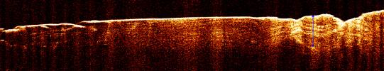
2006-12-13
Mars
Mars Reconnaissance Orbiter (MRO)
Shallow Subsurface Radar (SHARAD)
3194x591x3
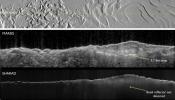
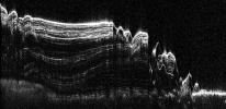
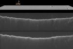
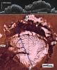
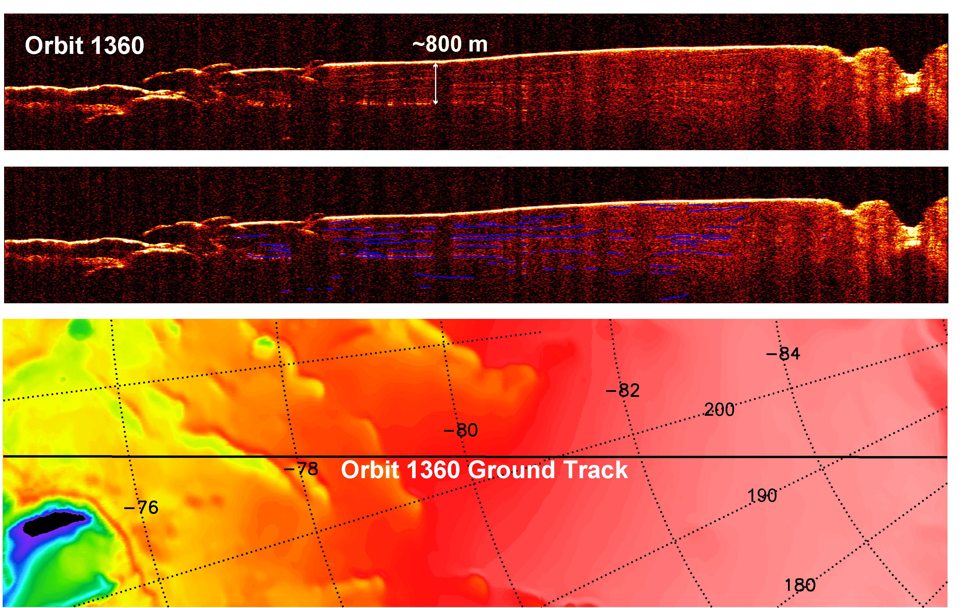
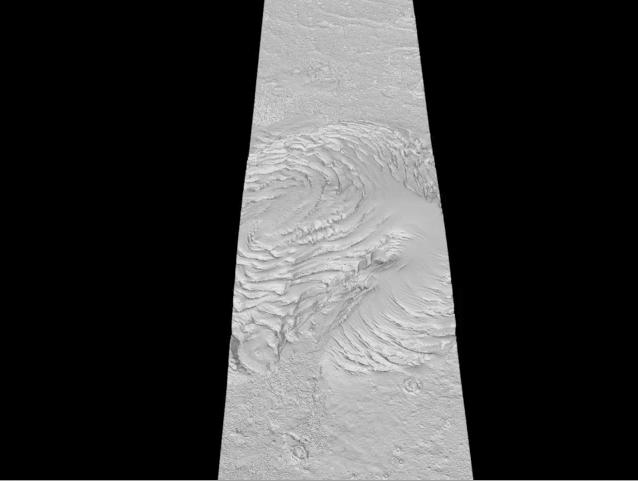
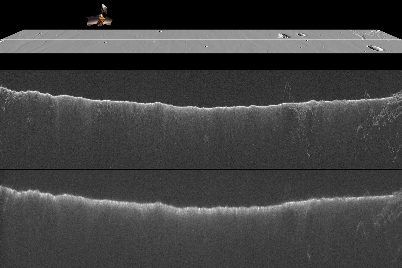
PIA09095:
Radar View of Layering near Mars' South Pole, Orbit 1360
Full Resolution:
TIFF
(5.663 MB)
JPEG
(722.7 kB)
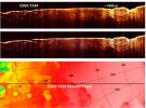
2006-12-13
Mars
Mars Reconnaissance Orbiter (MRO)
Shallow Subsurface Radar (SHARAD)
3253x2415x3
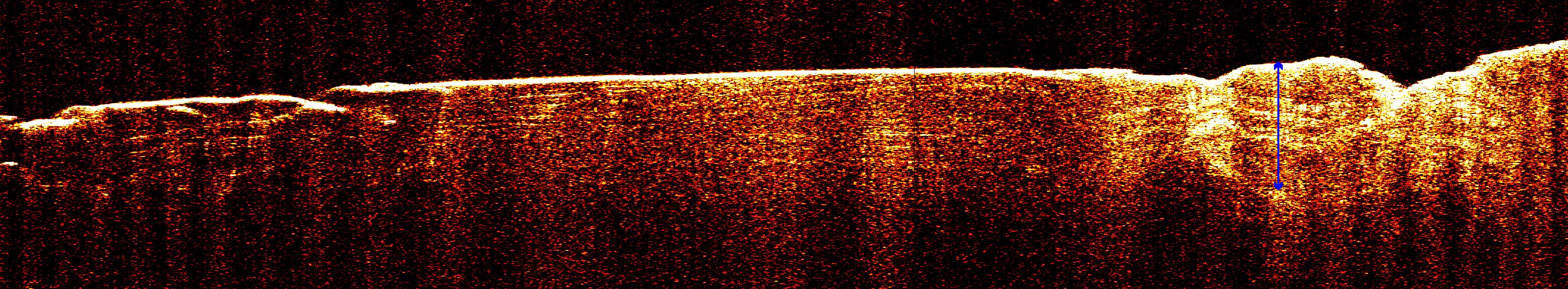
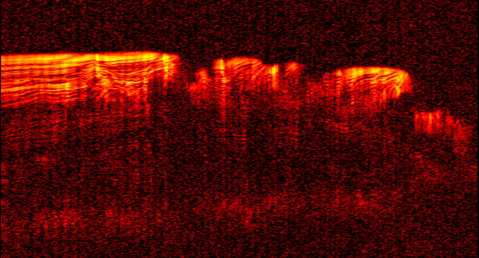
PIA09076:
Interpreting Radar View near Mars' South Pole, Orbit 1334
Full Resolution:
TIFF
(23.57 MB)
JPEG
(1.764 MB)
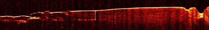
2006-12-13
Mars
Mars Reconnaissance Orbiter (MRO)
Shallow Subsurface Radar (SHARAD)
3192x460x3
PIA09073:
Radar View of Layering near Mars' South Pole, Orbit 1360
Full Resolution:
TIFF
(4.405 MB)
JPEG
(446.8 kB)
2006-12-13
Mars
Mars Reconnaissance Orbiter (MRO)
Shallow Subsurface Radar (SHARAD)
3275x2065x3
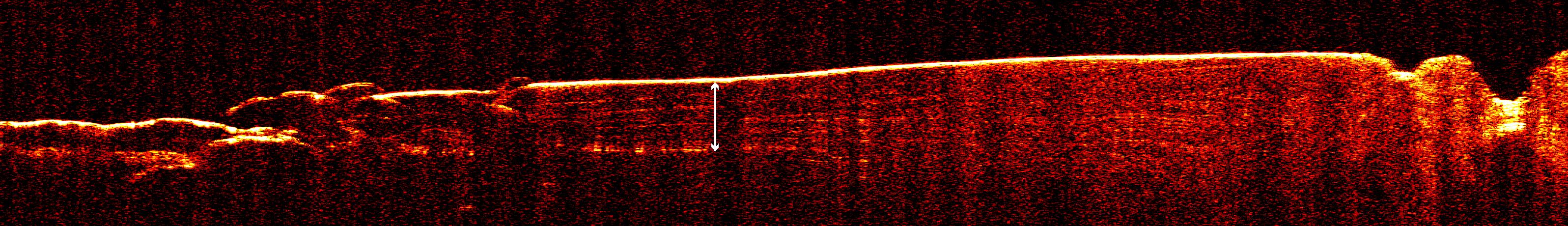
PIA09075:
Interpreting Radar View near Mars' South Pole, Orbit 1360
Full Resolution:
TIFF
(20.29 MB)
JPEG
(1.198 MB)
2006-12-13
Mars
Mars Reconnaissance Orbiter (MRO)
Shallow Subsurface Radar (SHARAD)
1617x870x3
PIA09096:
Interpreting Radar View near Mars' South Pole, Orbit 1334
Full Resolution:
TIFF
(1.41 MB)
JPEG
(299.9 kB)
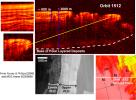
2006-12-13
Mars
Mars Reconnaissance Orbiter (MRO)
Shallow Subsurface Radar (SHARAD)
2634x1934x3
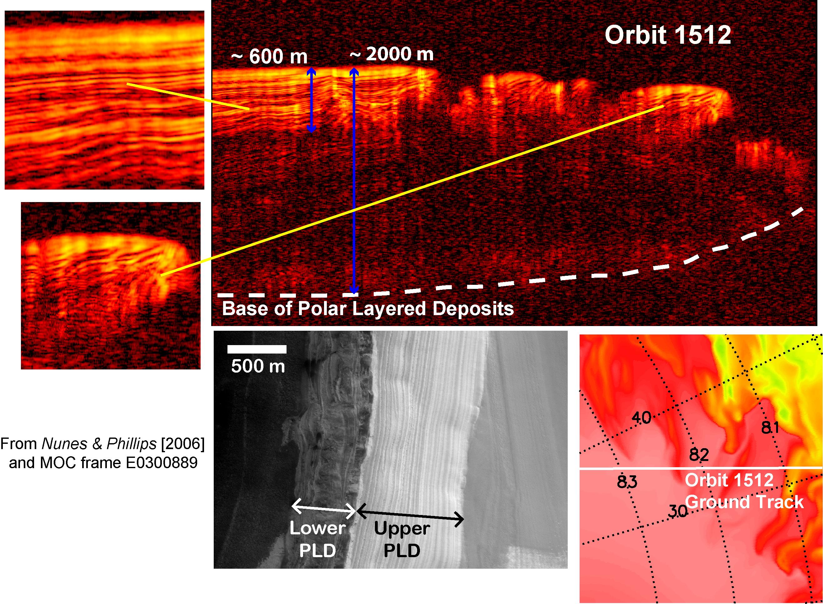
PIA09074:
Interpreting Radar View near Mars' North Pole, Orbit 1512
Full Resolution:
TIFF
(15.3 MB)
JPEG
(808.7 kB)
2008-04-17
Mars
Mars Express (MEX)
Mars Reconnaissance Orbiter (MRO)
MARSIS
Shallow Subsurface Radar (SHARAD)
1265x723x3
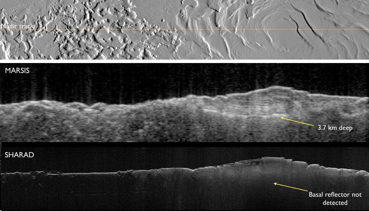
PIA10375:
Two Radar Sounders Examine South Polar Layered Deposits on Mars
Full Resolution:
TIFF
(2.747 MB)
JPEG
(134.7 kB)
2008-04-17
Mars
Mars Express (MEX)
Mars Reconnaissance Orbiter (MRO)
MARSIS
Shallow Subsurface Radar (SHARAD)
516x387x1
PIA10376:
Mars Radar Opens a Planet's Third Dimension
Full Resolution:
TIFF
(307.4 kB)
JPEG
(20.51 kB)
2008-05-15
Mars
Mars Reconnaissance Orbiter (MRO)
Shallow Subsurface Radar (SHARAD)
1152x1056x3
PIA10651:
How Thick is the North Polar Ice Cap on Mars?
Full Resolution:
TIFF
(3.654 MB)
JPEG
(319.4 kB)
2008-05-15
Mars
Mars Reconnaissance Orbiter (MRO)
Shallow Subsurface Radar (SHARAD)
2101x715x3
PIA10652:
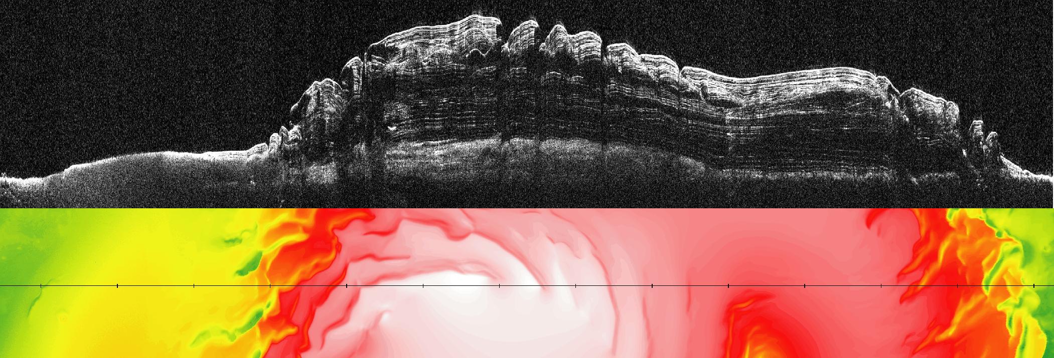
What Lies Below a Martian Ice Cap
Full Resolution:
TIFF
(4.513 MB)
JPEG
(351.7 kB)
2009-09-22
Mars
Mars Reconnaissance Orbiter (MRO)
HiRISE
Shallow Subsurface Radar (SHARAD)
1043x583x3
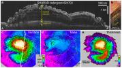
PIA12200:
Radar Mapping of Icy Layers Under Mars' North Pole
Full Resolution:
TIFF
(1.827 MB)
JPEG
(157.3 kB)
2010-03-02
Mars
Mars Reconnaissance Orbiter (MRO)
Shallow Subsurface Radar (SHARAD)
1098x818x3
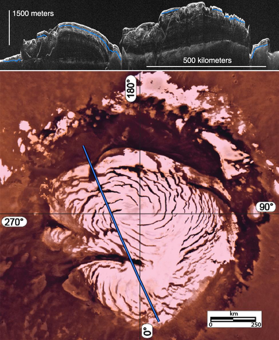
PIA12861:
Glacial Ice Deposits in Mid-Latitudes of Mars
Full Resolution:
TIFF
(2.698 MB)
JPEG
(237.4 kB)
2010-05-26
Mars
Mars Reconnaissance Orbiter (MRO)
Shallow Subsurface Radar (SHARAD)
1936x939x1
PIA13164:
North Polar Cap Cross Section
Full Resolution:
TIFF
(1.82 MB)
JPEG
(575.5 kB)
2011-04-21
Mars
Mars Reconnaissance Orbiter (MRO)
Shallow Subsurface Radar (SHARAD)
1775x380x1
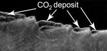
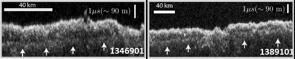
PIA13985:
Cross Section of Buried Carbon-Dioxide Ice on Mars
Full Resolution:
TIFF
(675.5 kB)
JPEG
(116.5 kB)
2011-04-21
Mars
Mars Reconnaissance Orbiter (MRO)
Shallow Subsurface Radar (SHARAD)
9380x8299x3
PIA13986:
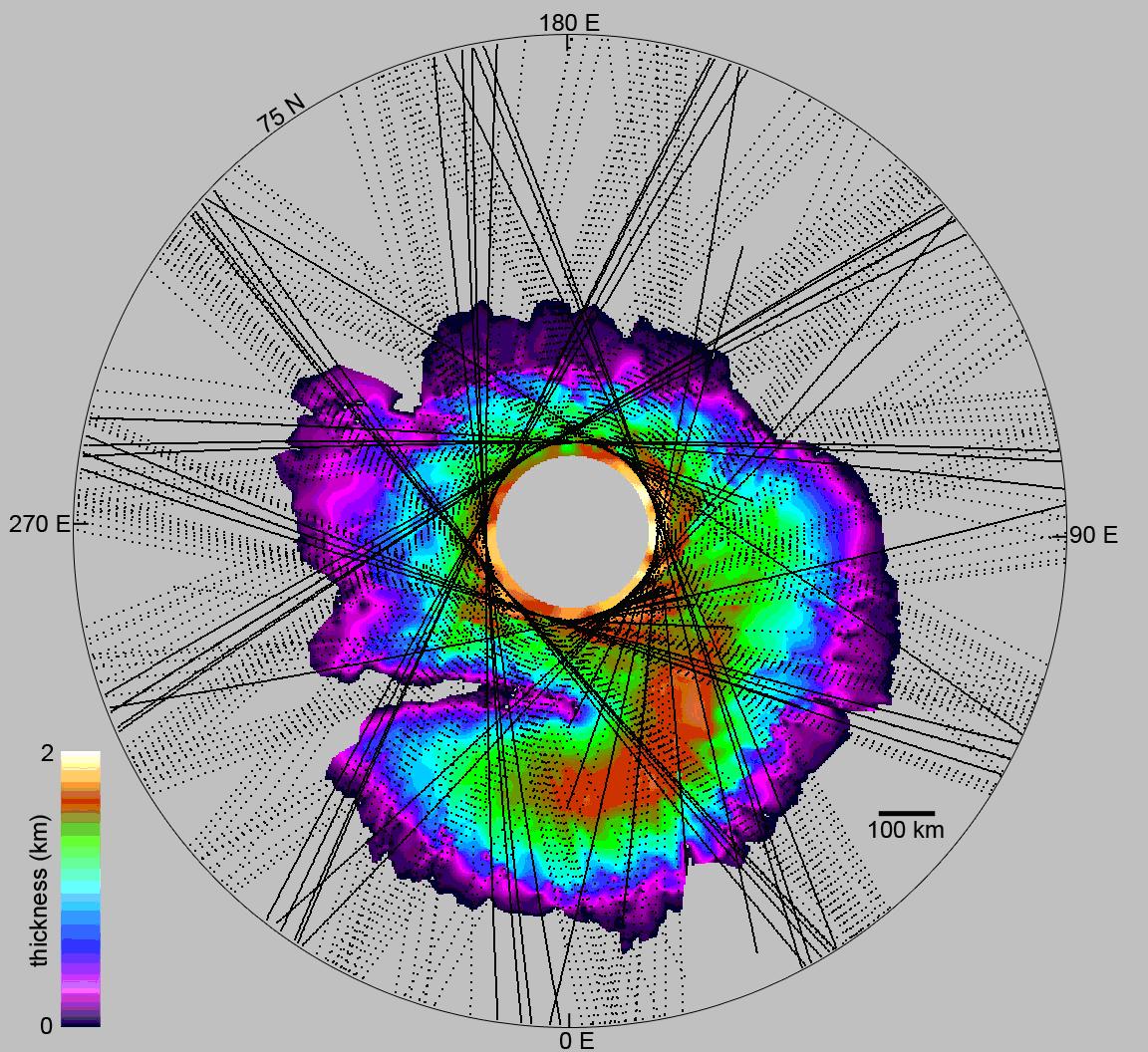
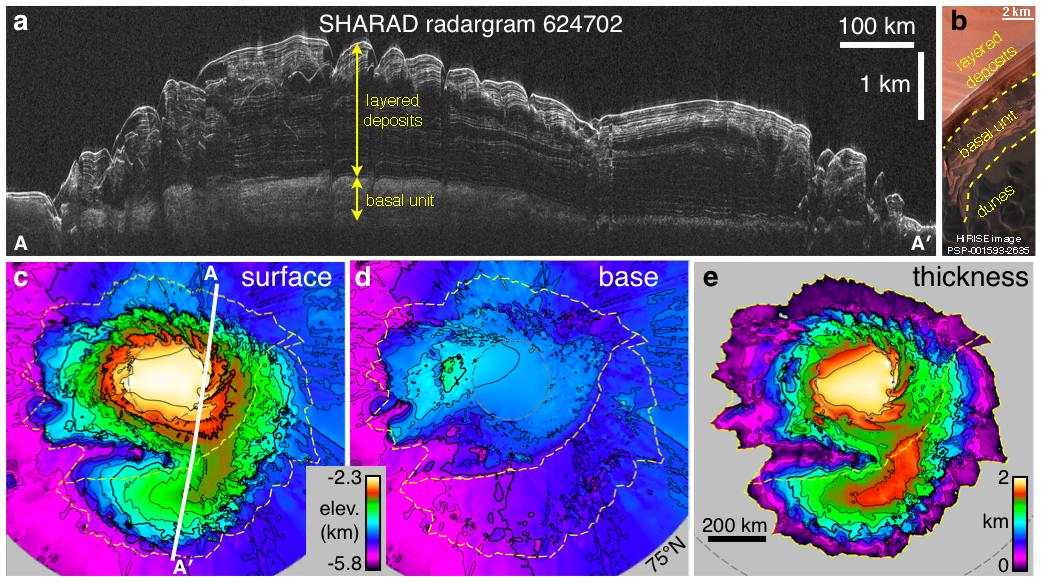
Thickness Map of Buried Carbon-Dioxide Deposit
Full Resolution:
TIFF
(233.5 MB)
JPEG
(4.87 MB)
2013-03-07
Mars
Mars Reconnaissance Orbiter (MRO)
Shallow Subsurface Radar (SHARAD)
1000x692x3
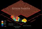
PIA16767:
Visualization of Buried Marte Vallis Channels
Full Resolution:
TIFF
(2.077 MB)
JPEG
(74.88 kB)
2014-11-07
Mars
Mars Reconnaissance Orbiter (MRO)
Shallow Subsurface Radar (SHARAD)
1534x1024x3
PIA18861:
Radar Indication of Effect of Comet Flyby on Martian Ionosphere
Full Resolution:
TIFF
(4.714 MB)
JPEG
(192.9 kB)
2016-05-26
Mars
Mars Reconnaissance Orbiter (MRO)
Viking
Shallow Subsurface Radar (SHARAD)
975x1188x3
PIA20029:
Signs of a Martian Ice Age
Full Resolution:
TIFF
(2.95 MB)
JPEG
(190.7 kB)
2016-11-22
Mars
Mars Reconnaissance Orbiter (MRO)
Shallow Subsurface Radar (SHARAD)
602x122x1
PIA21137:
Radargrams Indicating Ice-Rich Subsurface Deposit
Full Resolution:
TIFF
(73.74 kB)
JPEG
(21.33 kB)
2016-11-22
Mars
Mars Reconnaissance Orbiter (MRO)
Shallow Subsurface Radar (SHARAD)
596x286x3
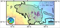
PIA21138:
Location of Large Subsurface Water-Ice Deposit in Utopia Planitia, Mars
Full Resolution:
TIFF
(322.1 kB)
JPEG
(44.46 kB)
Currently displaying images:
1 - 20
of 20


