Click on an image for detailed information
Click on a column heading to sort in ascending or descending order

My
List |
Addition Date
|
Target
|
Mission
|
Instrument
|
Size
|

|
1997-10-14 |
Mars
|
Mars Pathfinder (MPF)
|
Imager for Mars Pathfinder
|
510x385x3 |
|
-
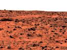
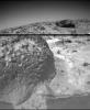
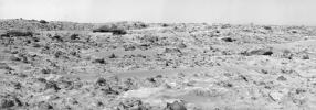
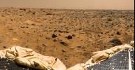
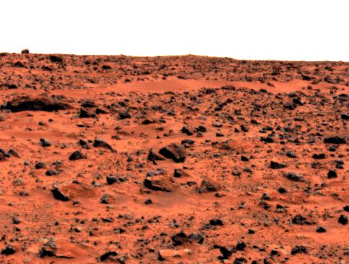
PIA00979:
-
"Roadrunner Flats"
Full Resolution:
TIFF
(97.43 kB)
JPEG
(49.77 kB)
|
|
|
1997-10-14 |
Mars
|
Mars Pathfinder (MPF)
|
Rover Cameras
|
1538x984x1 |
|
-
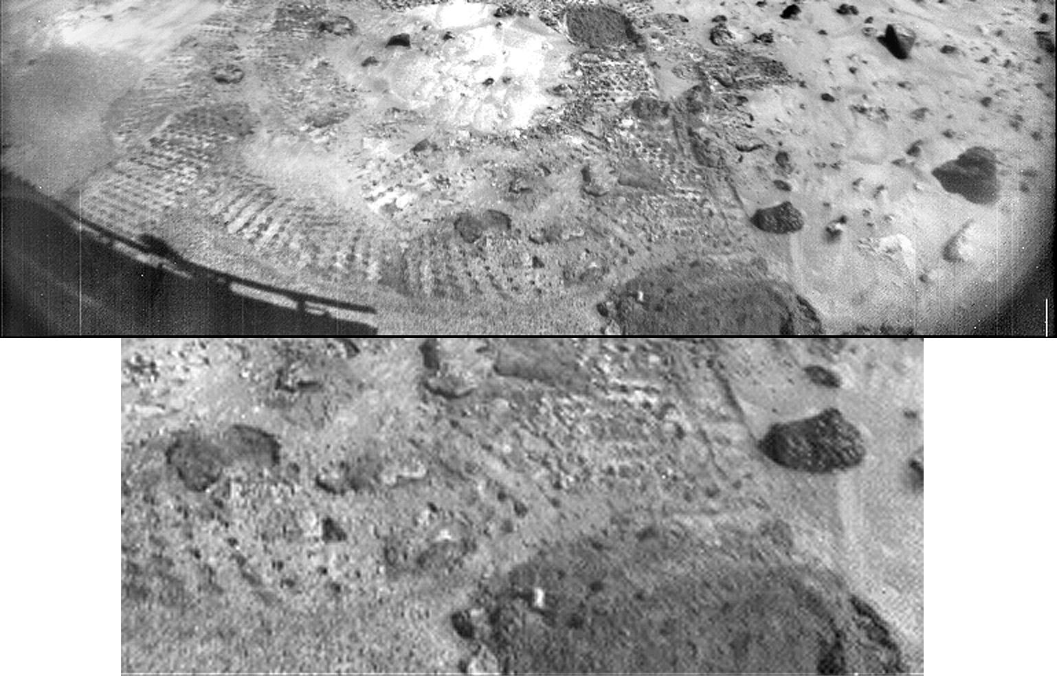
PIA00980:
-
Closeup of "Mermaid Dune"
Full Resolution:
TIFF
(1.428 MB)
JPEG
(213.8 kB)
|
|
|
1997-10-14 |
Mars
|
Mars Pathfinder (MPF)
|
Imager for Mars Pathfinder
|
1277x1239x3 |
|
-
PIA00981:
-
"Jenkins Dune"
Full Resolution:
TIFF
(5.209 MB)
JPEG
(264.9 kB)
|
|
|
1997-10-14 |
Mars
|
Mars Pathfinder (MPF)
|
Imager for Mars Pathfinder
|
1050x1140x3 |
|
-
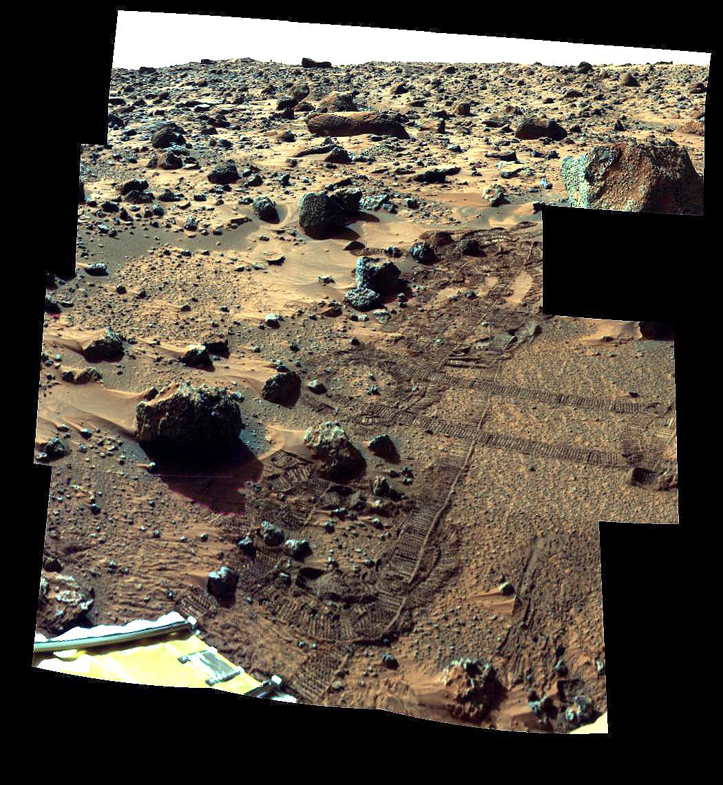
PIA00982:
-
"Barnacle Bill" and Surrounding from Super-Pan
Full Resolution:
TIFF
(2.964 MB)
JPEG
(246 kB)
|
|
|
1997-10-14 |
Mars
|
Mars Pathfinder (MPF)
|
Rover Cameras
|
383x472x1 |
|
-
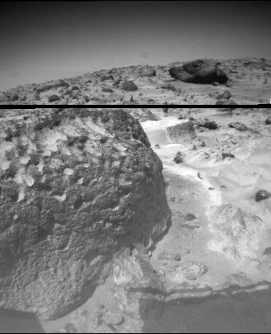
PIA00983:
-
Pits and Flutes on "Stimpy"
Full Resolution:
TIFF
(171.6 kB)
JPEG
(28.27 kB)
|
|
|
1997-10-14 |
Mars
|
Mars Pathfinder (MPF)
|
Rover Cameras
|
413x399x1 |
|
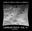
-
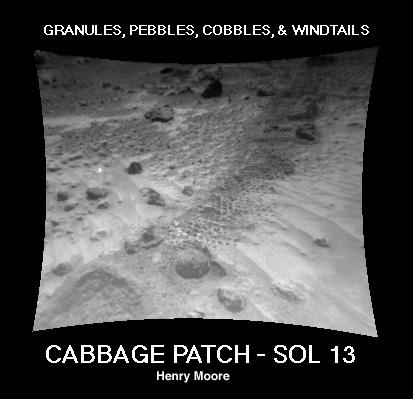
PIA00984:
-
"Cabbage Patch"
Full Resolution:
TIFF
(90.68 kB)
JPEG
(24 kB)
|
|
|
1997-10-14 |
Mars
|
Mars Pathfinder (MPF)
|
Imager for Mars Pathfinder
|
256x248x1 |
|
-
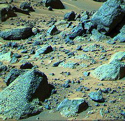
PIA00985:
-
Pebbles and Cobbles at MPF Site
Full Resolution:
TIFF
(78.29 kB)
JPEG
(19.51 kB)
|
|
|
1997-10-14 |
Mars
|
Mars Pathfinder (MPF)
|
Imager for Mars Pathfinder
|
256x248x3 |

|
-
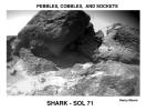
PIA00986:
-
"Shark"
Full Resolution:
TIFF
(73.15 kB)
JPEG
(32.26 kB)
|
|
|
1997-10-14 |
Mars
|
Mars Pathfinder (MPF)
|
Imager for Mars Pathfinder
|
256x248x3 |
|
-
PIA00987:
-
"Rock Garden"
Full Resolution:
TIFF
(72.21 kB)
JPEG
(31.42 kB)
|
|
|
1997-10-14 |
Mars
|
Mars Pathfinder (MPF)
|
Rover Cameras
|
593x446x1 |
|
-
PIA00988:
-
Pebbles, Cobbles, and Sockets
Full Resolution:
TIFF
(205.9 kB)
JPEG
(42.9 kB)
|
|
|
1997-10-14 |
Mars
|
Mars Pathfinder (MPF)
|
Rover Cameras
|
523x475x1 |
|
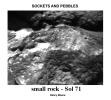
-
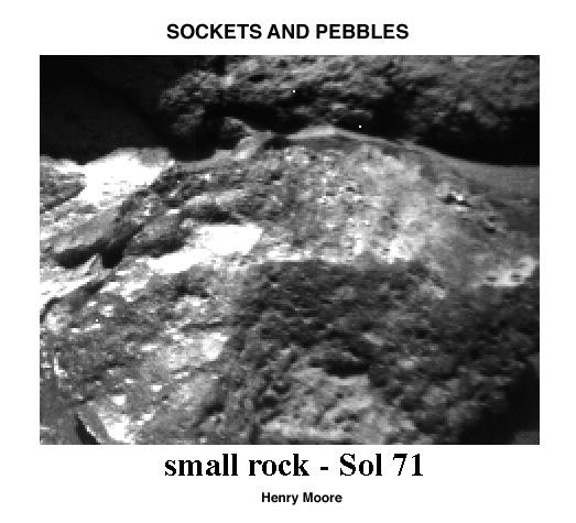
PIA00989:
-
Sockets and Pebbles
Full Resolution:
TIFF
(161.2 kB)
JPEG
(39.43 kB)
|
|
|
1997-10-14 |
Mars
|
Mars Pathfinder (MPF)
Viking
|
|
216x224x1 |
|
-
PIA00990:
-
Wind Drifts at Viking 1 Landing Site
Full Resolution:
TIFF
(48.92 kB)
JPEG
(10.82 kB)
|
|
|
1997-10-15 |
Mars
|
Mars Global Surveyor (MGS)
|
Mars Orbiter Camera (MOC)
|
928x1552x3 |
|
-
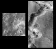
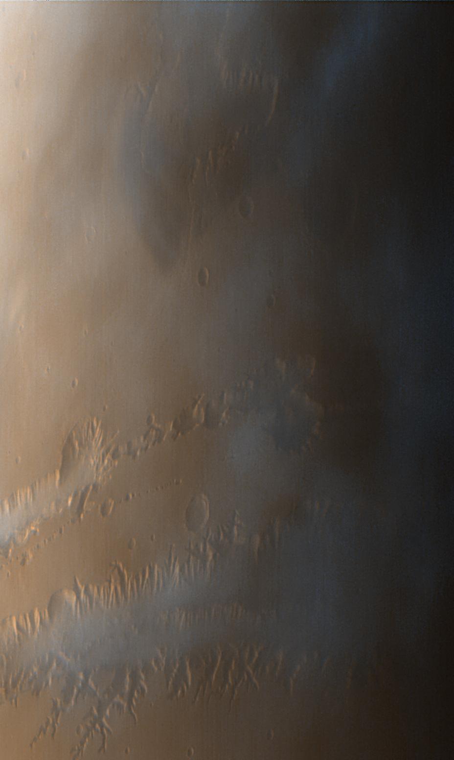
PIA00991:
-
Valles Marineris
Full Resolution:
TIFF
(3.993 MB)
JPEG
(82.71 kB)
|
|
|
1997-10-15 |
Mars
|
Mars Global Surveyor (MGS)
|
Mars Orbiter Camera (MOC)
|
1023x608x3 |
|
-
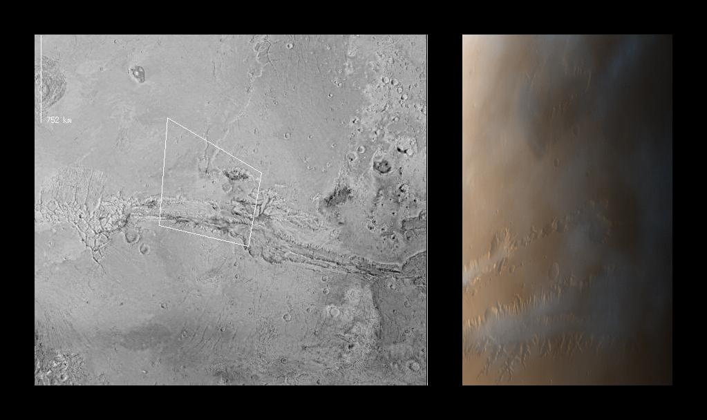
PIA00992:
-
Valles Marineris
Full Resolution:
TIFF
(956.1 kB)
JPEG
(68.46 kB)
|
|
|
1998-04-23 |
Mars
|
Mars Global Surveyor (MGS)
|
Mars Orbiter Camera (MOC)
|
834x834x3 |

|
-
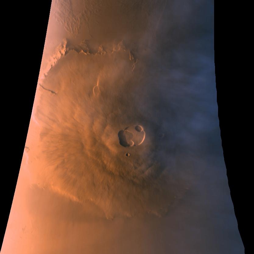
PIA00993:
-
Olympus Mons in Color
Full Resolution:
TIFF
(1.23 MB)
JPEG
(35.04 kB)
|
|
|
1997-11-04 |
Mars
|
Mars Pathfinder (MPF)
|
Imager for Mars Pathfinder
|
6283x1090x3 |
|
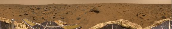
-
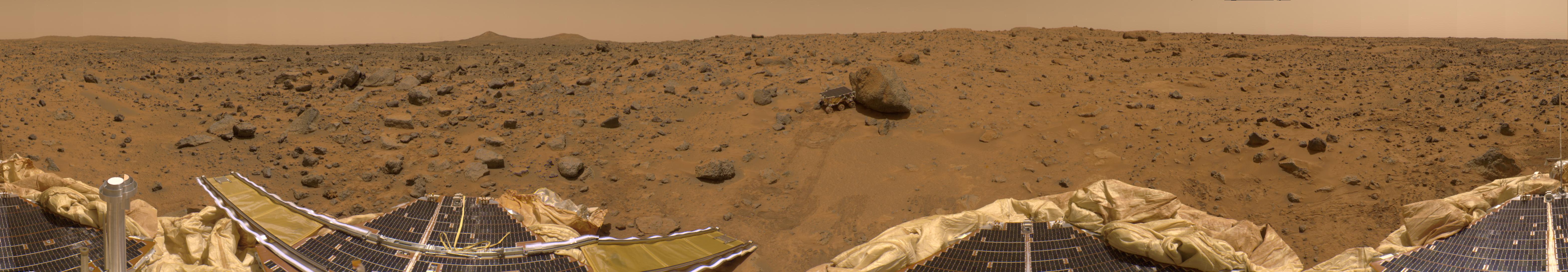
PIA00994:
Color Enhanced Version of 360-degree Panorama
Full Resolution:
TIFF
(21.37 MB)
JPEG
(1.191 MB)
|
|
|
1997-11-04 |
Mars
|
Mars Pathfinder (MPF)
|
Imager for Mars Pathfinder
|
4214x888x3 |
|
-
PIA00995:
The Twin Peaks in 3-D, as Viewed by the Mars Pathfinder IMP Camera
Full Resolution:
TIFF
(8.885 MB)
JPEG
(443.4 kB)
|
|
|
1997-11-04 |
Mars
|
Mars Pathfinder (MPF)
|
Rover Cameras
|
768x481x1 |

|
-
PIA00998:
-
Sojourner's View of "Yogi"
Full Resolution:
TIFF
(402.4 kB)
JPEG
(103.1 kB)
|
|
|
1997-11-04 |
Mars
|
Mars Pathfinder (MPF)
|
Imager for Mars Pathfinder
|
4204x1317x3 |
|
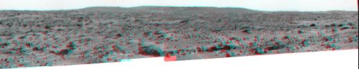
-
PIA00999:
-
Northeast View from Pathfinder Lander - Anaglyph
Full Resolution:
TIFF
(16.27 MB)
JPEG
(615.8 kB)
|
|
|
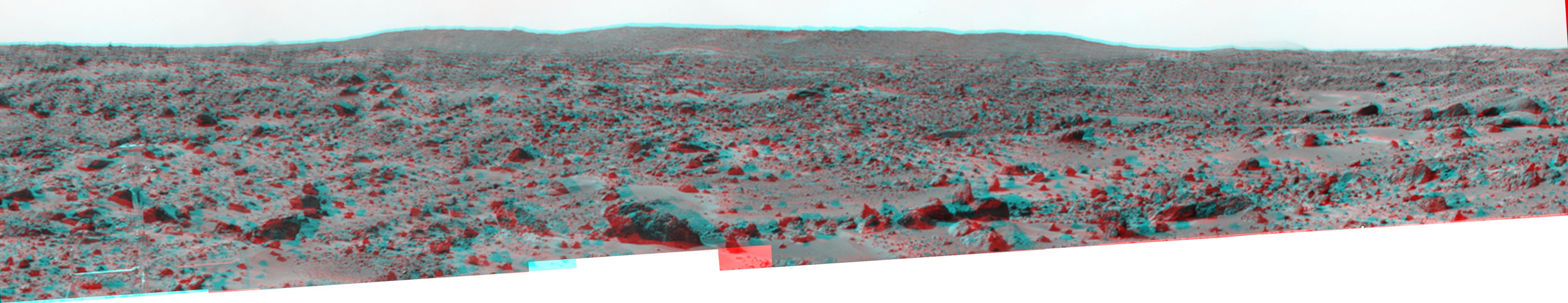
1997-11-04 |
Mars
|
Mars Pathfinder (MPF)
|
Imager for Mars Pathfinder
|
4375x1533x1 |
|
-
PIA01000:
-
Northeast View from Pathfinder Lander
Full Resolution:
TIFF
(5.217 MB)
JPEG
(531 kB)
|
|
|
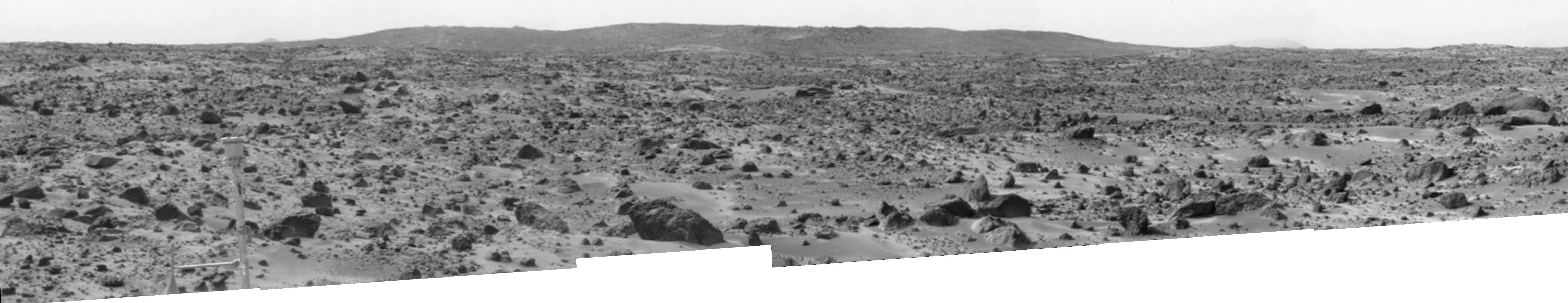
1997-11-04 |
Mars
|
Mars Pathfinder (MPF)
|
Imager for Mars Pathfinder
|
4214x887x1 |
|
-
PIA01001:
Twin Peaks (B/W)
Full Resolution:
TIFF
(3.169 MB)
JPEG
(373 kB)
|
|
|
1997-11-04 |
Mars
|
Mars Pathfinder (MPF)
|
Imager for Mars Pathfinder
|
1726x1090x3 |
|
-
PIA01002:
-
Portion of Enhanced 360-degree Gallery Pan
Full Resolution:
TIFF
(5.793 MB)
JPEG
(339.2 kB)
|
|
|
1997-11-04 |
Mars
|
Mars Pathfinder (MPF)
|
Imager for Mars Pathfinder
|
2128x1090x3 |
|
-
PIA01003:
-
Sojourner Within Color-Enhanced Panorama
Full Resolution:
TIFF
(7.214 MB)
JPEG
(380.8 kB)
|
|
|
1997-11-04 |
Mars
|
Mars Pathfinder (MPF)
|
Imager for Mars Pathfinder
|
2094x1090x3 |
|
-
PIA01004:
-
ASI/MET Within Color-Enhanced Panorama
Full Resolution:
TIFF
(7.116 MB)
JPEG
(413.1 kB)
|
|
|
1997-11-04 |
Mars
|
Mars Pathfinder (MPF)
|
Imager for Mars Pathfinder
|
6283x1090x3 |
|
-
PIA01005:
360-degree Color Panorama
Full Resolution:
TIFF
(18.62 MB)
JPEG
(840.3 kB)
|
|
|
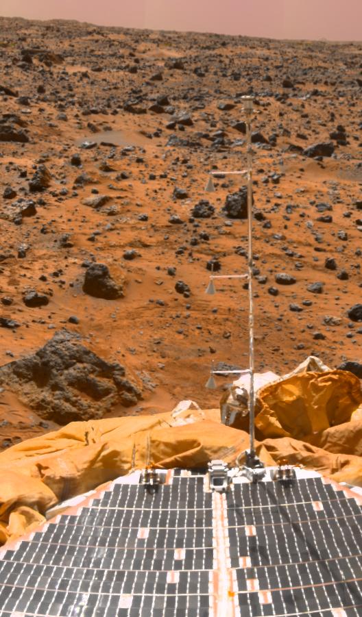
1997-11-04 |
Mars
|
Mars Pathfinder (MPF)
|
Imager for Mars Pathfinder
|
528x901x3 |
|
-
PIA01006:
-
ASI/MET Mast
Full Resolution:
TIFF
(1.261 MB)
JPEG
(103 kB)
|
|
|
1997-11-04 |
Mars
|
Mars Pathfinder (MPF)
|
Imager for Mars Pathfinder
|
6141x1189x3 |
|
-
PIA01007:
Big Crater as Viewed by Pathfinder Lander - Anaglyph
Full Resolution:
TIFF
(15.57 MB)
JPEG
(701.7 kB)
|
|
|
1997-11-04 |
Mars
|
Mars Pathfinder (MPF)
|
Imager for Mars Pathfinder
|
6141x1189x1 |

|
-
PIA01008:
Big Crater as Viewed by Pathfinder Lander
Full Resolution:
TIFF
(4.878 MB)
JPEG
(547.3 kB)
|
|
|
1997-11-10 |
Mars
|
Mars Global Surveyor (MGS)
|
MOLA
|
3300x2550x3 |
|
-
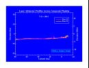
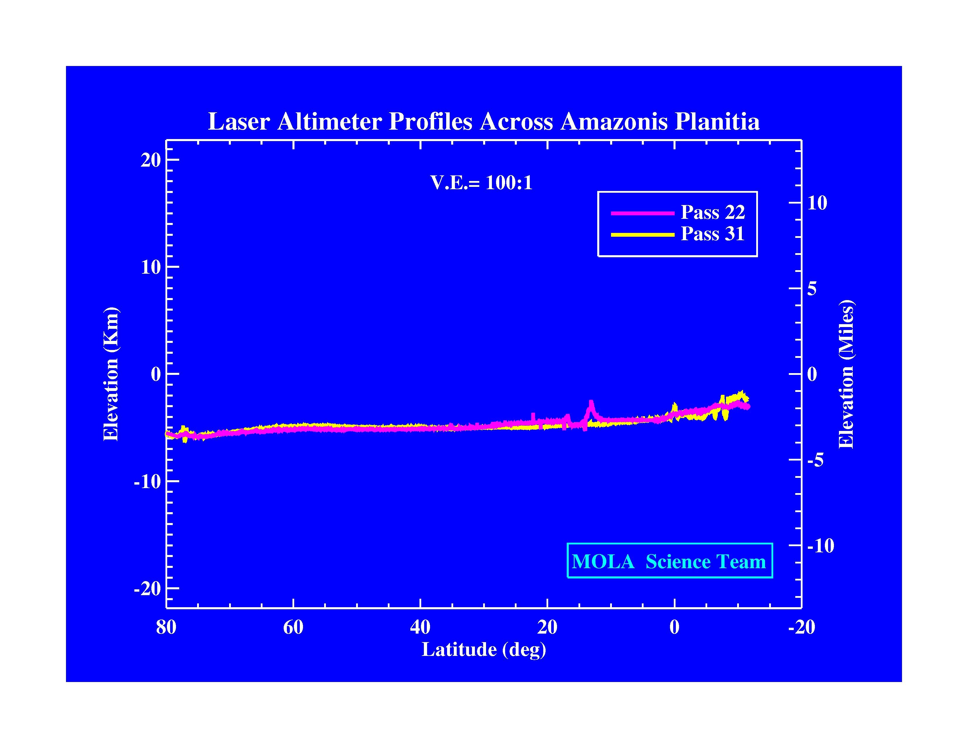
PIA01009:
-
Laser Altimeter Profiles Across Amazonis Planitia
Full Resolution:
TIFF
(530.8 kB)
JPEG
(371.9 kB)
|
|
|
1997-11-10 |
Mars
|
Mars Global Surveyor (MGS)
|
MOLA
|
3300x2550x3 |
|
-
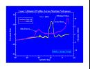
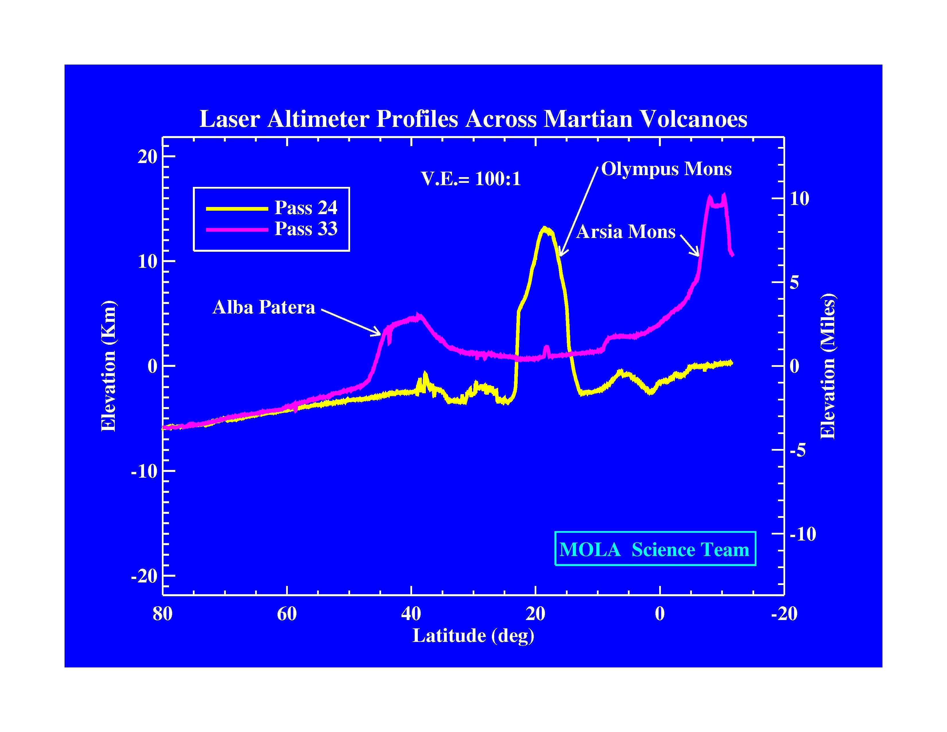
PIA01010:
-
Laser Altimeter Profiles Across Martian Volcanoes
Full Resolution:
TIFF
(677.9 kB)
JPEG
(424.4 kB)
|
|
|
1997-11-10 |
Mars
|
Mars Global Surveyor (MGS)
|
MOLA
|
3300x2550x3 |
|
-
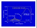
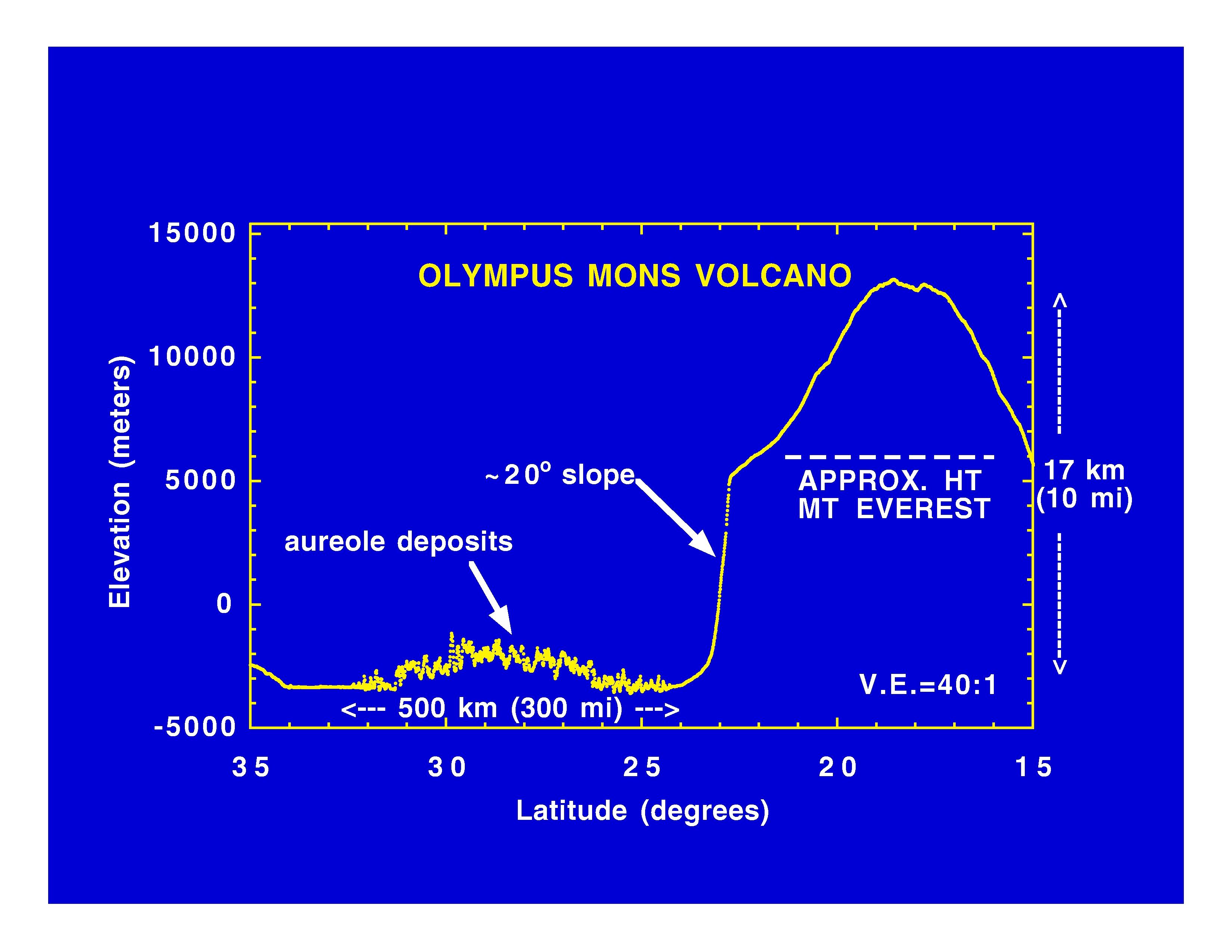
PIA01011:
-
Olympus Mons Volcano
Full Resolution:
TIFF
(625.4 kB)
JPEG
(414.7 kB)
|
|
|
1997-11-10 |
Mars
|
Mars Global Surveyor (MGS)
|
MOLA
|
3300x2550x3 |
|
-
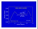
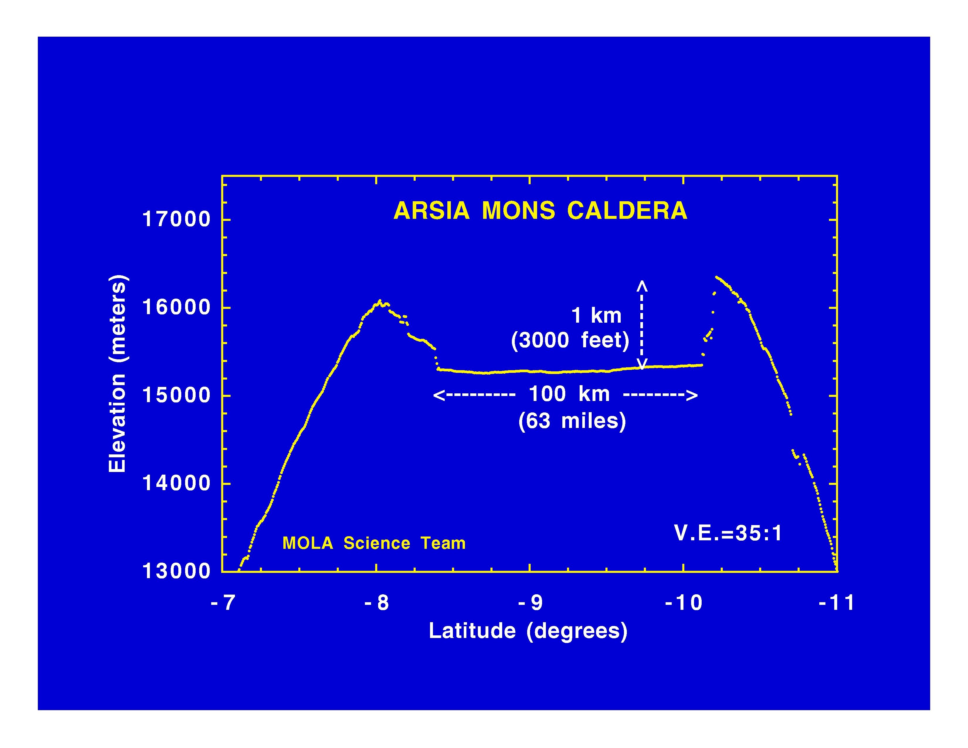
PIA01012:
-
Arsia Mons Caldera
Full Resolution:
TIFF
(534.1 kB)
JPEG
(365.8 kB)
|
|
|
1997-11-10 |
Mars
|
Mars Global Surveyor (MGS)
|
MOLA
|
3300x2550x3 |
|
-
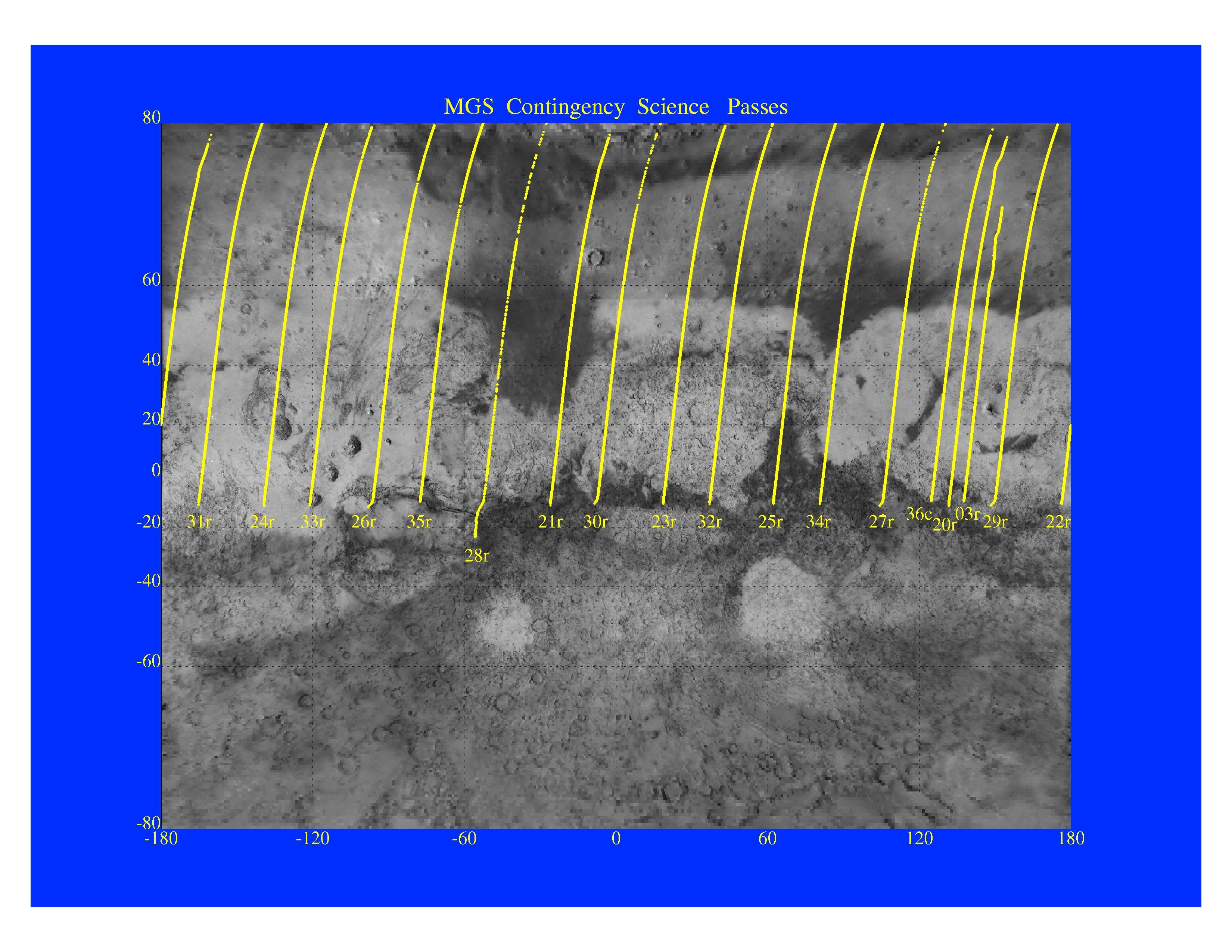
PIA01013:
-
MGS Contingency Science Passes
Full Resolution:
TIFF
(4.409 MB)
JPEG
(879.4 kB)
|
|
|
1997-11-10 |
Mars
|
Mars Global Surveyor (MGS)
|
MOLA
|
3300x2550x3 |
|
-
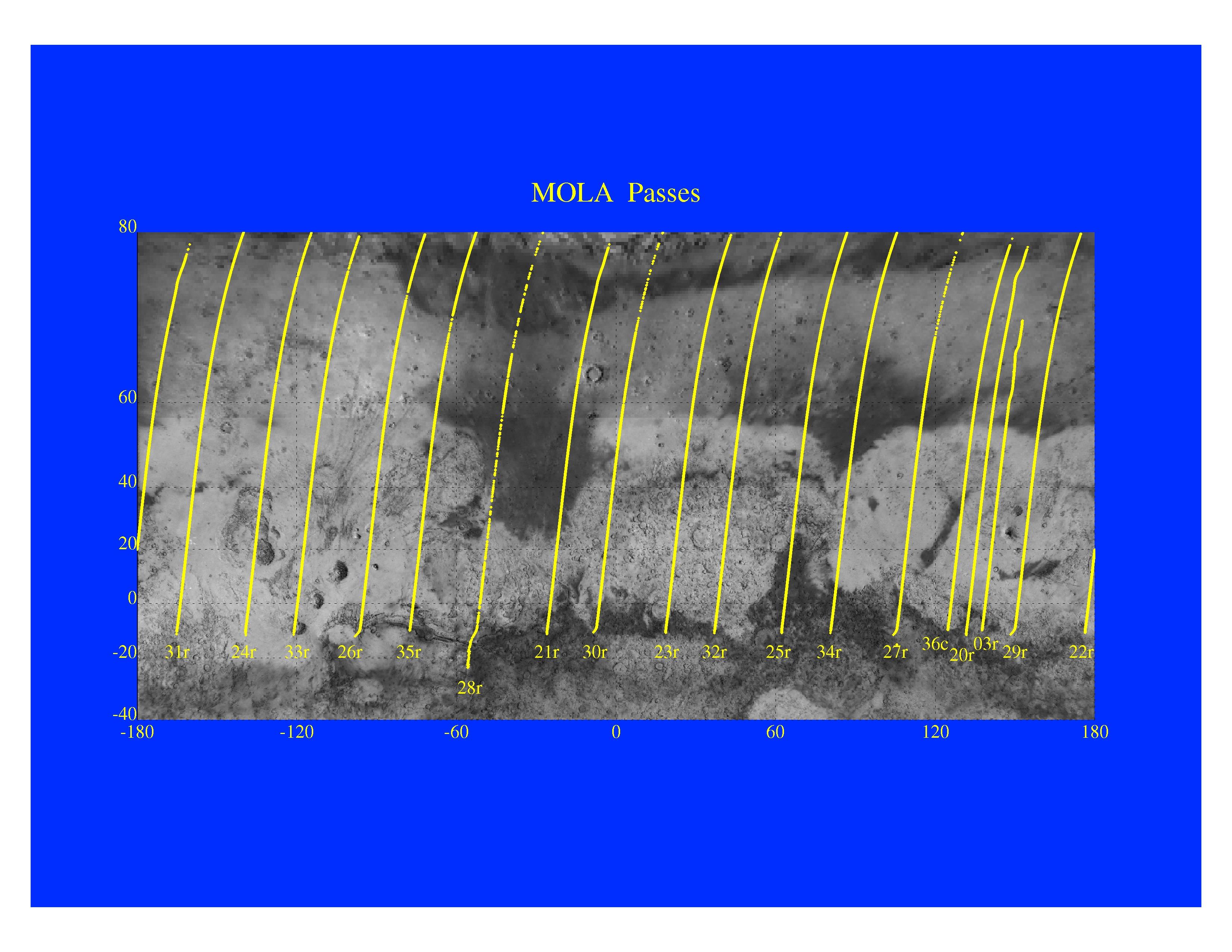
PIA01014:
-
Mars Orbiter Laser Altimeter Passes
Full Resolution:
TIFF
(3.582 MB)
JPEG
(723.3 kB)
|
|
|
1997-11-10 |
Mars
|
Mars Global Surveyor (MGS)
|
Magnetometer
|
996x746x3 |
|
-
PIA01015:
-
Martian Ionosphere
Full Resolution:
TIFF
(567.3 kB)
JPEG
(56.81 kB)
|
|
|
1997-11-10 |
Mars
|
Mars Global Surveyor (MGS)
|
Magnetometer
|
972x744x3 |
|
-
PIA01016:
-
Magnetic Anomalies on Mars
Full Resolution:
TIFF
(1.073 MB)
JPEG
(78.09 kB)
|
|
|
1997-11-10 |
Mars
|
Mars Global Surveyor (MGS)
|
Thermal Emission Spectrometer
|
1409x1091x3 |
|
-
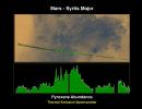
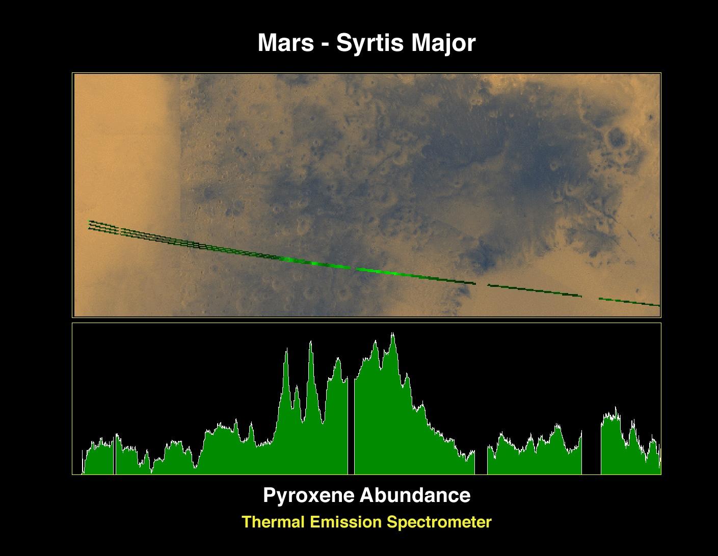
PIA01017:
-
Pyroxene at Syrtis Major
Full Resolution:
TIFF
(1.821 MB)
JPEG
(127.5 kB)
|
|
|
1997-11-10 |
Mars
|
Mars Global Surveyor (MGS)
|
Thermal Emission Spectrometer
|
1872x1224x3 |

|
-
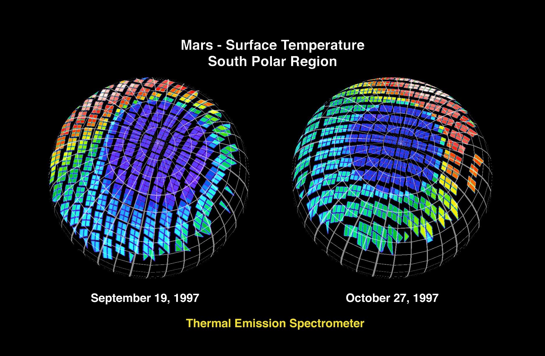
PIA01018:
-
Mars - Surface Temperature South Polar Region
Full Resolution:
TIFF
(2.253 MB)
JPEG
(360.5 kB)
|
|
|
1997-11-10 |
Mars
|
Mars Global Surveyor (MGS)
|
Thermal Emission Spectrometer
|
1400x1000x3 |
|
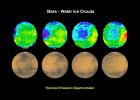
-
PIA01019:
-
Mars - Water Ice Clouds
Full Resolution:
TIFF
(1.695 MB)
JPEG
(147.2 kB)
|
|
|
1997-11-10 |
Mars
|
Mars Global Surveyor (MGS)
|
Thermal Emission Spectrometer
|
524x424x3 |
|
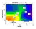
-
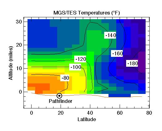
PIA01020:
-
MGS/TES Temperatures
Full Resolution:
TIFF
(17.04 kB)
JPEG
(32.43 kB)
|
|
|
1997-11-10 |
Mars
|
Mars Global Surveyor (MGS)
|
Mars Orbiter Camera (MOC)
|
2880x2880x1 |
|
-
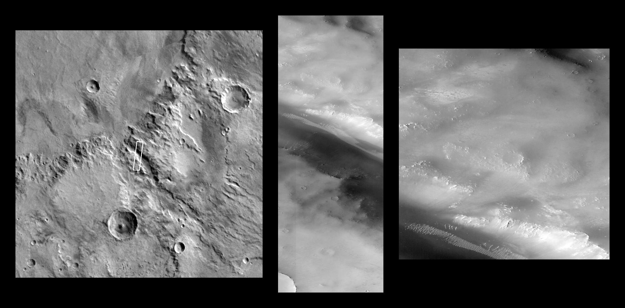
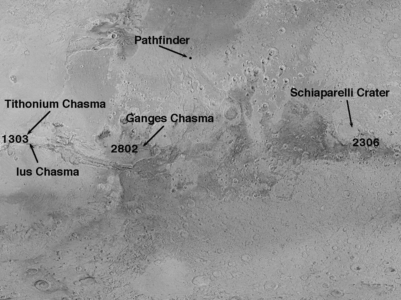
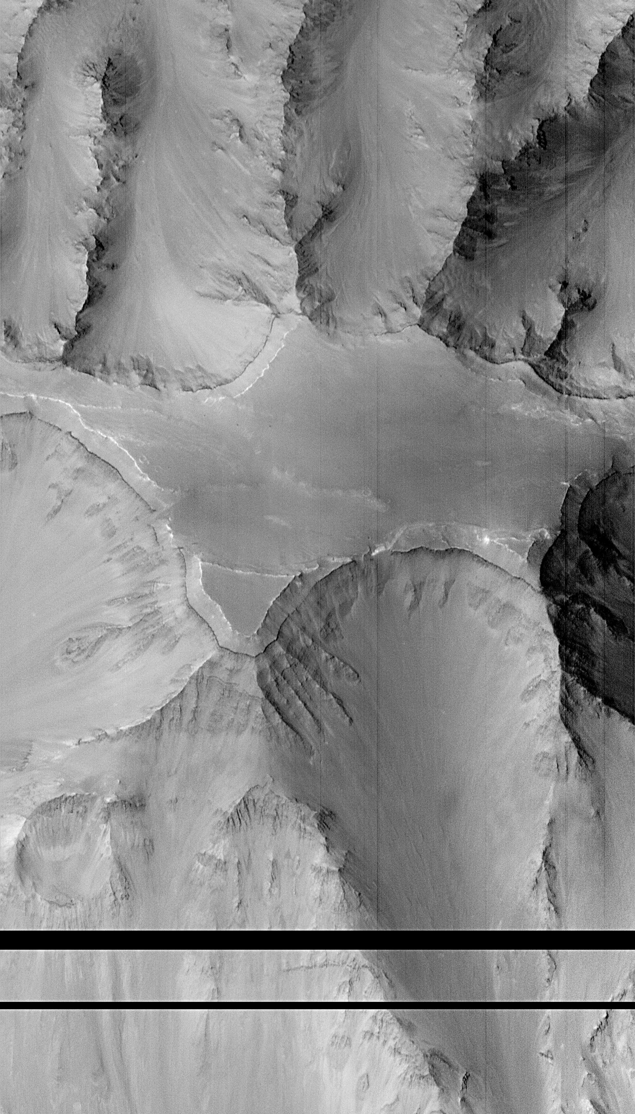
PIA01021:
-
Western Tithonium Chasma/Ius Chasma, Valles Marineris
Full Resolution:
TIFF
(5.33 MB)
JPEG
(771.9 kB)
|
|
|
1997-11-10 |
Mars
|
Mars Global Surveyor (MGS)
|
Mars Orbiter Camera (MOC)
|
1024x1728x1 |
|
-
PIA01022:
-
Western Tithonium Chasma/Ius Chasma, Valles Marineris - High Resolution Image
Full Resolution:
TIFF
(1.698 MB)
JPEG
(268.3 kB)
|
|
|
1997-11-10 |
Mars
|
Mars Global Surveyor (MGS)
|
Mars Orbiter Camera (MOC)
|
1706x1280x1 |
|
-
PIA01023:
-
Western Tithonium Chasma/Ius Chasma, Valles Marineris - High Resolution Image
Full Resolution:
TIFF
(1.89 MB)
JPEG
(259.4 kB)
|
|
|
1997-11-10 |
Mars
|
Mars Global Surveyor (MGS)
|
Mars Orbiter Camera (MOC)
|
2023x996x1 |
|
-
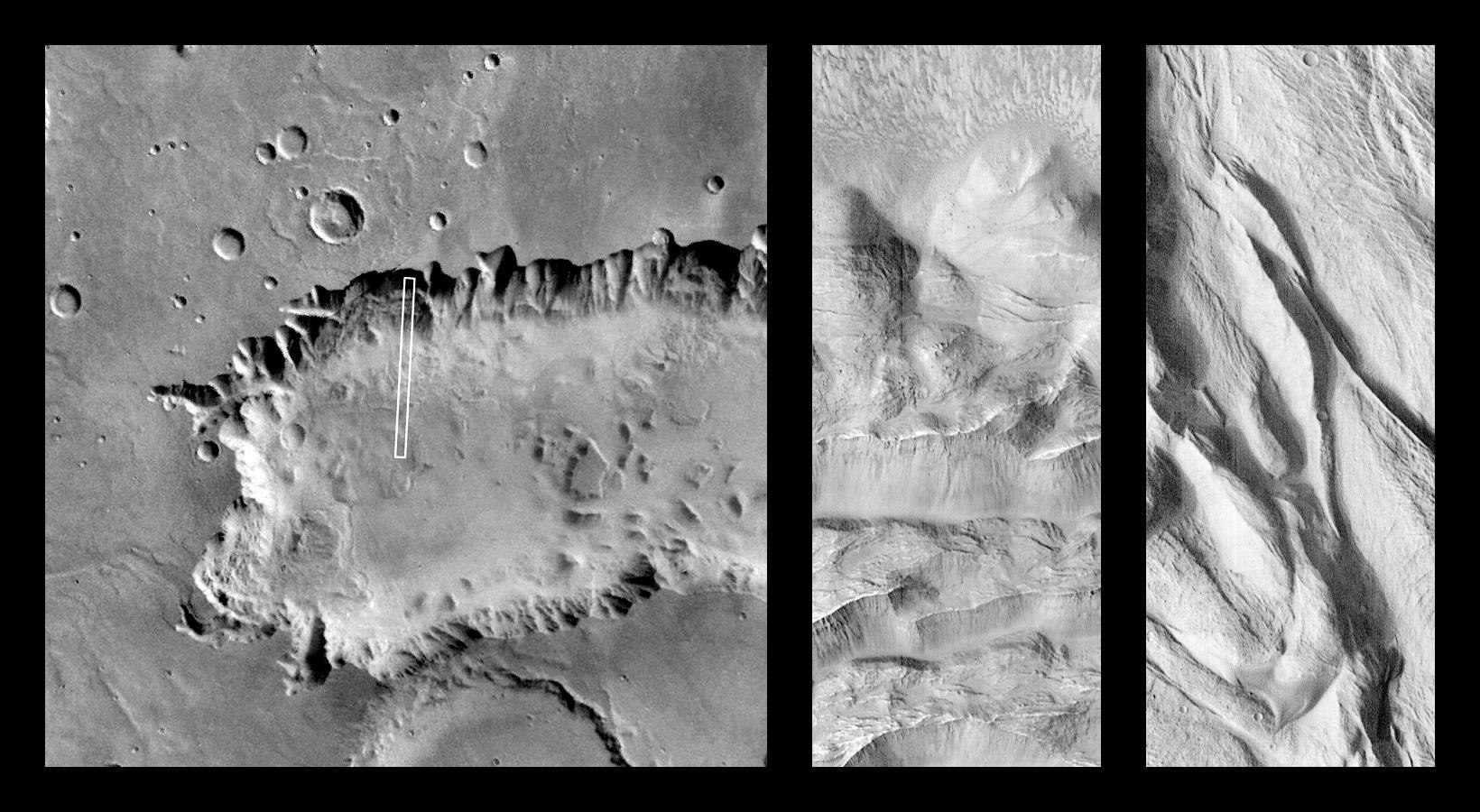
PIA01024:
-
Valley and Surrounding Terrain Adjacent to Schiaparelli Crater
Full Resolution:
TIFF
(1.266 MB)
JPEG
(185.7 kB)
|
|
|
1997-11-10 |
Mars
|
Mars Global Surveyor (MGS)
|
Mars Orbiter Camera (MOC)
|
1024x2688x1 |
|
-
PIA01025:
-
Valley and Surrounding Terrain Adjacent to Schiaparelli Crater - High Resolution Image
Full Resolution:
TIFF
(1.424 MB)
JPEG
(197 kB)
|
|
|
1997-11-10 |
Mars
|
Mars Global Surveyor (MGS)
|
Mars Orbiter Camera (MOC)
|
2048x2048x1 |
|
-
PIA01026:
-
Valley and Surrounding Terrain Adjacent to Schiaparelli Crater - High Resolution Image
Full Resolution:
TIFF
(2.249 MB)
JPEG
(297.8 kB)
|
|
|
1997-11-10 |
Mars
|
Mars Global Surveyor (MGS)
|
Mars Orbiter Camera (MOC)
|
1640x900x1 |
|
-
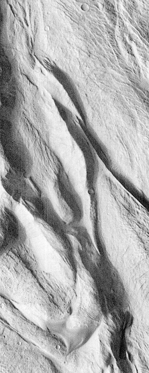
PIA01027:
-
Complex Floor Deposits Within Western Ganges Chasma, Valles Marineris
Full Resolution:
TIFF
(1.183 MB)
JPEG
(230.3 kB)
|
|
|
1997-11-10 |
Mars
|
Mars Global Surveyor (MGS)
|
Mars Orbiter Camera (MOC)
|
512x1280x1 |
|
-
PIA01028:
-
Complex Floor Deposits Within Western Ganges Chasma, Valles Marineris - High Resolution Image
Full Resolution:
TIFF
(635.6 kB)
JPEG
(139 kB)
|
|
|
1997-11-10 |
Mars
|
Mars Global Surveyor (MGS)
|
Mars Orbiter Camera (MOC)
|
512x1280x1 |

|
-
PIA01029:
-
Complex Floor Deposits Within Western Ganges Chasma, Valles Marineris - High Resolution Image
Full Resolution:
TIFF
(738.5 kB)
JPEG
(174.5 kB)
|
|
|
1997-11-10 |
Mars
|
Mars Global Surveyor (MGS)
|
Mars Orbiter Camera (MOC)
|
1280x960x1 |

|
-
PIA01030:
-
Mars Orbiter Camera High Resolution Images: Some Results From The First 6 Weeks In Orbit
Full Resolution:
TIFF
(1.248 MB)
JPEG
(298.2 kB)
|
|
|
2000-06-22 |
Mars
|
Mars Global Surveyor (MGS)
|
Mars Orbiter Camera (MOC)
|
892x668x3 |
|
-
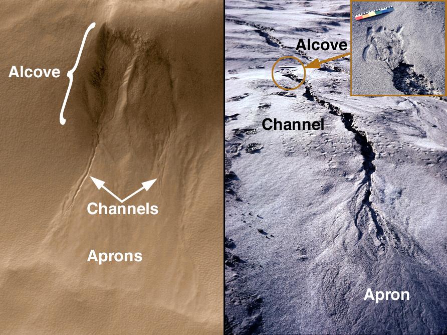
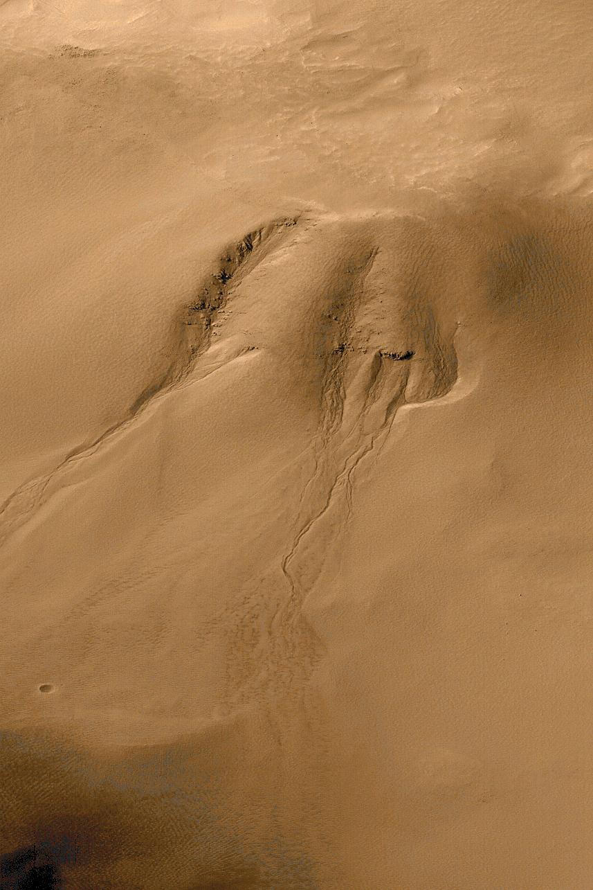
PIA01031:
-
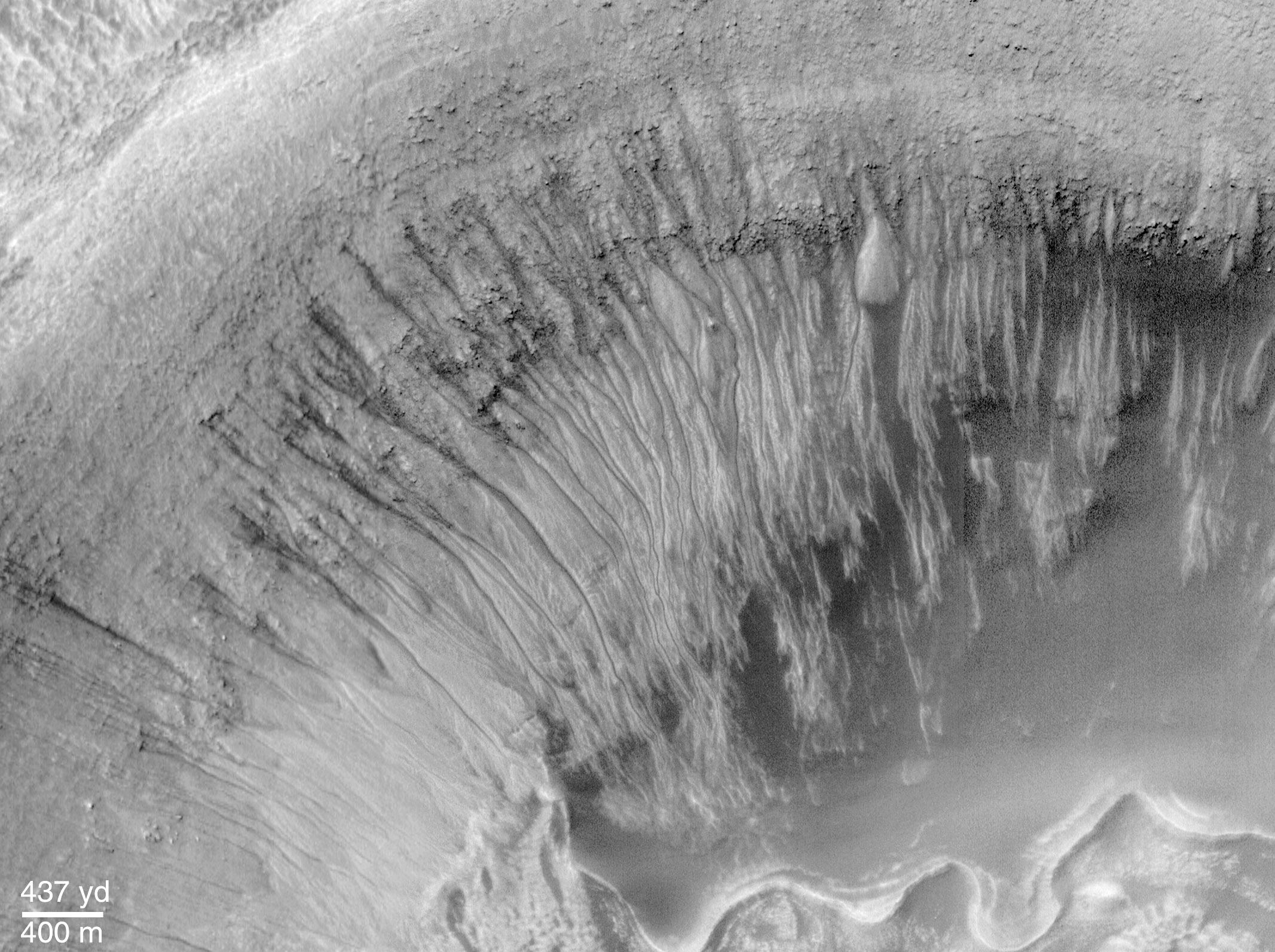
Evidence for Recent Liquid Water on Mars: Basic Features of Martian Gullies
Full Resolution:
TIFF
(1.896 MB)
JPEG
(136.2 kB)
|
|
|
2000-06-22 |
Mars
|
Mars Global Surveyor (MGS)
|
Mars Orbiter Camera (MOC)
|
712x534x1 |
|
-
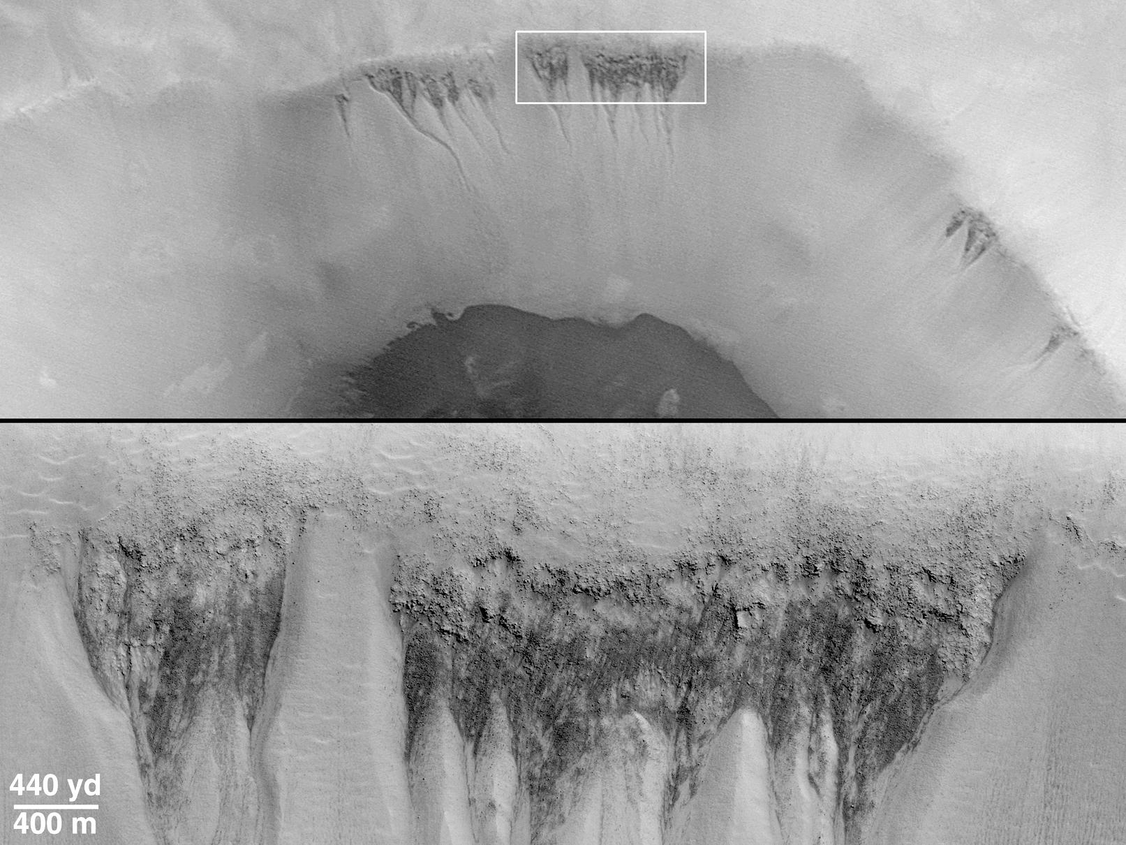
PIA01032:
-
Evidence for Recent Liquid Water on Mars:"Weeping" Layer in Gorgonum Chaos
Full Resolution:
TIFF
(301.9 kB)
JPEG
(51.97 kB)
|
|
|
2000-06-22 |
Mars
|
Mars Global Surveyor (MGS)
|
Mars Orbiter Camera (MOC)
|
1424x1233x3 |
|
-
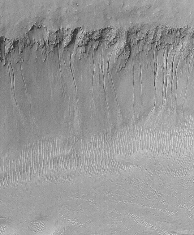
PIA01033:
-
Evidence for Recent Liquid Water on Mars: Gullies in Gorgonum Chaos
Full Resolution:
TIFF
(3.675 MB)
JPEG
(186.3 kB)
|
|
|
2000-06-22 |
Mars
|
Mars Global Surveyor (MGS)
|
Mars Orbiter Camera (MOC)
|
1080x810x1 |
|
-
PIA01034:
-
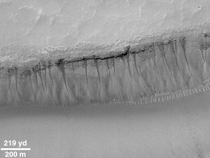
Evidence for Recent Liquid Water on Mars: Gullies at 70�S in Polar Pit Walls
Full Resolution:
TIFF
(765.9 kB)
JPEG
(134.8 kB)
|
|
|
2000-06-22 |
Mars
|
Mars Global Surveyor (MGS)
|
Mars Orbiter Camera (MOC)
|
857x1285x3 |
|
-
PIA01035:
-
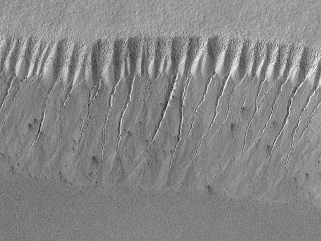
Evidence for Recent Liquid Water on Mars: Gullies in Crater Wall, Noachis Terra
Full Resolution:
TIFF
(2.867 MB)
JPEG
(152.3 kB)
|
|
|
2000-06-22 |
Mars
|
Mars Global Surveyor (MGS)
|
Mars Orbiter Camera (MOC)
|
1613x1210x1 |
|
-
PIA01036:
-
Evidence for Recent Liquid Water on Mars: Seepage Sites in "Aerobraking Crater" Revisited
Full Resolution:
TIFF
(1.626 MB)
JPEG
(301.9 kB)
|
|
|
2000-06-22 |
Mars
|
Mars Global Surveyor (MGS)
|
Mars Orbiter Camera (MOC)
|
627x760x1 |
|
-
PIA01037:
-
Evidence for Recent Liquid Water on Mars: South-facing Walls of Nirgal Vallis
Full Resolution:
TIFF
(404.8 kB)
JPEG
(84.61 kB)
|
|
|
2000-06-22 |
Mars
|
Mars Global Surveyor (MGS)
|
Mars Orbiter Camera (MOC)
|
2382x1788x1 |
|
-
PIA01038:
-
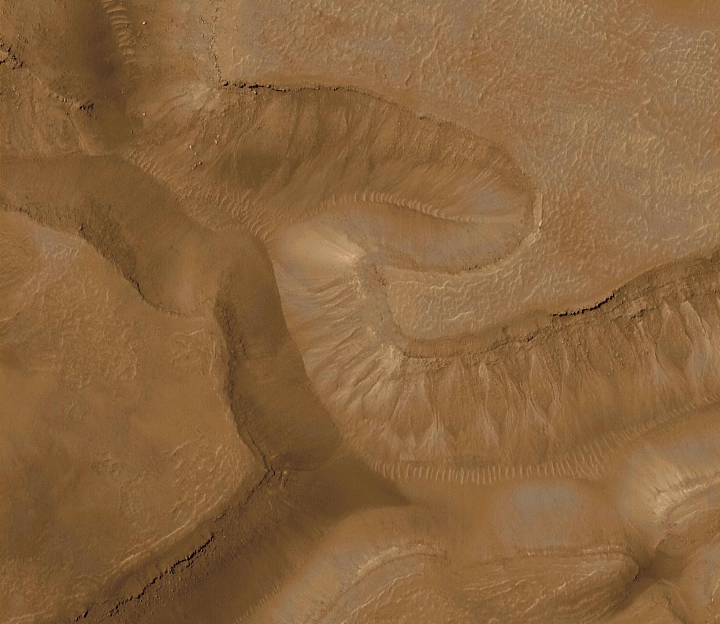
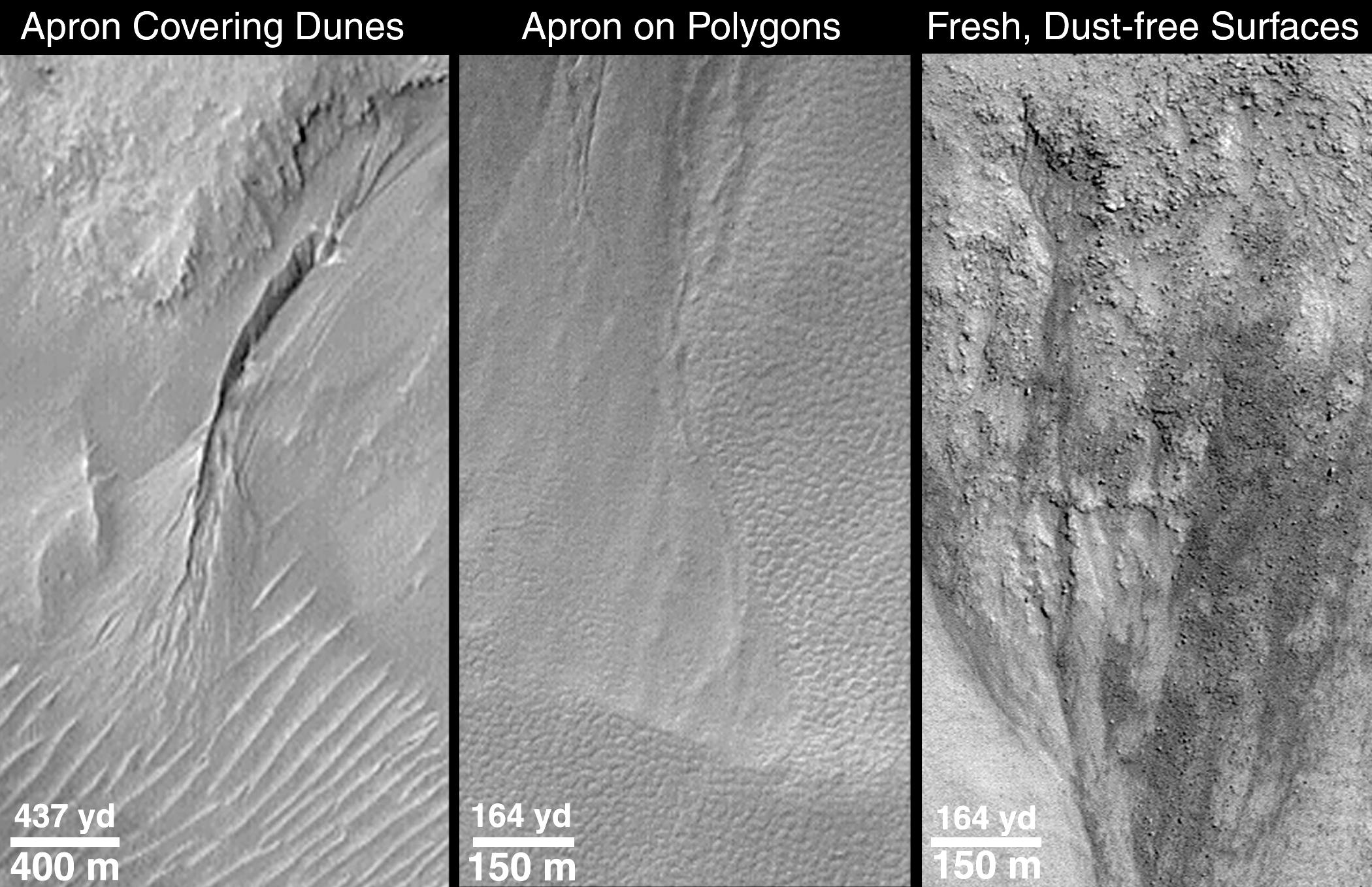
Evidence for Recent Liquid Water on Mars: Channels and Aprons in East Gorgonum Crater
Full Resolution:
TIFF
(3.538 MB)
JPEG
(610 kB)
|
|
|
2000-06-22 |
Mars
|
Mars Global Surveyor (MGS)
|
Mars Orbiter Camera (MOC)
|
2133x1593x1 |

|
-
PIA01039:
-
Evidence for Recent Liquid Water on Mars: Channeled Aprons in a Small Crater within Newton Crater
Full Resolution:
TIFF
(3.16 MB)
JPEG
(523.8 kB)
|
|
|
2000-06-22 |
Mars
|
Mars Global Surveyor (MGS)
|
Mars Orbiter Camera (MOC)
|
2609x2346x3 |
|
-
PIA01040:
-
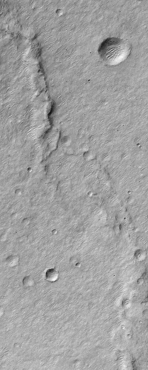
Evidence for Recent Liquid Water on Mars: Gullies in Sirenum Fossae Trough
Full Resolution:
TIFF
(11.75 MB)
JPEG
(702.4 kB)
|
|
|
2000-06-22 |
Mars
|
Mars Global Surveyor (MGS)
|
Mars Orbiter Camera (MOC)
|
2100x1357x1 |

|
-
PIA01041:
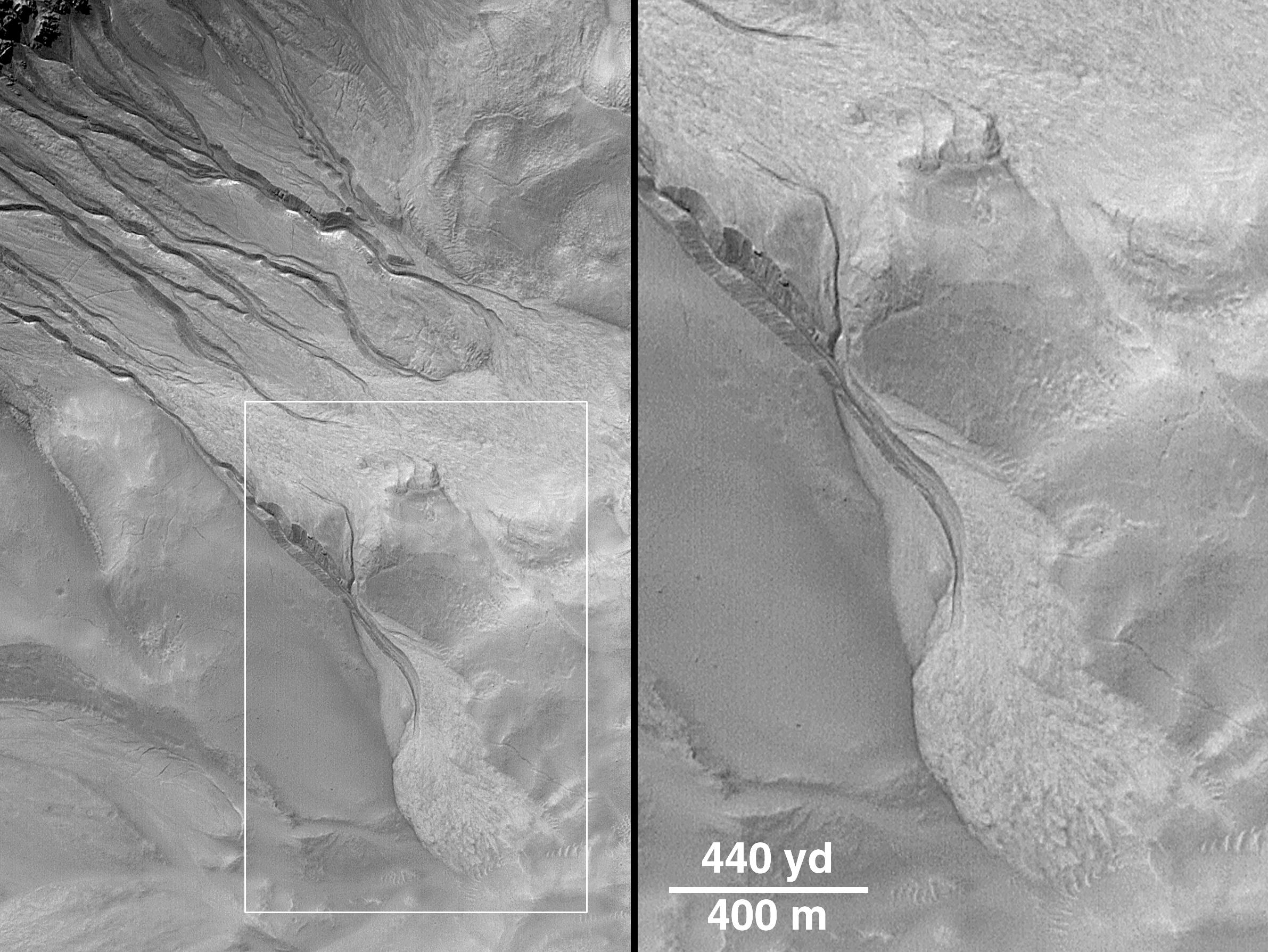
-
Evidence for Recent Liquid Water on Mars: Clues Regarding the Relative Youth of Martian Gullies
Full Resolution:
TIFF
(2.211 MB)
JPEG
(379.4 kB)
|
|
|
2000-06-22 |
Mars
|
Mars Global Surveyor (MGS)
|
Mars Orbiter Camera (MOC)
|
858x643x1 |
|
-
PIA01042:
-
Evidence for Recent Liquid Water on Mars: "Dry" Processes on One Slope; "Wet" Processes on Another
Full Resolution:
TIFF
(528.3 kB)
JPEG
(87.08 kB)
|
|
|
2000-08-02 |
Mars
|
Mars Global Surveyor (MGS)
|
Mars Orbiter Camera (MOC)
|
512x1279x1 |
|
-
PIA01043:
-
MGS MOC Returns to Service Following Solar Conjunction Hiatus
Full Resolution:
TIFF
(620.3 kB)
JPEG
(148.4 kB)
|
|
|
2000-08-02 |
Mars
|
Mars Global Surveyor (MGS)
|
Mars Orbiter Camera (MOC)
|
512x1279x1 |
|
-
PIA01044:
-
MGS MOC Returns to Service Following Solar Conjunction Hiatus
Full Resolution:
TIFF
(462.1 kB)
JPEG
(78.99 kB)
|
|
|
2000-08-02 |
Mars
|
Mars Global Surveyor (MGS)
|
Mars Orbiter Camera (MOC)
|
768x2556x1 |
|
-
PIA01045:
-
Frosted North Polar Sand Dunes in Early Spring
Full Resolution:
TIFF
(1.581 MB)
JPEG
(238.6 kB)
|
|
|
2000-08-02 |
Mars
|
Mars Global Surveyor (MGS)
|
Mars Orbiter Camera (MOC)
|
768x1536x1 |
|
-
PIA01046:
-
Sirenum Fossae Trough
Full Resolution:
TIFF
(1.072 MB)
JPEG
(130.6 kB)
|
|
|
2000-09-08 |
Mars
|
Mars Global Surveyor (MGS)
|
MOLA
|
757x995x3 |
|
-
PIA01049:
-
Regional Topographic Views of Mars from MOLA
Full Resolution:
TIFF
(1.717 MB)
JPEG
(157.5 kB)
|
|
|
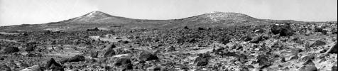
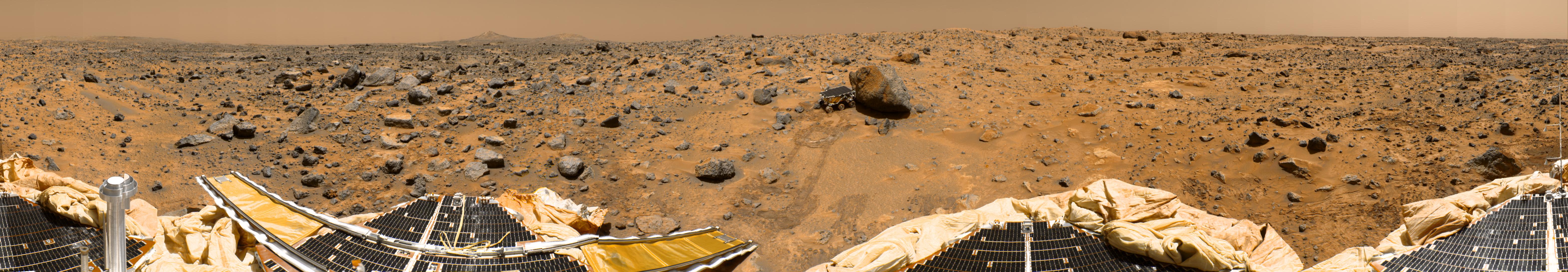
1997-12-12 |
Mars
|
Mars Pathfinder (MPF)
|
Imager for Mars Pathfinder
|
2550x3282x3 |
|
-
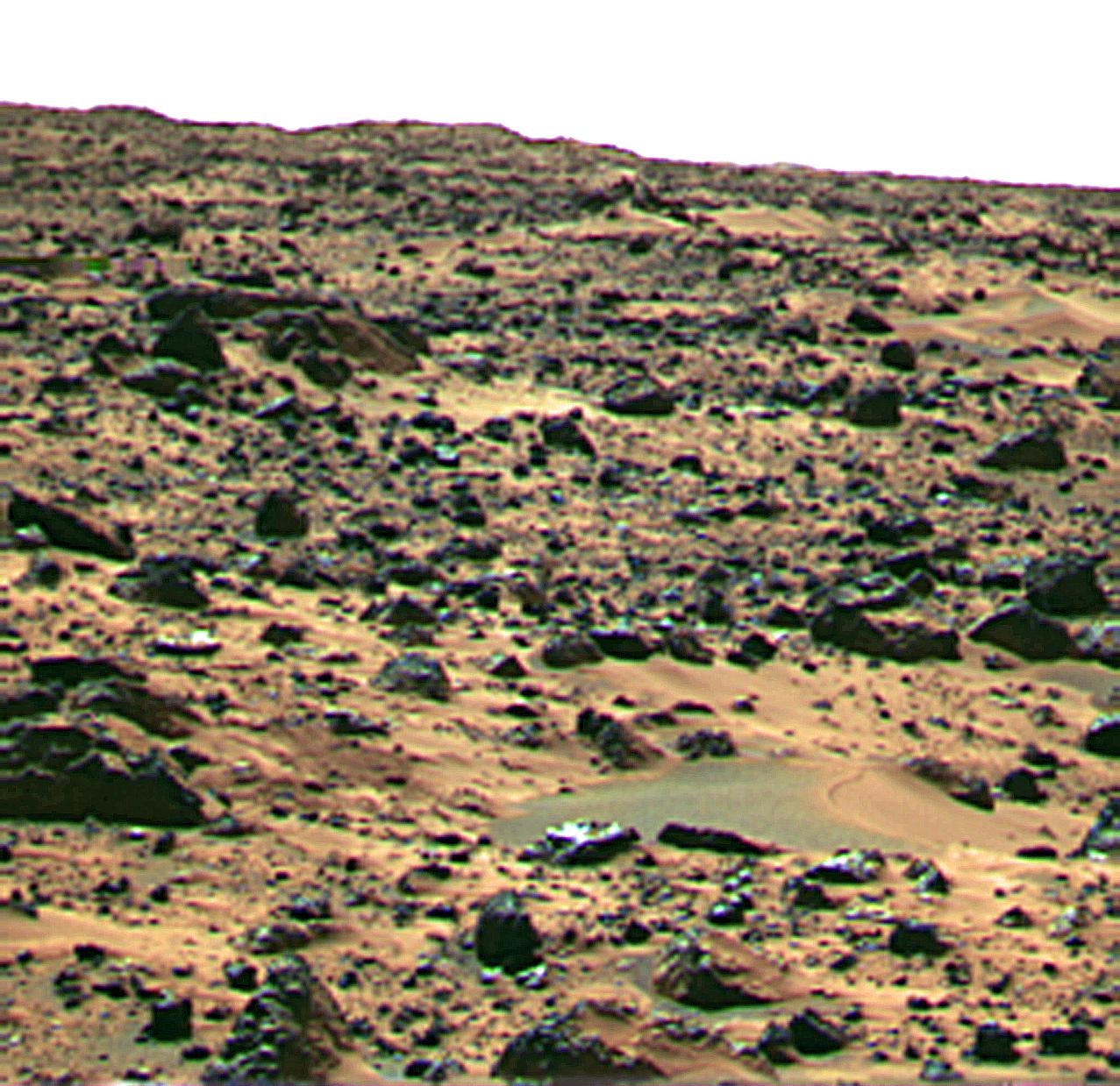
PIA01120:
-
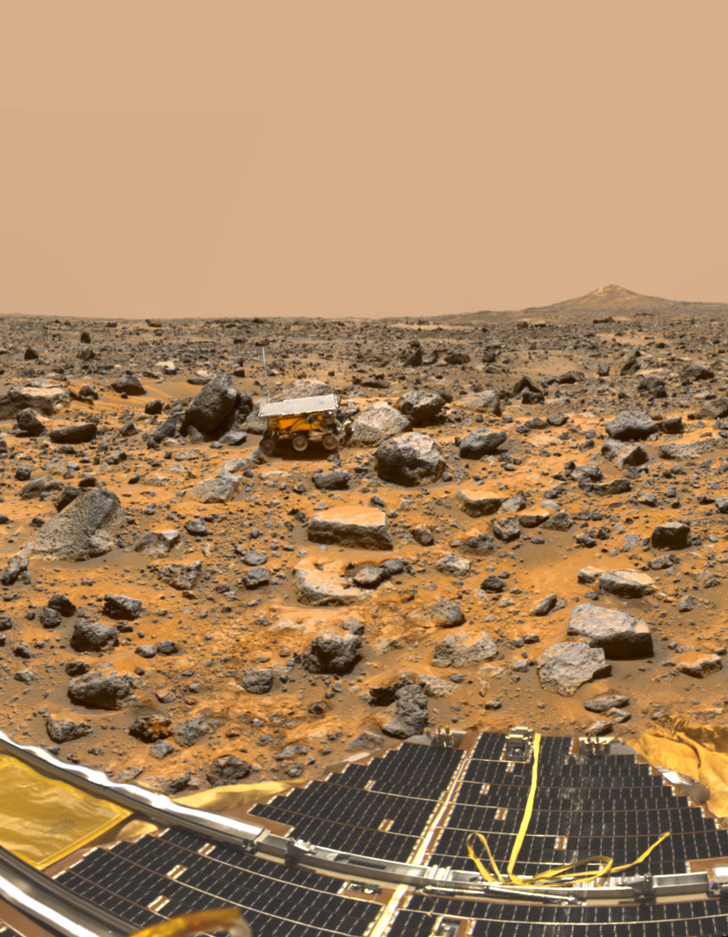
Pathfinder on Mars
Full Resolution:
TIFF
(19.19 MB)
JPEG
(867.8 kB)
|
|
|
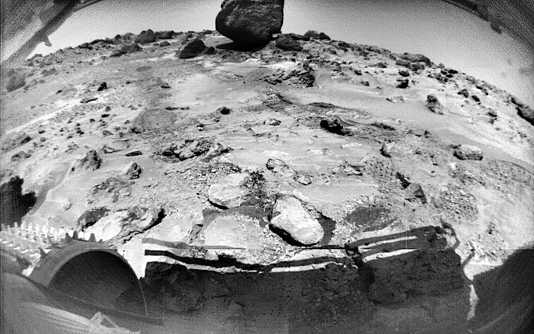
1997-12-12 |
Mars
|
Mars Pathfinder (MPF)
|
Rover Cameras
|
411x190x1 |

|
-
PIA01121:
-
Sojourner Rover View of Pathfinder Lander
Full Resolution:
TIFF
(66.42 kB)
JPEG
(14.27 kB)
|
|
|
1997-12-12 |
Mars
|
Mars Pathfinder (MPF)
|
Imager for Mars Pathfinder
|
1276x1175x3 |
|
-
PIA01122:
-
Sojourner Rover Near "The Dice"
Full Resolution:
TIFF
(4.989 MB)
JPEG
(166.8 kB)
|
|
|
1997-12-12 |
Mars
|
Mars Pathfinder (MPF)
|
Imager for Mars Pathfinder
|
1784x1271x3 |
|
-
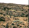
PIA01123:
-
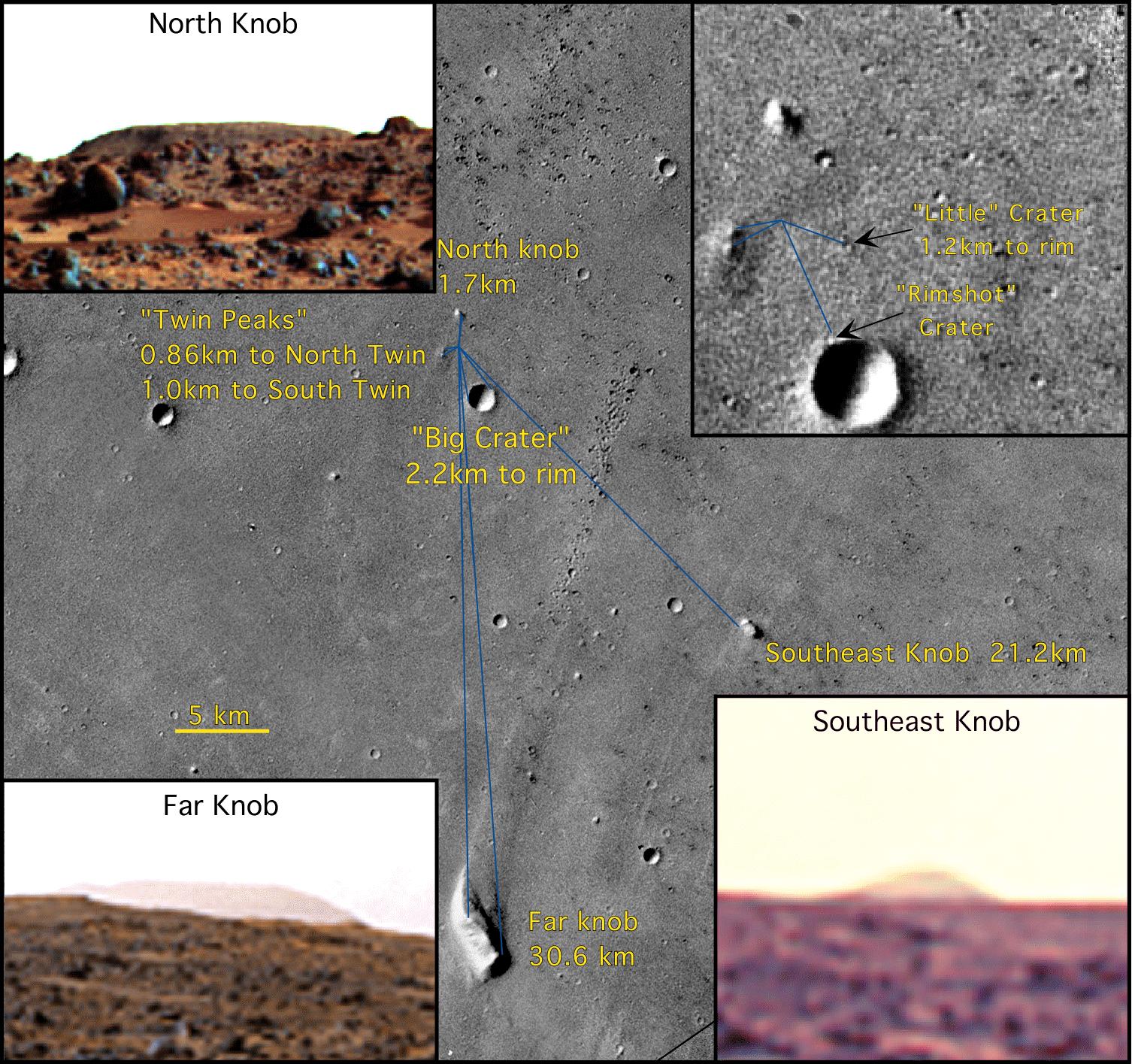
Mars Pathfinder Landing Ellipses
Full Resolution:
TIFF
(4.665 MB)
JPEG
(745.7 kB)
|
|
|
1997-12-12 |
Mars
|
Mars Pathfinder (MPF)
|
Imager for Mars Pathfinder
|
1506x1415x3 |
|
-
PIA01124:
-
Mars Pathfinder Landing Site
Full Resolution:
TIFF
(2.072 MB)
JPEG
(435.4 kB)
|
|
|
1998-01-07 |
Mars
|
Mars Pathfinder (MPF)
|
Imager for Mars Pathfinder
|
288x288x3 |
|
-
PIA01132:
-
Pathfinder Rover Atop "Mermaid Dune"
Full Resolution:
TIFF
(269.6 kB)
JPEG
(17.2 kB)
|
|
|
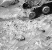
1998-01-07 |
Mars
|
Mars Pathfinder (MPF)
|
Rover Cameras
|
288x288x1 |
|
-
PIA01133:
-
Sojourner Rover View of Well-Rounded Pebbles in "Cabbage Patch"
Full Resolution:
TIFF
(75.4 kB)
JPEG
(14.17 kB)
|
|
|
1998-01-07 |
Mars
|
Mars Pathfinder (MPF)
|
Rover Cameras
|
370x288x1 |
|
-
PIA01134:
-
Sojourner Rover View of "Shark" and "Half Dome"
Full Resolution:
TIFF
(108.9 kB)
JPEG
(22.28 kB)
|
|
|
1998-01-07 |
Mars
|
Mars Pathfinder (MPF)
|
Rover Cameras
|
370x288x1 |
|
-
PIA01135:
-
Sojourner Rover View of Sockets and Pebbles
Full Resolution:
TIFF
(107 kB)
JPEG
(22.69 kB)
|
|
|
1998-01-07 |
Mars
|
Mars Pathfinder (MPF)
|
Rover Cameras
|
288x288x1 |

|
-
PIA01136:
-
Sojourner Rover View of "Souffle" Rock
Full Resolution:
TIFF
(82.3 kB)
JPEG
(15.64 kB)
|
|
|
1998-01-07 |
Mars
|
Mars Pathfinder (MPF)
|
Rover Cameras
|
288x288x1 |

|
-
PIA01137:
-
Sojourner Rover Tracks in Compressible Soil
Full Resolution:
TIFF
(81.45 kB)
JPEG
(15.58 kB)
|
|
|
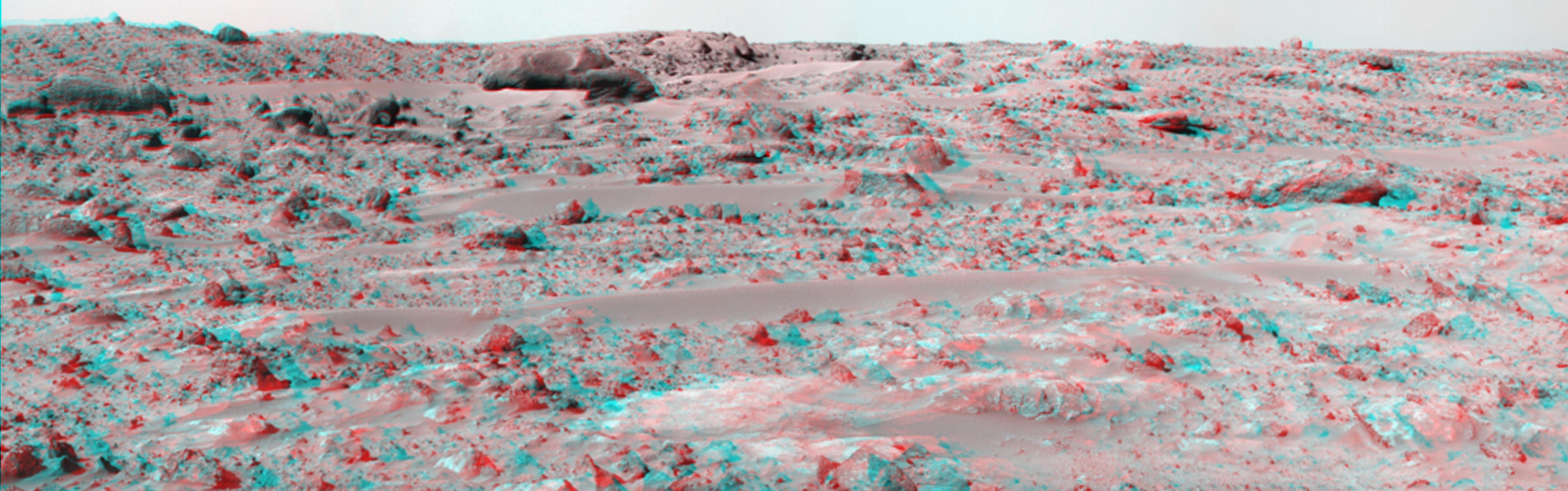
1998-01-07 |
Mars
|
Mars Pathfinder (MPF)
|
Rover Cameras
|
288x288x1 |

|
-
PIA01138:
-
Sojourner Rover View of Cloddy Deposits near "Pooh Bear"
Full Resolution:
TIFF
(94.96 kB)
JPEG
(20.89 kB)
|
|
|
1998-01-07 |
Mars
|
Mars Pathfinder (MPF)
|
Rover Cameras
|
288x288x1 |
|
-
PIA01139:
-
Sojourner Rover View of Platy Fragments near "Pop-Tart"
Full Resolution:
TIFF
(69.47 kB)
JPEG
(18.12 kB)
|
|
|
1998-04-02 |
Mars
|
Viking
|
Visual Imaging Subsystem - Camera A
|
640x472x1 |

|
-
PIA01141:
-
Geologic 'Face on Mars' Formation
Full Resolution:
TIFF
(316.9 kB)
JPEG
(60.68 kB)
|
|
|
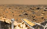
1998-03-26 |
Mars
|
Mars Pathfinder (MPF)
|
Imager for Mars Pathfinder
|
8553x2852x3 |
|
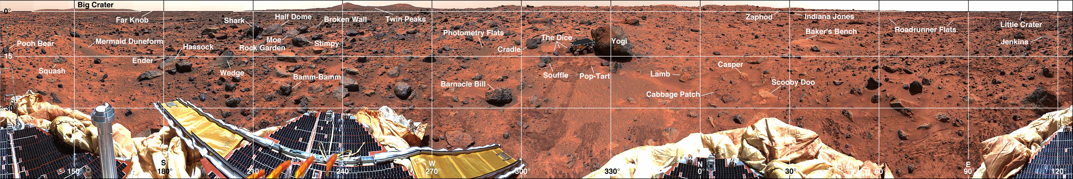
-
PIA01149:
-
Panoramic Views of the Landing site from Sagan Memorial Station
Full Resolution:
TIFF
(75.65 MB)
JPEG
(4.162 MB)
|
|
|
1998-03-26 |
Mars
|
Mars Pathfinder (MPF)
|
Imager for Mars Pathfinder
|
2954x2861x3 |
|
-
PIA01150:
-
Overhead View of Pathfinder Landing Site
Full Resolution:
TIFF
(6.368 MB)
JPEG
(1.939 MB)
|
|
|
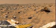
1998-03-26 |
Mars
|
Mars Pathfinder (MPF)
|
Imager for Mars Pathfinder
|
973x1219x3 |
|
-
PIA01151:
-
Overhead View of Area Surrounding Pathfinder
Full Resolution:
TIFF
(1.041 MB)
JPEG
(197 kB)
|
|
|
1998-03-26 |
Mars
|
Mars Pathfinder (MPF)
|
Imager for Mars Pathfinder
|
1219x1373x3 |
|
-
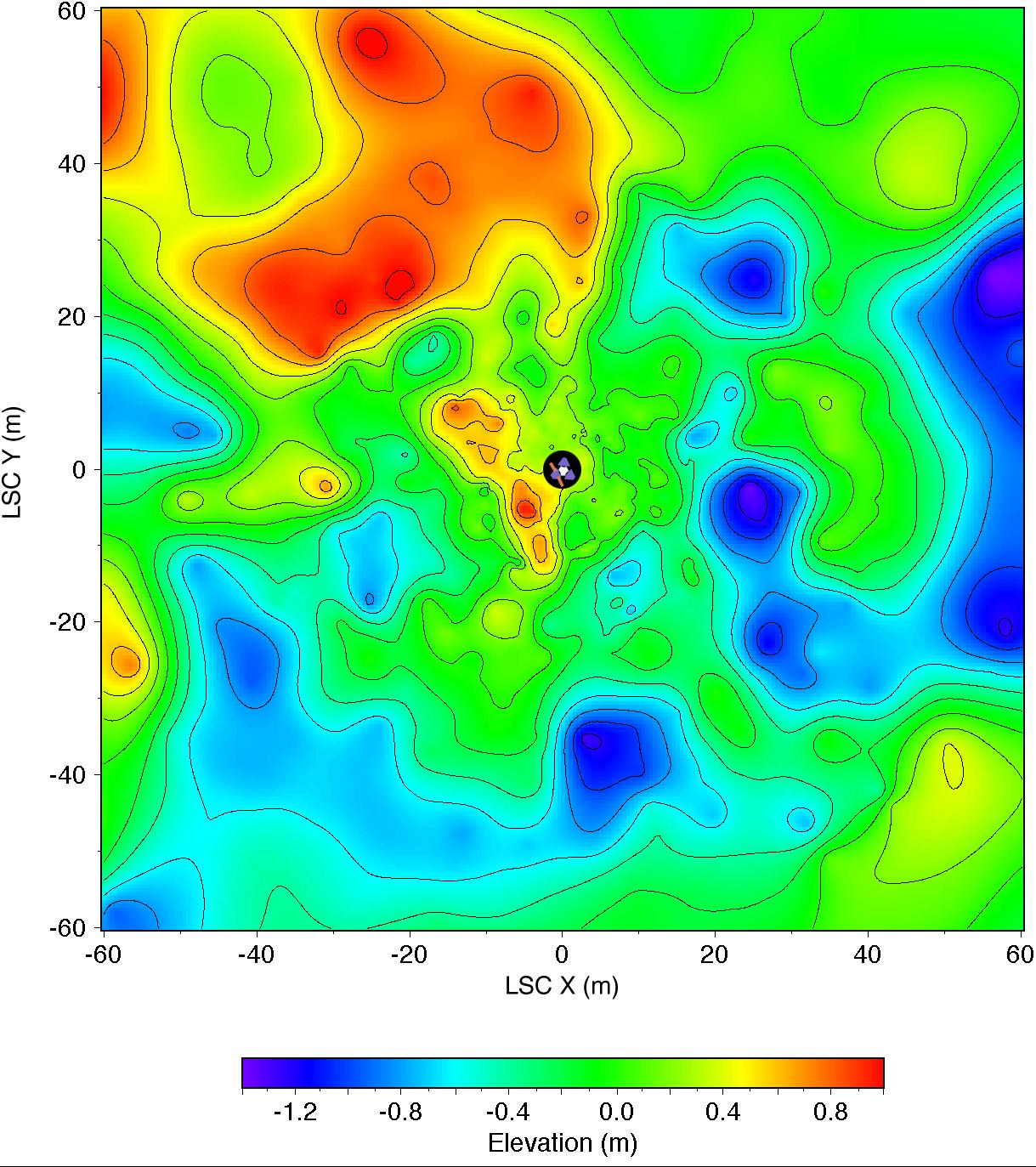
PIA01152:
-
Topographic Map of Pathfinder Landing Site
Full Resolution:
TIFF
(1.384 MB)
JPEG
(291.8 kB)
|
|
|
1998-03-26 |
Mars
|
Mars Pathfinder (MPF)
|
Imager for Mars Pathfinder
|
4201x701x3 |

|
-
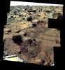
PIA01153:
Coordinate Map of Rocks at Pathfinder Landing Site
Full Resolution:
TIFF
(9.466 MB)
JPEG
(837.1 kB)
|
|
|
1998-03-26 |
Mars
|
Mars Pathfinder (MPF)
|
Imager for Mars Pathfinder
|
3400x2300x3 |
|
-
PIA01154:
-
Rock and Soil Types at Pathfinder Landing Site
Full Resolution:
TIFF
(14.44 MB)
JPEG
(464.2 kB)
|
|
|
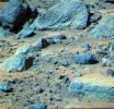
1998-02-12 |
Mars
|
Mars Global Surveyor (MGS)
|
Mars Orbiter Camera (MOC)
|
1536x2304x1 |
|
-
PIA01155:
-
Flow Ejecta and Slope Landslides in Small Crater
Full Resolution:
TIFF
(561.2 kB)
JPEG
(117.8 kB)
|
|
|
1998-02-12 |
Mars
|
Mars Global Surveyor (MGS)
|
Mars Orbiter Camera (MOC)
|
295x4988x1 |

|
-
PIA01156:
-
Flow Ejecta and Slope Landslides in Small Crater - High Resolution Image
Full Resolution:
TIFF
(1.57 MB)
JPEG
(390 kB)
|
|
|
1998-02-12 |
Mars
|
Mars Global Surveyor (MGS)
|
Mars Orbiter Camera (MOC)
|
2048x2304x1 |
|
-
PIA01157:
-
Schiaparelli Crater Rim and Interior Deposits
Full Resolution:
TIFF
(1.754 MB)
JPEG
(278 kB)
|
|
|
1998-02-12 |
Mars
|
Mars Global Surveyor (MGS)
|
Mars Orbiter Camera (MOC)
|
1024x2688x1 |
|
-
PIA01158:
-
Schiaparelli Crater Rim and Interior Deposits - High Resolution Image
Full Resolution:
TIFF
(1.78 MB)
JPEG
(277.8 kB)
|
|
|
1998-02-12 |
Mars
|
Mars Global Surveyor (MGS)
|
Mars Orbiter Camera (MOC)
|
1536x2304x1 |
|
-
PIA01159:
-
Medusae Fossae Formation
Full Resolution:
TIFF
(1.031 MB)
JPEG
(242 kB)
|
|
|
1998-02-12 |
Mars
|
Mars Global Surveyor (MGS)
|
Mars Orbiter Camera (MOC)
|
1024x6144x1 |

|
-
PIA01160:
-
Medusae Fossae Formation - High Resolution Image
Full Resolution:
TIFF
(5.934 MB)
JPEG
(1.246 MB)
|
|
|
1998-02-12 |
Mars
|
Mars Global Surveyor (MGS)
|
Mars Orbiter Camera (MOC)
|
1536x2304x1 |

|
-
PIA01161:
-
Flow-ejecta Crater in Icaria Planum
Full Resolution:
TIFF
(949.5 kB)
JPEG
(177.6 kB)
|
|
|
1998-02-12 |
Mars
|
Mars Global Surveyor (MGS)
|
Mars Orbiter Camera (MOC)
|
1024x6378x1 |
|
-
PIA01162:
-
Flow-ejecta Crater in Icaria Planum - High Resolution Image
Full Resolution:
TIFF
(6.383 MB)
JPEG
(1.424 MB)
|
|
|
1998-02-12 |
Mars
|
Mars Global Surveyor (MGS)
|
Mars Orbiter Camera (MOC)
|
1100x1100x3 |
|
-
PIA01163:
-
A Regional View of Mars on Orbit 63
Full Resolution:
TIFF
(1.748 MB)
JPEG
(66.47 kB)
|
|
|
1998-02-12 |
Mars
|
Mars Global Surveyor (MGS)
|
Mars Orbiter Camera (MOC)
|
3500x2000x1 |
|
-
PIA01167:
-
Layers within the Valles Marineris: Clues to the Ancient Crust of Mars
Full Resolution:
TIFF
(4.837 MB)
JPEG
(953.8 kB)
|
|
|
1998-02-12 |
Mars
|
Mars Global Surveyor (MGS)
|
Mars Orbiter Camera (MOC)
|
2048x3591x1 |
|
-
PIA01168:
-
Layers within the Valles Marineris: Clues to the Ancient Crust of Mars - High Resolution Image
Full Resolution:
TIFF
(8.157 MB)
JPEG
(1.694 MB)
|
|
|
1998-02-12 |
Mars
|
Mars Global Surveyor (MGS)
|
Mars Orbiter Camera (MOC)
|
2254x2000x1 |
|
-
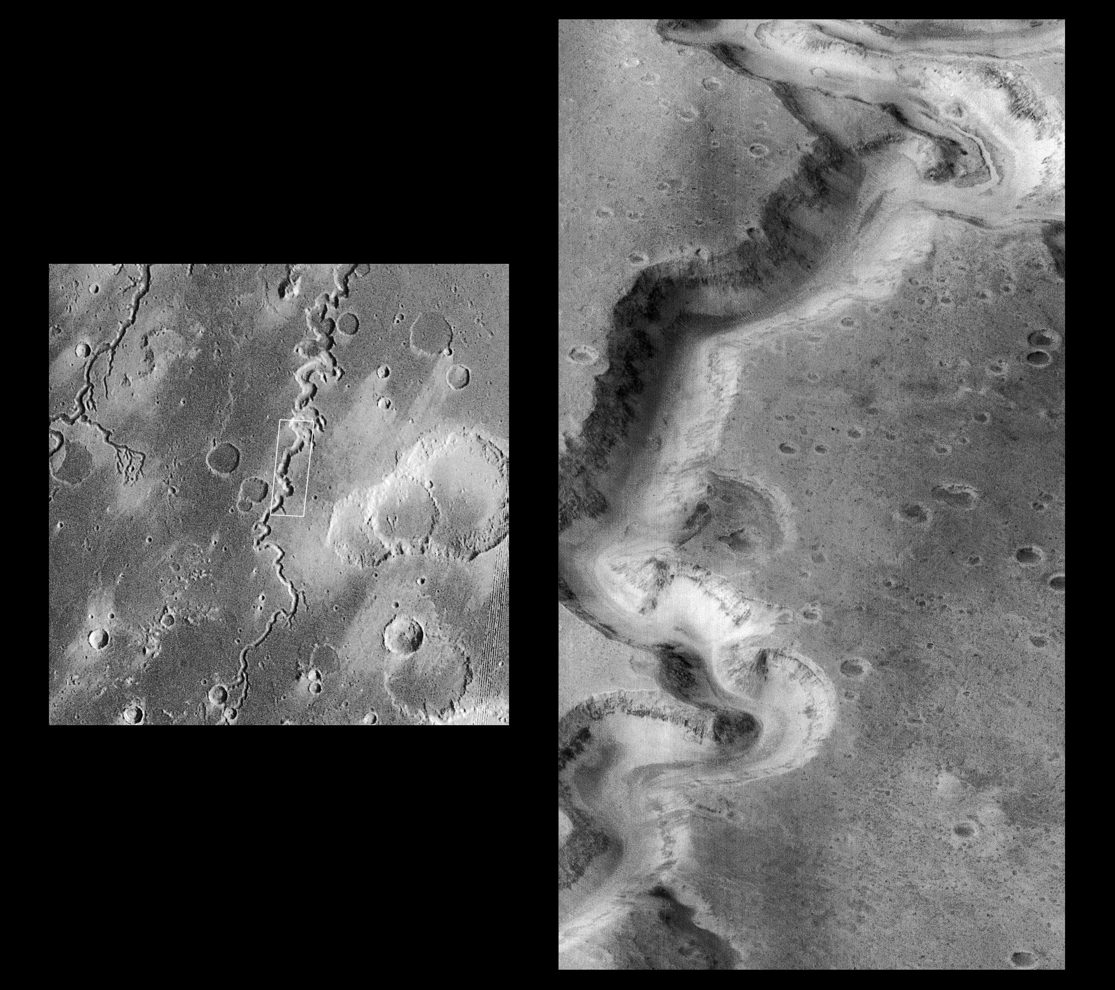
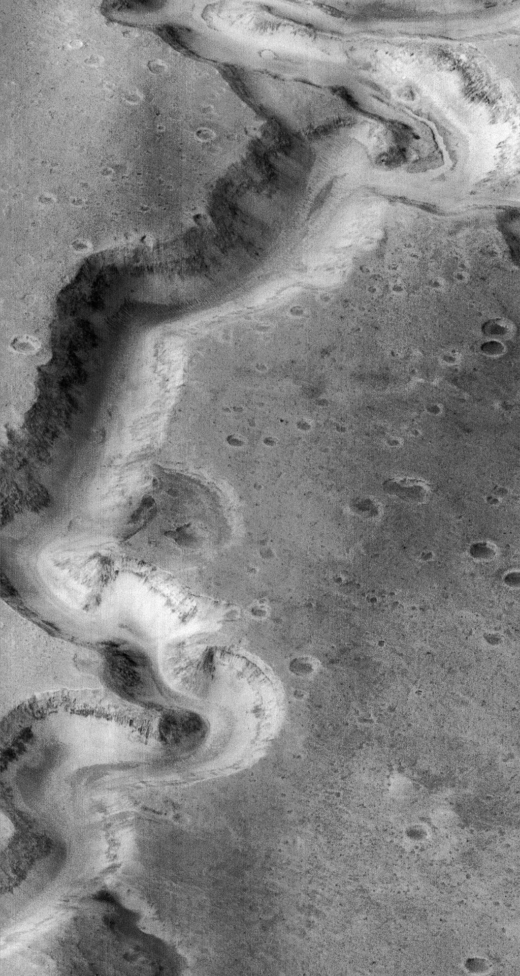
PIA01169:
-
Nanedi Vallis: Sustained Water FLow?
Full Resolution:
TIFF
(2.886 MB)
JPEG
(848.3 kB)
|
|
|
1998-02-12 |
Mars
|
Mars Global Surveyor (MGS)
|
Mars Orbiter Camera (MOC)
|
1024x1920x1 |

|
-
PIA01170:
-
Nanedi Vallis: Sustained Water Flow? - High Resolution Image
Full Resolution:
TIFF
(1.867 MB)
JPEG
(566.3 kB)
|


