Your search criteria found
1671
images
Target is Mars (and available satellites)
Go to PIAxxxxx:
Refine this list of images by:
Target:
Deimos
Mars
Phobos
Spacecraft:
Curiosity
Mars Reconnaissance Orbiter (MRO)
Mars Science Laboratory (MSL)
Opportunity
Phoenix Lander
Instrument:
Compact Reconnaissance Imaging Spectrometer for Mars (CRISM)
Context Camera (CTX)
High Resolution Imaging Science Experiment (HiRISE)
Mars Climate Sounder (MCS)
Mars Color Imager (MARCI)
Mars Orbiter Laser Altimeter
Optical Navigation Camera
Shallow Subsurface Radar (SHARAD)
Click on an image for detailed information
Click on a column heading to sort in ascending or descending order
My
List
Addition Date
Target
Mission
Instrument
Size
2014-02-22
Mars
Mars Reconnaissance Orbiter (MRO)
HiRISE
2880x1800x3
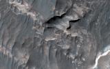
PIA17927:
Light-Toned Deposits along Coprates Chasma Slopes
Full Resolution:
TIFF
(15.56 MB)
JPEG
(607.3 kB)
2014-02-22
Mars
Mars Reconnaissance Orbiter (MRO)
HiRISE
2880x1800x3
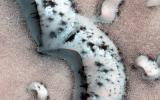
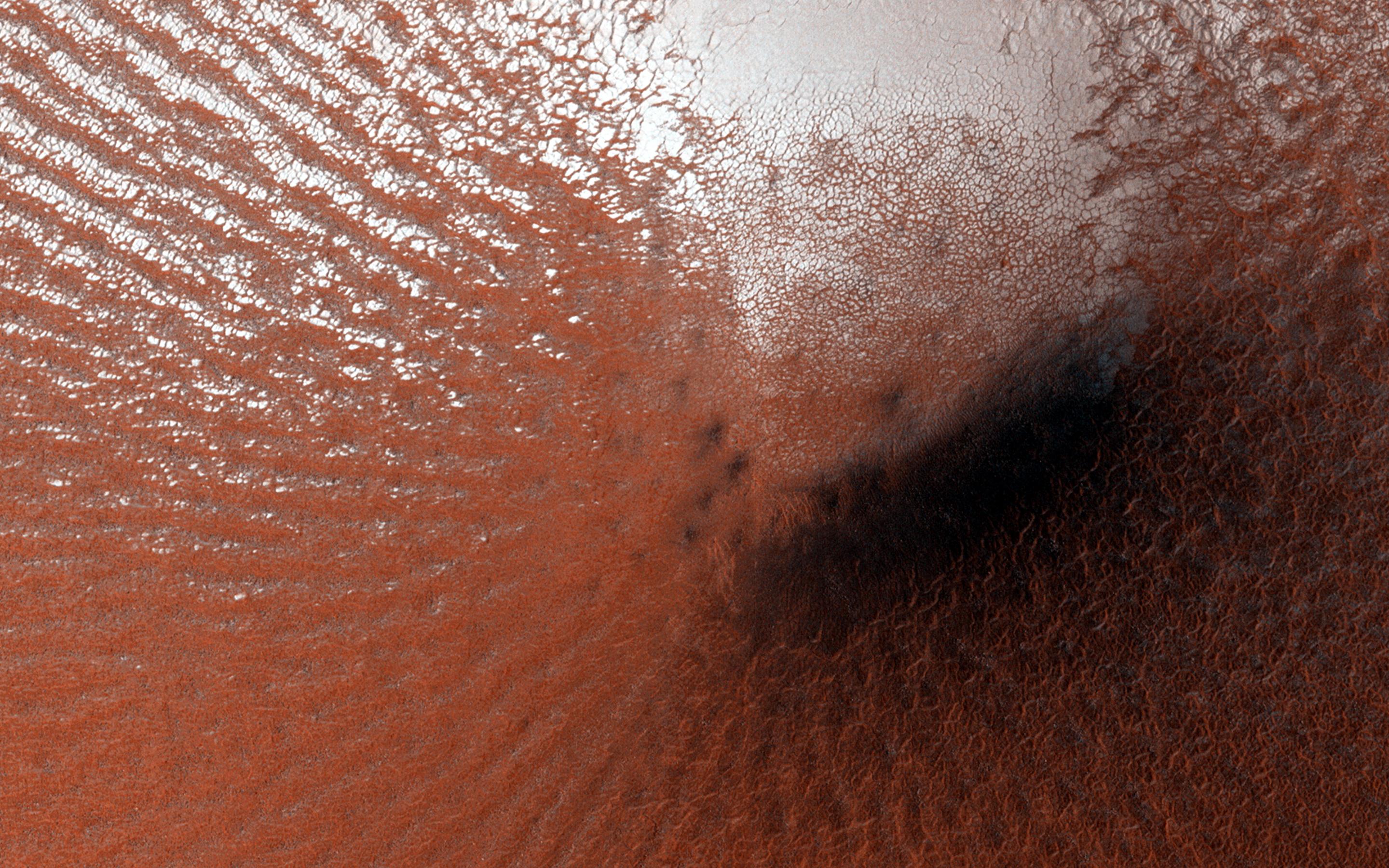
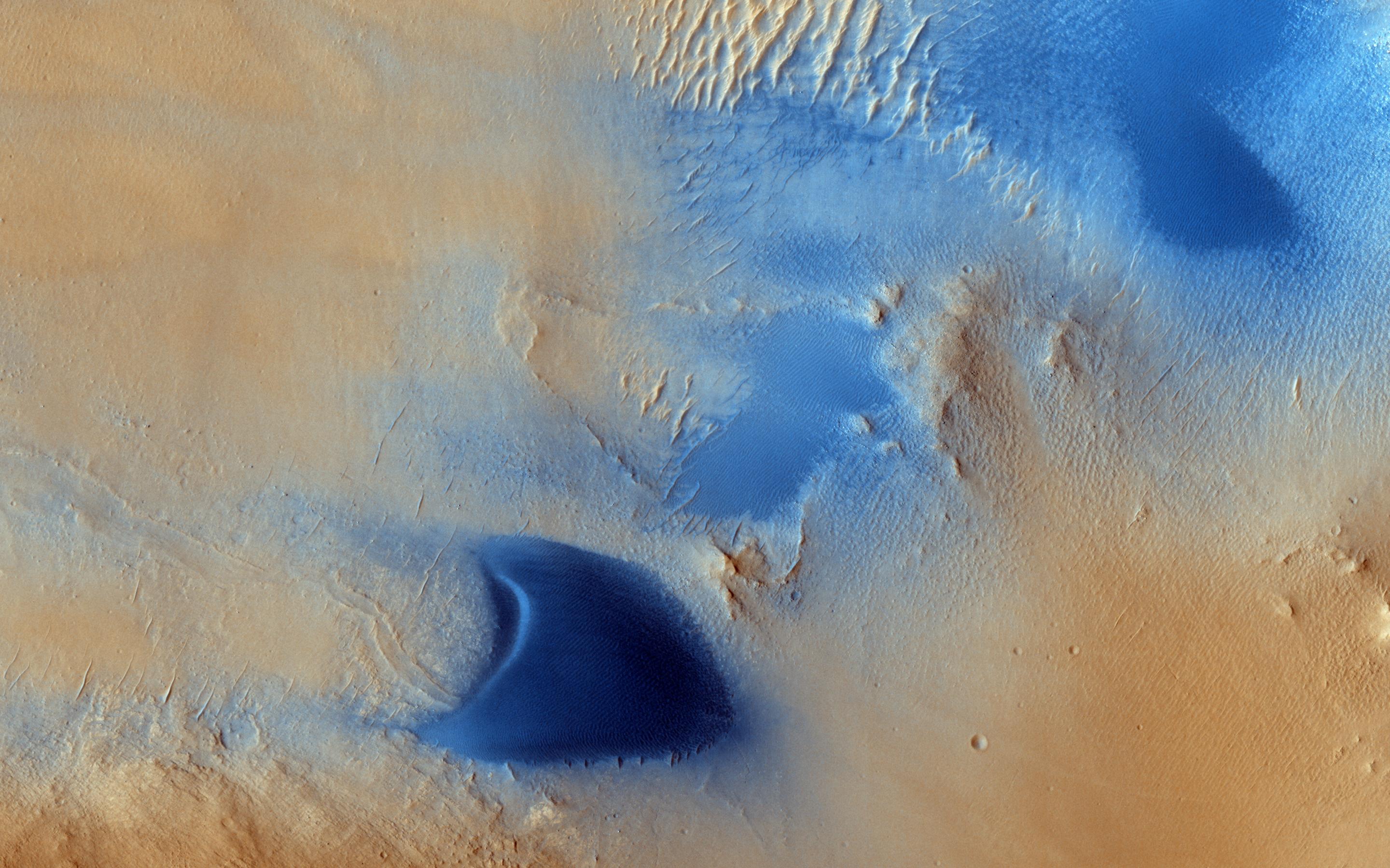
PIA17928:
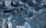
Shapes and Spots on a Polar Sand Dune
Full Resolution:
TIFF
(15.56 MB)
JPEG
(858 kB)
2014-02-22
Mars
Mars Reconnaissance Orbiter (MRO)
HiRISE
2880x1800x3
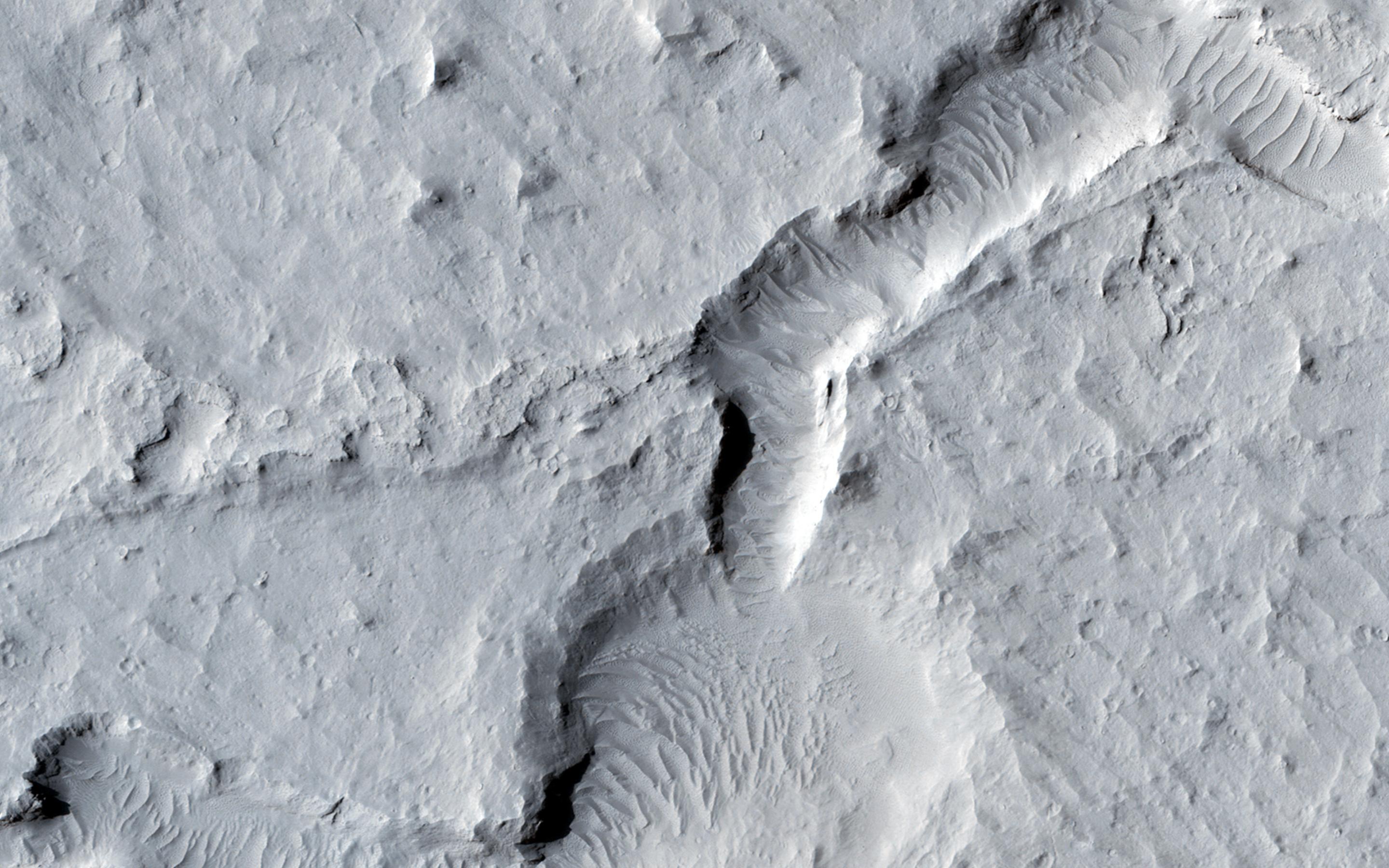
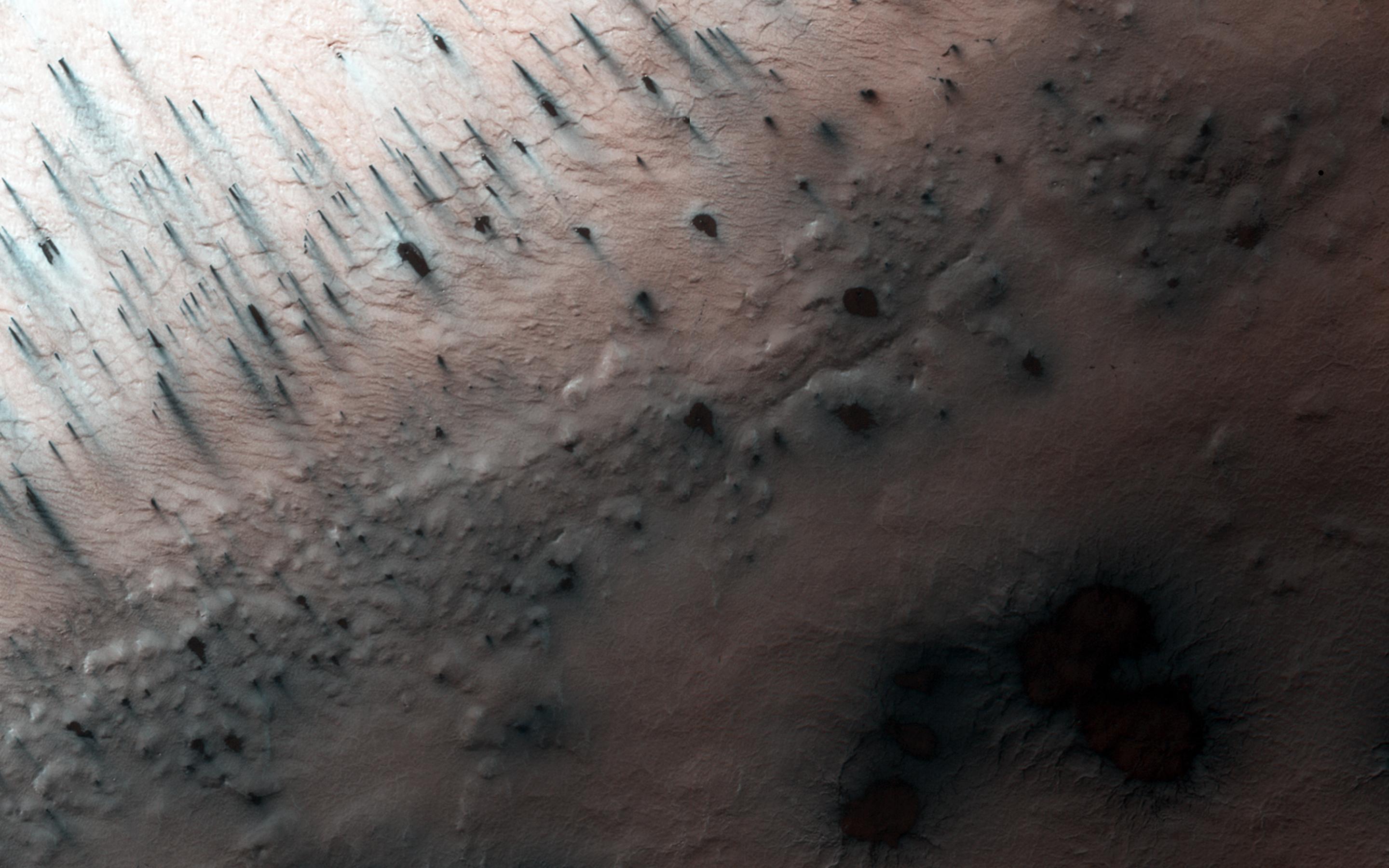
PIA17929:
Giant Gullies North of the Argyre Impact Basin
Full Resolution:
TIFF
(15.56 MB)
JPEG
(857.3 kB)
2013-04-10
Mars
Mars Reconnaissance Orbiter (MRO)
HiRISE
2560x1920x3
PIA17878:
Bright Tracks from Bouncing and Rolling Boulders
Full Resolution:
TIFF
(14.75 MB)
JPEG
(905 kB)
2013-04-10
Mars
Mars Reconnaissance Orbiter (MRO)
HiRISE
2560x1920x3
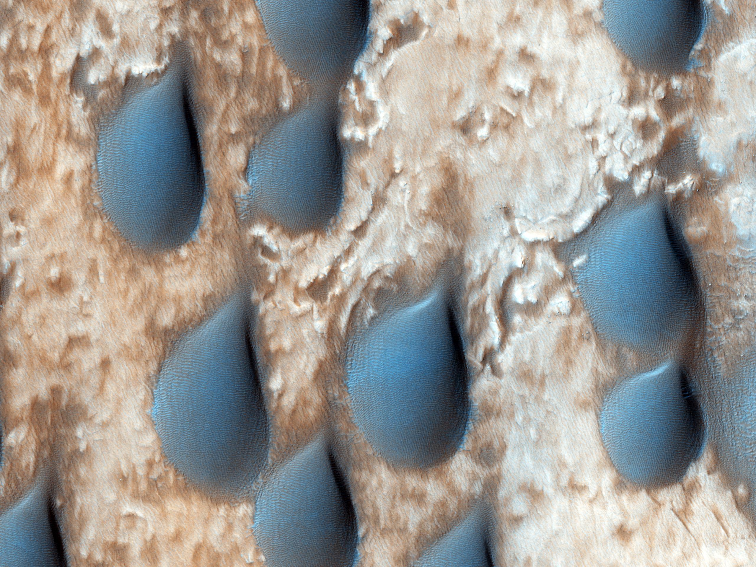
PIA17879:
Raindrops of Sand in Copernicus Crater
Full Resolution:
TIFF
(14.75 MB)
JPEG
(787.4 kB)
2013-04-10
Mars
Mars Reconnaissance Orbiter (MRO)
HiRISE
2560x1920x3
PIA17880:
Ridges and Grooves That Wave and Buckle on a Valley Floor
Full Resolution:
TIFF
(14.75 MB)
JPEG
(905.8 kB)
2014-03-12
Mars
Mars Reconnaissance Orbiter (MRO)
HiRISE
2880x1800x1
PIA17903:
Ejecta in Excess
Full Resolution:
TIFF
(5.191 MB)
JPEG
(877.3 kB)
2014-03-12
Mars
Mars Reconnaissance Orbiter (MRO)
HiRISE
2880x1800x3
PIA17904:
Craters within Craters
Full Resolution:
TIFF
(15.56 MB)
JPEG
(679.5 kB)
2014-03-12
Mars
Mars Reconnaissance Orbiter (MRO)
HiRISE
2880x1800x3
PIA17905:
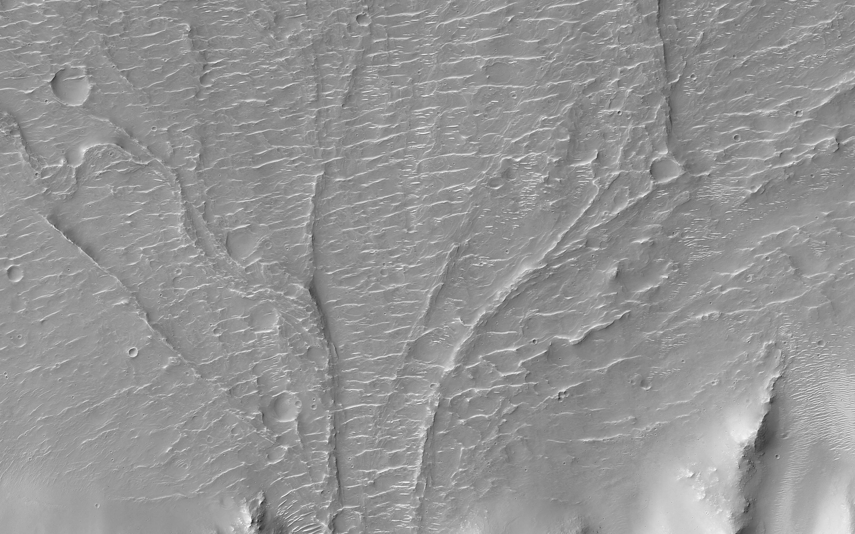
A Complex Valley Network Near Idaeus Fossae
Full Resolution:
TIFF
(15.56 MB)
JPEG
(840.2 kB)
2014-03-19
Mars
Mars Reconnaissance Orbiter (MRO)
HiRISE
2880x1800x3
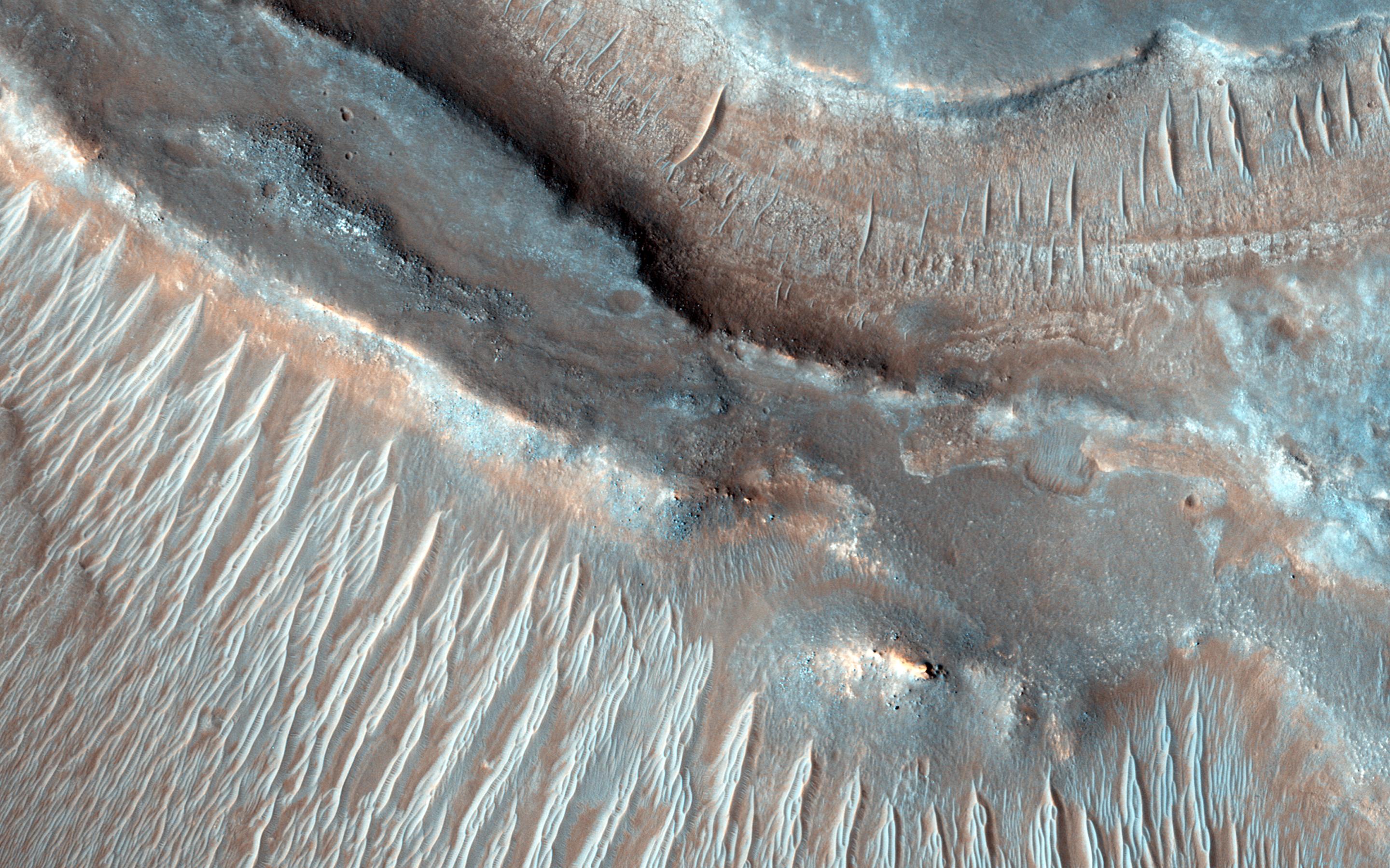
PIA17906:
A New Gully Channel in Terra Sirenum
Full Resolution:
TIFF
(15.56 MB)
JPEG
(754 kB)
2014-05-22
Mars
Mars Reconnaissance Orbiter (MRO)
MARCI
1700x1700x3
PIA18380:
Impact Scar Detected in Mars Weathercam Image
Full Resolution:
TIFF
(8.674 MB)
JPEG
(222.2 kB)
2014-05-22
Mars
Mars Reconnaissance Orbiter (MRO)
MARCI
928x242x3
PIA18381:
Best-Ever Pinning Down When a Space Rock Hit Mars
Full Resolution:
TIFF
(674.2 kB)
JPEG
(28.52 kB)
2014-05-22
Mars
Mars Reconnaissance Orbiter (MRO)
CTX
1980x2176x1
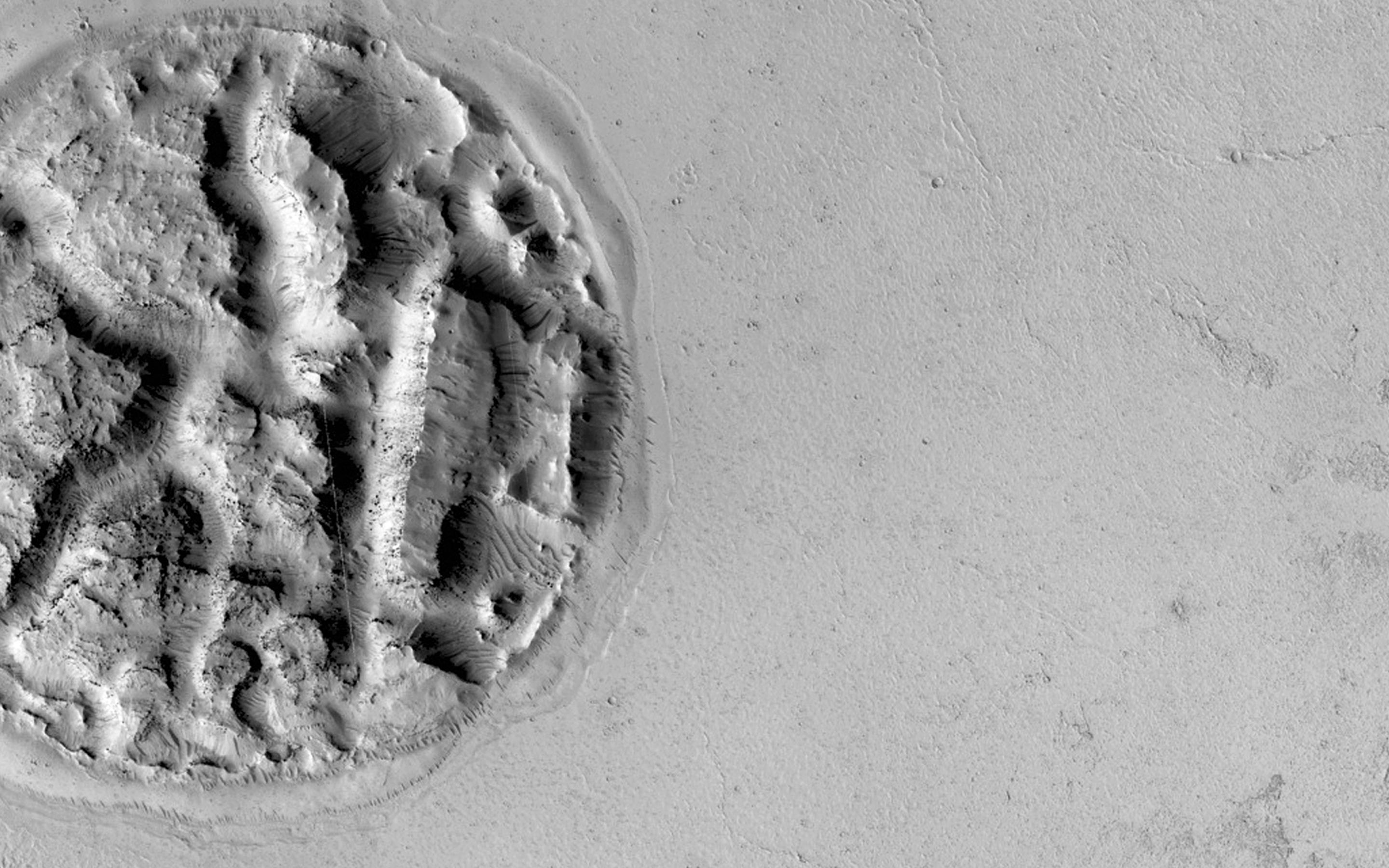
PIA18382:
Fresh Mars Crater Confirmed Within Impact Scar
Full Resolution:
TIFF
(4.313 MB)
JPEG
(1.148 MB)
2014-05-22
Mars
Mars Reconnaissance Orbiter (MRO)
CTX
1500x699x1
PIA18383:
Before-and-After Views Confirm Fresh Craters
Full Resolution:
TIFF
(1.05 MB)
JPEG
(153.2 kB)
2014-05-22
Mars
Mars Reconnaissance Orbiter (MRO)
HiRISE
1413x951x3
PIA18384:
Large, Fresh Crater Surrounded by Smaller Craters
Full Resolution:
TIFF
(4.033 MB)
JPEG
(174.3 kB)
2014-05-22
Mars
Mars Reconnaissance Orbiter (MRO)
HiRISE
741x493x3
PIA18385:
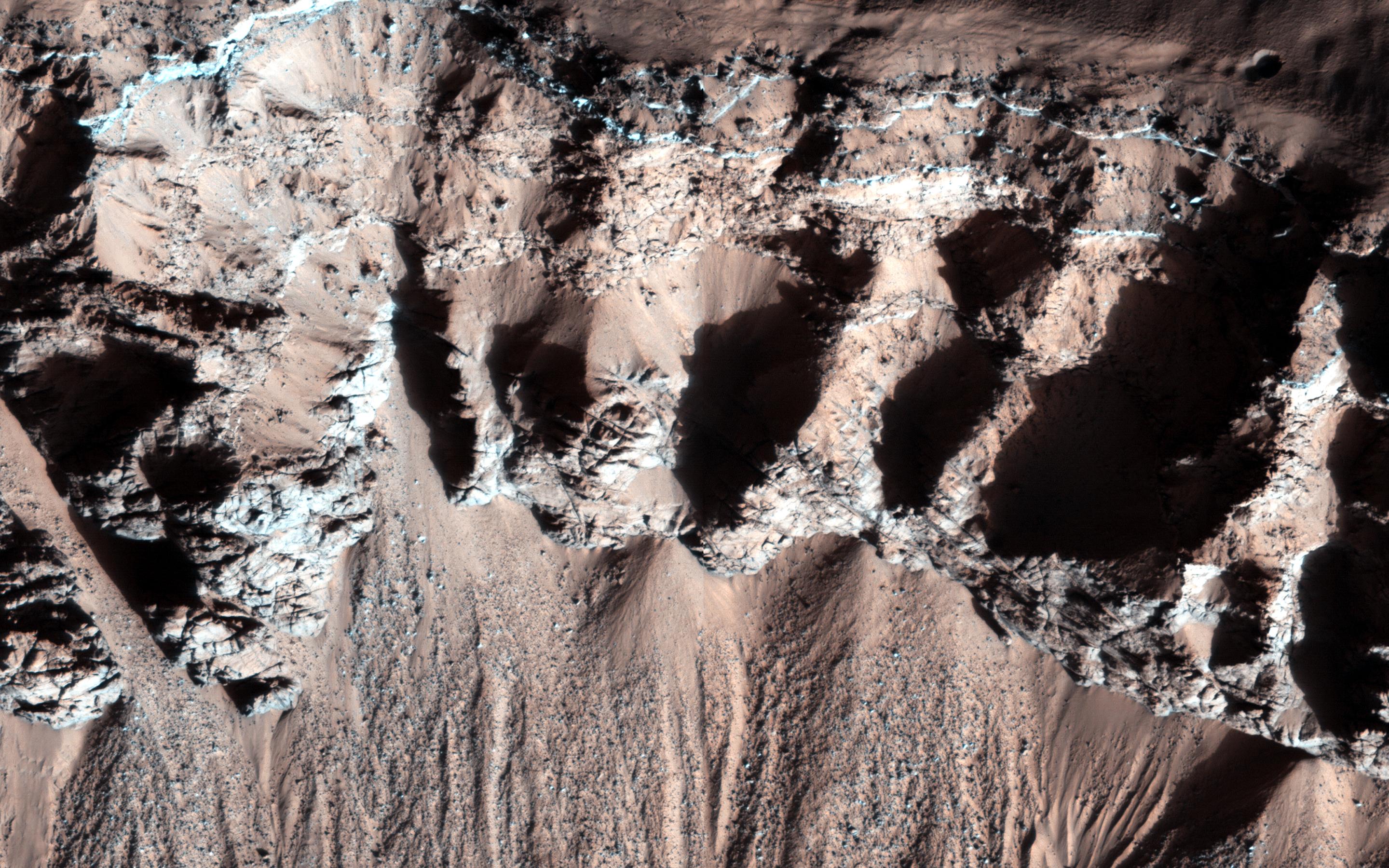
Landslides Near Fresh Crater on Mars
Full Resolution:
TIFF
(1.097 MB)
JPEG
(56.47 kB)
2014-07-08
Mars
Mars Reconnaissance Orbiter (MRO)
HiRISE
2312x1497x3
PIA18399:
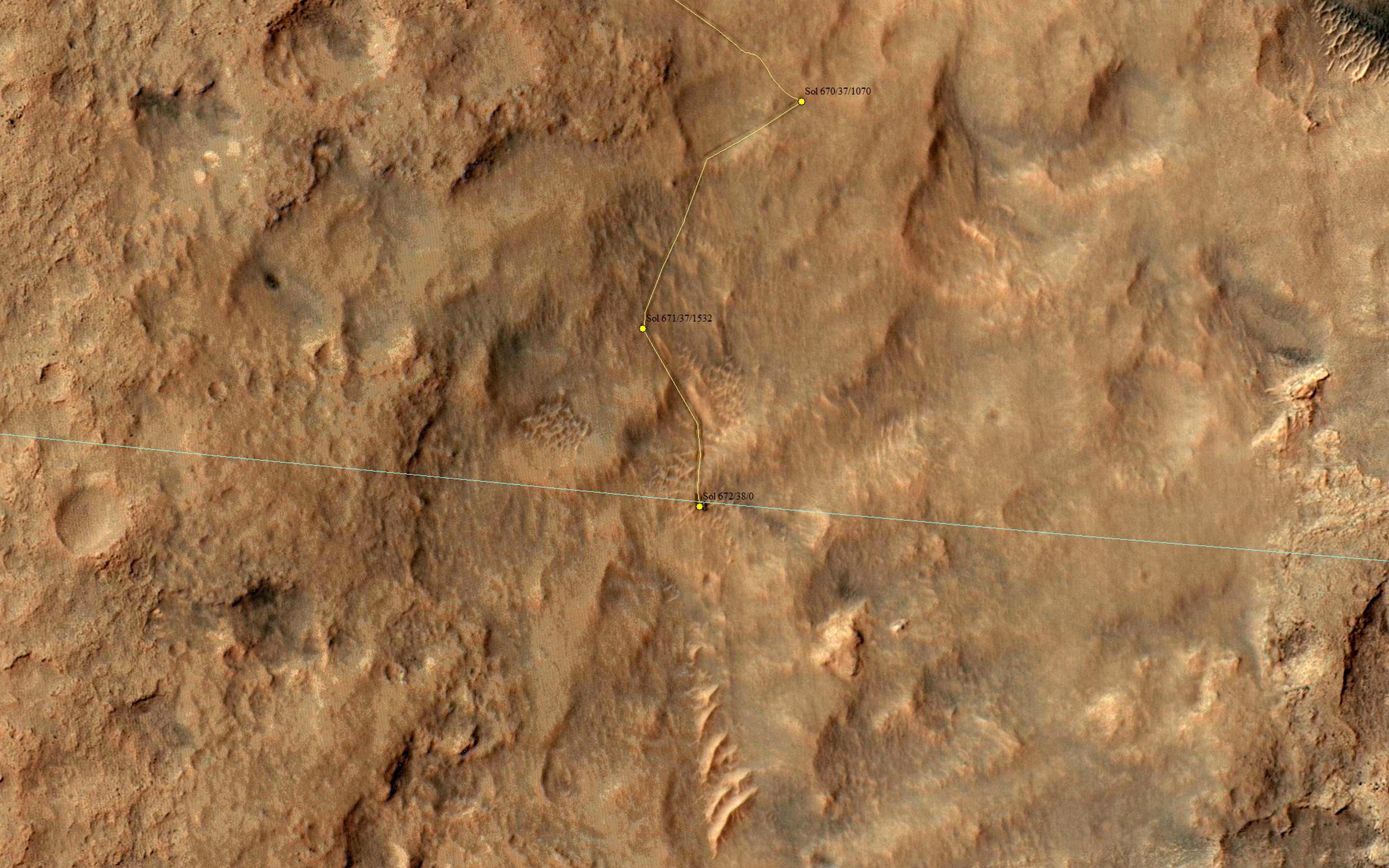
Curiosity Mars Rover Reaching Edge of Its Landing Ellipse
Full Resolution:
TIFF
(3.467 MB)
JPEG
(504.4 kB)
2014-07-10
Mars
Mars Reconnaissance Orbiter (MRO)
HiRISE
1250x1150x1
PIA18400:
Changes Near Downhill End of a Martian Gully
Full Resolution:
TIFF
(1.439 MB)
JPEG
(144.3 kB)
2014-07-08
Mars
Mars Reconnaissance Orbiter (MRO)
HiRISE
2880x1800x3
PIA18581:
Curiosity Offside!
Full Resolution:
TIFF
(15.56 MB)
JPEG
(689.5 kB)
2014-06-04
Mars
Mars Reconnaissance Orbiter (MRO)
HiRISE
840x333x1
PIA18511:
A Large Crater in Meridiani Planum
Full Resolution:
TIFF
(280.2 kB)
JPEG
(73.14 kB)
2014-06-04
Mars
Mars Reconnaissance Orbiter (MRO)
HiRISE
2880x1800x3
PIA18512:
Touring a Dusty Region
Full Resolution:
TIFF
(15.56 MB)
JPEG
(623.1 kB)
2014-06-04
Mars
Mars Reconnaissance Orbiter (MRO)
HiRISE
2880x1800x1
PIA18513:
An Alluvial Fan in a Low-Latitude Crater
Full Resolution:
TIFF
(5.191 MB)
JPEG
(646.5 kB)
2014-03-26
Mars
Mars Reconnaissance Orbiter (MRO)
HiRISE
2880x1800x3
PIA17907:
Bedrock in a Trough in Asimov Crater
Full Resolution:
TIFF
(15.56 MB)
JPEG
(914.3 kB)
2014-03-26
Mars
Mars Reconnaissance Orbiter (MRO)
HiRISE
2880x1800x3
PIA17908:
A Dark-Toned, Pitted Mound in a Crater in Northeast Arabia Terra
Full Resolution:
TIFF
(15.56 MB)
JPEG
(774.2 kB)
2014-03-26
Mars
Mars Reconnaissance Orbiter (MRO)
HiRISE
2880x1800x3
PIA17909:
A Large, Banded Angular Fragment in Nili Fossae
Full Resolution:
TIFF
(15.56 MB)
JPEG
(963.6 kB)
2014-03-26
Mars
Mars Reconnaissance Orbiter (MRO)
HiRISE
2880x1800x3
PIA17910:
An Unusual Mound
Full Resolution:
TIFF
(15.56 MB)
JPEG
(1.045 MB)
2014-07-16
Mars
Mars Reconnaissance Orbiter (MRO)
HiRISE
2880x1800x3
PIA18624:
The Icy Surface of the North Polar Cap
Full Resolution:
TIFF
(15.56 MB)
JPEG
(1.095 MB)
2014-07-16
Mars
Mars Reconnaissance Orbiter (MRO)
HiRISE
2880x1800x3
PIA18623:
Ridges in Eridania Basin
Full Resolution:
TIFF
(15.56 MB)
JPEG
(768.2 kB)
2014-07-16
Mars
Mars Reconnaissance Orbiter (MRO)
HiRISE
2880x1800x3
PIA18625:
Ancient Lake Sediments in a Crater
Full Resolution:
TIFF
(15.56 MB)
JPEG
(768 kB)
2014-07-28
Mars
Mars Exploration Rover (MER)
Mars Reconnaissance Orbiter (MRO)
CTX
2420x1838x3
PIA18404:
Opportunity's Journey Exceeds 25 Miles
Full Resolution:
TIFF
(13.35 MB)
JPEG
(943.2 kB)
2014-07-02
Mars
Mars Reconnaissance Orbiter (MRO)
HiRISE
2880x1800x3
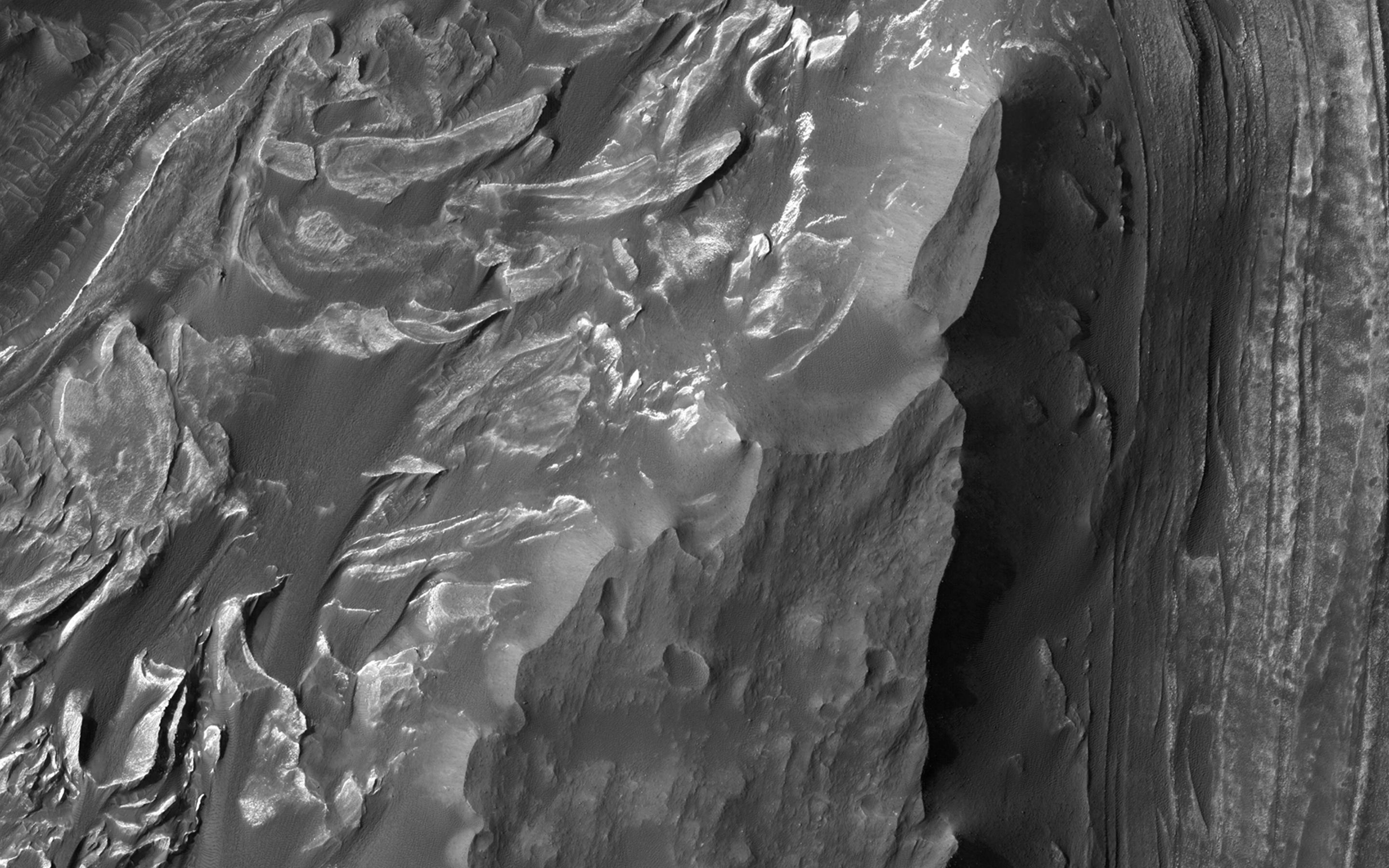
PIA18589:
A Giant Cave on a Giant Volcano
Full Resolution:
TIFF
(15.56 MB)
JPEG
(824.1 kB)
2014-07-02
Mars
Mars Reconnaissance Orbiter (MRO)
HiRISE
2880x1800x3
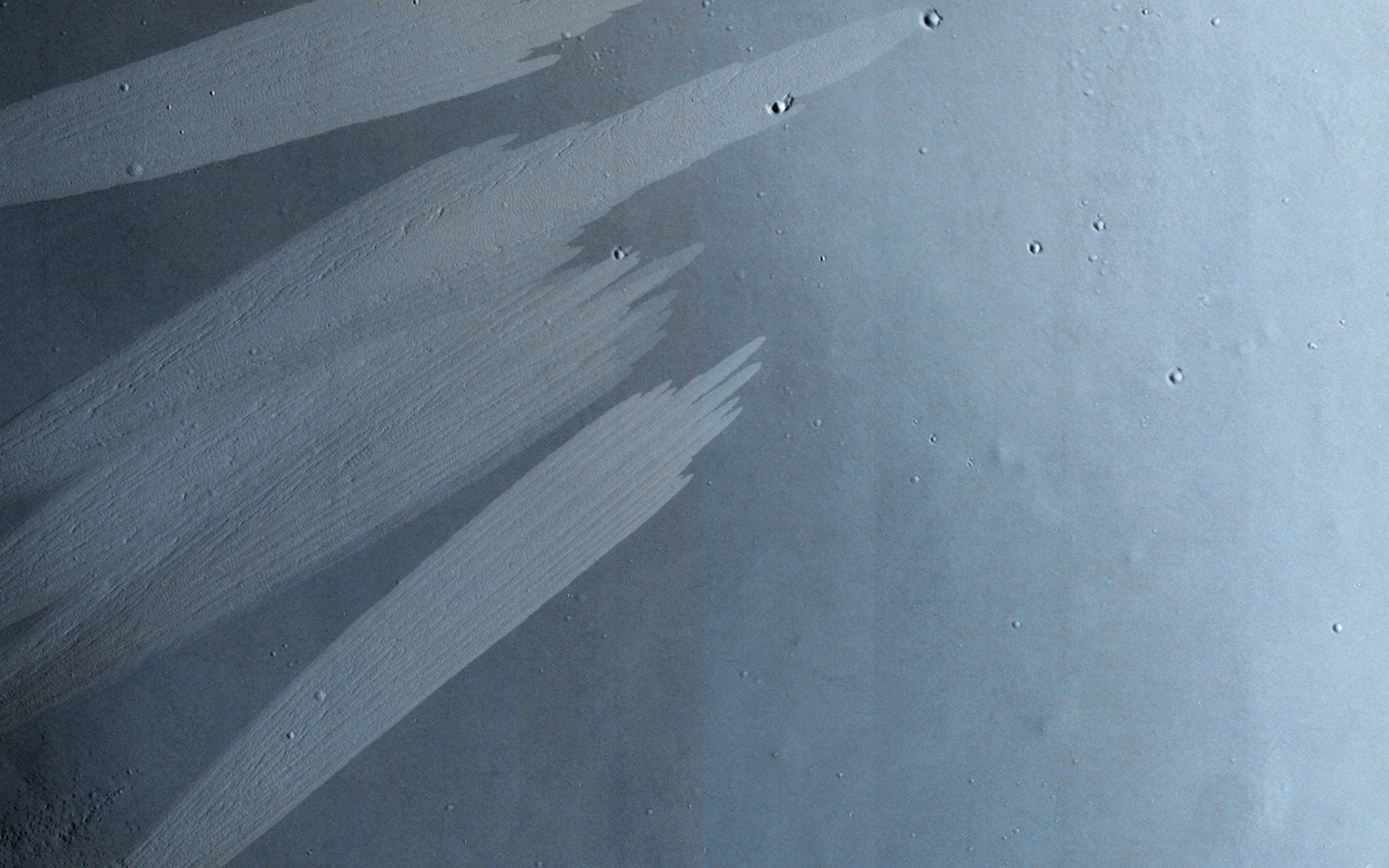
PIA18620:
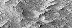
Feathery Ridges
Full Resolution:
TIFF
(15.56 MB)
JPEG
(822.4 kB)
2014-07-02
Mars
Mars Reconnaissance Orbiter (MRO)
HiRISE
2880x1800x3
PIA18622:
An Impact Crater in Isidis Planitia
Full Resolution:
TIFF
(15.56 MB)
JPEG
(682.5 kB)
2014-07-02
Mars
Mars Reconnaissance Orbiter (MRO)
HiRISE
2880x1800x3
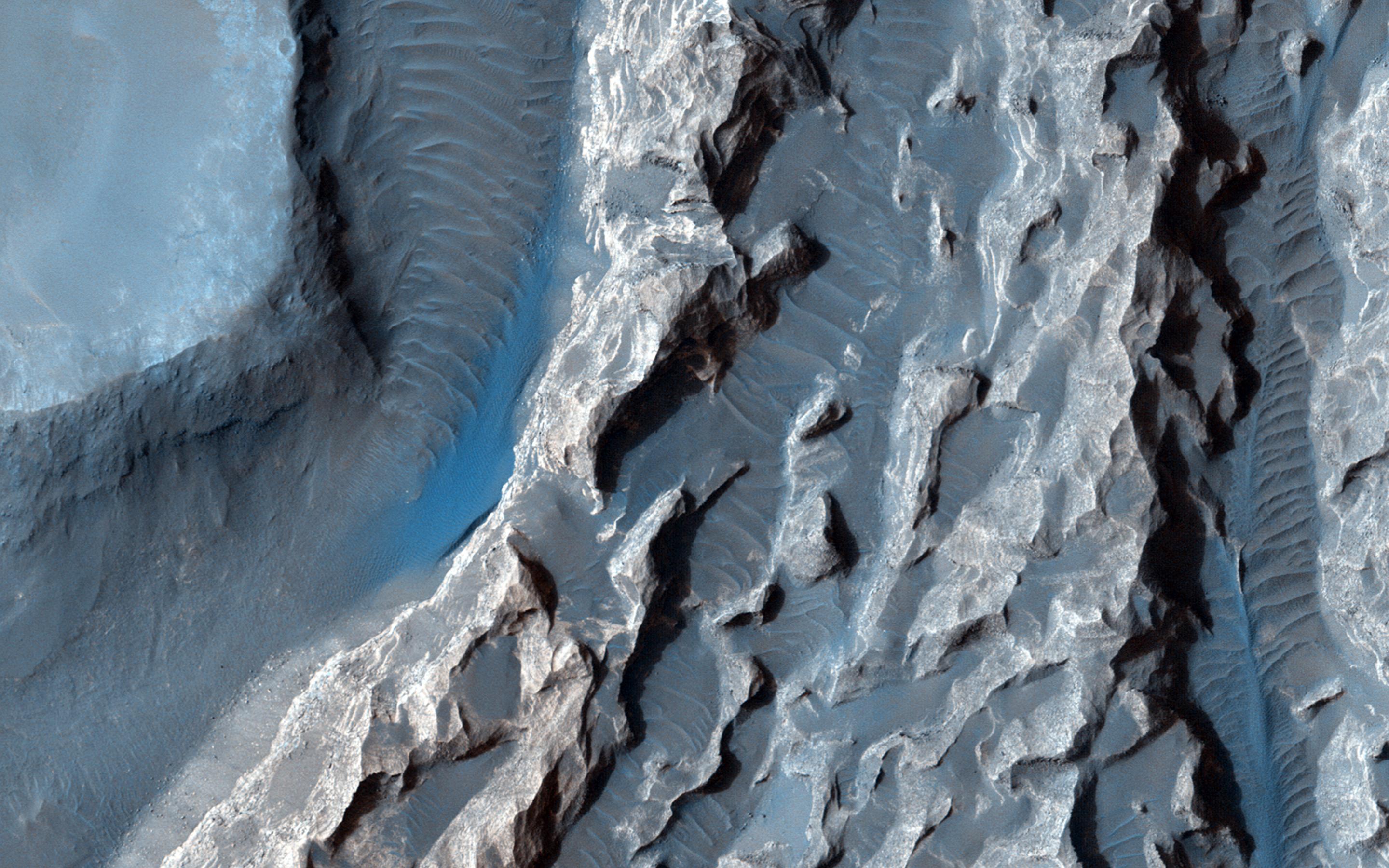
PIA18621:
A Revealing Landslide in Hebes Chasma
Full Resolution:
TIFF
(15.56 MB)
JPEG
(599 kB)
2014-07-30
Mars
Mars Reconnaissance Orbiter (MRO)
HiRISE
2880x1800x3
PIA18632:
Water-Bearing Rocks in Noctis Labyrinthus
Full Resolution:
TIFF
(15.56 MB)
JPEG
(986.8 kB)
2014-07-30
Mars
Mars Reconnaissance Orbiter (MRO)
HiRISE
2880x1800x1
PIA18633:
Preserving Ice from a Vanished Terrain
Full Resolution:
TIFF
(5.191 MB)
JPEG
(798.5 kB)
2014-07-30
Mars
Mars Reconnaissance Orbiter (MRO)
HiRISE
2880x1800x3
PIA18634:
Frosty Gullies
Full Resolution:
TIFF
(15.56 MB)
JPEG
(1.386 MB)
2014-07-30
Mars
Mars Reconnaissance Orbiter (MRO)
HiRISE
2880x1800x3
PIA18635:
Layers and Sand on the Floor of Schiaparelli Crater
Full Resolution:
TIFF
(15.56 MB)
JPEG
(1.025 MB)
2014-08-01
Mars
Mars Reconnaissance Orbiter (MRO)
Mars Science Laboratory (MSL)
HiRISE
3300x2550x3
PIA18408:
Sandy Martian Valleys in Curiosity's Near Future
Full Resolution:
TIFF
(25.26 MB)
JPEG
(1.213 MB)
2014-08-13
Mars
Mars Reconnaissance Orbiter (MRO)
HiRISE
2311x1486x1
PIA18594:
An Irregular, Upright Boulder on Mars
Full Resolution:
TIFF
(3.438 MB)
JPEG
(414 kB)
2014-08-13
Mars
Mars Reconnaissance Orbiter (MRO)
HiRISE
2880x1800x1
PIA18645:
Strange Cones and Flows
Full Resolution:
TIFF
(5.191 MB)
JPEG
(1.315 MB)
2014-08-13
Mars
Mars Reconnaissance Orbiter (MRO)
HiRISE
2880x1800x3
PIA18646:
The Side of Chasma Boreale
Full Resolution:
TIFF
(15.56 MB)
JPEG
(1.215 MB)
2014-08-13
Mars
Mars Reconnaissance Orbiter (MRO)
HiRISE
2880x1800x3
PIA18647:
Glaciation at the Eastern Hellas Margin
Full Resolution:
TIFF
(15.56 MB)
JPEG
(1.016 MB)
2014-06-18
Mars
Mars Reconnaissance Orbiter (MRO)
HiRISE
2880x1800x3
PIA18585:
Sand Dune Catch and Release
Full Resolution:
TIFF
(15.56 MB)
JPEG
(743.6 kB)
2014-06-18
Mars
Mars Reconnaissance Orbiter (MRO)
HiRISE
2880x1800x3
PIA18586:
Blockfall on the North Polar Layered Deposits
Full Resolution:
TIFF
(15.56 MB)
JPEG
(790.1 kB)
2014-06-18
Mars
Mars Reconnaissance Orbiter (MRO)
HiRISE
2880x1800x3
PIA18587:
Waiting for Dust Devils
Full Resolution:
TIFF
(5.191 MB)
JPEG
(1.172 MB)
2014-06-18
Mars
Mars Reconnaissance Orbiter (MRO)
HiRISE
2880x1800x3
PIA18588:
Moving Mass Material on a Mesa
Full Resolution:
TIFF
(15.56 MB)
JPEG
(650.1 kB)
2014-05-22
Mars
Mars Reconnaissance Orbiter (MRO)
HiRISE
2880x1800x3
PIA18648:
What Gullies Can Say
Full Resolution:
TIFF
(15.56 MB)
JPEG
(696.7 kB)
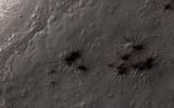
2014-09-11
Mars
Mars Reconnaissance Orbiter (MRO)
Mars Science Laboratory (MSL)
HiRISE
2550x3300x3
PIA18475:
Curiosity's Next Steps
Full Resolution:
TIFF
(25.25 MB)
JPEG
(1.735 MB)
2014-09-11
Mars
Mars Reconnaissance Orbiter (MRO)
Mars Science Laboratory (MSL)
HiRISE
3300x2550x3
PIA18474:
Slopes of Mount Sharp
Full Resolution:
TIFF
(25.26 MB)
JPEG
(1.023 MB)
2014-08-27
Mars
Mars Reconnaissance Orbiter (MRO)
HiRISE
2880x1800x3
PIA18773:
A Possible Landing Site in Aram Dorsum for the ExoMars Rover
Full Resolution:
TIFF
(15.56 MB)
JPEG
(608.6 kB)
2014-08-27
Mars
Mars Reconnaissance Orbiter (MRO)
HiRISE
2880x1800x3
PIA18774:
Weird Crater
Full Resolution:
TIFF
(15.56 MB)
JPEG
(933 kB)
2014-08-27
Mars
Mars Reconnaissance Orbiter (MRO)
HiRISE
2880x1800x3
PIA18775:
Mantled Terrain in the Southern Mid-Latitudes
Full Resolution:
TIFF
(15.56 MB)
JPEG
(874.7 kB)
2014-08-27
Mars
Mars Reconnaissance Orbiter (MRO)
HiRISE
2880x1800x3
PIA18776:
A New Impact Crater Near NASA's InSight Landing Region
Full Resolution:
TIFF
(15.56 MB)
JPEG
(1.268 MB)
2014-09-10
Mars
Mars Reconnaissance Orbiter (MRO)
HiRISE
2880x1800x3
PIA18804:
Chaos in Eridania Basin
Full Resolution:
TIFF
(15.56 MB)
JPEG
(684.1 kB)
2014-09-10
Mars
Mars Reconnaissance Orbiter (MRO)
HiRISE
2880x1800x3
PIA18805:
Mysterious Light-Toned Deposit in Vinogradov Crater
Full Resolution:
TIFF
(15.56 MB)
JPEG
(1.01 MB)
2014-09-10
Mars
Mars Reconnaissance Orbiter (MRO)
HiRISE
2880x1800x3
PIA18806:
Banded TARs in Iapygia
Full Resolution:
TIFF
(15.56 MB)
JPEG
(738.2 kB)
2014-09-10
Mars
Mars Reconnaissance Orbiter (MRO)
HiRISE
2880x1800x1
PIA18807:
Overlapping Lobate Lava Flows in Daedalia Planum
Full Resolution:
TIFF
(5.191 MB)
JPEG
(515.1 kB)
2014-09-11
Mars
Mars Reconnaissance Orbiter (MRO)
Mars Science Laboratory (MSL)
HiRISE
4890x3912x3
PIA18780:
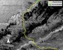
Curiosity Rover Planned Route
Full Resolution:
TIFF
(57.42 MB)
JPEG
(3.739 MB)
2014-09-11
Mars
Mars Reconnaissance Orbiter (MRO)
Mars Science Laboratory (MSL)
HiRISE
4173x3008x3
PIA18781:
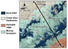
Map of Lower Mount Sharp
Full Resolution:
TIFF
(37.68 MB)
JPEG
(1.64 MB)
2014-09-11
Mars
Mars Reconnaissance Orbiter (MRO)
Mars Science Laboratory (MSL)
HiRISE
1927x1542x3
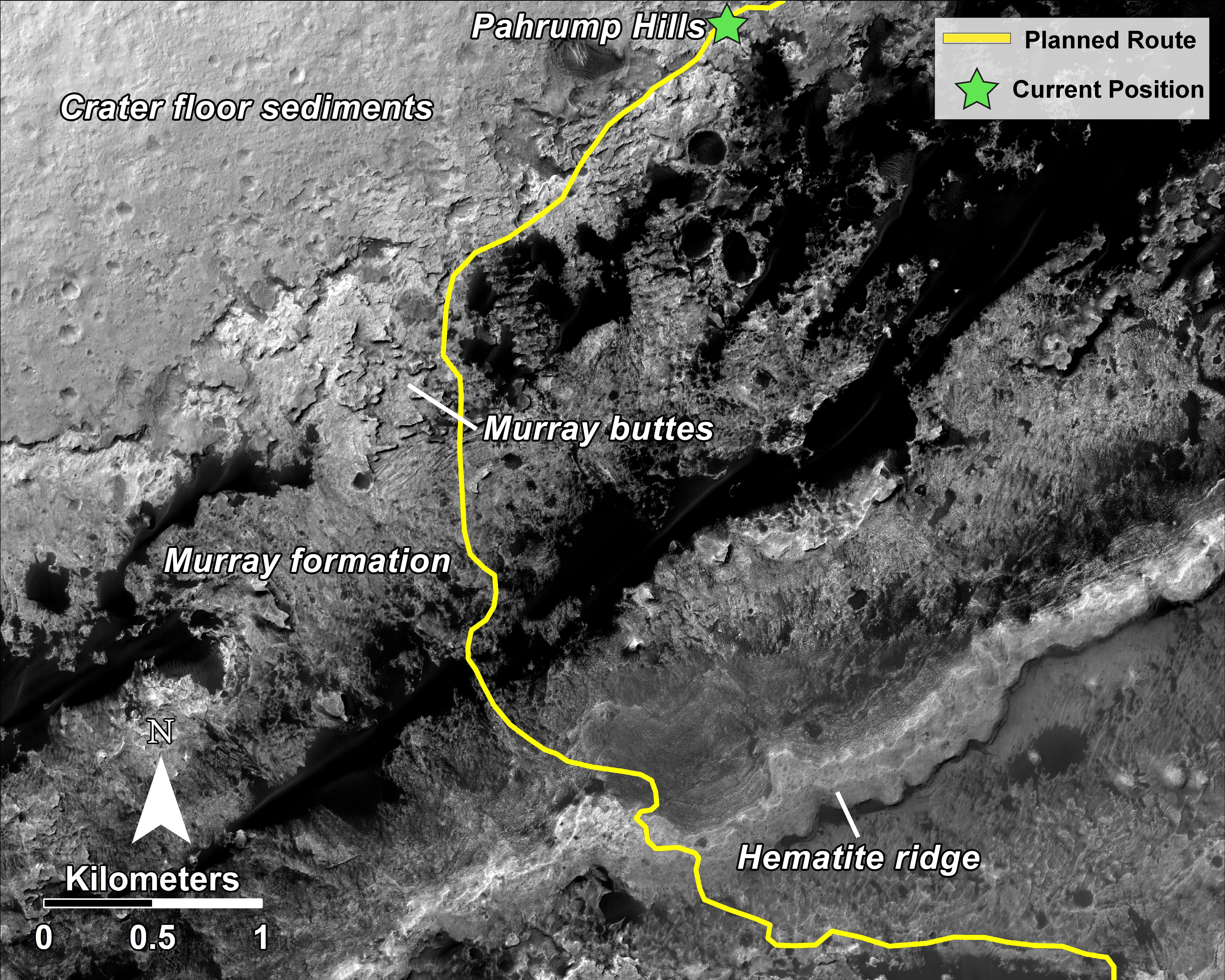
PIA18783:
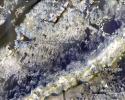
'Murray Buttes' Mesa
Full Resolution:
TIFF
(8.918 MB)
JPEG
(471.3 kB)
2014-09-11
Mars
Mars Reconnaissance Orbiter (MRO)
Mars Science Laboratory (MSL)
HiRISE
1927x1542x3
PIA18784:
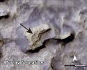
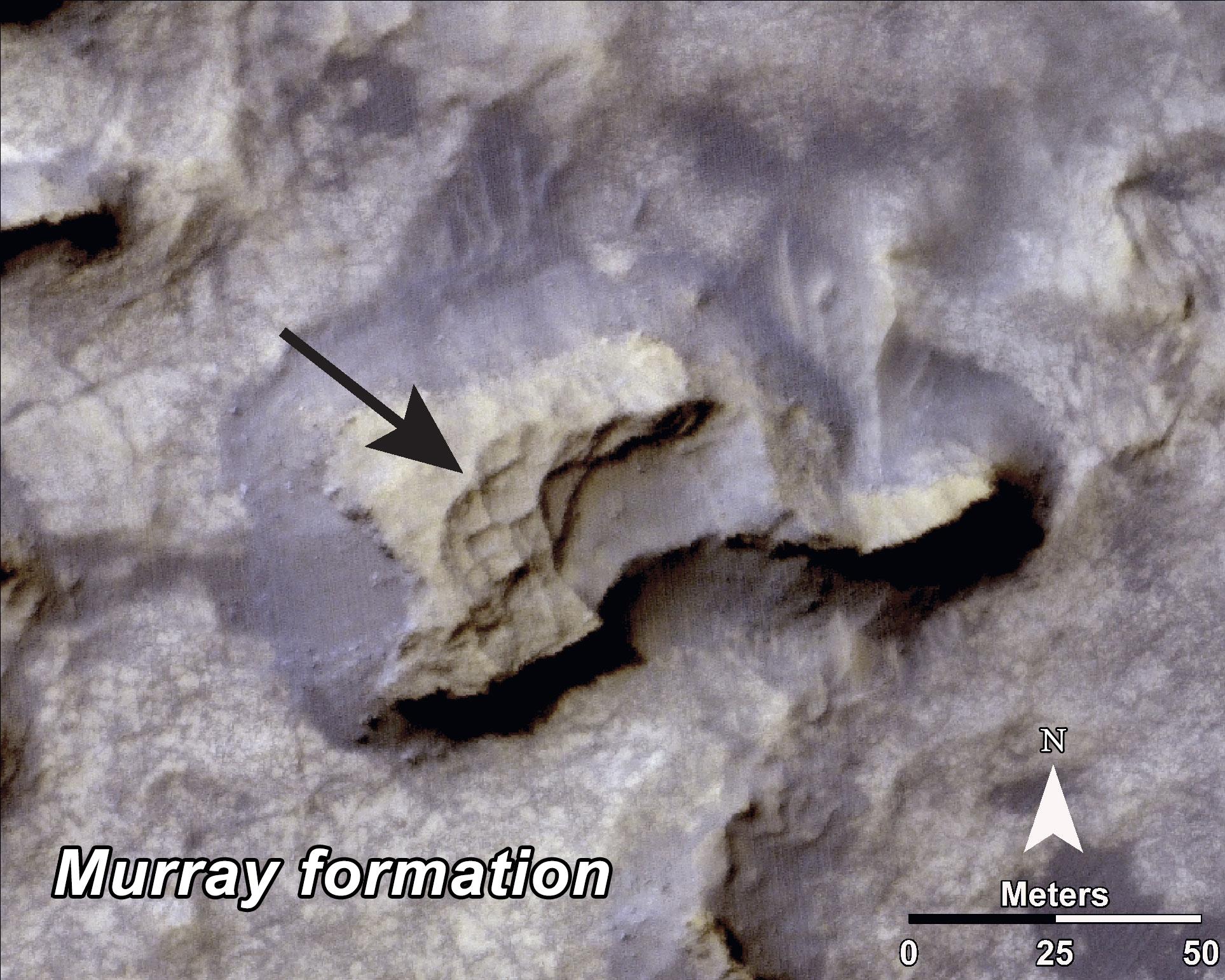
Bands on the 'Murray Formation'
Full Resolution:
TIFF
(8.918 MB)
JPEG
(563 kB)
2014-09-11
Mars
Mars Reconnaissance Orbiter (MRO)
Mars Science Laboratory (MSL)
HiRISE
3000x2400x3
PIA18785:
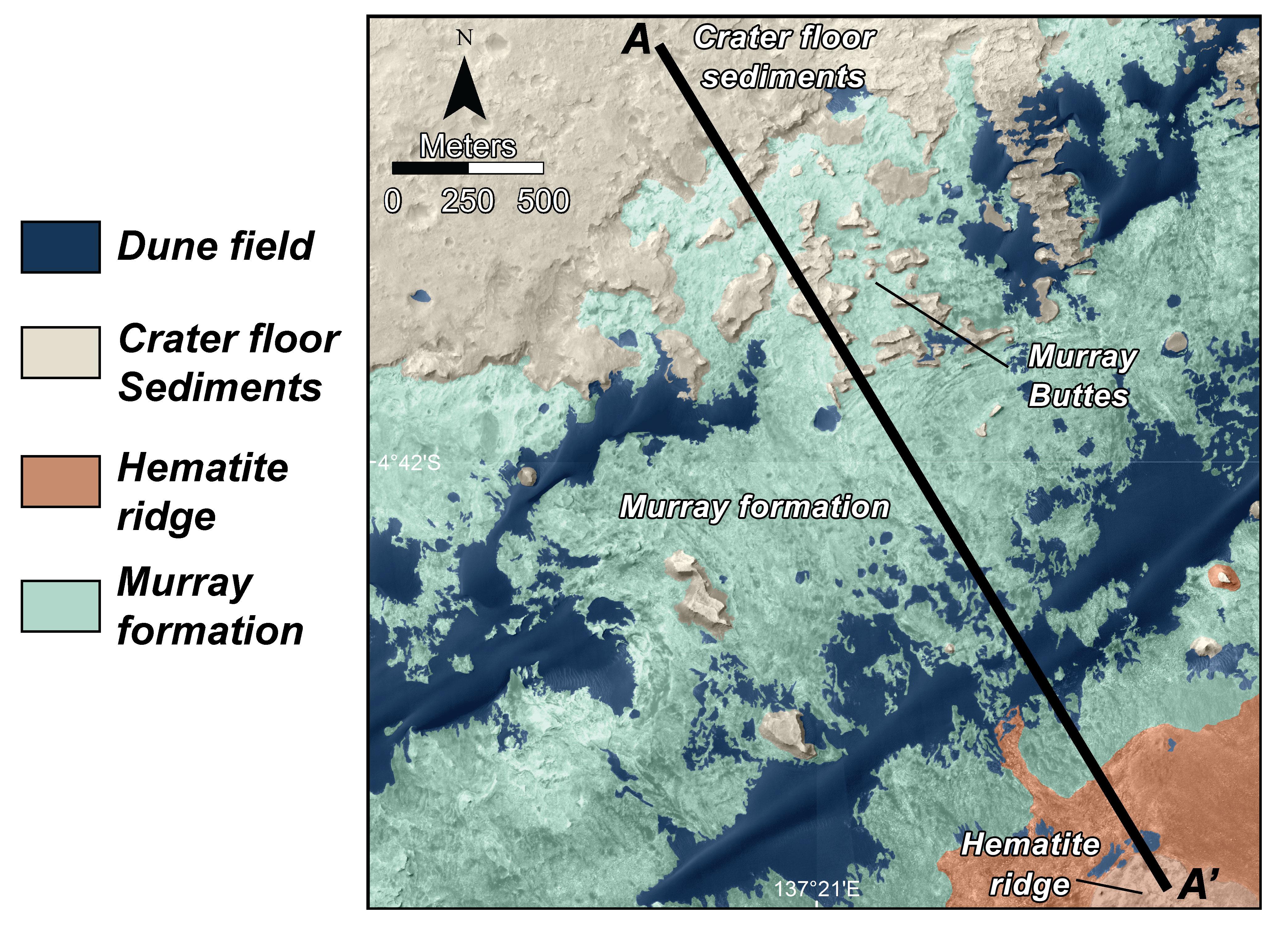
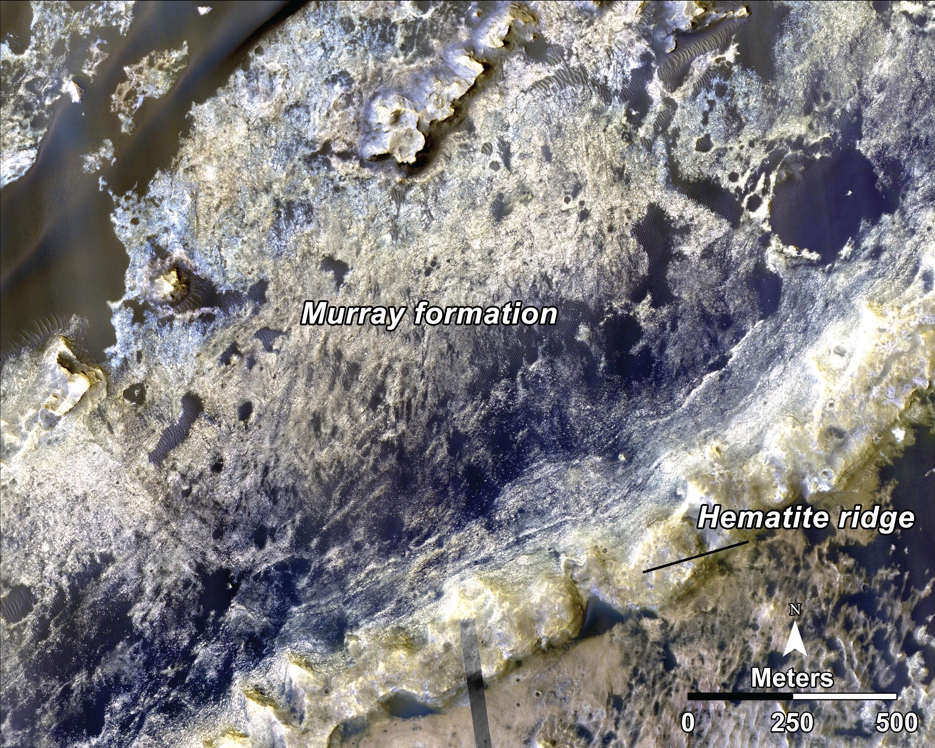
Geological Transition
Full Resolution:
TIFF
(21.61 MB)
JPEG
(2.032 MB)
2014-05-21
Mars
Mars Reconnaissance Orbiter (MRO)
HiRISE
840x333x1
PIA17482:
New Impact Site
Full Resolution:
TIFF
(280.2 kB)
JPEG
(95.43 kB)
2014-05-22
Mars
Mars Reconnaissance Orbiter (MRO)
HiRISE
2880x1800x3
PIA18771:
At the Edge of a Polar Cap
Full Resolution:
TIFF
(15.56 MB)
JPEG
(796.4 kB)
2014-05-22
Mars
Mars Reconnaissance Orbiter (MRO)
HiRISE
2880x1800x1
PIA18772:
Global Eyes on an Impact Prize
Full Resolution:
TIFF
(5.191 MB)
JPEG
(700.7 kB)
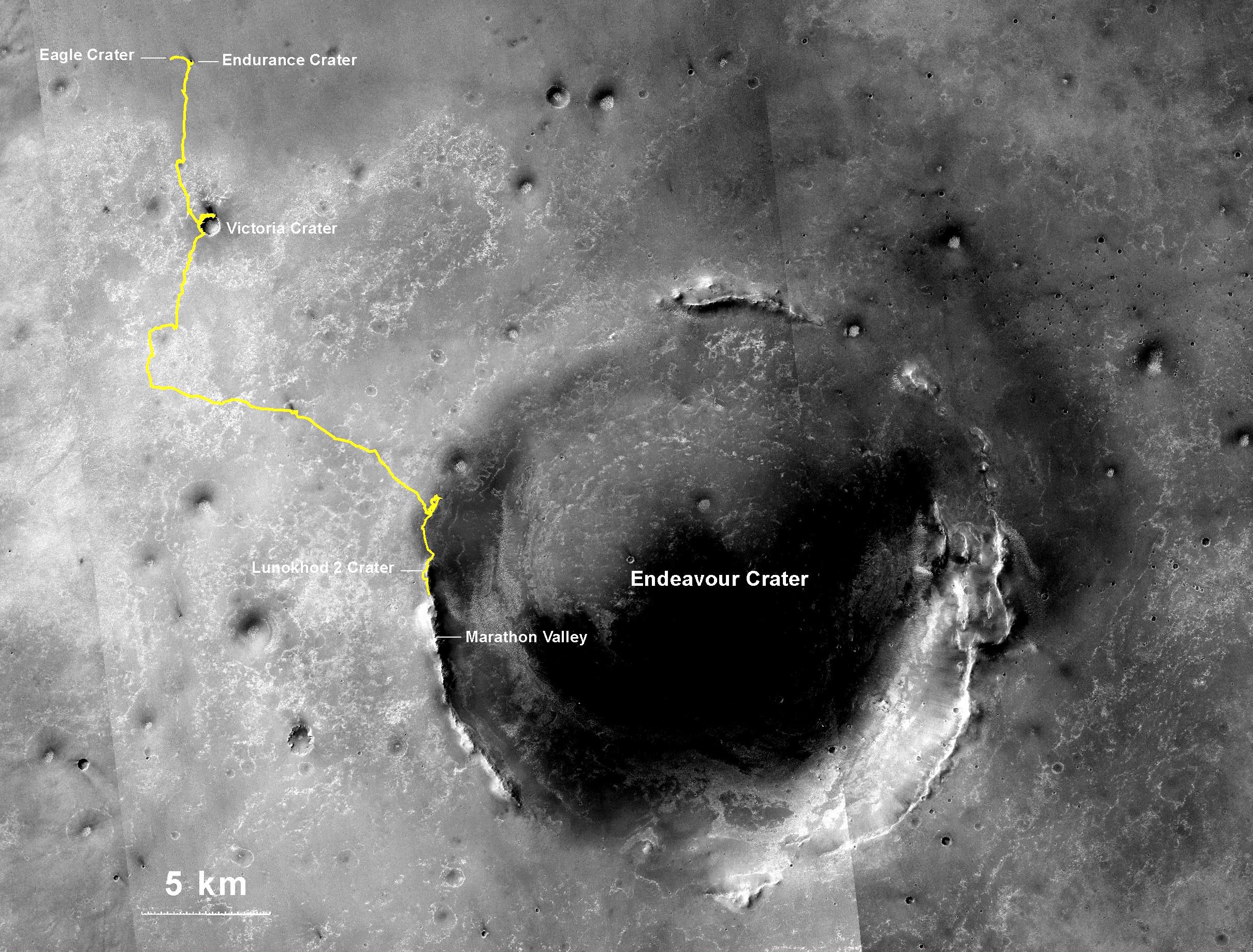
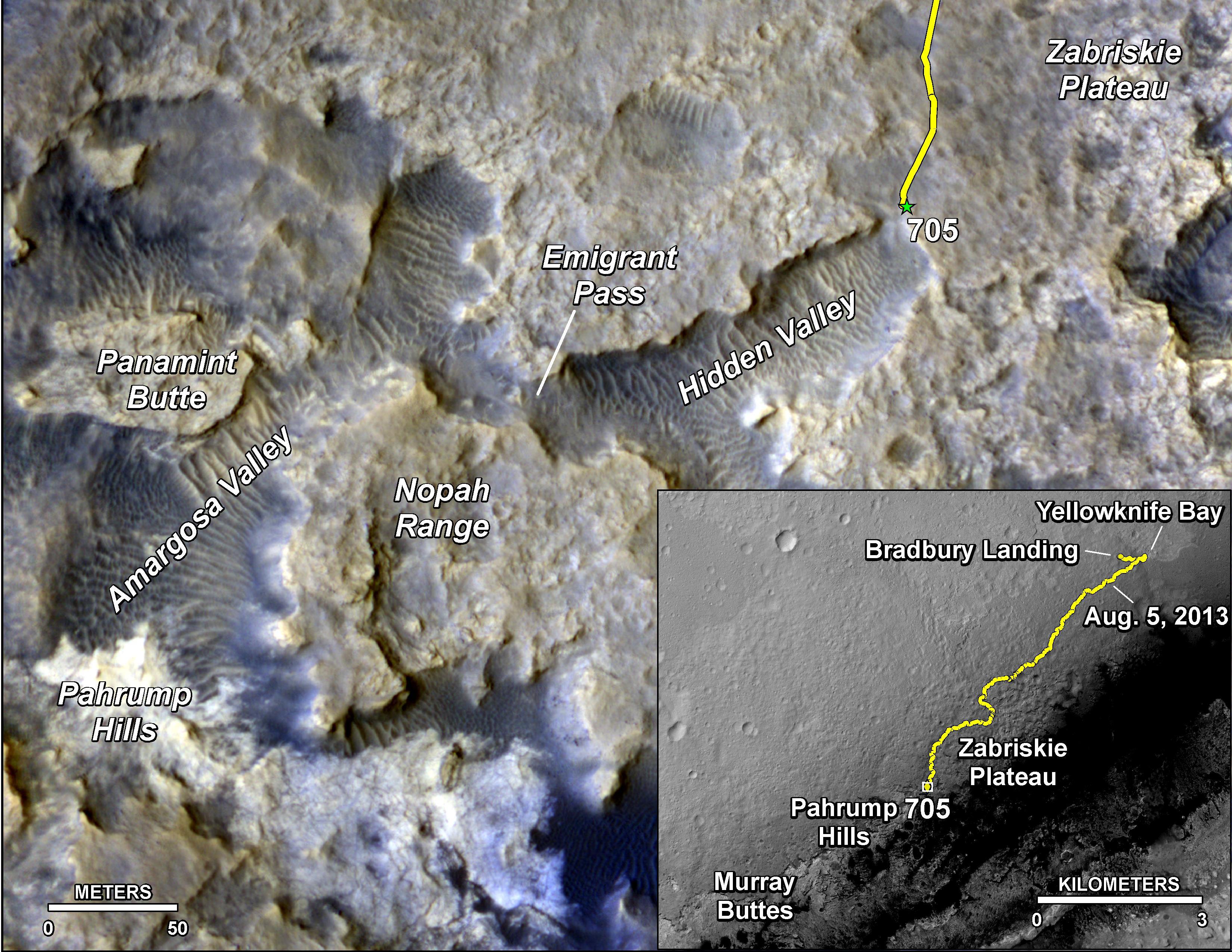
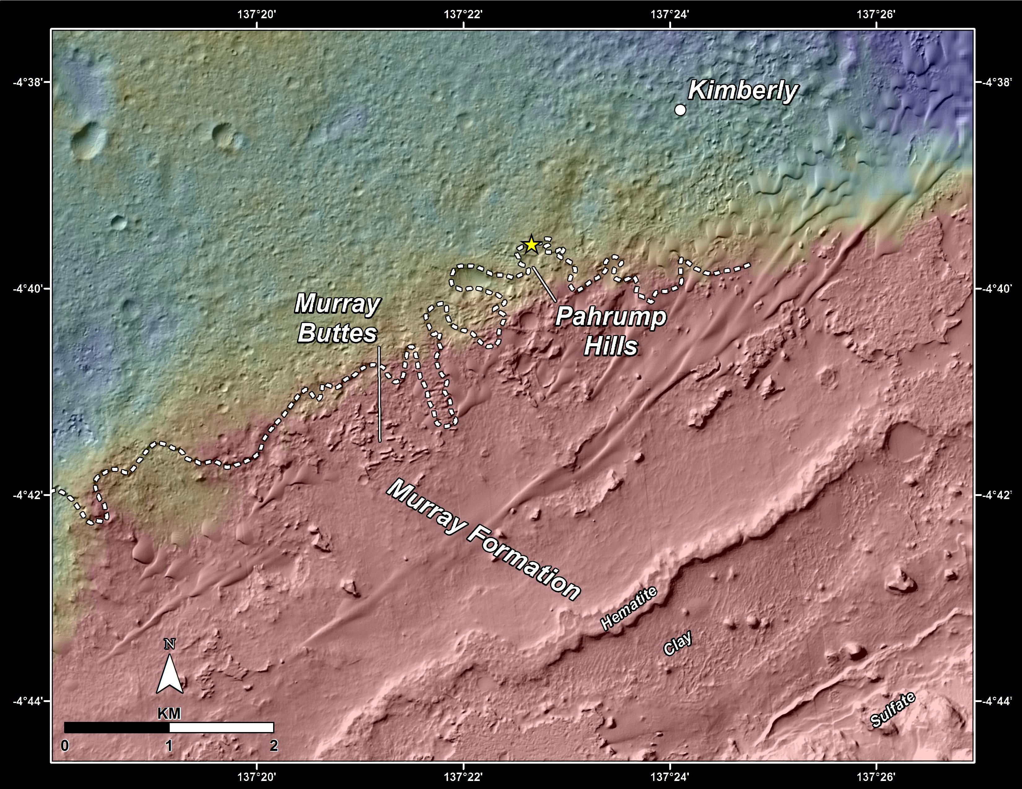
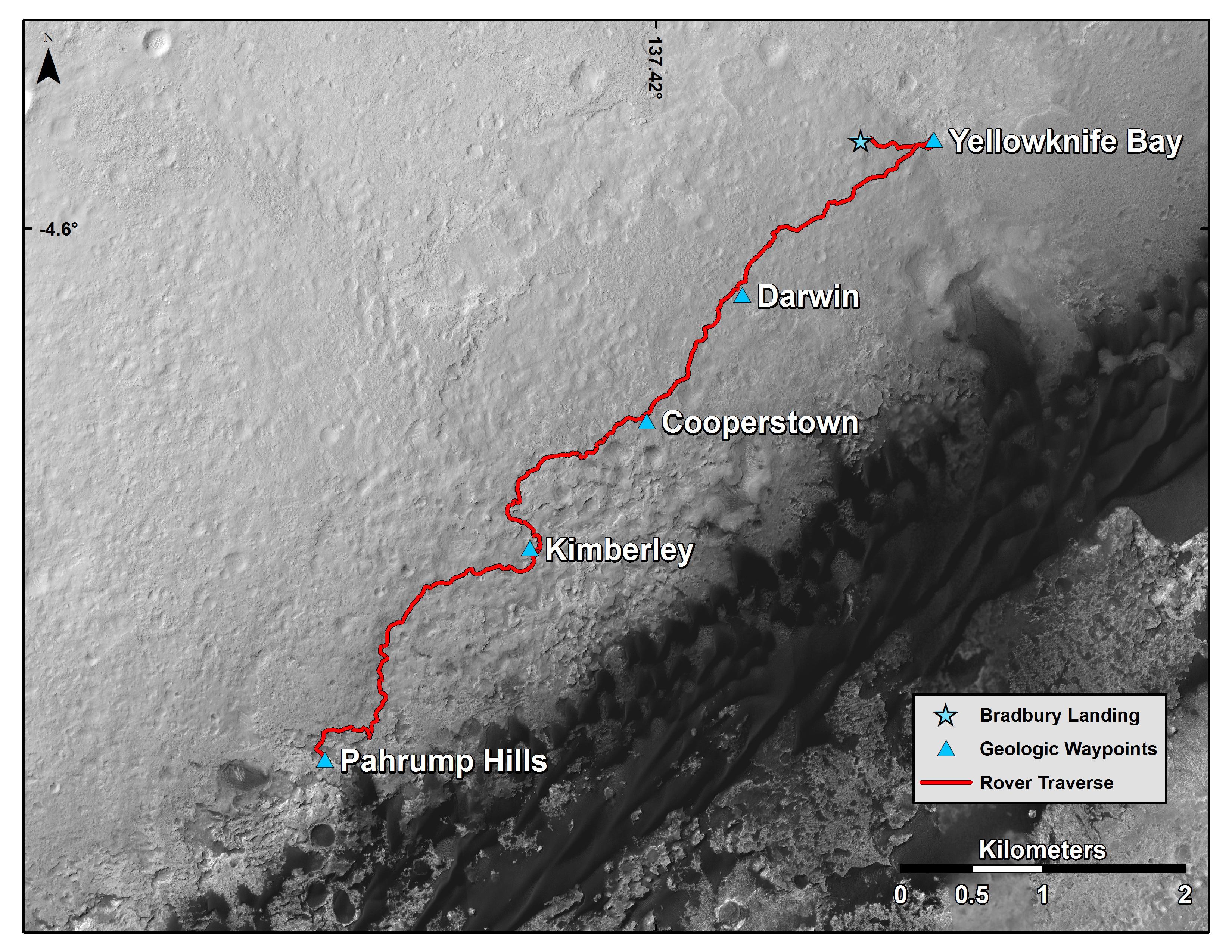
2014-09-25
Mars
Mars Reconnaissance Orbiter (MRO)
Mars Science Laboratory (MSL)
HiRISE
3300x2550x3
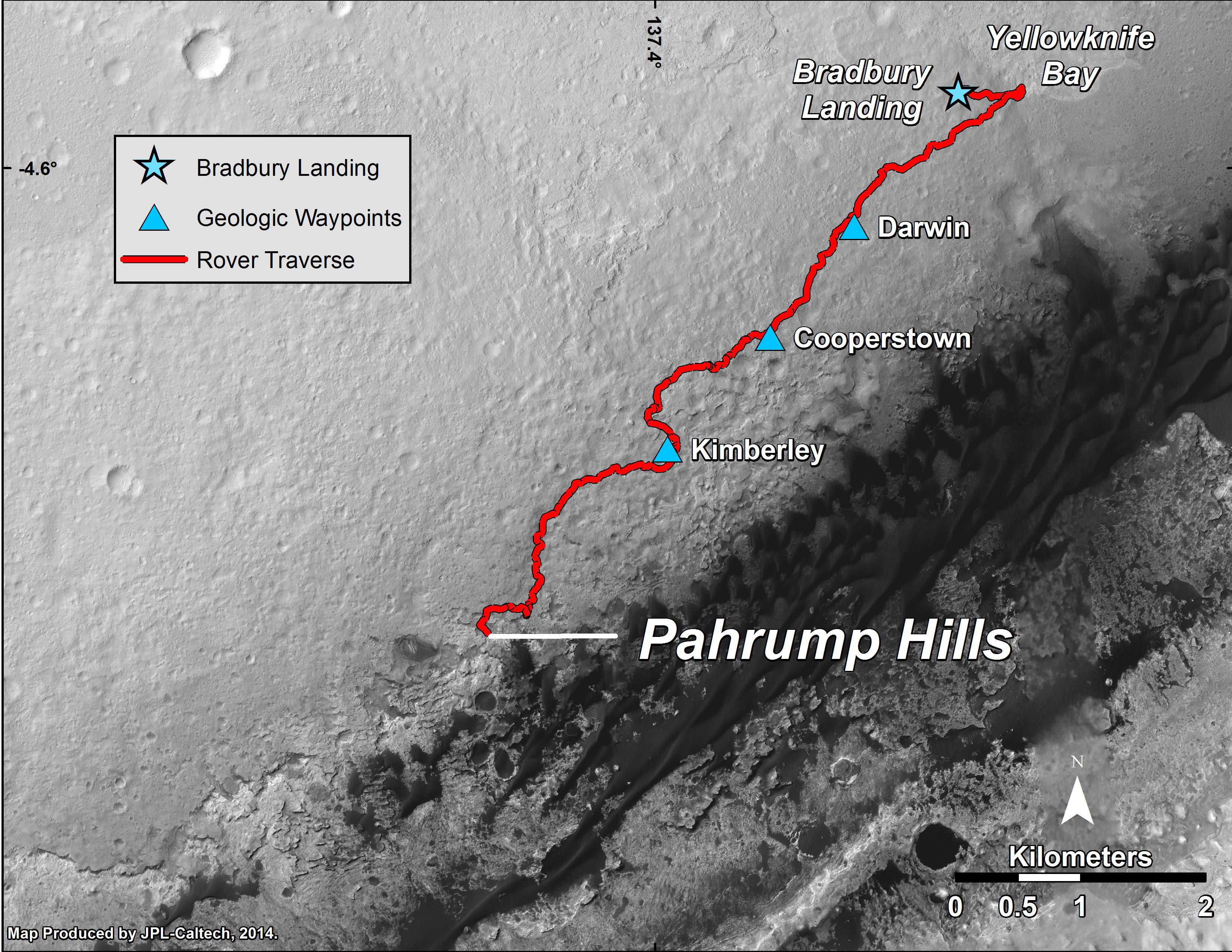
PIA18607:
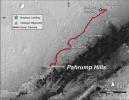
Curiosity Mars Rover's Route from Landing to 'Pahrump Hills'
Full Resolution:
TIFF
(25.26 MB)
JPEG
(1.571 MB)
2014-10-01
Mars
Mars Reconnaissance Orbiter (MRO)
HiRISE
2880x1800x3
PIA18817:
Possible Future Mars Landing Site in Oxia Planum
Full Resolution:
TIFF
(15.56 MB)
JPEG
(705.9 kB)
2014-10-01
Mars
Mars Reconnaissance Orbiter (MRO)
HiRISE
2880x1800x3
PIA18818:
Continual Dune and Ripple Migration in Nili Patera
Full Resolution:
TIFF
(15.56 MB)
JPEG
(807.2 kB)
2014-10-01
Mars
Mars Reconnaissance Orbiter (MRO)
HiRISE
2880x1800x3
PIA18819:
Bright Slope Streaks in Arabia Terra
Full Resolution:
TIFF
(15.56 MB)
JPEG
(556.2 kB)
2014-10-01
Mars
Mars Reconnaissance Orbiter (MRO)
HiRISE
2880x1800x3
PIA18820:
Dome and Barchan Dunes in Newton Crater
Full Resolution:
TIFF
(15.56 MB)
JPEG
(1.351 MB)
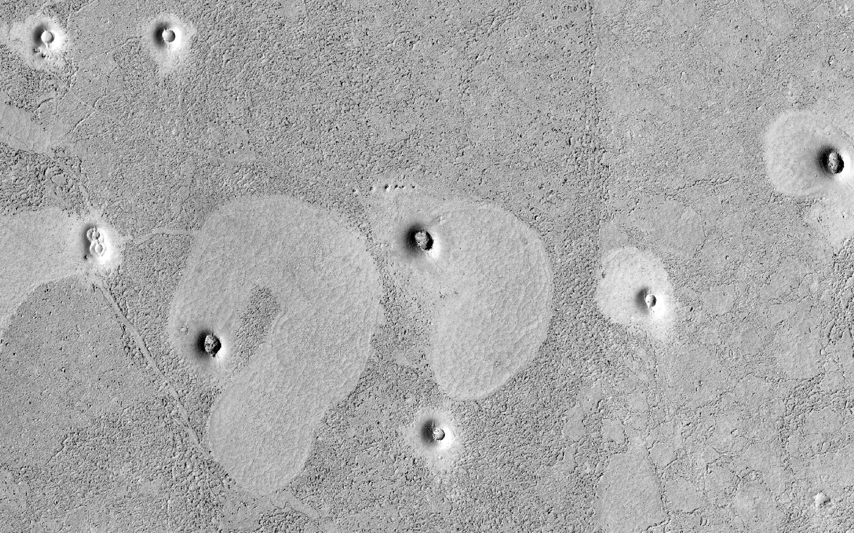
2014-10-15
Mars
Mars Reconnaissance Orbiter (MRO)
HiRISE
2880x1800x3
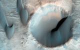
PIA18829:
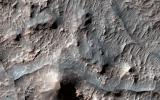
A Light Toned Deposit in Arsinoes Chaos
Full Resolution:
TIFF
(15.56 MB)
JPEG
(693 kB)
2014-10-15
Mars
Mars Reconnaissance Orbiter (MRO)
HiRISE
2880x1800x1
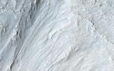
PIA18830:
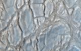
Mounds of Layered Material on the West Edge of Melas Chasma
Full Resolution:
TIFF
(5.191 MB)
JPEG
(662.3 kB)
2014-10-15
Mars
Mars Reconnaissance Orbiter (MRO)
HiRISE
2880x1800x3
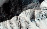
PIA18831:
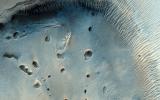
A Collection of Landforms in Eastern Elysium Planitia
Full Resolution:
TIFF
(15.56 MB)
JPEG
(595.3 kB)
2014-10-15
Mars
Mars Reconnaissance Orbiter (MRO)
HiRISE
2880x1800x3
PIA18832:
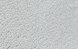
Perennial Frost in a Crater on the Northern Plains
Full Resolution:
TIFF
(15.56 MB)
JPEG
(895.2 kB)
2014-10-20
Mars
Mars Reconnaissance Orbiter (MRO)
HiRISE
929x610x1
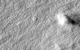
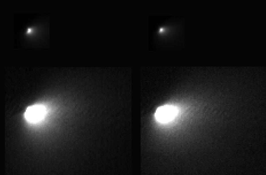
PIA18618:
First Resolved Image of a Long-Period Comet's Nucleus
Full Resolution:
TIFF
(567.5 kB)
JPEG
(26.9 kB)
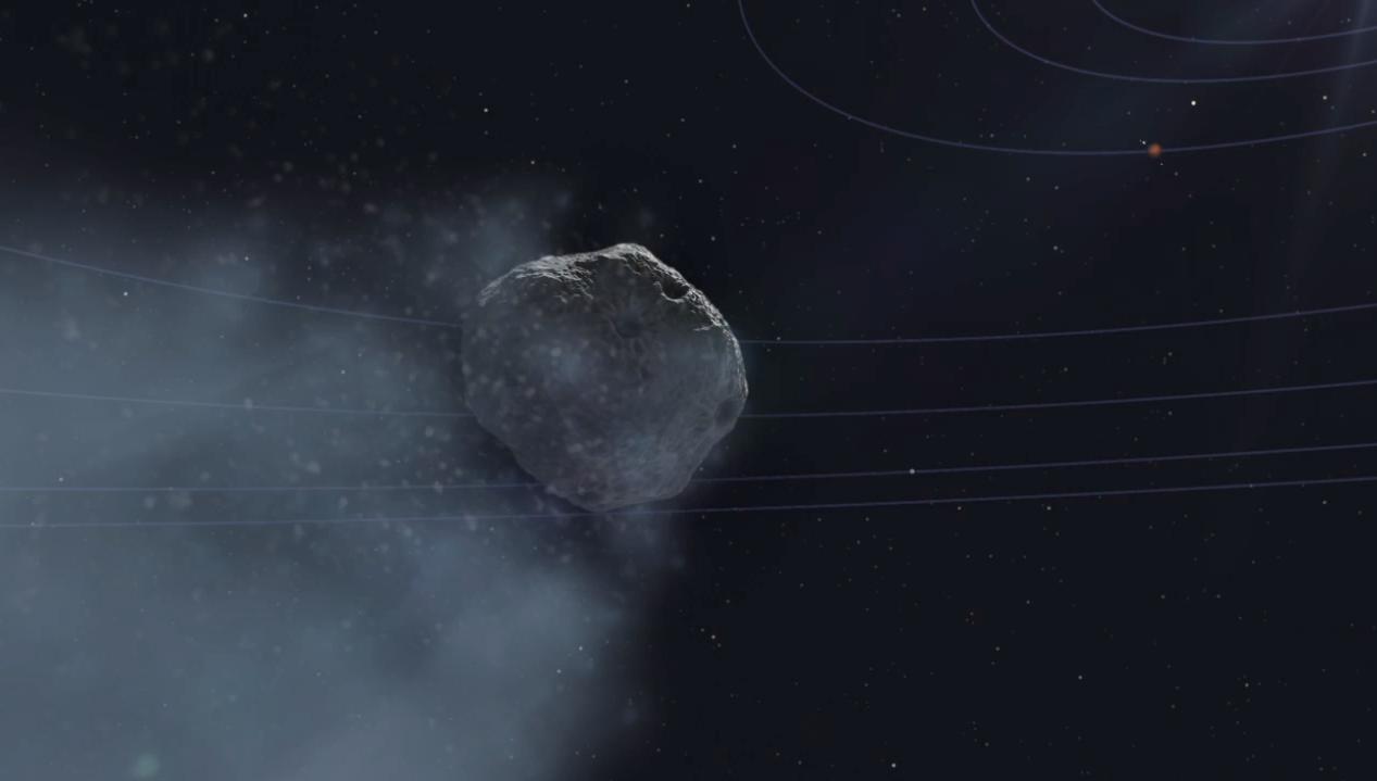
2014-10-24
Mars
Mars Reconnaissance Orbiter (MRO)
CRISM
1010x500x3
PIA15291:
Images From Mars-Orbiting Spectrometer Show Comet's Coma
Full Resolution:
TIFF
(1.516 MB)
JPEG
(38.03 kB)
2014-10-29
Mars
Mars Reconnaissance Orbiter (MRO)
HiRISE
2880x1800x1
PIA18887:
Which Way is Up?
Full Resolution:
TIFF
(5.191 MB)
JPEG
(506.4 kB)
2014-10-29
Mars
Mars Reconnaissance Orbiter (MRO)
HiRISE
2880x1800x3
PIA18888:
Search for the Mars 2 Debris Field
Full Resolution:
TIFF
(15.56 MB)
JPEG
(1.2 MB)
2014-10-29
Mars
Mars Reconnaissance Orbiter (MRO)
HiRISE
2880x1800x3
PIA18889:
Sand Sources Near Athabasca Valles
Full Resolution:
TIFF
(15.56 MB)
JPEG
(844.8 kB)
2014-10-29
Mars
Mars Reconnaissance Orbiter (MRO)
HiRISE
2880x1800x3
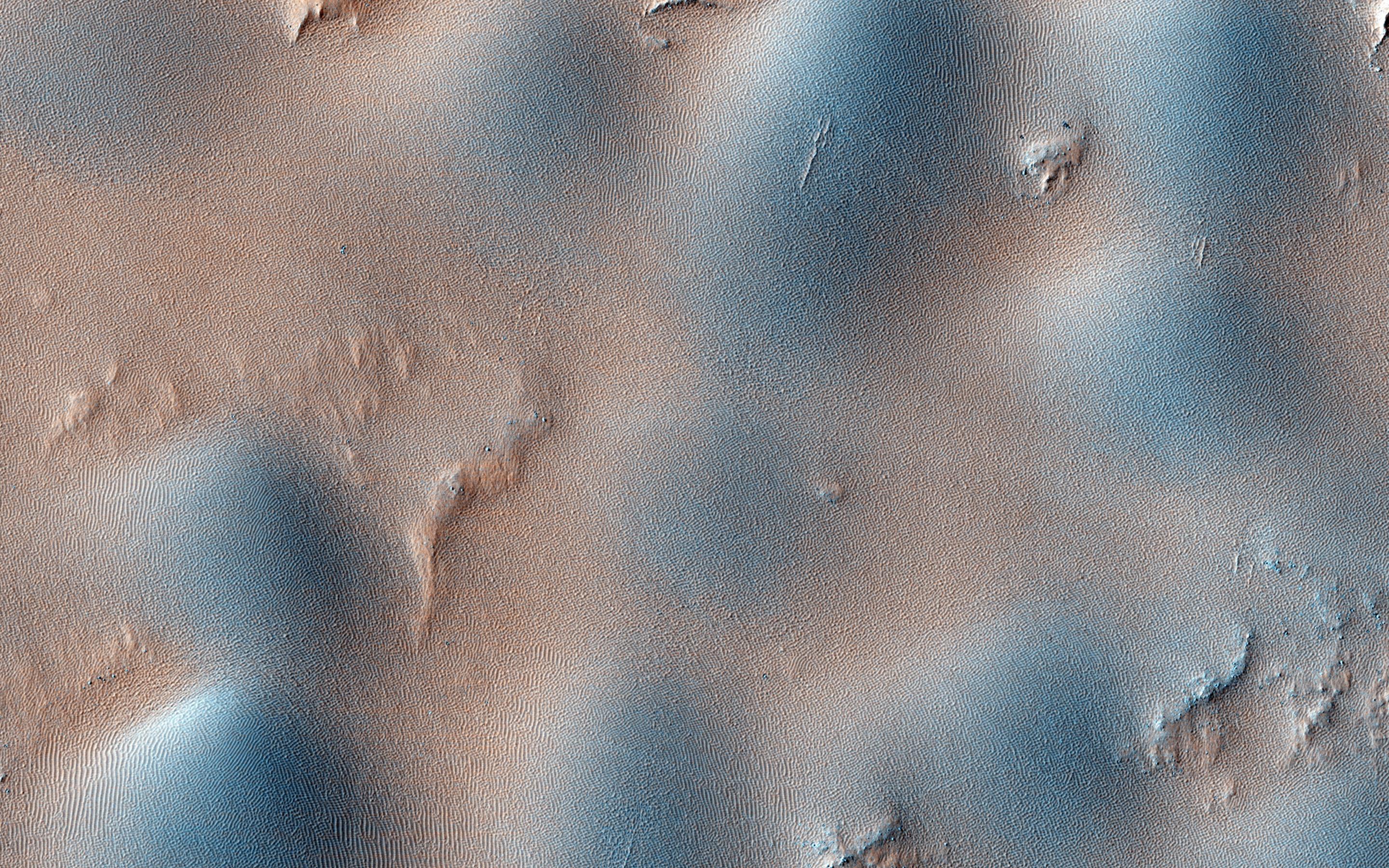
PIA18890:
Hardened Dunes in Arcadia Planitia
Full Resolution:
TIFF
(15.56 MB)
JPEG
(968.1 kB)
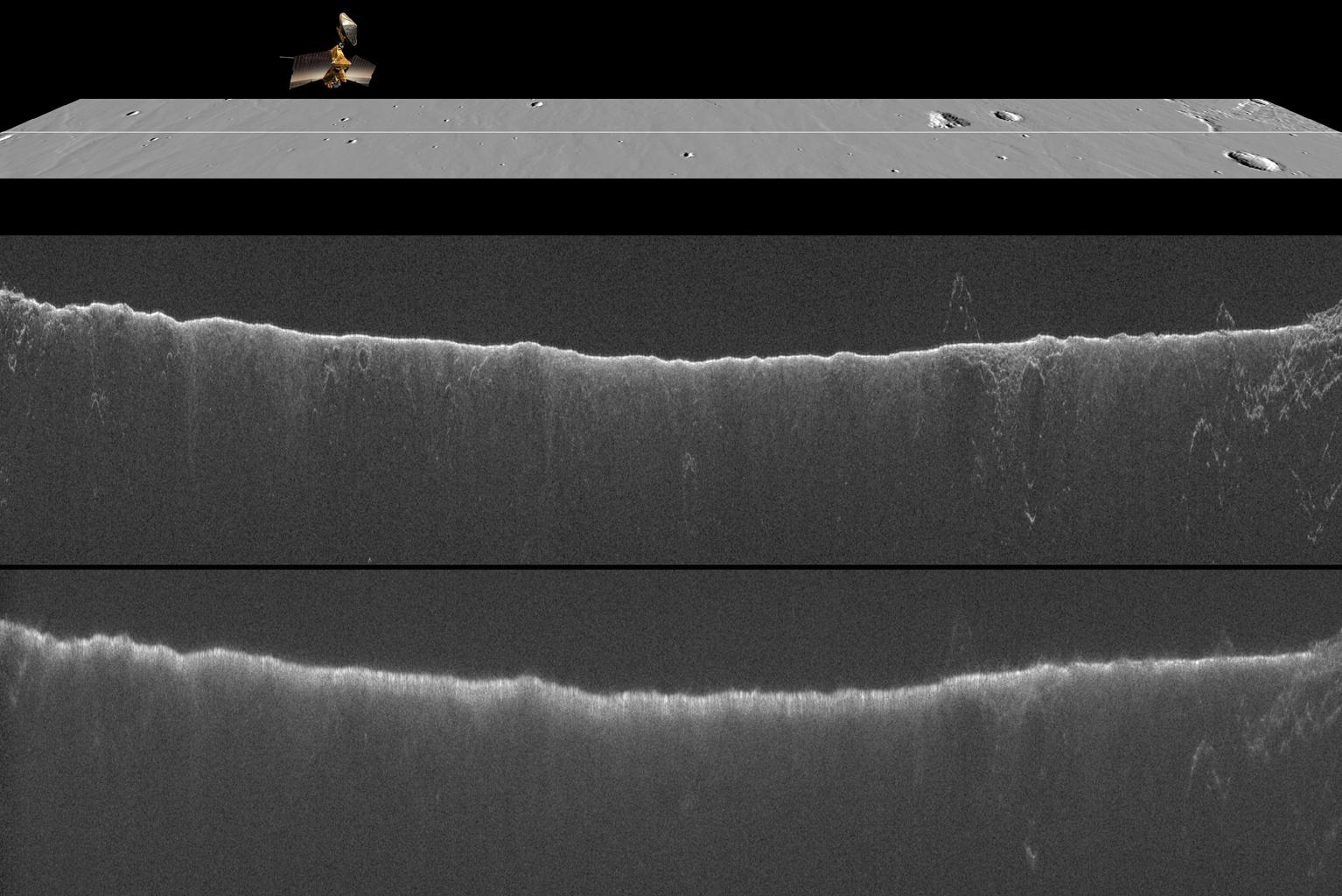
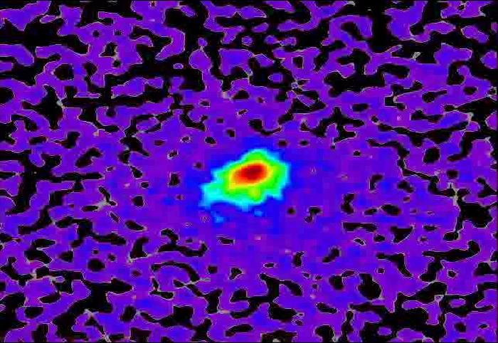
2014-11-07
Mars
Mars Reconnaissance Orbiter (MRO)
Shallow Subsurface Radar (SHARAD)
1534x1024x3
PIA18861:
Radar Indication of Effect of Comet Flyby on Martian Ionosphere
Full Resolution:
TIFF
(4.714 MB)
JPEG
(192.9 kB)
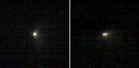
2014-11-07
Mars
Mars Reconnaissance Orbiter (MRO)
HiRISE
973x779x3
PIA18862:
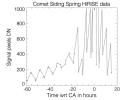
Brightness Rhythm of Mars Flyby Comet Is Clue to Rotation Rate
Full Resolution:
TIFF
(759 kB)
JPEG
(58.15 kB)
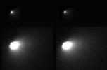
2014-11-07
Mars
Mars Reconnaissance Orbiter (MRO)
HiRISE
1692x1128x1
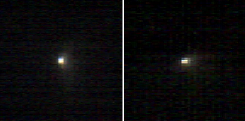
PIA18863:
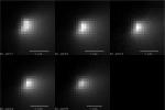
Mars Orbiter Sizes Up Passing Comet
Full Resolution:
TIFF
(1.911 MB)
JPEG
(66.52 kB)
2014-11-07
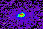
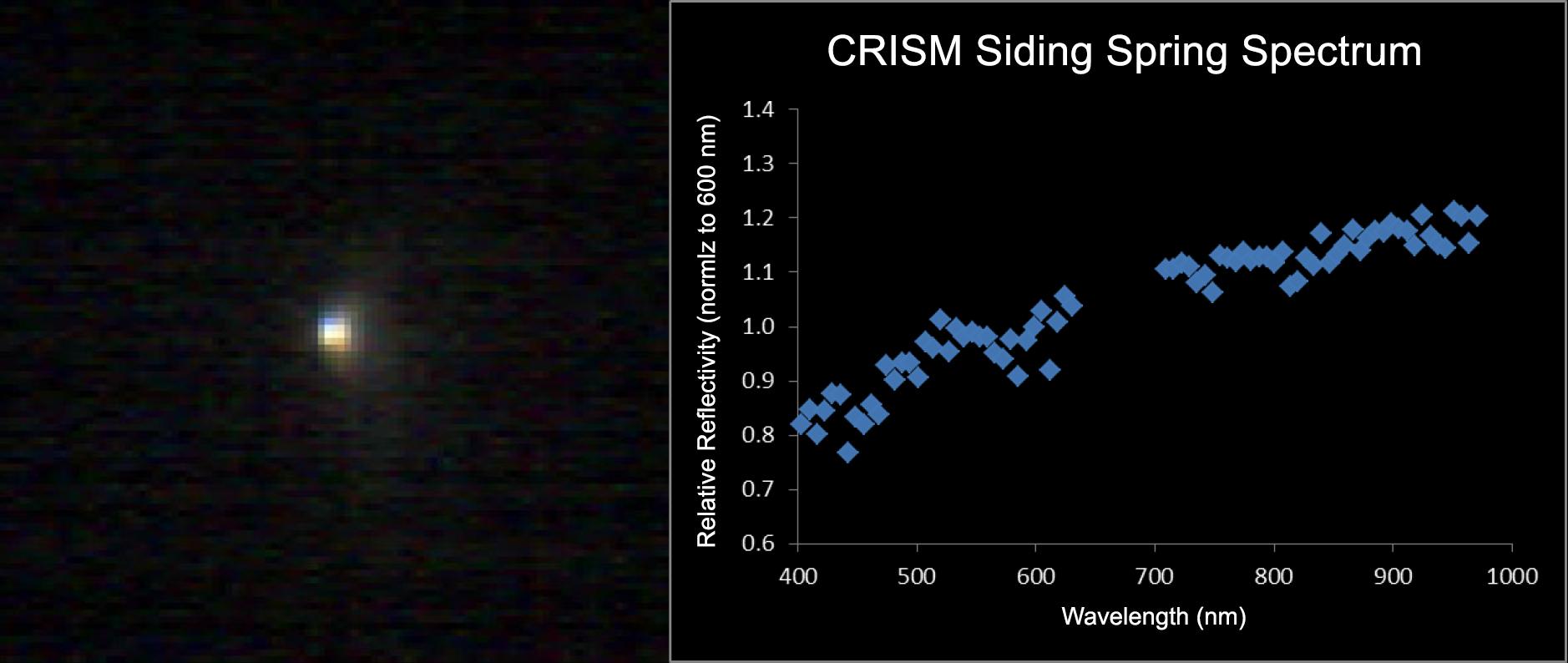
Mars
Mars Reconnaissance Orbiter (MRO)
CRISM
1878x794x3
PIA18865:
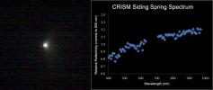
Mars-Orbiting Spectrometer Shows Dusty Comet's Spectrum
Full Resolution:
TIFF
(4.475 MB)
JPEG
(94.77 kB)
2014-11-07
Mars
Mars Reconnaissance Orbiter (MRO)
HiRISE
1267x719x3
PIA19045:
Mars Orbiter Observes Comet Siding Spring (Animation)
Full Resolution:
TIFF
(2.734 MB)
JPEG
(36.37 kB)
2014-11-07
Mars
Mars Reconnaissance Orbiter (MRO)
HiRISE
700x482x3
PIA19044:
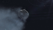
Mars-Flyby Comet in False Color
Full Resolution:
TIFF
(1.013 MB)
JPEG
(77.35 kB)
2014-11-13
Mars
Mars Reconnaissance Orbiter (MRO)
HiRISE
2880x1800x3
PIA18892:
Spring in Inca City I
Full Resolution:
TIFF
(15.56 MB)
JPEG
(748.4 kB)
2014-11-13
Mars
Mars Reconnaissance Orbiter (MRO)
HiRISE
2880x1800x3
PIA18893:
Spring in Inca City II
Full Resolution:
TIFF
(15.56 MB)
JPEG
(680.1 kB)
2014-11-13
Mars
Mars Reconnaissance Orbiter (MRO)
HiRISE
2880x1800x3
PIA18894:
Spring in Inca City III
Full Resolution:
TIFF
(15.56 MB)
JPEG
(730.6 kB)
2014-11-13
Mars
Mars Reconnaissance Orbiter (MRO)
HiRISE
2880x1800x3
PIA18895:
Spring in Inca City IV
Full Resolution:
TIFF
(15.56 MB)
JPEG
(667.2 kB)
2014-11-13
Mars
Mars Reconnaissance Orbiter (MRO)
HiRISE
2880x1800x3
PIA18896:
Spring in Inca City V
Full Resolution:
TIFF
(15.56 MB)
JPEG
(452.8 kB)
2014-12-03
Mars
Mars Reconnaissance Orbiter (MRO)
HiRISE
2880x1800x3
PIA18930:
Braided TARs in Syrtis Major
Full Resolution:
TIFF
(15.56 MB)
JPEG
(831.4 kB)
2014-12-03
Mars
Mars Reconnaissance Orbiter (MRO)
HiRISE
2880x1800x3
PIA18931:
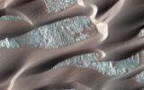
Dunes and Wind Streaks in Arabia Terra
Full Resolution:
TIFF
(15.56 MB)
JPEG
(683.5 kB)
2014-12-03
Mars
Mars Reconnaissance Orbiter (MRO)
HiRISE
2880x1800x1
PIA18932:
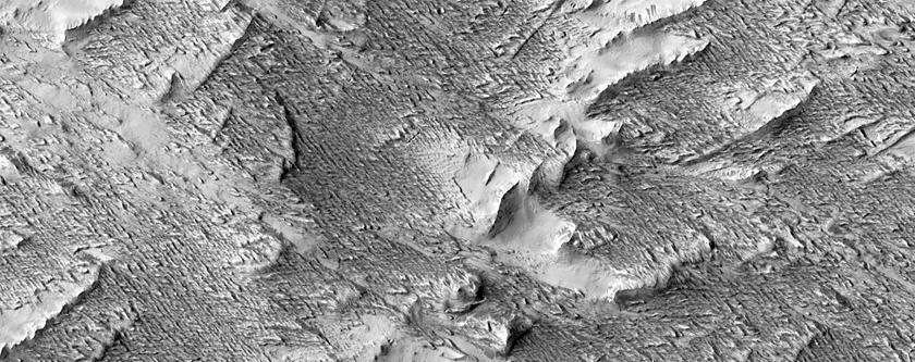
An Enigmatic Feature in Athabasca Lava Flows
Full Resolution:
TIFF
(5.191 MB)
JPEG
(552.5 kB)
2014-12-03
Mars
Mars Reconnaissance Orbiter (MRO)
HiRISE
2880x1800x3
PIA18933:
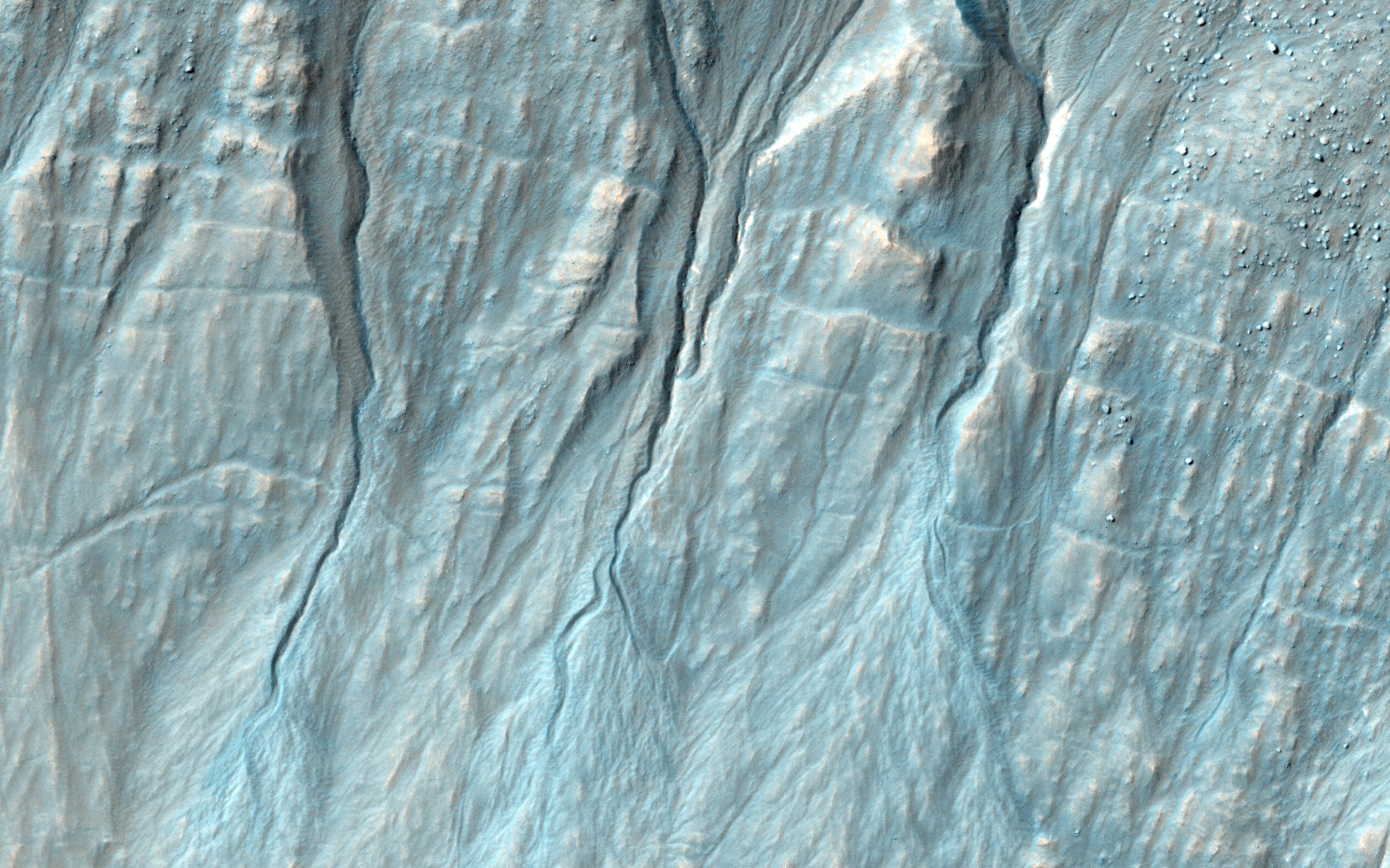
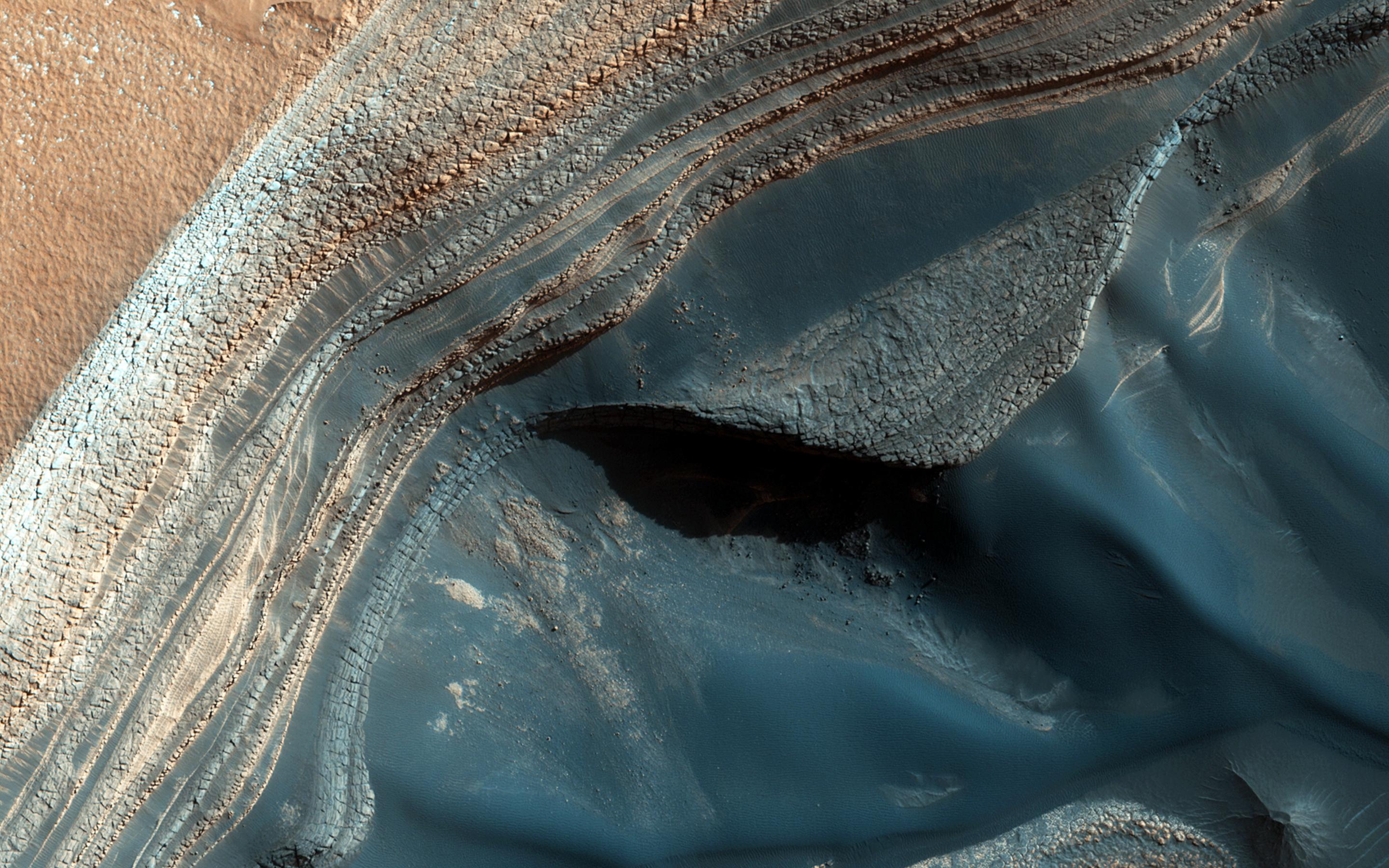
Clays along the Coprates Chasma Plateau
Full Resolution:
TIFF
(15.56 MB)
JPEG
(1.023 MB)
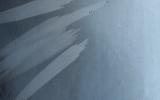
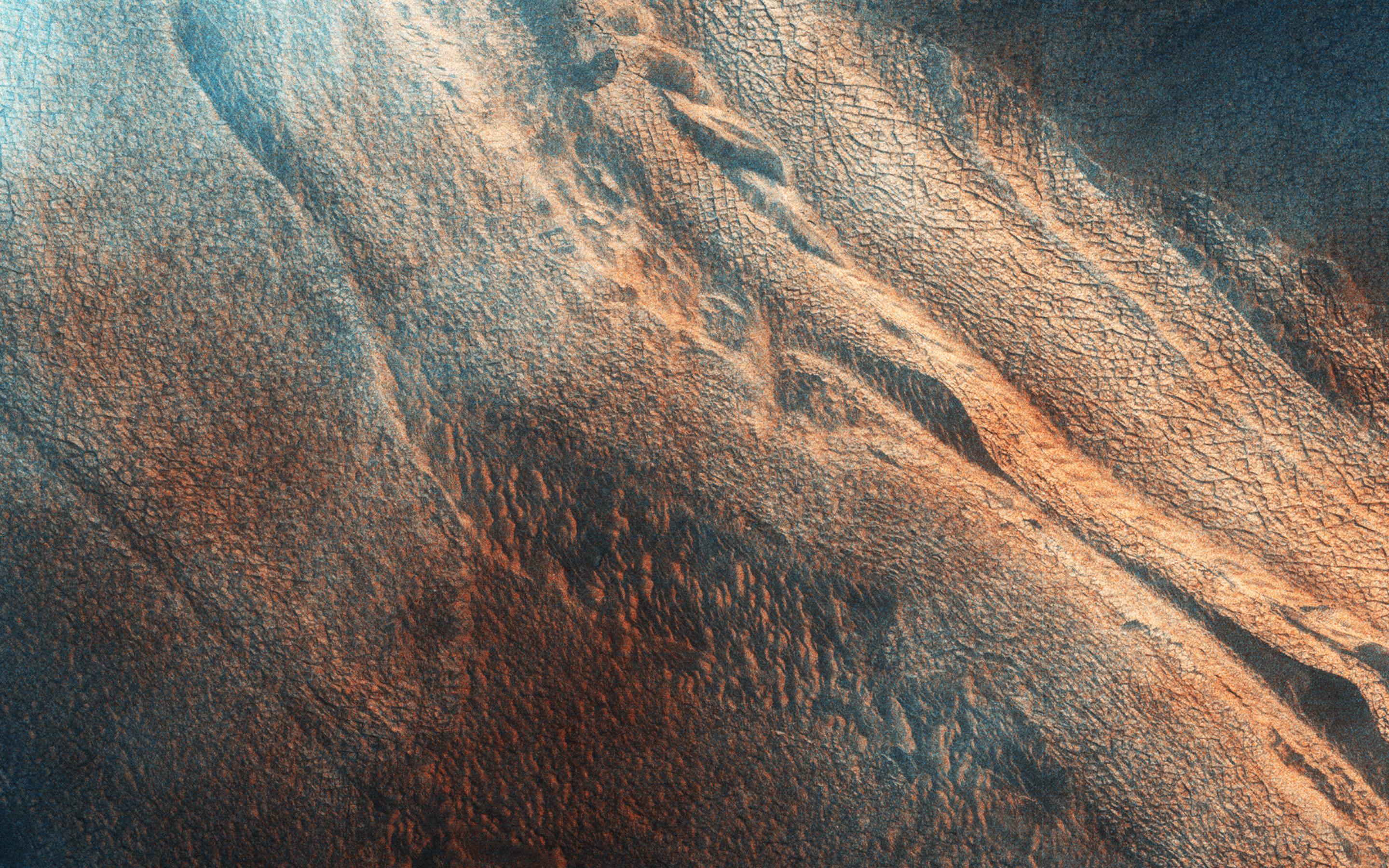
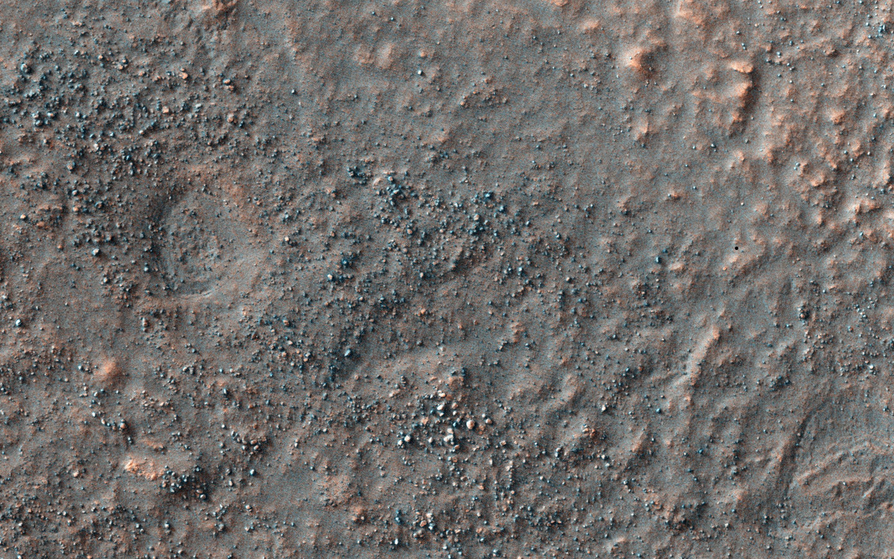
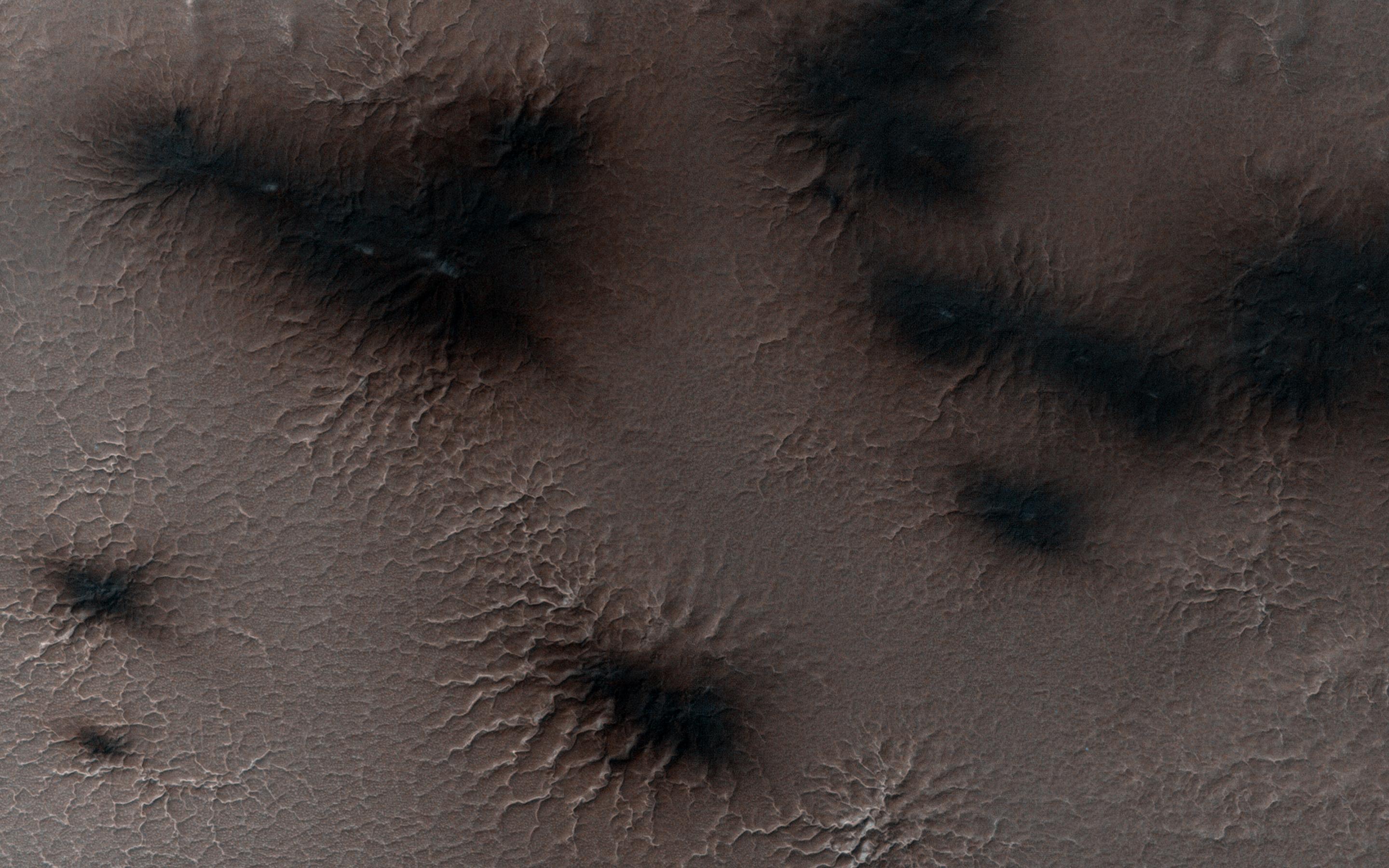
2014-12-08
Mars
Mars Reconnaissance Orbiter (MRO)
Mars Science Laboratory (MSL)
HiRISE
3300x2550x3
PIA19067:
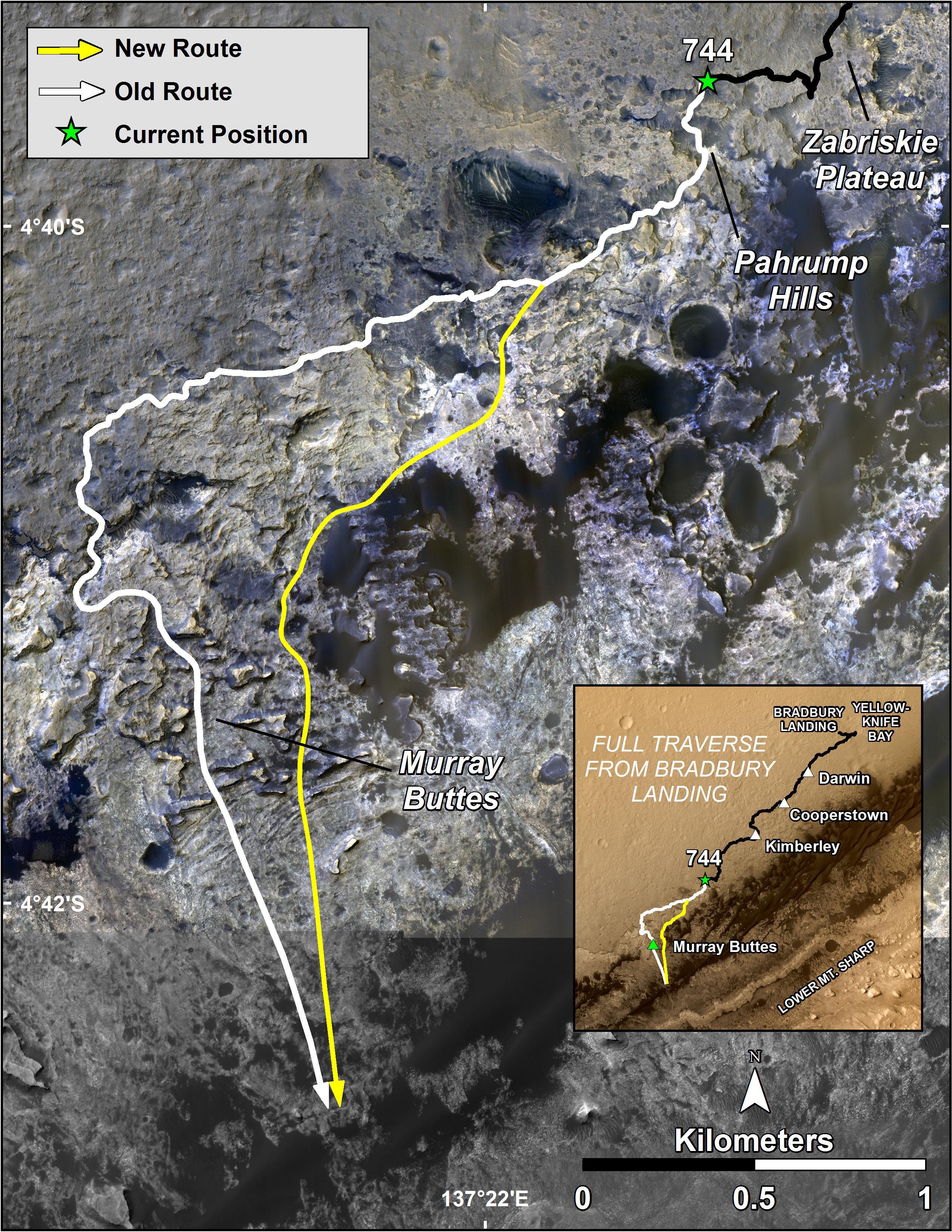
Curiosity Mars Rover's Route from Landing to Base of Mount Sharp
Full Resolution:
TIFF
(25.26 MB)
JPEG
(1.381 MB)
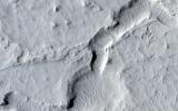
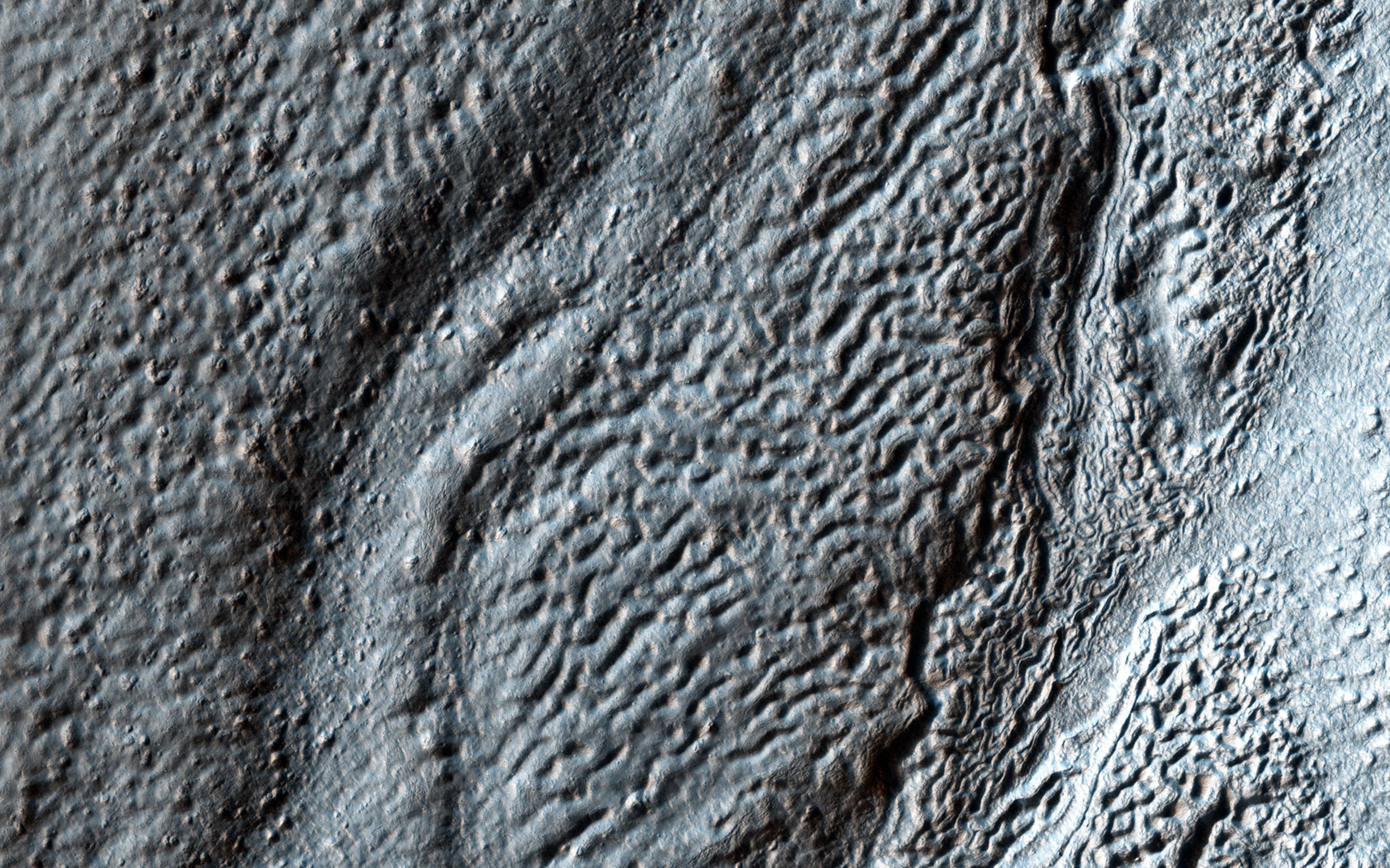
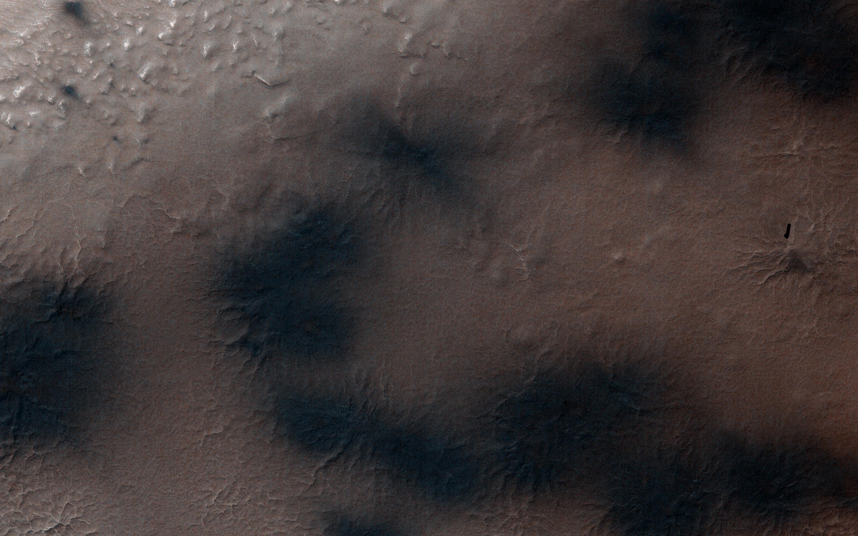
2014-12-10
Mars
Mars Reconnaissance Orbiter (MRO)
HiRISE
2880x1800x3
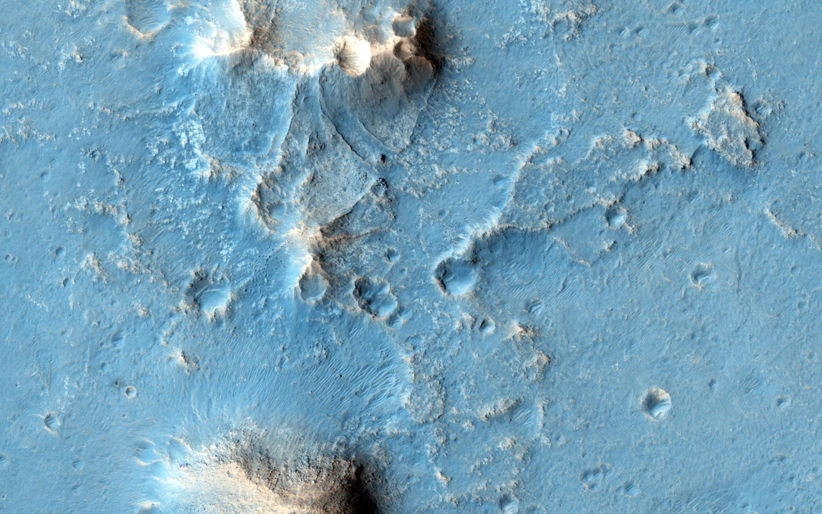
PIA19116:
Seeing Beneath the Surface in Morava Valles
Full Resolution:
TIFF
(15.56 MB)
JPEG
(986.2 kB)
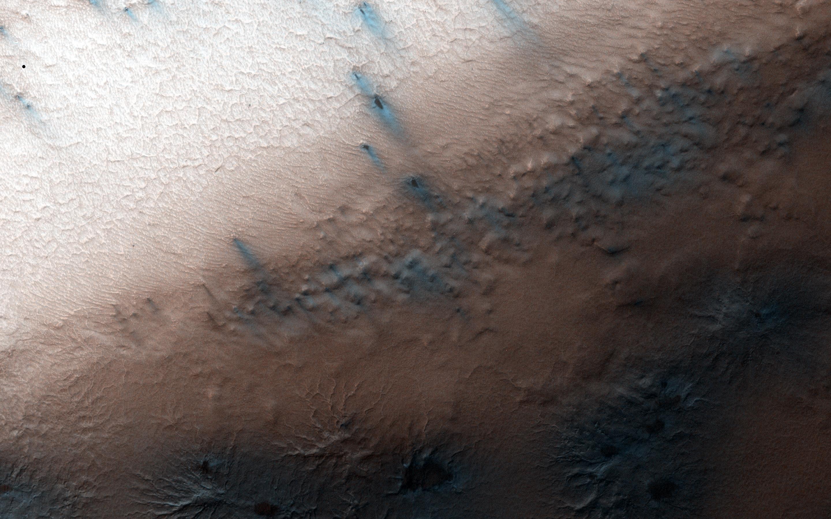
2014-12-10
Mars
Mars Reconnaissance Orbiter (MRO)
HiRISE
2880x1800x3
PIA19117:
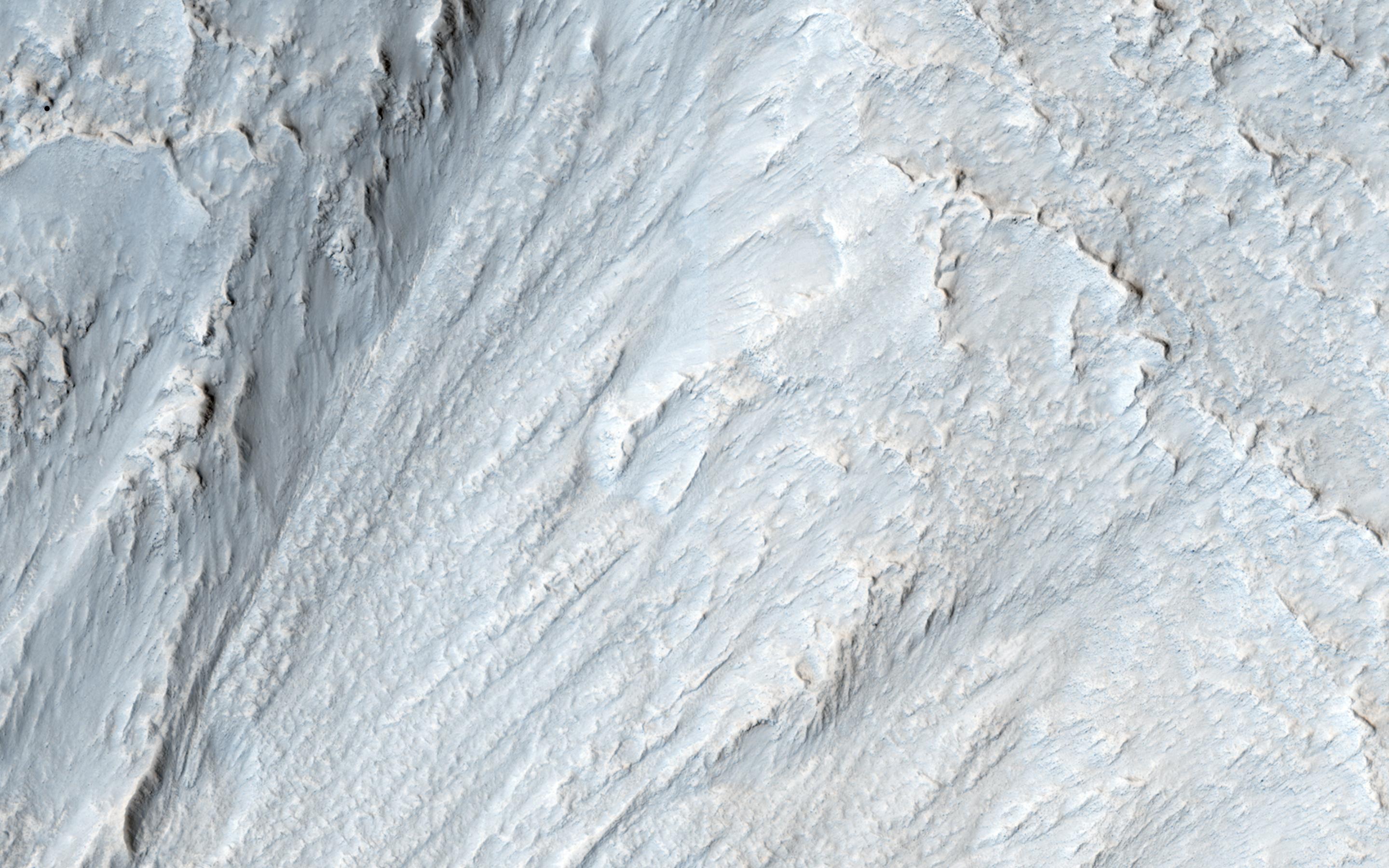
Frosted Gullies in a Central Pit
Full Resolution:
TIFF
(15.56 MB)
JPEG
(922.7 kB)
2014-12-10
Mars
Mars Reconnaissance Orbiter (MRO)
HiRISE
2880x1800x3
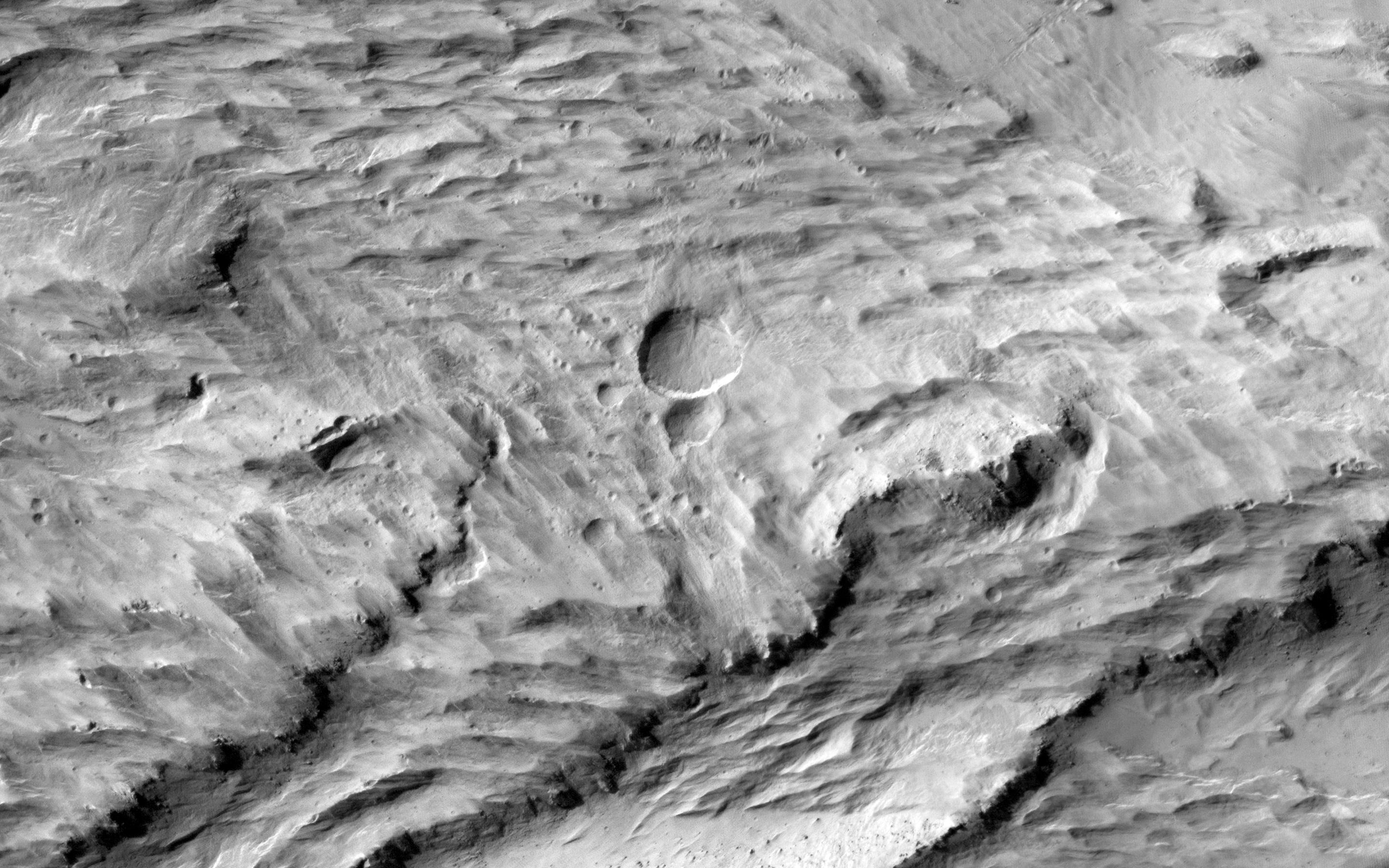
PIA19118:
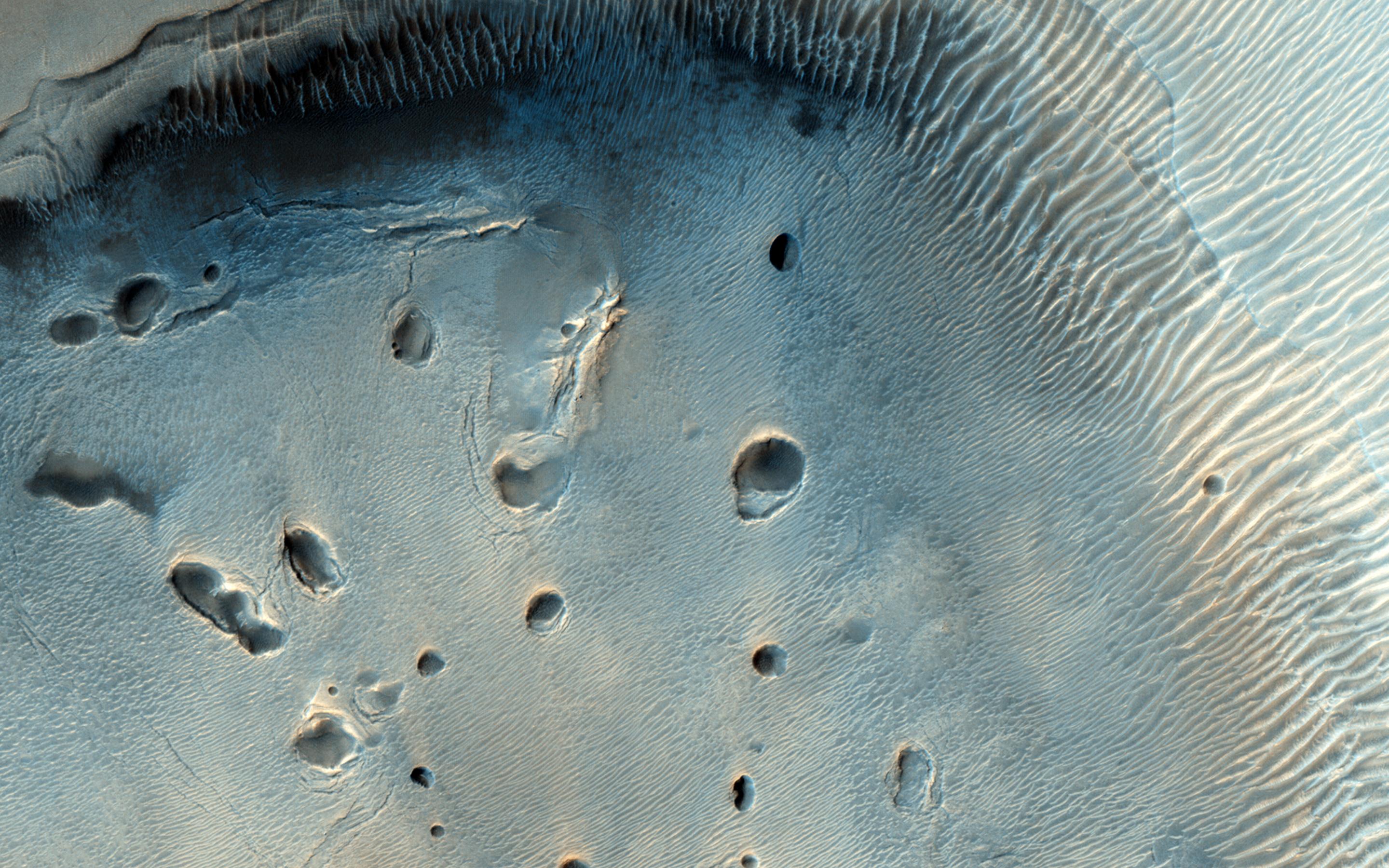
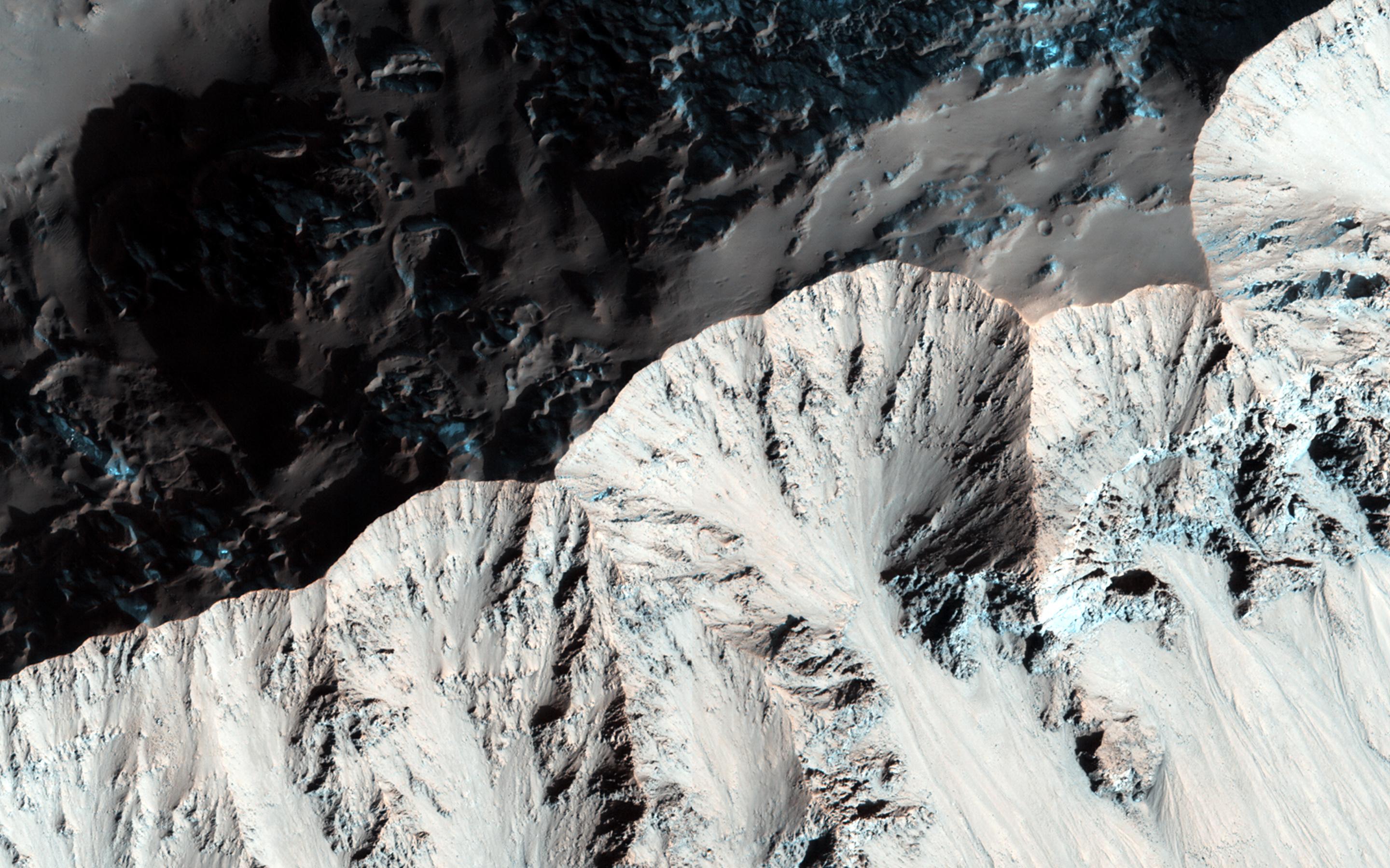
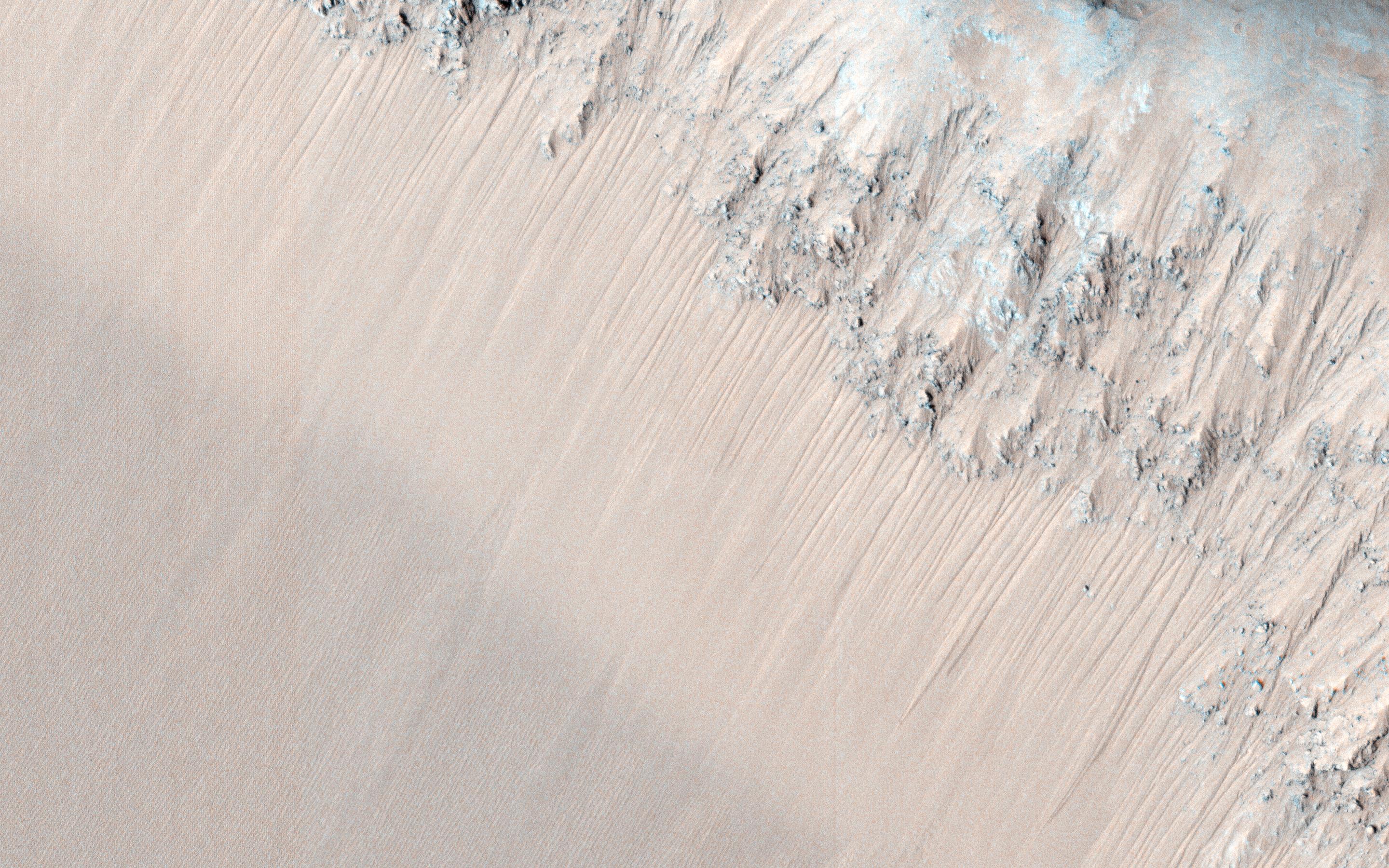
Recurring Slope Lineae in Juventae Chasma
Full Resolution:
TIFF
(15.56 MB)
JPEG
(1.026 MB)
1-100
101-200
201-300
301-400
401-500
501-600
601-700
701-800
801-900
901-1000
Currently displaying images:
801 - 900
of 1671


