Click on an image for detailed information
Click on a column heading to sort in ascending or descending order

My
List |
Addition Date
|
Target
|
Mission
|
Instrument
|
Size
|

|
2013-08-08 |
Mars
|
Mars Reconnaissance Orbiter (MRO)
|
HiRISE
|
2880x1800x3 |
|
-
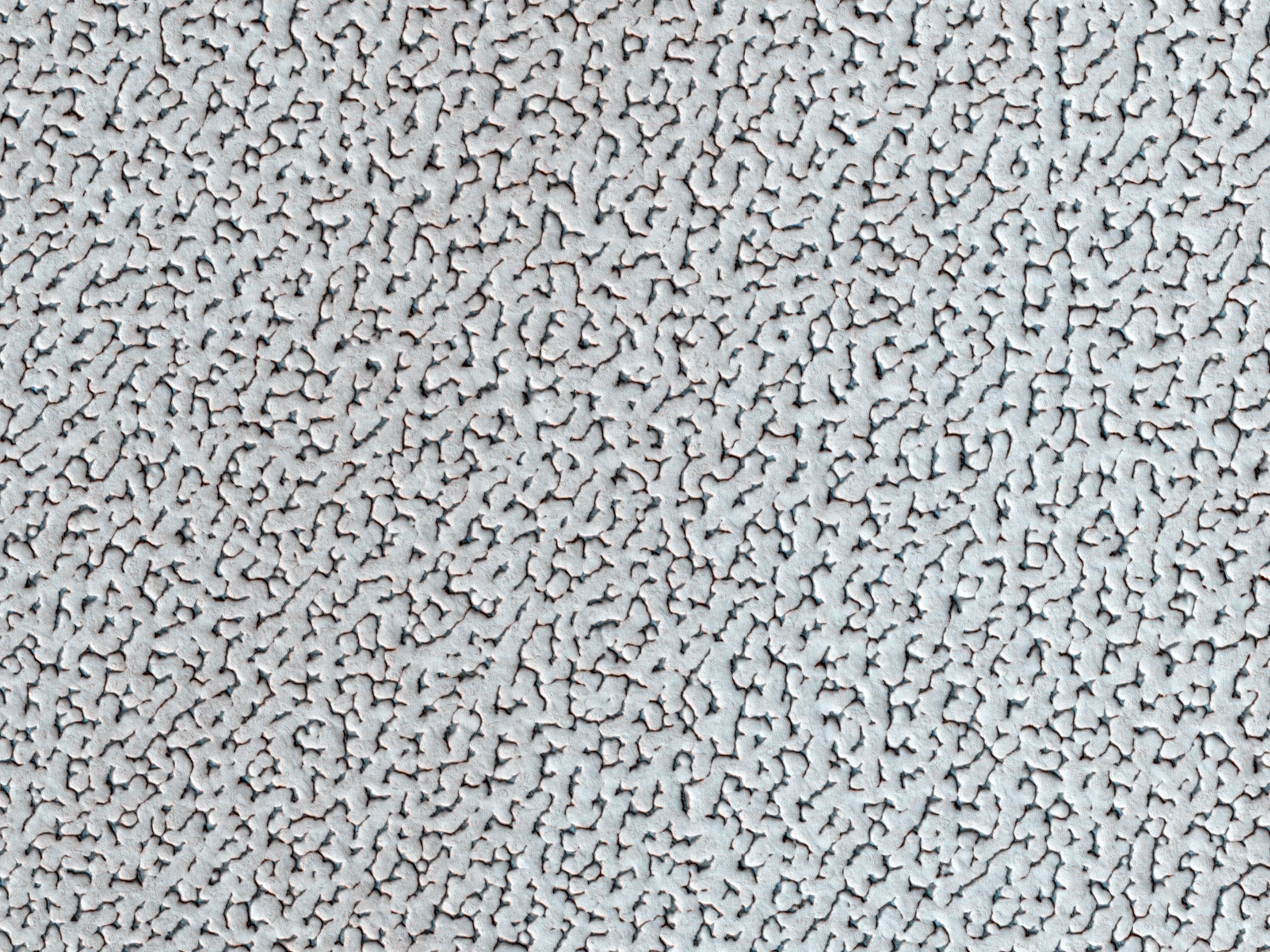
PIA17636:
-
Polygonal Surface Patterns at the South Pole
Full Resolution:
TIFF
(15.56 MB)
JPEG
(553.2 kB)
|
|
|
2013-08-08 |
Mars
|
Mars Reconnaissance Orbiter (MRO)
|
HiRISE
|
2880x1800x3 |
|
-
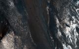
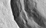
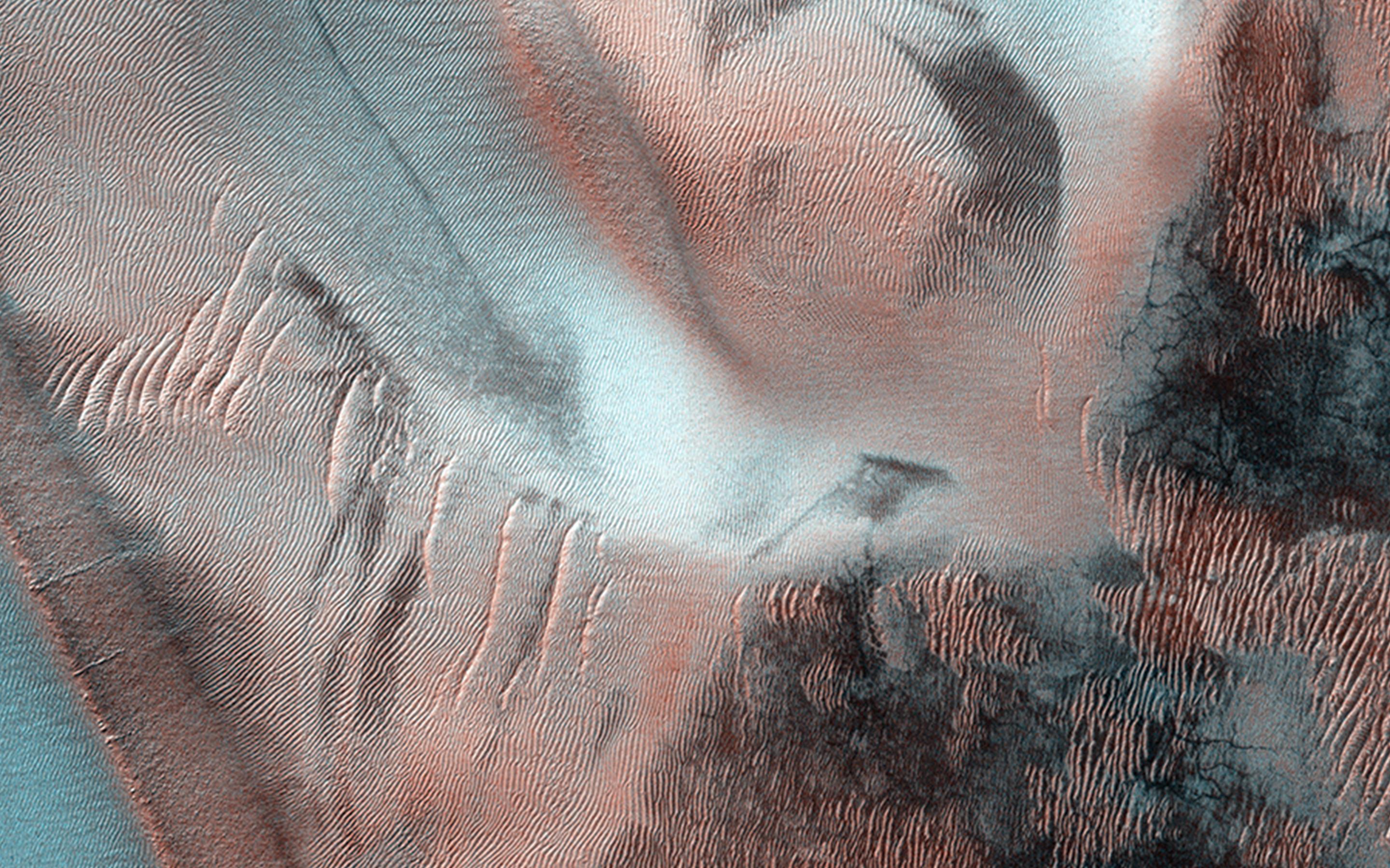
PIA17637:
-
Diffuse Winter Lighting of the Chasma Boreale Scarp
Full Resolution:
TIFF
(15.56 MB)
JPEG
(1.183 MB)
|
|
|
2013-08-08 |
Mars
|
Mars Reconnaissance Orbiter (MRO)
|
HiRISE
|
2880x1800x3 |
|
-
PIA17638:
-
Bright Dunes in Syria Planum
Full Resolution:
TIFF
(15.56 MB)
JPEG
(1.179 MB)
|
|
|
2013-08-21 |
Mars
|
Mars Reconnaissance Orbiter (MRO)
|
HiRISE
|
2880x1800x3 |
|
-
PIA17639:
-
Small Crater within Pollack Crater Containing Light-Toned Material
Full Resolution:
TIFF
(15.56 MB)
JPEG
(665.2 kB)
|
|
|
2013-08-21 |
Mars
|
Mars Reconnaissance Orbiter (MRO)
|
HiRISE
|
2880x1800x3 |
|
-
PIA17640:
-
Lava Against an Impact Crater in Elysium Planitia
Full Resolution:
TIFF
(15.56 MB)
JPEG
(1.028 MB)
|
|
|
2013-08-21 |
Mars
|
Mars Reconnaissance Orbiter (MRO)
|
HiRISE
|
2880x1800x3 |
|
-
PIA17641:
-
Frosted Impact Crater in Late Northern Winter
Full Resolution:
TIFF
(15.56 MB)
JPEG
(822.3 kB)
|
|
|
2013-08-21 |
Mars
|
Mars Reconnaissance Orbiter (MRO)
|
HiRISE
|
2880x1800x3 |

|
-
PIA17642:
-
Looking for Changes in Dust Drifts West of Alba Mons
Full Resolution:
TIFF
(15.56 MB)
JPEG
(852.5 kB)
|
|
|
2013-08-21 |
Mars
|
Mars Reconnaissance Orbiter (MRO)
|
HiRISE
|
2880x1800x3 |
|
-
PIA17643:
-
Basin in the West Candor Chasma Layered Deposits
Full Resolution:
TIFF
(15.56 MB)
JPEG
(877.5 kB)
|
|
|
2013-08-21 |
Mars
|
Mars Reconnaissance Orbiter (MRO)
|
HiRISE
|
2880x1800x3 |
|
-
PIA17644:
-
Oxbows and Cutoffs in Idaeus Fossae
Full Resolution:
TIFF
(15.56 MB)
JPEG
(1.256 MB)
|
|
|
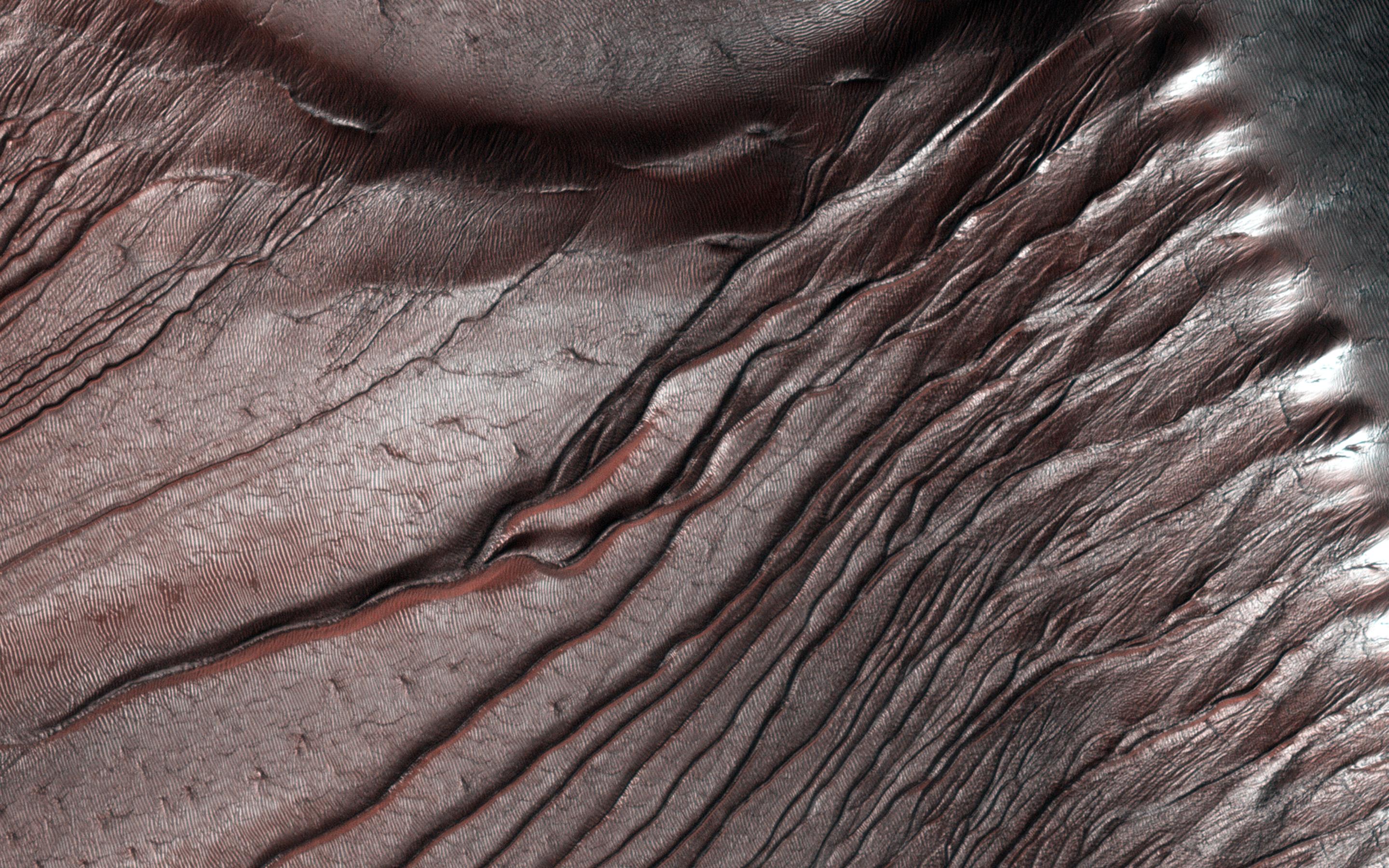
2013-08-27 |
Mars
|
Mars Reconnaissance Orbiter (MRO)
Mars Science Laboratory (MSL)
|
HiRISE
|
3300x2550x3 |
|
-
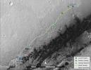
PIA17355:
-
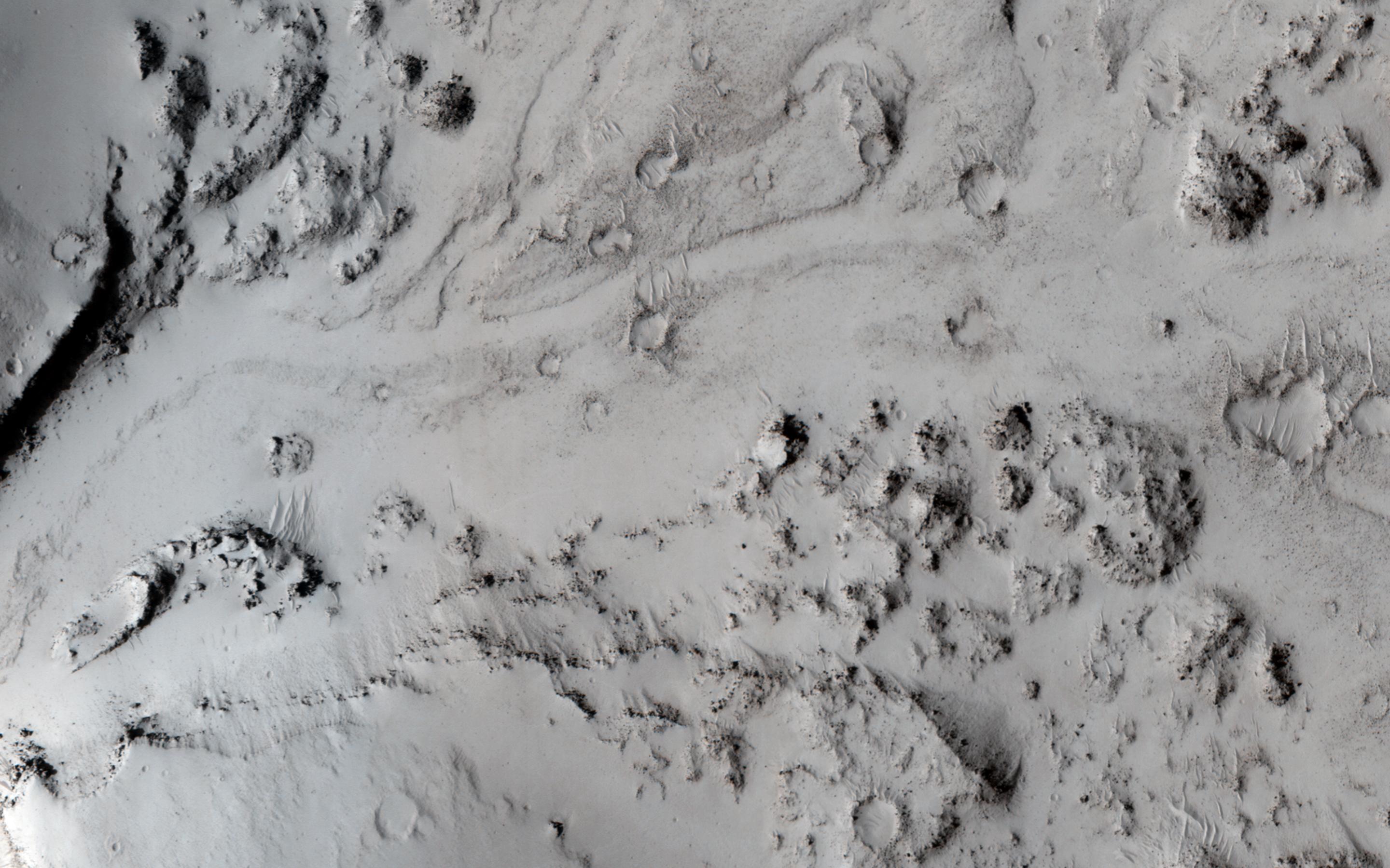
Curiosity's Progress on Route from 'Glenelg' to Mount Sharp
Full Resolution:
TIFF
(25.26 MB)
JPEG
(1.493 MB)
|
|
|
2013-08-28 |
Mars
|
Mars Reconnaissance Orbiter (MRO)
|
HiRISE
|
2880x1800x3 |
|
-
PIA17645:
-
Breaching a Crater Rim in Tartarus Montes
Full Resolution:
TIFF
(15.56 MB)
JPEG
(538.9 kB)
|
|
|
2013-08-28 |
Mars
|
Mars Reconnaissance Orbiter (MRO)
|
HiRISE
|
2880x1800x3 |
|
-
PIA17646:
-
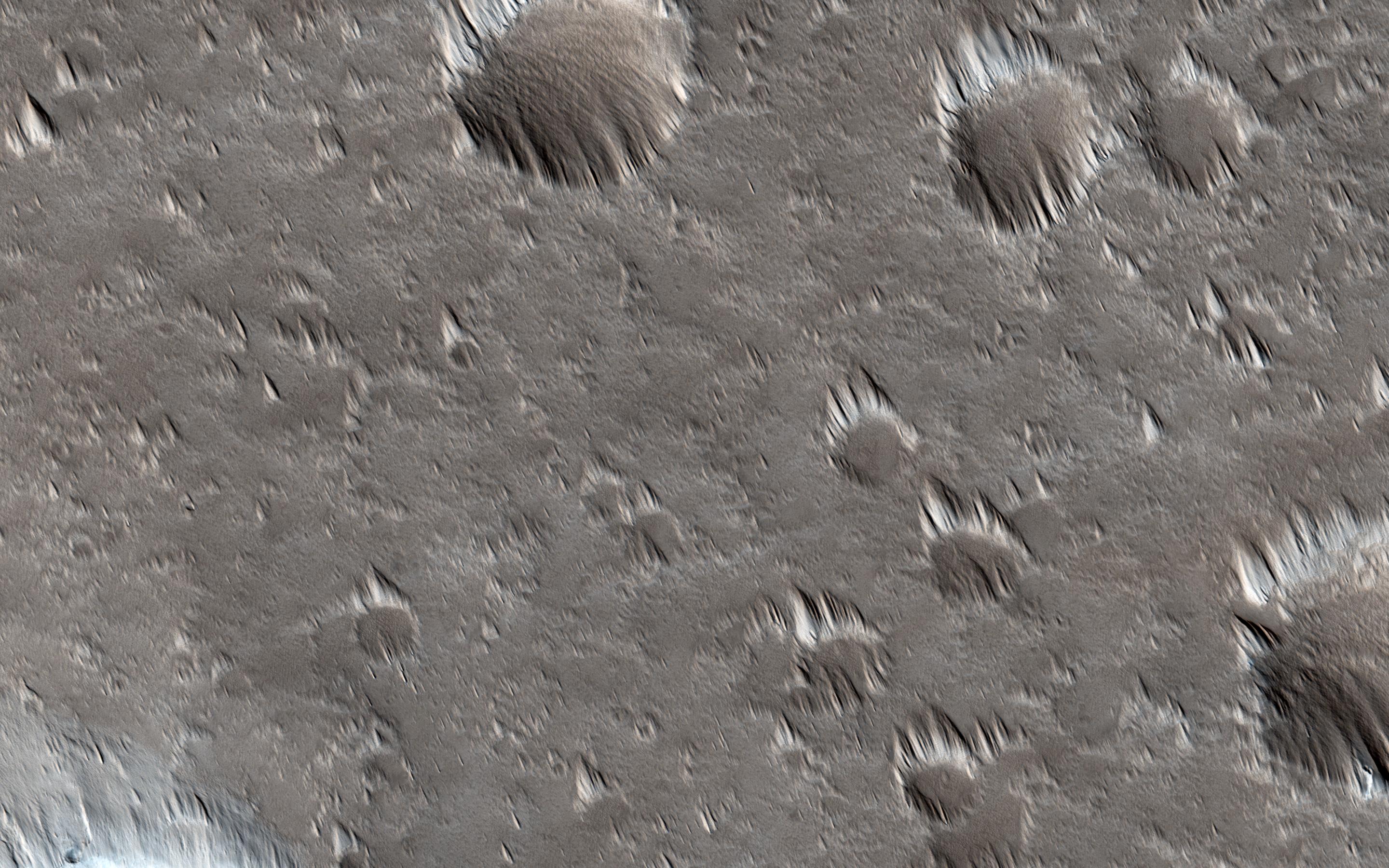
Migrating and Static Sand Ripples on Mars
Full Resolution:
TIFF
(15.56 MB)
JPEG
(820.1 kB)
|
|
|
2013-09-03 |
Mars
|
Mars Reconnaissance Orbiter (MRO)
|
HiRISE
|
2880x1800x3 |
|
-
PIA17647:
-
Gullied Massif in the Nereidum Montes
Full Resolution:
TIFF
(15.56 MB)
JPEG
(1.114 MB)
|
|
|
2013-09-03 |
Mars
|
Mars Reconnaissance Orbiter (MRO)
|
HiRISE
|
2880x1800x3 |
|
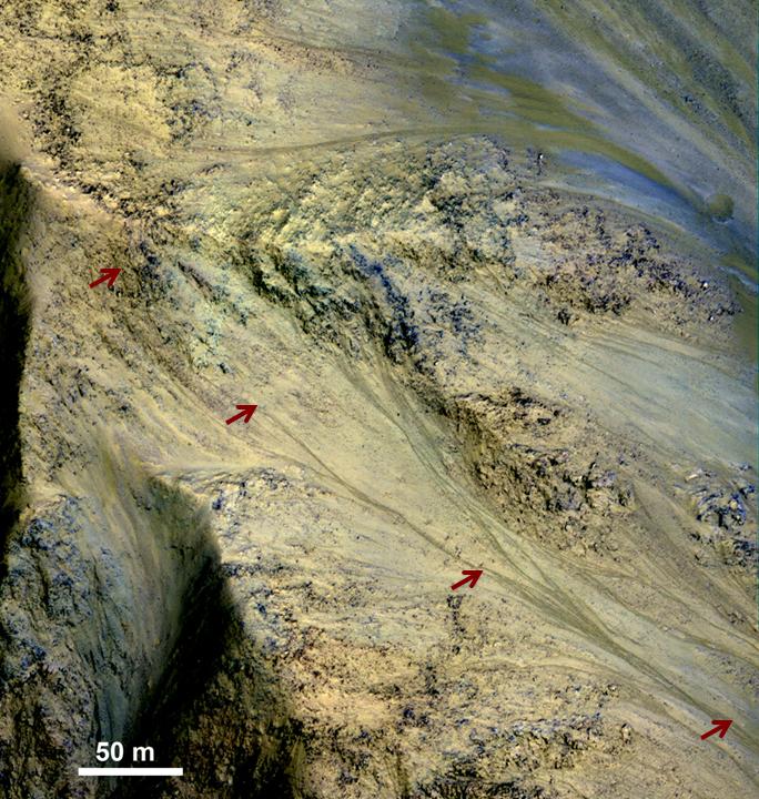
-
PIA17648:
-
Slope Lineae along Coprates Chasma Ridge
Full Resolution:
TIFF
(15.56 MB)
JPEG
(862.3 kB)
|
|
|
2013-09-12 |
Mars
|
Mars Reconnaissance Orbiter (MRO)
|
HiRISE
|
2880x1800x3 |
|
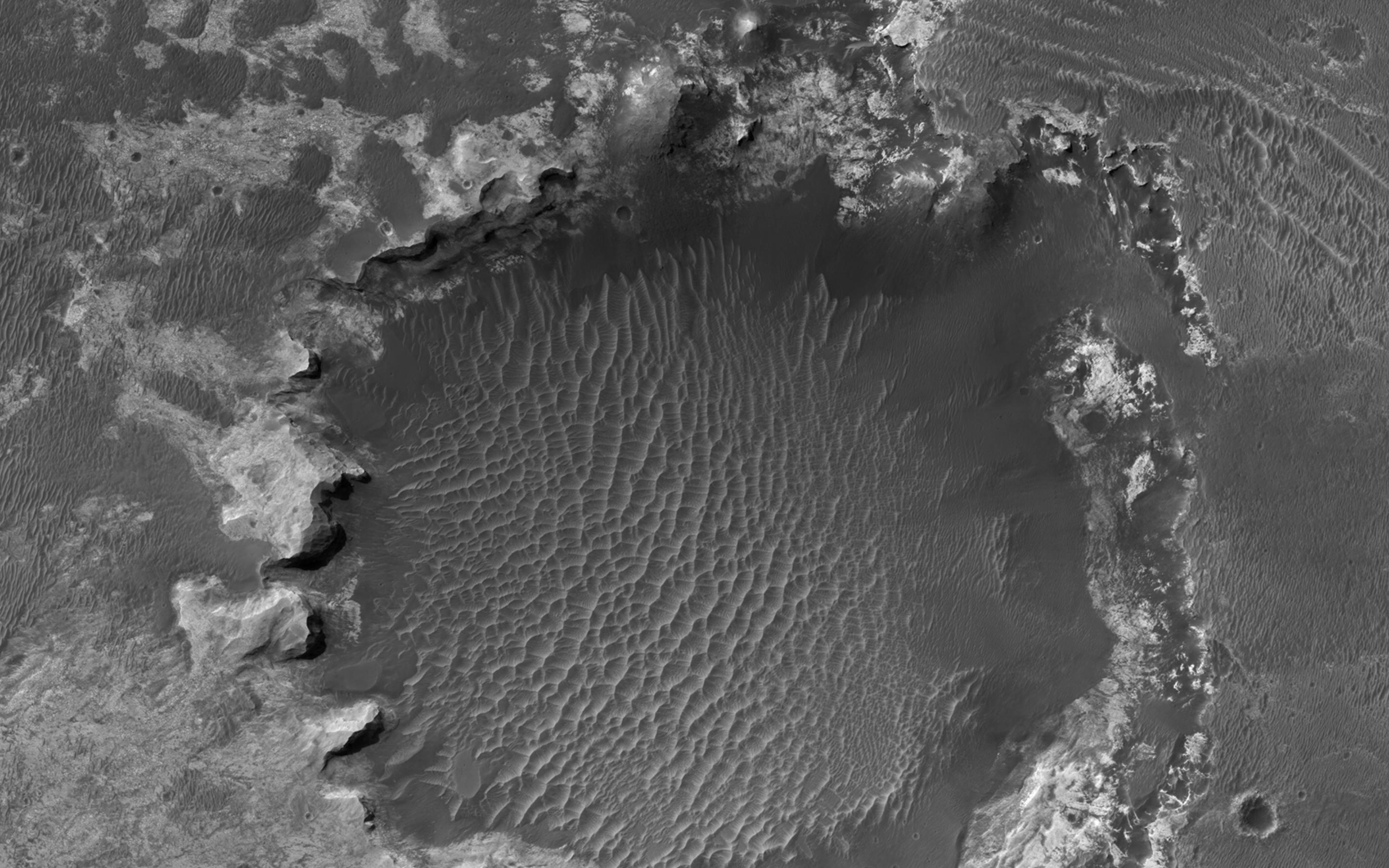
-
PIA17630:
-
Layers, Bedrock Ridges, and Dark Sand in Schiaparelli Crater
Full Resolution:
TIFF
(15.56 MB)
JPEG
(908.3 kB)
|
|
|
2013-09-12 |
Mars
|
Mars Reconnaissance Orbiter (MRO)
|
HiRISE
|
2880x1800x3 |
|
-
PIA17631:
-
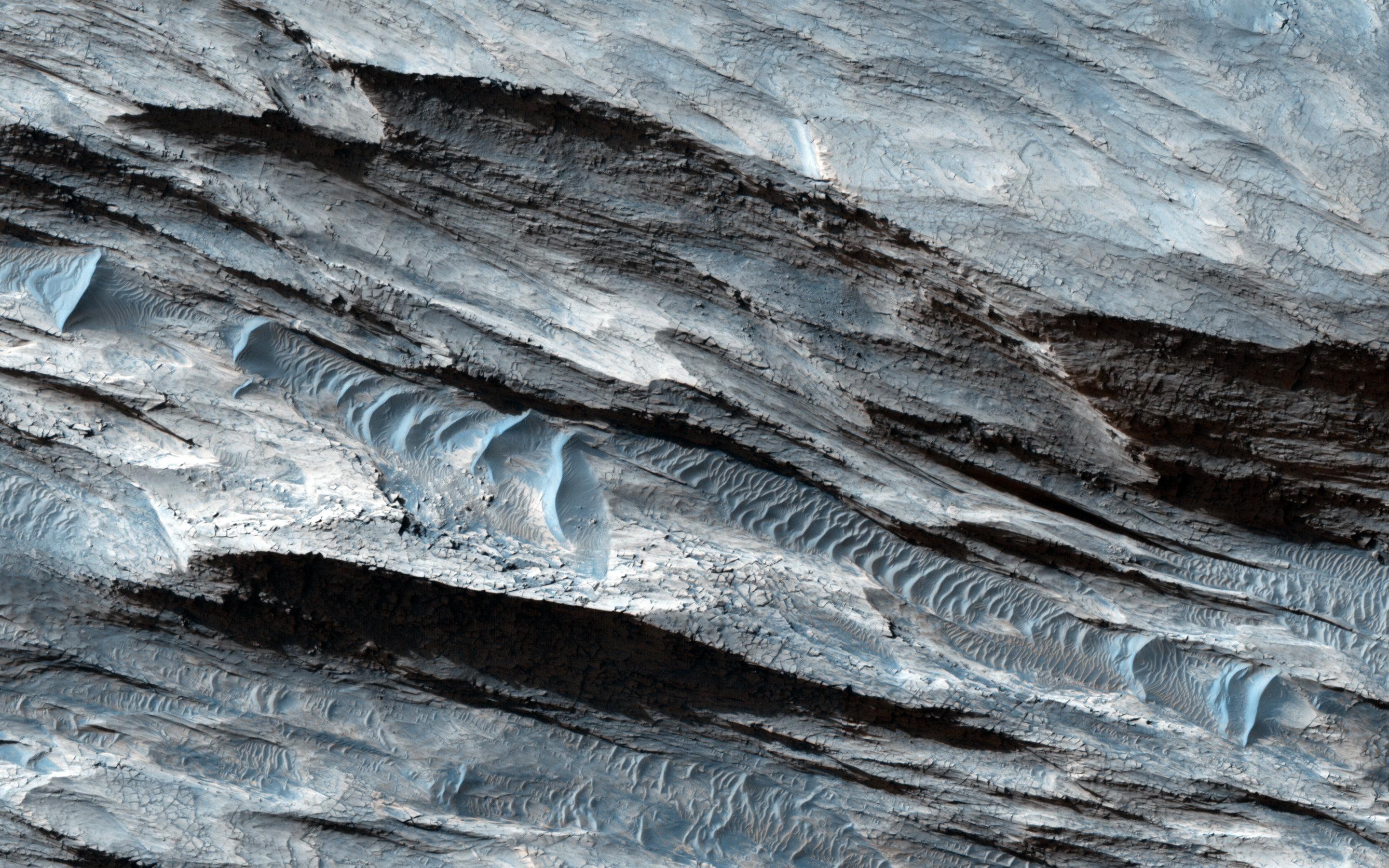
Terraced Craters and Layered Targets
Full Resolution:
TIFF
(15.56 MB)
JPEG
(1.341 MB)
|
|
|
2013-09-18 |
Mars
|
Mars Reconnaissance Orbiter (MRO)
|
HiRISE
|
2880x1800x3 |
|
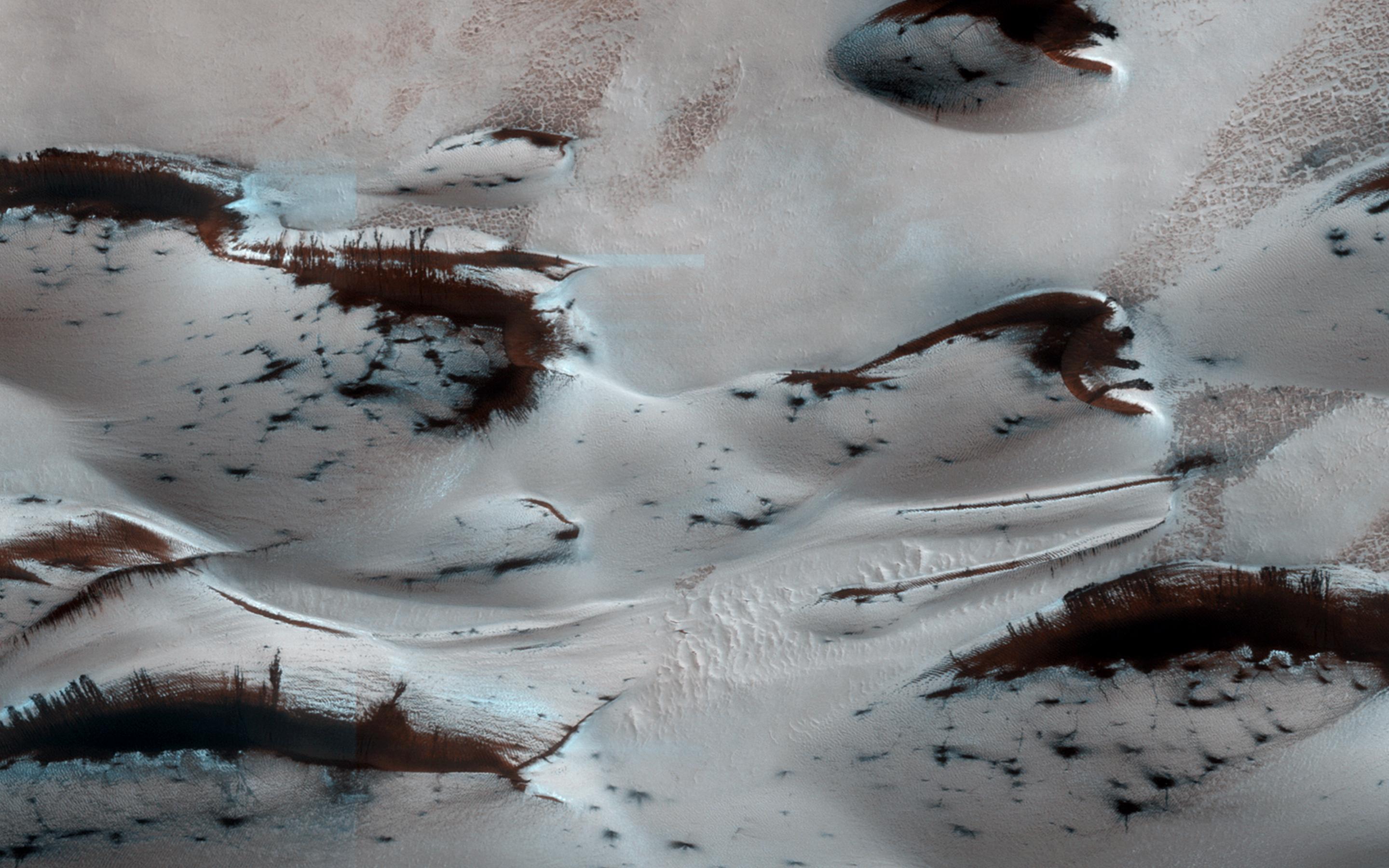
-
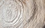
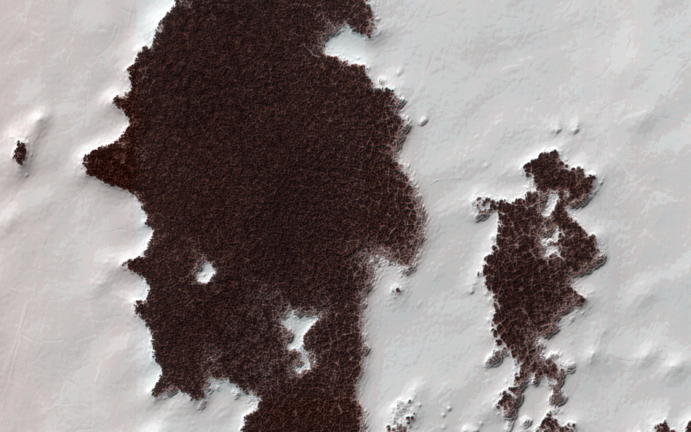
PIA17628:
-
Two Generations of Windblown Sediments
Full Resolution:
TIFF
(15.56 MB)
JPEG
(641.7 kB)
|
|
|
2013-09-18 |
Mars
|
Mars Reconnaissance Orbiter (MRO)
|
HiRISE
|
2880x1800x3 |
|
-
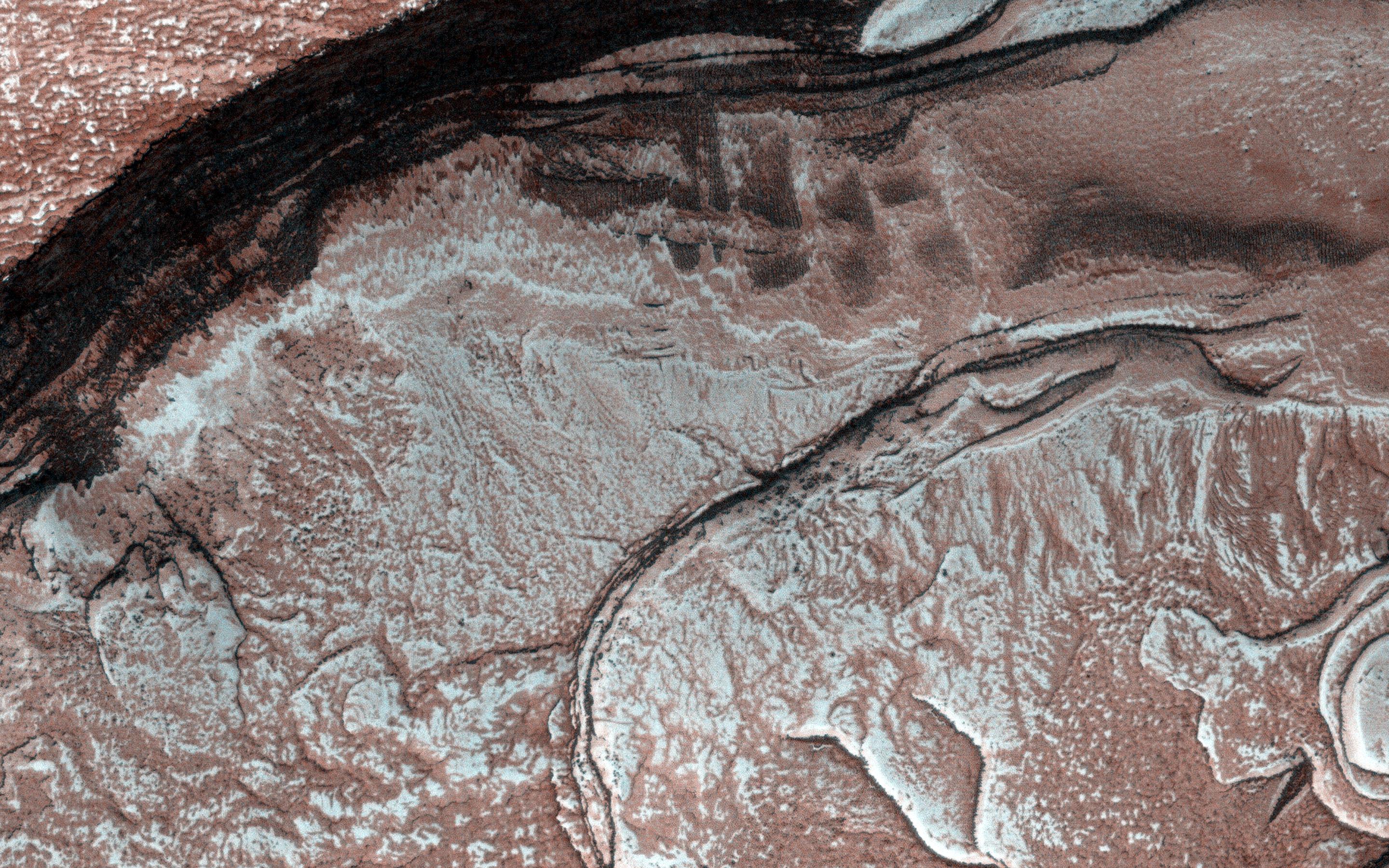
PIA17629:
-
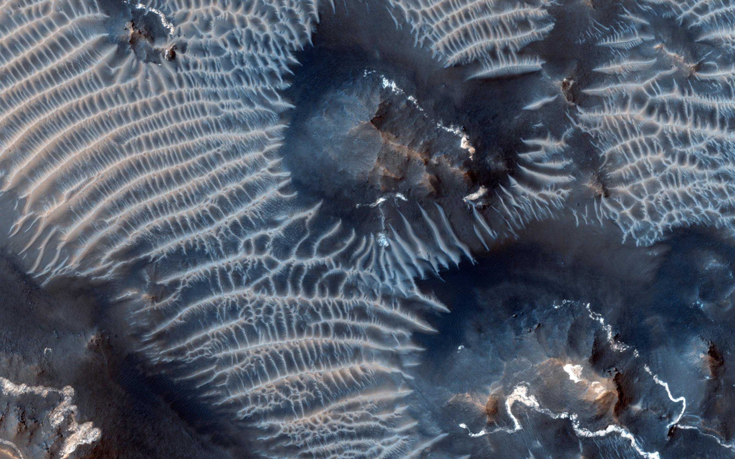
Martian Glaciers and Brain Terrain
Full Resolution:
TIFF
(15.56 MB)
JPEG
(1.045 MB)
|
|
|
2013-10-02 |
Mars
|
Mars Reconnaissance Orbiter (MRO)
|
HiRISE
|
2880x1800x1 |

|
-
PIA17575:
-
Differential Compaction around a Crater Peak
Full Resolution:
TIFF
(5.191 MB)
JPEG
(915.7 kB)
|
|
|
2013-10-02 |
Mars
|
Mars Reconnaissance Orbiter (MRO)
|
HiRISE
|
2880x1800x3 |
|
-
PIA17572:
-
Aligned Scallops
Full Resolution:
TIFF
(15.56 MB)
JPEG
(1.475 MB)
|
|
|
2013-10-02 |
Mars
|
Mars Reconnaissance Orbiter (MRO)
|
HiRISE
|
1898x1007x3 |
|
-
PIA17573:
-
Colorful Dunes
Full Resolution:
TIFF
(5.736 MB)
JPEG
(301.4 kB)
|
|
|
2013-10-16 |
Mars
|
Mars Reconnaissance Orbiter (MRO)
|
HiRISE
|
2880x1800x3 |
|
-
PIA17548:
-
Fall Frosting
Full Resolution:
TIFF
(15.56 MB)
JPEG
(887.8 kB)
|
|
|
2013-10-16 |
Mars
|
Mars Reconnaissance Orbiter (MRO)
|
HiRISE
|
2880x1800x3 |
|
-
PIA17549:
-
Possible Impacts from MSL Hardware
Full Resolution:
TIFF
(15.56 MB)
JPEG
(1.513 MB)
|
|
|
2013-10-16 |
Mars
|
Mars Reconnaissance Orbiter (MRO)
|
HiRISE
|
2880x1800x3 |
|
-
PIA17570:
-
Bedding Details in Layered Rock
Full Resolution:
TIFF
(15.56 MB)
JPEG
(600.1 kB)
|
|
|
2013-10-16 |
Mars
|
Mars Reconnaissance Orbiter (MRO)
|
HiRISE
|
2880x1800x3 |
|
-
PIA17571:
-
Fretted Terrains and Ground Deformation
Full Resolution:
TIFF
(15.56 MB)
JPEG
(1.05 MB)
|
|
|
2013-10-17 |
Mars
|
Mars Reconnaissance Orbiter (MRO)
|
HiRISE
|
1920x1080x3 |

|
-
PIA17447:
-
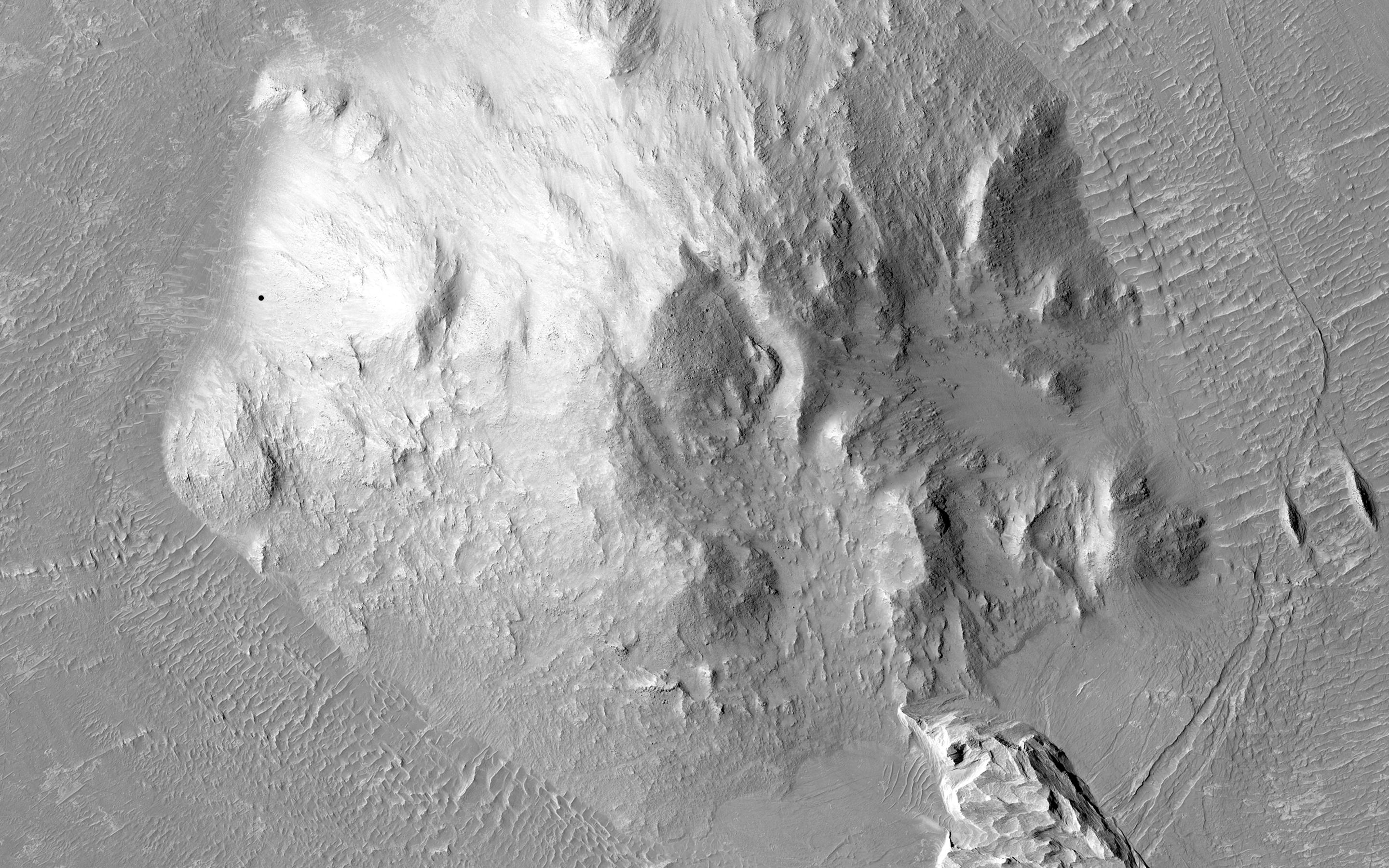
Mountainous Crater Rim on Mars
Full Resolution:
TIFF
(6.223 MB)
JPEG
(169.6 kB)
|
|
|
2013-10-18 |
Mars
|
Mars Reconnaissance Orbiter (MRO)
|
HiRISE
|
2880x1800x1 |
|
-
PIA17574:
-
Sinuous Ridge Cutting Across Geologic Units of the Medusae Fossae Formation
Full Resolution:
TIFF
(5.191 MB)
JPEG
(1.039 MB)
|
|
|
2013-10-30 |
Mars
|
Mars Reconnaissance Orbiter (MRO)
|
HiRISE
|
2880x1800x3 |
|
-
PIA17623:
-
Spring Slide
Full Resolution:
TIFF
(15.56 MB)
JPEG
(659.6 kB)
|
|
|
2013-10-30 |
Mars
|
Mars Reconnaissance Orbiter (MRO)
|
HiRISE
|
2880x1800x3 |
|
-
PIA17624:
-
Beautiful Layers in the Central Uplift of Mazamba Crater
Full Resolution:
TIFF
(15.56 MB)
JPEG
(935.8 kB)
|
|
|
2013-10-30 |
Mars
|
Mars Reconnaissance Orbiter (MRO)
|
HiRISE
|
2880x1800x3 |
|
-
PIA17625:
-
Enigmatic Channels on the Floor of Mangala Valles
Full Resolution:
TIFF
(15.56 MB)
JPEG
(1.052 MB)
|
|
|
2013-10-30 |
Mars
|
Mars Reconnaissance Orbiter (MRO)
|
HiRISE
|
2880x1800x3 |

|
-
PIA17626:
-
Martian Thunderbird
Full Resolution:
TIFF
(5.191 MB)
JPEG
(1.13 MB)
|
|
|
2013-11-06 |
Mars
|
Mars Reconnaissance Orbiter (MRO)
|
HiRISE
|
2880x1800x3 |
|
-
PIA17670:
-
Dust Covered Channels on Tharsis Tholus
Full Resolution:
TIFF
(15.56 MB)
JPEG
(747.6 kB)
|
|
|
2013-11-06 |
Mars
|
Mars Reconnaissance Orbiter (MRO)
|
HiRISE
|
2880x1800x3 |
|
-
PIA17671:
-
Hints of an Ancient Shoreline in Southern Isidis Planitia
Full Resolution:
TIFF
(15.56 MB)
JPEG
(1.058 MB)
|
|
|
2013-11-06 |
Mars
|
Mars Reconnaissance Orbiter (MRO)
|
HiRISE
|
2880x1800x3 |
|
-
PIA17672:
-
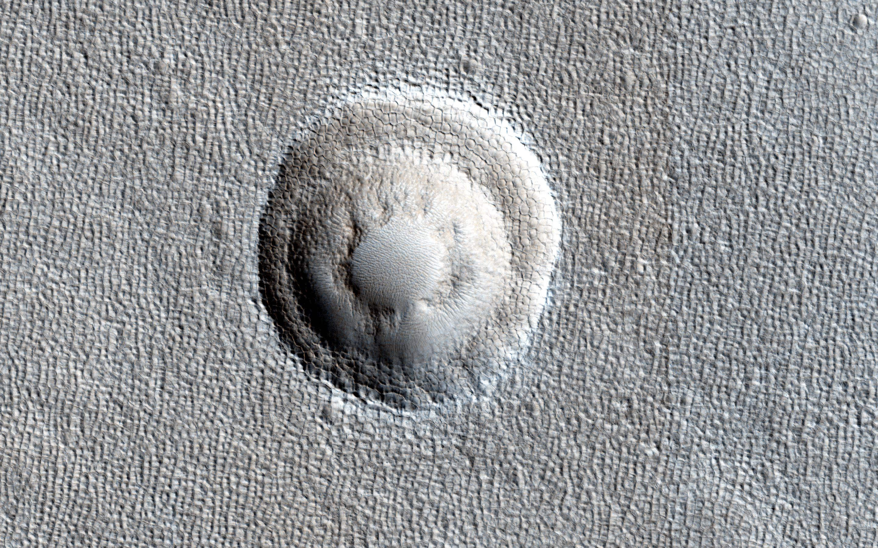
Breached Rim of a Circular Depression
Full Resolution:
TIFF
(15.56 MB)
JPEG
(617.4 kB)
|
|
|
2013-11-06 |
Mars
|
Mars Reconnaissance Orbiter (MRO)
|
HiRISE
|
2880x1800x3 |
|
-
PIA17673:
-
Cratered Cones in Tartarus Montes
Full Resolution:
TIFF
(15.56 MB)
JPEG
(783.3 kB)
|
|
|
2013-11-08 |
Mars
|
Mars Reconnaissance Orbiter (MRO)
|
HiRISE
|
1280x960x3 |
|
-
PIA17675:
-
Dunes on the Rim of the Hellas Impact Basin
Full Resolution:
TIFF
(3.688 MB)
JPEG
(290.9 kB)
|
|
|
2013-11-13 |
Mars
|
Mars Reconnaissance Orbiter (MRO)
|
HiRISE
|
2880x1800x1 |
|
-
PIA17688:
-
Rafts of Lava with Strange Infrared Properties
Full Resolution:
TIFF
(5.191 MB)
JPEG
(1.161 MB)
|
|
|
2013-11-13 |
Mars
|
Mars Reconnaissance Orbiter (MRO)
|
HiRISE
|
2880x1800x1 |

|
-
PIA17689:
-
Crater with Trough in Utopia Rupes
Full Resolution:
TIFF
(5.191 MB)
JPEG
(856.5 kB)
|
|
|
2013-11-13 |
Mars
|
Mars Reconnaissance Orbiter (MRO)
|
HiRISE
|
2880x1800x3 |
|
-
PIA17690:
-
Linear Ridges
Full Resolution:
TIFF
(15.56 MB)
JPEG
(474.1 kB)
|
|
|
2013-11-13 |
Mars
|
Mars Reconnaissance Orbiter (MRO)
|
HiRISE
|
2880x1800x3 |
|
-
PIA17691:
-
Sandstone Cliffs and Hematite Lag Deposits of Ophir Mensa
Full Resolution:
TIFF
(15.56 MB)
JPEG
(750.2 kB)
|
|
|
2013-11-13 |
Mars
|
Mars Reconnaissance Orbiter (MRO)
|
HiRISE
|
1152x1072x1 |

|
-
PIA17587:
-
'Murray Buttes' at Foot of Mount Sharp on Mars
Full Resolution:
TIFF
(1.236 MB)
JPEG
(248 kB)
|
|
|
2013-11-13 |
Mars
|
Mars Exploration Rover (MER)
Mars Reconnaissance Orbiter (MRO)
|
HiRISE
|
8192x4298x3 |
|
-
PIA17586:
-
A New Perspective on Murray Ridge
Full Resolution:
TIFF
(105.7 MB)
JPEG
(2.803 MB)
|
|
|
2013-11-20 |
Mars
|
Mars Reconnaissance Orbiter (MRO)
|
HiRISE
|
2880x1800x1 |

|
-
PIA17701:
-
Nirgal Vallis Tributaries
Full Resolution:
TIFF
(5.191 MB)
JPEG
(826.1 kB)
|
|
|
2013-11-20 |
Mars
|
Mars Reconnaissance Orbiter (MRO)
|
HiRISE
|
2880x1800x3 |
|
-
PIA17702:
-
Hydrated Sulfate Landslides in Ophir Chasma
Full Resolution:
TIFF
(15.56 MB)
JPEG
(801 kB)
|
|
|
2013-11-20 |
Mars
|
Mars Reconnaissance Orbiter (MRO)
|
HiRISE
|
2880x1800x3 |
|
-
PIA17703:
-
A Textured Mesa
Full Resolution:
TIFF
(15.56 MB)
JPEG
(751.1 kB)
|
|
|
2013-11-20 |
Mars
|
Mars Reconnaissance Orbiter (MRO)
|
HiRISE
|
2880x1800x3 |

|
-
PIA17704:
-
Martian Intersection
Full Resolution:
TIFF
(15.56 MB)
JPEG
(703.6 kB)
|
|
|
2013-12-03 |
Mars
|
Mars Exploration Rover (MER)
Mars Reconnaissance Orbiter (MRO)
|
CTX
|
4731x3605x3 |
|
-
PIA17589:
-
Opportunity's Journey, Approaching 10th Anniversary
Full Resolution:
TIFF
(51.19 MB)
JPEG
(3.199 MB)
|
|
|
2013-12-09 |
Mars
|
Mars Reconnaissance Orbiter (MRO)
Mars Science Laboratory (MSL)
|
CTX
|
3300x2550x3 |
|
-
PIA17596:
-
Possible Extent of Ancient Lake in Gale Crater, Mars
Full Resolution:
TIFF
(25.26 MB)
JPEG
(1.34 MB)
|
|
|
2013-12-09 |
Mars
|
Mars Reconnaissance Orbiter (MRO)
Mars Science Laboratory (MSL)
|
HiRISE
|
960x720x3 |
|
-
PIA17597:
-
Erosion Patterns May Guide Mars Rover to Rocks Recently Exposed
Full Resolution:
TIFF
(2.075 MB)
JPEG
(87.76 kB)
|
|
|
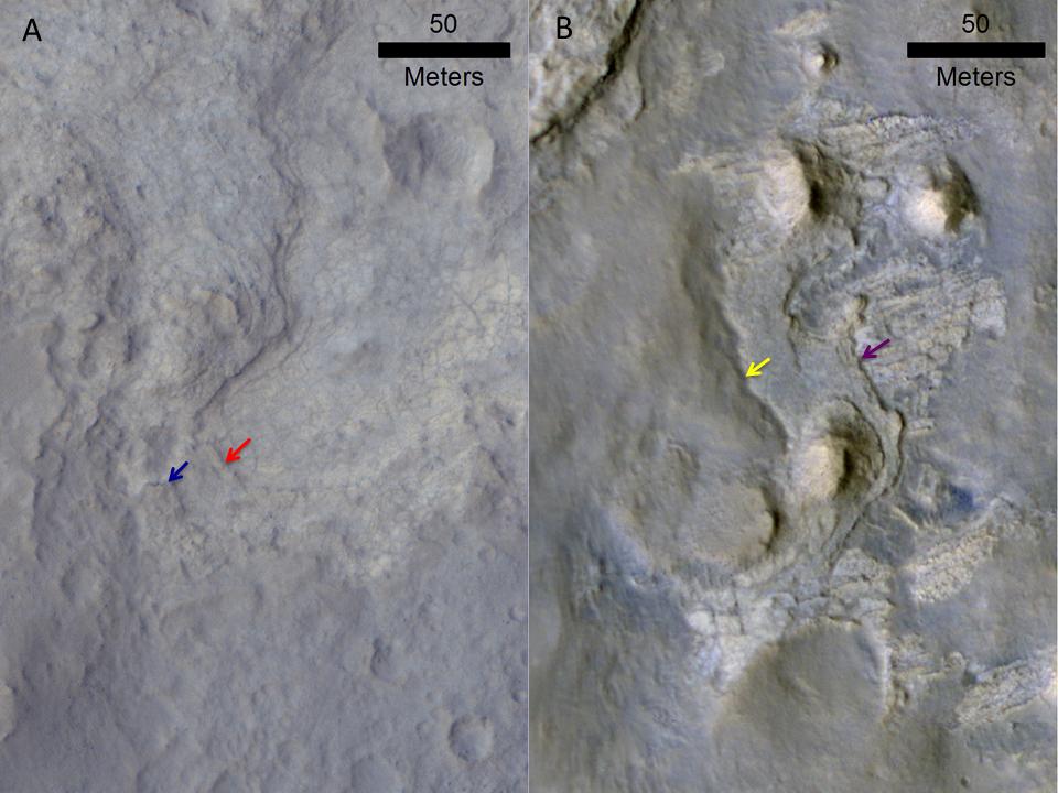
2013-12-10 |
Mars
|
Mars Reconnaissance Orbiter (MRO)
|
HiRISE
|
684x720x3 |
|
-
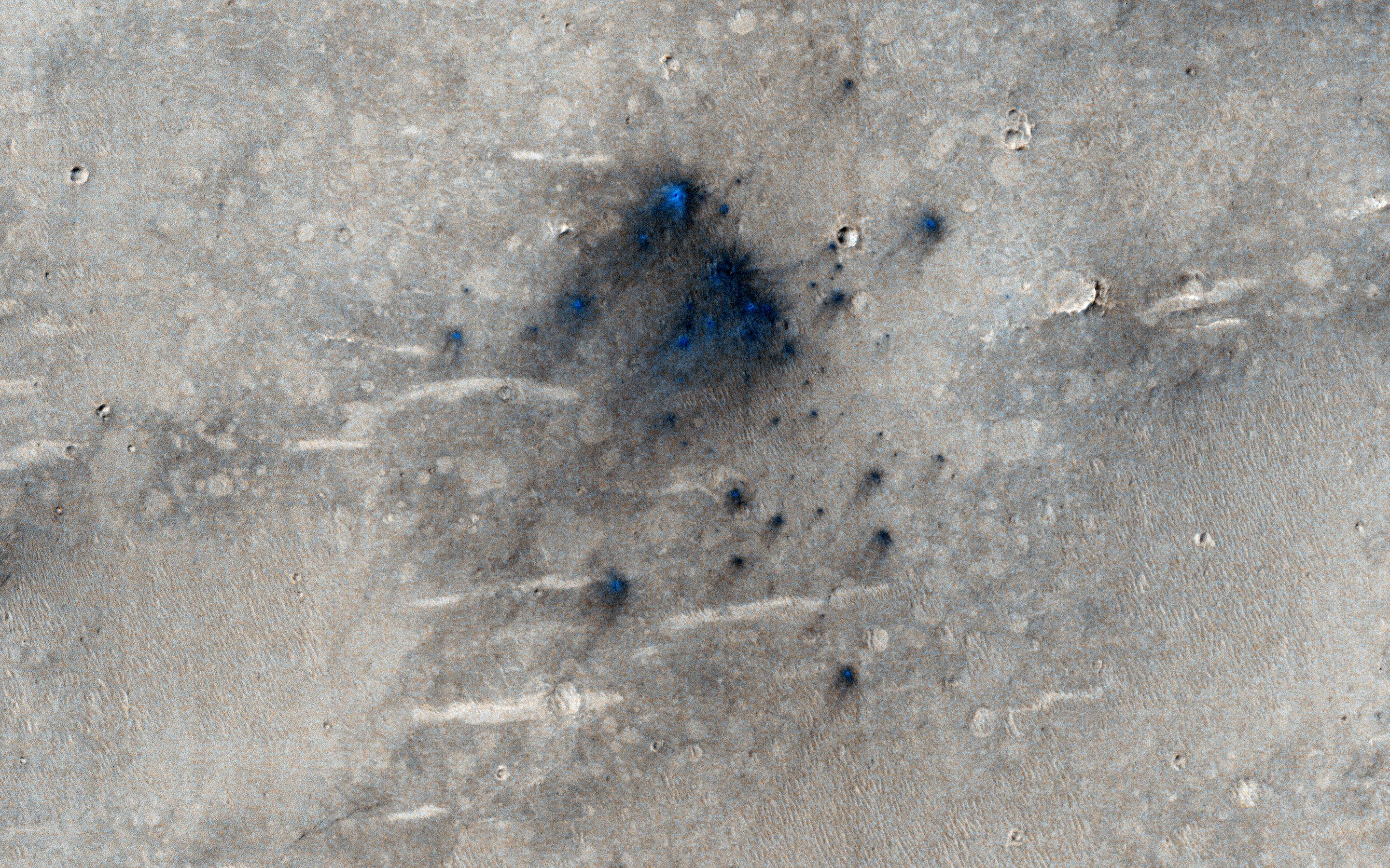
PIA17605:
-
Long, Recurring Linear Marking on Martian Slope
Full Resolution:
TIFF
(1.478 MB)
JPEG
(128 kB)
|
|
|
2013-12-10 |
Mars
|
Mars Reconnaissance Orbiter (MRO)
|
HiRISE
|
1653x1352x3 |
|
-
PIA17606:
-
Seasonal Changes in Dark Marks on an Equatorial Martian Slope

Full Resolution:
TIFF
(2.239 MB)
JPEG
(426.6 kB)
|
|
|
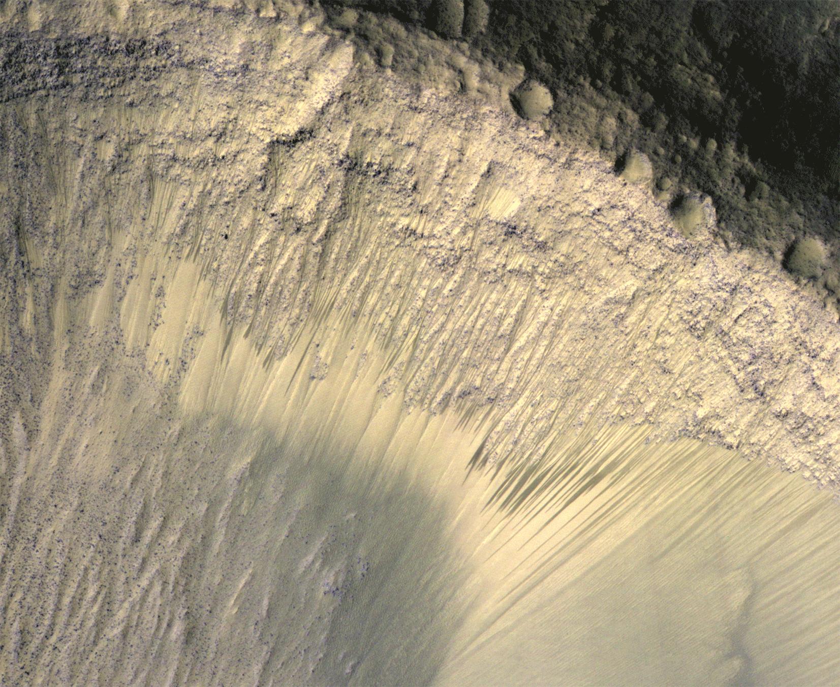
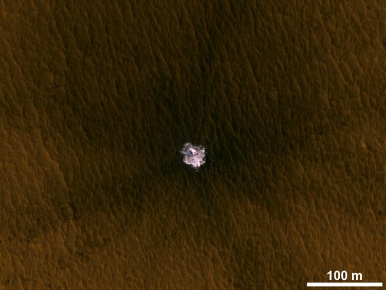
2013-12-10 |
Mars
|
Mars Reconnaissance Orbiter (MRO)
|
HiRISE
|
751x564x3 |

|
-
PIA17608:
-
Fresh Crater Exposing Buried Ice on Mid-Latitude Mars
Full Resolution:
TIFF
(1.271 MB)
JPEG
(46.92 kB)
|
|
|
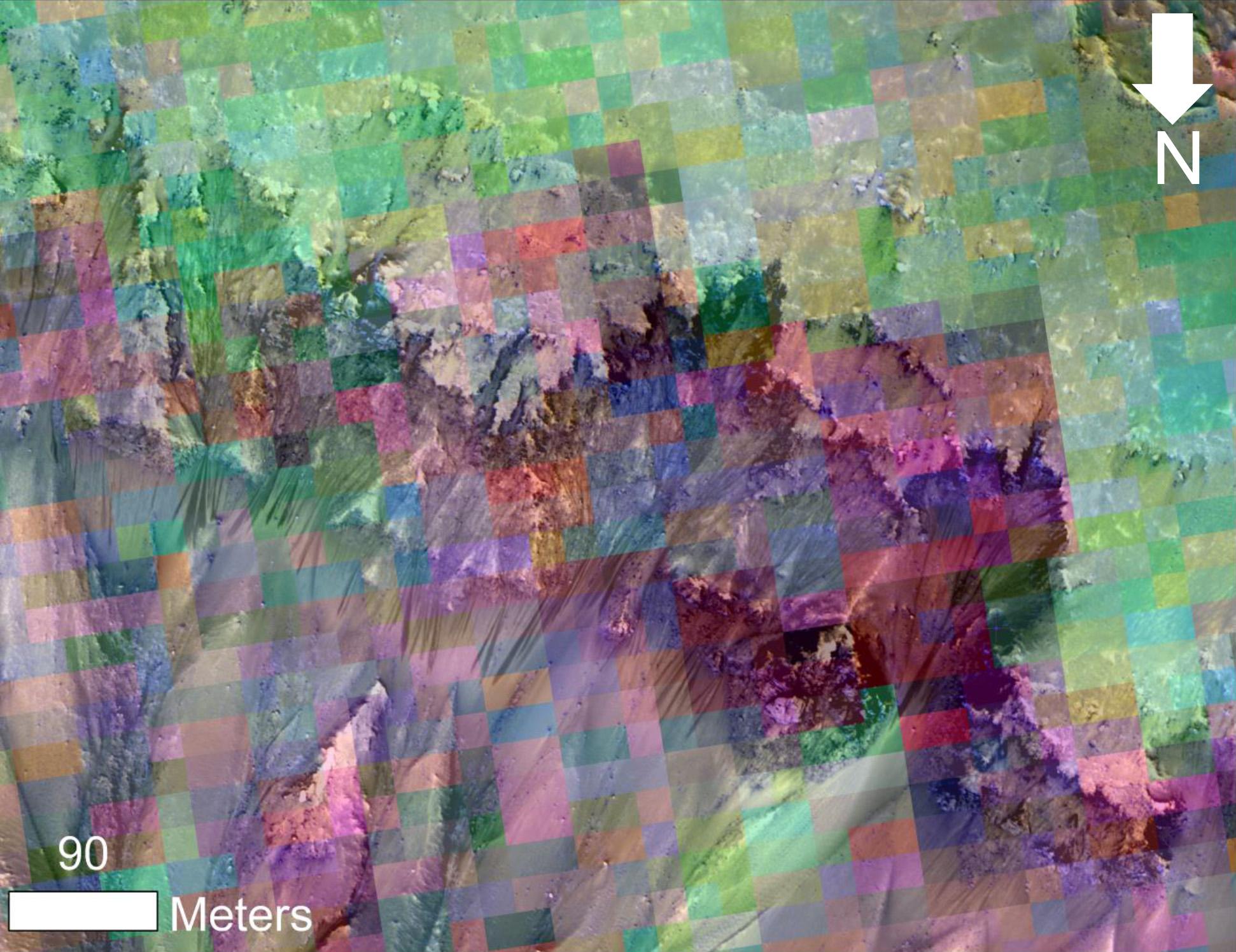
2013-12-10 |
Mars
|
Mars Reconnaissance Orbiter (MRO)
|
HiRISE
|
1020x765x3 |
|
-
PIA17750:
-
Mars Orbiter Laser Altimeter, Thermal Emission Imaging System
Full Resolution:
TIFF
(2.342 MB)
JPEG
(100.8 kB)
|
|
|
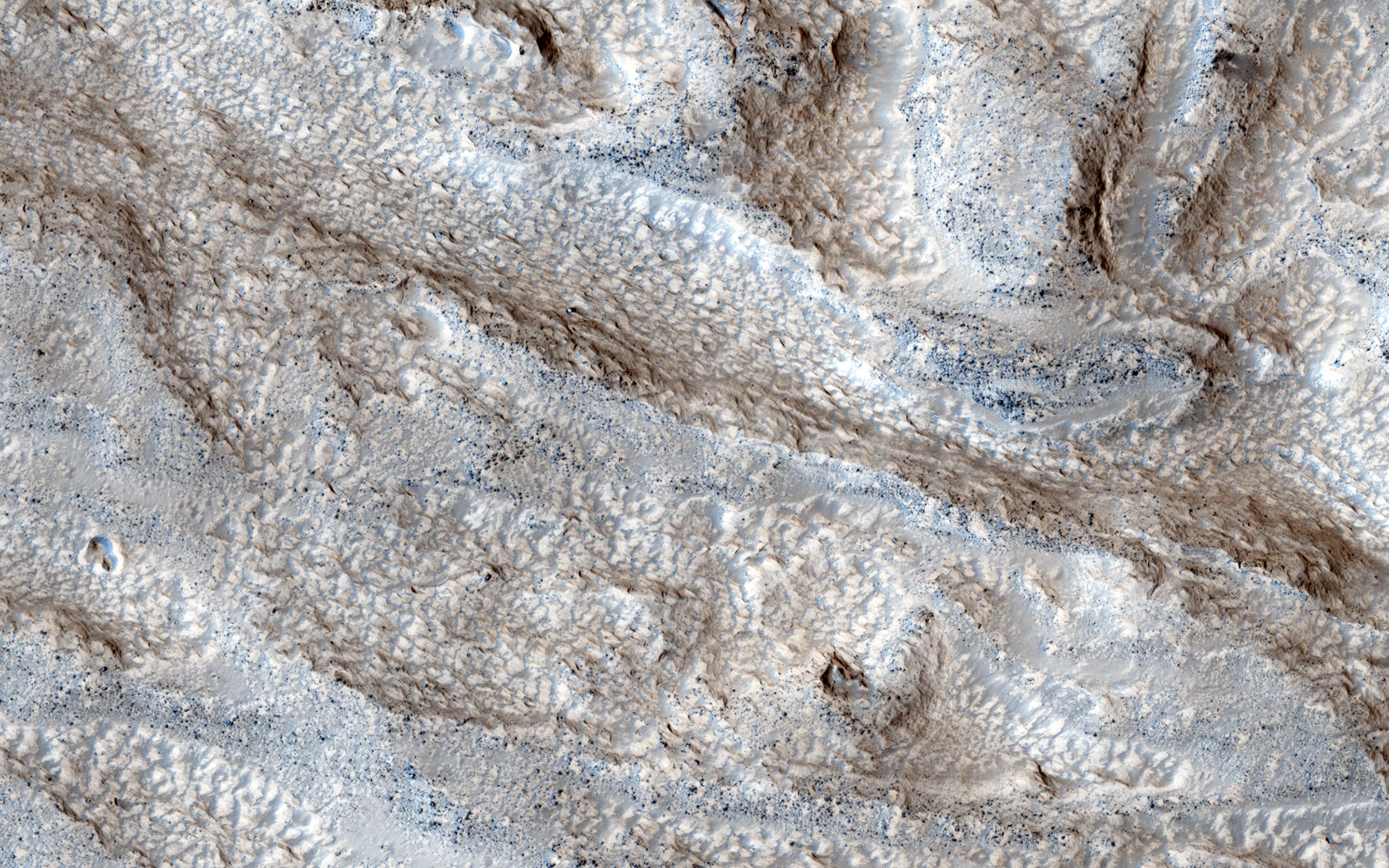
2014-01-09 |
Mars
|
Mars Reconnaissance Orbiter (MRO)
|
HiRISE
|
2560x1920x3 |
|
-
PIA17857:
-
Rippled Surfaces on a Slope in Coloe Fossae
Full Resolution:
TIFF
(14.75 MB)
JPEG
(799.1 kB)
|
|
|
2014-01-09 |
Mars
|
Mars Reconnaissance Orbiter (MRO)
|
HiRISE
|
2560x1920x3 |
|
-
PIA17858:
-
Banded Ridges in Hellas
Full Resolution:
TIFF
(14.75 MB)
JPEG
(1.041 MB)
|
|
|
2014-01-09 |
Mars
|
Mars Reconnaissance Orbiter (MRO)
|
HiRISE
|
2560x1920x3 |

|
-
PIA17859:
-
The Obliquity of Mars (Periodic Bedding in Tithonium Chasma)
Full Resolution:
TIFF
(14.75 MB)
JPEG
(749 kB)
|
|
|
2014-01-09 |
Mars
|
Mars Reconnaissance Orbiter (MRO)
|
HiRISE
|
2120x2419x3 |
|
-
PIA17754:
-
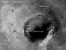
Curiosity Rover Tracks, Viewed from Orbit in December 2013
Full Resolution:
TIFF
(15.39 MB)
JPEG
(813.9 kB)
|
|
|
2014-01-09 |
Mars
|
Mars Reconnaissance Orbiter (MRO)
|
HiRISE
|
2016x1464x1 |
|
-
PIA17755:
-
Curiosity Trekking, Viewed from Orbit in December 2013
Full Resolution:
TIFF
(2.955 MB)
JPEG
(386.4 kB)
|
|
|
2014-01-15 |
Mars
|
Mars Reconnaissance Orbiter (MRO)
|
HiRISE
|
2560x1920x3 |
|
-
PIA17873:
-
Dunes on the Rim of the Hellas Impact Basin
Full Resolution:
TIFF
(14.75 MB)
JPEG
(1.248 MB)
|
|
|
2014-01-15 |
Mars
|
Mars Reconnaissance Orbiter (MRO)
|
HiRISE
|
2560x1920x3 |
|
-
PIA17874:
-
Recent Volcanism in Valles Marineris
Full Resolution:
TIFF
(14.75 MB)
JPEG
(836.7 kB)
|
|
|
2014-01-15 |
Mars
|
Mars Reconnaissance Orbiter (MRO)
|
HiRISE
|
2560x1920x3 |
|
-
PIA17875:
-
Looking for Salts on Mars
Full Resolution:
TIFF
(14.75 MB)
JPEG
(849.3 kB)
|
|
|
2014-01-15 |
Mars
|
Mars Reconnaissance Orbiter (MRO)
|
HiRISE
|
2560x1920x3 |

|
-
PIA17876:
-
Fissure near Cerberus Fossae with Tectonic Morphologies
Full Resolution:
TIFF
(14.75 MB)
JPEG
(741.1 kB)
|
|
|
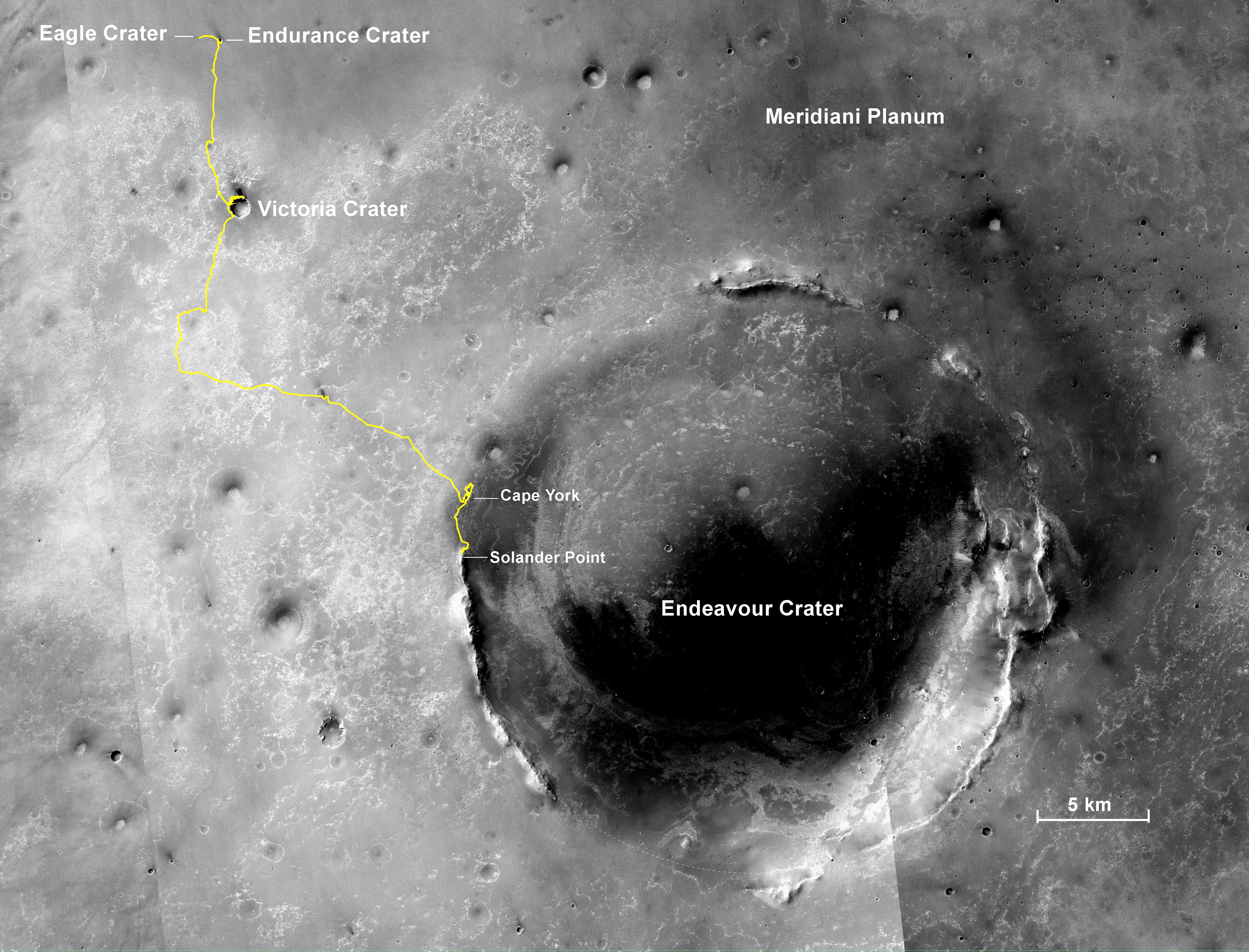
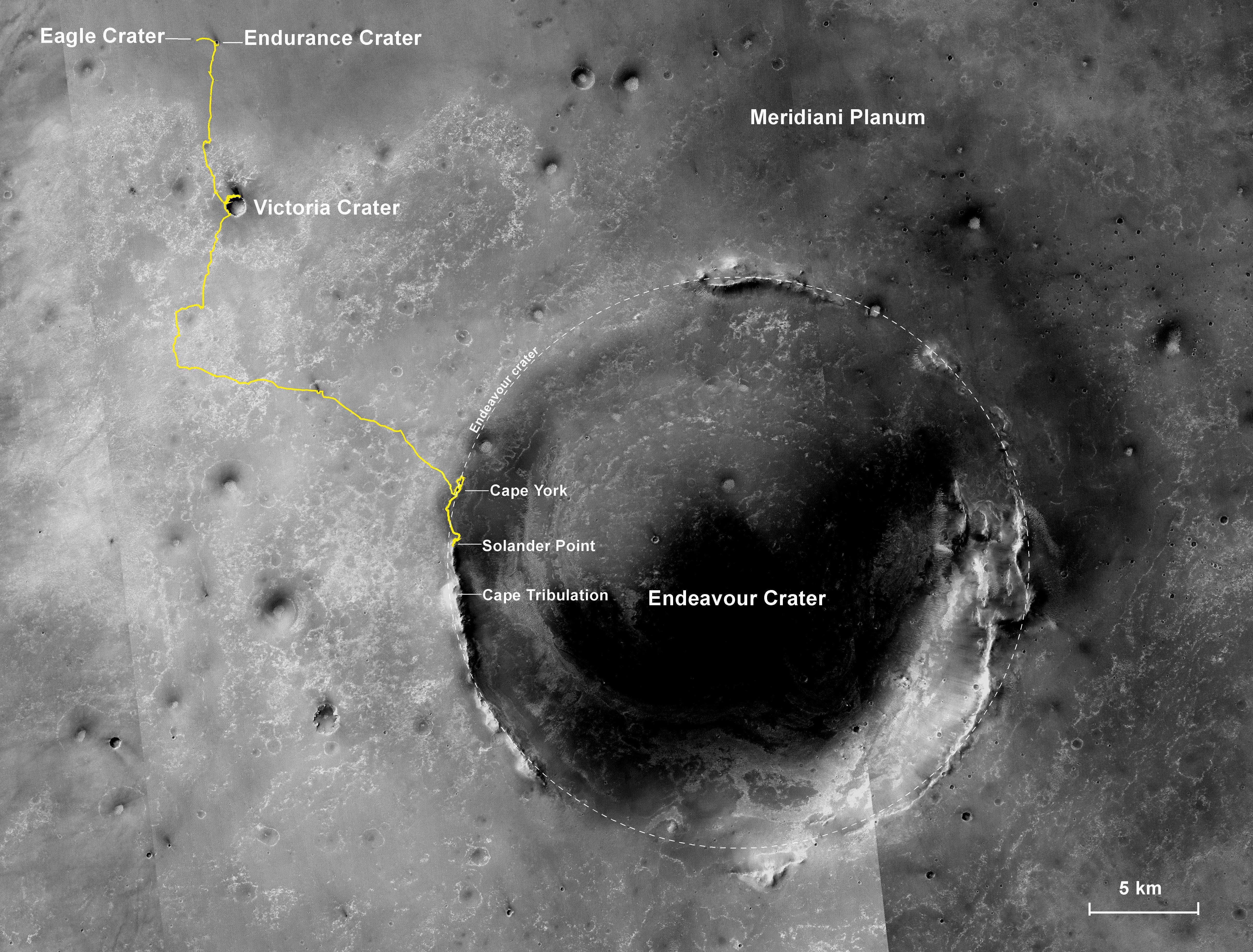
2014-01-23 |
Mars
|
Mars Exploration Rover (MER)
Mars Reconnaissance Orbiter (MRO)
|
HiRISE
|
1064x1265x3 |
|
-
PIA17264:
-
'Cape York' Explored
Full Resolution:
TIFF
(4.04 MB)
JPEG
(138.1 kB)
|
|
|
2014-01-23 |
Mars
|
Mars Exploration Rover (MER)
Mars Reconnaissance Orbiter (MRO)
|
CTX
|
4853x3687x3 |
|
-
PIA17758:
-
Opportunity's First Decade of Driving on Mars
Full Resolution:
TIFF
(53.71 MB)
JPEG
(3.168 MB)
|
|
|
2014-01-29 |
Mars
|
Mars Reconnaissance Orbiter (MRO)
Mars Science Laboratory (MSL)
|
HiRISE
|
3300x2550x3 |
|
-
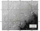
PIA17765:
-
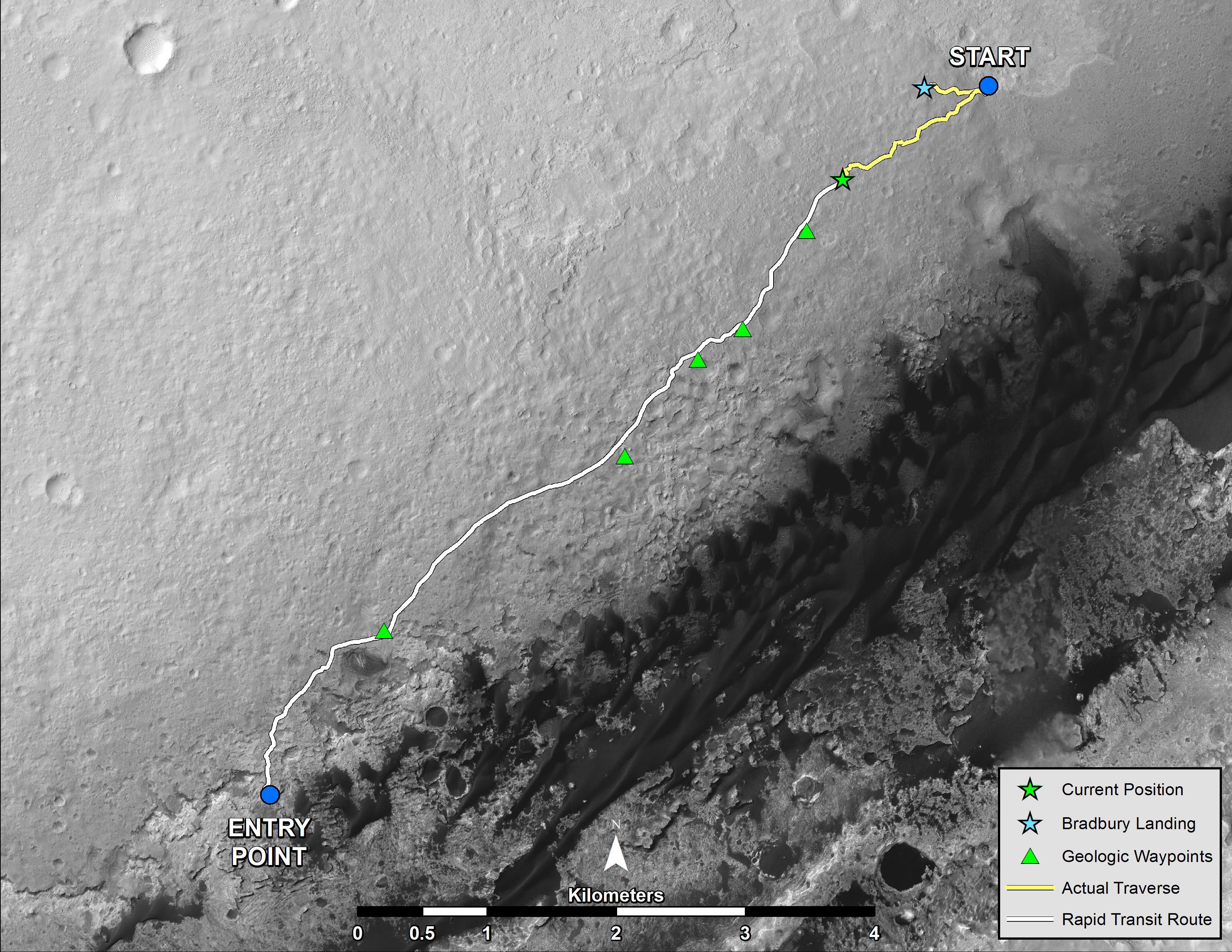
Traverse Map for Mars Rover Curiosity as of Jan. 26, 2014
Full Resolution:
TIFF
(25.26 MB)
JPEG
(1.211 MB)
|
|
|
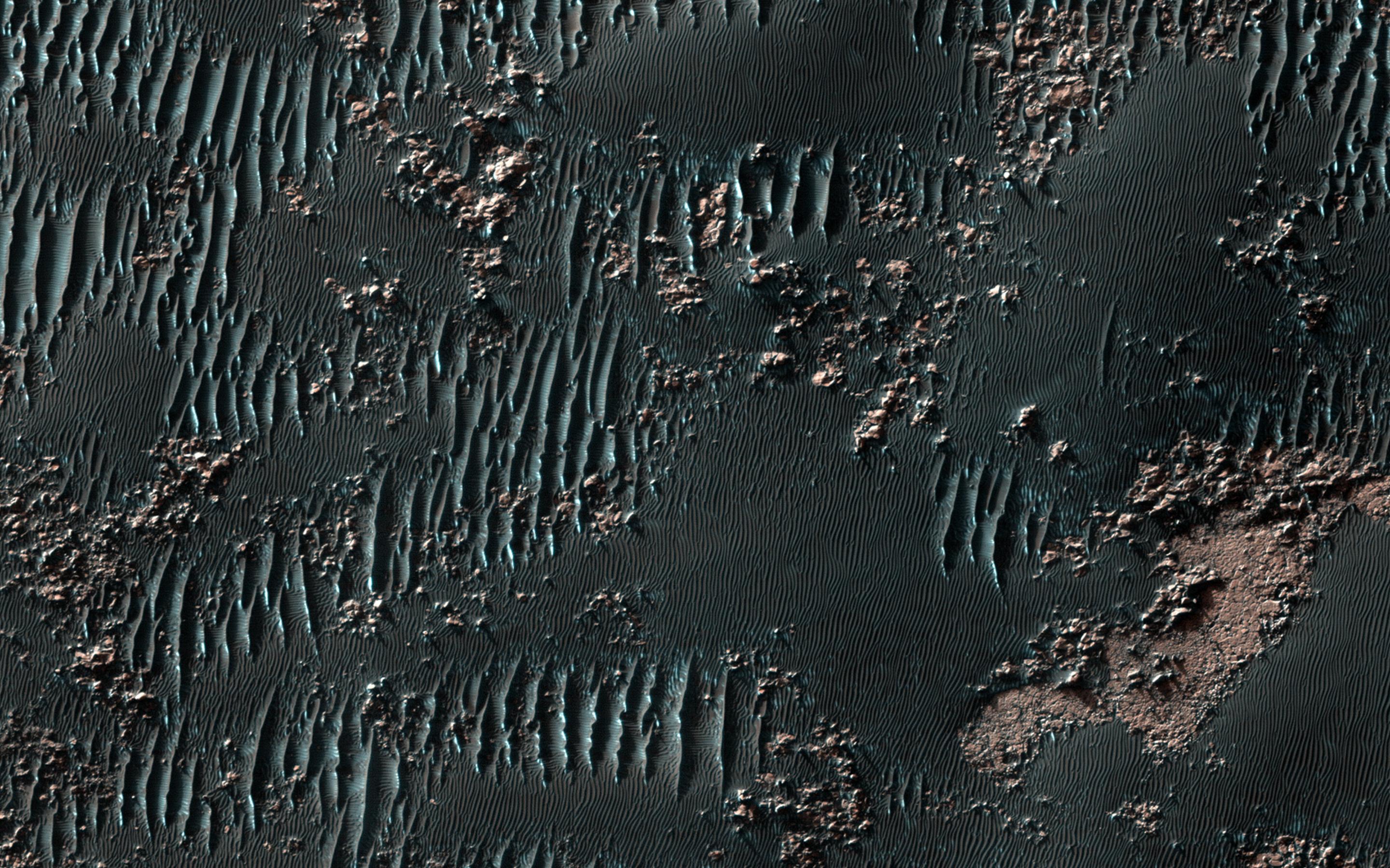
2014-02-05 |
Mars
|
Mars Reconnaissance Orbiter (MRO)
|
HiRISE
|
2880x1800x3 |
|
-
PIA17984:
-
Squiggly Sand Dunes
Full Resolution:
TIFF
(15.56 MB)
JPEG
(923.9 kB)
|
|
|
2014-02-05 |
Mars
|
Mars Reconnaissance Orbiter (MRO)
|
HiRISE
|
2880x1800x3 |
|
-
PIA17985:
-
Channels in Phlegra Montes
Full Resolution:
TIFF
(15.56 MB)
JPEG
(977.8 kB)
|
|
|
2014-02-05 |
Mars
|
Mars Reconnaissance Orbiter (MRO)
|
HiRISE
|
2880x1800x3 |
|
-
PIA17986:
-
Fall Frost Accumulation on Russell Crater Dunes
Full Resolution:
TIFF
(15.56 MB)
JPEG
(962.1 kB)
|
|
|
2014-02-05 |
Mars
|
Mars Reconnaissance Orbiter (MRO)
|
HiRISE
|
1024x768x3 |
|
-
PIA17932:
-
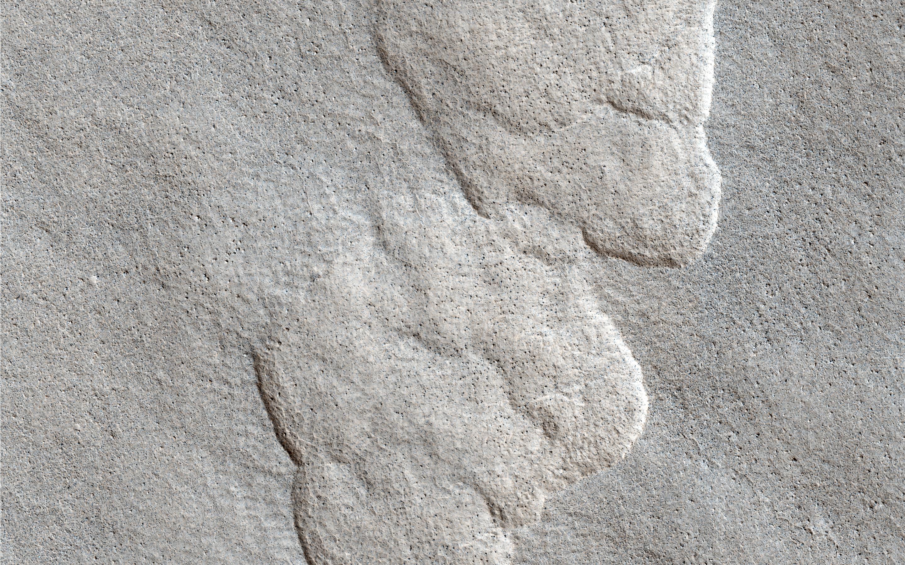
A Spectacular New Martian Impact Crater
Full Resolution:
TIFF
(2.36 MB)
JPEG
(200.7 kB)
|
|
|
2014-02-10 |
Mars
|
Mars Reconnaissance Orbiter (MRO)
|
HiRISE
|
1943x2512x3 |
|
-
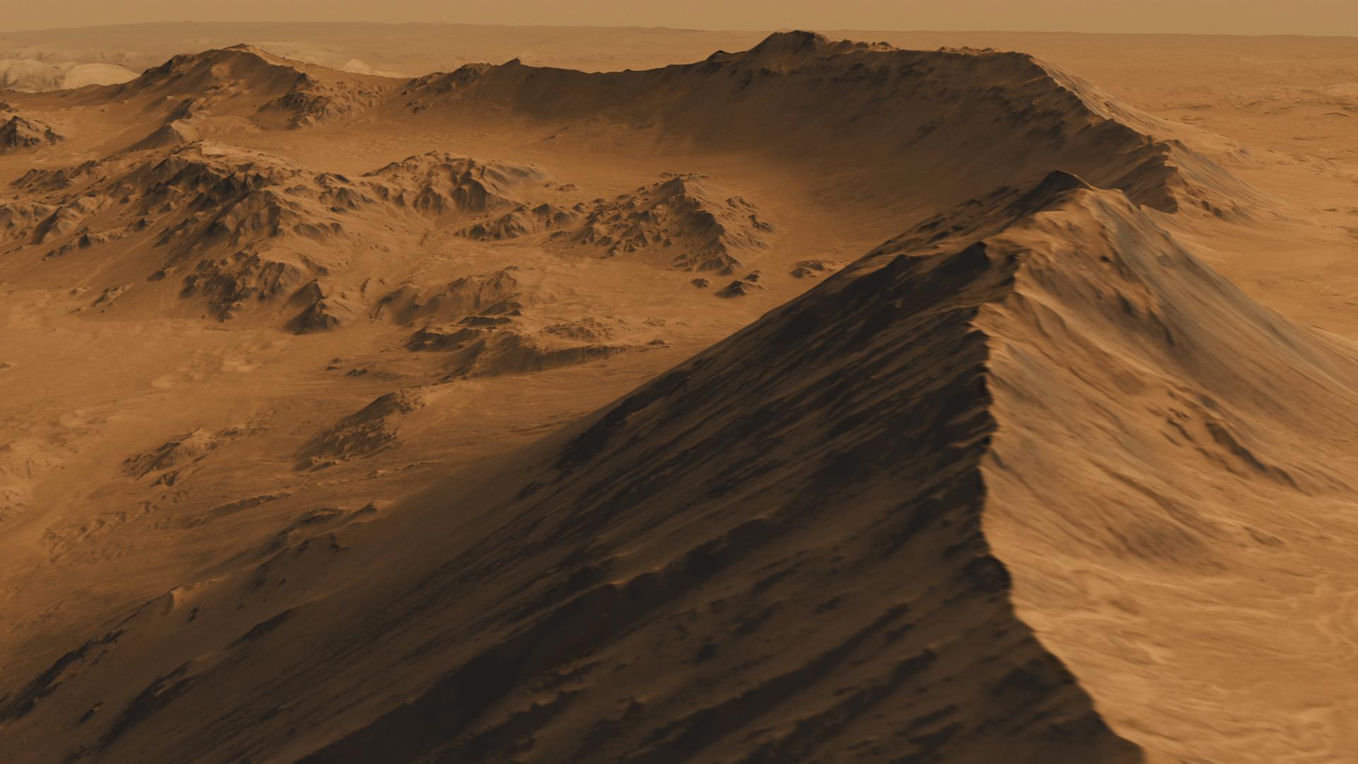
PIA17933:
-
Warm-Season Flows on Martian Slope
Full Resolution:
TIFF
(14.65 MB)
JPEG
(614.7 kB)
|
|
|
2014-02-10 |
Mars
|
Mars Reconnaissance Orbiter (MRO)
|
HiRISE
|
1942x1495x3 |
|
-
PIA17934:
-
Color-Coded Clues to Composition Superimposed on Martian Seasonal-Flow Image
Full Resolution:
TIFF
(8.713 MB)
JPEG
(345.8 kB)
|
|
|
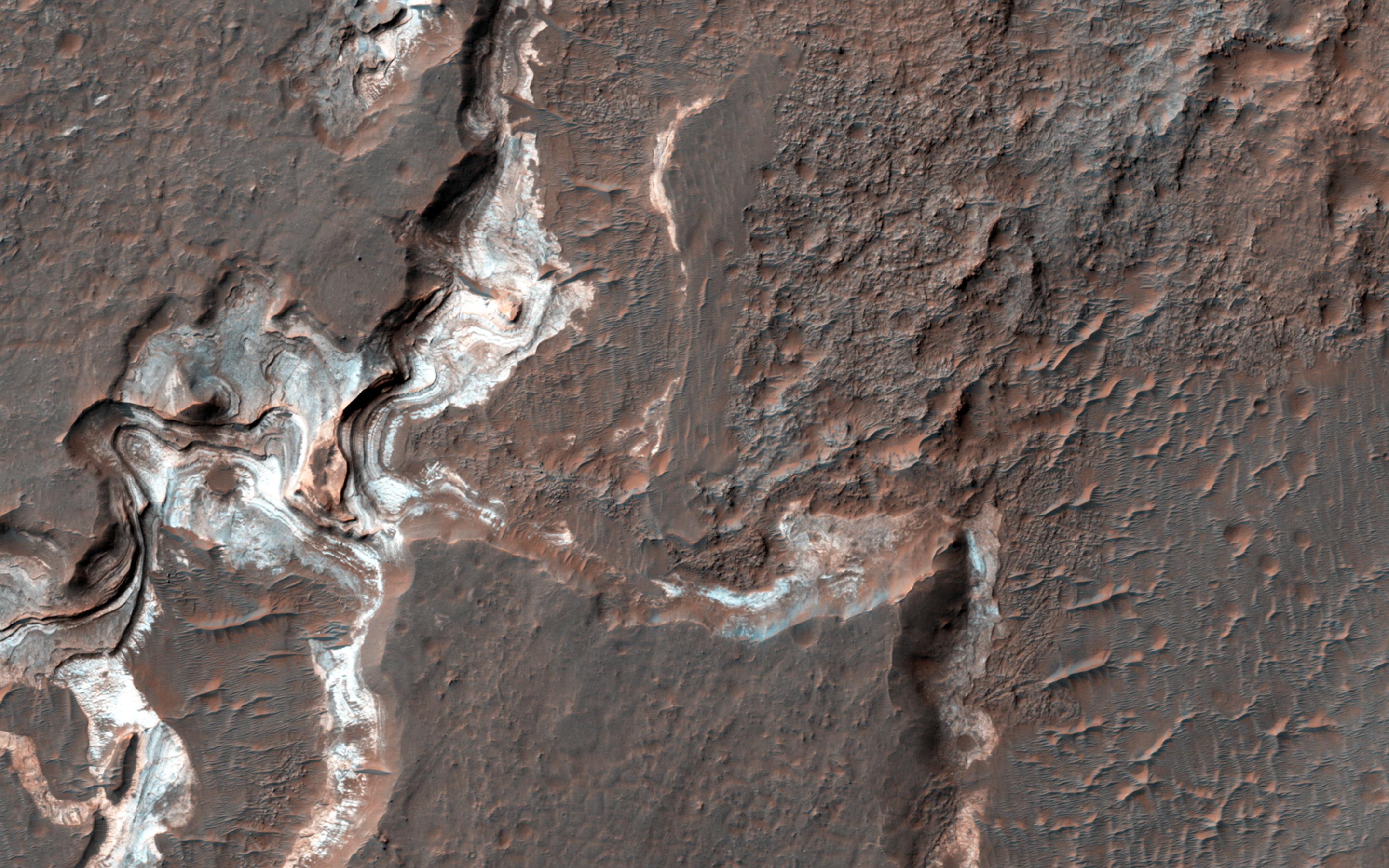
2014-02-13 |
Mars
|
Mars Reconnaissance Orbiter (MRO)
|
HiRISE
|
2880x1800x3 |
|
-
PIA17980:
-
Bright Sediments on the Floor of Ladon Basin
Full Resolution:
TIFF
(15.56 MB)
JPEG
(742.8 kB)
|
|
|
2014-02-13 |
Mars
|
Mars Reconnaissance Orbiter (MRO)
|
HiRISE
|
2880x1800x3 |
|
-
PIA17981:
-
Dunes Flying in Formation
Full Resolution:
TIFF
(15.56 MB)
JPEG
(797.8 kB)
|
|
|
2014-02-13 |
Mars
|
Mars Reconnaissance Orbiter (MRO)
|
HiRISE
|
2880x1800x3 |
|
-
PIA17982:
-
Which Came First, the Yardang or the Platy Flow?
Full Resolution:
TIFF
(15.56 MB)
JPEG
(895.9 kB)
|
|
|
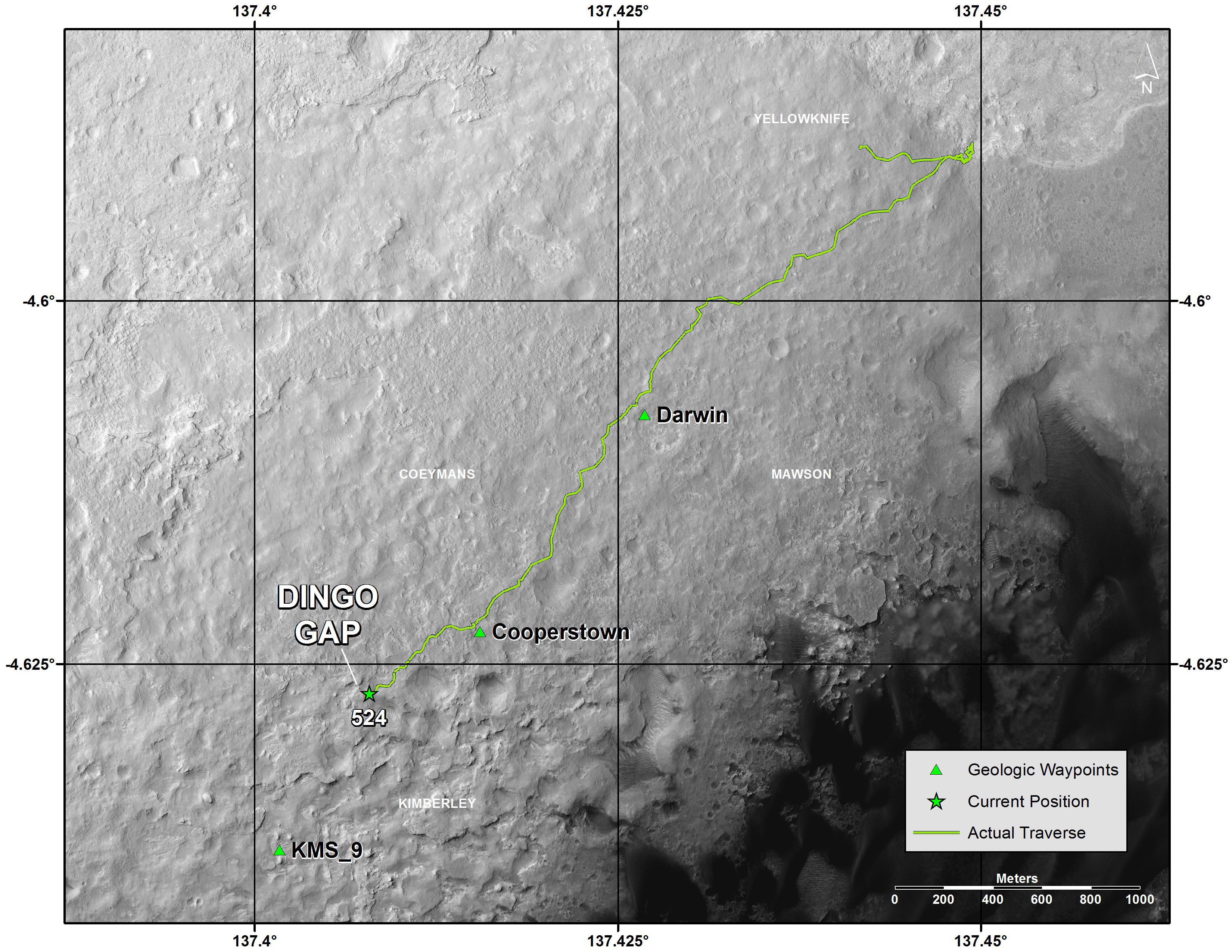
2014-02-13 |
Mars
|
Mars Reconnaissance Orbiter (MRO)
|
HiRISE
|
2880x1800x3 |
|
-
PIA17983:
-
Viewing Dingo Gap
Full Resolution:
TIFF
(15.56 MB)
JPEG
(893.3 kB)
|
|
|
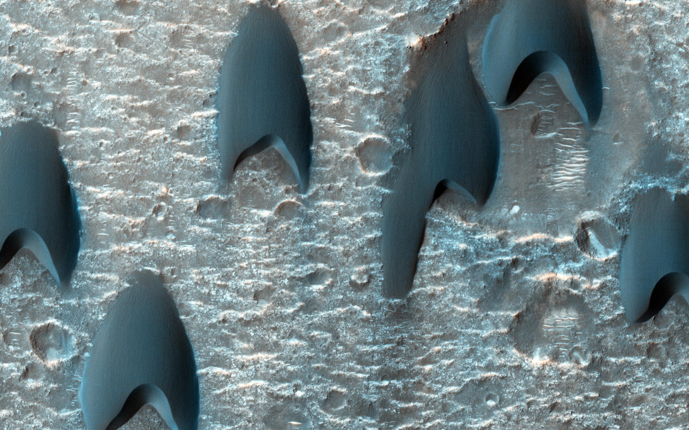
2014-02-19 |
Mars
|
Mars Exploration Rover (MER)
Mars Reconnaissance Orbiter (MRO)
|
HiRISE
|
1416x1441x3 |
|
-
PIA17941:
-
Opportunity Rover on 'Murray Ridge' Seen From Orbit
Full Resolution:
TIFF
(6.124 MB)
JPEG
(282.8 kB)
|
|
|
2014-02-22 |
Mars
|
Mars Reconnaissance Orbiter (MRO)
|
HiRISE
|
2880x1800x3 |
|
-
PIA17926:
-
Oxus Patera Collapse Feature
Full Resolution:
TIFF
(15.56 MB)
JPEG
(676.7 kB)
|
|
|
2014-02-22 |
Mars
|
Mars Reconnaissance Orbiter (MRO)
|
HiRISE
|
2880x1800x3 |
|
-
PIA17927:
-
Light-Toned Deposits along Coprates Chasma Slopes
Full Resolution:
TIFF
(15.56 MB)
JPEG
(607.3 kB)
|
|
|
2014-02-22 |
Mars
|
Mars Reconnaissance Orbiter (MRO)
|
HiRISE
|
2880x1800x3 |
|
-
PIA17928:
-
Shapes and Spots on a Polar Sand Dune
Full Resolution:
TIFF
(15.56 MB)
JPEG
(858 kB)
|
|
|
2014-02-22 |
Mars
|
Mars Reconnaissance Orbiter (MRO)
|
HiRISE
|
2880x1800x3 |
|
-
PIA17929:
-
Giant Gullies North of the Argyre Impact Basin
Full Resolution:
TIFF
(15.56 MB)
JPEG
(857.3 kB)
|
|
|
2014-02-26 |
Mars
|
Mars Reconnaissance Orbiter (MRO)
|
HiRISE
|
2880x1800x3 |
|
-
PIA18113:
-
Dunes Streaming through Hills
Full Resolution:
TIFF
(15.56 MB)
JPEG
(609.6 kB)
|
|
|
2014-02-26 |
Mars
|
Mars Reconnaissance Orbiter (MRO)
|
HiRISE
|
2880x1800x3 |
|
-
PIA18114:
-
Frost in Dune Shadows
Full Resolution:
TIFF
(15.56 MB)
JPEG
(675.7 kB)
|
|
|
2014-02-26 |
Mars
|
Mars Reconnaissance Orbiter (MRO)
|
HiRISE
|
2880x1800x3 |
|
-
PIA18115:
-
Craters in an Icy Surface
Full Resolution:
TIFF
(15.56 MB)
JPEG
(984.6 kB)
|
|
|
2014-02-26 |
Mars
|
Mars Reconnaissance Orbiter (MRO)
|
HiRISE
|
2880x1800x3 |
|
-
PIA18116:
-
Equatorial Gullies
Full Resolution:
TIFF
(15.56 MB)
JPEG
(685.4 kB)
|
|
|
2014-03-05 |
Mars
|
Mars Reconnaissance Orbiter (MRO)
|
HiRISE
|
2880x1800x3 |
|
-
PIA18109:
-
Sand Dunes in Spring
Full Resolution:
TIFF
(15.56 MB)
JPEG
(552 kB)
|
|
|
2014-03-05 |
Mars
|
Mars Reconnaissance Orbiter (MRO)
|
HiRISE
|
2880x1800x1 |
|
-
PIA18110:
-
A Crater Straddling Two Terrain Units
Full Resolution:
TIFF
(5.191 MB)
JPEG
(612.7 kB)
|
|
|
2014-03-05 |
Mars
|
Mars Reconnaissance Orbiter (MRO)
|
HiRISE
|
2560x1920x3 |
|
-
PIA18111:
-
Don't Get Lost in the North Polar Ice Cap
Full Resolution:
TIFF
(14.75 MB)
JPEG
(902.1 kB)
|
|
|
2014-03-05 |
Mars
|
Mars Reconnaissance Orbiter (MRO)
|
HiRISE
|
2880x1800x3 |
|
-
PIA18112:
-
Many Small Interesting Ridges in Erythraea Fossa
Full Resolution:
TIFF
(15.56 MB)
JPEG
(747.4 kB)
|
|
|
2014-03-12 |
Mars
|
Mars Reconnaissance Orbiter (MRO)
|
HiRISE
|
2880x1800x1 |

|
-
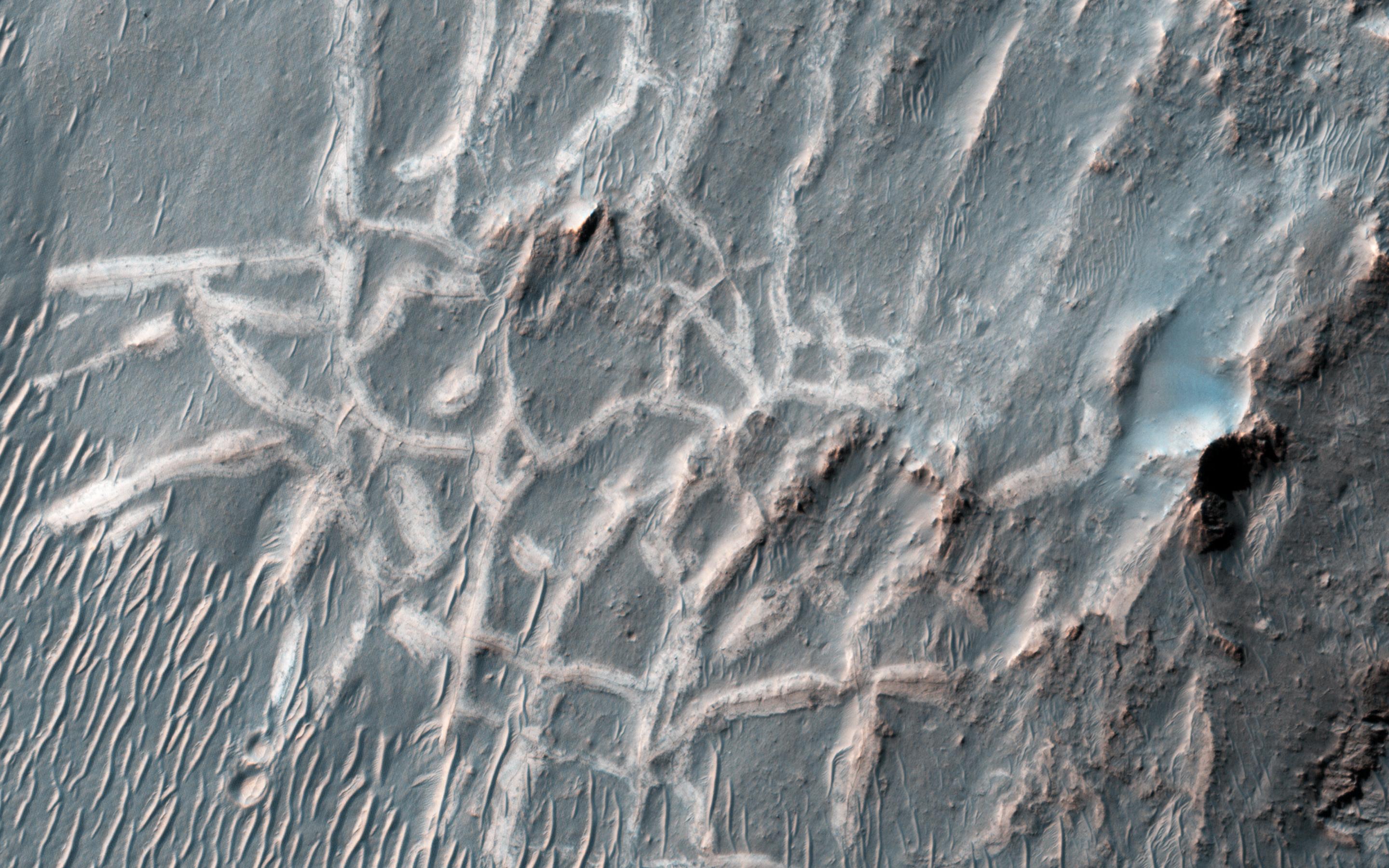
PIA17903:
-
Ejecta in Excess
Full Resolution:
TIFF
(5.191 MB)
JPEG
(877.3 kB)
|
|
|
2014-03-12 |
Mars
|
Mars Reconnaissance Orbiter (MRO)
|
HiRISE
|
2880x1800x3 |

|
-
PIA17904:
-
Craters within Craters
Full Resolution:
TIFF
(15.56 MB)
JPEG
(679.5 kB)
|
|
|
2014-03-12 |
Mars
|
Mars Reconnaissance Orbiter (MRO)
|
HiRISE
|
2880x1800x3 |
|
-
PIA17905:
-
A Complex Valley Network Near Idaeus Fossae
Full Resolution:
TIFF
(15.56 MB)
JPEG
(840.2 kB)
|
|
|
2014-03-19 |
Mars
|
Mars Reconnaissance Orbiter (MRO)
|
HiRISE
|
800x800x3 |
|
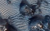
-
PIA17958:
-
A New Gully Channel in Terra Sirenum, Mars
Full Resolution:
TIFF
(1.921 MB)
JPEG
(100.4 kB)
|
|
|
2014-03-19 |
Mars
|
Mars Reconnaissance Orbiter (MRO)
|
HiRISE
|
2880x1800x3 |
|
-
PIA17906:
-
A New Gully Channel in Terra Sirenum
Full Resolution:
TIFF
(15.56 MB)
JPEG
(754 kB)
|
|
|
2014-03-26 |
Mars
|
Mars Reconnaissance Orbiter (MRO)
|
HiRISE
|
2880x1800x3 |
|
-
PIA17907:
-
Bedrock in a Trough in Asimov Crater
Full Resolution:
TIFF
(15.56 MB)
JPEG
(914.3 kB)
|
|
|
2014-03-26 |
Mars
|
Mars Reconnaissance Orbiter (MRO)
|
HiRISE
|
2880x1800x3 |
|
-
PIA17908:
-
A Dark-Toned, Pitted Mound in a Crater in Northeast Arabia Terra
Full Resolution:
TIFF
(15.56 MB)
JPEG
(774.2 kB)
|
|
|
2014-03-26 |
Mars
|
Mars Reconnaissance Orbiter (MRO)
|
HiRISE
|
2880x1800x3 |

|
-
PIA17909:
-
A Large, Banded Angular Fragment in Nili Fossae
Full Resolution:
TIFF
(15.56 MB)
JPEG
(963.6 kB)
|
|
|
2014-03-26 |
Mars
|
Mars Reconnaissance Orbiter (MRO)
|
HiRISE
|
2880x1800x3 |
|
-
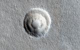
PIA17910:
-
An Unusual Mound
Full Resolution:
TIFF
(15.56 MB)
JPEG
(1.045 MB)
|
|
|
2014-04-09 |
Mars
|
Mars Reconnaissance Orbiter (MRO)
|
HiRISE
|
2880x1800x3 |
|
-
PIA17916:
-
Opportunity Rover's Winter Work at Murray Ridge
Full Resolution:
TIFF
(15.56 MB)
JPEG
(576.8 kB)
|
|
|
2014-04-09 |
Mars
|
Mars Reconnaissance Orbiter (MRO)
|
HiRISE
|
2880x1800x1 |
|
-
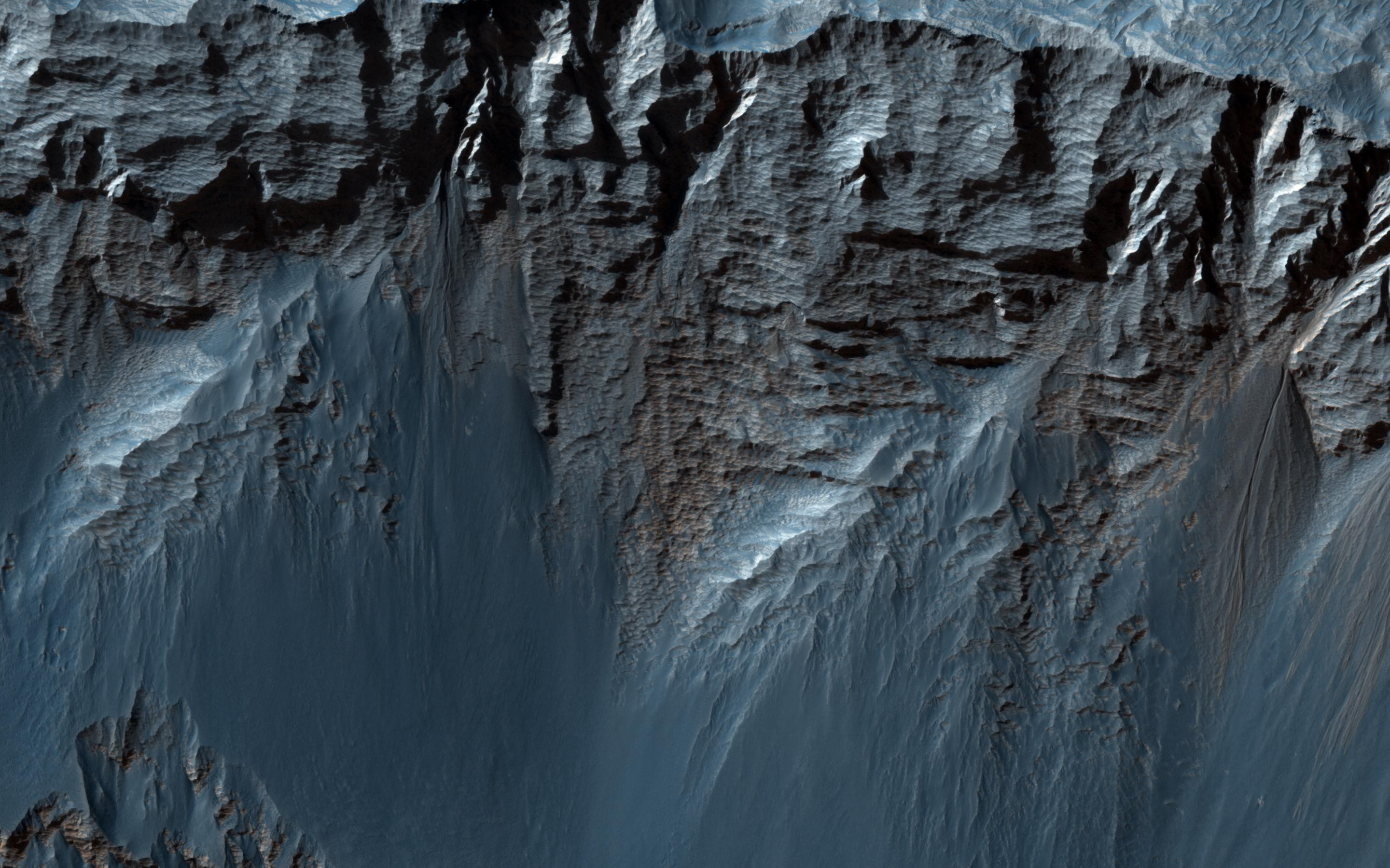
PIA17917:
-
Slumping Terraces on a Crater Wall
Full Resolution:
TIFF
(5.191 MB)
JPEG
(678 kB)
|
|
|
2014-04-09 |
Mars
|
Mars Reconnaissance Orbiter (MRO)
|
HiRISE
|
2880x1800x1 |
|
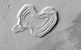
-
PIA17918:
-
A Heart in Ascraeus Mons
Full Resolution:
TIFF
(5.191 MB)
JPEG
(751.7 kB)
|


