|
Your search criteria found 12731 images Target is Mars (and available satellites) |
| My List |
Addition Date | Target |
Mission
|
Instrument | Size |

|
2002-12-18 | Mars |
2001 Mars Odyssey |
THEMIS |
1191x3097x1 |
|
|
|||||
|
|
2002-12-18 | Mars |
2001 Mars Odyssey |
THEMIS |
1186x3079x1 |
|
|
|||||
|
|
2002-12-19 | Mars |
2001 Mars Odyssey |
THEMIS |
1116x2971x1 |
|
|
|||||
|
|
2002-12-19 | Mars |
2001 Mars Odyssey |
THEMIS |
1189x3079x1 |
|
|
|||||
|
|
2002-12-19 | Mars |
2001 Mars Odyssey |
THEMIS |
1237x2971x1 |
|
|
|||||
|
|
2002-12-19 | Mars |
2001 Mars Odyssey |
THEMIS |
1181x2845x1 |
|
|
|||||
|
|
2002-12-19 | Mars |
2001 Mars Odyssey |
THEMIS |
1235x3025x1 |
|
|
|||||
|
|
2002-12-19 | Mars |
2001 Mars Odyssey |
THEMIS |
1181x3007x1 |
|
|
|||||
|
|
2002-12-19 | Mars |
2001 Mars Odyssey |
THEMIS |
1231x3043x1 |
|
|
|||||
|
|
2002-12-19 | Mars |
2001 Mars Odyssey |
THEMIS |
1106x1521x1 |
|
|||||
|
|
2002-12-19 | Mars |
2001 Mars Odyssey |
THEMIS |
1237x3025x1 |
|
|
|||||
|
|
2002-12-19 | Mars |
2001 Mars Odyssey |
THEMIS |
1233x3025x1 |
|
|
|||||
|
|
2002-12-19 | Mars |
2001 Mars Odyssey |
THEMIS |
1239x3043x1 |
|
|
|||||
|
|
2002-12-19 | Mars |
2001 Mars Odyssey |
THEMIS |
1217x3061x1 |
|
|
|||||
|
|
2002-12-19 | Mars |
2001 Mars Odyssey |
THEMIS |
1183x3061x1 |
|
|
|||||
|
|
2002-12-20 | Mars |
2001 Mars Odyssey |
THEMIS |
1235x3025x1 |
|
|
|||||
|
|
2002-12-20 | Mars |
2001 Mars Odyssey |
THEMIS |
1231x3061x1 |
|
|
|||||
|
|
2002-12-20 | Mars |
2001 Mars Odyssey |
THEMIS |
1240x3043x1 |
|
|
|||||
|
|
2002-12-20 | Mars |
2001 Mars Odyssey |
THEMIS |
1240x3043x1 |
|
|
|||||
|
|
2002-12-20 | Mars |
2001 Mars Odyssey |
THEMIS |
1224x3025x1 |
|
|
|||||
|
|
2002-12-20 | Mars |
2001 Mars Odyssey |
THEMIS |
1215x3061x1 |
|
|
|||||
|
|
2002-12-20 | Mars |
2001 Mars Odyssey |
THEMIS |
1239x3007x1 |
|
|
|||||
|
|
2002-12-20 | Mars |
2001 Mars Odyssey |
THEMIS |
1233x3061x1 |
|
|
|||||
|
|
2002-12-20 | Mars |
2001 Mars Odyssey |
THEMIS |
1181x2791x1 |
|
|
|||||
|
|
2002-12-20 | Mars |
2001 Mars Odyssey |
THEMIS |
1082x1503x1 |
|
|||||
|
|
2002-12-20 | Mars |
2001 Mars Odyssey |
THEMIS |
1239x3007x1 |
|
|
|||||
|
|
2003-01-24 | Mars |
2001 Mars Odyssey |
THEMIS |
869x629x1 |
|
|||||
|
|
2003-01-09 | Mars |
2001 Mars Odyssey |
THEMIS |
1219x3025x1 |
|
|
|||||
|
|
2003-01-09 | Mars |
2001 Mars Odyssey |
THEMIS |
1235x3025x1 |
|
|
|||||
|
|
2003-01-09 | Mars |
2001 Mars Odyssey |
THEMIS |
1213x3025x1 |
|
|
|||||
|
|
2003-01-09 | Mars |
2001 Mars Odyssey |
THEMIS |
1181x3007x1 |
|
|
|||||
|
|
2003-01-09 | Mars |
2001 Mars Odyssey |
THEMIS |
1238x3043x1 |
|
|
|||||
|
|
2003-01-09 | Mars |
2001 Mars Odyssey |
THEMIS |
1237x3043x1 |
|
|
|||||
|
|
2003-01-11 | Mars |
2001 Mars Odyssey |
THEMIS |
1230x3025x1 |
|
|
|||||
|
|
2003-01-15 | Mars |
2001 Mars Odyssey |
THEMIS |
1228x3025x1 |
|
|
|||||
|
|
2003-01-15 | Mars |
2001 Mars Odyssey |
THEMIS |
1199x3061x1 |
|
|
|||||
|
|
2003-01-17 | Mars |
2001 Mars Odyssey |
THEMIS |
1137x2989x1 |
|
|
|||||
|
|
2003-01-17 | Mars |
2001 Mars Odyssey |
THEMIS |
1199x3007x1 |
|
|
|||||
|
|
2003-01-22 | Mars |
2001 Mars Odyssey |
THEMIS |
1239x3043x1 |
|
|
|||||
|
|
2003-01-22 | Mars |
2001 Mars Odyssey |
THEMIS |
1203x3007x1 |
|
|
|||||
|
|
2003-01-24 | Mars |
2001 Mars Odyssey |
THEMIS |
1236x3025x1 |
|
|
|||||
|
|
2003-01-24 | Mars |
2001 Mars Odyssey |
THEMIS |
1199x3007x1 |
|
|
|||||
|
|
2003-01-28 | Mars |
2001 Mars Odyssey |
1196x3007x1 | |
|
|
|||||
|
|
2003-01-28 | Mars |
2001 Mars Odyssey |
1213x3061x1 | |
|
|
|||||
|
|
2003-01-30 | Mars |
2001 Mars Odyssey |
THEMIS |
1233x3043x1 |
|
|
|||||
|
|
2003-01-30 | Mars |
2001 Mars Odyssey |
THEMIS |
1196x3007x1 |
|
|
|||||
|
|
2003-02-03 | Mars |
2001 Mars Odyssey |
THEMIS |
1191x3007x1 |
|
|
|||||
|
|
2003-02-03 | Mars |
2001 Mars Odyssey |
THEMIS |
1078x2707x1 |
|
|
|||||
|
|
2003-02-07 | Mars |
2001 Mars Odyssey |
THEMIS |
1225x3025x1 |
|
|
|||||
|
|
2003-02-07 | Mars |
2001 Mars Odyssey |
THEMIS |
1141x2989x1 |
|
|
|||||
|
|
2003-02-10 | Mars |
2001 Mars Odyssey |
THEMIS |
1239x3043x1 |
|
|
|||||
|
|
2003-02-10 | Mars |
2001 Mars Odyssey |
THEMIS |
1229x2989x1 |
|
|
|||||
|
|
2003-02-12 | Mars |
2001 Mars Odyssey |
THEMIS |
1231x2971x1 |
|
|
|||||
|
|
2003-02-12 | Mars |
2001 Mars Odyssey |
THEMIS |
1194x2827x1 |
|
|
|||||
|
|
2003-02-14 | Mars |
2001 Mars Odyssey |
THEMIS |
1086x2917x1 |
|
|
|||||
|
|
2003-02-14 | Mars |
2001 Mars Odyssey |
THEMIS |
1215x3025x1 |
|
|
|||||
|
|
2003-02-19 | Mars |
2001 Mars Odyssey |
THEMIS |
824x1199x1 |
|
|||||
|
|
2003-02-18 | Mars |
2001 Mars Odyssey |
THEMIS |
1222x3133x1 |
|
|
|||||
|
|
2003-02-20 | Mars |
2001 Mars Odyssey |
THEMIS |
1203x2845x1 |
|
|
|||||
|
|
2003-02-20 | Mars |
2001 Mars Odyssey |
THEMIS |
1175x3007x1 |
|
|
|||||
|
|
2003-02-26 | Mars |
2001 Mars Odyssey |
THEMIS |
1205x3007x1 |
|
|
|||||
|
|
2003-02-26 | Mars |
2001 Mars Odyssey |
THEMIS |
1238x3043x1 |
|
|
|||||
|
|
2003-02-26 | Mars |
2001 Mars Odyssey |
THEMIS |
1238x3043x1 |
|
|
|||||
|
|
2003-02-26 | Mars |
2001 Mars Odyssey |
THEMIS |
1196x3007x1 |
|
|
|||||
|
|
2003-03-06 | Mars |
2001 Mars Odyssey |
THEMIS |
1231x3025x1 |
|
|
|||||
|
|
2003-03-06 | Mars |
2001 Mars Odyssey |
THEMIS |
1239x3043x1 |
|
|
|||||
|
|
2003-03-06 | Mars |
2001 Mars Odyssey |
THEMIS |
1227x3025x1 |
|
|
|||||
|
|
2003-03-06 | Mars |
2001 Mars Odyssey |
THEMIS |
1237x3025x1 |
|
|
|||||
|
|
2003-03-07 | Mars |
2001 Mars Odyssey |
THEMIS |
1169x3007x1 |
|
|
|||||
|
|
2003-03-07 | Mars |
2001 Mars Odyssey |
THEMIS |
1201x3007x1 |
|
|
|||||
|
|
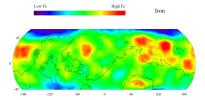
2003-03-13 | Mars |
2001 Mars Odyssey |
Gamma Ray Spectrometer Suite |
2068x1009x3 |
|
|||||
|
|
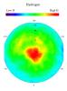
2003-03-13 | Mars |
2001 Mars Odyssey |
Gamma Ray Spectrometer Suite |
1163x1579x3 |
|
|||||
|
|
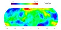
2003-03-13 | Mars |
2001 Mars Odyssey |
Gamma Ray Spectrometer Suite |
2072x1013x3 |
|
|||||
|
|
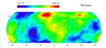
2003-03-13 | Mars |
2001 Mars Odyssey |
Gamma Ray Spectrometer Suite |
2065x929x3 |

|
|||||
|
|
2003-03-13 | Mars |
2001 Mars Odyssey |
Gamma Ray Spectrometer Suite |
2068x947x3 |
|
|||||
|
|
2003-03-13 | Mars |
2001 Mars Odyssey |
Mars Radiation Experiment |
907x621x3 |
|
|||||
|
|
2003-03-13 | Mars |
2001 Mars Odyssey |
THEMIS |
2995x1953x1 |

|
|||||
|
|
2003-03-13 | Mars |
2001 Mars Odyssey |
THEMIS |
2995x1953x1 |
|
|||||
|
|
2003-03-13 | Mars |
2001 Mars Odyssey |
THEMIS |
1463x1203x3 |

|
|||||
|
|
2003-03-13 | Mars |
2001 Mars Odyssey |
THEMIS |
686x960x3 |
|
|||||
|
|
2003-03-14 | Mars |
2001 Mars Odyssey |
THEMIS |
1233x3025x1 |
|
|
|||||
|
|
2003-03-14 | Mars |
2001 Mars Odyssey |
THEMIS |
1240x3043x1 |
|
|
|||||
|
|
2003-03-14 | Mars |
2001 Mars Odyssey |
THEMIS |
1213x3025x1 |
|
|
|||||
|
|
2003-03-19 | Mars |
2001 Mars Odyssey |
THEMIS |
1054x3151x1 |
|
|
|||||
|
|
2003-03-19 | Mars |
2001 Mars Odyssey |
THEMIS |
1240x3043x1 |
|
|
|||||
|
|
2003-03-19 | Mars |
2001 Mars Odyssey |
THEMIS |
1240x3043x1 |
|
|
|||||
|
|
2003-03-22 | Mars |
2001 Mars Odyssey |
THEMIS |
1233x3025x1 |
|
|
|||||
|
|
2003-03-22 | Mars |
2001 Mars Odyssey |
THEMIS |
1237x3043x1 |
|
|
|||||
|
|
2003-03-22 | Mars |
2001 Mars Odyssey |
THEMIS |
1411x3103x1 |
|
|
|||||
|
|
2003-03-27 | Mars |
2001 Mars Odyssey |
THEMIS |
1239x3043x1 |
|
|
|||||
|
|
2003-03-27 | Mars |
2001 Mars Odyssey |
THEMIS |
1201x3007x1 |
|
|
|||||
|
|
2003-04-02 | Mars |
2001 Mars Odyssey |
THEMIS |
1419x3170x1 |
|
|
|||||
|
|
2003-04-02 | Mars |
2001 Mars Odyssey |
THEMIS |
1847x3049x1 |
|
|||||
|
|
2003-04-02 | Mars |
2001 Mars Odyssey |
THEMIS |
1413x3065x1 |
|
|
|||||
|
|
2003-04-04 | Mars |
2001 Mars Odyssey |
THEMIS |
1413x3134x1 |
|
|
|||||
|
|
2003-04-04 | Mars |
2001 Mars Odyssey |
THEMIS |
1227x3061x1 |
|
|
|||||
|
|
2003-04-04 | Mars |
2001 Mars Odyssey |
THEMIS |
1409x3064x1 |
|
|
|||||
|
|
2003-04-09 | Mars |
2001 Mars Odyssey |
THEMIS |
1419x3058x1 |
|
|
|||||
|
|
2003-04-09 | Mars |
2001 Mars Odyssey |
THEMIS |
1217x3025x1 |
|
|
|||||
|
|
2003-04-09 | Mars |
2001 Mars Odyssey |
THEMIS |
1489x3012x1 |
|
|
|||||

|
 |
|
 |
 |
|
|
|
|
|
|

|
| 1-100 | 101-200 | 201-300 | 301-400 | 401-500 | 501-600 | 601-700 | 701-800 | 801-900 | 901-1000 |
| Currently displaying images: 201 - 300 of 12731 |