Your search criteria found 810 images
Target is Mars (and available satellites)
Go to PIAxxxxx:
Refine this list of images by:
Target:
Spacecraft:
Instrument:
Click on an image for detailed information
Click on a column heading to sort in ascending or descending order
My
List
Addition Date Target Mission InstrumentSort Descending Size
Add Image to Favorite List 2018-06-13 Mars Mars Science Laboratory (MSL)
Mastcam
4054x1808x3
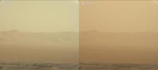
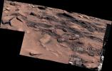
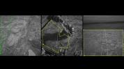
These two views from NASA's Curiosity rover, acquired specifically to measure the amount of dust inside Gale Crater, show that dust has increased over three days from a major Martian dust storm.
PIA22520:
Curiosity's View of the June 2018 Dust Storm
Full Resolution:     TIFF (6.58 MB)     JPEG (235 kB)
Add Image to Favorite List 2018-06-20 Mars Mars Science Laboratory (MSL)
Mastcam
2374x1083x3
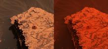
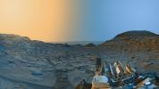
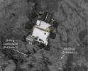
Two images from the Mast Camera onboard NASA's Curiosity rover depict the change in the color of light illuminating the Martian surface since a dust storm engulfed Gale Crater. At left shows the 'Duluth' drill site on May 21, 2018; at right from June 17.
PIA22330:
Duluth After Dust Storm
Full Resolution:     TIFF (7.17 MB)     JPEG (332.7 kB)
Add Image to Favorite List 2018-09-06 Mars Mars Science Laboratory (MSL)
Mastcam
10000x2886x3
NASA's Curiosity rover surveyed its surroundings on Aug. 9, 2018, showing its current location on Mars' Vera Rubin Ridge. The panorama includes skies darkened by a fading global dust storm and a rare view of the rover itself.
PIA22545:
Panorama of Vera Rubin Ridge
Full Resolution:     TIFF (67.34 MB)     JPEG (3.445 MB)
Add Image to Favorite List 2019-02-22 Mars Mars Science Laboratory (MSL)
Mastcam
1328x1184x3
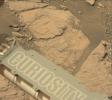
NASA's Curiosity Mars rover took this image with its Mastcam on Feb. 10, 2019 (Sol 2316). The rover is currently exploring a region of Mount Sharp nicknamed Glen Torridon that has lots of clay minerals.
PIA23047:
Curiosity on the Clay Unit
Full Resolution:     TIFF (4.41 MB)     JPEG (175 kB)
Add Image to Favorite List 2019-04-04 Phobos Mars Science Laboratory (MSL)
Mastcam
256x256x1
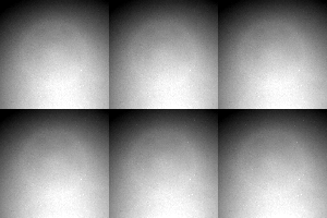
This series of images shows the Martian moon Phobos as it crossed in front of the Sun, as seen by NASA's Curiosity Mars rover on Tuesday, March 26, 2019 (Sol 2359).
PIA23133:
Curiosity Observes Phobos Eclipse: Sol 2359
Full Resolution:     TIFF (44.39 kB)     JPEG (3.074 kB)
Add Image to Favorite List 2019-04-04 Deimos Mars Science Laboratory (MSL)
Mastcam
256x256x1
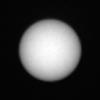
This series of images shows the Martian moon Deimos as it crossed in front of the Sun, as seen by NASA's Curiosity Mars rover on Sunday, March 17, 2019 (the 2,350th Martian day, or sol, of the mission).
PIA23134:
Curiosity Observes Deimos Eclipse: Sol 2350
Full Resolution:     TIFF (52.08 kB)     JPEG (3.197 kB)
Add Image to Favorite List 2019-04-11 Mars Mars Science Laboratory (MSL)
Mastcam
4700x2308x3
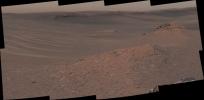
The Mast Camera (Mastcam) on NASA's Curiosity Mars rover captured this mosaic as it explored the clay-bearing unit on February 3, 2019 (Sol 2309).
PIA23139:
Curiosity Surveys the Clay-Bearing Unit
Full Resolution:     TIFF (26.05 MB)     JPEG (1.911 MB)
Add Image to Favorite List 2019-04-11 Mars Mars Science Laboratory (MSL)
Mastcam
5699x1322x3
The Mast Camera (Mastcam) on NASA's Curiosity Mars rover captured this mosaic as it explored the clay-bearing unit on Jan. 23, 2019 (Sol 2299).
PIA23137:
Curiosity Sees Waves in the Clay Unit
Full Resolution:     TIFF (18.56 MB)     JPEG (1.306 MB)
Add Image to Favorite List 2019-04-11 Mars Mars Science Laboratory (MSL)
Mastcam
2000x1800x3
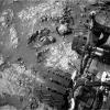
The Mast Camera, or Mastcam, on NASA's Curiosity Mars rover captured this set of images before and after it drilled a rock on Saturday, April 6, 2019.
PIA23138:
Curiosity's First Clay Unit Drill Hole
Full Resolution:     TIFF (9.931 MB)     JPEG (494.8 kB)
Add Image to Favorite List 2019-02-08 Mars Mars Science Laboratory (MSL)
Mastcam
2000x466x3
This panorama from the Mast Camera (Mastcam) on NASA's Curiosity Mars rover was taken on Dec. 19, 2018 (Sol 2265).
PIA23042:
Curiosity's 360 Panorama of Rock Hall
Full Resolution:     TIFF (1.967 MB)     JPEG (163.3 kB)
Add Image to Favorite List 2019-08-05 Mars Mars Science Laboratory (MSL)
Mastcam
29163x8474x3
This 360-degree panorama of a location called 'Teal Ridge' was captured on Mars by the Mast Camera, or Mastcam, on NASA's Curiosity rover on June 18, 2019.
PIA23346:
Curiosity Surveys Teal Ridge
Full Resolution:     TIFF (397.9 MB)     JPEG (26.02 MB)
Add Image to Favorite List 2019-08-05 Mars Mars Science Laboratory (MSL)
Mastcam
7455x3249x3
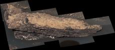
This mosaic of images shows a boulder-sized rock called 'Strathdon,' which is made up of many complex layers. NASA's Curiosity Mars rover took these images using its Mast Camera, or Mastcam.
PIA23348:
Mastcam Views Strathdon
Full Resolution:     TIFF (40.66 MB)     JPEG (2.437 MB)
Add Image to Favorite List 2020-03-04 Mars Mars Science Laboratory (MSL)
Mastcam
2960x765x3
NASA's Curiosity rover captured its highest-resolution panorama of the Martian surface between Nov. 24 and Dec. 1, 2019.
PIA23623:
Curiosity's 1.8-Billion-Pixel Panorama
Full Resolution:     TIFF (4.436 MB)     JPEG (350.2 kB)
Add Image to Favorite List 2020-06-15 Mars Mars Science Laboratory (MSL)
Mastcam
760x1140x3
Two images of the night sky were combined to show Earth and Venus as seen by NASA's Curiosity Mars rover on June 5, 2020. The planets appear as pinpoints of light owing to a combination of distance and dust in the air.
PIA23899:
Curiosity Rover Finds Earth and Venus in the Martian Sky
Full Resolution:     TIFF (934.1 kB)     JPEG (22.8 kB)
Add Image to Favorite List 2020-07-06 Mars Mars Science Laboratory (MSL)
Mastcam
21671x8937x3
Stitched together from 116 images, this view captured by NASA's Curiosity Mars rover shows the path it will take in the summer of 2020 as it drives toward the next region it will be investigating, the sulfate-bearing unit.
PIA23973:
Curiosity's Path to the Sulfate-Bearing Unit
Full Resolution:     TIFF (392.7 MB)     JPEG (32.36 MB)
Add Image to Favorite List 2020-07-06 Mars Mars Science Laboratory (MSL)
Mastcam
8916x4147x3
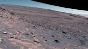
Stitched together from 28 images, NASA's Curiosity Mars rover captured this view from Greenheugh Pediment on April 9, 2020.
PIA23974:
Curiosity's View From the Top of the Greenheugh Pediment
Full Resolution:     TIFF (104.8 MB)     JPEG (8.276 MB)
Add Image to Favorite List 2020-07-06 Mars Mars Science Laboratory (MSL)
Mastcam
4690x2189x3
The goosebump-like features in the center of this image were formed by water billions of years ago. NASA's Curiosity Mars rover discovered them as it crested the slope of Greenheugh Pediment on Feb. 24, 2020.
PIA23975:
Curiosity Finds Nodules near the Top of Pediment Slope
Full Resolution:     TIFF (16.7 MB)     JPEG (1.134 MB)
Add Image to Favorite List 2020-08-03 Mars Mars Science Laboratory (MSL)
Mastcam
20251x4204x3
The Mast Camera, or Mastcam, on NASA's Curiosity Mars rover used its telephoto lens to capture Mount Sharp in the morning illumination on Oct. 13, 2019.
PIA23898:
A Dramatic View of Mars' Mount Sharp
Full Resolution:     TIFF (119.5 MB)     JPEG (7.692 MB)
Add Image to Favorite List 2020-08-03 Mars Mars Science Laboratory (MSL)
Mastcam
4128x423x3
This wide panorama was taken by NASA's Curiosity Mars rover on Dec. 19, 2019. On the righthand foreground is Western Butte. The ridge with a crusty cap in the background is the Greenheugh pediment.
PIA23971:
Curiosity Captures a Spaghetti Western Landscape on Mars
Full Resolution:     TIFF (4.337 MB)     JPEG (372.4 kB)
Add Image to Favorite List 2021-01-12 Mars Mars Science Laboratory (MSL)
Mastcam
29163x7353x3
This panorama, made up of 122 individual images stitched together, was taken by NASA's Curiosity Mars rover on November 18, 2020, the 2,946th Martian day, or sol, of the mission.
PIA24180:
Curiosity's View of Benches on Mars
Full Resolution:     TIFF (442.3 MB)     JPEG (35.65 MB)
Add Image to Favorite List 2021-03-30 Mars Mars Science Laboratory (MSL)
Mastcam
1207x400x3
NASA's Curiosity Mars rover used its Mastcam instrument to take the 32 individual images that make up this panorama of the outcrop nicknamed Mont Mercou. It took a second panorama to create a stereoscopic view. Both panoramas were taken on March 4, 2021.
PIA24266:
Curiosity's 3D View of Mont Mercou
Full Resolution:     TIFF (1.32 MB)     JPEG (144.5 kB)
Add Image to Favorite List 2021-03-30 Mars Mars Science Laboratory (MSL)
Mastcam
29163x7195x3
NASA's Curiosity Mars rover used its Mastcam instrument to take the 126 individual images that make up this 360-degree panorama on March 3, 2021, the 3,048th Martian day, or sol, of the mission.
PIA24269:
Curiosity's 360-Degree View Approaching Mont Mercou
Full Resolution:     TIFF (451.8 MB)     JPEG (36.07 MB)
Add Image to Favorite List 2021-04-05 Mars Mars Science Laboratory (MSL)
Mastcam
7254x2370x3
NASA's Curiosity Mars rover used its Mastcam to take an image of this mountain, nicknamed Rafael Navarro Mountain after the astrobiologist Rafael Navarro-González, who worked on the mission until he passed away January 26, 2021.
PIA24544:
Rafael Navarro Mountain
Full Resolution:     TIFF (39.96 MB)     JPEG (2.719 MB)
Add Image to Favorite List 2021-05-10 Mars Mars Science Laboratory (MSL)
Mastcam
29163x7891x3
NASA's Curiosity Mars rover took this 360-degree panorama while atop Mont Mercou, a rock formation that offered a view into Gale Crater below. The panorama is stitched together from 132 individual images taken on April 15, 2021.
PIA24626:
Curiosity's 360-degree View Atop Mont Mercou
Full Resolution:     TIFF (459.3 MB)     JPEG (31.54 MB)
Add Image to Favorite List 2021-05-28 Mars Mars Science Laboratory (MSL)
Mastcam
7000x3000x3
NASA's Curiosity Mars rover captured these clouds just after sunset on March 19, 2021. The image is made up of 21 individual images stitched together and color corrected so that the scene appears as it would to the human eye.
PIA24622:
Curiosity Spots Clouds Over Mont Mercou
Full Resolution:     TIFF (40.61 MB)     JPEG (1.304 MB)
Add Image to Favorite List 2021-05-28 Mars Mars Science Laboratory (MSL)
Mastcam
1900x1160x3
This GIF shows clouds drifting over Mount Sharp on Mars, as viewed by NASA's Curiosity rover on March 19, 2021. Each frame of the scene was stitched together from six individual images.
PIA24661:
Curiosity GIF Shows Drifting Clouds Over Mars' Mount Sharp
Full Resolution:     TIFF (3.821 MB)     JPEG (88.01 kB)
Add Image to Favorite List 2021-05-28 Mars Mars Science Laboratory (MSL)
Mastcam
5077x1390x3
NASA's Curiosity Mars rover spotted these iridescent, or mother of pearl, clouds on March 5, 2021. Seen here are five frames stitched together from a much wider panorama taken by the rover's Mast Camera, or Mastcam.
PIA24662:
Curiosity Spots Iridescent Mother of Pearl Clouds
Full Resolution:     TIFF (11.27 MB)     JPEG (265.2 kB)
Add Image to Favorite List 2021-08-17 Mars Mars Science Laboratory (MSL)
Mastcam
29061x7568x3
NASA's Curiosity Mars rover used its Mast Camera, or Mastcam, to capture this 360-degree view on July 3, 2021. The panorama is made up of 129 individual images that were sent to Earth, after which they are stitched together.
PIA24643:
Curiosity Looks Uphill Past Rafael Navarro Mountain
Full Resolution:     TIFF (464.9 MB)     JPEG (35.85 MB)
Add Image to Favorite List 2022-01-25 Mars Mars Science Laboratory (MSL)
Mastcam
4550x5688x3
NASA's Curiosity Mars rover used its Mast Camera, or Mastcam, to capture this scene of a drill hole named Edinburgh. The images used to create the scene were taken on March 22 and 23, 2020.
PIA25046:
Curiosity Mastcam's View of Edinburgh
Full Resolution:     TIFF (72.01 MB)     JPEG (4.517 MB)
Add Image to Favorite List 2022-04-07 Mars Mars Science Laboratory (MSL)
Mastcam
5833x3324x3
NASA's Curiosity Mars rover used its Mast Camera, or Mastcam, to survey these wind-sharpened rocks, called ventifacts, on March 15, 2022. The team has informally described these patches of ventifacts as gator-back rocks because of their scaly appearance.
PIA25175:
Curiosity Finds Gator-Back Rocks on Greenheugh
Full Resolution:     TIFF (58.19 MB)     JPEG (5.294 MB)
Add Image to Favorite List 2022-04-07 Mars Mars Science Laboratory (MSL)
Mastcam
29163x8101x3
NASA's Curiosity Mars rover used its Mast Camera, or Mastcam, to take this 360-degree panorama on March 23, 2022. The team has informally described the wind-sharpened rocks seen here as gator-back rocks because of their scaly appearance.
PIA25176:
Curiosity's 360-Degree Panorama of Gator-Back Rocks on Greenheugh
Full Resolution:     TIFF (455.6 MB)     JPEG (36.32 MB)
Add Image to Favorite List 2022-05-18 Mars Mars Science Laboratory (MSL)
Mastcam
7630x2295x3
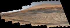
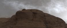
NASA's Curiosity Mars rover used its Mast Camera, or Mastcam, to capture this mound of rock nicknamed East Cliffs on May 7, 2022, the 3,466th Martian day, or sol, of the mission.
PIA25288:
Door-Shaped Fracture Spotted by Curiosity at East Cliffs
Full Resolution:     TIFF (30.19 MB)     JPEG (2.872 MB)
Add Image to Favorite List 2022-06-15 Mars Mars Science Laboratory (MSL)
Mastcam
1338x1193x3
NASA's Curiosity Mars rover spotted these finger-like rocks with its Mast Camera, or Mastcam, on May 15, 2022.
PIA25362:
Curiosity Spots Finger-Like Rocks
Full Resolution:     TIFF (4.791 MB)     JPEG (434.7 kB)
Add Image to Favorite List 2022-06-22 Mars Mars Science Laboratory (MSL)
Mastcam
17708x5681x3
NASA's Curiosity Mars rover captured this image of the sulfate-bearing region and upper Mount Sharp in a dust haze on May 26, 2022.
PIA25365:
Curiosity's View of Haze During Dust Season
Full Resolution:     TIFF (166.9 MB)     JPEG (11.07 MB)
Add Image to Favorite List 2022-06-22 Mars Mars Science Laboratory (MSL)
Mastcam
29163x8571x3
NASA's Curiosity Mars rover captured this 360-degree panorama near a location nicknamed Sierra Maigualida on May 22, 2022. The panorama is made up of 133 individual images captured by Curiosity's Mast Camera, or Mastcam.
PIA25366:
Curiosity's 360-degree Panorama Near Sierra Maigualida
Full Resolution:     TIFF (442.9 MB)     JPEG (33.48 MB)
Add Image to Favorite List 2022-06-22 Mars Mars Science Laboratory (MSL)
Mastcam
6325x2726x3
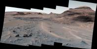
NASA's Curiosity Mars rover captured this view of a sulfate-bearing region using its Mastcam on May 2, 2022. Dark boulders seen near the center are thought to have formed from sand deposited in ancient streams or ponds.
PIA25367:
Curiosity's View of Sulfate-Bearing Region and Streambed Rocks
Full Resolution:     TIFF (30.63 MB)     JPEG (2.614 MB)
Add Image to Favorite List 2022-06-22 Mars Mars Science Laboratory (MSL)
Mastcam
4966x2494x3
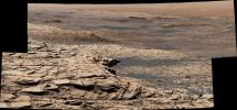
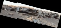
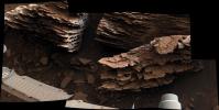
NASA's Curiosity Mars rover captured this view of layered, flaky rocks believed to have formed in an ancient streambed or small pond. The six images that make up this mosaic were captured using Curiosity's Mast Camera, or Mastcam, on June 2, 2022.
PIA25368:
Curiosity's Mastcam Views Flaky, Streambed Rocks
Full Resolution:     TIFF (27.36 MB)     JPEG (1.796 MB)
Add Image to Favorite List 2022-06-22 Mars Mars Science Laboratory (MSL)
Mastcam
6057x3373x3
NASA's Curiosity Mars rover captured evidence of layers that built up as windblown sand both accumulated and was scoured away at a location nicknamed Las Claritas. This image was captured using Curiosity's Mast Camera, or Mastcam, on May 19, 2022.
PIA25369:
Curiosity's Mastcam Views Layers at Las Claritas
Full Resolution:     TIFF (61.32 MB)     JPEG (4.871 MB)
Add Image to Favorite List 2022-08-05 Mars Mars Science Laboratory (MSL)
Mastcam
29163x8000x3
NASA's Curiosity Mars rover took this 360-degree panorama at a drill site nicknamed Avanavero on June 20, 2022. In its decade on the Red Planet, the rover has used the drill on its robotic arm to collect 41 rock and soil samples for analysis.
PIA25407:
Curiosity's 360-Degree Panorama of Avanavero Drill Site
Full Resolution:     TIFF (495.9 MB)     JPEG (38.13 MB)
Add Image to Favorite List 2022-10-19 Mars Mars Science Laboratory (MSL)
Mastcam
29163x8638x3
NASA's Curiosity Mars rover used its Mast Camera, or Mastcam, to capture this panorama while driving toward the center of this scene, an area that forms the narrow Paraitepuy Pass on Aug. 14, 2022.
PIA25413:
Curiosity's View of Paraitepuy Pass
Full Resolution:     TIFF (536.6 MB)     JPEG (46.38 MB)
Add Image to Favorite List 2022-10-19 Mars Mars Science Laboratory (MSL)
Mastcam
8323x4225x3
NASA's Curiosity Mars rover used its Mast Camera, or Mastcam, to capture this panorama of a hill nicknamed Bolívar and adjacent sand ridges on Aug. 23, the 3,572nd Martian day, or sol, of the mission.
PIA25414:
Curiosity's View of Sand Ridges and Bolívar
Full Resolution:     TIFF (78.61 MB)     JPEG (6.244 MB)
Add Image to Favorite List 2022-10-19 Mars Mars Science Laboratory (MSL)
Mastcam
2073x1226x3
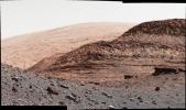
NASA's Curiosity Mars rover used its Mast Camera, or Mastcam, to capture this detail shot of the sandy foreground, a hill nicknamed Orinoco within the sulfate-bearing unit, and upper Mount Sharp in the distance.
PIA25415:
Curiosity's Close-Up of Rocks in Paraitepuy Pass
Full Resolution:     TIFF (7.414 MB)     JPEG (582.7 kB)
Add Image to Favorite List 2022-10-19 Mars Mars Science Laboratory (MSL)
Mastcam
1328x1184x3
Curiosity used its Mast Camera, or Mastcam, to capture this image of its 36th successful drill hole on Mount Sharp, at a rock called Canaima. The pulverized rock sample was acquired on Oct. 3, 2022.
PIA25418:
Curiosity's 36th Drill Hole at Canaima
Full Resolution:     TIFF (4.172 MB)     JPEG (254.5 kB)
Add Image to Favorite List 2023-02-02 Mars Mars Science Laboratory (MSL)
Mastcam
8071x4719x3
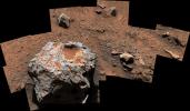
NASA's Curiosity Mars rover captured this iron-nickel meteorite nicknamed Cacao on Jan, 28, 2023. This meteorite is estimated to be about 1 foot (30 centimeters) across.
PIA25737:
Curiosity Finds a Meteorite, 'Cacao'
Full Resolution:     TIFF (74.32 MB)     JPEG (5.559 MB)
Add Image to Favorite List 2023-02-08 Mars Mars Science Laboratory (MSL)
Mastcam
29163x8373x3
NASA's Curiosity used its Mastcam to capture this 360-degree panorama of Marker Band Valley on Dec. 16, 2022. Rippled rock textures found in this area are the clearest evidence the rover has seen of water and waves from Mars' ancient past.
PIA25732:
Curiosity's 360-Degree View of Marker Band Valley
Full Resolution:     TIFF (503.7 MB)     JPEG (36.73 MB)
Add Image to Favorite List 2023-02-08 Mars Mars Science Laboratory (MSL)
Mastcam
10089x2399x3
At the bottom of this valley, called Gediz Vallis, is a mound of boulders and debris that are believed to have been swept there by wet landslides billions of years ago. The rover team hopes to get a closer look at this evidence for flowing water.
PIA25733:
Curiosity Views Gediz Vallis
Full Resolution:     TIFF (57.2 MB)     JPEG (4.202 MB)
Add Image to Favorite List 2023-02-08 Mars Mars Science Laboratory (MSL)
Mastcam
9275x5809x3
NASA's Curiosity rover captured this image of rhythmic rock layers with a repetitive pattern in their spacing and thickness. The pattern might have been caused by weather or climate cycles, such as dust storms happening at regular intervals.
PIA25734:
Curiosity Views Rhythmic Rock Layers
Full Resolution:     TIFF (132.8 MB)     JPEG (7.953 MB)
Add Image to Favorite List 2023-03-06 Mars Mars Science Laboratory (MSL)
Mastcam
3813x1024x3
NASA's Curiosity Mars rover captured these sun rays shining through clouds at sunset on Feb. 2, 2023. It was the first time that sun rays, also known as crepuscular rays, have been viewed so clearly on Mars.
PIA25739:
Curiosity Views First Martian 'Sun Rays'
Full Resolution:     TIFF (7.479 MB)     JPEG (97.4 kB)
Add Image to Favorite List 2023-03-06 Mars Mars Science Laboratory (MSL)
Mastcam
3417x1163x3
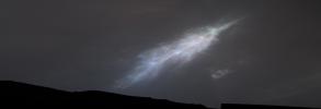
This feather-shaped iridescent cloud was captured just after sunset on Jan. 27, 2023. Studying the colors in iridescent clouds tells scientists something about particle size within the clouds and how they grow over time.
PIA25740:
Curiosity Views Feather-Shaped Iridescent Cloud
Full Resolution:     TIFF (5.465 MB)     JPEG (93.38 kB)
Add Image to Favorite List 2023-08-03 Mars Mars Science Laboratory (MSL)
Mastcam
9000x2641x3
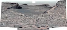
NASA's Curiosity used its Mastcam to capture this impact crater in a location nicknamed Jau on July 25, 2023. This was one of dozens of impact craters Curiosity stopped by after completing the most difficult climb of the mission.
PIA26014:
Curiosity Views a Crater at 'Jau'
Full Resolution:     TIFF (45.85 MB)     JPEG (3.742 MB)
Add Image to Favorite List 2023-08-03 Mars Mars Science Laboratory (MSL)
Mastcam
4617x2950x3
NASA's Curiosity left these tracks after trying multiple times to crest a slippery slope. This mosaic, made up of seven images that were stitched together after being sent back to Earth, was captured by the rover's Mastcam on June 13, 2023.
PIA25920:
Curiosity's Climb Attempt Leaves Tracks
Full Resolution:     TIFF (30.24 MB)     JPEG (2.791 MB)
Add Image to Favorite List 2023-08-03 Mars Mars Science Laboratory (MSL)
Mastcam
2892x1314x3
NASA's Curiosity looks back down at Marker Band Valley, where the rover's tracks are visible in the distance, after climbing a steep slope. This mosaic was captured by the rover's Mastcam on June 21, 2023.
PIA26011:
Curiosity's View Back Toward 'Marker Band Valley'
Full Resolution:     TIFF (11.1 MB)     JPEG (1.224 MB)
Add Image to Favorite List 2023-08-03 Mars Mars Science Laboratory (MSL)
Mastcam
9000x2584x3
NASA's Curiosity captured this 360-degree view of a challenging Martian slope that had a steep incline, slippery sand, and wheel-size boulders. This mosaic is composed of 145 images taken by the rover's Mastcam June 27, 2023.
PIA26012:
Curiosity's View up a Challenging Slope
Full Resolution:     TIFF (48.08 MB)     JPEG (4.328 MB)
Add Image to Favorite List 2023-08-03 Mars Mars Science Laboratory (MSL)
Mastcam
5684x3174x3
NASA's Curiosity Mars rover attempted to climb a slope near the center of this image, but struggled due to the incline, slippery sand, and wheel-size rocks.
PIA26013:
Curiosity's Attempted Climb up a Slope
Full Resolution:     TIFF (54.15 MB)     JPEG (5.622 MB)
Add Image to Favorite List 2023-08-09 Mars Mars Science Laboratory (MSL)
Mastcam
29163x8162x3
This panorama captured by NASA's Curiosity Mars rover shows a location nicknamed Pontours where scientists spotted preserved, ancient mud cracks believed to have formed during long cycles of wet and dry conditions over many years.
PIA25915:
Curiosity Views Mud Cracks in the Clay-Sulfate Transition Region
Full Resolution:     TIFF (476.1 MB)     JPEG (31.49 MB)
Add Image to Favorite List 2023-09-18 Mars Mars Science Laboratory (MSL)
Mastcam
9000x2394x3
NASA's Curiosity captured this 360-degree panorama while parked below Gediz Vallis Ridge, a formation that preserves a record of one of the last wet periods seen on this part of Mars.
PIA26019:
Curiosity Views Gediz Vallis Ridge
Full Resolution:     TIFF (48.14 MB)     JPEG (4.548 MB)
Add Image to Favorite List 2023-11-06 Mars Mars Science Laboratory (MSL)
Mastcam
1504x1000x3
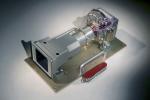
On Sept. 19, 2023, the Mastcam's filter wheel became stuck between the green and clear filter positions.
PIA26043:
Curiosity Mastcam Filter Wheel
Full Resolution:     TIFF (3.852 MB)     JPEG (134.8 kB)
Add Image to Favorite List 2023-11-06 Mars Mars Science Laboratory (MSL)
Mastcam
1583x1482x3
NASA's Curiosity Mars rover used the drill on the end of its robotic arm to collect a sample from a rock nicknamed Sequoia on Oct. 17, 2023. The rover's Mastcam captured this image.
PIA26048:
Curiosity Views 'Sequoia' Using Its Mastcam
Full Resolution:     TIFF (5.387 MB)     JPEG (433.2 kB)
Add Image to Favorite List 2013-06-19 Mars Mars Science Laboratory (MSL)
Mastcam
Navcam (MSL)
17548x3022x3
This image from NASA's Curiosity Mars rover shows Curiosity at the 'Rocknest' site where the rover scooped up samples of windblown dust and sand.
PIA16918:
Billion-Pixel View From Curiosity at Rock Nest, White-Balanced
Full Resolution:     TIFF (159.1 MB)     JPEG (7.72 MB)
Add Image to Favorite List 2013-06-19 Mars Mars Science Laboratory (MSL)
Mastcam
Navcam (MSL)
17548x3022x3
This image from NASA's Curiosity Mars rover shows Curiosity at the 'Rocknest' site where the rover scooped up samples of windblown dust and sand.
PIA16919:
Billion-Pixel View From Curiosity at Rock Nest, Raw Color
Full Resolution:     TIFF (159.1 MB)     JPEG (7.4 MB)
Add Image to Favorite List 2013-03-12 Mars Mars Exploration Rover (MER)
Mars Science Laboratory (MSL)
Mastcam
Panoramic Camera
2660x1179x3
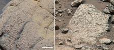
This set of images compares rocks seen by NASA's Opportunity rover and Curiosity rover at two different parts of Mars.
PIA16833:
Two Different Aqueous Environments
Full Resolution:     TIFF (9.412 MB)     JPEG (605.8 kB)
Add Image to Favorite List 2013-08-02 Mars Mars Science Laboratory (MSL)
Navigation Camera
1000x462x1
The prominent rock in this image from NASA's rover Curiosity, informally named 'East Bull Rock,' is about 20 inches (half a meter) high. The rock-studded local rise dominating the image is called 'Elsie Mountain'.
PIA17082:
Westward View from Curiosity on Sol 347
Full Resolution:     TIFF (462.7 kB)     JPEG (74.03 kB)
Add Image to Favorite List 2014-05-06 Mars Mars Science Laboratory (MSL)
Navigation Camera
598x293x1
This image from the Navigation Camera (Navcam) on NASA's Curiosity Mars rover shows two holes at top center drilled into a sandstone target called 'Windjana.' The farther hole, with larger pile of tailings around it, is a full-depth sampling hole.
PIA18090:
Sample-Collection Drill Hole on Martian Sandstone Target 'Windjana'
Full Resolution:     TIFF (175.6 kB)     JPEG (42.97 kB)
Add Image to Favorite List 2015-04-16 Mars Mars Science Laboratory (MSL)
Navigation Camera
3345x777x1
NASA's Curiosity Mars rover used its Navigation Camera (Navcam) to capture this scene toward the west just after completing a drive that took the mission's total driving distance past 10 kilometers (6.214 miles).
PIA19391:
Ten Kilometers and Counting, on Mars
Full Resolution:     TIFF (2.602 MB)     JPEG (261.5 kB)
Add Image to Favorite List 2020-06-12 Mars Mars Science Laboratory (MSL)
Navigation Camera
1600x900x3
Three images from the tool called AI4Mars show different kinds of Martian terrain as seen by NASA's Curiosity rover.
PIA23897:
Martian Terrain as Viewed in AI4Mars
Full Resolution:     TIFF (1.408 MB)     JPEG (168.6 kB)
Add Image to Favorite List 2022-10-19 Mars Mars Science Laboratory (MSL)
Navigation Camera (M2020)
7696x2165x1
NASA's Curiosity Mars rover used its navigation cameras, or Navcams, to capture this panorama while driving through the narrow Paraitepuy Pass on Aug. 11, 2022, the 3,560th Martian day, or sol, of the mission.
PIA25417:
Curiosity's Navcams View Paraitepuy Pass
Full Resolution:     TIFF (11.31 MB)     JPEG (1.471 MB)
Add Image to Favorite List 2023-06-13 Mars Mars Science Laboratory (MSL)
Navigation Camera (M2020)
3840x2160x3
NASA's Curiosity Mars rover used its navigation cameras to capture panoramas of Marker Band Valley at two times of day on April 8, 2023. Color was added to a combination of both panoramas.
PIA25912:
Curiosity's 'Postcard' of 'Marker Band Valley'
Full Resolution:     TIFF (19.22 MB)     JPEG (666.5 kB)
Add Image to Favorite List 2012-08-09 Mars Mars Science Laboratory (MSL)
Navcam (MSL)
4313x4281x1
This full-resolution self-portrait shows the deck of NASA's Curiosity rover from the rover's Navigation cameras. This full-resolution self-portrait shows the deck of NASA's Curiosity rover from the rover's Navigation cameras.
PIA16027:
Checking out the Rover Deck in Full Resolution
Full Resolution:     TIFF (18.5 MB)     JPEG (935.7 kB)
Add Image to Favorite List 2012-08-17 Mars Mars Science Laboratory (MSL)
Navcam (MSL)
5341x5301x1
This full-resolution self-portrait shows the deck of NASA's Curiosity rover. The back of the rover can be at top left, two of the right side wheels at left, and the undulating rim of Gale Crater forms the lighter color strip in the background.
PIA16063:
Still Life with Rover
Full Resolution:     TIFF (28.36 MB)     JPEG (1.591 MB)
Add Image to Favorite List 2012-08-20 Mars Mars Science Laboratory (MSL)
Navcam (MSL)
7703x2253x1
With the addition of four high-resolution Navigation Camera, or Navcam, images, taken on Aug. 18 (Sol 12), Curiosity's 360-degree landing-site panorama now includes the highest point on Mount Sharp visible from the rover.
PIA16077:
The Heights of Mount Sharp
Full Resolution:     TIFF (17.37 MB)     JPEG (1.363 MB)
Add Image to Favorite List 2012-08-29 Mars Mars Science Laboratory (MSL)
Navcam (MSL)
1024x1024x1
Soil clinging to the right middle and rear wheels of NASA's Mars rover Curiosity can be seen in this image taken by the Curiosity's Navigation Camera after the rover's third drive on Mars.
PIA15693:
Martian Soil on Curiosity's Wheels After Sol 22 Drive
Full Resolution:     TIFF (1.05 MB)     JPEG (247.4 kB)
Add Image to Favorite List 2012-09-06 Mars Mars Science Laboratory (MSL)
Navcam (MSL)
7703x1749x1
This scene shows the surroundings of the location where NASA's Mars rover Curiosity arrived on the 29th Martian day, or sol, of the rover's mission on Mars (Sept. 4, 2012).
PIA15698:
Curiosity's Location During Arm Checkouts
Full Resolution:     TIFF (13.49 MB)     JPEG (1.578 MB)
Add Image to Favorite List 2012-09-12 Mars Mars Science Laboratory (MSL)
Navcam (MSL)
1024x1024x1
This image from NASA's Curiosity rover shows the inlet covers for the Sample Analysis at Mars instrument as the rover continues to check out its instruments in the first phase after landing.
PIA16164:
Opening and Closing SAM Animation Icon
Full Resolution:     TIFF (1.05 MB)     JPEG (101.4 kB)
Add Image to Favorite List 2012-09-19 Mars Mars Science Laboratory (MSL)
Navcam (MSL)
1024x1024x1
The drive by NASA's Mars rover Curiosity during the mission's 43rd Martian day ended with this rock front of the rover. The rover team has assessed it as a suitable target for the first use of Curiosity's contact instruments on a rock.
PIA16155:
'Jake Matijevic' Contact Target for Curiosity
Full Resolution:     TIFF (1.05 MB)     JPEG (254.6 kB)
Add Image to Favorite List 2012-10-04 Mars Mars Science Laboratory (MSL)
Navcam (MSL)
7824x1488x1
This 360-degree panorama from NASA's Mars rover Curiosity shows the rocky terrain of 'Rocknest' surrounding it as of its 55th Martian day, or sol, of the mission (Oct. 1, 2012).
PIA16202:
View on the Way to 'Glenelg'
Full Resolution:     TIFF (11.65 MB)     JPEG (1.1 MB)
Add Image to Favorite List 2012-10-04 Mars Mars Science Laboratory (MSL)
Navcam (MSL)
1024x1024x1
NASA's Mars rover Curiosity cut a wheel scuff mark into a wind-formed ripple at the 'Rocknest' site to give researchers a better opportunity to examine the particle-size distribution of the material forming the ripple.
PIA16205:
Wheel Scuff Mark at 'Rocknest'
Full Resolution:     TIFF (1.05 MB)     JPEG (281.5 kB)
Add Image to Favorite List 2012-10-12 Mars Mars Science Laboratory (MSL)
Navcam (MSL)
7703x2198x1
Smooth surfaces of windblown sand and dust of the 'Rocknest' area signal an appropriate place for NASA's Curiosity to collect and use the mission's first few scoopfuls of soil.
PIA16227:
Curiosity's Location During First Scooping
Full Resolution:     TIFF (16.95 MB)     JPEG (1.911 MB)
Add Image to Favorite List 2012-10-18 Mars Mars Science Laboratory (MSL)
Navcam (MSL)
1024x1024x1
Three bite marks left in the Martian ground by the scoop on the robotic arm of NASA's Mars rover Curiosity are visible in this image. Each of the three bites is about 2 inches (5 centimeters) wide.
PIA16231:
Curiosity's First Three Bites Into Martian Ground
Full Resolution:     TIFF (1.05 MB)     JPEG (161.7 kB)
Add Image to Favorite List 2012-10-25 Mars Mars Science Laboratory (MSL)
Navcam (MSL)
438x200x1
Sample material from the fourth scoop of Martian soil collected by NASA's Mars rover Curiosity is on the rover's observation tray in this image taken during the mission's 78th Martian sol, (Oct. 24, 2012) by Curiosity's left Navigation Camera.
PIA16235:
Scooped Material on Rover's Observation Tray
Full Resolution:     TIFF (87.91 kB)     JPEG (14.34 kB)
Add Image to Favorite List 2012-11-15 Mars Mars Science Laboratory (MSL)
Navcam (MSL)
1024x1024x1
NASA's Mars rover Curiosity used a mechanism on its robotic arm to dig up five scoopfuls of material from a patch of dusty sand called 'Rocknest,' producing the five bite-mark pits visible in this image from the rover's left Navigation Camera (Navcam).
PIA16199:
Five Bites Into Mars
Full Resolution:     TIFF (1.05 MB)     JPEG (120.5 kB)
Add Image to Favorite List 2012-11-20 Mars Mars Science Laboratory (MSL)
Navcam (MSL)
1024x1024x1
NASA's Mars rover Curiosity drove 83 feet eastward during the 102nd Martian day, or sol, of the mission (Nov. 18, 2012). At the end of the drive, Curiosity's view was toward 'Yellowknife Bay' in the 'Glenelg' area of Gale Crater.
PIA16447:
Post-Drive View on Curiosity's Sol 102
Full Resolution:     TIFF (1.05 MB)     JPEG (179.7 kB)
Add Image to Favorite List 2012-11-20 Mars Mars Science Laboratory (MSL)
Navcam (MSL)
3707x996x1
NASA's Mars rover Curiosity drove 6.2 feet (1.9 meters) during the 100th Martian day, or sol, of the mission (Nov. 16, 2012). The view spans from north at the left to south-southeast at the right. It is presented in a cylindrical projection.
PIA16448:
Curiosity's Eastward View After Sol 100 Drive
Full Resolution:     TIFF (3.696 MB)     JPEG (460.2 kB)
Add Image to Favorite List 2012-11-20 Mars Mars Science Laboratory (MSL)
Navcam (MSL)
3893x1162x3
NASA's Mars rover Curiosity drove 6.2 feet (1.9 meters) during the 100th Martian day, or sol, of the mission (Nov. 16, 2012). The rover used its Navigation Camera after the drive to record the images combined into this 3-D panoramic view.
PIA16449:
Curiosity's Eastward View After Sol 100 Drive, Stereo
Full Resolution:     TIFF (13.58 MB)     JPEG (640.8 kB)
Add Image to Favorite List 2012-12-11 Mars Mars Science Laboratory (MSL)
Navcam (MSL)
5012x988x1
The NASA Mars rover Curiosity used its Navigation Camera (Navcam) during the mission's 120th Martian day, or sol (Dec. 7, 2012), to record the seven images combined into this panoramic view.
PIA16551:
Sol 120 Panorama from Curiosity, near 'Shaler'
Full Resolution:     TIFF (4.96 MB)     JPEG (606.5 kB)
Add Image to Favorite List 2012-12-11 Mars Mars Science Laboratory (MSL)
Navcam (MSL)
5168x1157x3
This stereo panoramic view combines 14 images taken by NASA's Mars rover Curiosity during the mission's 120th Martian day, or sol (Dec. 7, 2012). You need 3D glasses.
PIA16552:
Sol 120 Panorama from Curiosity, near 'Shaler' (Stereo)
Full Resolution:     TIFF (17.95 MB)     JPEG (728.3 kB)
Add Image to Favorite List 2012-12-18 Mars Mars Science Laboratory (MSL)
Navcam (MSL)
1024x1024x1
The NASA Mars rover Curiosity used its left Navigation Camera to record this view of the step down into a shallow depression called 'Yellowknife Bay.' The descent into the basin crossed a step about 2 feet high, visible in the upper half of this image.
PIA16553:
Looking Back at Entry Into 'Yellowknife Bay'
Full Resolution:     TIFF (1.05 MB)     JPEG (138.6 kB)
Add Image to Favorite List 2012-12-21 Mars Mars Science Laboratory (MSL)
Navcam (MSL)
4798x1769x1
In a shallow depression called 'Yellowknife Bay,' the NASA Mars rover Curiosity drove to an edge of the feature to record this view of the ledge at the margin and a view across the 'bay' during the 130th Martian day, or sol, (Dec. 17, 2012).
PIA16562:
At Edge of 'Yellowknife Bay,' Sol 130
Full Resolution:     TIFF (8.502 MB)     JPEG (863 kB)
Add Image to Favorite List 2013-01-04 Mars Mars Science Laboratory (MSL)
Navcam (MSL)
1371x667x1
The sinuous rock feature in the lower center of this mosaic of images recorded by the NASA Mars rover Curiosity is called 'Snake River.' Curiosity gets a closer look at Snake River for before proceeding to other nearby rocks.
PIA16564:
'Snake River' Rock Feature Viewed by Curiosity Mars Rover
Full Resolution:     TIFF (915.7 kB)     JPEG (179.5 kB)
Add Image to Favorite List 2013-04-23 Mars Mars Science Laboratory (MSL)
Navcam (MSL)
7824x3328x3
In the center foreground, NASA's Curiosity rover's arm holds the tool turret above a target called 'Wernecke' on the 'John Klein' patch of pale-veined mudstone.
PIA16847:
Mars Stereo View from "John Klein" to Mount Sharp (Raw)
Full Resolution:     TIFF (78.14 MB)     JPEG (2.325 MB)
Add Image to Favorite List 2013-03-25 Mars Mars Science Laboratory (MSL)
Navcam (MSL)
1024x1024x1
This view of Curiosity's left-front and left-center wheels and of marks made by wheels on the ground in the 'Yellowknife Bay' area comes from one of six cameras used on Mars for the first time more than six months after the rover landed.
PIA16812:
View From Camera Not Used During Curiosity's First Six Months on Mars
Full Resolution:     TIFF (1.05 MB)     JPEG (241.9 kB)
Add Image to Favorite List 2013-04-23 Mars Mars Science Laboratory (MSL)
Navcam (MSL)
7824x2131x3
The left and right eyes of the Navigation Camera (Navcam) in NASA's Curiosity Mars rover took the dozens of images combined into this 3-D scene of the rover and its surroundings.
PIA16925:
Mars Stereo View from "John Klein" to Mount Sharp
Full Resolution:     TIFF (50.04 MB)     JPEG (1.804 MB)
Add Image to Favorite List 2013-06-05 Mars Mars Science Laboratory (MSL)
Navcam (MSL)
1372x1104x3
This image produced from software used for planning drives of NASA's Mars rover Curiosity depicts the location and size of the rover when it was driven into position for drilling into rock target 'Cumberland.'
PIA17065:
Position of Curiosity for Drilling at 'Cumberland'
Full Resolution:     TIFF (4.546 MB)     JPEG (185.5 kB)
Add Image to Favorite List 2013-07-02 Phobos Mars Science Laboratory (MSL)
Navcam (MSL)
511x511x1
This frame from an animation shows Phobos, the larger of the two moons of Mars, passing overhead, as observed by NASA's Mars rover Curiosity, centered straight overhead starting shortly after sunset.
PIA17270:
Phobos Passing Overhead Animation Icon
Full Resolution:     TIFF (261.6 kB)     JPEG (15.82 kB)
Add Image to Favorite List 2013-07-08 Mars Mars Science Laboratory (MSL)
Navcam (MSL)
1024x1024x1
This view from the left Navigation Camera (Navcam) of NASA's Mars Rover Curiosity looks back at wheel tracks made during the first drive away from the last science target in the 'Glenelg' area.
PIA17272:
First Leg of Long Trek Toward Mount Sharp
Full Resolution:     TIFF (1.05 MB)     JPEG (298.1 kB)
Add Image to Favorite List 2013-07-11 Mars Mars Science Laboratory (MSL)
Navcam (MSL)
1024x1024x1
Lower slopes of Mount Sharp appear at the top of this image taken by the right Navigation Camera (Navcam) of NASA's Mars rover Curiosity at the end of a drive of about 135 feet during the 329th Martian day, or sol, of the rover's work on Mars.
PIA17269:
Heading for Mount Sharp, Sol 329
Full Resolution:     TIFF (1.05 MB)     JPEG (248.8 kB)
Add Image to Favorite List 2013-08-27 Mars Mars Science Laboratory (MSL)
Navcam (MSL)
6124x987x1
This mosaic of images from the Navigation Camera (Navcam) on NASA's Mars rover Curiosity shows the scene from the rover's position on the 376th Martian day, or sol, of the mission (Aug. 27, 2013).
PIA17354:
View Ahead After Curiosity's Sol 376 Drive Using Autonomous Navigation
Full Resolution:     TIFF (6.053 MB)     JPEG (873.6 kB)
Add Image to Favorite List 2013-09-10 Mars Mars Science Laboratory (MSL)
Navcam (MSL)
1840x718x1
In the upper central portion of this image is a patch of ground paler than its surroundings as seen by NASA's Mars rover Curiosity after reaching the top of a rise called 'Panorama Point.'
PIA17359:
Curiosity's View from 'Panorama Point' to 'Waypoint 1' and Outcrop 'Darwin'
Full Resolution:     TIFF (1.323 MB)     JPEG (210.5 kB)
Add Image to Favorite List 2013-10-29 Mars Mars Science Laboratory (MSL)
Navcam (MSL)
1323x456x1
The low ridge that appears as a dark band below the horizon in the center of this scene is a Martian outcrop called 'Cooperstown,' a possible site for contact inspection with tools on the robotic arm of NASA's Mars rover Curiosity.
PIA17580:
Curiosity's View of "Cooperstown" Outcrop on Route to Mount Sharp
Full Resolution:     TIFF (604.1 kB)     JPEG (97.89 kB)
Add Image to Favorite List 2013-12-20 Mars Mars Science Laboratory (MSL)
Navcam (MSL)
7696x1739x1
The rock-studded terrain NASA's Mars rover Curiosity has traversed since October 2013 appears to have accelerated the pace of wear and tear on the rover's wheels. Future drives may be charted to cross smoother ground where available.
PIA17581:
Rocky Mars Ground Where Curiosity Has Been Driving
Full Resolution:     TIFF (13.4 MB)     JPEG (1.933 MB)
Add Image to Favorite List 2013-12-20 Mars Mars Science Laboratory (MSL)
Navcam (MSL)
7733x2206x3
NASA's Mars rover Curiosity captured this 3-D view of the rock-studded terrain Curiosity has traversed since October 2013, accelerating the pace of wear and tear on the rover's wheels.
PIA17584:
Rocky Mars Ground Where Curiosity Has Been Driving (Stereo)
Full Resolution:     TIFF (51.19 MB)     JPEG (2.437 MB)
Retrieve Previous Set  Jump to a Previous Set   Jump to a Previous Set   Jump to a Previous Set   Jump to a Previous Set   Jump to a Previous Set   Jump to a Previous Set   Current Set   Jump to a Following Set   Jump to a Following Set   Retrieve Next Set 
 1-100   101-200   201-300   301-400   401-500   501-600   601-700   701-800   801-900 
Currently displaying images: 601 - 700 of 810