|
Your search criteria found 1000 images Target is Mars (and available satellites) |
| My List |
Addition Date | Target | Mission |
Instrument
|
Size |

|
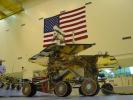
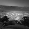
2003-10-30 | Mars |
Mars Exploration Rover (MER) |
1280x960x3 | |
|
|||||
|
|
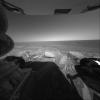
2003-10-30 | Mars |
Mars Exploration Rover (MER) |
626x960x3 | |
|
|||||
|
|
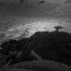
2003-10-30 | Mars |
Mars Exploration Rover (MER) |
1280x960x3 | |
|
|||||
|
|
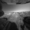
2003-10-30 | Mars |
Mars Exploration Rover (MER) |
1280x834x3 | |
|
|||||
|
|
2003-10-30 | Mars |
Mars Exploration Rover (MER) |
626x960x3 | |
|
|||||
|
|
2003-10-30 | Mars |
Mars Exploration Rover (MER) |
1280x960x3 | |

|
|||||
|
|
2003-10-30 | Mars |
Mars Exploration Rover (MER) |
1280x960x3 | |
|
|||||
|
|
2003-10-30 | Mars |
Mars Exploration Rover (MER) |
3000x1955x3 | |
|
|||||
|
|
2003-10-30 | Mars |
Mars Exploration Rover (MER) |
1536x2048x3 | |
|
|||||
|
|
2003-10-30 | Mars |
Mars Exploration Rover (MER) |
1800x1350x3 | |

|
|||||
|
|
2003-11-07 | Mars |
Mars Exploration Rover (MER) |
3000x1955x3 | |
|
|||||
|
|
2003-11-07 | Mars |
Mars Exploration Rover (MER) |
3000x1955x3 | |
|
|||||
|
|
2003-11-07 | Mars |
Mars Exploration Rover (MER) |
3000x1955x3 | |
|
|||||
|
|
2003-11-07 | Mars |
Mars Exploration Rover (MER) |
3000x2387x3 | |
|
|||||
|
|
2003-11-07 | Mars |
Mars Exploration Rover (MER) |
3000x1968x3 | |

|
|||||
|
|
2003-11-07 | Mars |
Mars Exploration Rover (MER) |
3000x1995x3 | |
|
|||||
|
|
2003-11-07 | Mars |
Mars Exploration Rover (MER) |
3000x1995x3 | |

|
|||||
|
|
2004-02-09 | Mars |
2001 Mars Odyssey Mars Exploration Rover (MER) |
1000x750x3 | |
|
|||||
|
|
2004-02-12 | Mars |
Mars Exploration Rover (MER) |
720x480x3 | |
|
|||||
|
|
2004-02-17 | Mars |
Mars Exploration Rover (MER) |
692x609x3 | |
|
|||||
|
|
2004-02-17 | Mars |
Mars Exploration Rover (MER) |
904x469x3 | |
|
|||||
|
|
2004-05-06 | Mars |
Mars Exploration Rover (MER) |
1126x882x3 | |
|
|||||
|
|
2005-12-05 | Mars |
Mars Exploration Rover (MER) |
911x623x3 | |
|
|||||
|
|
2005-12-05 | Mars |
Mars Exploration Rover (MER) |
896x549x3 | |

|
|||||
|
|
2009-01-05 | Mars |
Mars Exploration Rover (MER) |
2442x3246x3 | |
|
|||||
|
|
2009-01-05 | Mars |
Mars Exploration Rover (MER) |
2442x3246x3 | |
|
|||||
|
|
2013-06-07 | Mars |
Mars Exploration Rover (MER) |
3082x2500x3 | |
|
|||||
|
|
2014-01-23 | Mars |
Mars Exploration Rover (MER) |
1280x720x3 | |
|
|||||
|
|
2015-03-24 | Mars |
Mars Exploration Rover (MER) |
3200x1400x3 | |

|
|||||
|
|
2018-06-13 | Mars |
Mars Exploration Rover (MER) |
1500x1000x3 | |
|
|||||
|
|
2004-02-09 | Mars |
Mars Global Surveyor (MGS) Mars Exploration Rover (MER) |
5440x5400x3 | |

|
|||||
|
|
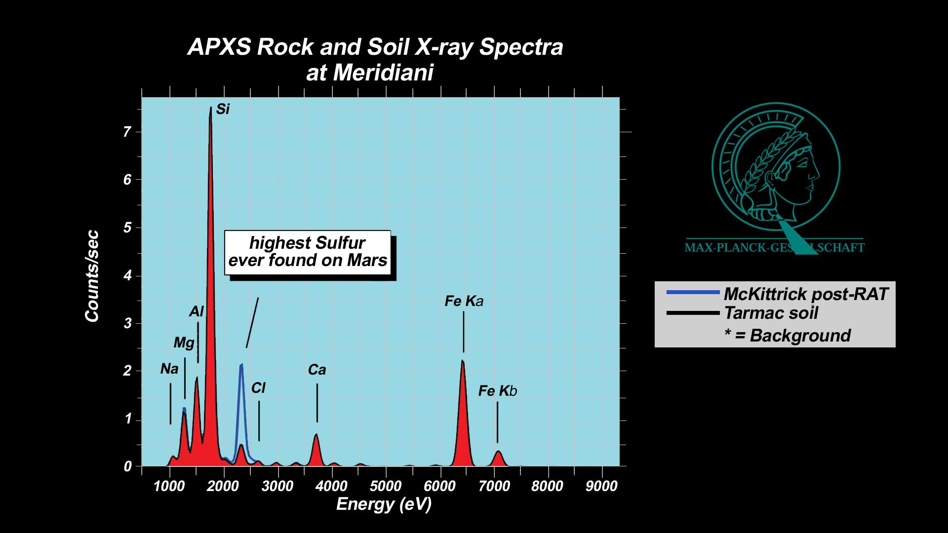
2004-02-19 | Mars |
Mars Exploration Rover (MER) |
Alpha Particle X-ray Spectrometer |
1092x724x3 |
|
|||||
|
|
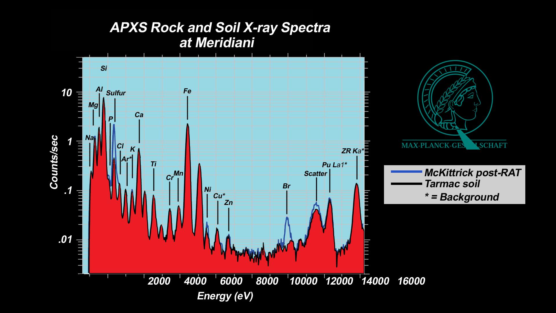
2004-03-02 | Mars |
Mars Exploration Rover (MER) |
Alpha Particle X-ray Spectrometer |
1920x1080x3 |
|
|||||
|
|
2004-04-14 | Mars |
Mars Exploration Rover (MER) |
Alpha Particle X-ray Spectrometer |
1031x783x3 |
|
|||||
|
|
2004-07-16 | Mars |
Mars Exploration Rover (MER) |
Alpha Particle X-ray Spectrometer |
720x540x3 |
|
|||||
|
|
2011-09-01 | Mars |
Mars Exploration Rover (MER) |
Alpha Particle X-ray Spectrometer |
934x673x3 |
|
|||||
|
|
2004-03-13 | Mars |
Mars Exploration Rover (MER) |
Alpha Particle X-ray Spectrometer Microscopic Imager Moessbauer Spectrometer |
2048x2048x1 |
|
|||||
|
|
2004-02-02 | Mars |
Mars Exploration Rover (MER) |
Alpha Particle X-ray Spectrometer Panoramic Camera |
512x512x1 |

|
|||||
|
|
2004-03-02 | Mars |
Mars Exploration Rover (MER) |
Alpha Particle X-ray Spectrometer Rock Abrasion Tool (RAT) |
1920x1080x3 |
|
|||||
|
|
2004-03-02 | Mars |
Mars Exploration Rover (MER) |
Alpha Particle X-ray Spectrometer Rock Abrasion Tool (RAT) |
1920x1080x3 |

|
|||||
|
|
2004-03-02 | Mars |
Mars Exploration Rover (MER) |
Alpha Particle X-ray Spectrometer Rock Abrasion Tool (RAT) |
720x486x3 |
|
|||||
|
|
2010-06-29 | Mars |
Mars Exploration Rover (MER) |
CTX |
4056x4096x1 |

|
|||||
|
|
2011-06-08 | Mars |
Mars Exploration Rover (MER) Mars Reconnaissance Orbiter (MRO) |
CTX |
2948x2193x3 |
|
|||||
|
|
2011-08-05 | Mars |
Mars Exploration Rover (MER) |
CTX |
943x1989x3 |
|
|
|||||
|
|
2011-08-05 | Mars |
Mars Exploration Rover (MER) |
CTX |
943x759x3 |
|
|||||
|
|
2011-09-01 | Mars |
Mars Exploration Rover (MER) Mars Reconnaissance Orbiter (MRO) |
CTX |
5664x7979x3 |
|
|||||
|
|
2013-06-07 | Mars |
Mars Exploration Rover (MER) Mars Reconnaissance Orbiter (MRO) |
CTX |
5198x3900x3 |
|
|||||
|
|
2013-12-03 | Mars |
Mars Exploration Rover (MER) Mars Reconnaissance Orbiter (MRO) |
CTX |
4731x3605x3 |
|
|||||
|
|
2014-01-23 | Mars |
Mars Exploration Rover (MER) Mars Reconnaissance Orbiter (MRO) |
CTX |
4853x3687x3 |
|
|||||
|
|
2014-07-28 | Mars |
Mars Exploration Rover (MER) Mars Reconnaissance Orbiter (MRO) |
CTX |
2420x1838x3 |
|
|||||
|
|
2015-03-24 | Mars |
Mars Exploration Rover (MER) |
CTX |
3360x2537x3 |
|
|||||
|
|
2017-04-19 | Mars |
Mars Exploration Rover (MER) |
CTX |
509x905x1 |
|
|||||
|
|
2010-12-10 | Mars |
Mars Exploration Rover (MER) |
CTX HiRISE |
3038x6485x1 |
|
|
|||||
|
|
2004-01-25 | Mars |
Mars Exploration Rover (MER) |
Descent Image Motion Estimation System (DIMES) |
1024x1021x1 |
|
|||||
|
|
2004-01-25 | Mars |
Mars Exploration Rover (MER) |
Descent Image Motion Estimation System (DIMES) |
1024x1021x1 |
|
|||||
|
|
2004-01-25 | Mars |
Mars Exploration Rover (MER) |
Descent Image Motion Estimation System (DIMES) |
1024x1021x1 |
|
|||||
|
|
2004-02-09 | Mars |
Mars Exploration Rover (MER) |
Descent Image Motion Estimation System (DIMES) |
878x774x3 |
|
|||||
|
|
2004-02-09 | Mars |
Mars Exploration Rover (MER) |
Descent Image Motion Estimation System (DIMES) |
764x614x3 |
|
|||||
|
|
2004-02-09 | Mars |
Mars Exploration Rover (MER) |
Descent Image Motion Estimation System (DIMES) |
875x345x3 |
|
|||||
|
|
2004-01-28 | Mars |
Mars Global Surveyor (MGS) Mars Exploration Rover (MER) |
Descent Image Motion Estimation System (DIMES) Mars Orbiter Camera (MOC) |
1700x1700x1 |
|
|||||
|
|
2004-06-03 | Mars |
Mars Global Surveyor (MGS) Mars Exploration Rover (MER) |
Descent Image Motion Estimation System (DIMES) Mars Orbiter Camera (MOC) Navigation Camera Panoramic Camera |
4004x4000x1 |
|
|||||
|
|
2004-02-09 | Mars |
2001 Mars Odyssey Mars Global Surveyor (MGS) Mars Exploration Rover (MER) |
Descent Image Motion Estimation System (DIMES) Mars Orbiter Camera (MOC) Thermal Emission Imaging System |
4000x5308x3 |
|
|||||
|
|
2005-03-30 | Mars |
Mars Exploration Rover (MER) Mars Global Surveyor (MGS) 2001 Mars Odyssey |
Descent Image Motion Estimation System (DIMES) Mars Orbiter Camera Thermal Emission Imaging System |
2392x1823x3 |
|
|||||
|
|
2005-12-05 | Mars |
2001 Mars Odyssey Mars Global Surveyor (MGS) Mars Exploration Rover (MER) |
Descent Image Motion Estimation System (DIMES) Mars Orbiter Camera Thermal Emission Imaging System |
1411x2043x3 |
|
|||||
|
|
2004-09-21 | Mars |
Mars Exploration Rover (MER) |
Descent Image Motion Estimation System (DIMES) Navigation Camera |
1054x701x3 |
|
|||||
|
|
2004-01-25 | Mars |
Mars Exploration Rover (MER) |
Hazcam |
512x512x1 |
|
|||||
|
|
2004-01-28 | Mars |
Mars Exploration Rover (MER) |
Hazcam |
512x512x1 |

|
|||||
|
|
2004-01-28 | Mars |
Mars Exploration Rover (MER) |
Hazcam |
512x512x5 |
|
|
||||
|
|
2004-01-30 | Mars |
Mars Exploration Rover (MER) |
Hazcam |
1024x1024x1 |

|
|||||
|
|
2004-01-30 | Mars |
Mars Exploration Rover (MER) |
Hazcam |
1024x1024x3 |
|
|
||||
|
|
2004-01-31 | Mars |
Mars Exploration Rover (MER) |
Hazcam |
1024x1024x1 |

|
|||||
|
|
2004-01-31 | Mars |
Mars Exploration Rover (MER) |
Hazcam |
1024x1024x1 |
|
|||||
|
|
2004-01-31 | Mars |
Mars Exploration Rover (MER) |
Hazcam |
1024x1024x3 |
|
|||||
|
|
2004-02-02 | Mars |
Mars Exploration Rover (MER) |
Hazcam |
512x512x1 |

|
|||||
|
|
2004-02-02 | Mars |
Mars Exploration Rover (MER) |
Hazcam |
954x1024x3 |
|
|||||
|
|
2004-02-04 | Mars |
Mars Exploration Rover (MER) |
Hazcam |
512x512x1 |

|
|||||
|
|
2004-02-06 | Mars |
Mars Exploration Rover (MER) |
Hazcam |
1024x865x3 |
|
|||||
|
|
2004-02-06 | Mars |
Mars Exploration Rover (MER) |
Hazcam |
1024x1024x6 |
|
|
||||
|
|
2004-02-06 | Mars |
Mars Exploration Rover (MER) |
Hazcam |
1024x1024x5 |
|
|
||||
|
|
2004-02-06 | Mars |
Mars Exploration Rover (MER) |
Hazcam |
1024x1024x6 |
|
|
||||
|
|
2004-02-16 | Mars |
Mars Exploration Rover (MER) |
Hazcam |
1024x1024x1 |

|
|||||
|
|
2004-02-17 | Mars |
Mars Exploration Rover (MER) |
Hazcam |
1025x947x1 |

|
|||||
|
|
2004-02-17 | Mars |
Mars Exploration Rover (MER) |
Hazcam |
1431x953x1 |
|
|||||
|
|
2004-02-17 | Mars |
Mars Exploration Rover (MER) |
Hazcam |
1022x624x1 |
|
|||||
|
|
2004-02-18 | Mars |
Mars Exploration Rover (MER) |
Hazcam |
544x624x7 |
|
|
||||
|
|
2004-02-19 | Mars |
Mars Exploration Rover (MER) |
Hazcam |
512x512x9 |
|
|
||||
|
|
2004-03-03 | Mars |
Mars Exploration Rover (MER) |
Hazcam |
256x256x1 |
|
|||||
|
|
2004-03-13 | Mars |
Mars Exploration Rover (MER) |
Hazcam |
1024x1024x1 |
|
|||||
|
|
2004-03-16 | Mars |
Mars Exploration Rover (MER) |
Hazcam |
3100x3100x3 |
|
|||||
|
|
2004-03-19 | Mars |
Mars Exploration Rover (MER) |
Hazcam |
3200x3209x1 |
|
|||||
|
|
2004-03-30 | Mars |
Mars Exploration Rover (MER) |
Hazcam |
1014x1014x1 |
|
|||||
|
|
2004-03-29 | Mars |
Mars Exploration Rover (MER) |
Hazcam |
512x512x1 |

|
|||||
|
|
2004-04-01 | Mars |
Mars Exploration Rover (MER) |
Hazcam |
1024x768x1 |
|
|||||
|
|
2004-04-02 | Mars |
Mars Exploration Rover (MER) |
Hazcam |
512x512x8 |
|
|
||||
|
|
2004-04-08 | Mars |
Mars Exploration Rover (MER) |
Hazcam |
1024x1024x1 |
|
|||||
|
|
2004-04-14 | Mars |
Mars Exploration Rover (MER) |
Hazcam |
1022x616x18 |
|
|
||||
|
|
2004-06-15 | Mars |
Mars Exploration Rover (MER) |
Hazcam |
1024x1024x1 |
|
|||||
|
|
2004-06-15 | Mars |
Mars Exploration Rover (MER) |
Hazcam |
1024x1024x1 |
|
|||||
|
|
2004-06-15 | Mars |
Mars Exploration Rover (MER) |
Hazcam |
1024x1024x1 |
|
|||||
|
|
2004-06-15 | Mars |
Mars Exploration Rover (MER) |
Hazcam |
1024x1024x1 |
|
|||||
 |
 |
|
|
|
|
|
|
|
|

|
|
| 1-100 | 101-200 | 201-300 | 301-400 | 401-500 | 501-600 | 601-700 | 701-800 | 801-900 | 901-1000 |
| Currently displaying images: 1 - 100 of 1000 |