Click on an image for detailed information
Click on a column heading to sort in ascending or descending order

My
List |
Addition Date
|
Target
|
Mission
|
Instrument
|
Size
|

|
1998-09-26 |
Earth
|
TOPEX/Poseidon
|
Altimeter
|
900x900x3 |
|
-
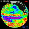
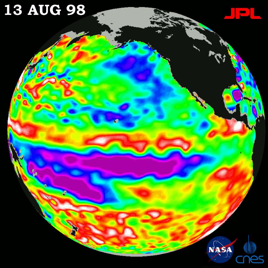
PIA01473:
-
TOPEX/El Ni�o Watch - Little Change in Pacific, August 13, 1998
Full Resolution:
TIFF
(912.8 kB)
JPEG
(118.6 kB)
|
|
|
1998-09-26 |
Earth
|
TOPEX/Poseidon
|
Altimeter
|
902x900x3 |
|
-
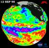
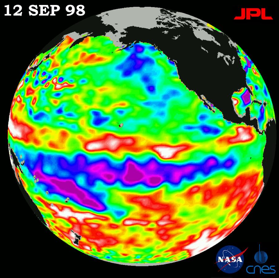
PIA01474:
-
TOPEX/El Ni�o Watch - Satellite Shows Pacific Running Hot and Cold, September 12, 1998
Full Resolution:
TIFF
(820.8 kB)
JPEG
(120 kB)
|
|
|
1998-10-30 |
Earth
|
Voyager
|
VG Imaging Science Subsystem
|
2012x2994x3 |
|
-
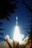
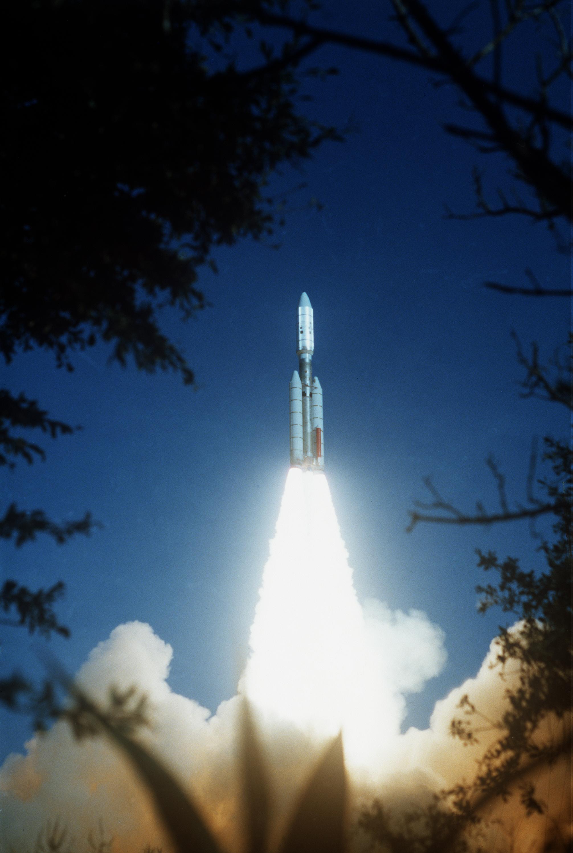
PIA01480:
-
Voyager 2 Launch
Full Resolution:
TIFF
(17.25 MB)
JPEG
(444 kB)
|
|
|
1998-11-04 |
Earth
|
TOPEX/Poseidon
|
Altimeter
|
1908x1908x3 |
|
-
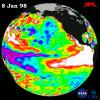
PIA01164:
-
TOPEX/El Ni�o Watch - El Ni�o Warm Water Pool Decreasing, Jan, 08, 1998
Full Resolution:
TIFF
(3.555 MB)
JPEG
(356 kB)
|
|
|
1998-11-04 |
Earth
|
TOPEX/Poseidon
|
Altimeter
|
1912x1908x3 |
|
-
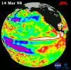
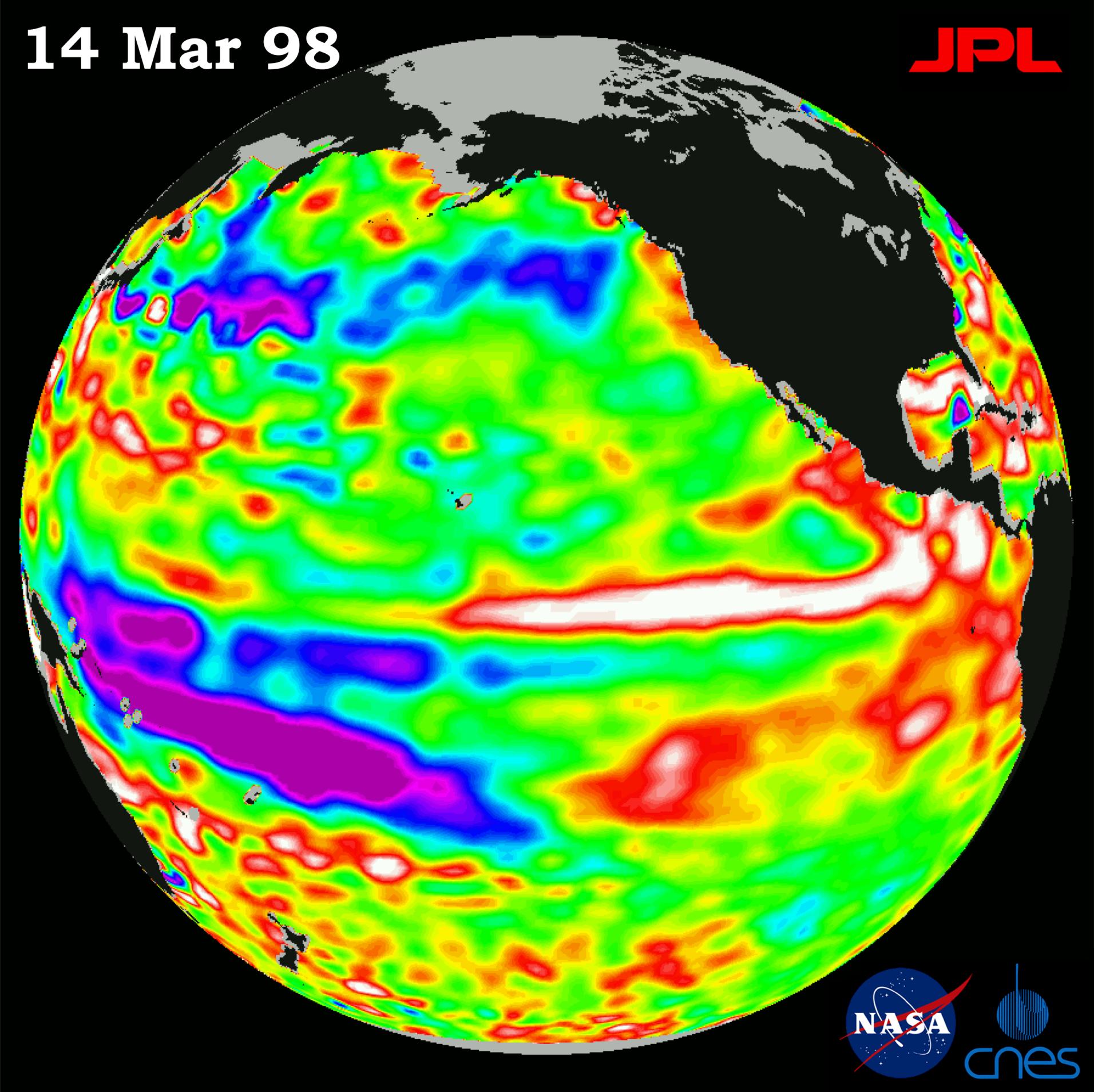
PIA01449:
-
TOPEX/El Ni�o Watch - Satellite shows El Ni�o-related Sea Surface Height, Mar, 14, 1998
Full Resolution:
TIFF
(4.161 MB)
JPEG
(361.7 kB)
|
|
|
1998-12-05 |
Earth
|
TOPEX/Poseidon
|
Altimeter
|
902x900x3 |
|
-
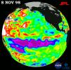
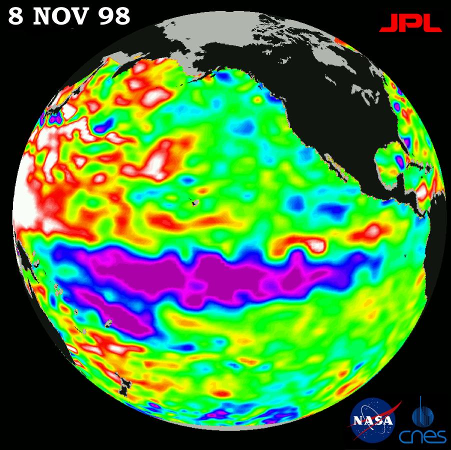
PIA01497:
-
TOPEX/El Ni�o Watch - La Ni�a looks "frozen" in Pacific, November 8, 1998
Full Resolution:
TIFF
(827.3 kB)
JPEG
(116.7 kB)
|
|
|
1998-12-05 |
Earth
|
TOPEX/Poseidon
|
Altimeter
|
902x900x3 |
|
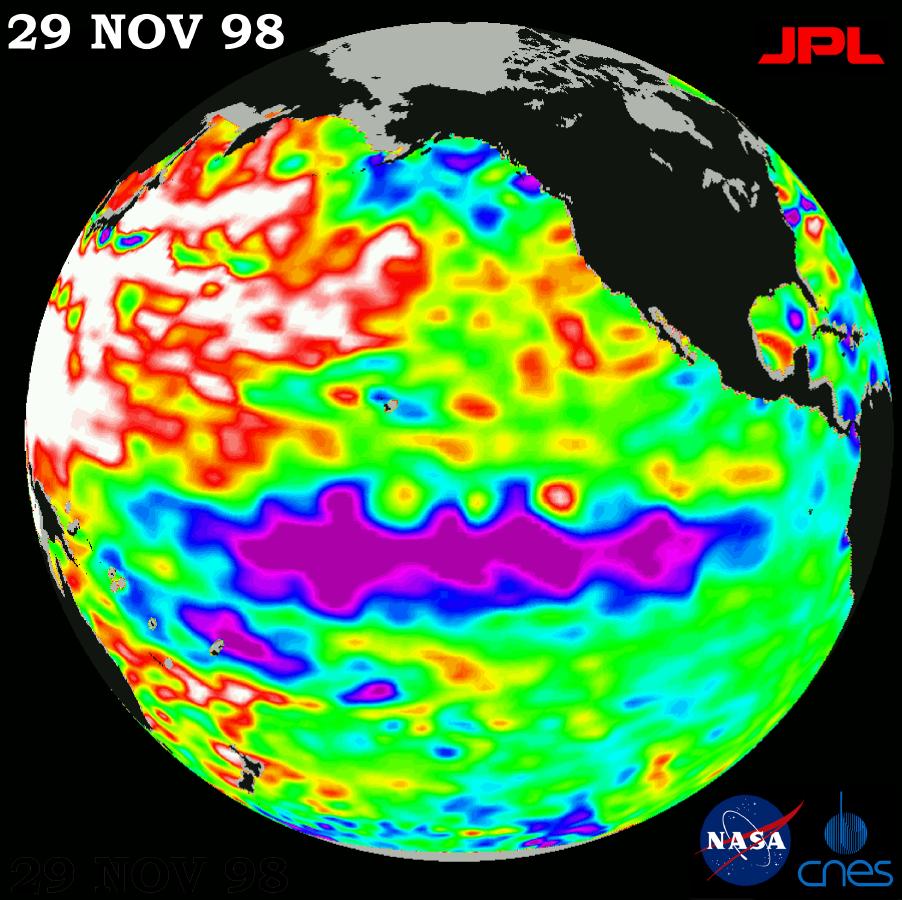
-
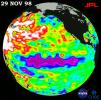
PIA01498:
-
TOPEX/El Ni�o Watch - Topex/Poseidon Shows Unusual Pacific, November 29, 1998
Full Resolution:
TIFF
(821.3 kB)
JPEG
(117.7 kB)
|
|
|
1999-01-27 |
Earth
|
Spaceborne Imaging Radar-C/X-Band Synthetic Aperture Radar
|
|
804x1330x3 |
|
-
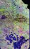
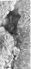
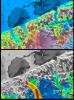
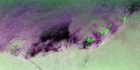
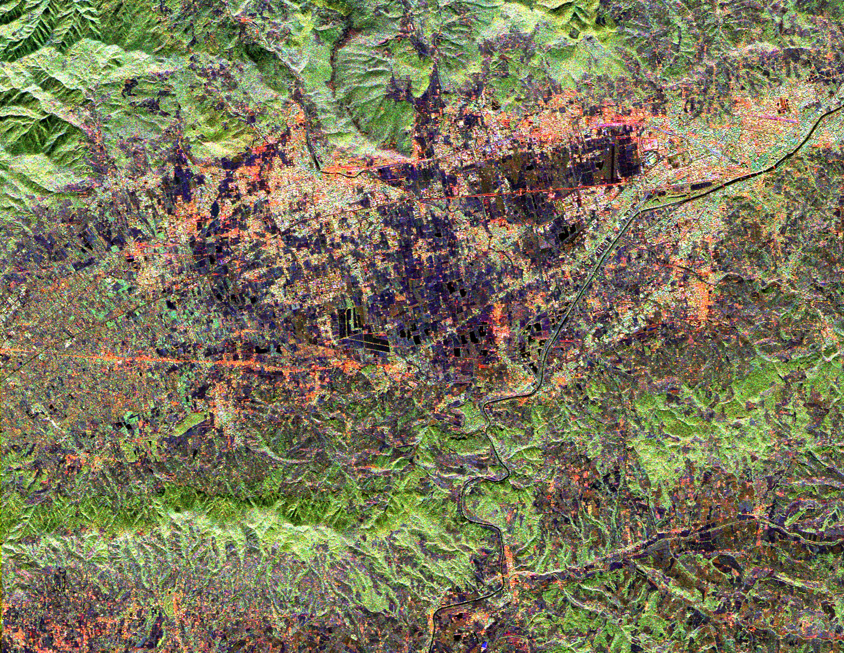
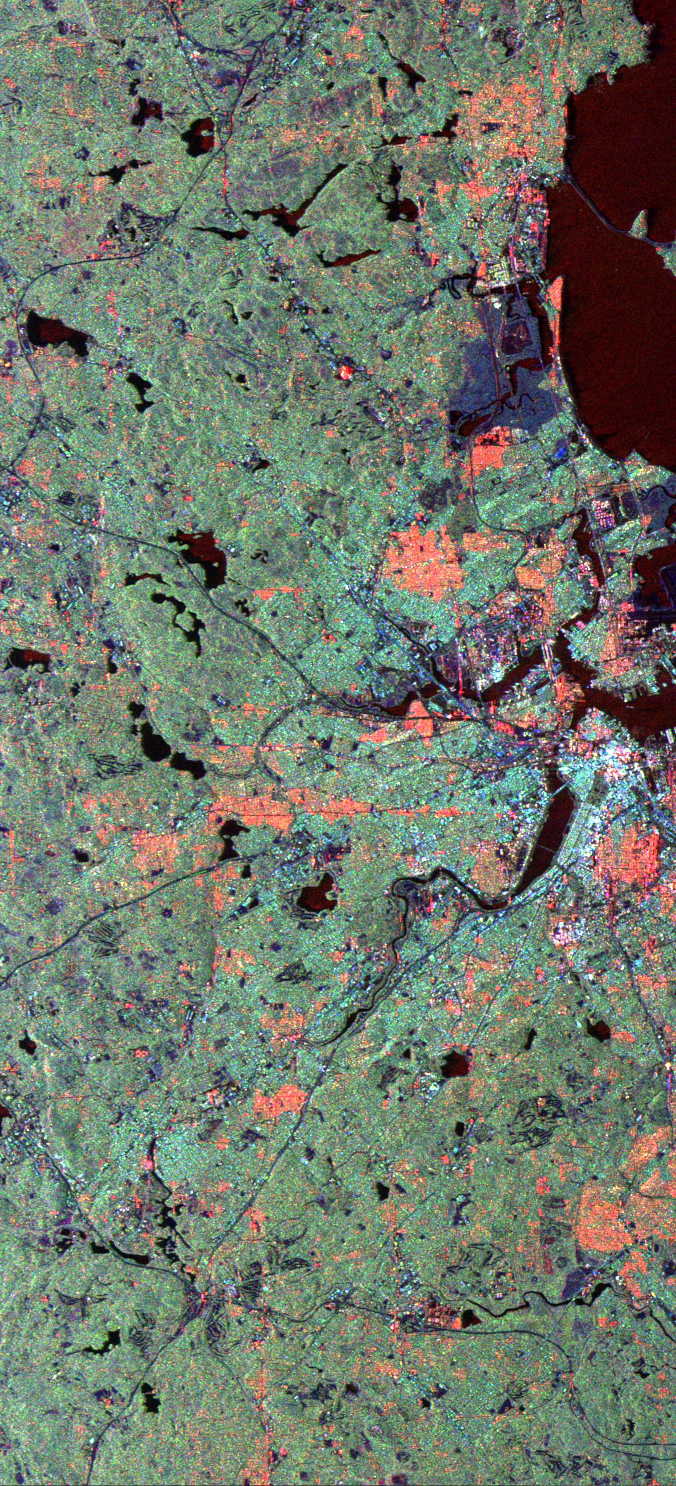
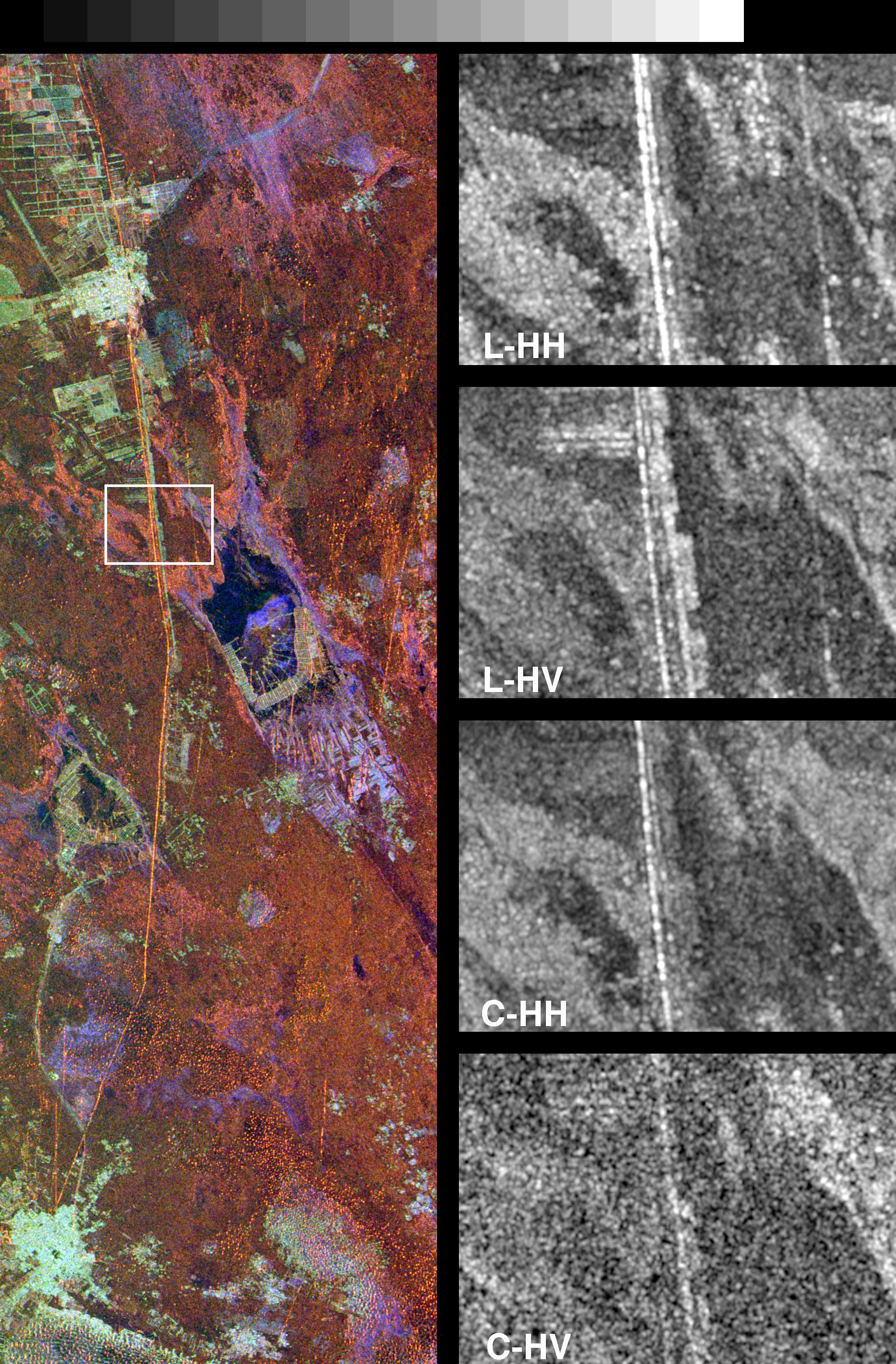
PIA01700:
-
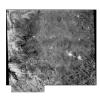
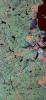
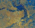
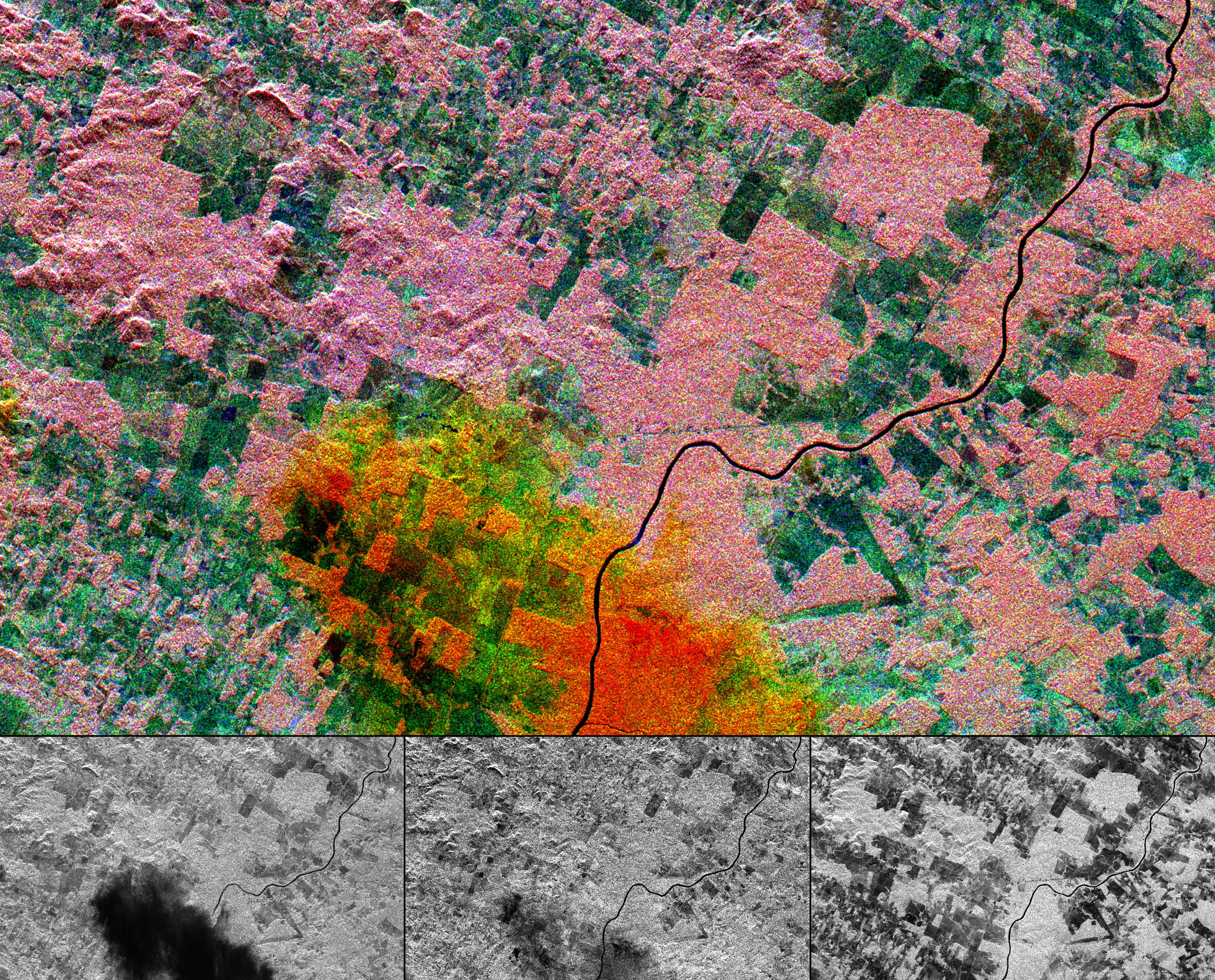
Space Radar Image of Raco, Michigan
Full Resolution:
TIFF
(4.208 MB)
JPEG
(489.4 kB)
|
|
|
1999-01-27 |
Earth
|
Spaceborne Imaging Radar-C/X-Band Synthetic Aperture Radar
|
|
784x1765x1 |
|
-
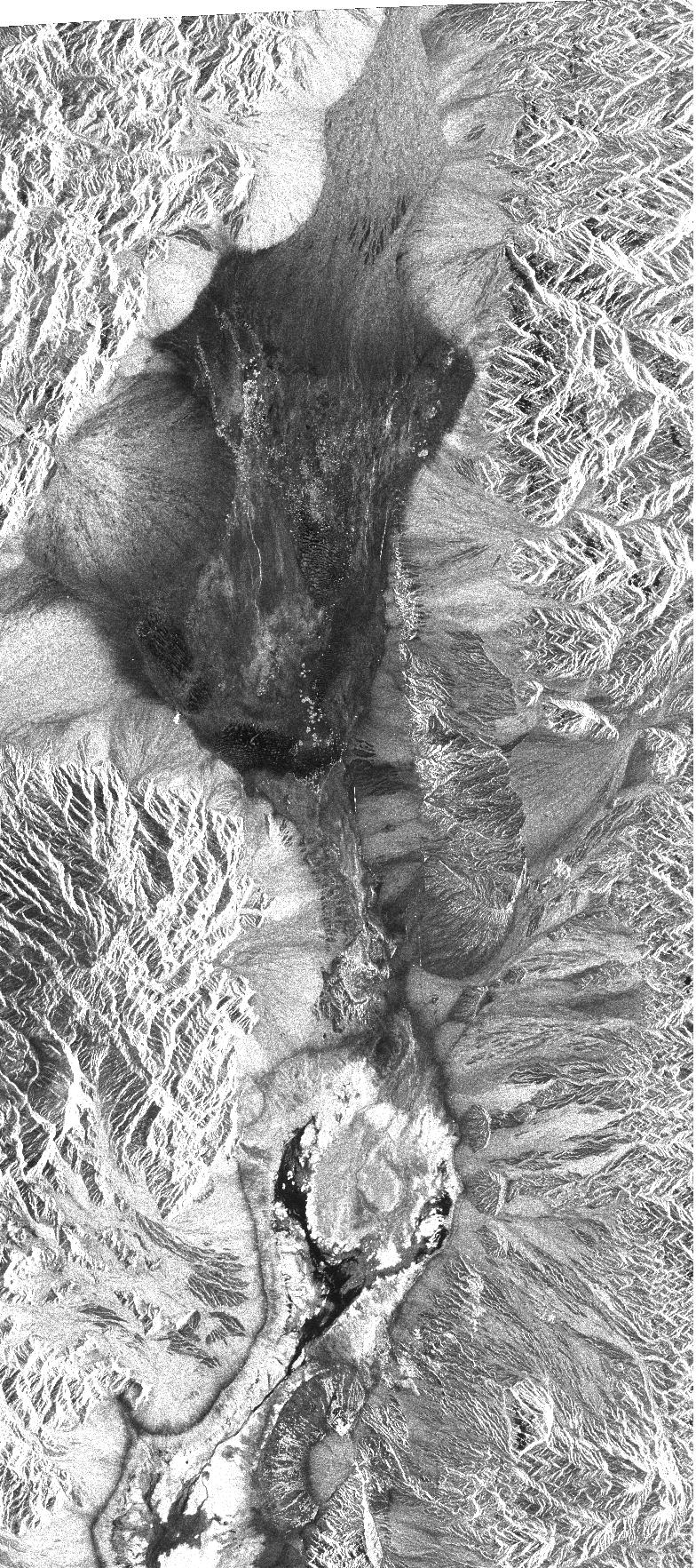
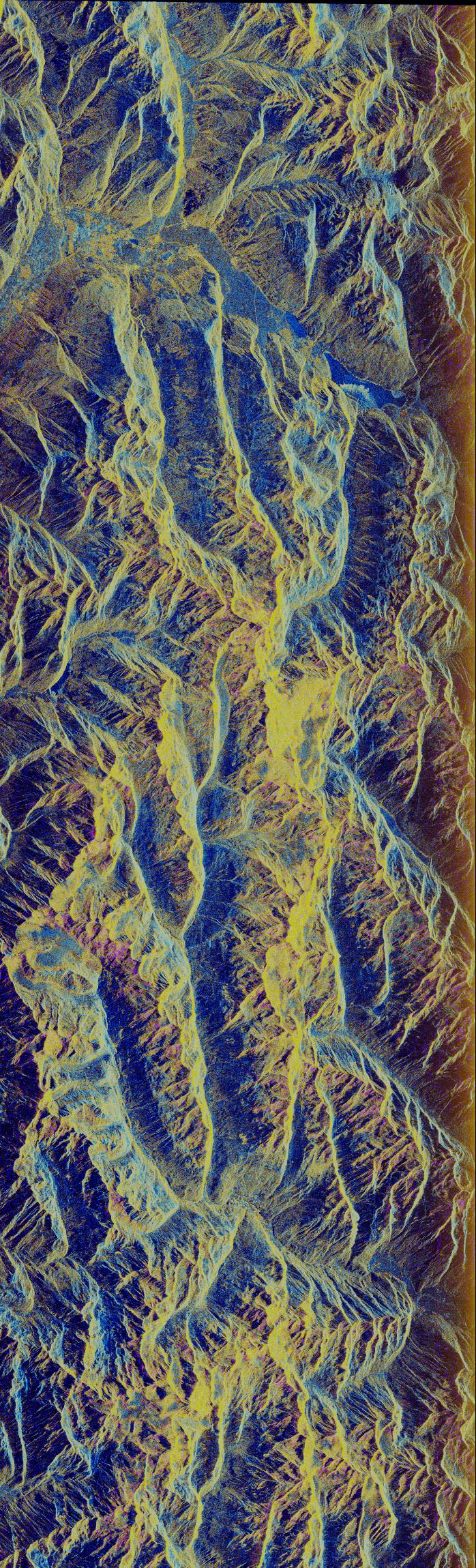
PIA01701:
-
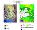
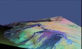
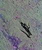
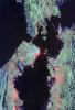
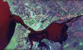
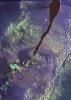
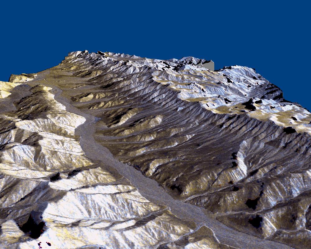
Space Radar Image of Death Valley, California
Full Resolution:
TIFF
(1.602 MB)
JPEG
(565.3 kB)
|
|
|
1999-01-27 |
Earth
|
Spaceborne Imaging Radar-C/X-Band Synthetic Aperture Radar
|
|
788x1838x3 |
|
-
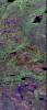
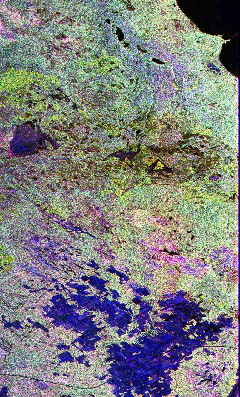
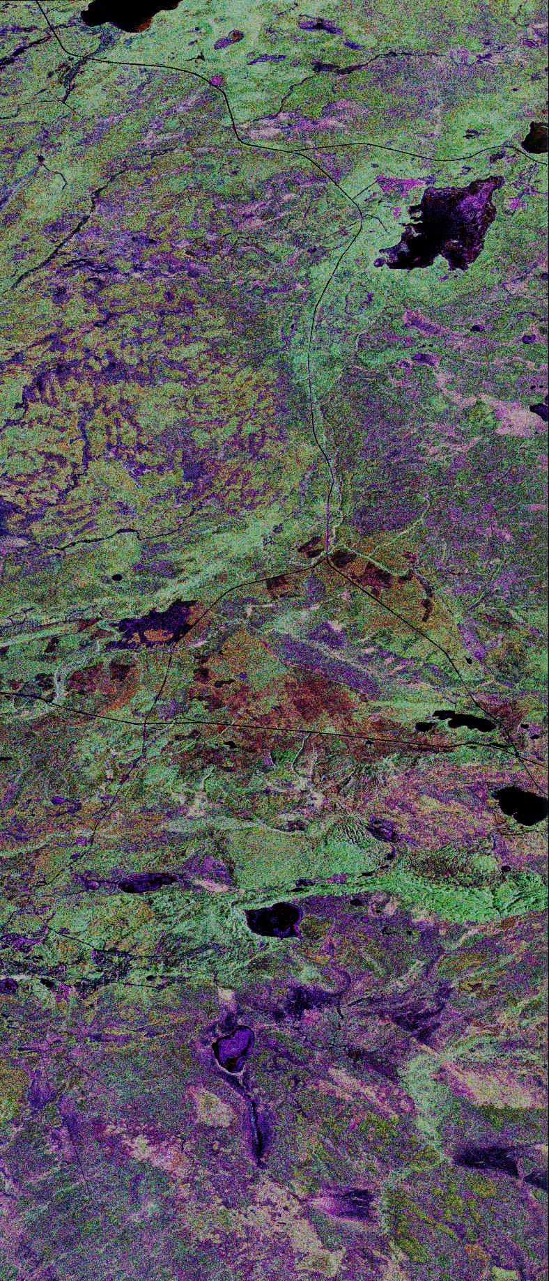
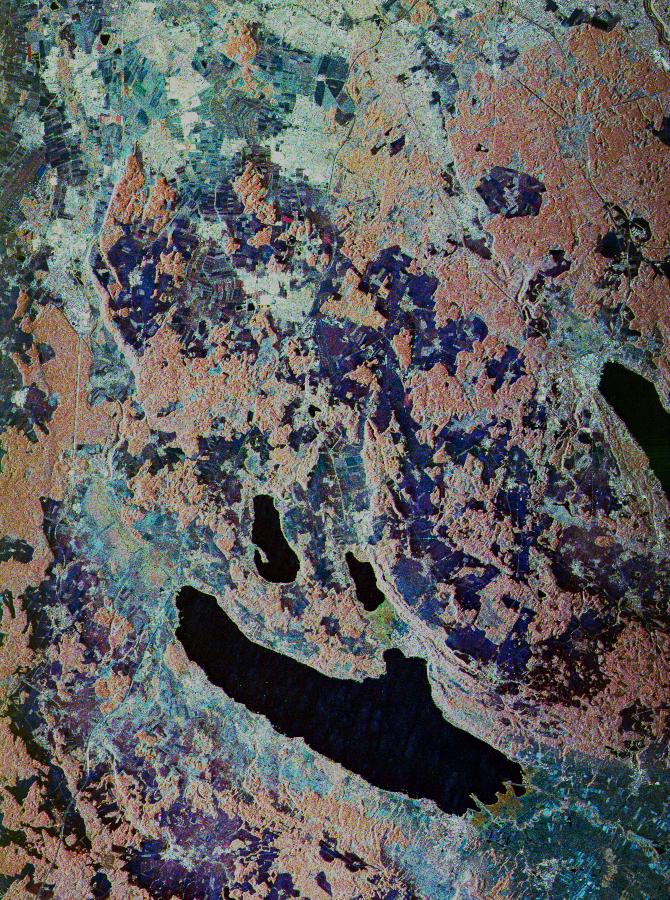
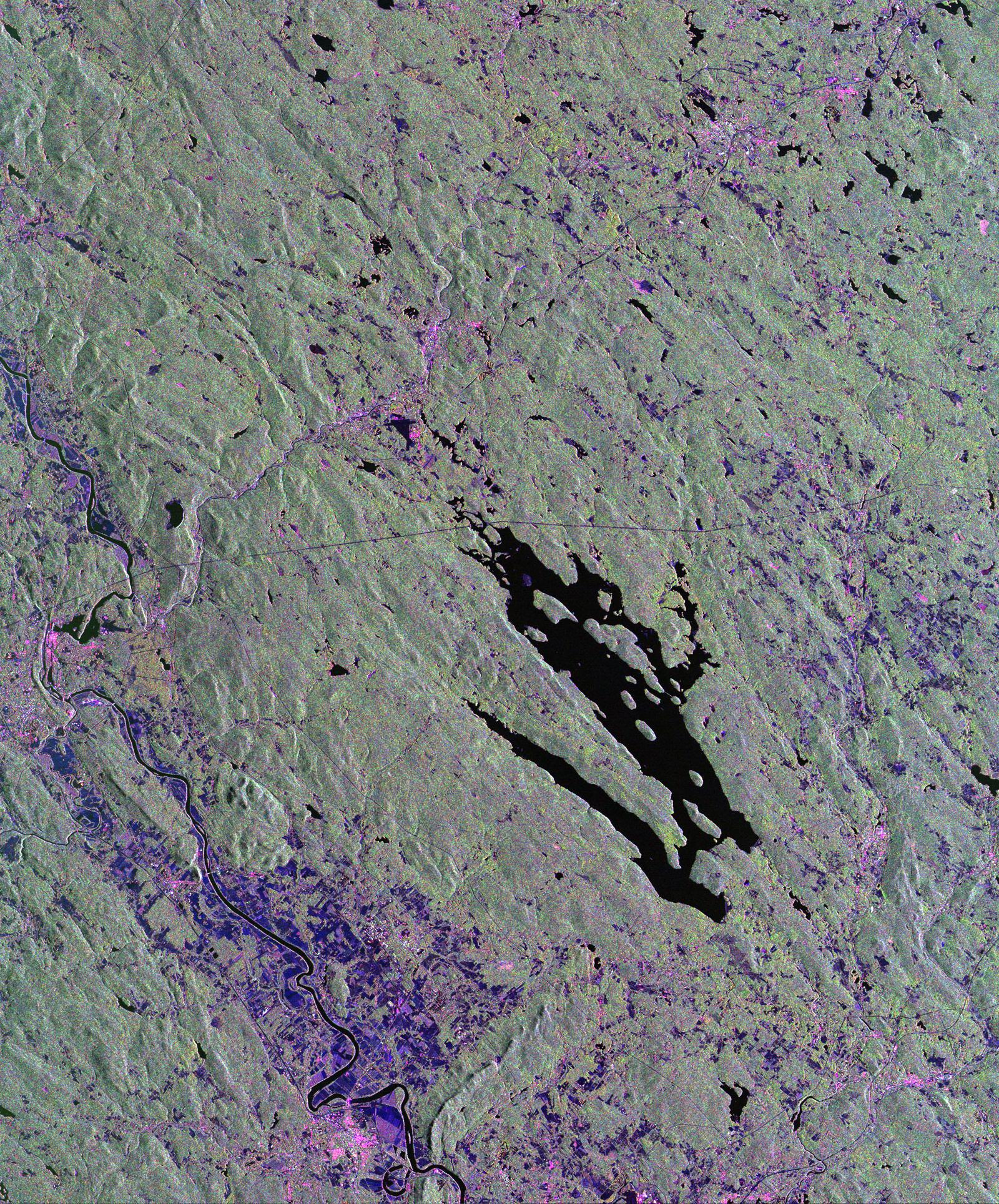
PIA01702:
-
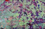
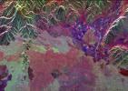
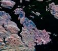
Space Radar Image of Prince Albert, Canada
Full Resolution:
TIFF
(3.205 MB)
JPEG
(705.9 kB)
|
|
|
1999-01-27 |
Earth
|
Spaceborne Imaging Radar-C/X-Band Synthetic Aperture Radar
|
|
1536x972x3 |
|
-
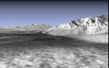
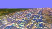
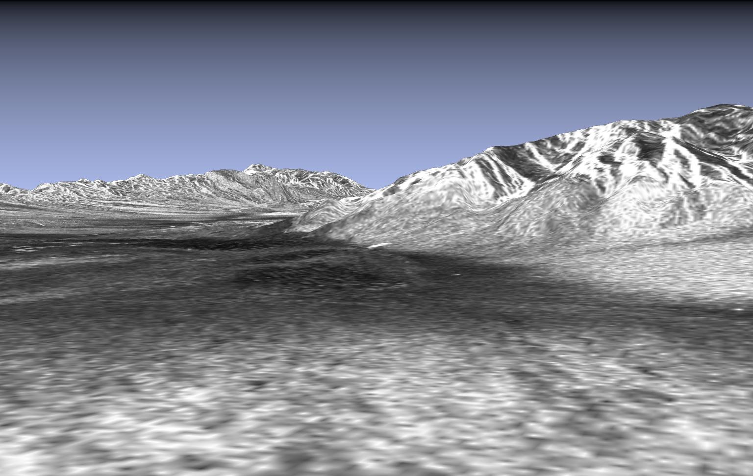
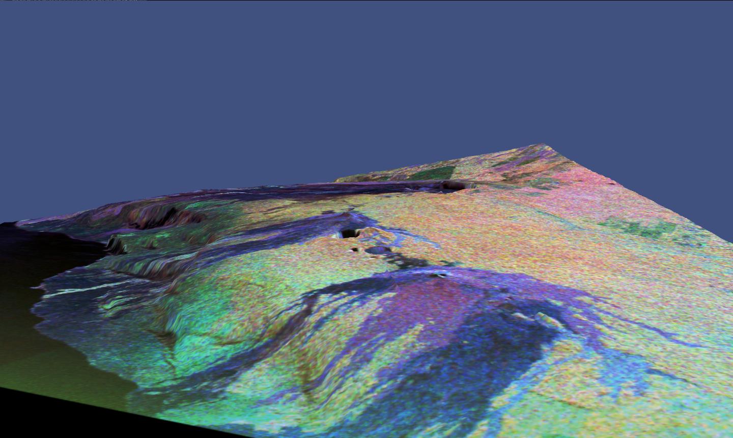
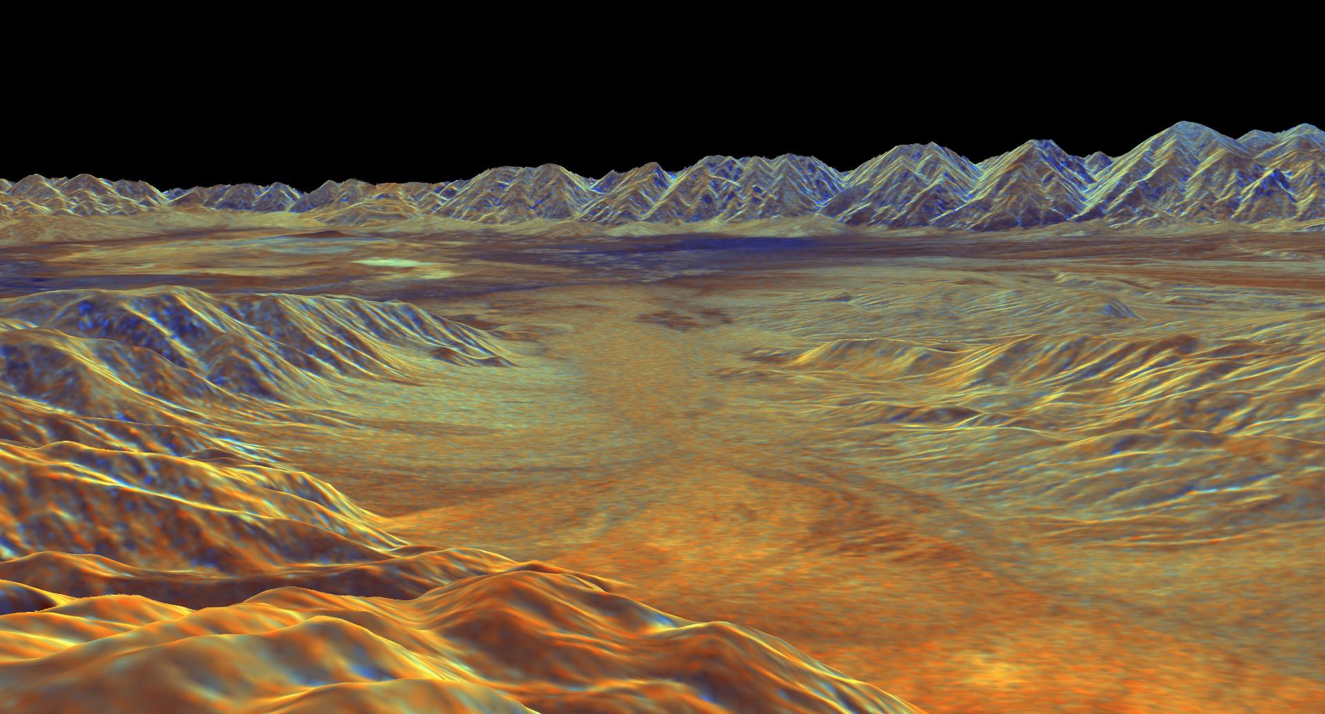
PIA01703:
-
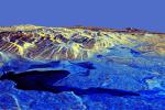
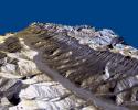
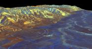
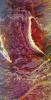
Space Radar Image of Death Valley in 3-D
Full Resolution:
TIFF
(1.41 MB)
JPEG
(167.8 kB)
|
|
|
1999-01-27 |
Earth
|
Spaceborne Imaging Radar-C/X-Band Synthetic Aperture Radar
|
|
698x2299x3 |

|
-
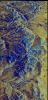
PIA01704:
-
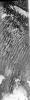
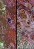
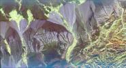
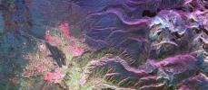
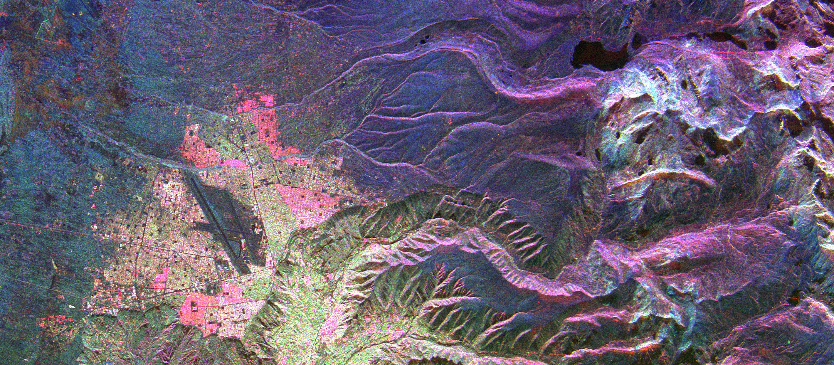
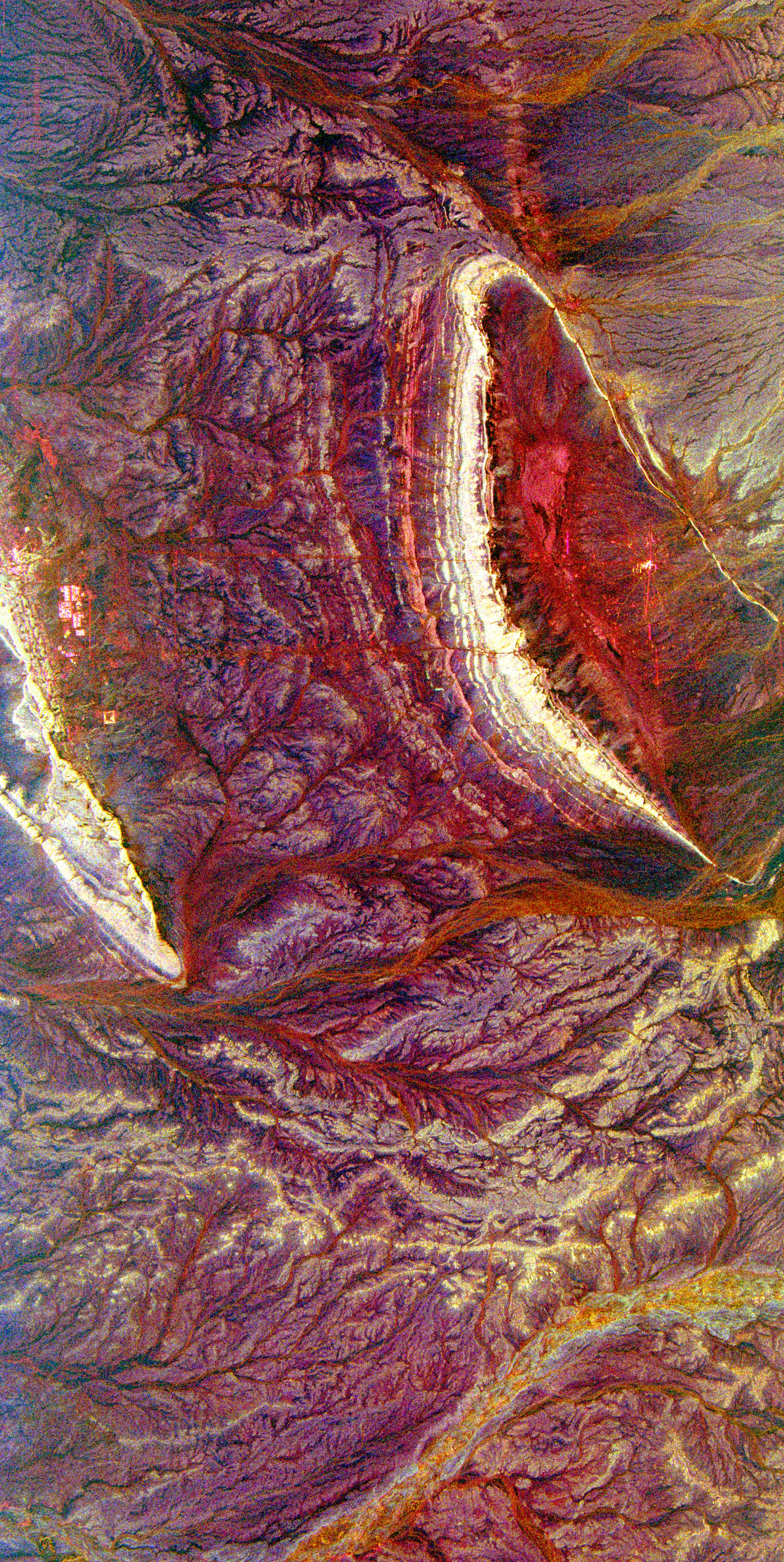
Space Radar Image of Oetzal, Austria
Full Resolution:
TIFF
(5.334 MB)
JPEG
(639.8 kB)
|
|
|
1999-01-27 |
Earth
|
Spaceborne Imaging Radar-C/X-Band Synthetic Aperture Radar
|
|
866x1813x3 |
|
-
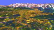
PIA01705:
-
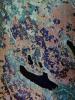
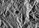
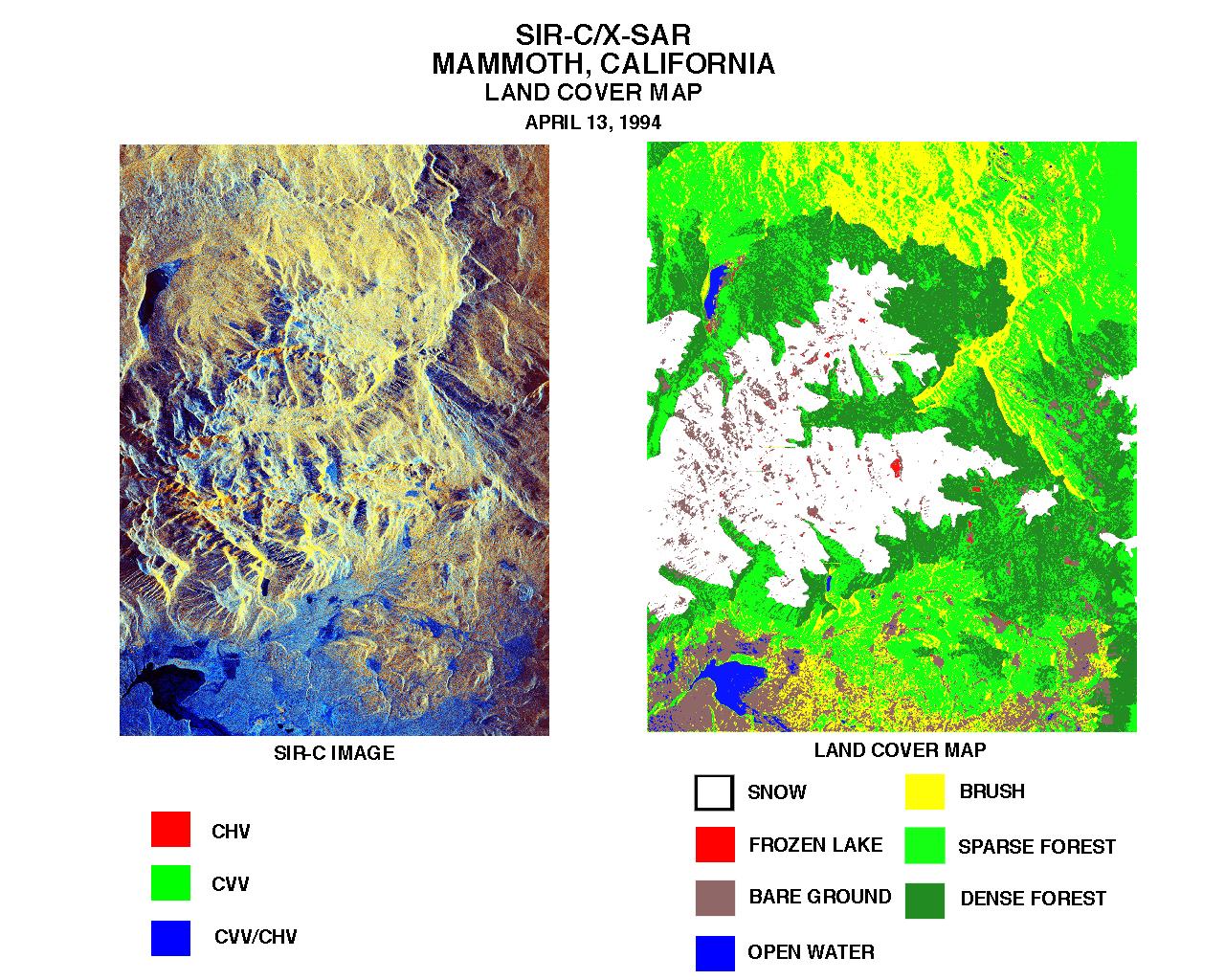
Space Radar Image of Mammoth, California
Full Resolution:
TIFF
(5.759 MB)
JPEG
(635.4 kB)
|
|
|
1999-01-27 |
Earth
|
Spaceborne Imaging Radar-C/X-Band Synthetic Aperture Radar
|
|
768x2026x3 |
|
-
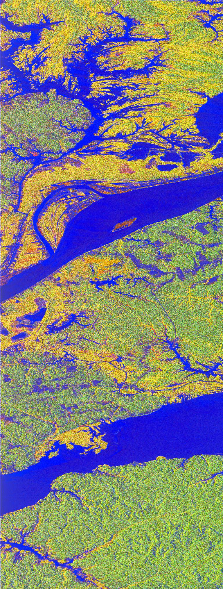
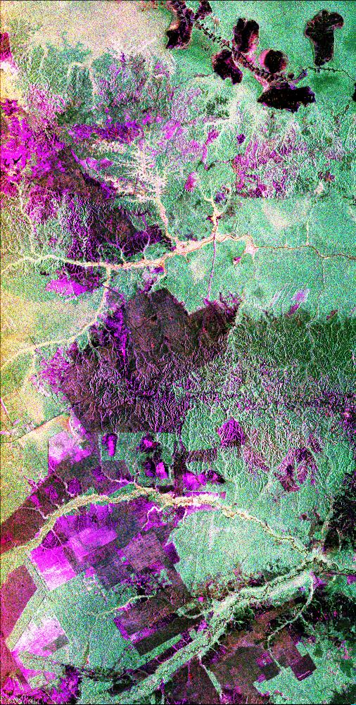
PIA01706:
-
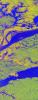
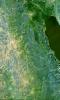
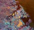
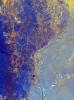
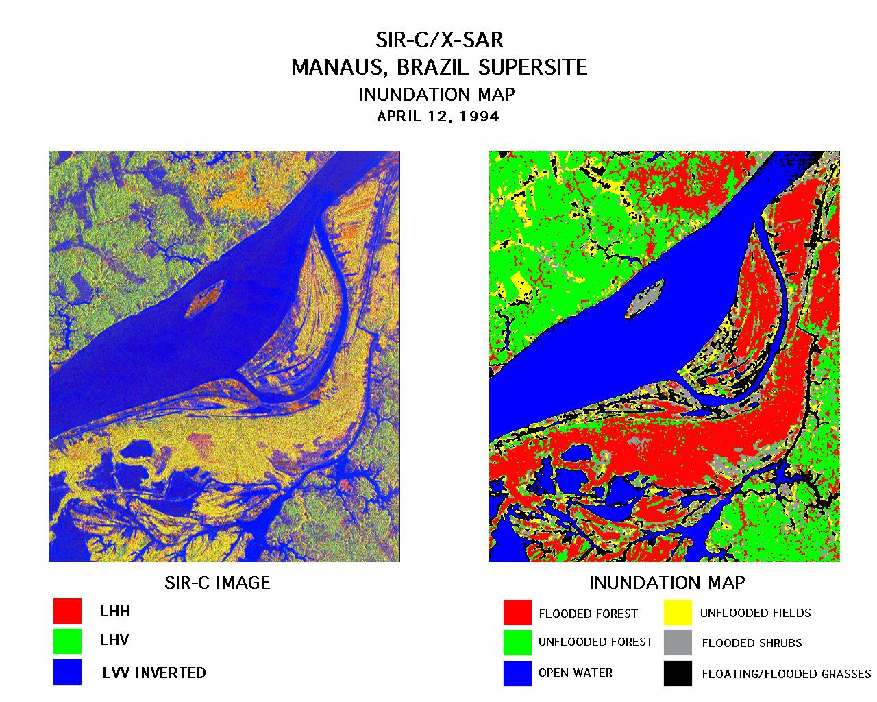
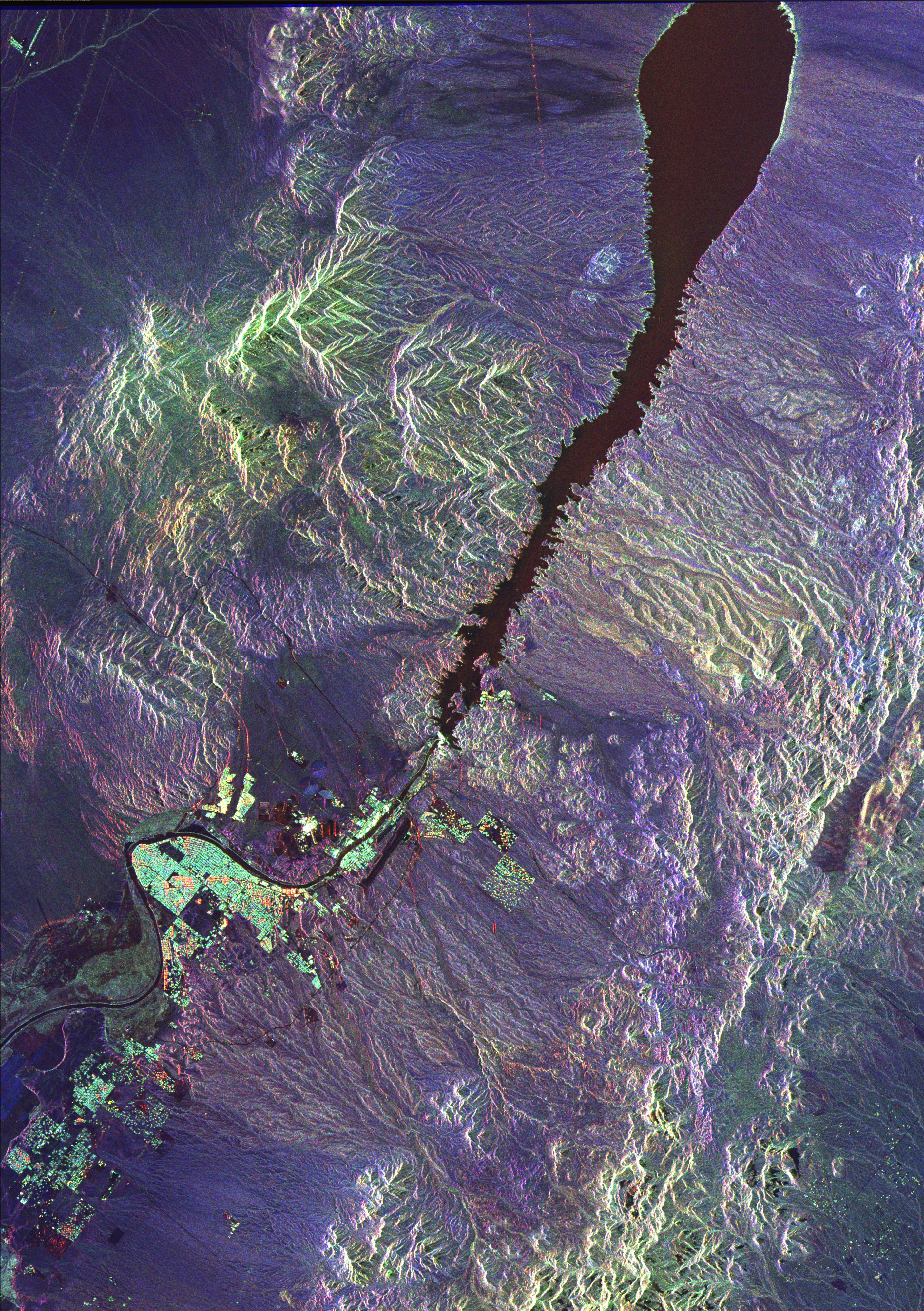
Space Radar Image of Manaus, Brazil
Full Resolution:
TIFF
(6.189 MB)
JPEG
(710.6 kB)
|
|
|
1999-01-27 |
Earth
|
Spaceborne Imaging Radar-C/X-Band Synthetic Aperture Radar
|
|
1440x972x3 |

|
-
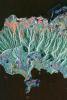
PIA01708:
-
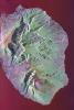
Space Radar Image Isla Isabela in 3-D
Full Resolution:
TIFF
(1.477 MB)
JPEG
(173.6 kB)
|
|
|
1999-01-27 |
Earth
|
Spaceborne Imaging Radar-C/X-Band Synthetic Aperture Radar
|
|
1116x1130x3 |
|
-
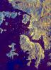
PIA01709:
-
SPace Radar Image of Mt. Pinatubo, Philippines
Full Resolution:
TIFF
(4.975 MB)
JPEG
(576.1 kB)
|
|
|
1999-01-27 |
Earth
|
Spaceborne Imaging Radar-C/X-Band Synthetic Aperture Radar
|
|
1042x1433x3 |

|
-
PIA01710:
-
Space Radar Image of Kilauea, Hawaii
Full Resolution:
TIFF
(5.636 MB)
JPEG
(549.3 kB)
|
|
|
1999-01-27 |
Earth
|
Spaceborne Imaging Radar-C/X-Band Synthetic Aperture Radar
|
|
736x994x3 |
|
-
PIA01711:
-
Space Radar Image of Safsaf, North Africa
Full Resolution:
TIFF
(2.76 MB)
JPEG
(328.7 kB)
|
|
|
1999-01-27 |
Earth
|
Spaceborne Imaging Radar-C/X-Band Synthetic Aperture Radar
|
|
1280x1024x3 |
|
-
PIA01712:
-
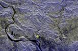
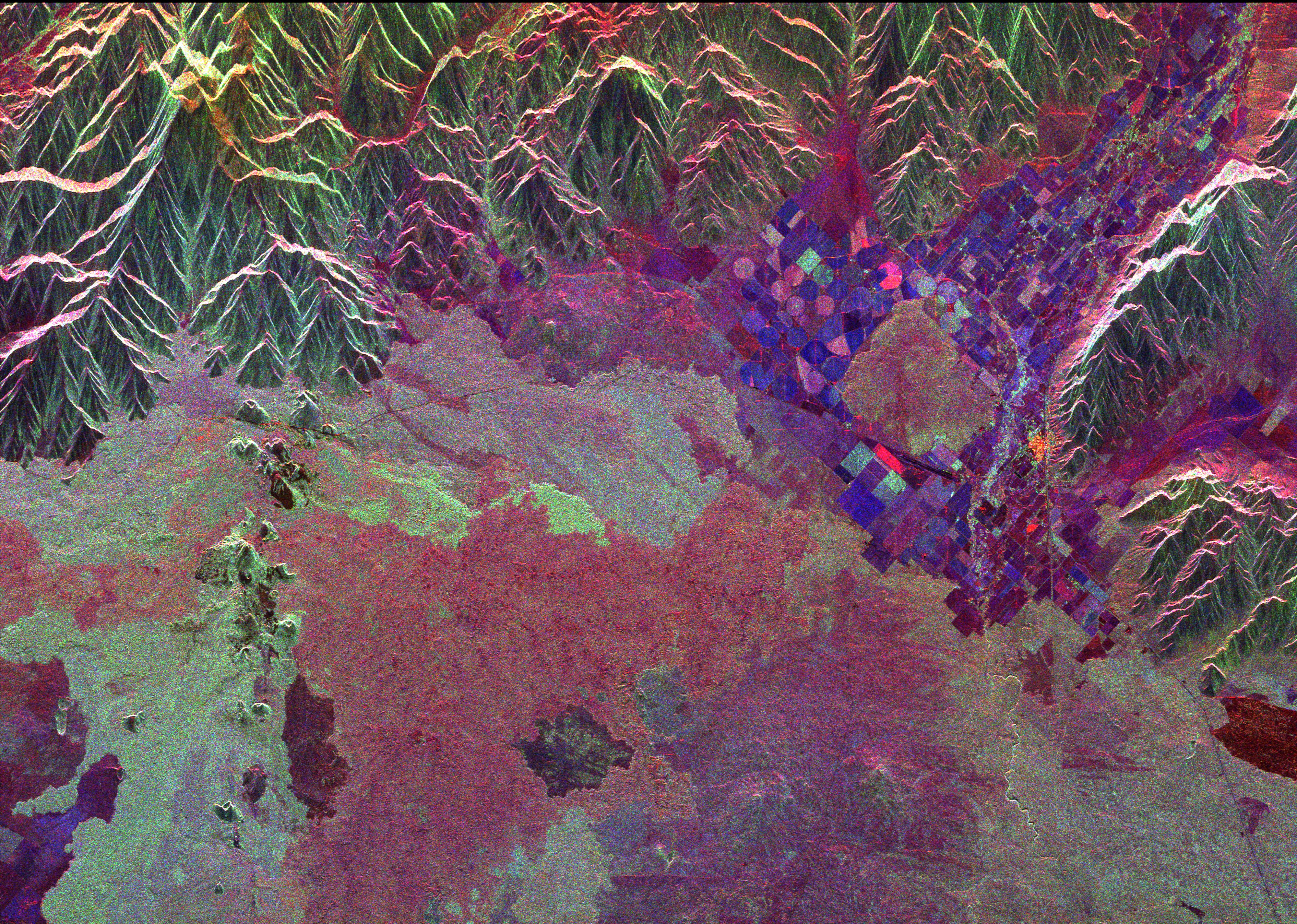
Space Radar Image of Manaus, Brazil
Full Resolution:
TIFF
(1.531 MB)
JPEG
(300.6 kB)
|
|
|
1999-01-27 |
Earth
|
Spaceborne Imaging Radar-C/X-Band Synthetic Aperture Radar
|
|
1700x2200x3 |
|
-
PIA01713:
-
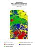
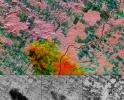
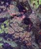
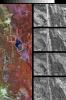
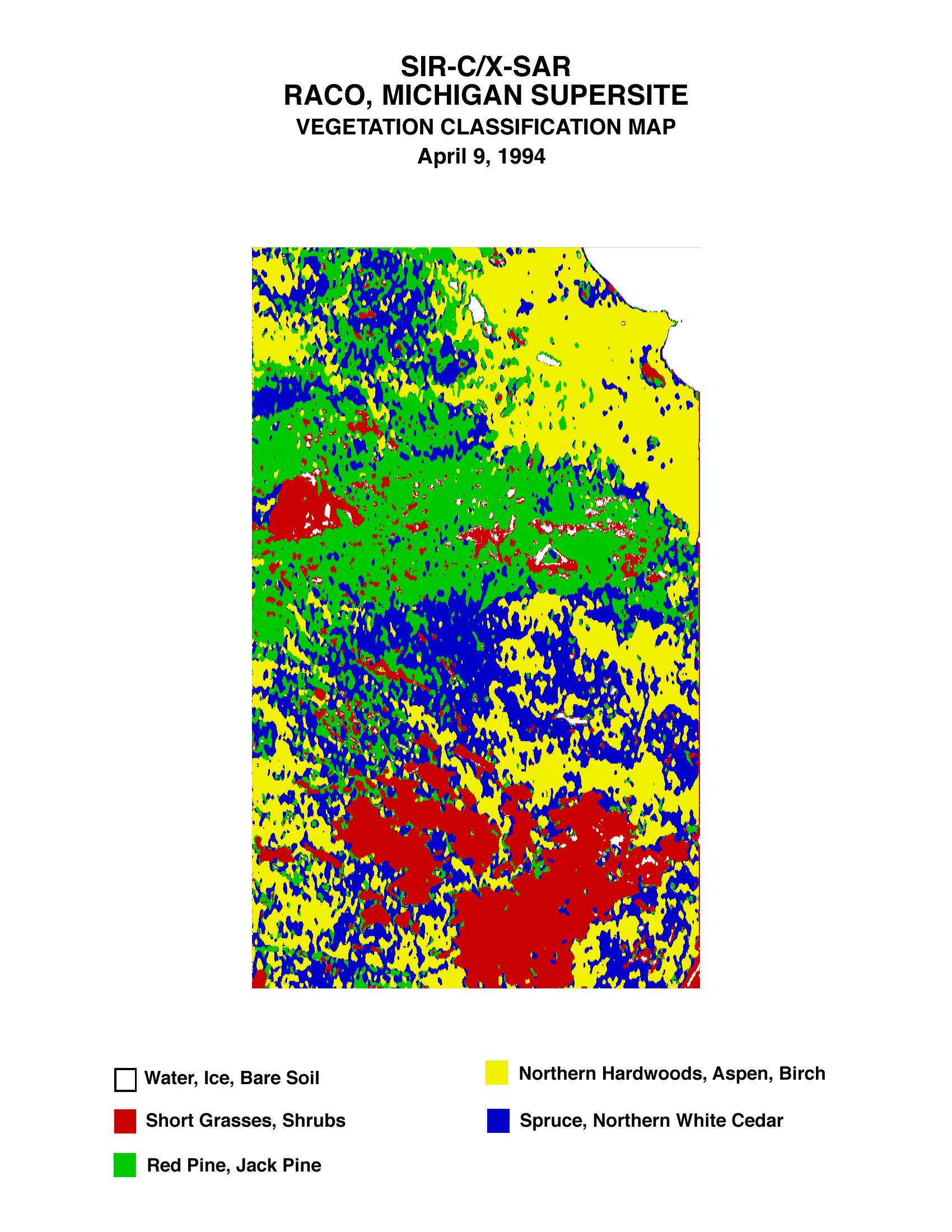
Space Radar Image of Raco Vegetation Map
Full Resolution:
TIFF
(511.3 kB)
JPEG
(447.6 kB)
|
|
|
1999-01-27 |
Earth
|
Spaceborne Imaging Radar-C/X-Band Synthetic Aperture Radar
|
|
1700x2200x3 |
|
-
PIA01714:
-
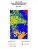
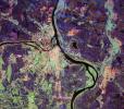
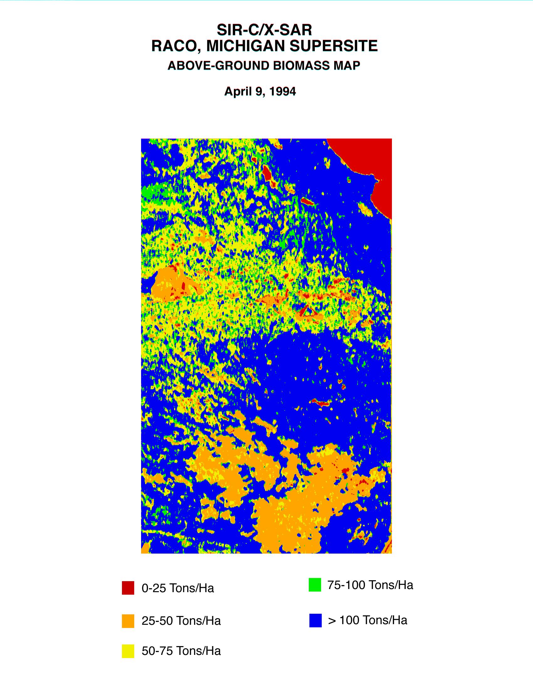
Space Radar Image of Raco Biomass Map
Full Resolution:
TIFF
(628.7 kB)
JPEG
(457.8 kB)
|
|
|
1999-01-27 |
Earth
|
Spaceborne Imaging Radar-C/X-Band Synthetic Aperture Radar
|
|
1280x1024x3 |
|
-
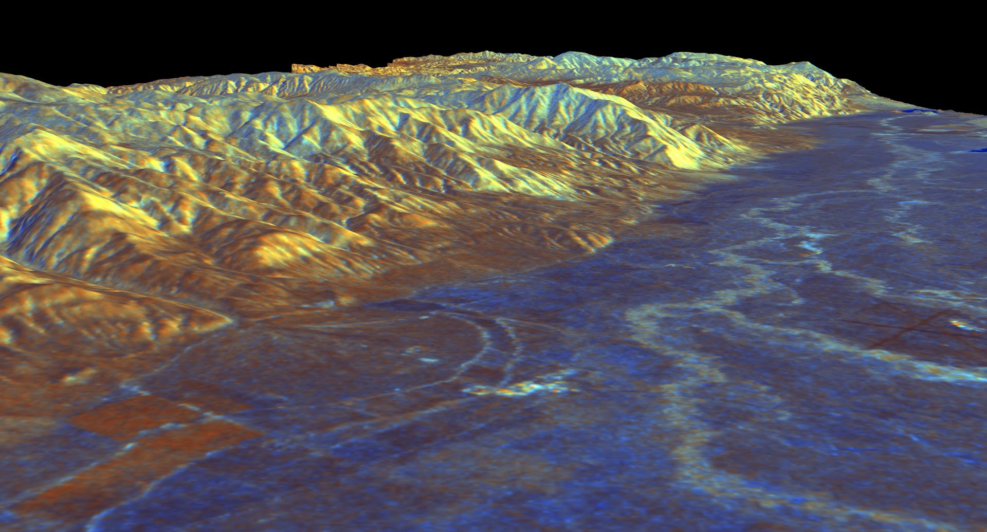
PIA01715:
-
Space Radar Image of Mammoth, California
Full Resolution:
TIFF
(1.8 MB)
JPEG
(315 kB)
|
|
|
1999-01-27 |
Earth
|
Spaceborne Imaging Radar-C/X-Band Synthetic Aperture Radar
|
|
670x900x3 |
|
-
PIA01716:
-
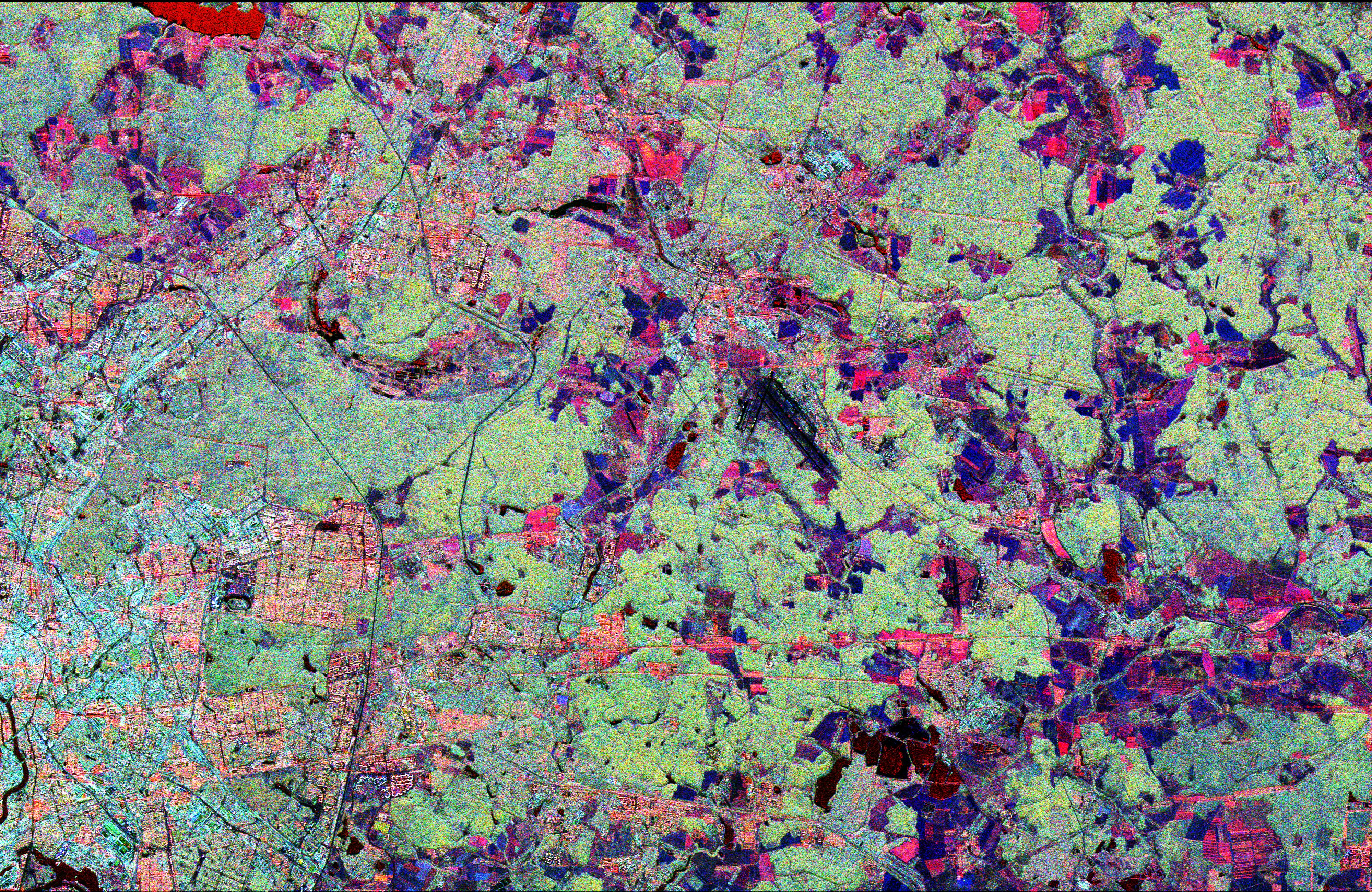
Space Radar Image of Oberpfaffenhofen, Germany
Full Resolution:
TIFF
(2.316 MB)
JPEG
(228.1 kB)
|
|
|
1999-01-27 |
Earth
|
Spaceborne Imaging Radar-C/X-Band Synthetic Aperture Radar
|
|
1440x862x3 |
|
-
PIA01717:
-
Space Radar Image of Kilauea, Hawaii in 3-D
Full Resolution:
TIFF
(2.615 MB)
JPEG
(140.6 kB)
|
|
|
1999-01-27 |
Earth
|
Spaceborne Imaging Radar-C/X-Band Synthetic Aperture Radar
|
|
1440x961x3 |
|
-
PIA01718:
-
Space Radar Image of Mammoth, California in 3-D
Full Resolution:
TIFF
(3.938 MB)
JPEG
(259.6 kB)
|
|
|
1999-01-27 |
Earth
|
Spaceborne Imaging Radar-C/X-Band Synthetic Aperture Radar
|
|
1114x1295x3 |

|
-
PIA01719:
-
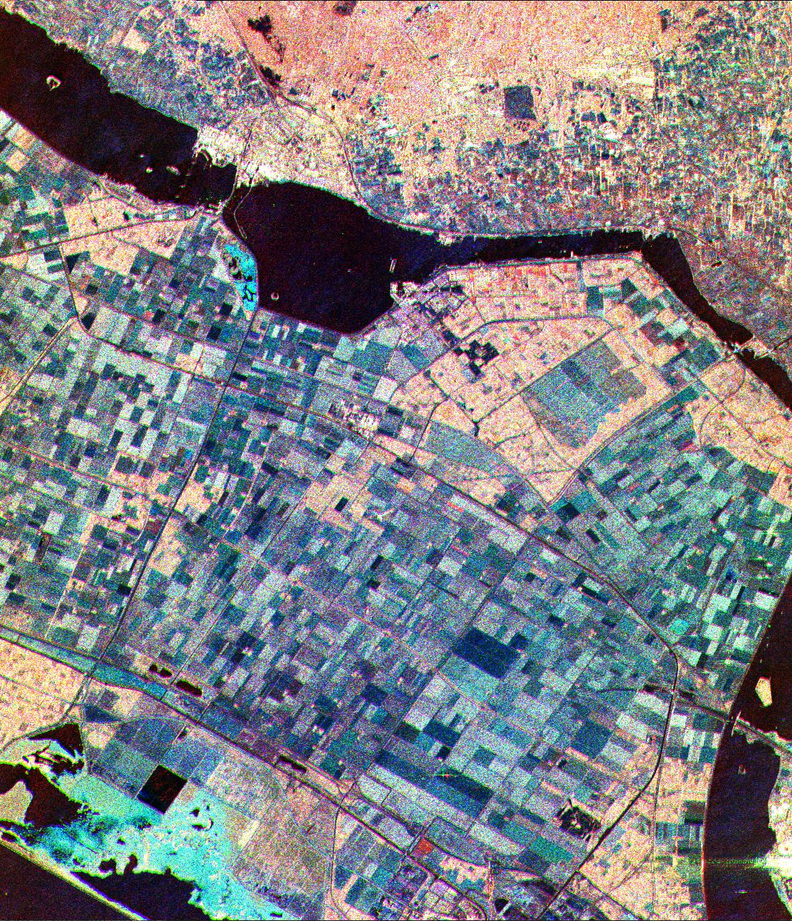
Space Radar Image of Flevoland, Netherlands
Full Resolution:
TIFF
(5.552 MB)
JPEG
(713.3 kB)
|
|
|
1999-01-27 |
Earth
|
Spaceborne Imaging Radar-C/X-Band Synthetic Aperture Radar
|
|
690x2309x1 |
|
-
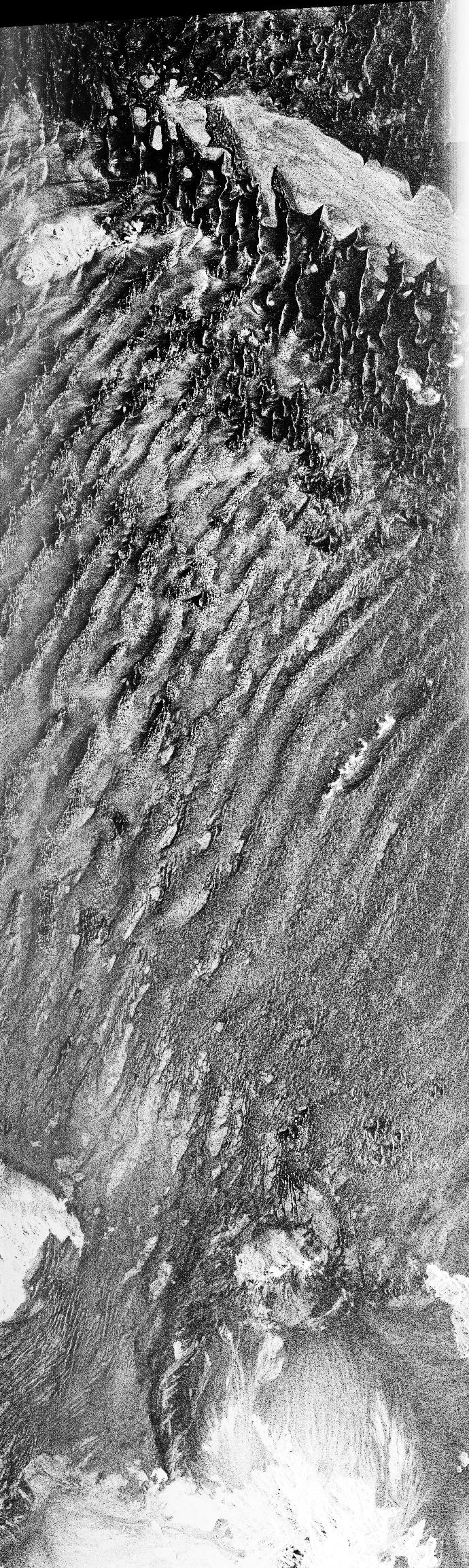
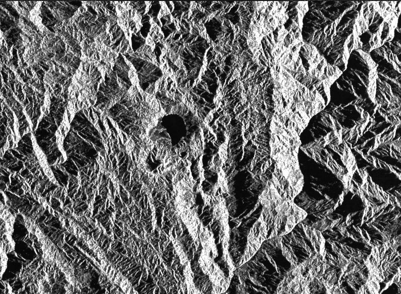
PIA01720:
-
Space Radar Image of Namib Desert in Southern Namib
Full Resolution:
TIFF
(1.742 MB)
JPEG
(721.2 kB)
|
|
|
1999-01-27 |
Earth
|
Spaceborne Imaging Radar-C/X-Band Synthetic Aperture Radar
|
|
1075x2000x3 |

|
-
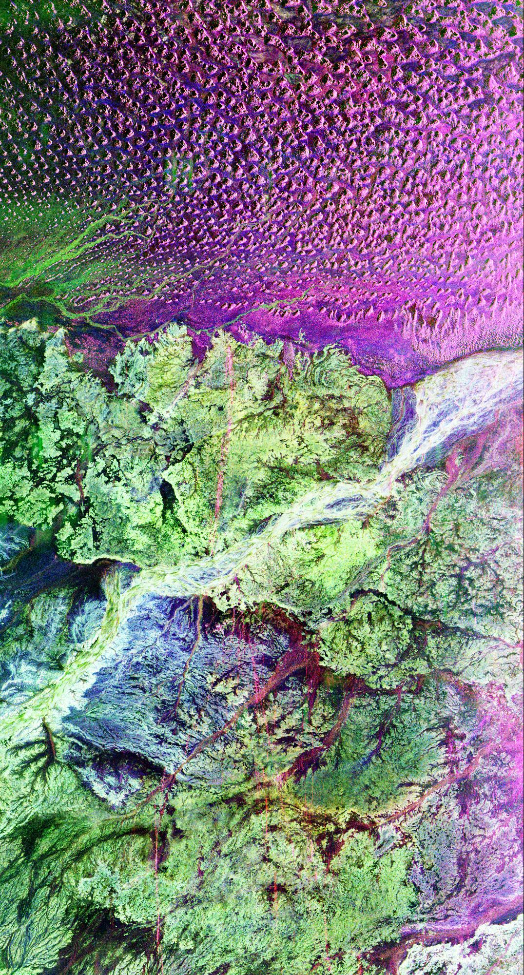
PIA01721:
-
Space Radar Image of the Lost City of Ubar
Full Resolution:
TIFF
(8.57 MB)
JPEG
(952.1 kB)
|
|
|
1999-01-27 |
Earth
|
Spaceborne Imaging Radar-C/X-Band Synthetic Aperture Radar
|
|
798x585x1 |
|
-
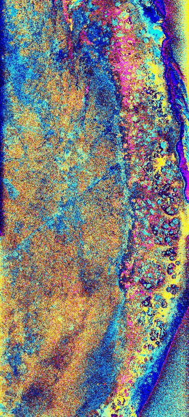
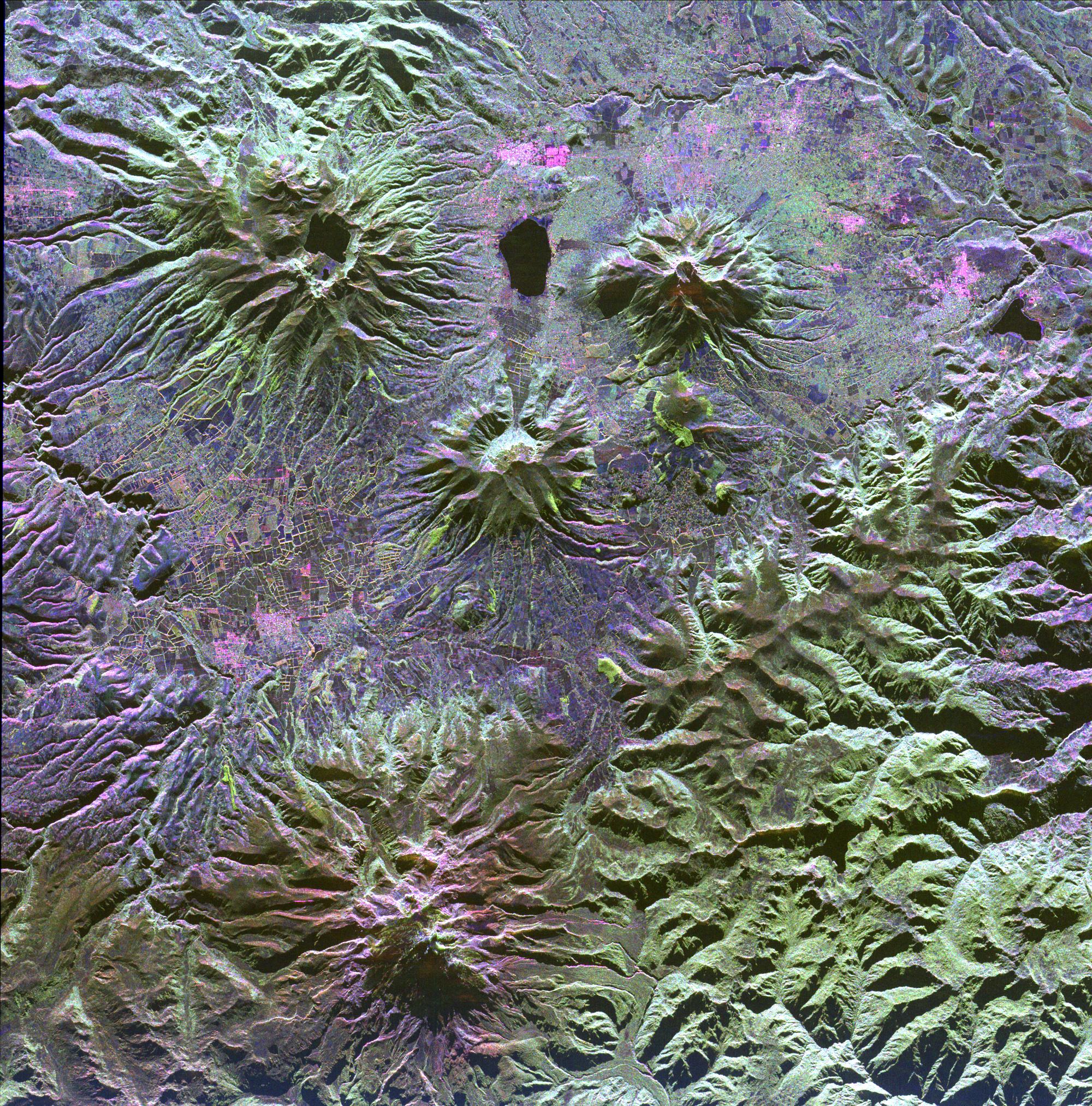
PIA01722:
-
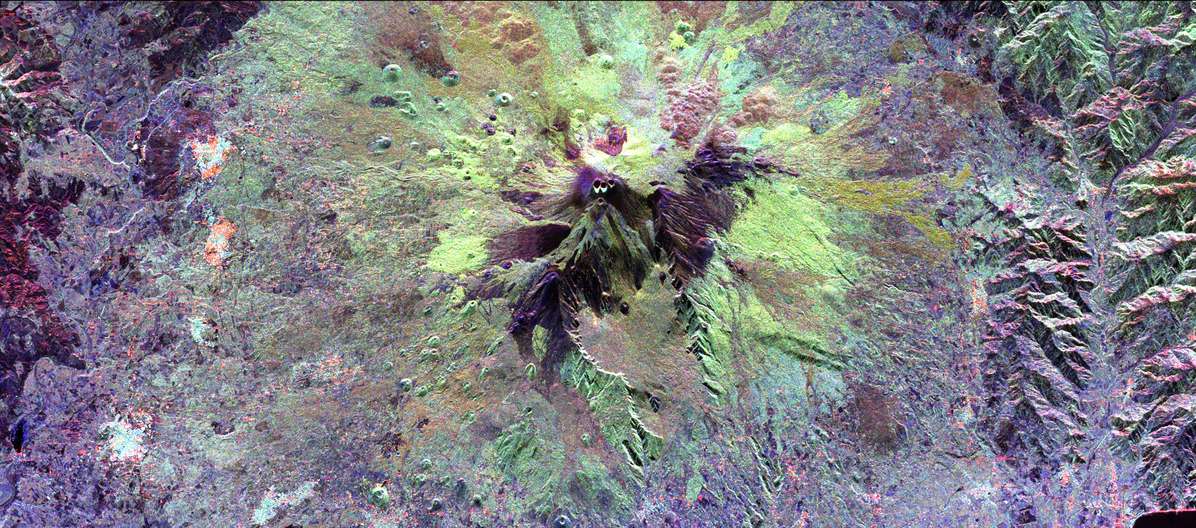
Space Radar Image of Colombian Volcano
Full Resolution:
TIFF
(568.7 kB)
JPEG
(181.8 kB)
|
|
|
1999-01-27 |
Earth
|
Spaceborne Imaging Radar-C/X-Band Synthetic Aperture Radar
|
|
376x828x3 |
|
-
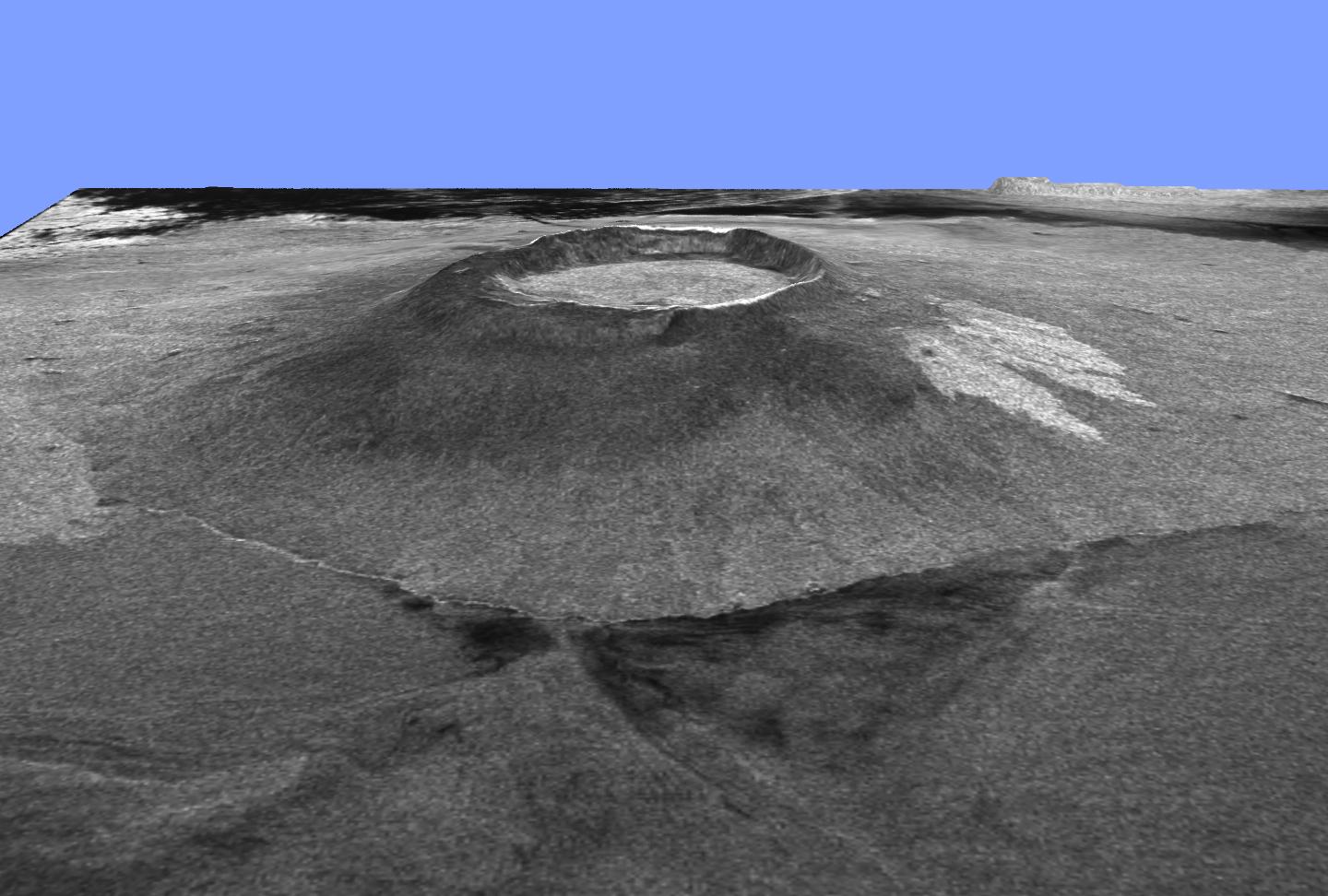
PIA01723:
-
Space Radar Image of the Yucatan Impact Crater Site
Full Resolution:
TIFF
(727.4 kB)
JPEG
(179.2 kB)
|
|
|
1999-01-27 |
Earth
|
Spaceborne Imaging Radar-C/X-Band Synthetic Aperture Radar
|
|
990x2655x3 |

|
-
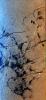
PIA01724:
-
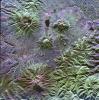
Space Radar Image of Central African Gorilla Habitat
Full Resolution:
TIFF
(10.21 MB)
JPEG
(1.071 MB)
|
|
|
1999-04-15 |
Earth
|
TOPEX/Poseidon
|
Altimeter
|
900x900x3 |
|
-
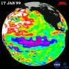
PIA01525:
-
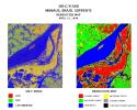
TOPEX/El Ni�o Watch - La Ni�a Weakening, January 17, 1999
Full Resolution:
TIFF
(901.6 kB)
JPEG
(119 kB)
|
|
|
1999-04-15 |
Earth
|
TOPEX/Poseidon
|
Altimeter
|
902x900x3 |
|
-
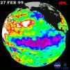
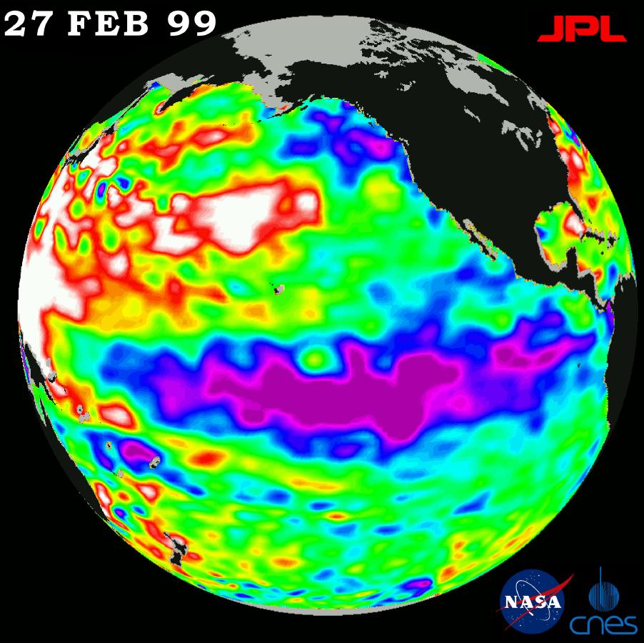
PIA01526:
-
TOPEX/El Ni�o Watch - La Ni�a Hangs On, February 27, 1999
Full Resolution:
TIFF
(883.6 kB)
JPEG
(115.5 kB)
|
|
|
1999-04-15 |
Earth
|
Spaceborne Imaging Radar-C/X-Band Synthetic Aperture Radar
|
Imaging Radar
|
2010x1800x1 |
|
-
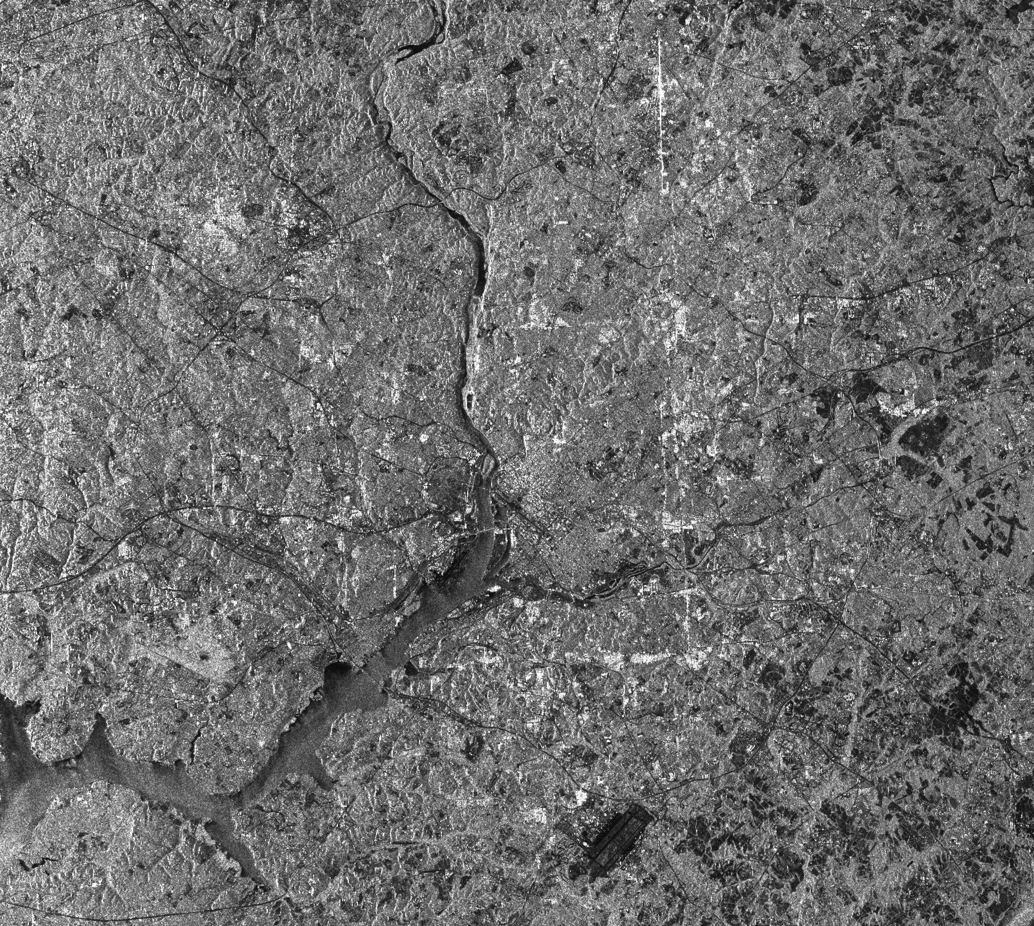
PIA01303:
-
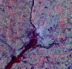
Space Radar Image of Washington, D.C.
Full Resolution:
TIFF
(4.622 MB)
JPEG
(1.396 MB)
|
|
|
1999-04-15 |
Earth
|
Spaceborne Imaging Radar-C/X-Band Synthetic Aperture Radar
|
|
1480x1480x1 |
|
-
PIA01787:
-
Space Radar Image of West Texas - SAR Scan
Full Resolution:
TIFF
(1.434 MB)
JPEG
(452.8 kB)
|
|
|
1999-04-15 |
Earth
|
Spaceborne Imaging Radar-C/X-Band Synthetic Aperture Radar
|
|
1600x1928x3 |
|
-
PIA01788:
-
Space Radar Image of Harvard Forest
Full Resolution:
TIFF
(11.7 MB)
JPEG
(1.158 MB)
|
|
|
1999-04-15 |
Earth
|
Spaceborne Imaging Radar-C/X-Band Synthetic Aperture Radar
|
|
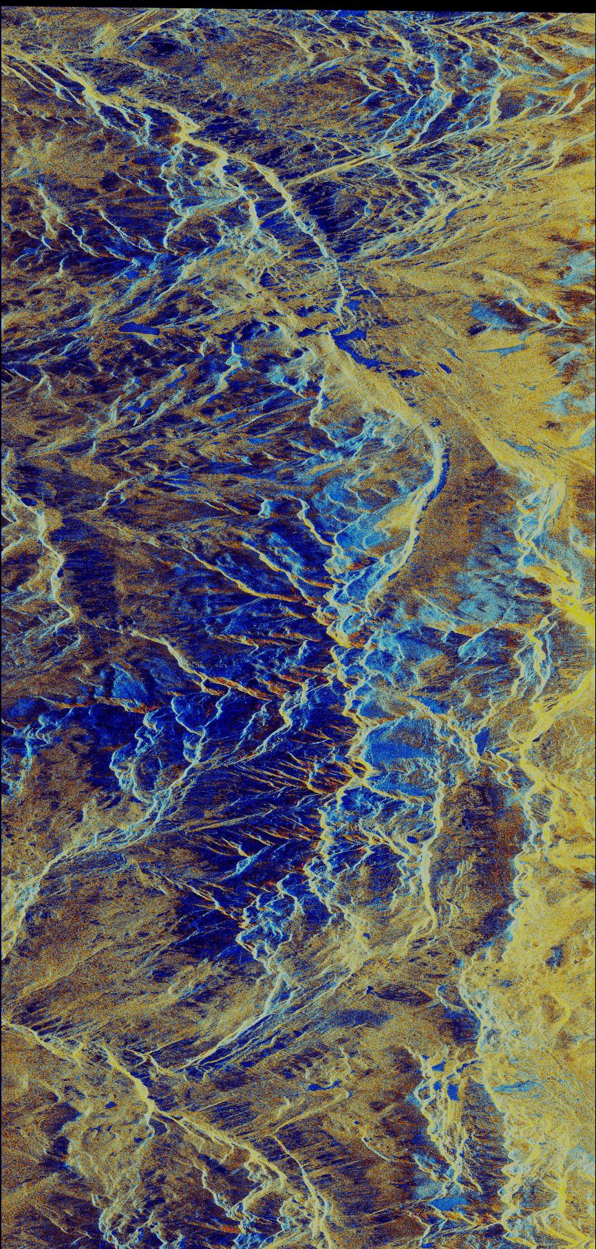
1000x800x3 |
|
-
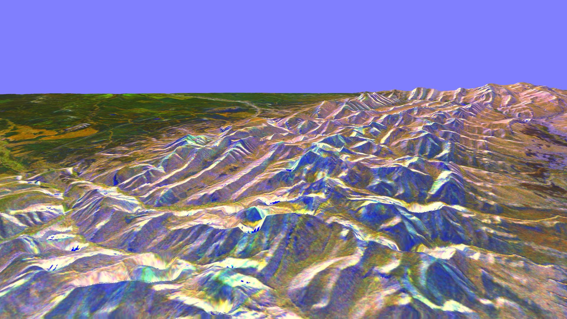
PIA01800:
-
Space Radar Image of Karakax Valley, China 3-D
Full Resolution:
TIFF
(2.026 MB)
JPEG
(170.8 kB)
|
|
|
1999-04-15 |
Earth
|
Spaceborne Imaging Radar-C/X-Band Synthetic Aperture Radar
|
|
4000x2600x3 |
|
-
PIA01775:
-
Space Radar Image of Star City, Russia
Full Resolution:
TIFF
(41.12 MB)
JPEG
(4.695 MB)
|
|
|
1999-04-15 |
Earth
|
Spaceborne Imaging Radar-C/X-Band Synthetic Aperture Radar
|
|
4100x1812x3 |
|
-
PIA01776:
-
Space Radar Image of Mt. Etna, Italy
Full Resolution:
TIFF
(28.43 MB)
JPEG
(2.308 MB)
|
|
|
1999-04-15 |
Earth
|
Spaceborne Imaging Radar-C/X-Band Synthetic Aperture Radar
|
|
3000x3716x3 |
|
-
PIA01777:
-
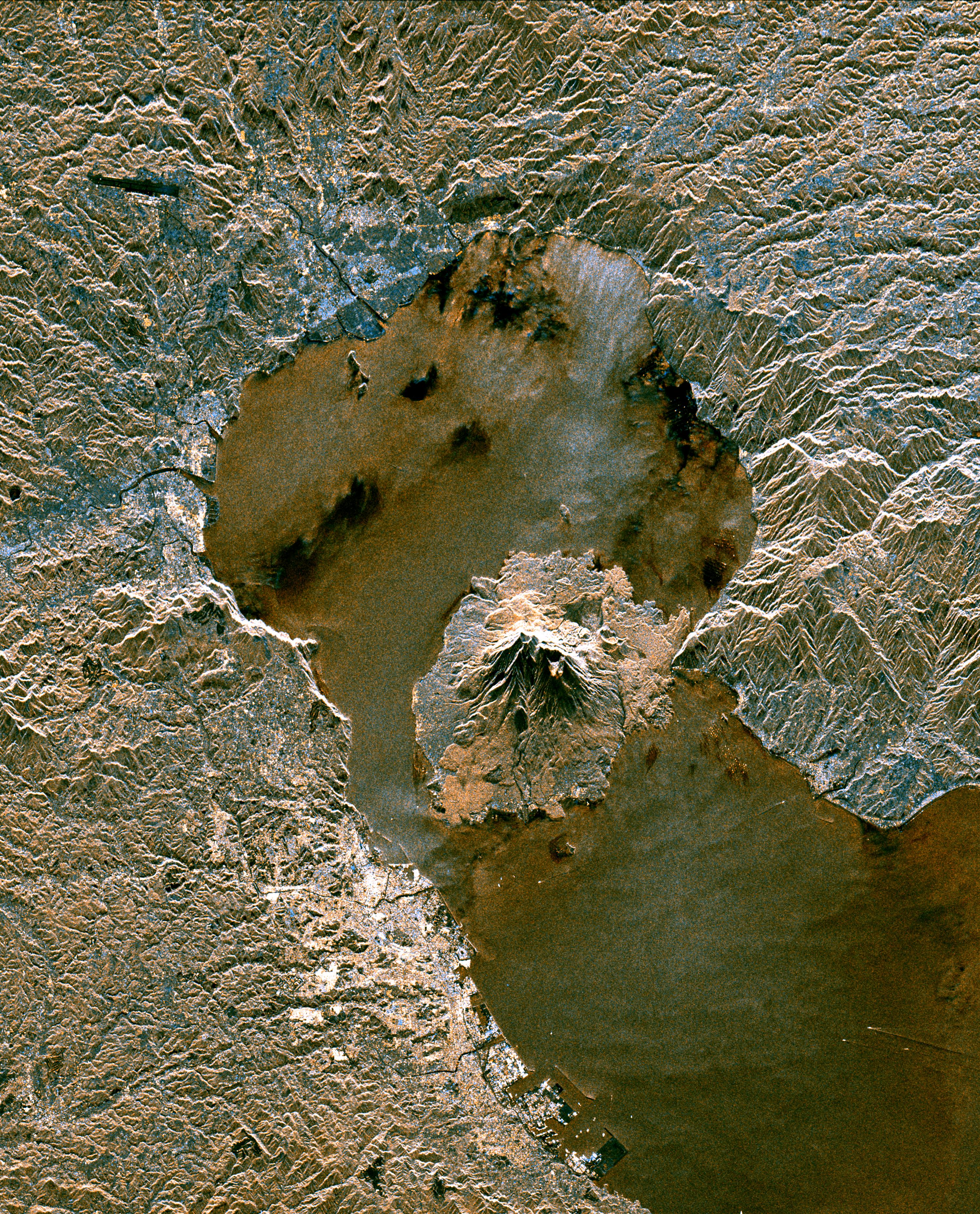
Space Radar Image of Sakura-Jima Volcano, Japan
Full Resolution:
TIFF
(39.95 MB)
JPEG
(3.308 MB)
|
|
|
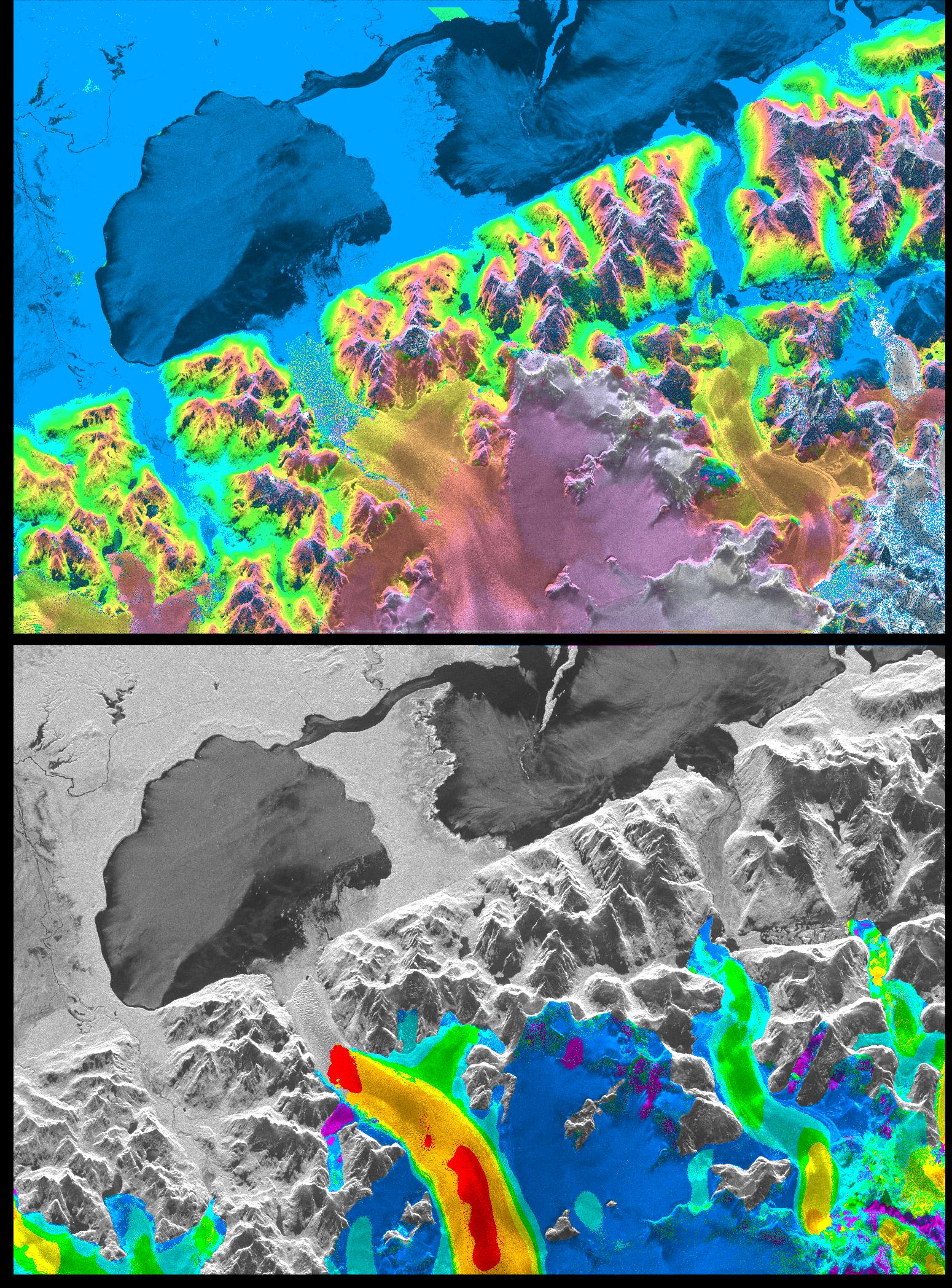
1999-04-15 |
Earth
|
Spaceborne Imaging Radar-C/X-Band Synthetic Aperture Radar
|
|
1999x2327x3 |

|
-
PIA01778:
-
Space Radar Image of Patagonian Ice Fields
Full Resolution:
TIFF
(16.9 MB)
JPEG
(1.593 MB)
|
|
|
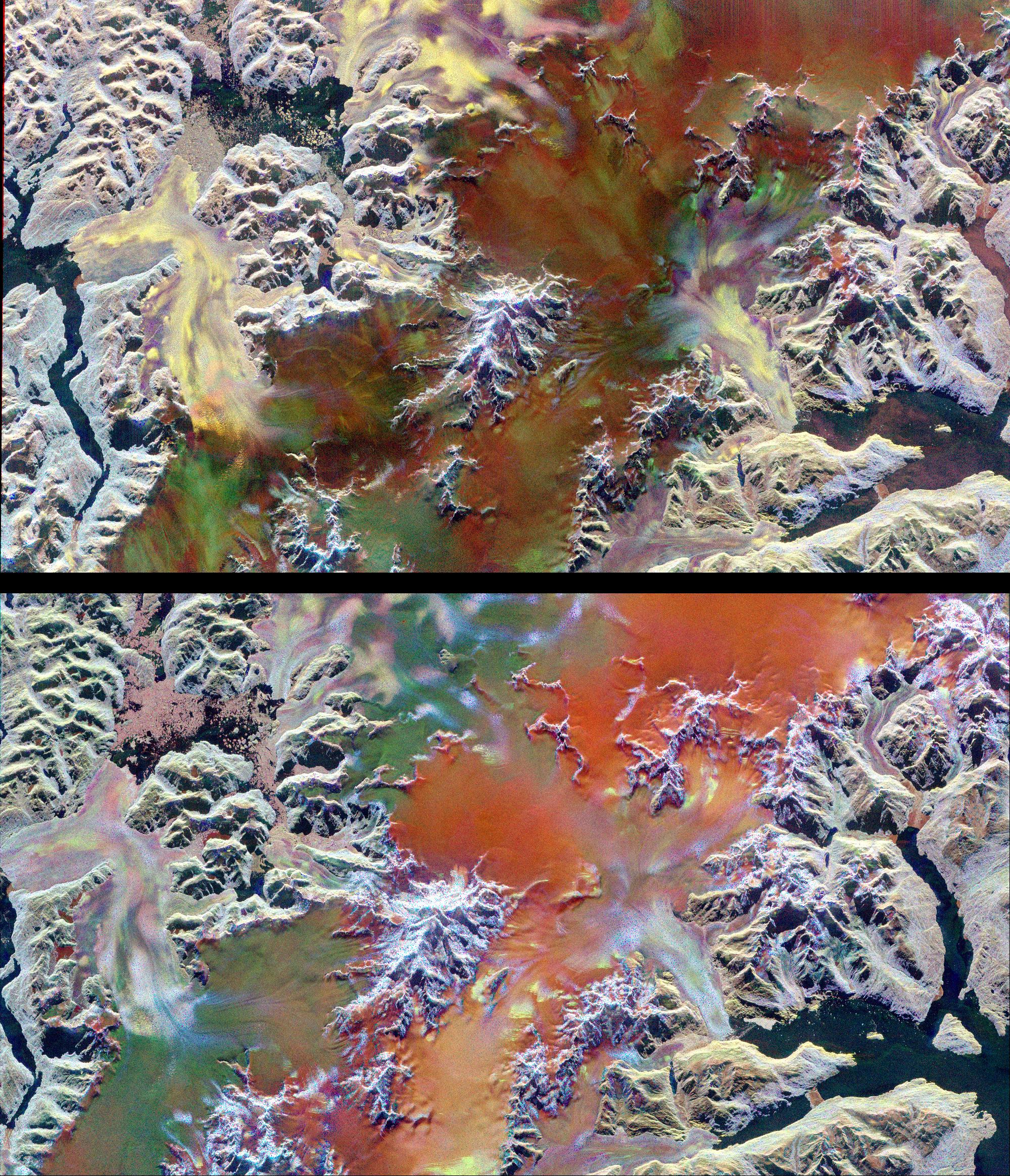
1999-04-15 |
Earth
|
Spaceborne Imaging Radar-C/X-Band Synthetic Aperture Radar
|
|
3600x2180x3 |
|
-
PIA01779:
-
Space Radar Image of Teide Volcano
Full Resolution:
TIFF
(11.93 MB)
JPEG
(1.764 MB)
|
|
|
1999-04-15 |
Earth
|
Spaceborne Imaging Radar-C/X-Band Synthetic Aperture Radar
|
|
1875x3180x3 |
|
-
PIA01780:
-
Space Radar Image of Vesuvius, Italy
Full Resolution:
TIFF
(19.35 MB)
JPEG
(2.751 MB)
|
|
|
1999-04-15 |
Earth
|
Spaceborne Imaging Radar-C/X-Band Synthetic Aperture Radar
|
|
1550x2096x3 |
|
-
PIA01781:
-
Space Radar Image of San Rafael Glacier, Chile
Full Resolution:
TIFF
(6.016 MB)
JPEG
(908.4 kB)
|
|
|
1999-04-15 |
Earth
|
Spaceborne Imaging Radar-C/X-Band Synthetic Aperture Radar
|
|
4500x3600x3 |

|
-
PIA01782:
-
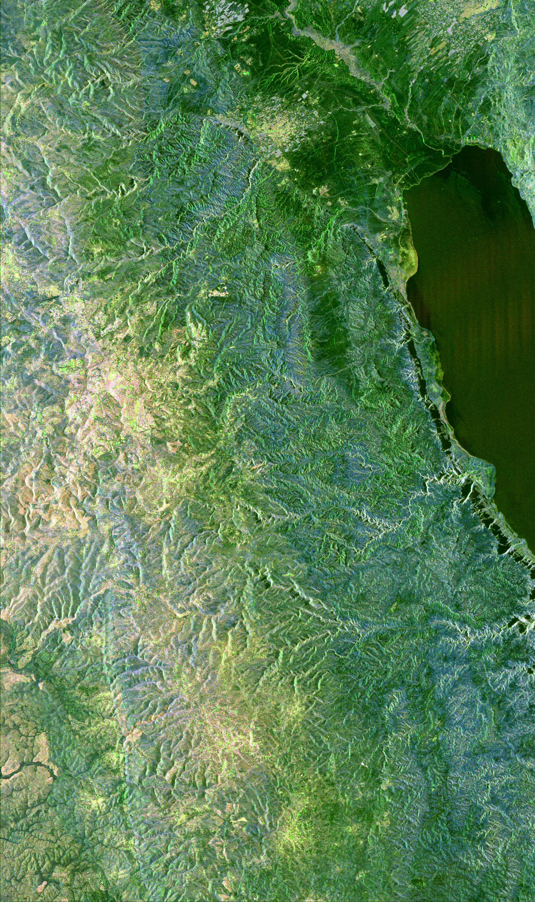
Space Radar Image of Central Java, Indonesia
Full Resolution:
TIFF
(63.05 MB)
JPEG
(5.97 MB)
|
|
|
1999-04-15 |
Earth
|
Spaceborne Imaging Radar-C/X-Band Synthetic Aperture Radar
|
|
1494x2665x3 |
|
-
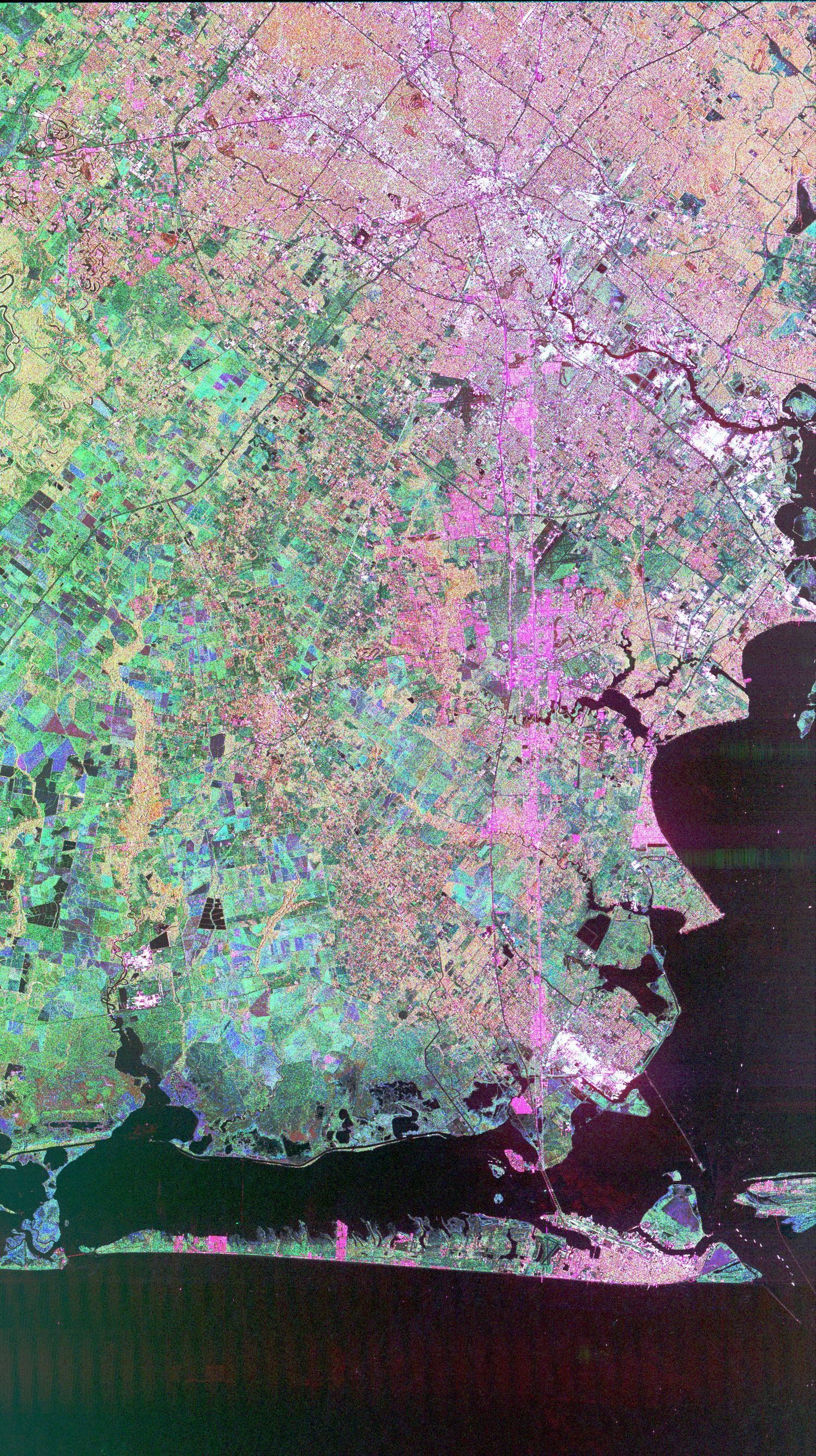
PIA01783:
-
Space Radar Image of Houston, Texas
Full Resolution:
TIFF
(13.73 MB)
JPEG
(1.529 MB)
|
|
|
1999-04-15 |
Earth
|
Spaceborne Imaging Radar-C/X-Band Synthetic Aperture Radar
|
|
2749x4938x3 |

|
-
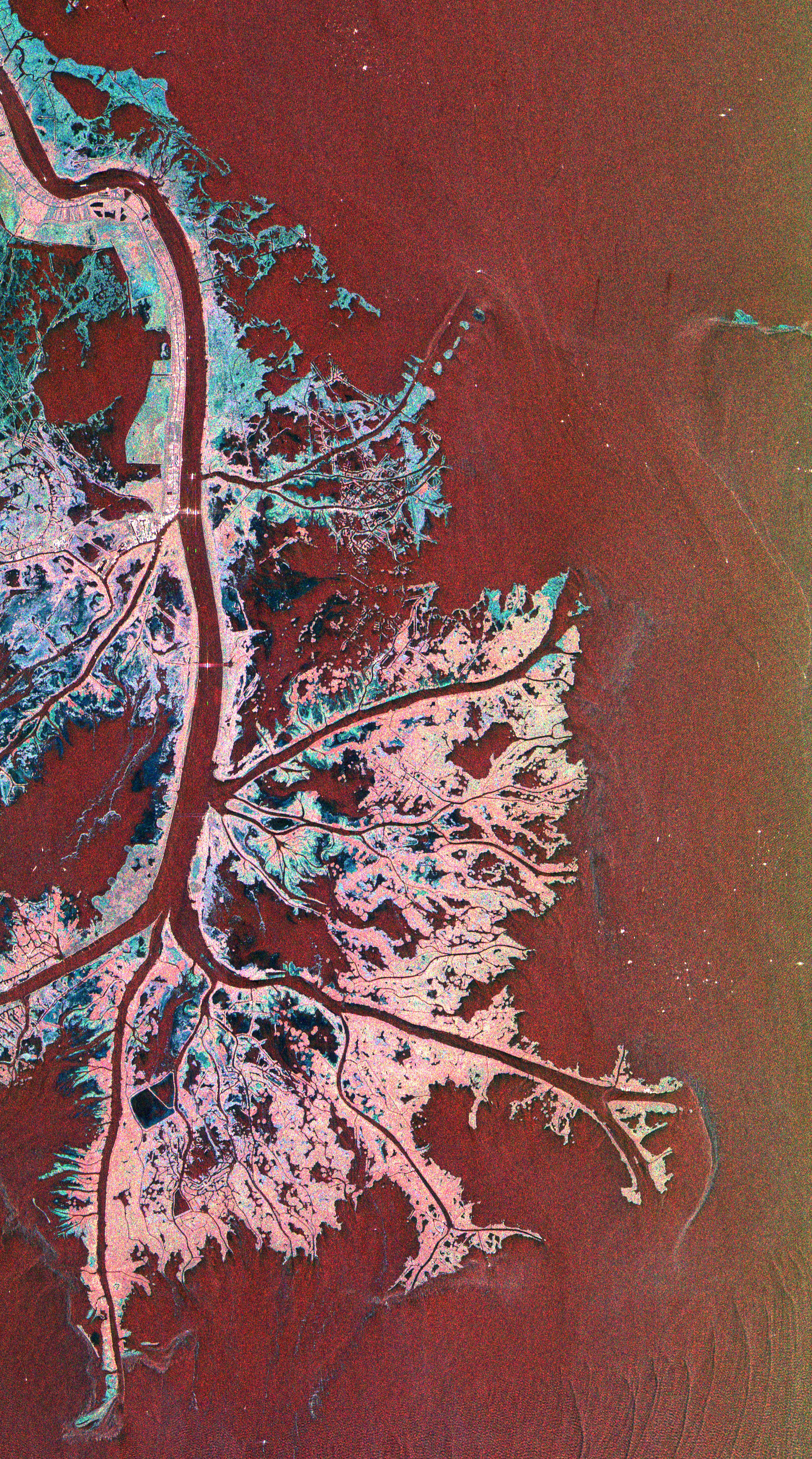
PIA01784:
-
Space Radar Image of Mississippi Delta
Full Resolution:
TIFF
(49.58 MB)
JPEG
(4.041 MB)
|
|
|
1999-04-15 |
Earth
|
Spaceborne Imaging Radar-C/X-Band Synthetic Aperture Radar
|
|
3500x1436x3 |
|
-
PIA01786:
-
Space Radar Image of Weddell Sea Ice
Full Resolution:
TIFF
(19.79 MB)
JPEG
(2.057 MB)
|
|
|
1999-04-15 |
Earth
|
Spaceborne Imaging Radar-C/X-Band Synthetic Aperture Radar
|
|
4125x3170x3 |
|
-
PIA01789:
-
Space Radar Image of Los Angeles, California
Full Resolution:
TIFF
(50.23 MB)
JPEG
(5.598 MB)
|
|
|
1999-04-15 |
Earth
|
Spaceborne Imaging Radar-C/X-Band Synthetic Aperture Radar
|
|
3200x4700x3 |
|
-
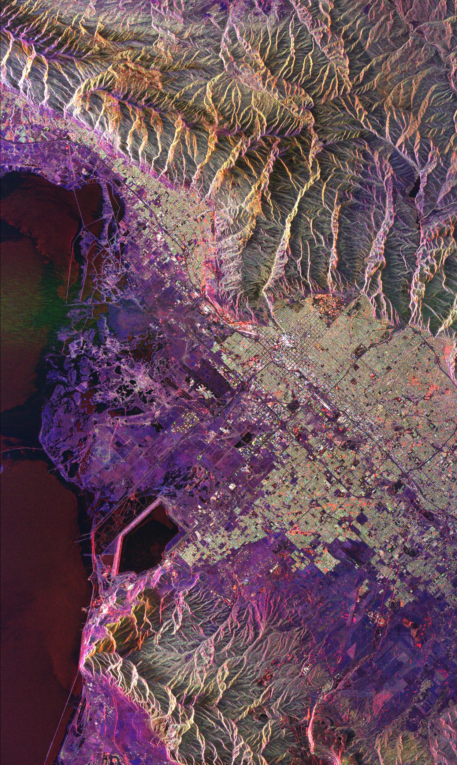
PIA01791:
-
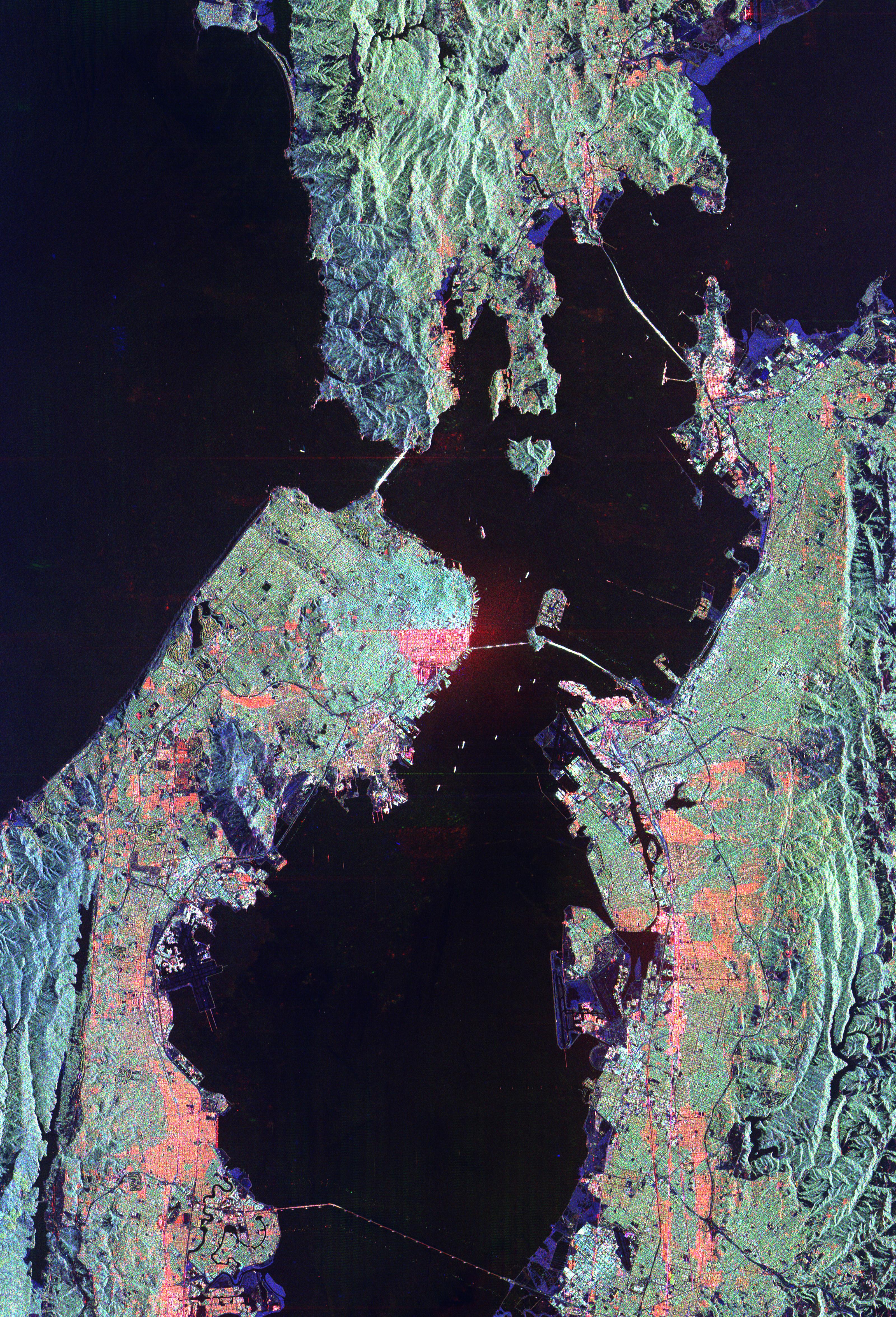
Space Radar Image of San Francisco, California
Full Resolution:
TIFF
(50.23 MB)
JPEG
(3.735 MB)
|
|
|
1999-04-15 |
Earth
|
Spaceborne Imaging Radar-C/X-Band Synthetic Aperture Radar
|
|
2200x1750x3 |
|
-
PIA01793:
-
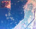
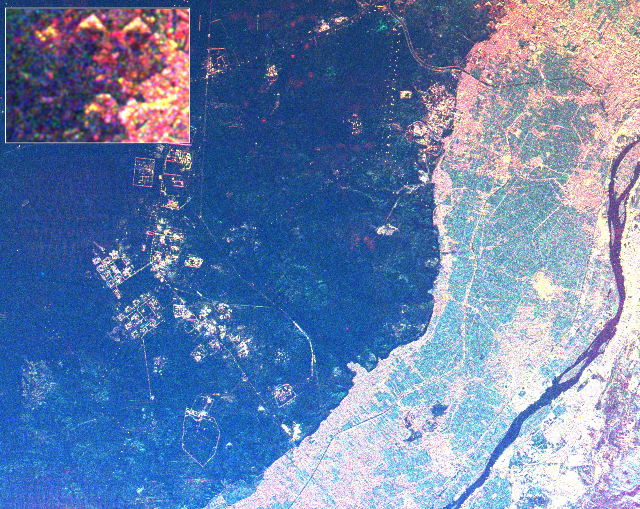
Space Radar Image of Giza Egypt - with Enlargement
Full Resolution:
TIFF
(13.76 MB)
JPEG
(1.011 MB)
|
|
|
1999-04-15 |
Earth
|
Spaceborne Imaging Radar-C/X-Band Synthetic Aperture Radar
|
|
2050x2998x3 |
|
-
PIA01794:
-
Space Radar Image of Great Wall of China
Full Resolution:
TIFF
(23.05 MB)
JPEG
(1.589 MB)
|
|
|
1999-04-15 |
Earth
|
Spaceborne Imaging Radar-C/X-Band Synthetic Aperture Radar
|
|
2709x2097x3 |

|
-
PIA01795:
-
Space Radar Image of Florence, Italy
Full Resolution:
TIFF
(22.04 MB)
JPEG
(2.274 MB)
|
|
|
1999-04-15 |
Earth
|
Spaceborne Imaging Radar-C/X-Band Synthetic Aperture Radar
|
|
3998x2166x3 |
|
-
PIA01796:
-
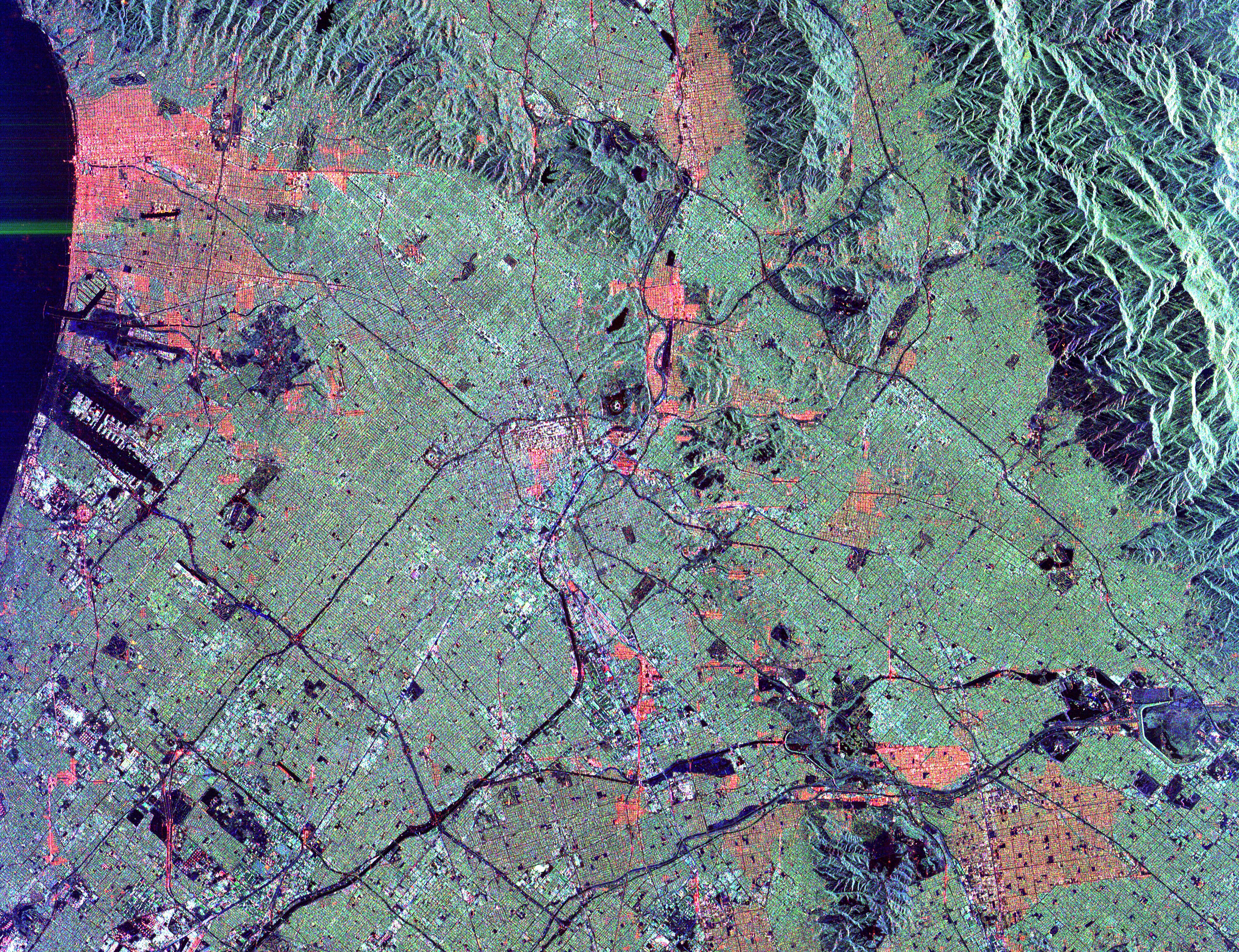
Space Radar Image of Pishan, China
Full Resolution:
TIFF
(30.7 MB)
JPEG
(2.58 MB)
|
|
|
1999-04-15 |
Earth
|
Spaceborne Imaging Radar-C/X-Band Synthetic Aperture Radar
|
|
506x1001x3 |

|
-
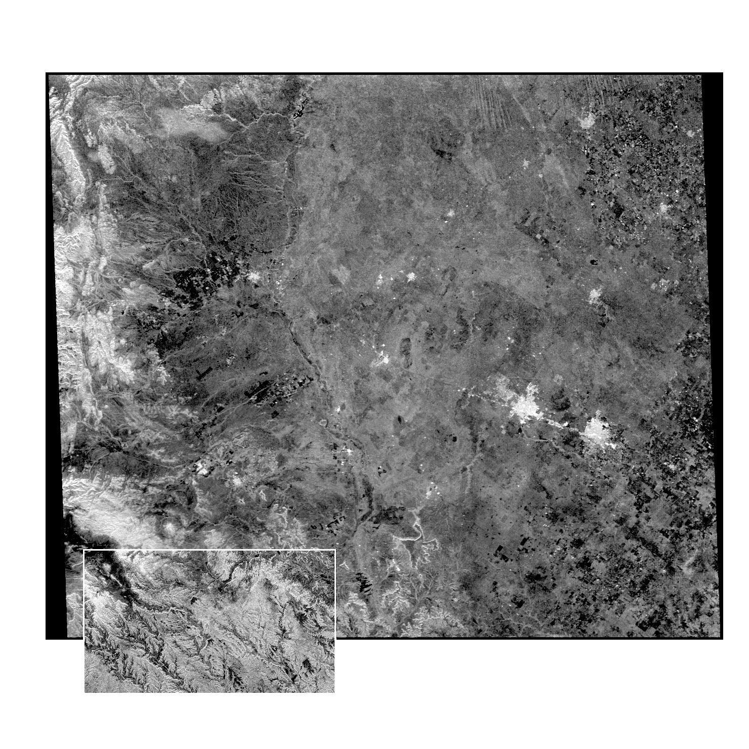
PIA01797:
-
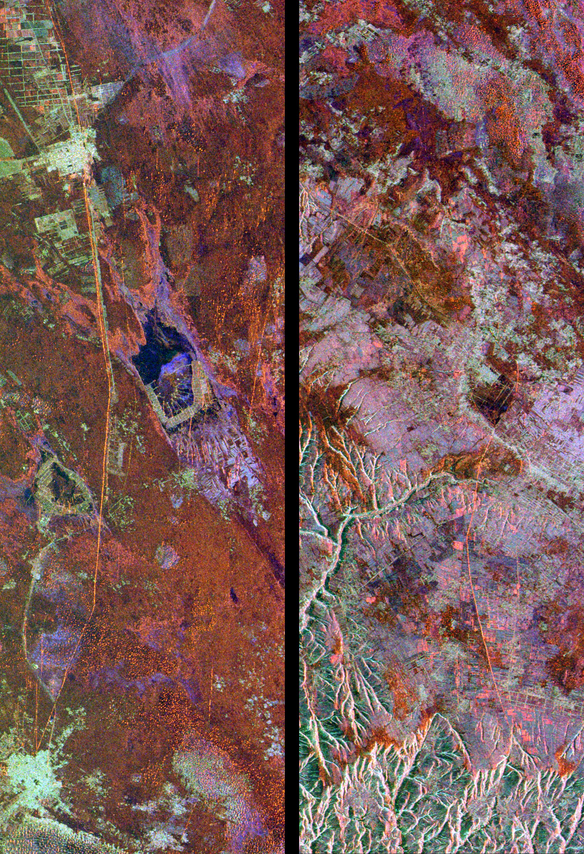
Space Radar Image of Central Sumatra, Indonesia
Full Resolution:
TIFF
(1.82 MB)
JPEG
(246 kB)
|
|
|
1999-04-15 |
Earth
|
Spaceborne Imaging Radar-C/X-Band Synthetic Aperture Radar
|
|
1494x2500x3 |

|
-
PIA01798:
-
Space Radar Image of Salt Lake City, Utah
Full Resolution:
TIFF
(13.97 MB)
JPEG
(1.173 MB)
|
|
|
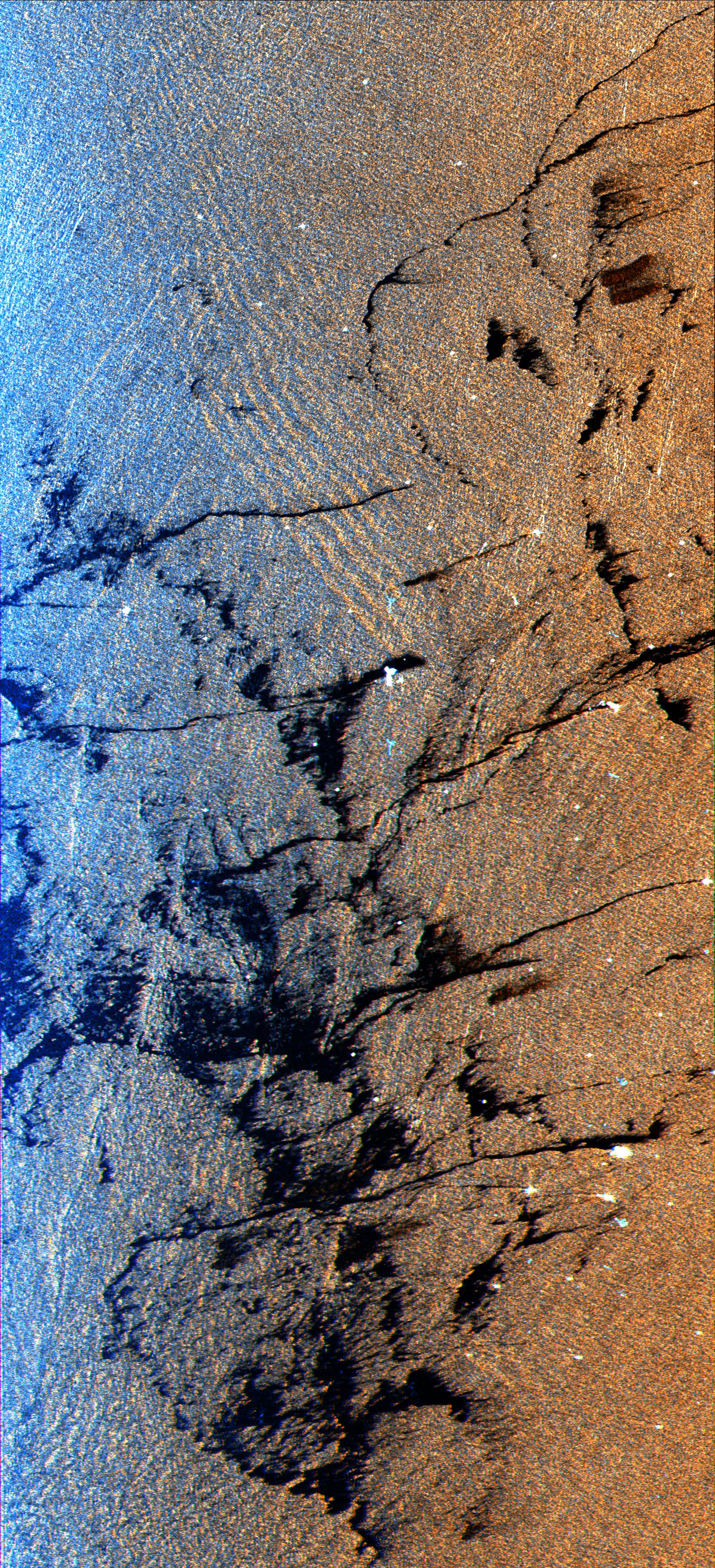
1999-04-15 |
Earth
|
Spaceborne Imaging Radar-C/X-Band Synthetic Aperture Radar
|
|
2694x1359x3 |
|
-
PIA01799:
-
Space Radar Image of North Atlantic Ocean
Full Resolution:
TIFF
(14.14 MB)
JPEG
(1.832 MB)
|
|
|
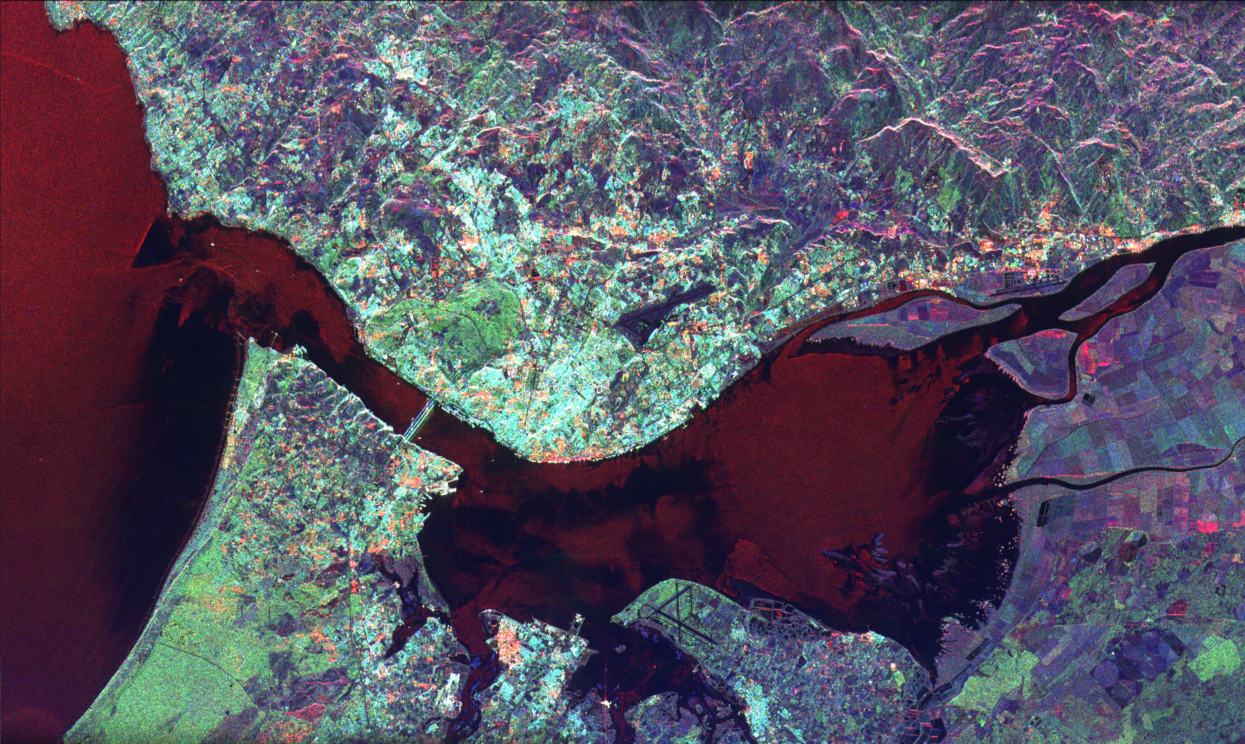
1999-04-15 |
Earth
|
Spaceborne Imaging Radar-C/X-Band Synthetic Aperture Radar
|
|
2076x2470x3 |

|
-
PIA01801:
-
Space Radar Image of Sudan Collision Zone
Full Resolution:
TIFF
(16.56 MB)
JPEG
(2.247 MB)
|
|
|
1999-04-15 |
Earth
|
Spaceborne Imaging Radar-C/X-Band Synthetic Aperture Radar
|
|
3800x2300x3 |
|
-
PIA01802:
-
Space Radar Image of Weddell Sea
Full Resolution:
TIFF
(28.59 MB)
JPEG
(1.717 MB)
|
|
|
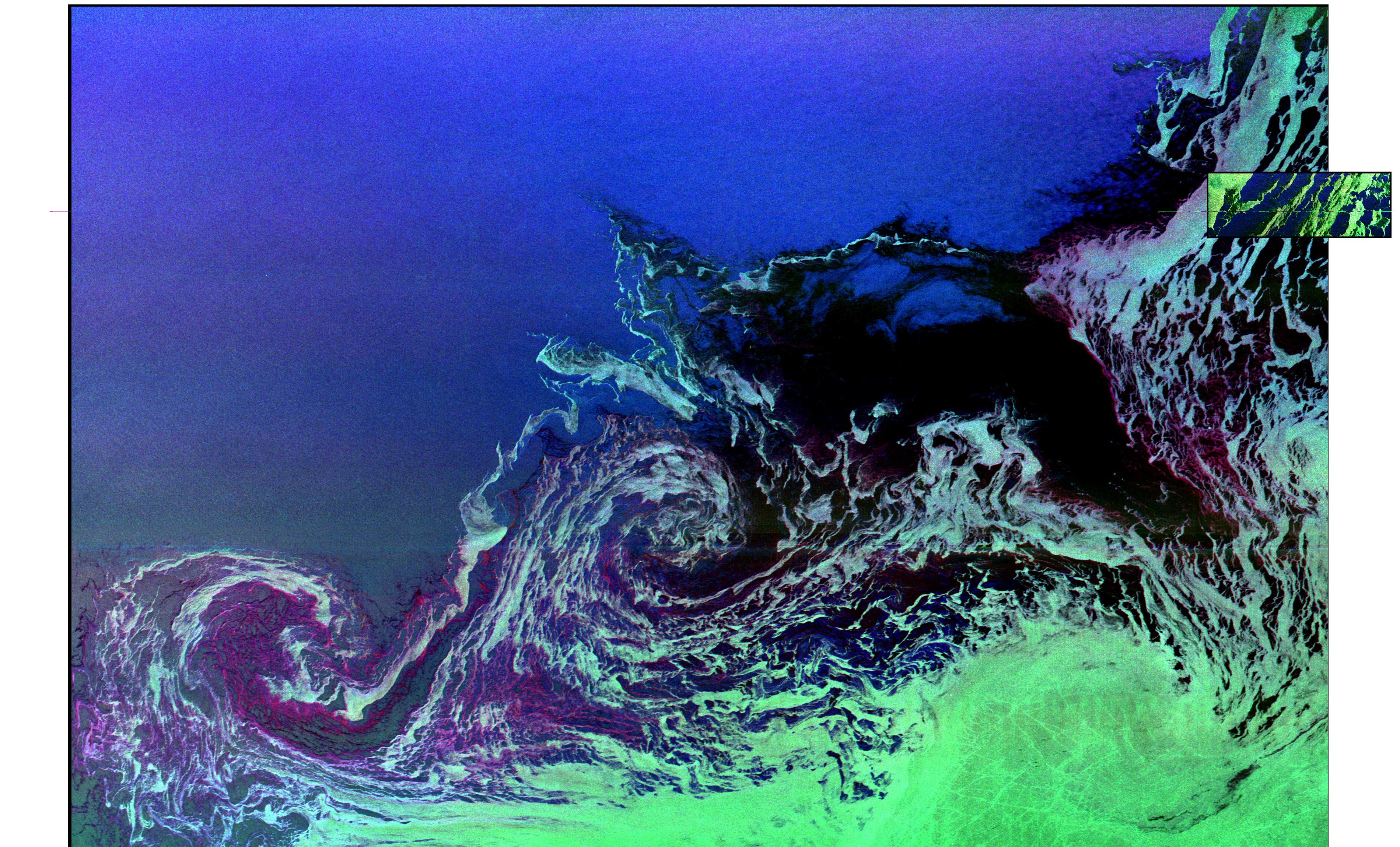
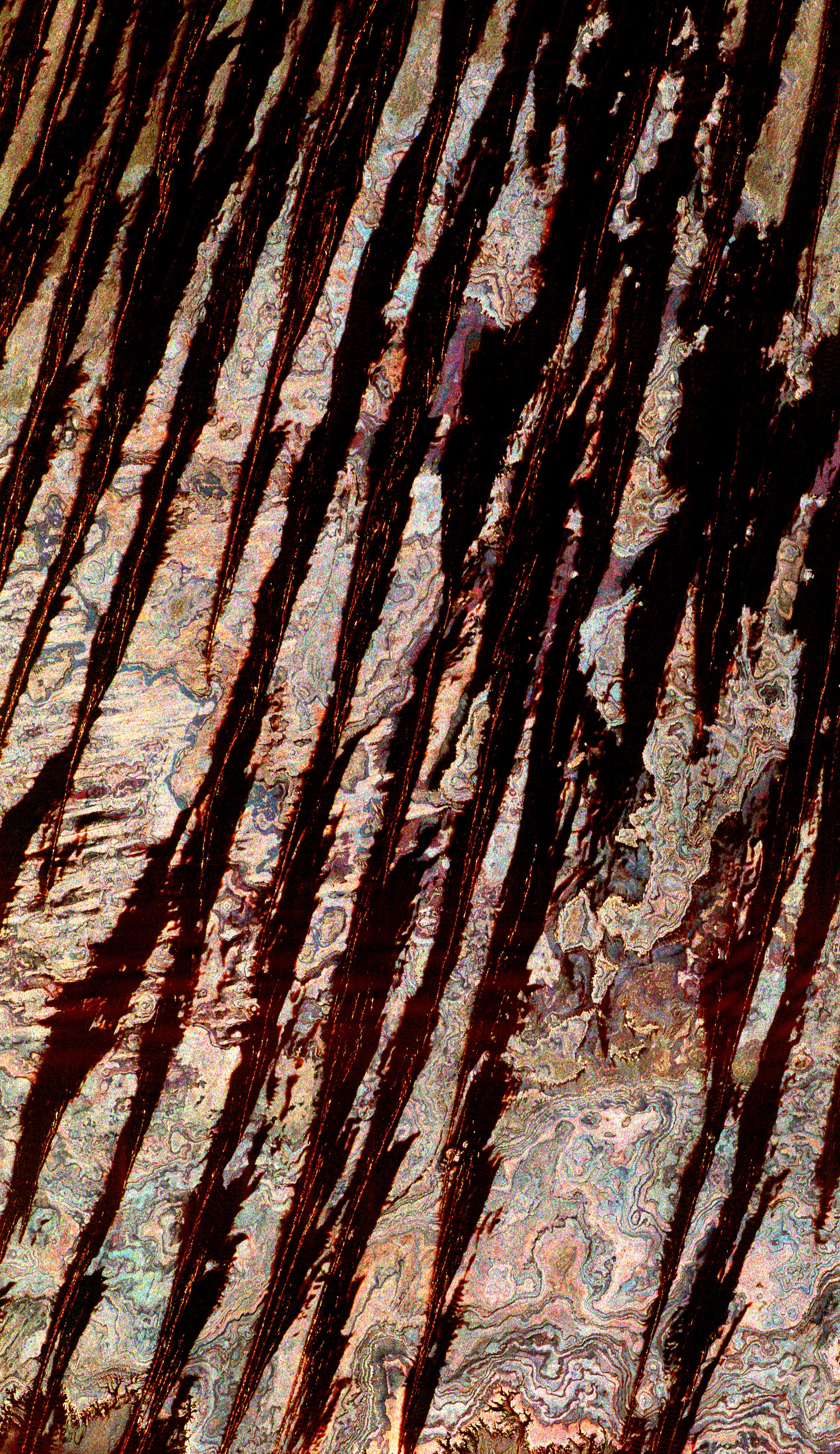
1999-04-15 |
Earth
|
Spaceborne Imaging Radar-C/X-Band Synthetic Aperture Radar
|
|
1644x3604x3 |
|
-
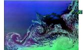
PIA01803:
-
Space Radar Image of Oil Slicks
Full Resolution:
TIFF
(21.1 MB)
JPEG
(2.086 MB)
|
|
|
1999-04-15 |
Earth
|
Spaceborne Imaging Radar-C/X-Band Synthetic Aperture Radar
|
|
2300x1617x3 |
|
-
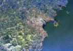
PIA01804:
-
Space Radar Image of Dublin, Ireland
Full Resolution:
TIFF
(14.17 MB)
JPEG
(1.381 MB)
|
|
|
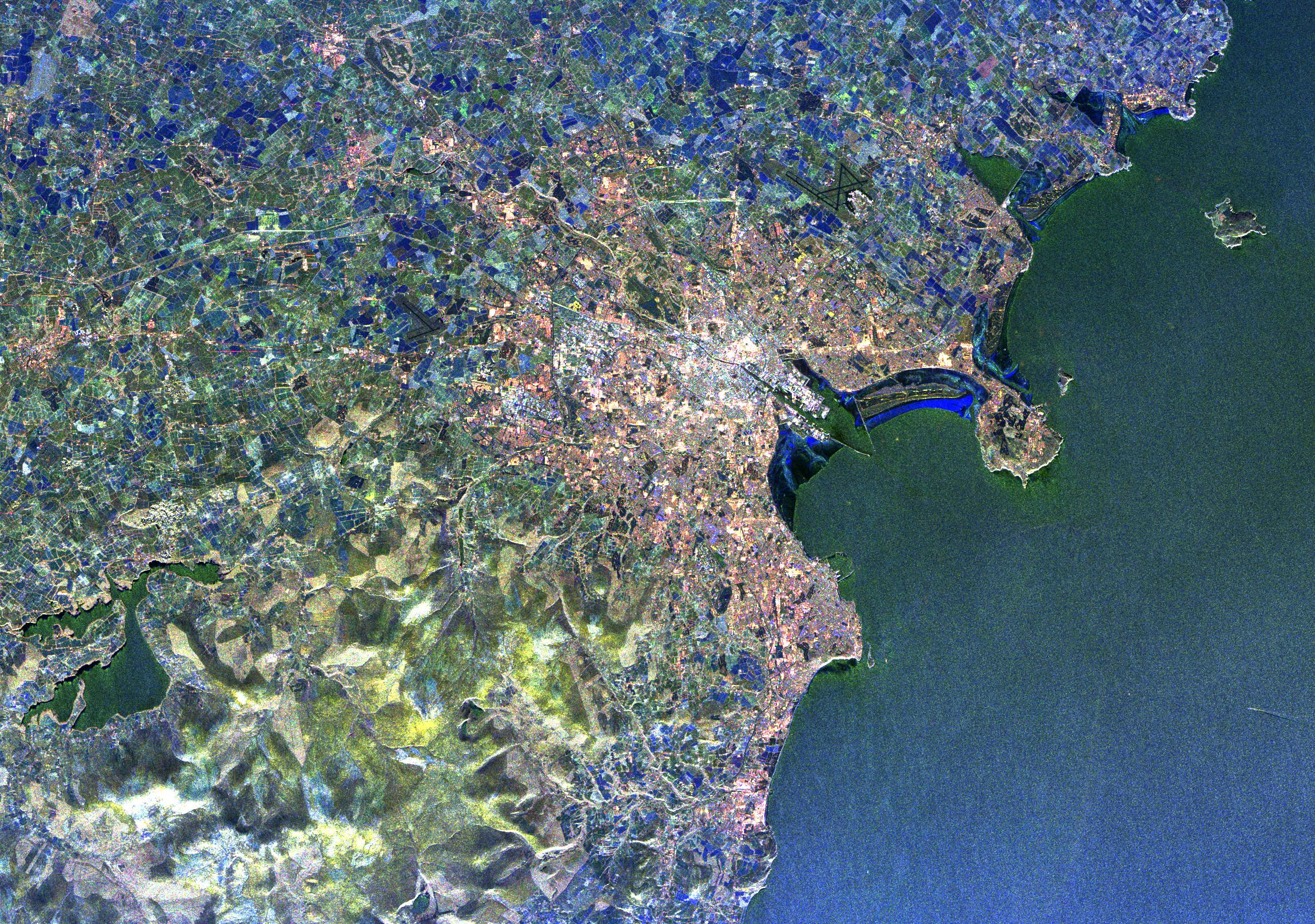
1999-04-15 |
Earth
|
Spaceborne Imaging Radar-C/X-Band Synthetic Aperture Radar
|
|
4000x2392x3 |
|
-
PIA01807:
-
Space Radar Image of Lisbon, Portugal
Full Resolution:
TIFF
(34.58 MB)
JPEG
(2.158 MB)
|
|
|
1999-04-15 |
Earth
|
Spaceborne Imaging Radar-C/X-Band Synthetic Aperture Radar
|
|
1920x1035x3 |

|
-
PIA01808:
-
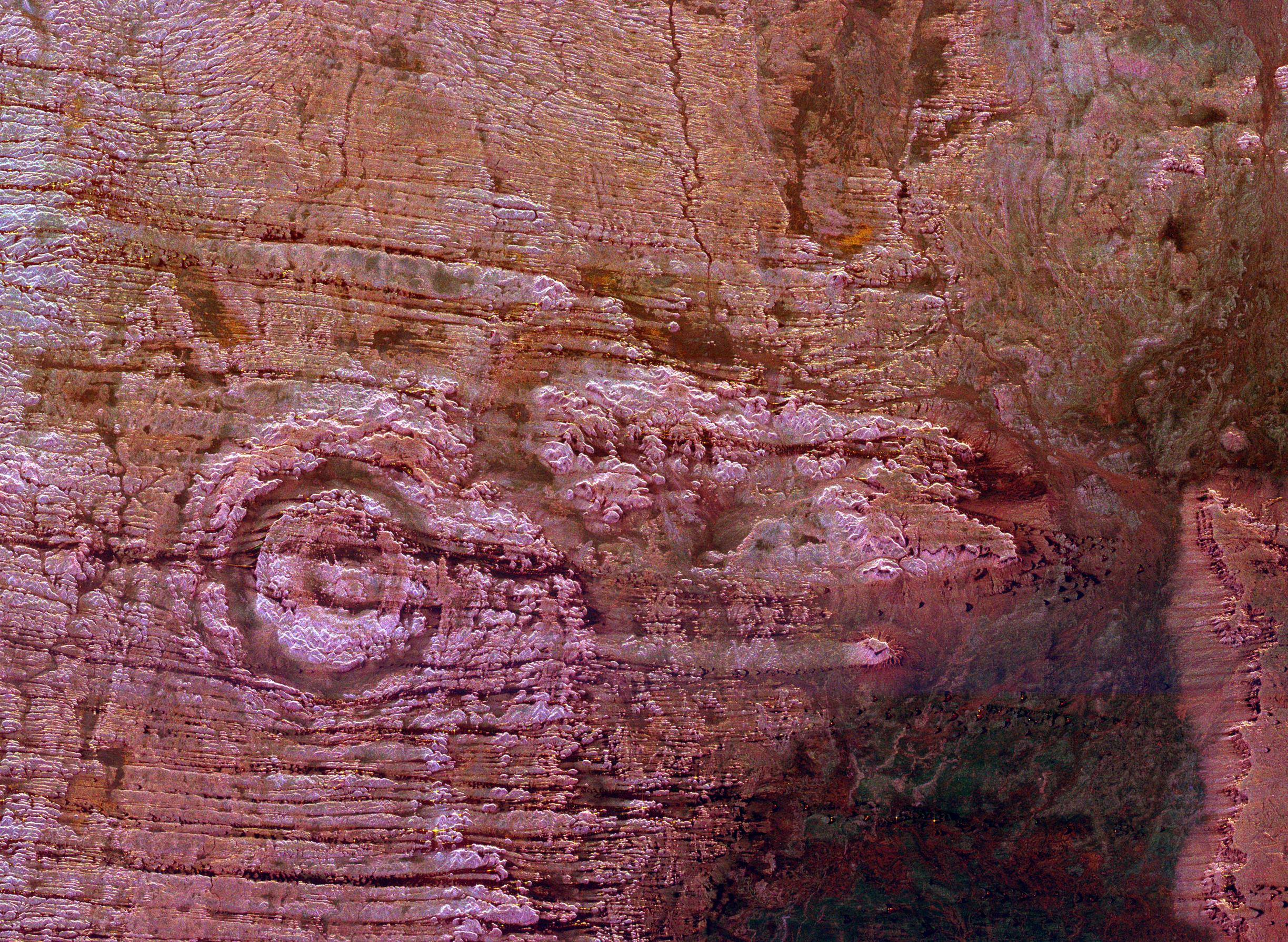
Space Radar Image of Saline Valley, California
Full Resolution:
TIFF
(5.441 MB)
JPEG
(241.2 kB)
|
|
|
1999-04-15 |
Earth
|
Spaceborne Imaging Radar-C/X-Band Synthetic Aperture Radar
|
|
1920x1035x3 |
|
-
PIA01809:
-
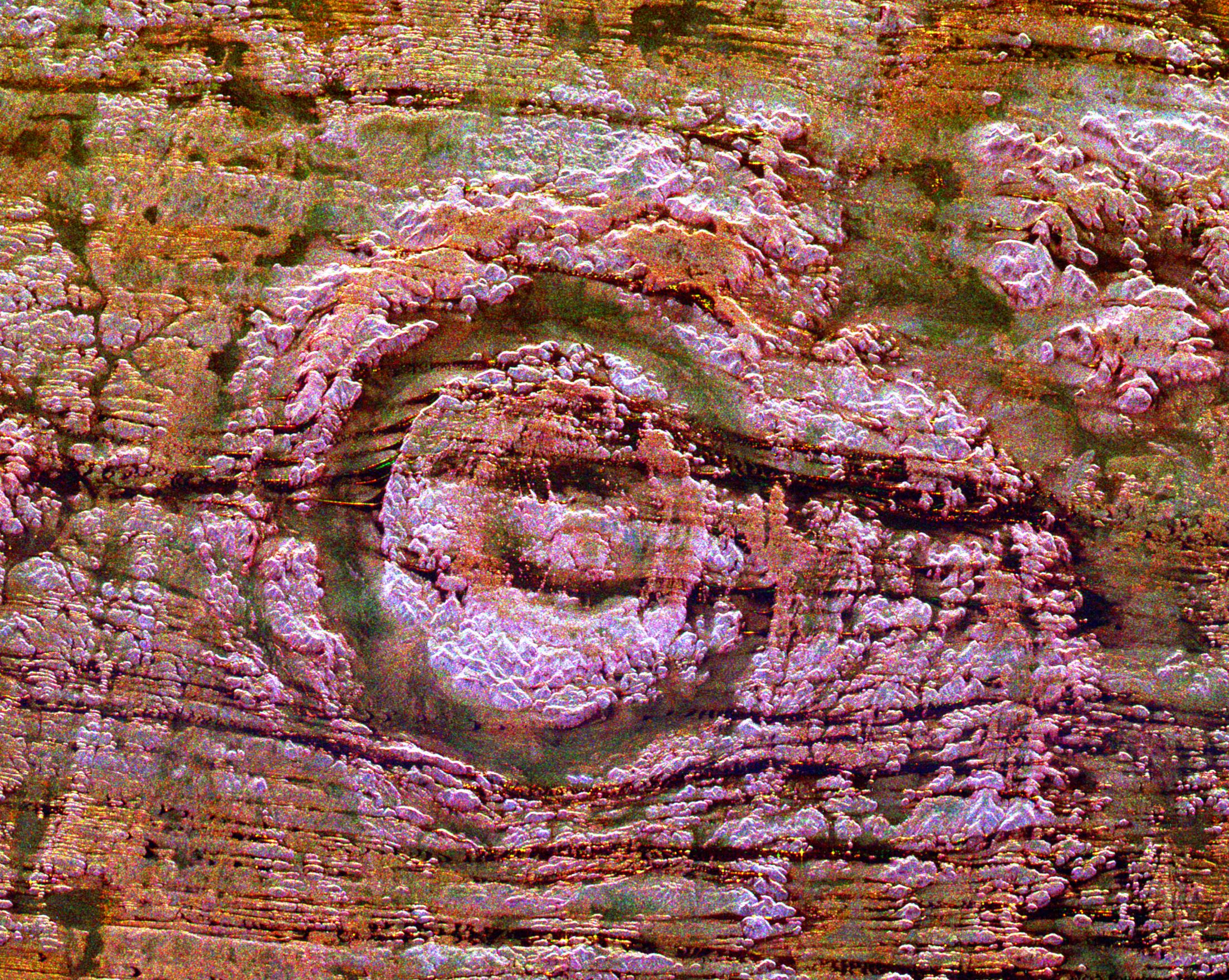
Space Radar Image of Owens Valley, California
Full Resolution:
TIFF
(5.689 MB)
JPEG
(234.3 kB)
|
|
|
1999-04-15 |
Earth
|
Spaceborne Imaging Radar-C/X-Band Synthetic Aperture Radar
|
|
2000x2026x3 |
|
-
PIA01810:
-
Space Radar Image of North Ecuador
Full Resolution:
TIFF
(15.34 MB)
JPEG
(1.338 MB)
|
|
|
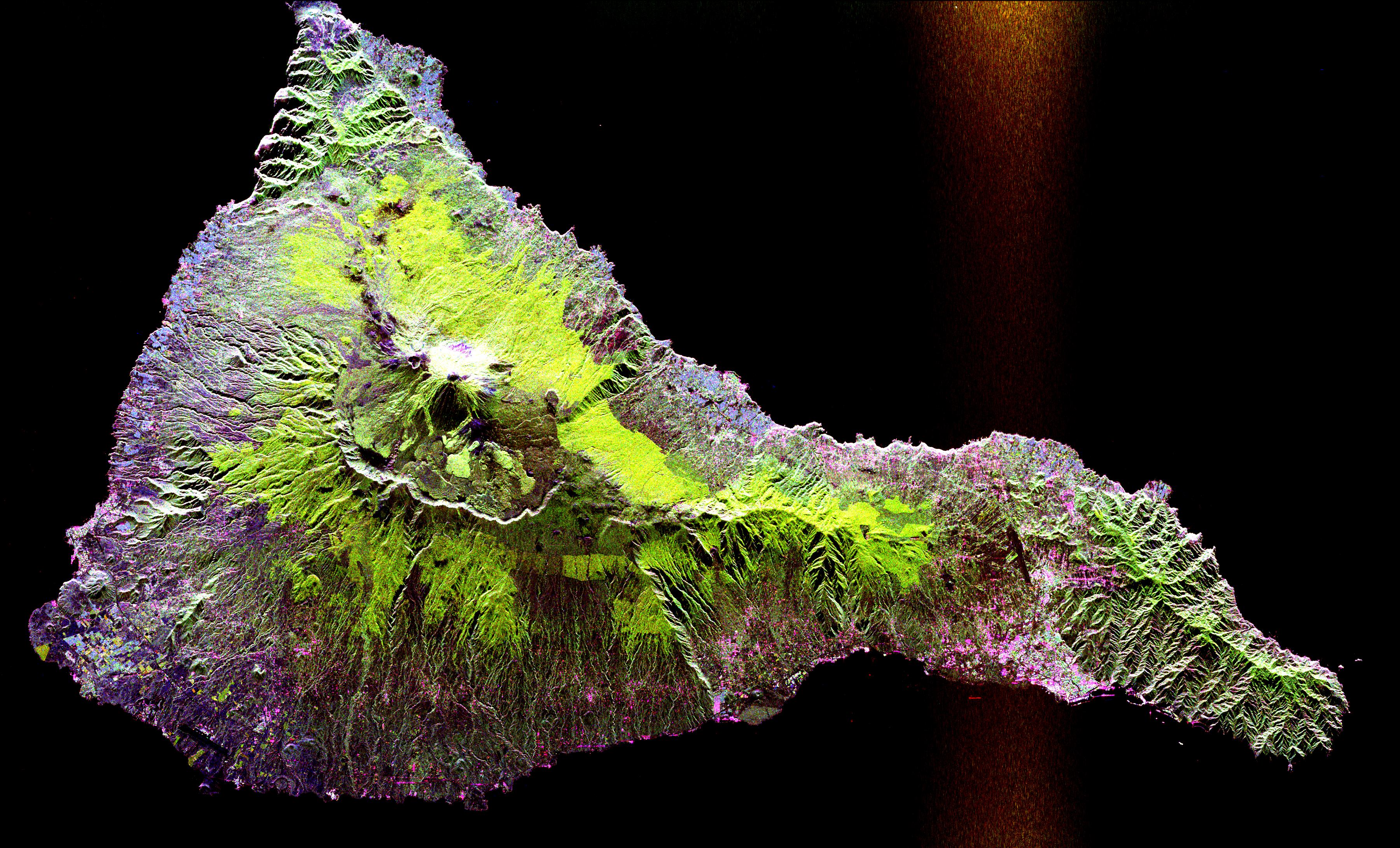
1999-04-15 |
Earth
|
Spaceborne Imaging Radar-C/X-Band Synthetic Aperture Radar
|
|
2004x3000x3 |
|
-
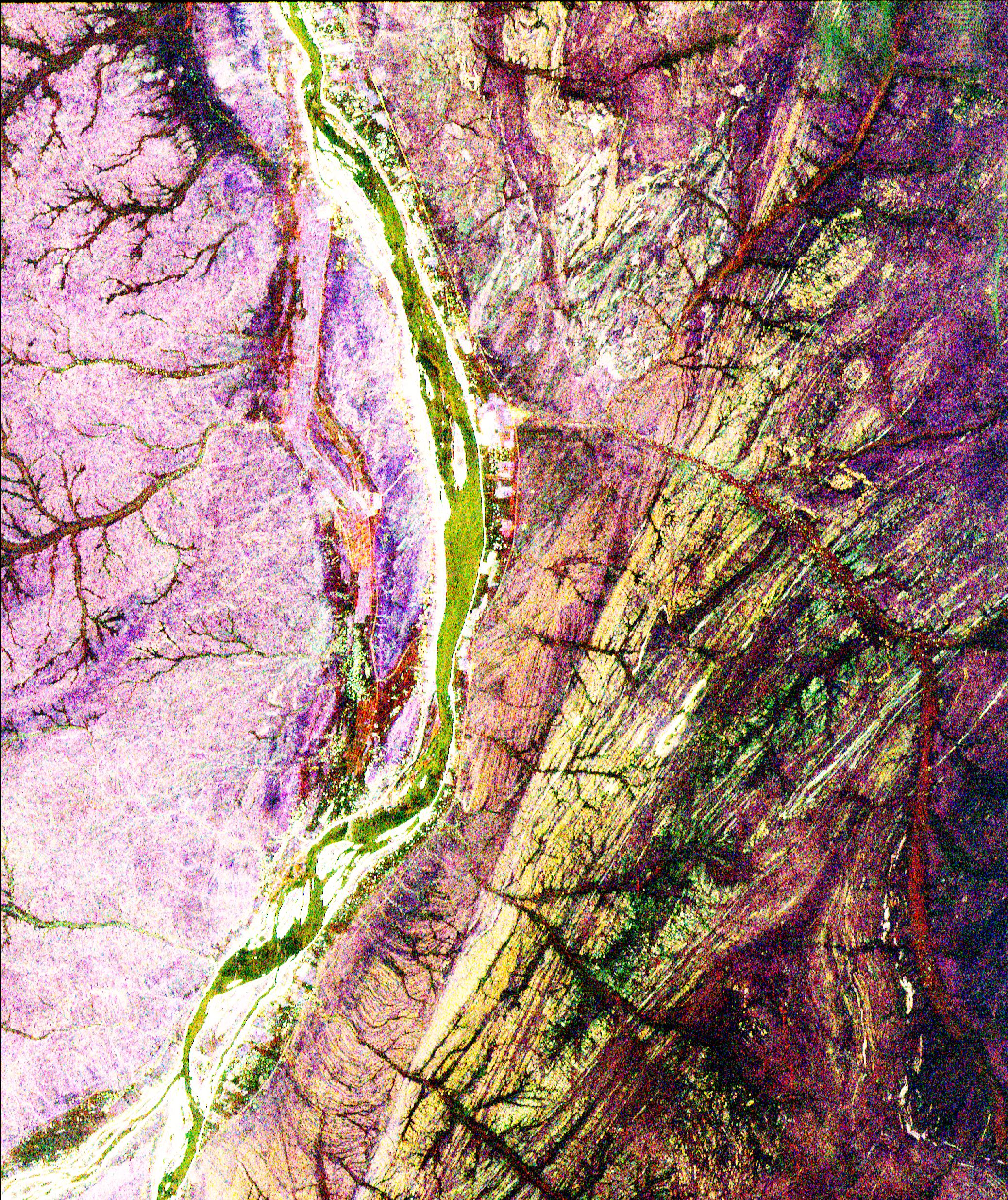
PIA01811:
-
Space Radar Image of Reunion Island
Full Resolution:
TIFF
(22.31 MB)
JPEG
(1.61 MB)
|
|
|
1999-04-15 |
Earth
|
Spaceborne Imaging Radar-C/X-Band Synthetic Aperture Radar
|
|
1365x3000x3 |
|
-
PIA01812:
-
Space Radar Image of Boston, Massachusetts
Full Resolution:
TIFF
(15.55 MB)
JPEG
(1.138 MB)
|
|
|
1999-04-15 |
Earth
|
Spaceborne Imaging Radar-C/X-Band Synthetic Aperture Radar
|
|
2840x1243x3 |
|
-
PIA01813:
-
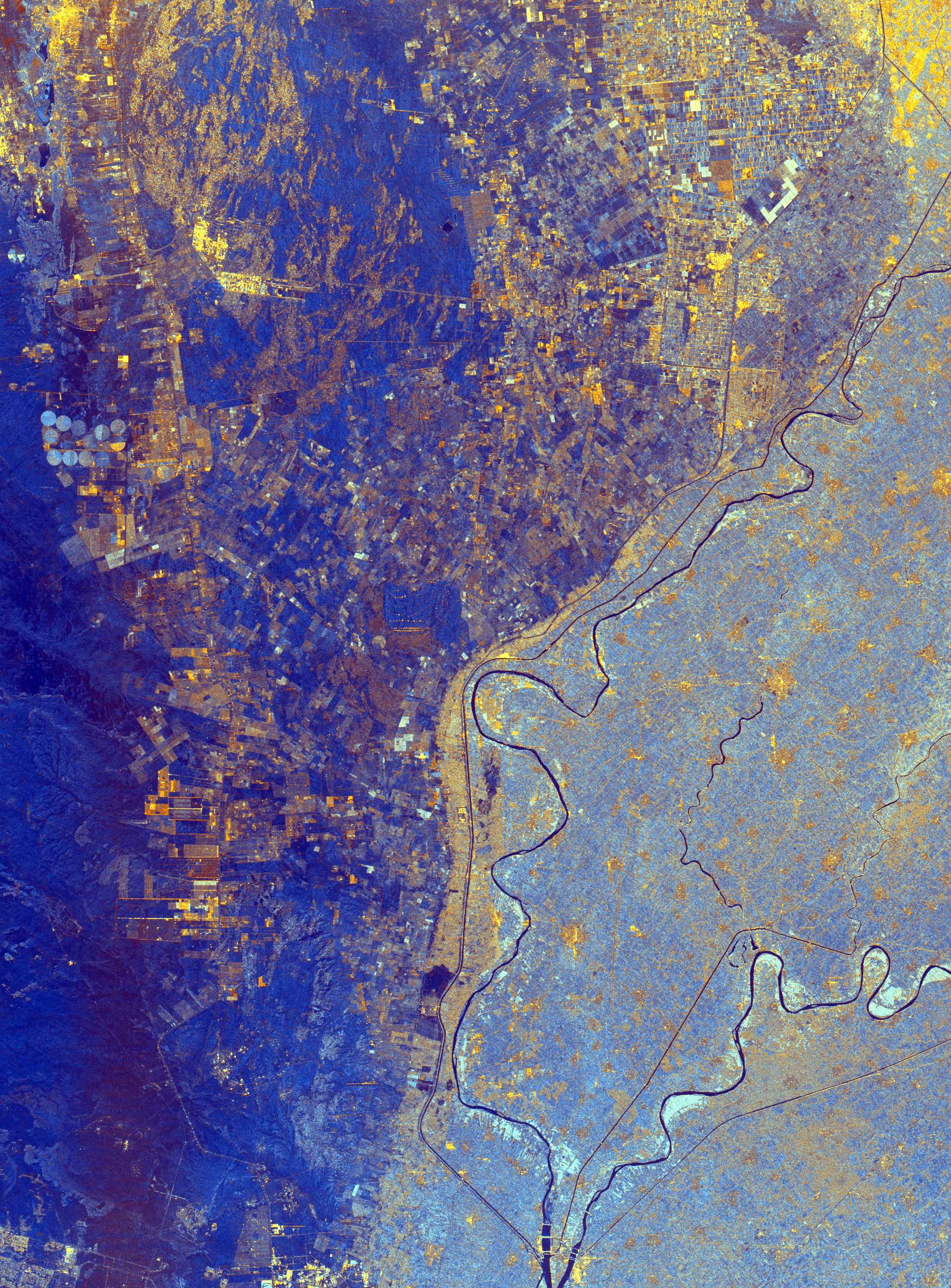
Space Radar Image of La Paz, Bolivia
Full Resolution:
TIFF
(13.04 MB)
JPEG
(1.023 MB)
|
|
|
1999-04-15 |
Earth
|
Spaceborne Imaging Radar-C/X-Band Synthetic Aperture Radar
|
|
1750x2950x3 |
|
-
PIA01814:
-
Space Radar Image of Jerusalem and the Dead Sea
Full Resolution:
TIFF
(19.16 MB)
JPEG
(1.522 MB)
|
|
|
1999-04-15 |
Earth
|
Spaceborne Imaging Radar-C/X-Band Synthetic Aperture Radar
|
|
2016x1951x3 |
|
-
PIA01815:
-
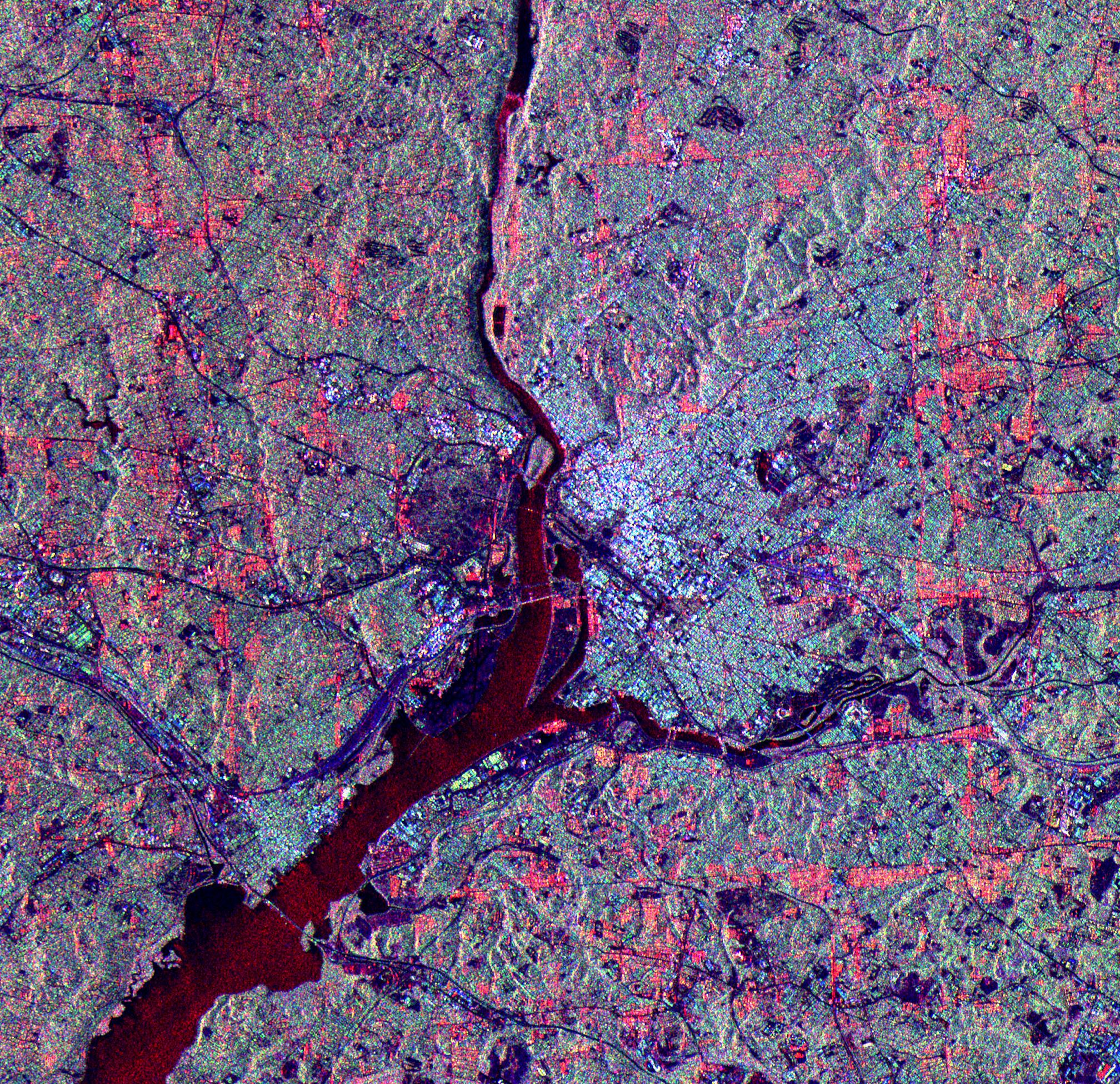
Space Radar Image of Washington D.C.
Full Resolution:
TIFF
(14.94 MB)
JPEG
(1.6 MB)
|
|
|
1999-04-15 |
Earth
|
Spaceborne Imaging Radar-C/X-Band Synthetic Aperture Radar
|
|
3425x2778x3 |
|
-
PIA01817:
-
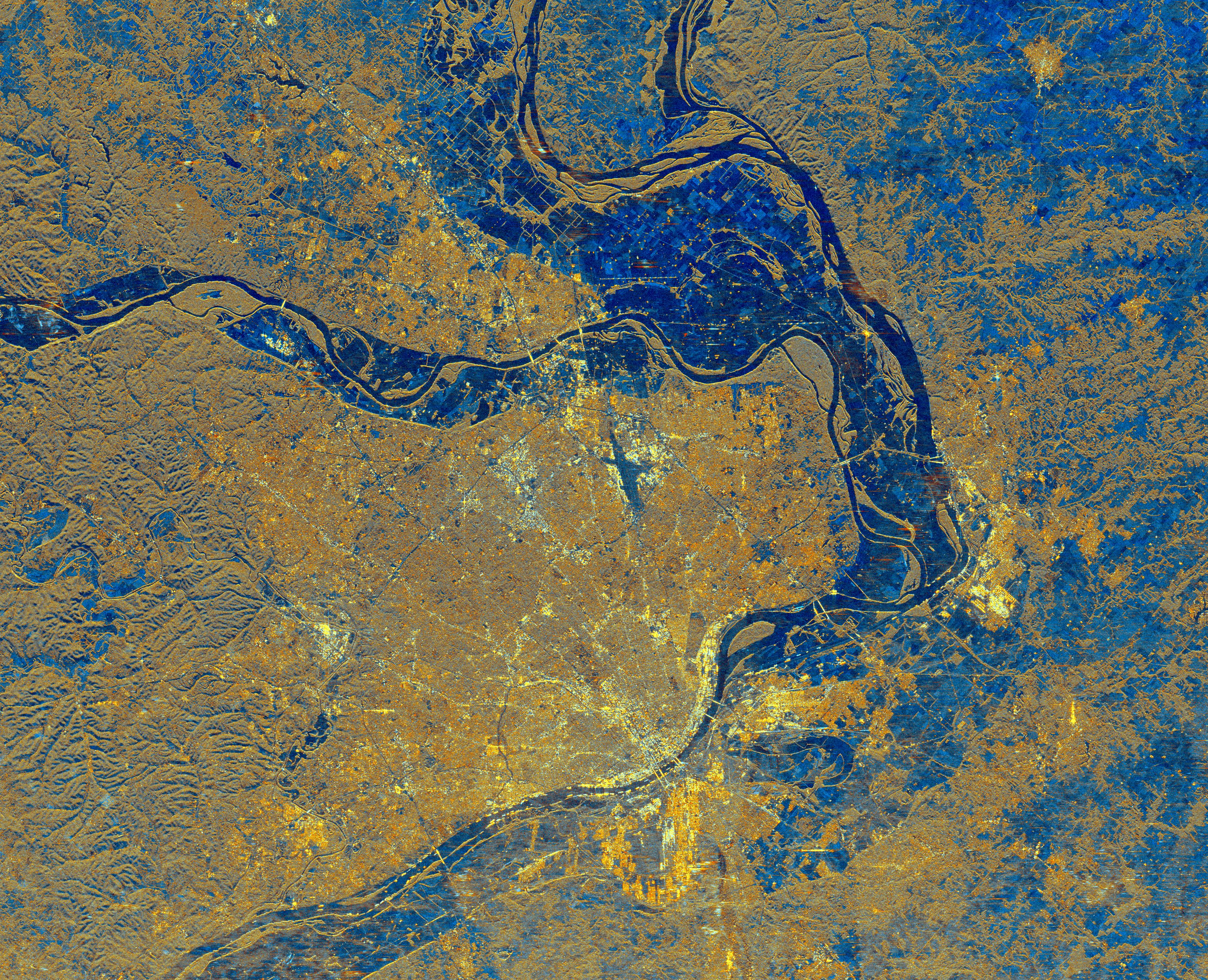
Space Radar Image of St. Louis, Missouri
Full Resolution:
TIFF
(34.15 MB)
JPEG
(3.708 MB)
|
|
|
1999-04-15 |
Earth
|
Spaceborne Imaging Radar-C/X-Band Synthetic Aperture Radar
|
|
2820x4000x3 |
|
-
PIA01818:
-
Space Radar Image of Colorado River
Full Resolution:
TIFF
(41.37 MB)
JPEG
(2.792 MB)
|
|
|
1999-04-15 |
Earth
|
Spaceborne Imaging Radar-C/X-Band Synthetic Aperture Radar
|
|
4000x2850x3 |
|
-
PIA01819:
-
Space Radar Image of Craters of the Moon, Idaho
Full Resolution:
TIFF
(42.98 MB)
JPEG
(3.466 MB)
|
|
|
1999-04-15 |
Earth
|
Spaceborne Imaging Radar-C/X-Band Synthetic Aperture Radar
|
|
2495x4970x3 |
|
-
PIA01820:
-
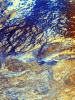
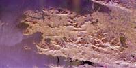
Space Radar Image of Central Plain, Oman
Full Resolution:
TIFF
(44.4 MB)
JPEG
(3.969 MB)
|
|
|
1999-04-15 |
Earth
|
Spaceborne Imaging Radar-C/X-Band Synthetic Aperture Radar
|
|
2817x2273x3 |
|
-
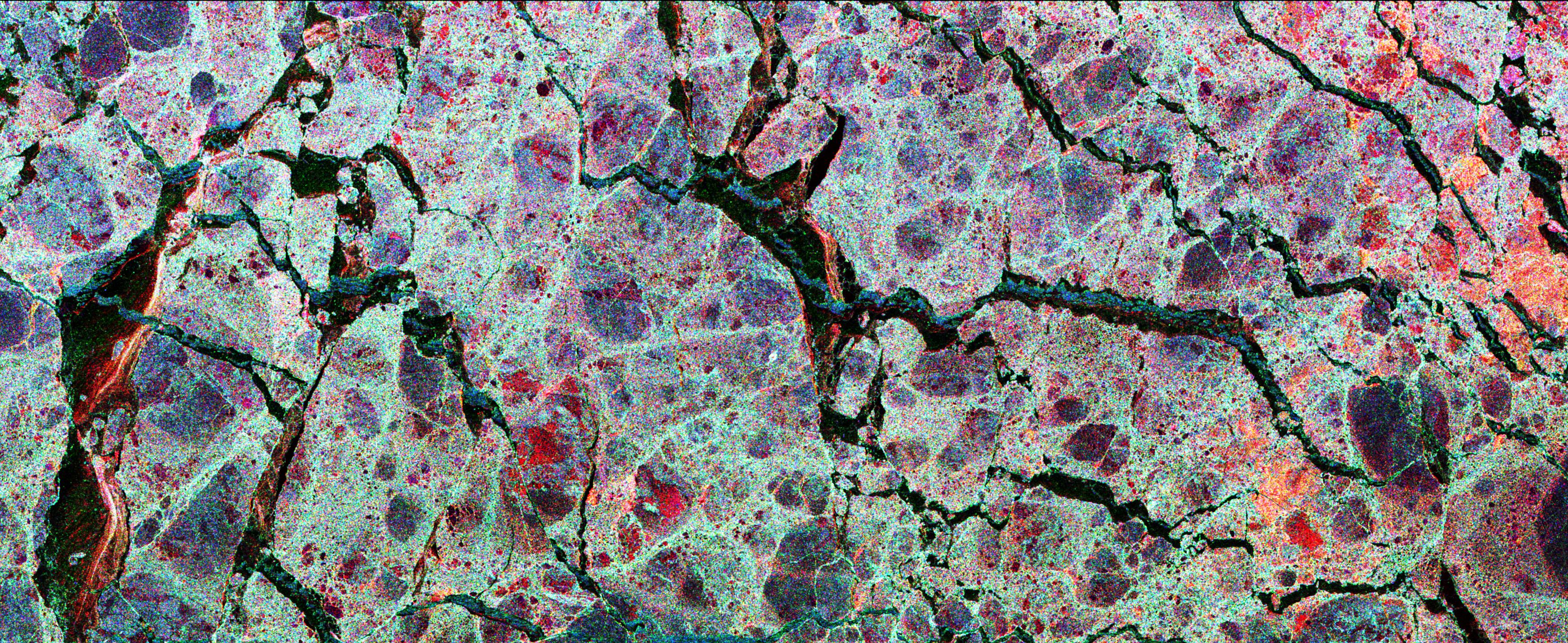
PIA01821:
-
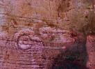
Space Radar Image of Randonia Rain Cell
Full Resolution:
TIFF
(20.31 MB)
JPEG
(2.657 MB)
|
|
|
1999-04-15 |
Earth
|
Spaceborne Imaging Radar-C/X-Band Synthetic Aperture Radar
|
|
2540x4396x3 |

|
-
PIA01822:
-
Space Radar Image of Egypt Sand Dunes
Full Resolution:
TIFF
(28.15 MB)
JPEG
(3.102 MB)
|
|
|
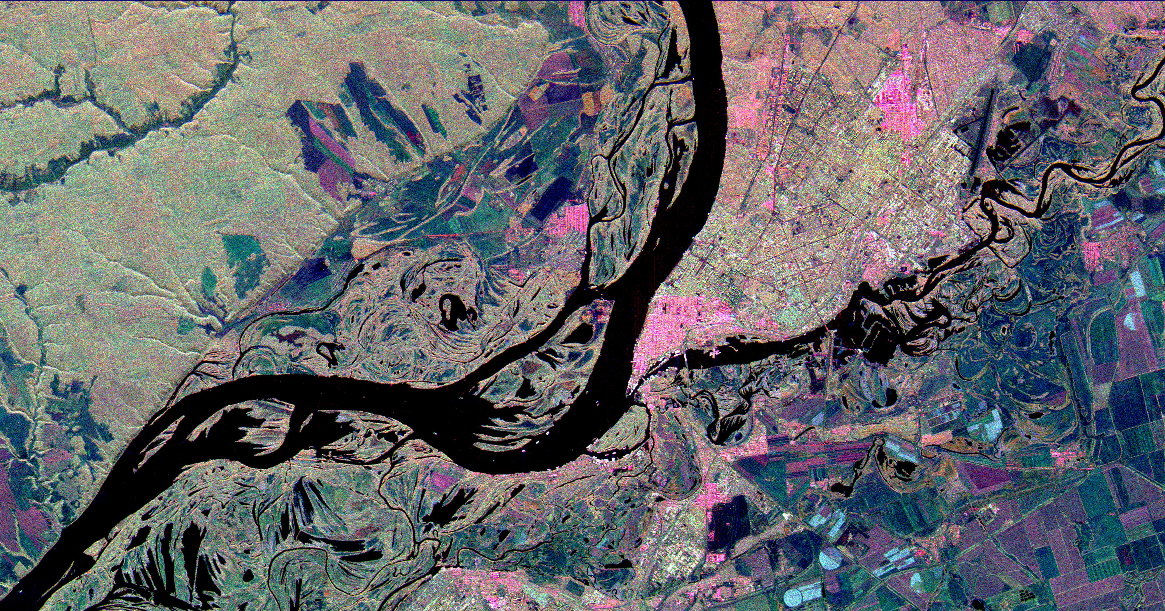
1999-04-15 |
Earth
|
Spaceborne Imaging Radar-C/X-Band Synthetic Aperture Radar
|
[NULL]
|
4000x2100x3 |

|
-
PIA01823:
-
Space Radar Image of Samara, Russia
Full Resolution:
TIFF
(28.13 MB)
JPEG
(2.748 MB)
|
|
|
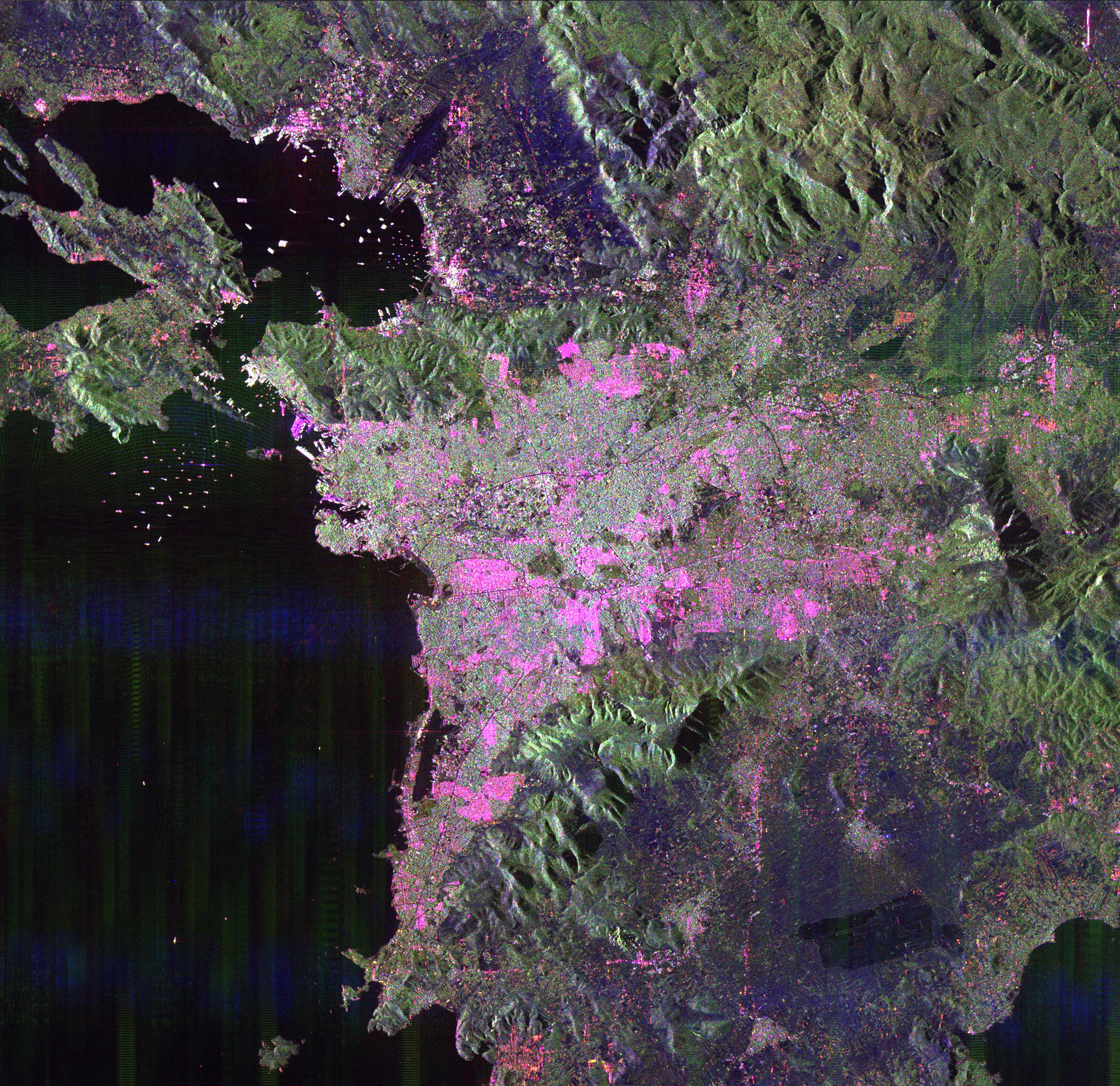
1999-04-15 |
Earth
|
Spaceborne Imaging Radar-C/X-Band Synthetic Aperture Radar
|
|
3612x3502x3 |
|
-
PIA01824:
-
Space Radar Image of Athens, Greece
Full Resolution:
TIFF
(42.86 MB)
JPEG
(2.881 MB)
|
|
|
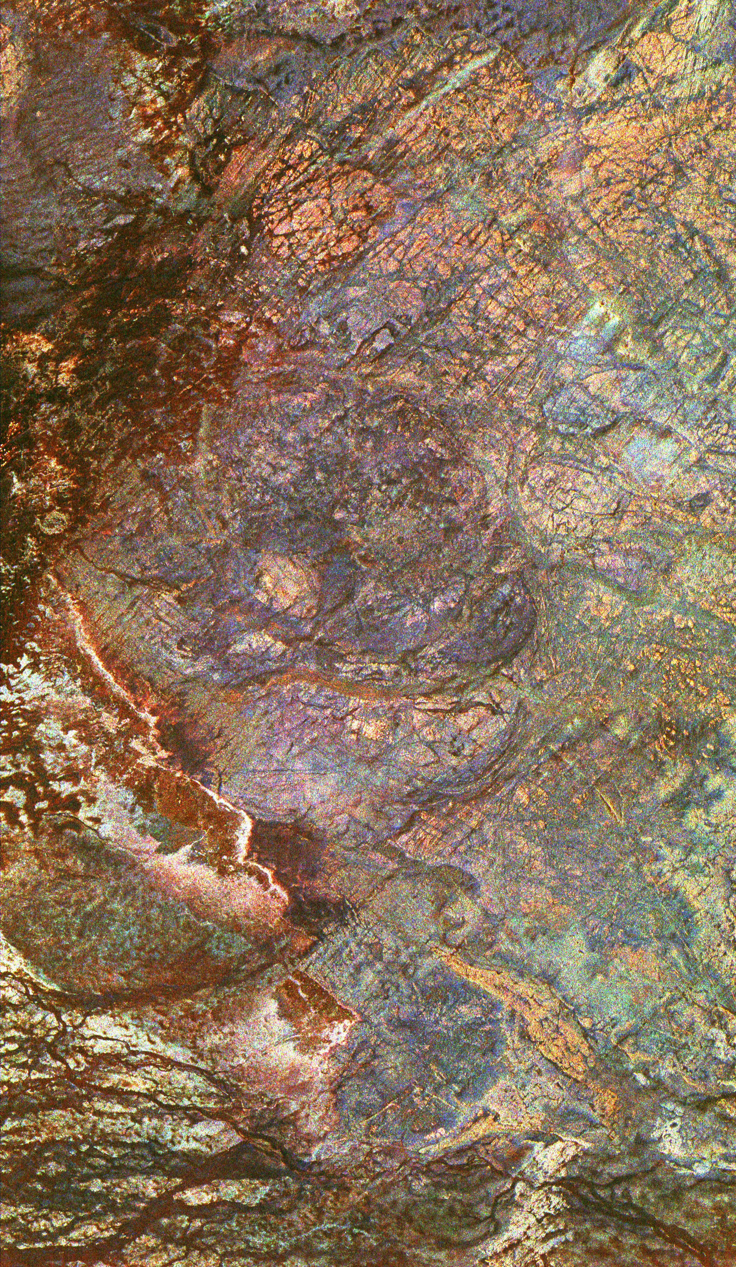
1999-04-15 |
Earth
|
Spaceborne Imaging Radar-C/X-Band Synthetic Aperture Radar
|
|
2413x4151x3 |
|
-
PIA01825:
-
Space Radar Image of Safsaf Oasis, Egypt
Full Resolution:
TIFF
(39.25 MB)
JPEG
(3.539 MB)
|
|
|
1999-04-15 |
Earth
|
Spaceborne Imaging Radar-C/X-Band Synthetic Aperture Radar
|
|
2913x2485x3 |

|
-
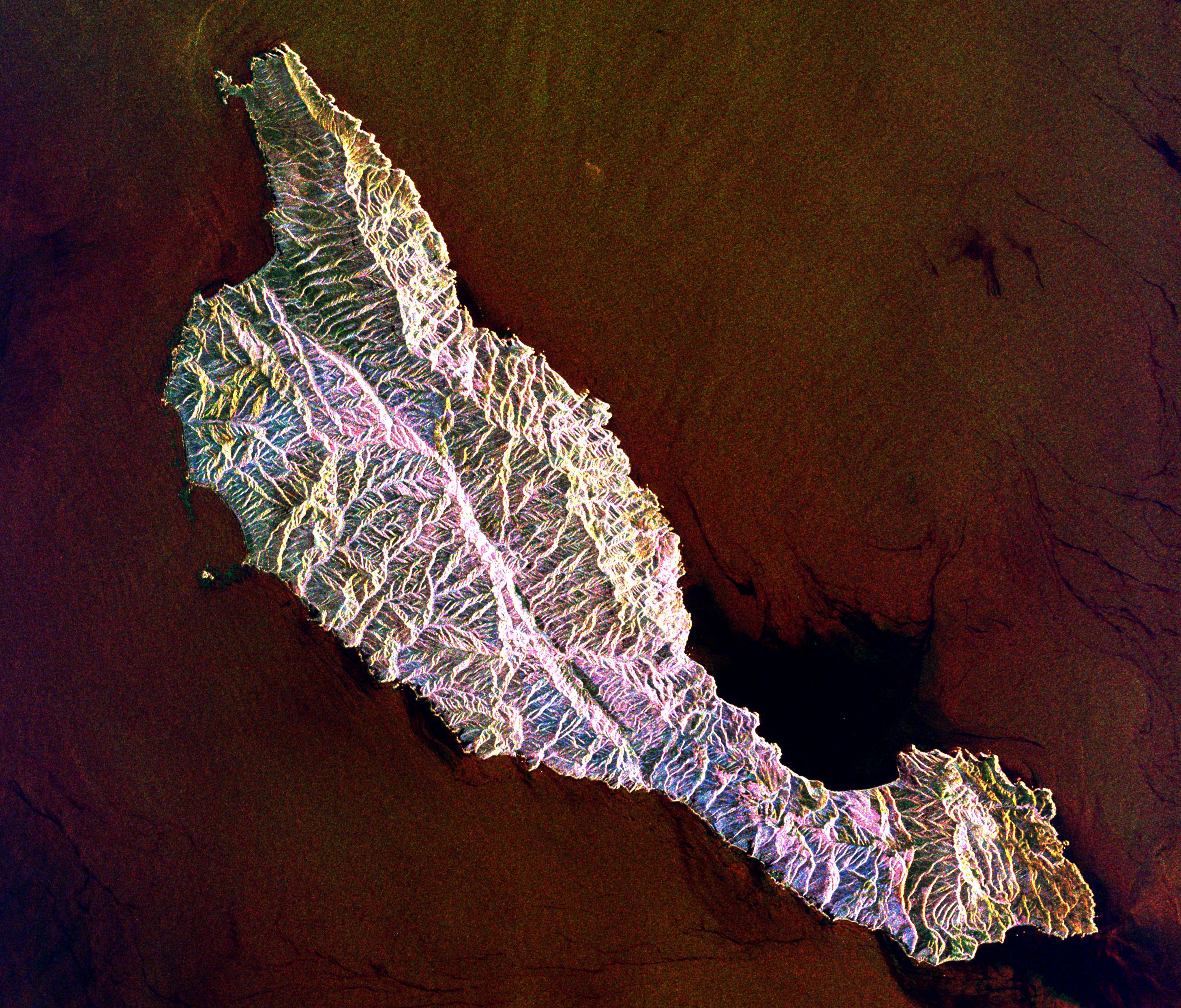
PIA01826:
-
Space Radar Image of Santa Cruz Island, California
Full Resolution:
TIFF
(22.87 MB)
JPEG
(1.617 MB)
|
|
|
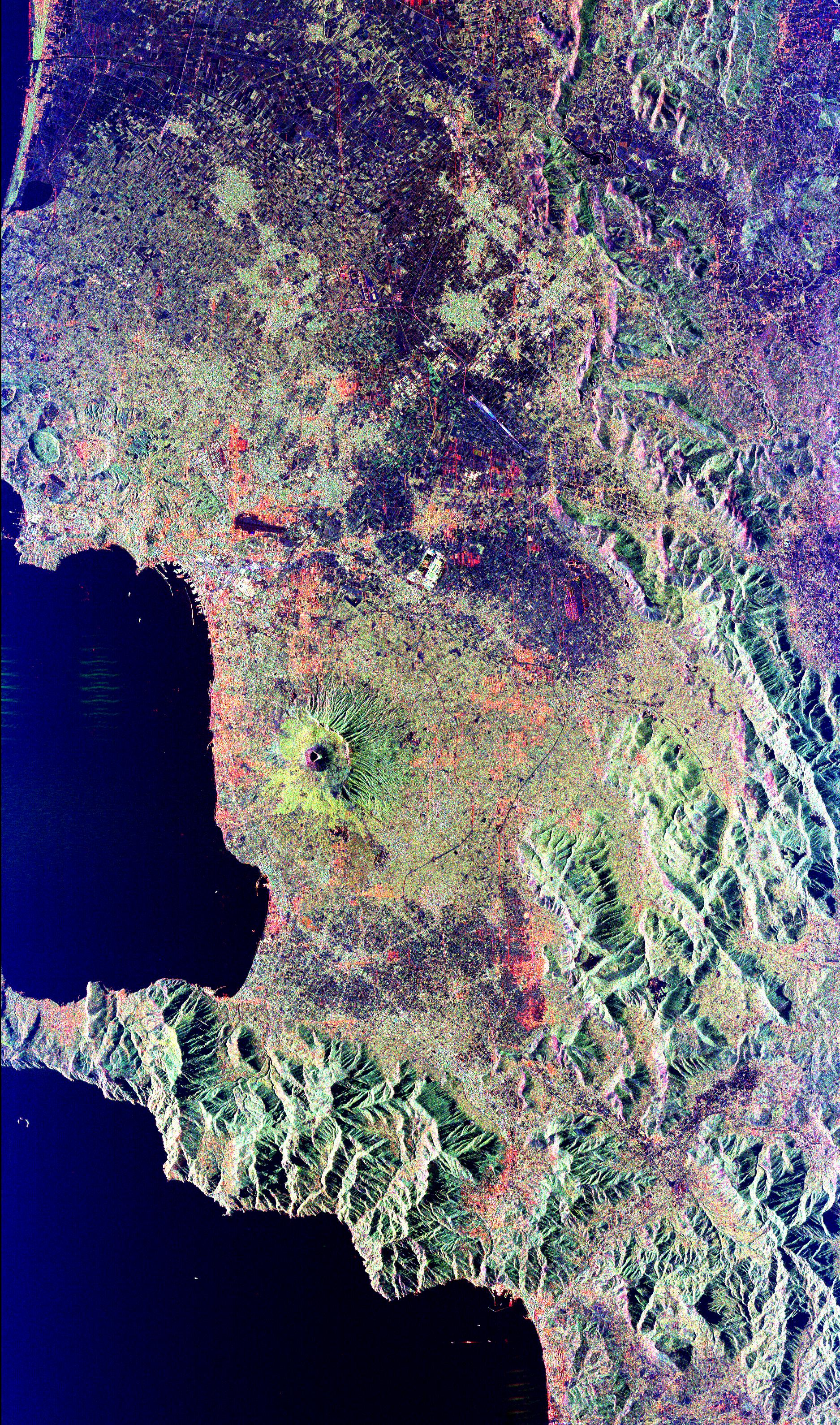
1999-04-15 |
Earth
|
Spaceborne Imaging Radar-C/X-Band Synthetic Aperture Radar
|
|
3997x3408x3 |
|
-
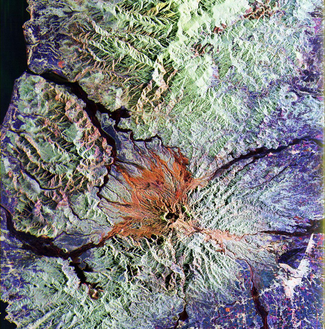
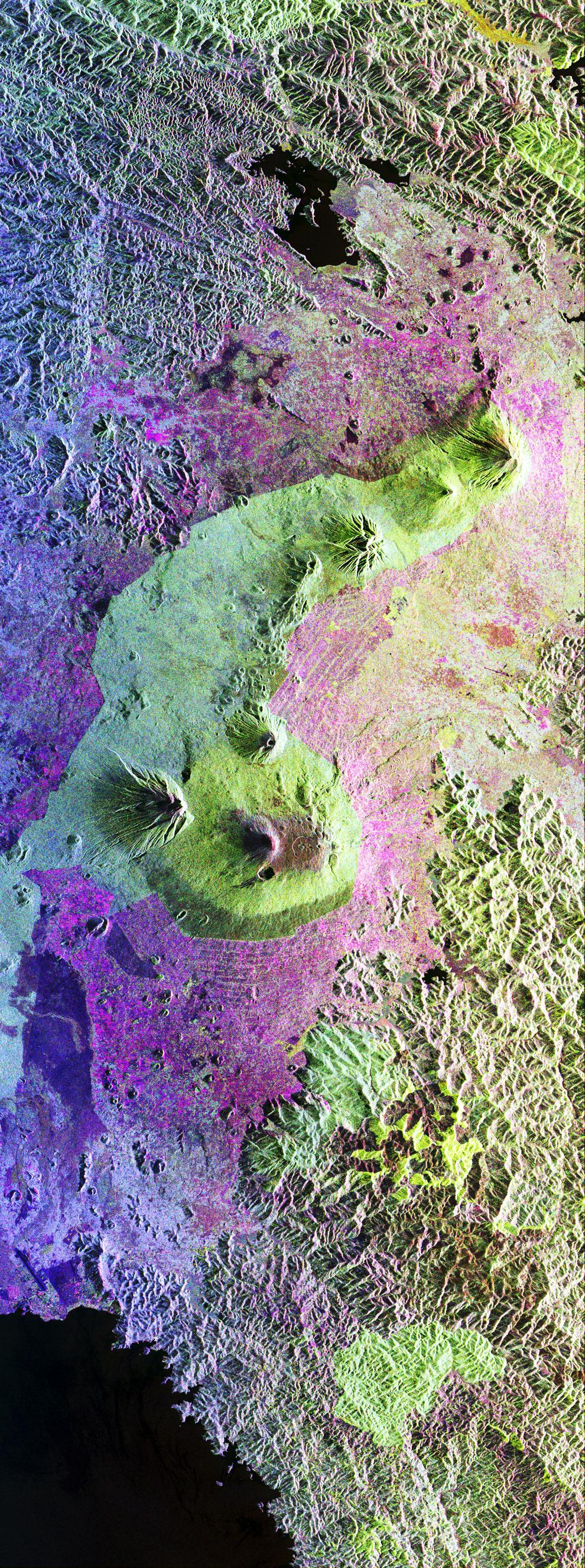
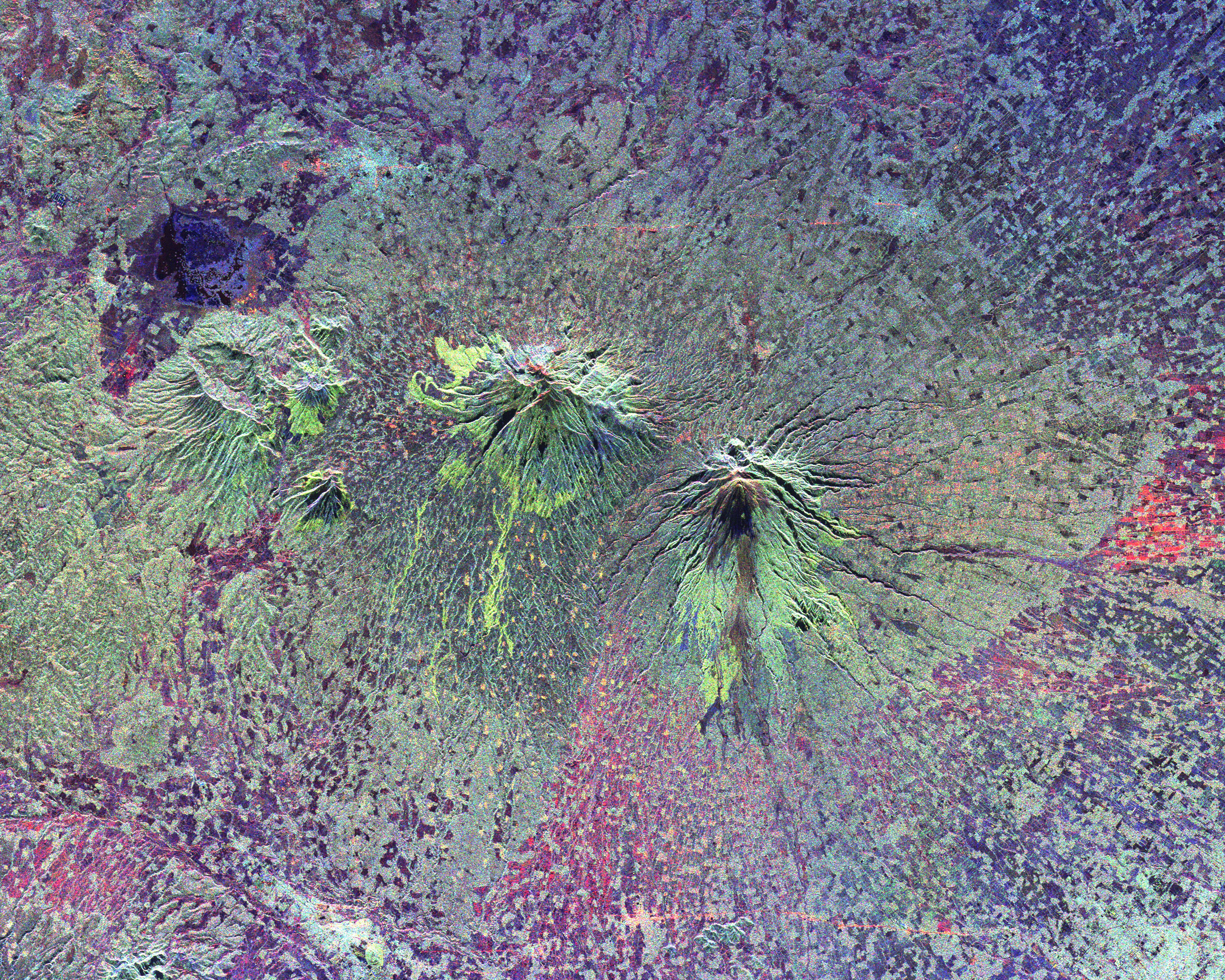
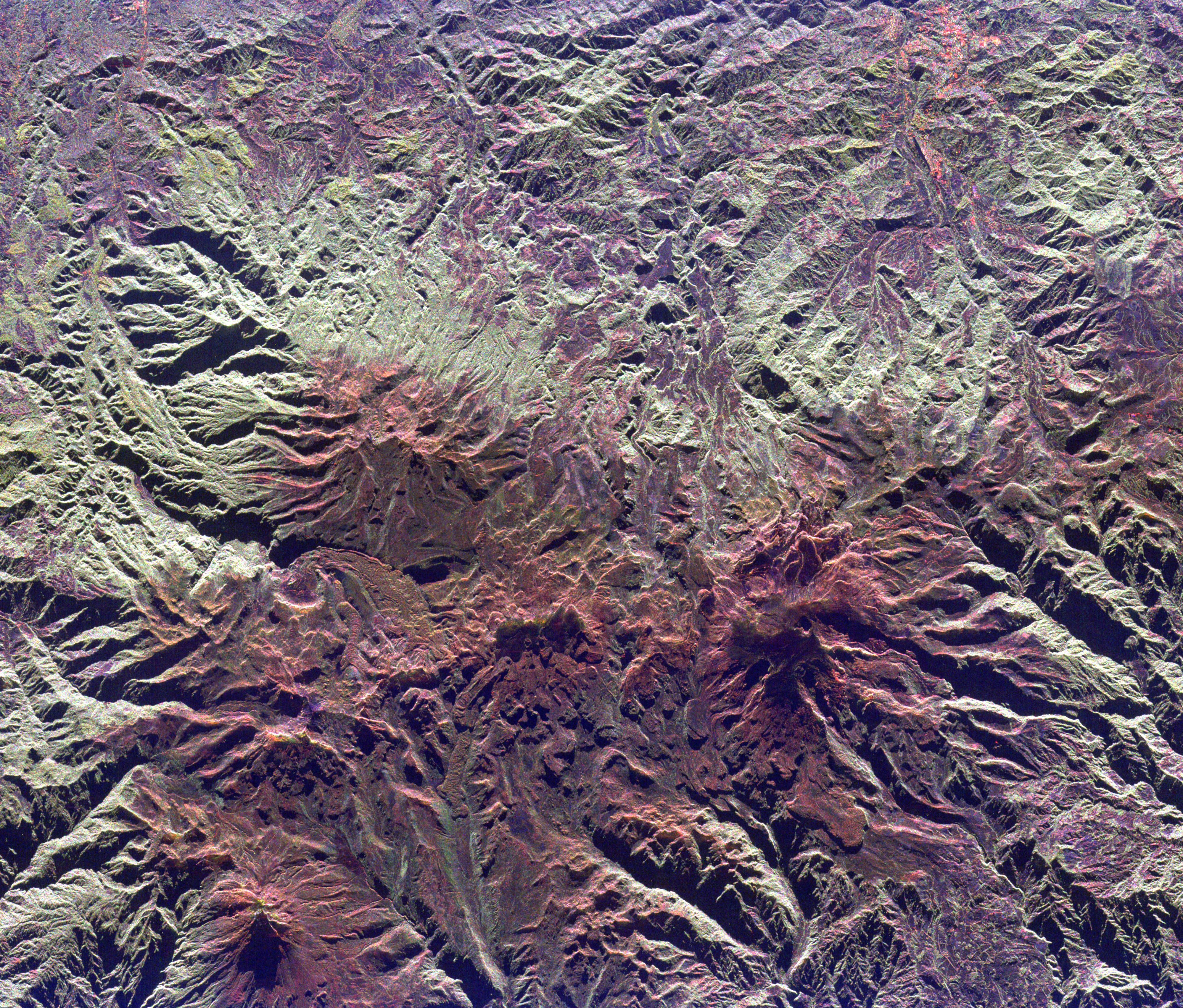
PIA01827:
-
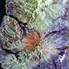
Space Radar Image of Ruiz Volcano, Colombia
Full Resolution:
TIFF
(47.97 MB)
JPEG
(3.49 MB)
|
|
|
1999-04-15 |
Earth
|
Spaceborne Imaging Radar-C/X-Band Synthetic Aperture Radar
|
|
3000x2612x3 |
|
-
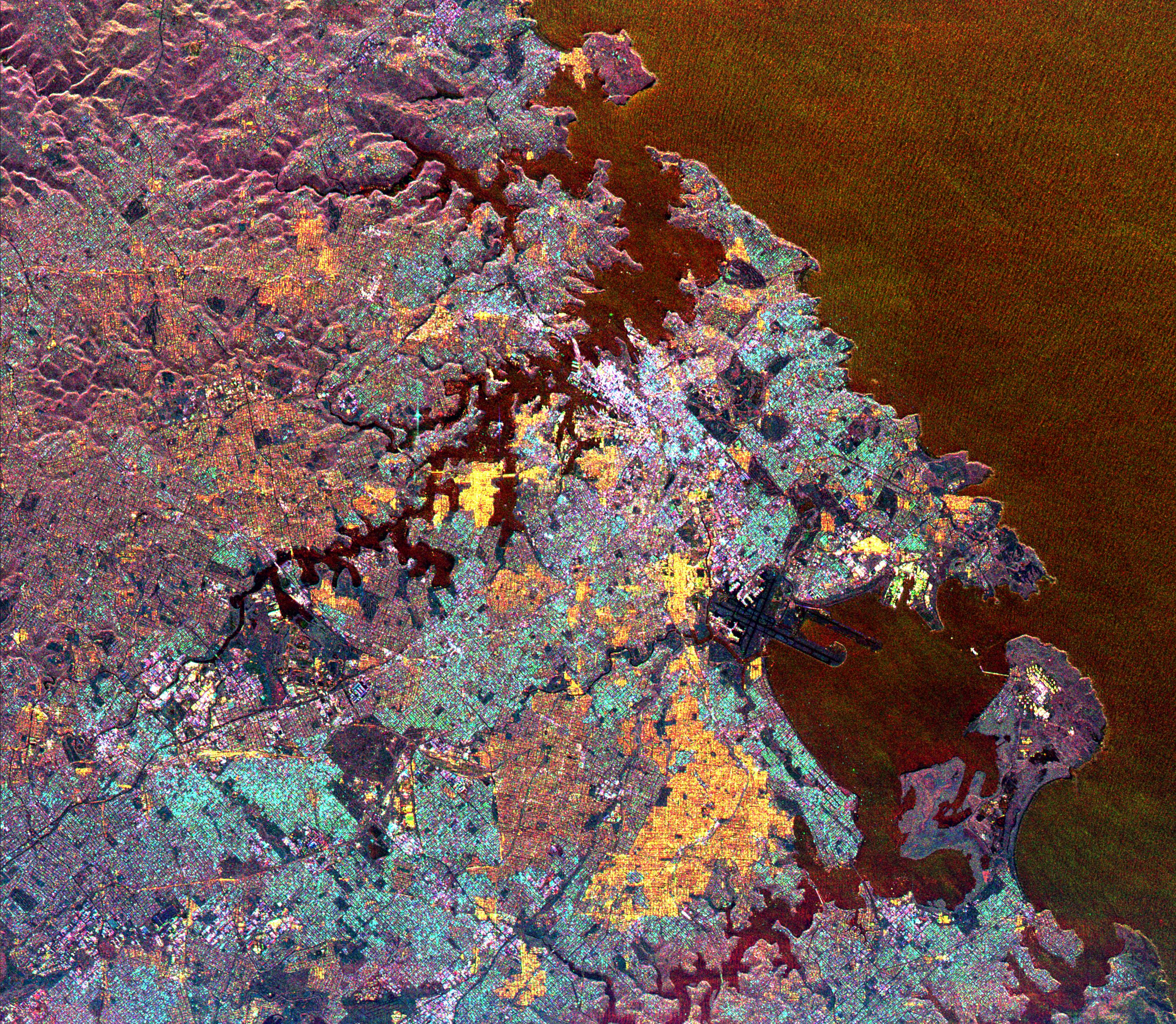
PIA01828:
-
Space Radar Image of Sydney, Australia
Full Resolution:
TIFF
(28.37 MB)
JPEG
(2.644 MB)
|
|
|
1999-04-15 |
Earth
|
Spaceborne Imaging Radar-C/X-Band Synthetic Aperture Radar
|
|
2000x2400x3 |
|
-
PIA01829:
-
Space Radar Image of Canberra, Australia
Full Resolution:
TIFF
(17.97 MB)
JPEG
(1.306 MB)
|
|
|
1999-04-15 |
Earth
|
Spaceborne Imaging Radar-C/X-Band Synthetic Aperture Radar
|
|
3321x2916x3 |
|
-
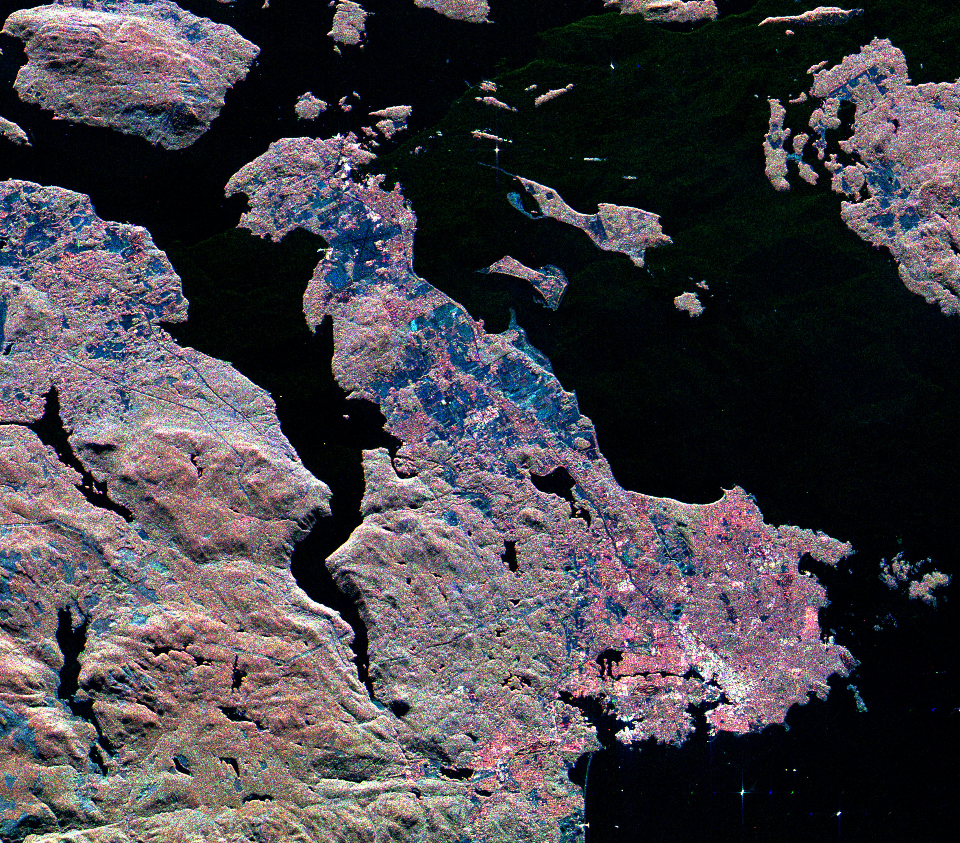
PIA01830:
-
Space Radar Image of Victoria, Canada
Full Resolution:
TIFF
(26.86 MB)
JPEG
(2.501 MB)
|
|
|
1999-04-15 |
Earth
|
Spaceborne Imaging Radar-C/X-Band Synthetic Aperture Radar
|
|
2447x1789x3 |
|
-
PIA01831:
-
Space Radar Image of Possible String of Impact Creaters
Full Resolution:
TIFF
(16.99 MB)
JPEG
(1.246 MB)
|
|
|
1999-04-15 |
Earth
|
Spaceborne Imaging Radar-C/X-Band Synthetic Aperture Radar
|
|
2206x1758x3 |

|
-
PIA01833:
-
Space Radar of Image Aorounga Impact Crater, Chad
Full Resolution:
TIFF
(14.7 MB)
JPEG
(1.28 MB)
|
|
|
1999-04-15 |
Earth
|
Spaceborne Imaging Radar-C/X-Band Synthetic Aperture Radar
|
|
2233x3024x3 |
|
-
PIA01836:
-
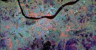
Space Radar Image of Nile River Delta, Egypt
Full Resolution:
TIFF
(25.89 MB)
JPEG
(2.052 MB)
|
|
|
1999-04-15 |
Earth
|
Spaceborne Imaging Radar-C/X-Band Synthetic Aperture Radar
|
|
2325x1521x3 |
|
-
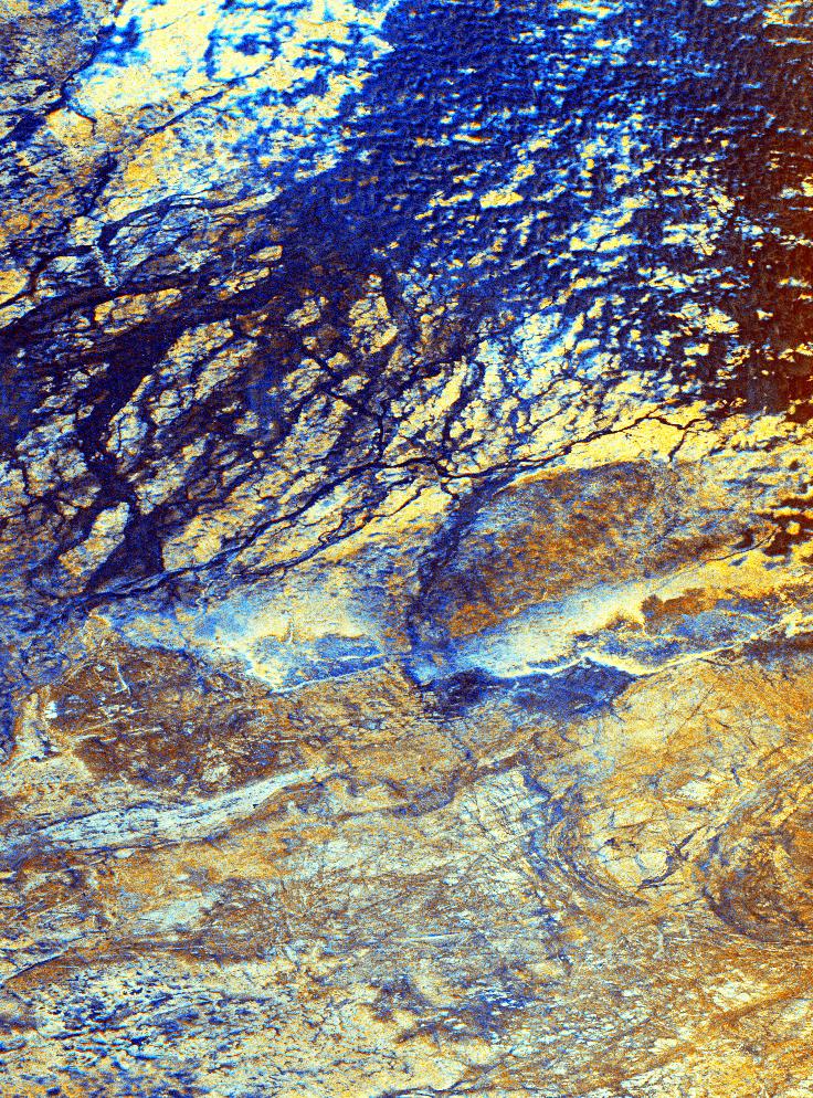
PIA01837:
-
Space Radar Image of Mineral Resources, China
Full Resolution:
TIFF
(9.551 MB)
JPEG
(1.02 MB)
|
|
|
1999-04-15 |
Earth
|
Spaceborne Imaging Radar-C/X-Band Synthetic Aperture Radar
|
|
2050x3120x3 |
|
-
PIA01838:
-
Space Radar Image of Great Wall of China
Full Resolution:
TIFF
(16.51 MB)
JPEG
(1.113 MB)
|
|
|
1999-04-15 |
Earth
|
Spaceborne Imaging Radar-C/X-Band Synthetic Aperture Radar
|
|
2805x2472x3 |
|
-
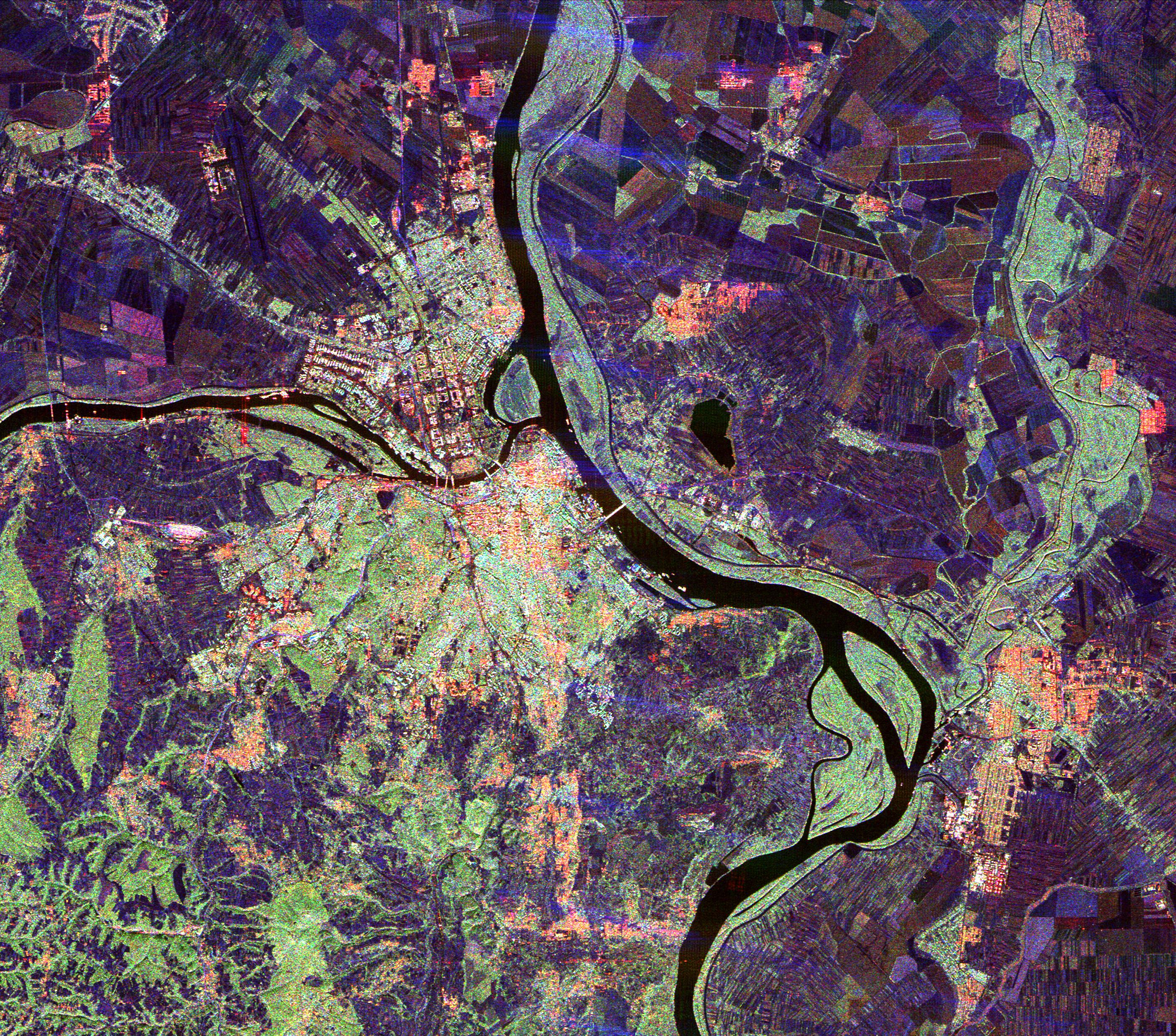
PIA01839:
-
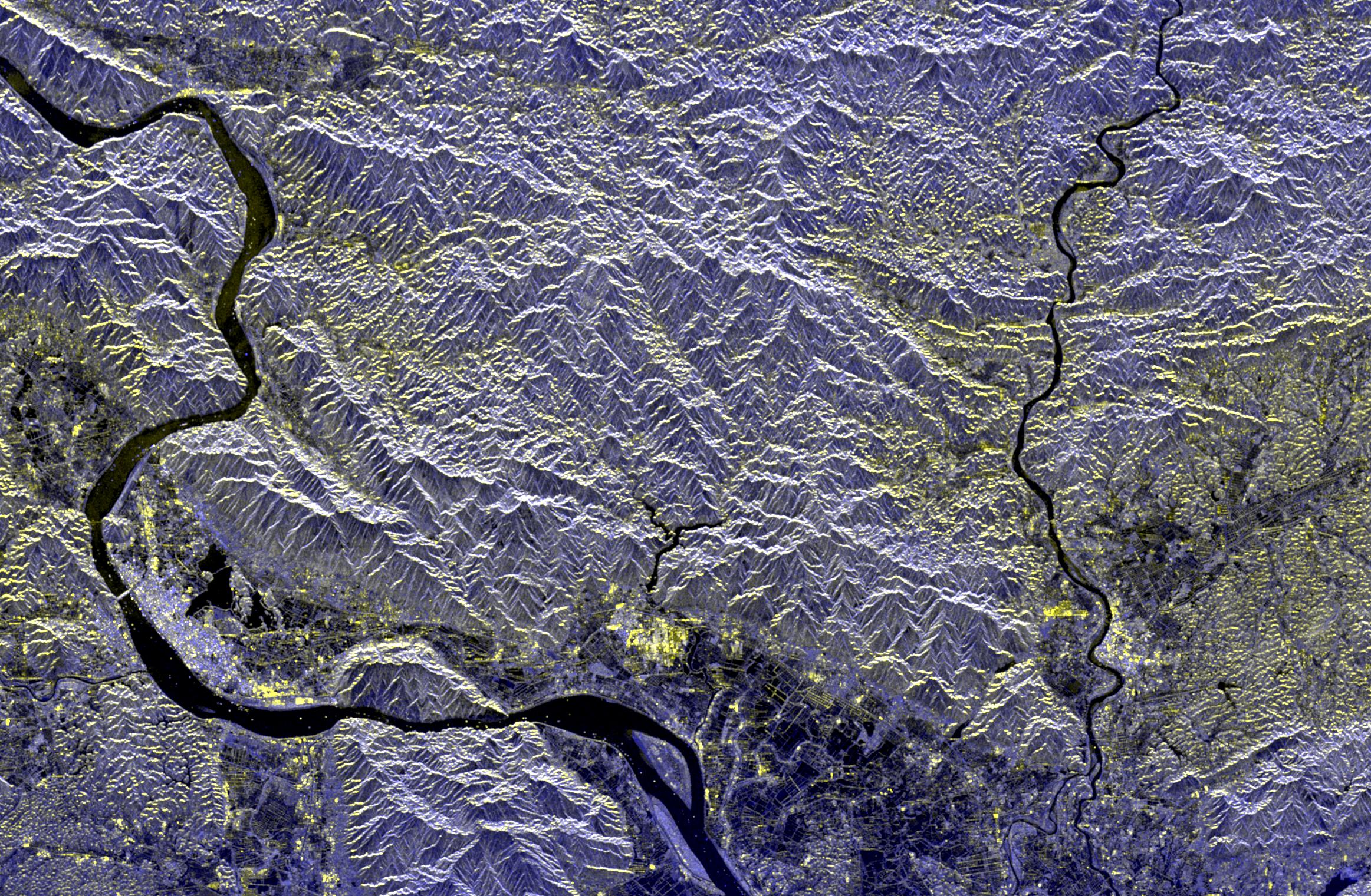
Space Radar Image of Belgrade, Serbia
Full Resolution:
TIFF
(26.23 MB)
JPEG
(2.34 MB)
|
|
|
1999-04-15 |
Earth
|
Spaceborne Imaging Radar-C/X-Band Synthetic Aperture Radar
|
|
1920x1080x3 |
|
-
PIA01840:
-
Space Radar Image of Rocky Mountains, Montana
Full Resolution:
TIFF
(5.591 MB)
JPEG
(319.5 kB)
|
|
|
1999-04-15 |
Earth
|
Spaceborne Imaging Radar-C/X-Band Synthetic Aperture Radar
|
|
1920x1080x3 |
|
-
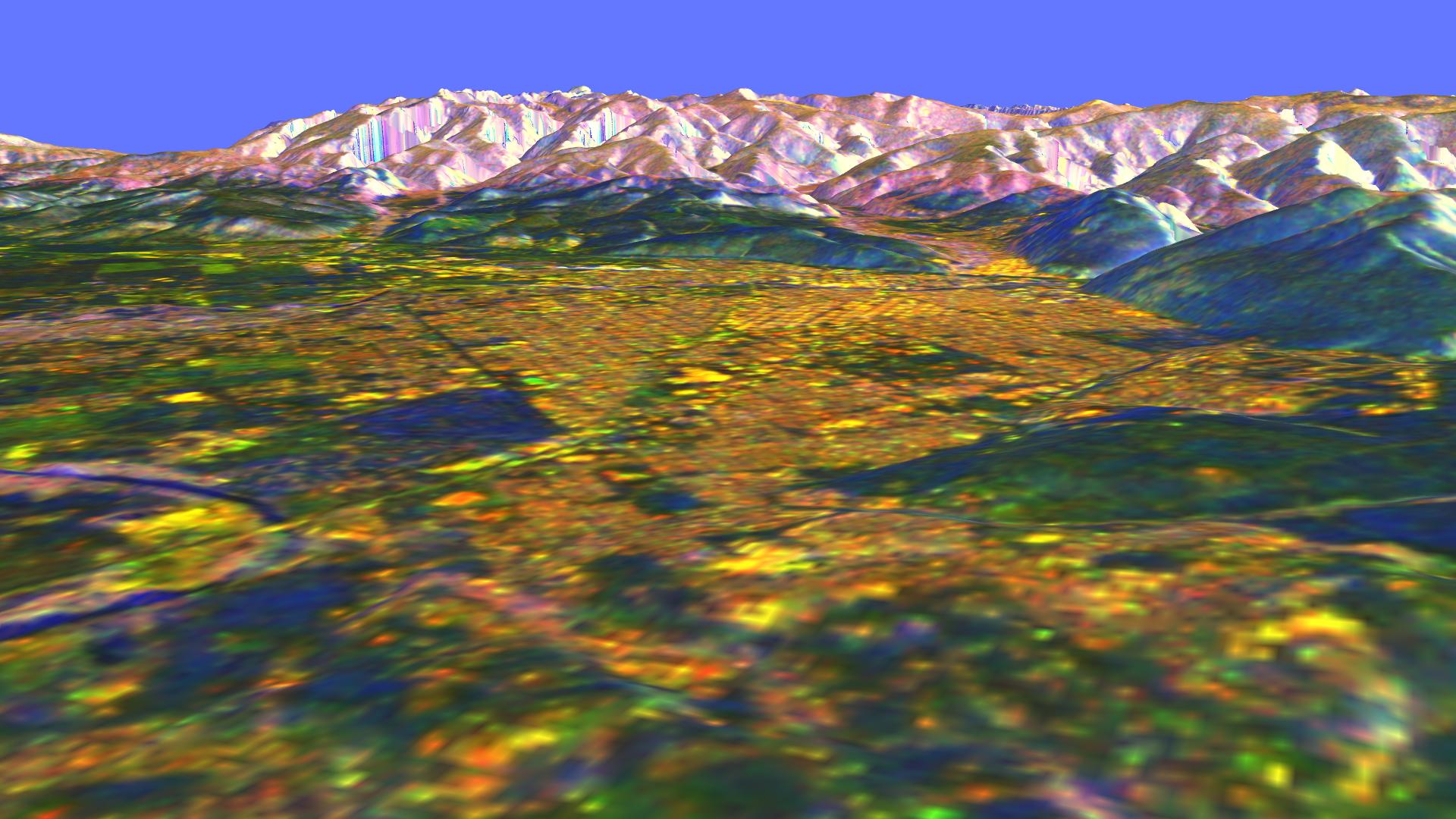
PIA01841:
-
Space Radar Image of Missoula, Montana in 3-D
Full Resolution:
TIFF
(6.282 MB)
JPEG
(267.3 kB)
|
|
|
1999-04-15 |
Earth
|
Spaceborne Imaging Radar-C/X-Band Synthetic Aperture Radar
|
|
1648x2449x3 |
|
-
PIA01842:
-
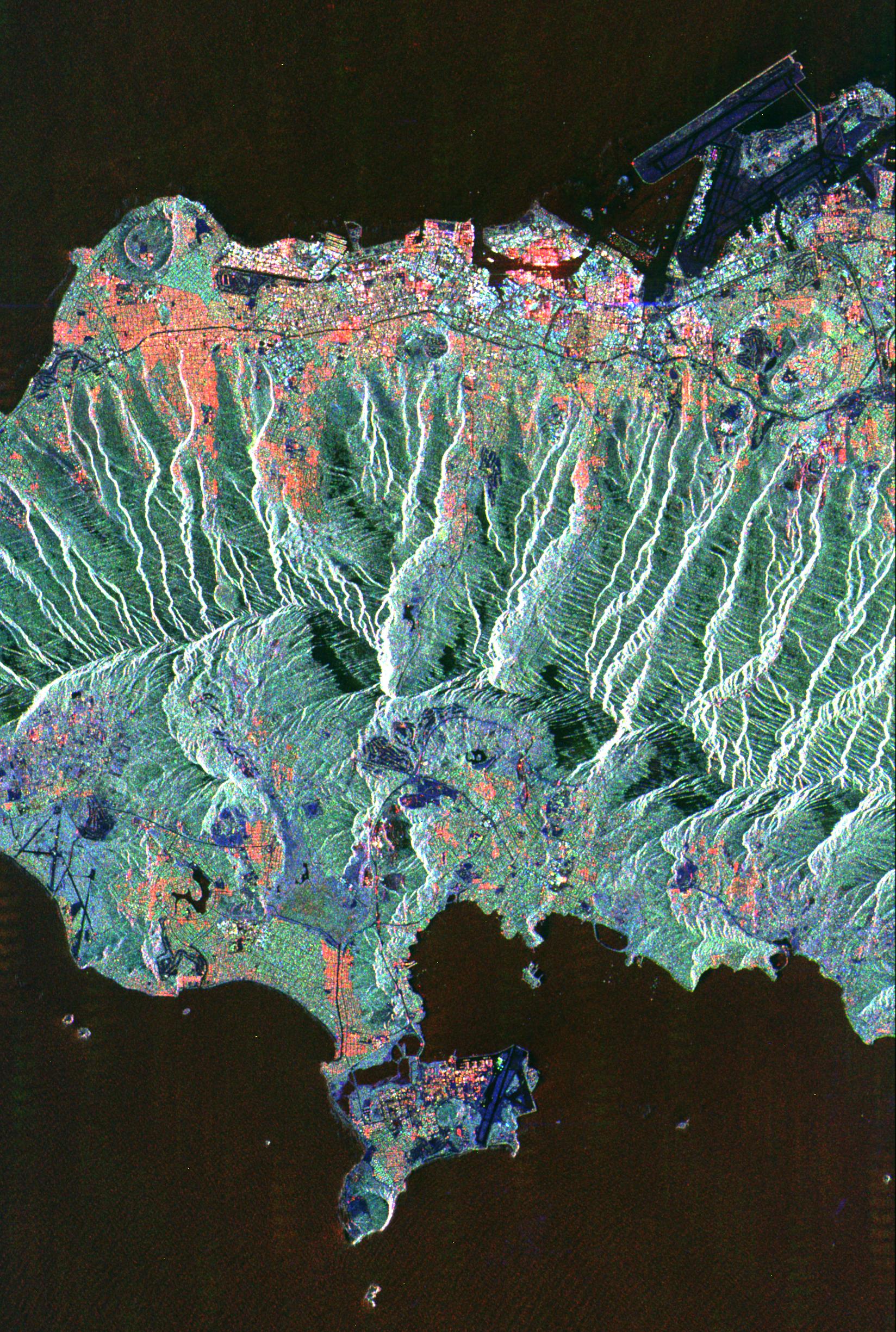
Space Radar Image of Honolulu, Oahu, Hawaii
Full Resolution:
TIFF
(12.13 MB)
JPEG
(961.7 kB)
|
|
|
1999-04-15 |
Earth
|
Spaceborne Imaging Radar-C/X-Band Synthetic Aperture Radar
|
|
1792x2496x3 |
|
-
PIA01843:
-
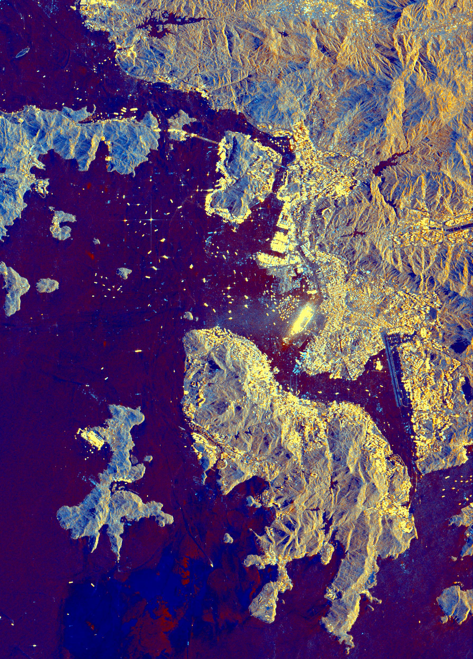
Space Radar Image of Hong Kong
Full Resolution:
TIFF
(13.68 MB)
JPEG
(1.002 MB)
|
|
|
1999-04-15 |
Earth
|
Spaceborne Imaging Radar-C/X-Band Synthetic Aperture Radar
|
|
1196x627x3 |
|
-
PIA01844:
-
Space Radar Image of Calcutta, West Bengal, India
Full Resolution:
TIFF
(2.759 MB)
JPEG
(203.7 kB)
|
|
|
1999-04-15 |
Earth
|
Spaceborne Imaging Radar-C/X-Band Synthetic Aperture Radar
|
|
2466x2881x3 |
|
-
PIA01845:
-
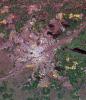
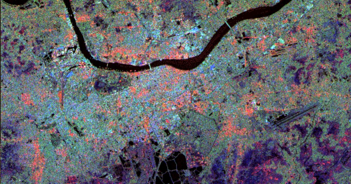
Space Radar Image of Munich, Germany
Full Resolution:
TIFF
(26.31 MB)
JPEG
(2.135 MB)
|
|
|
1999-04-15 |
Earth
|
Spaceborne Imaging Radar-C/X-Band Synthetic Aperture Radar
|
|
5881x4501x3 |

|
-
PIA01846:
-
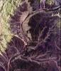
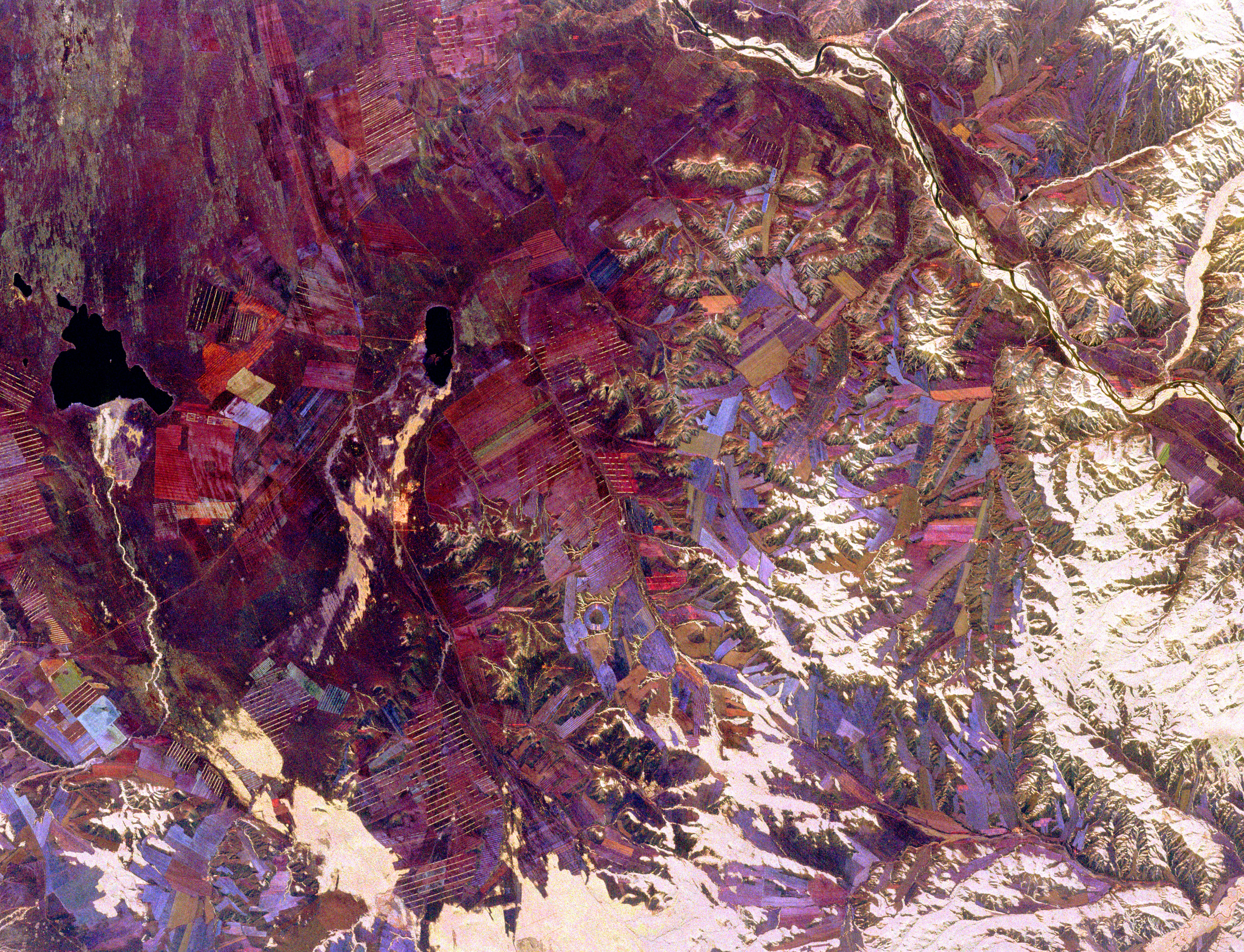
Space Radar Image of Tuva, Central Asia
Full Resolution:
TIFF
(80.21 MB)
JPEG
(6.547 MB)
|
|
|
1999-04-15 |
Earth
|
Spaceborne Imaging Radar-C/X-Band Synthetic Aperture Radar
|
|
2177x2057x3 |

|
-
PIA01847:
-
Space Radar Image of Phnom Phen, Cambodia
Full Resolution:
TIFF
(16.8 MB)
JPEG
(1.418 MB)
|
|
|
1999-04-15 |
Earth
|
Spaceborne Imaging Radar-C/X-Band Synthetic Aperture Radar
|
|
3295x1662x3 |
|
-
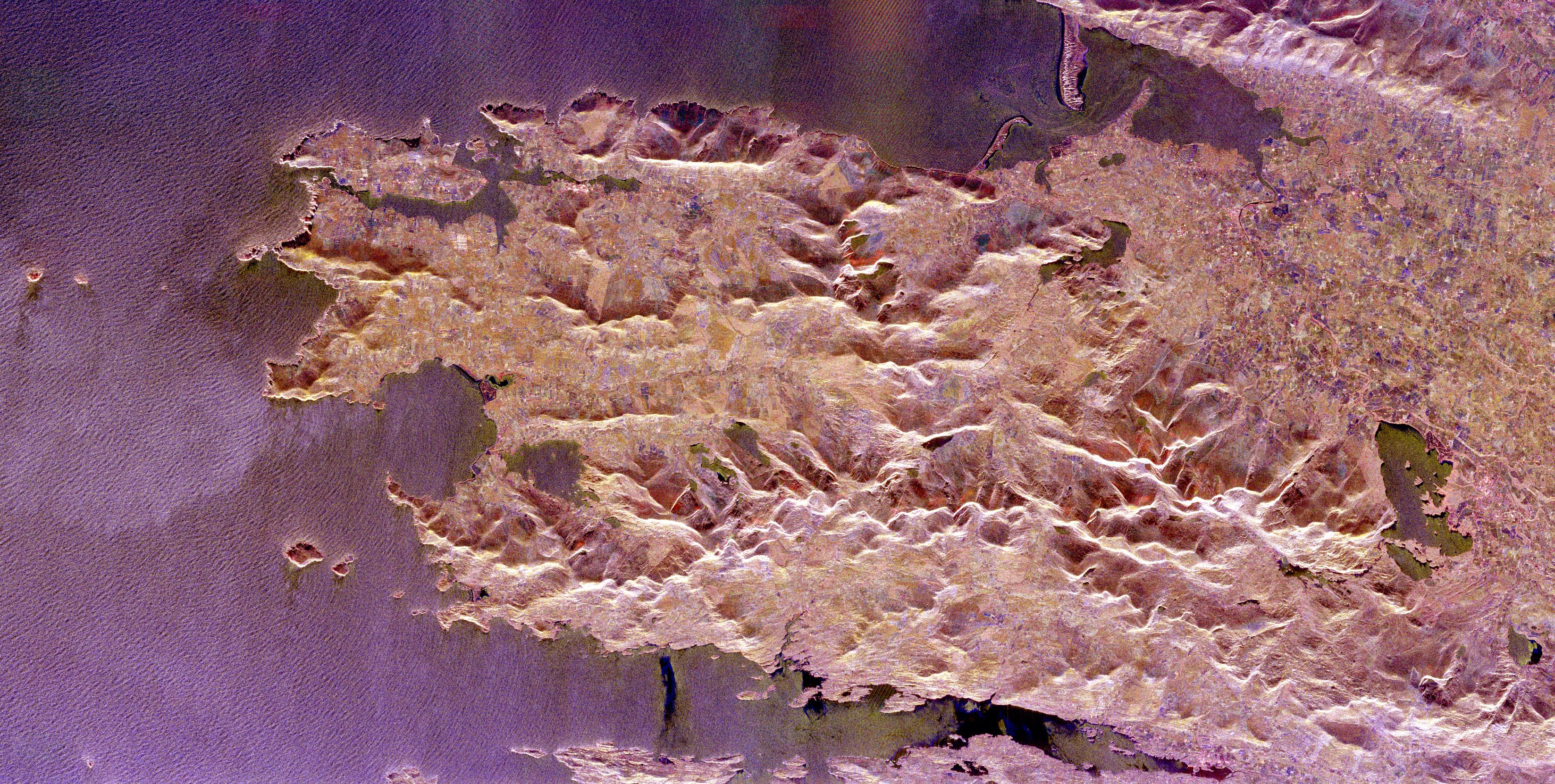
PIA01848:
-
Space Radar Image of County Kerry, Ireland
Full Resolution:
TIFF
(18.29 MB)
JPEG
(1.841 MB)
|
|
|
1999-04-15 |
Earth
|
Spaceborne Imaging Radar-C/X-Band Synthetic Aperture Radar
|
|
3000x3500x3 |
|
-
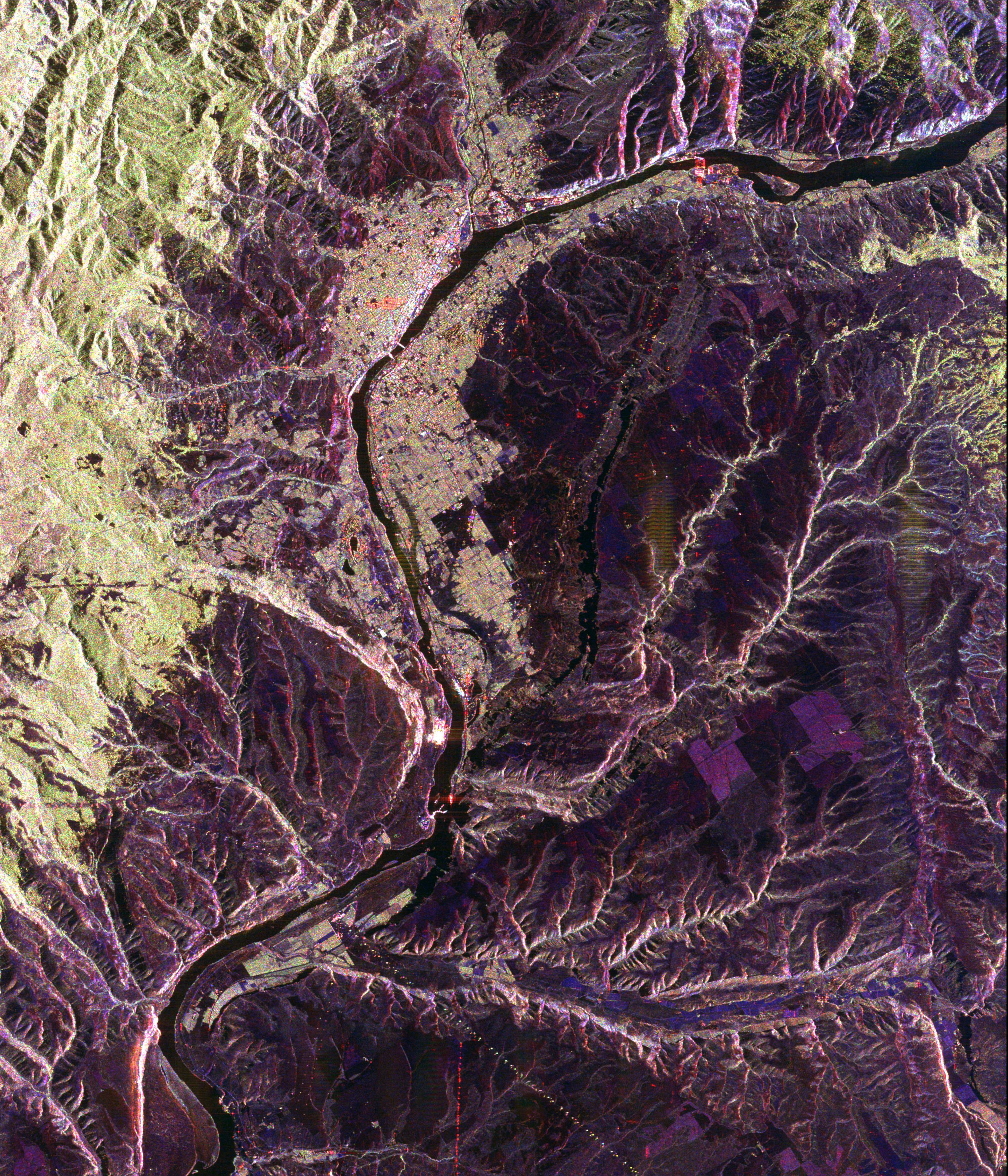
PIA01849:
-
Space Radar Image of Wenatchee, Washington
Full Resolution:
TIFF
(37.48 MB)
JPEG
(2.441 MB)
|


