|
Your search criteria found 2593 images Target is Earth (and available satellites) |
| My List |
Addition Date | Target | Mission |
Instrument
|
Size |

|
2002-03-20 | Earth |
Terra |
MISR |
1026x688x3 |
|
|||||
|
|
2002-03-27 | Earth |
Terra |
MISR |
1017x1444x3 |
|
|||||
|
|
2002-04-03 | Earth |
Terra |
MISR |
1152x1500x3 |
|
|||||
|
|
2002-04-10 | Earth |
Terra |
MISR |
1106x675x3 |
|
|||||
|
|
2002-04-17 | Earth |
Terra |
MISR |
1280x680x3 |
|
|||||
|
|
2002-04-24 | Earth |
Terra |
MISR |
1020x651x3 |

|
|||||
|
|
2002-05-01 | Earth |
Terra |
MISR |
2060x1242x3 |

|
|||||
|
|
2002-05-08 | Earth |
Terra |
MISR |
1532x1408x3 |
|
|||||
|
|
2002-05-10 | Earth |
Terra |
MISR |
538x818x3 |
|
|||||
|
|
2002-05-15 | Earth |
Terra |
MISR |
1079x802x3 |
|
|||||
|
|
2002-05-22 | Earth |
Terra |
MISR |
1063x1565x3 |
|
|||||
|
|
2002-05-29 | Earth |
Terra |
MISR |
1100x872x3 |
|
|||||
|
|
2002-06-12 | Earth |
Terra |
MISR |
1660x933x3 |
|
|||||
|
|
2002-06-19 | Earth |
Terra |
MISR |
1632x582x3 |

|
|||||
|
|
2002-06-26 | Earth |
Terra |
MISR |
1276x1050x3 |
|
|||||
|
|
2002-07-03 | Earth |
Terra |
MISR |
1214x1700x3 |
|
|||||
|
|
2002-07-10 | Earth |
Terra |
MISR |
1960x1600x3 |
|
|||||
|
|
2002-07-17 | Earth |
Terra |
MISR |
1806x1070x3 |
|
|||||
|
|
2002-07-24 | Earth |
Terra |
MISR |
1811x2182x3 |
|
|||||
|
|
2002-07-31 | Earth |
Terra |
MISR |
1351x1348x3 |
|
|||||
|
|
2002-08-07 | Earth |
Terra |
MISR |
1069x970x3 |
|
|||||
|
|
2002-08-14 | Earth |
Terra |
MISR |
1548x1256x3 |
|
|||||
|
|
2002-08-21 | Earth |
Terra |
MISR |
1964x2808x3 |
|
|||||
|
|
2002-08-28 | Earth |
Terra |
MISR |
1392x805x3 |
|
|||||
|
|
2002-09-04 | Earth |
Terra |
MISR |
1058x1169x3 |
|
|||||
|
|
2002-09-11 | Earth |
Terra |
MISR |
682x730x3 |
|
|||||
|
|
2002-09-18 | Earth |
Terra |
MISR |
1341x2060x3 |
|
|||||
|
|
2002-09-25 | Earth |
Terra |
MISR |
1268x1390x3 |
|
|||||
|
|
2002-10-02 | Earth |
Terra |
MISR |
2400x1086x3 |
|
|||||
|
|
2002-10-09 | Earth |
Terra |
MISR |
3584x3252x3 |
|
|||||
|
|
2002-10-16 | Earth |
Terra |
MISR |
742x861x3 |

|
|||||
|
|
2002-11-06 | Earth |
Terra |
MISR |
1506x847x3 |

|
|||||
|
|
2002-11-13 | Earth |
Terra |
MISR |
1079x984x3 |

|
|||||
|
|
2002-11-20 | Earth |
Terra |
MISR |
2207x1900x3 |
|
|||||
|
|
2002-11-27 | Earth |
Terra |
MISR |
3036x2560x3 |
|
|||||
|
|
2002-12-04 | Earth |
Terra |
MISR |
1072x1074x3 |

|
|||||
|
|
2002-12-11 | Earth |
Terra |
MISR |
1260x1014x3 |
|
|||||
|
|
2002-12-18 | Earth |
Terra |
MISR |
889x906x3 |
|
|||||
|
|
2003-01-02 | Earth |
Terra |
MISR |
1522x1789x3 |
|
|||||
|
|
2003-01-08 | Earth |
Terra |
MISR |
1559x1368x3 |
|
|||||
|
|
2003-01-15 | Earth |
Terra |
MISR |
940x738x3 |
|
|||||
|
|
2003-01-22 | Earth |
Terra |
MISR |
1632x1869x3 |
|
|||||
|
|
2003-01-29 | Earth |
Terra |
MISR |
3200x1420x3 |

|
|||||
|
|
2003-02-05 | Earth |
Terra |
MISR |
782x1146x3 |
|
|||||
|
|
2003-02-12 | Earth |
Terra |
MISR |
2070x2288x3 |
|
|||||
|
|
2003-02-19 | Earth |
Terra |
MISR |
1218x1896x3 |

|
|||||
|
|
2003-02-26 | Earth |
Terra |
MISR |
691x1200x3 |
|
|||||
|
|
2003-03-05 | Earth |
Terra |
MISR |
1521x1041x3 |
|
|||||
|
|
2003-03-12 | Earth |
Terra |
MISR |
1134x1885x3 |
|
|||||
|
|
2003-03-19 | Earth |
Terra |
MISR |
1060x1344x3 |

|
|||||
|
|
2003-03-26 | Earth |
Terra |
MISR |
1344x2219x3 |
|
|||||
|
|
2003-04-02 | Earth |
Terra |
MISR |
2366x1722x3 |

|
|||||
|
|
2003-04-09 | Earth |
Terra |
MISR |
1362x1824x3 |
|
|||||
|
|
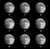
2003-04-16 | Moon |
Terra |
MISR |
1080x1050x3 |
|
|||||
|
|
2003-04-23 | Earth |
Terra |
MISR |
1314x1756x3 |
|
|||||
|
|
2003-04-30 | Earth |
Terra |
MISR |
2156x3424x3 |
|
|||||
|
|
2003-05-07 | Earth |
Terra |
MISR |
2476x2291x3 |

|
|||||
|
|
2003-05-15 | Earth |
Terra |
MISR |
2400x2400x3 |
|
|||||
|
|
2003-05-21 | Earth |
Terra |
MISR |
794x858x3 |

|
|||||
|
|
2003-05-28 | Earth |
Terra |
MISR |
1078x1282x3 |
|
|||||
|
|
2003-06-03 | Earth |
Terra |
MISR |
400x309x3 |
|
|||||
|
|
2003-06-04 | Earth |
Terra |
MISR |
1466x896x3 |
|
|||||
|
|
2003-06-11 | Earth |
Terra |
MISR |
1797x2300x3 |
|
|||||
|
|
2003-06-25 | Earth |
Terra |
MISR |
1438x620x3 |

|
|||||
|
|
2003-07-16 | Earth |
Terra |
MISR |
1174x970x3 |

|
|||||
|
|
2003-08-13 | Earth |
Terra |
MISR |
1798x920x3 |
|
|||||
|
|
2003-09-10 | Earth |
Terra |
MISR |
1280x866x3 |
|
|||||
|
|
2003-09-18 | Earth |
Terra |
MISR |
1011x1115x3 |
|
|||||
|
|
2003-09-24 | Earth |
Terra |
MISR |
1291x1683x3 |
|
|||||
|
|
2003-10-08 | Earth |
Terra |
MISR |
1270x1468x3 |

|
|||||
|
|
2003-10-22 | Earth |
Terra |
MISR |
1539x2131x3 |
|
|||||
|
|
2003-10-29 | Earth |
Terra |
MISR |
2464x2300x3 |
|
|||||
|
|
2003-11-12 | Earth |
Terra |
MISR |
945x805x3 |

|
|||||
|
|
2003-11-19 | Earth |
Terra |
MISR |
1200x1128x3 |
|
|||||
|
|
2003-11-26 | Earth |
Terra |
MISR |
877x1185x3 |

|
|||||
|
|
2003-12-04 | Earth |
Terra |
MISR |
2895x3200x3 |
|
|||||
|
|
2003-12-10 | Earth |
Terra |
MISR |
1062x860x3 |
|
|||||
|
|
2003-12-23 | Earth |
Terra |
MISR |
924x764x3 |
|
|||||
|
|
2004-01-07 | Earth |
Terra |
MISR |
1374x889x3 |
|
|||||
|
|
2004-01-21 | Earth |
Terra |
MISR |
2574x2766x3 |
|
|||||
|
|
2004-02-04 | Earth |
Terra |
MISR |
1352x1548x3 |

|
|||||
|
|
2004-02-18 | Earth |
Terra |
MISR |
2384x2675x3 |
|
|||||
|
|
2004-03-03 | Earth |
Terra |
MISR |
3020x1941x3 |
|
|||||
|
|
2004-03-17 | Earth |
Terra |
MISR |
2244x1392x3 |
|
|||||
|
|
2004-03-31 | Earth |
Terra |
MISR |
2602x1511x3 |
|
|||||
|
|
2004-08-04 | Earth |
Terra |
MISR |
1365x1480x3 |

|
|||||
|
|
2004-04-14 | Earth |
Terra |
MISR |
1732x1421x3 |
|
|||||
|
|
2004-04-28 | Earth |
Terra |
MISR |
1337x1692x3 |

|
|||||
|
|
2004-05-12 | Earth |
Terra |
MISR |
1106x1355x3 |
|
|||||
|
|
2004-05-26 | Earth |
Terra |
MISR |
680x792x3 |
|
|||||
|
|
2004-06-09 | Earth |
Terra |
MISR |
1140x1187x3 |
|
|||||
|
|
2004-07-07 | Earth |
Terra |
MISR |
3141x2477x3 |
|
|||||
|
|
2004-07-21 | Earth |
Terra |
MISR |
2927x1778x3 |
|
|||||
|
|
2004-08-18 | Earth |
Terra |
MISR |
1526x1162x3 |
|
|||||
|
|
2004-09-01 | Earth |
Terra |
MISR |
2544x1527x3 |
|
|||||
|
|
2004-09-14 | Earth |
Terra |
MISR |
1693x1262x3 |

|
|||||
|
|
2004-09-29 | Earth |
Terra |
MISR |
3292x3608x3 |
|
|||||
|
|
2004-10-02 | Earth |
Terra |
MISR |
1336x924x3 |

|
|||||
|
|
2004-10-27 | Earth |
Terra |
MISR |
1669x2088x3 |
|
|||||
|
|
2004-11-10 | Earth |
Terra |
MISR |
1723x1838x3 |
|
|||||

|
 |
|
|
 |
 |
|
|
|
|
|

|
| 1-100 | 101-200 | 201-300 | 301-400 | 401-500 | 501-600 | 601-700 | 701-800 | 801-900 | 901-1000 |
| Currently displaying images: 301 - 400 of 2593 |