Your search criteria found 2588 images
Target is Earth (and available satellites)
Go to PIAxxxxx:
Refine this list of images by:
Target:
Mission:
Spacecraft:
Instrument:
Click on an image for detailed information
Click on a column heading to sort in ascending or descending order
My
List
Addition Date Target Mission InstrumentSort Descending Size
Add Image to Favorite List 2016-03-21 Earth Terra
ASTER
3836x2710x3
On March 21, 2016, Torrential rains in the mid-South of the United States in mid-March 2016 produced flooding throughout Texas, Louisiana and Mississippi, as seen by NASA's Terra spacecraft.
PIA20533:
Persistent Flooding in Louisiana Imaged by NASA Spacecraft
Full Resolution:     TIFF (23.38 MB)     JPEG (1.729 MB)
Add Image to Favorite List 2016-04-20 Earth Terra
ASTER
1569x1479x3
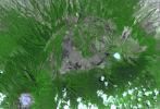
This image from NASA's Terra spacecraft shows a perspective view, looking toward the Aso volcanic caldera, which indicates the epicenter with a red star.
PIA20591:
NASA Satellite Shows Site of Devastating Japan Quakes
Full Resolution:     TIFF (6.964 MB)     JPEG (633.3 kB)
Add Image to Favorite List 2016-05-13 Earth Terra
ASTER
2800x1400x3
NASA's Terra spacecraft reveals signs of life in New Zealand's Mount Ruapehu Volcano which has been on a level 1 volcanic alert for some time, indicating minor volcanic unrest.
PIA20665:
Signs of Life in Mighty New Zealand Volcano seen by NASA Spacecraft
Full Resolution:     TIFF (5.634 MB)     JPEG (460.3 kB)
Add Image to Favorite List 2016-05-10 Earth Terra
ASTER
544x568x3
The city of Nome lies on the southern Seward Peninsula coast of Alaska, on the Bering Sea, as shown in this image from NASA's Terra spacecraft.
PIA20610:
Nome, Alaska
Full Resolution:     TIFF (927.5 kB)     JPEG (83.04 kB)
Add Image to Favorite List 2016-05-18 Earth Terra
ASTER
1335x894x3
The wildfire that devastated Fort McMurray in May 13, 2016 and forced the evacuation of an additional 12,000 residents in the area is seen in this image from NASA's Terra spacecraft.
PIA20586:
Devastating Fort McMurray Wildfire in Canada seen by NASA Spacecraft
Full Resolution:     TIFF (3.284 MB)     JPEG (159.6 kB)
Add Image to Favorite List 2016-05-27 Earth Terra
ASTER
2415x2022x3
Mt. Etna, Sicily, Italy, is Europe's most active volcano. In mid-May 2016, Mt. Etna put on a display of lava fountaining, ash clouds and lava flows. Three of the four summit craters were active. NASA's Terra spacecraft acquired this image on May 26, 2016.
PIA14456:
Activity at Europe's Most Active Volcano Eyed by NASA Spacecraft
Full Resolution:     TIFF (14.45 MB)     JPEG (746.4 kB)
Add Image to Favorite List 2016-05-24 Earth Terra
ASTER
1507x1482x3
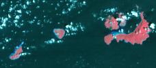
This image from NASA's Terra spacecraft shows St. Matthew Island, a remote island in the Bering Sea in Alaska.
PIA20622:
St. Matthew Island, Alaska
Full Resolution:     TIFF (1.266 MB)     JPEG (86.54 kB)
Add Image to Favorite List 2016-06-15 Earth Terra
ASTER
3652x4200x3
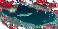
This image from NASA's Terra spacecraft shows Lake Urmia, a saline lake in northwestern Iran.
PIA20637:
Lake Urmia, Iran
Full Resolution:     TIFF (45.65 MB)     JPEG (2.036 MB)
Add Image to Favorite List 2016-06-22 Earth Terra
ASTER
2160x1635x3
The Sherpa fire, seen by NASA's Terra spacecraft, in Santa Barbara County, CA has burned over 12 square miles since it started on June 15, 2016. Smoke from the fire reached Los Angeles on the weekend.
PIA20734:
Major Wildfire Near Santa Barbara seen by NASA Spacecraft
Full Resolution:     TIFF (10.46 MB)     JPEG (770.8 kB)
Add Image to Favorite List 2016-07-01 Earth Terra
ASTER
2200x2076x3
The Erskine wildfire, northeast of Bakersfield, California, is the state's largest to date in 2016. After starting on June 23, the fire has consumed 47,000 acres. This image is from NASA's Terra spacecraft.
PIA20741:
Impact of Destructive California Wildfire Captured by NASA Spacecraft
Full Resolution:     TIFF (12.45 MB)     JPEG (885.2 kB)
Add Image to Favorite List 2016-07-05 Earth Terra
ASTER
3039x2821x3
This image from NASA's Terra spacecraft shows Rostov-on-Don, a Russian City on the Don River, 32 kilometers from the Sea of Azov.
PIA20776:
Rostov, Russia
Full Resolution:     TIFF (25.73 MB)     JPEG (2.126 MB)
Add Image to Favorite List 2016-07-26 Earth Terra
ASTER
1753x1485x3
Clew Bay is in County Mayo, Republic of Ireland. It contains Ireland's best example of sunken glacial drumlins. This image was acquired May 31, 2016 by NASA's Terra spacecraft.
PIA18670:
Clew Bay, Ireland
Full Resolution:     TIFF (7.813 MB)     JPEG (536.9 kB)
Add Image to Favorite List 2016-08-09 Earth Terra
ASTER
2841x2028x3
The Soberanes fire, in Central California near Big Sur, had grown to more than 67,000 acres when NASA's Terra spacecraft captured this image on Aug. 6, 2016.
PIA20725:
Growing Wildfire Near Big Sur, California Imaged by NASA's Terra Spacecraft
Full Resolution:     TIFF (13.66 MB)     JPEG (749.1 kB)
Add Image to Favorite List 2016-08-10 Earth Terra
ASTER
1440x1584x3
Lilongwe is the capital city of Malawi. This image from NASA's Terra spacecraft shows like many cities in Africa, it has seen phenomenal growth in the last 50 years.
PIA20804:
Lilongwe, Malawi
Full Resolution:     TIFF (6.846 MB)     JPEG (835.5 kB)
Add Image to Favorite List 2016-08-24 Earth Terra
ASTER
1299x1943x3
This image from NASA's Terra spacecraft shows Chuquicamata, in Chile's Atacama Desert, which is the largest open pit copper mine in the world, by excavated volume.
PIA20973:
Chiquicamata Mine, Chile
Full Resolution:     TIFF (7.575 MB)     JPEG (539.6 kB)
Add Image to Favorite List 2016-09-07 Earth Terra
ASTER
1812x1456x3
In San Bernardino County, California, the Blue Cut fire burned ferociously for one week starting Aug. 16, 2016. NASA's Terra spacecraft captured this image on Sept. 3, 2016. Healthy vegetation is depicted in red, with burnt areas in shades of black.
PIA20899:
Extent of California Blue Cut Fire Devastation Seen by NASA Spacecraft
Full Resolution:     TIFF (7.918 MB)     JPEG (602.8 kB)
Add Image to Favorite List 2016-09-07 Earth Terra
ASTER
546x411x3
This image from NASA's Terra spacecraft shows the Five hundred meter Aperture Spherical Telescope (FAST), a radio telescope in China's Guizhou Province.
PIA20986:
Five-Hundred-Meter Aperture Spherical Telescope, China
Full Resolution:     TIFF (673.7 kB)     JPEG (43.08 kB)
Add Image to Favorite List 2016-09-16 Earth Terra
ASTER
2062x1854x3
The first Norse settlement of Greenland was at Brattahlid (now Qassiarsuk), as shown in this image captured by NASA's Terra spacecraft.
PIA20996:
Qassiarsuk, Greenland
Full Resolution:     TIFF (11.47 MB)     JPEG (698.3 kB)
Add Image to Favorite List 2016-09-29 Earth Terra
ASTER
1988x1101x3
Heron Island is located in Queensland, Australia, off the Australian mainland. The island is famous for diving and snorkeling and is a World Heritage-Listed Marine National Park. NASA's Terra spacecraft acquired this image on December 22, 2001.
PIA20900:
A Bird's Eye View of Australia's Heron Island
Full Resolution:     TIFF (5.33 MB)     JPEG (203.1 kB)
Add Image to Favorite List 2016-09-30 Earth Terra
ASTER
1403x1442x3
The Blackhawk landslide, Lucerne Valley, California, is a lobe of marble breccia, as shown in this image from NASA's Terra spacecraft.
PIA21008:
Blackhawk Landslide, California
Full Resolution:     TIFF (5.732 MB)     JPEG (419.1 kB)
Add Image to Favorite List 2016-10-05 Earth Terra
ASTER
1094x839x3
This image from NASA's Terra satellite taken on Sept. 22, 2016, shows a deadly avalanche tumbling down a Tibetan mountain.
PIA21069:
NASA Satellite Eyes Deadly Tibetan Landslide
Full Resolution:     TIFF (2.297 MB)     JPEG (101 kB)
Add Image to Favorite List 2016-10-13 Earth Terra
ASTER
2763x1493x3
The southernmost tip of Africa is marked by the Cape Agulhas lighthouse, as shown in this image from NASA's Terra spacecraft.
PIA21014:
Cape Agulhas, South Africa
Full Resolution:     TIFF (11.42 MB)     JPEG (573.9 kB)
Add Image to Favorite List 2016-11-08 Earth Terra
ASTER
965x757x3
This image from NASA's Terra satellite shows the location of a a magnitude 5.0 earthquake struck near the town of Cushing, Oklahoma, occurring on Nov. 6, 2016, at 7:44 p.m., local time.
PIA21099:
Oklahoma Area Struck By Magnitude 5.0 Earthquake Imaged by NASA Satellite
Full Resolution:     TIFF (2.185 MB)     JPEG (191.1 kB)
Add Image to Favorite List 2016-11-09 Earth Terra
ASTER
2022x3012x3
This image from NASA's Terra spacecraft shows the Republic of Maldives, a country located in the Indian Ocean, southwest of India. It comprises twenty-six atolls, and 1192 coral islands, with an average ground elevation of 1.5 m.
PIA21166:
Republic of Maldives
Full Resolution:     TIFF (14.07 MB)     JPEG (887.6 kB)
Add Image to Favorite List 2016-11-15 Earth Terra
ASTER
3684x2704x3
This image from NASA's Terra spacecraft shows Shadegan, Iran, which is northeast of where the Tigris and Euphrates Rivers enter the Persian Gulf.
PIA21170:
Shadegan, Iran
Full Resolution:     TIFF (29.9 MB)     JPEG (1.611 MB)
Add Image to Favorite List 2016-12-01 Earth Terra
ASTER
395x655x3
Lying 3 km off the Llyn peninsula of Wales, this image from NASA's Terra spacecraft shows Bardsey Island, known as the Island of 20,000 saints. While today's permanent population numbers only four, the island was once an important religious site.
PIA21182:
Bardsey Island, Wales
Full Resolution:     TIFF (776.7 kB)     JPEG (54.91 kB)
Add Image to Favorite List 2016-12-12 Earth Terra
ASTER
3087x2484x3
In far western China is Xinjiang Prefecture, with its capital of Kashgar, as shown in the bottom right of this image captured by NASA's Terra spacecraft.
PIA21189:
Kashgar, China
Full Resolution:     TIFF (23.01 MB)     JPEG (1.747 MB)
Add Image to Favorite List 2017-01-06 Earth Terra
ASTER
3367x3672x3
This image from NASA's Terra spacecraft shows Lanzarote, the easternmost of the Canary Islands, which is 125 km off the coast of Africa, and the fourth largest of the archipelago.
PIA21284:
Lanzarote, Canary Islands
Full Resolution:     TIFF (21.83 MB)     JPEG (1.084 MB)
Add Image to Favorite List 2017-02-01 Earth Terra
ASTER
3996x3291x3
Yamzho Yumco (Sacred Swan) Lake in Tibet is surrounded by snow-capped mountains and is one of the three largest sacred lakes, as shown in this image from NASA's Terra spacecraft.
PIA21304:
Yamzho Yumco Lake, Tibet
Full Resolution:     TIFF (38.47 MB)     JPEG (2.052 MB)
Add Image to Favorite List 2017-02-15 Earth Terra
ASTER
2385x1968x3
This image from NASA's Terra spacecraft shows Bermuda, a British Overseas Territory in the western Atlantic off the east coast of North America. The uninhabited islands were first discovered in 1503 by the Spanish explorer Juan de Bermudez.
PIA21315:
Bermuda
Full Resolution:     TIFF (12.91 MB)     JPEG (736.9 kB)
Add Image to Favorite List 2017-03-09 Earth Terra
ASTER
3168x2592x3
New Zealand contains over 3,000 glaciers, most of which are in the Southern Alps on the South Island. Since 1890, the glaciers have been retreating, with short periods of small advances, as shown in this image from NASA's Terra spacecraft.
PIA21509:
New Zealand Glaciers
Full Resolution:     TIFF (24.64 MB)     JPEG (1.33 MB)
Add Image to Favorite List 2017-03-24 Earth Terra
ASTER
1775x2267x3
In eastern California, along the western edge of the Great Basin, sits Mono Lake, as shown in this image from NASA's Terra spacecraft. This is a salty remnant of a wetter era. Estimates are that the lake existed for at least 760,000 years.
PIA21518:
Mono Lake, California
Full Resolution:     TIFF (11.27 MB)     JPEG (687.6 kB)
Add Image to Favorite List 2017-04-13 Earth Terra
ASTER
919x1243x3
This image from NASA's Terra spacecraft shows the Diavik Mine in northern Canada.The largest diamond found in North America came from the Diavik Mine. The Foxfire diamond weighs an impressive 187 carats.
PIA21536:
Diavik Mine, Canada
Full Resolution:     TIFF (3.428 MB)     JPEG (179.9 kB)
Add Image to Favorite List 2017-04-28 Earth Terra
ASTER
3262x3671x3
In the high plains of the Andes in Bolivia, Lake Poopo has virtually vanished, as shown in this image from NASA's Terra spacecraft. Once covering over 3,000 square kilometers, the lake essentially dried up in 2015.
PIA21546:
Lake Poopo, Bolivia
Full Resolution:     TIFF (31.94 MB)     JPEG (1.333 MB)
Add Image to Favorite List 2017-05-15 Earth Terra
ASTER
1046x1058x3
This image from NASA's Terra spacecraft shows Goldstrike in northeast Nevada, the largest gold mine in North America.
PIA21665:
Goldstrike Mine, Nevada
Full Resolution:     TIFF (3.321 MB)     JPEG (212.4 kB)
Add Image to Favorite List 2017-06-15 Earth Terra
ASTER
690x822x3
This image from NASA's Terra spacecraft shows Henderson Island, which is part of the United Kingdom's Pitcairn Islands group in the South Pacific.
PIA21691:
Henderson Island, South Pacific
Full Resolution:     TIFF (1.451 MB)     JPEG (55.88 kB)
Add Image to Favorite List 2017-07-14 Earth Terra
ASTER
2317x1574x3
This image from NASA's Terra spacecraft shows Ijen volcano, which has a one-kilometer-wide turquoise-colored acidic crater lake.
PIA21787:
Ijen Volcano, Indonesia
Full Resolution:     TIFF (10.95 MB)     JPEG (750.5 kB)
Add Image to Favorite List 2017-08-01 Earth Terra
ASTER
3133x3265x3
This image from NASA's Terra spacecraft shows Salalah, the second largest city in the Sultanate of Oman, located in the far southern tip of the country.
PIA21803:
Salalah, Oman
Full Resolution:     TIFF (26.46 MB)     JPEG (1.658 MB)
Add Image to Favorite List 2017-08-14 Earth Terra
ASTER
2424x3006x3
This image from NASA's Terra satellite, acquired on Aug. 13, 2017, shows 46,000 burned acres southwest of Pocatello, Idaho, threatening homes and filling the area with smoke.
PIA21875:
Idaho Wildfire Imaged by NASA's Terra Spacecraft
Full Resolution:     TIFF (19.44 MB)     JPEG (1.056 MB)
Add Image to Favorite List 2017-08-15 Earth Terra
ASTER
2900x1450x3
This image from NASA's Terra spacecraft shows Lake Enriquillo, a hypersaline lake in the Dominican Republic.
PIA21815:
Lake Enriquillo, Dominican Republic
Full Resolution:     TIFF (12.17 MB)     JPEG (732.4 kB)
Add Image to Favorite List 2017-08-21 Earth Terra
ASTER
1745x1813x3
This image from NASA's Terra satellite, acquired on Aug. 18, 2017, shows the Whitewater Fire in the Mount Jefferson Wilderness in Oregon, started by a lightning strike. The smoke clouds sit over the burned area, just west-northwest of Mount Jefferson.
PIA21877:
Oregon Wildfire in Eclipse Zone Imaged by NASA Satellite
Full Resolution:     TIFF (9.495 MB)     JPEG (490.3 kB)
Add Image to Favorite List 2017-08-22 Earth Terra
ASTER
1577x1294x3
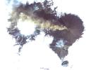
This image from NASA's Terra satellite, acquired on Aug. 20, 2017, shows Shiveluch, one of the world's most active volcanoes, poking through above a solid cloud deck, with an ash plume streaming to the west.
PIA21878:
NASA Satellite Images Erupting Russian Volcano
Full Resolution:     TIFF (2.775 MB)     JPEG (164.4 kB)
Add Image to Favorite List 2017-08-24 Earth Terra
ASTER
2118x2659x3
This image from NASA's Terra satellite, acquired on Aug. 23, 2017, shows smoke from the Cinder Butte fire, outside of the town of Riley, Oregon.
PIA21879:
Oregon Wildfire Captured in NASA Satellite Image
Full Resolution:     TIFF (11.97 MB)     JPEG (676.7 kB)
Add Image to Favorite List 2017-08-29 Earth Terra
ASTER
1809x2754x3
The border between Belize (right) and Guatemala (left) illustrates striking differences between near-pristine forests in Belize and agriculture fields in Guatemala. This image from NASA's Terra spacecraft was acquired May 10, 2016.
PIA21826:
Belize-Guatemala Border
Full Resolution:     TIFF (14.95 MB)     JPEG (826.9 kB)
Add Image to Favorite List 2017-09-05 Earth Terra
ASTER
876x1786x3
On Sept. 5, 2017 NASA's Terra satellite captured this image of the area around Bay City, Texas, SW of Houston. Hurricane Harvey caused extensive inland flooding.
PIA21940:
Hurricane Harvey Flooding Seen in New NASA Satellite Image
Full Resolution:     TIFF (4.695 MB)     JPEG (441 kB)
Add Image to Favorite List 2017-09-18 Earth Terra
ASTER
1228x894x3
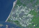
Westland in the Netherlands is the greenhouse capital of the world. It is the number two exporter of food as measured by value, second only to the United States. This image from NASA's Terra spacecraft was acquired on June 12, 2014.
PIA21986:
Westland, The Netherlands
Full Resolution:     TIFF (3.295 MB)     JPEG (232 kB)
Add Image to Favorite List 2017-10-02 Earth Terra
ASTER
2670x3669x3
Minnesota's Northwest Angle is the northernmost point of the continental United States. The Angle became part of the US due to a map error during the 1783 Treaty of Paris. This image from NASA's Terra spacecraft was acquired September 22, 2013.
PIA21997:
Northwest Angle, Minnesota
Full Resolution:     TIFF (25.31 MB)     JPEG (989.1 kB)
Add Image to Favorite List 2017-10-09 Earth Terra
ASTER
1368x897x3
On Sept. 1, 2017 NASA's Terra satellite captured this image of the area the La Tuna Canyon fire began in the foothills north of Los Angeles.
PIA22044:
Scar from One of Los Angeles' Biggest Wildfires Imaged by NASA Satellite
Full Resolution:     TIFF (3.683 MB)     JPEG (414.8 kB)
Add Image to Favorite List 2017-10-06 Earth Terra
ASTER
471x301x1
On Sept. 28, 2017 NASA's Terra satellite captured this nighttime thermal infrared image of Manaro Voui volcano on Ambae island in Vanuatu as it began spewing ash in a moderate eruption, prompting authorities to order the evacuation of all 11,000 residents
PIA22045:
Simmering Vanuatu Volcano Imaged by NASA Satellite
Full Resolution:     TIFF (99.99 kB)     JPEG (22.78 kB)
Add Image to Favorite List 2017-10-13 Earth Terra
ASTER
3804x6066x3
On Oct. 12, 2017 NASA's Terra satellite acquired this image of Northern California's wine country where major fires are burning. The city of Santa Rosa is in the upper left corner; Napa is in the upper right; and Sonoma is in the center.
PIA22046:
Destructive Northern California Fires Seen in New NASA Satellite Image
Full Resolution:     TIFF (58.82 MB)     JPEG (2.965 MB)
Add Image to Favorite List 2017-10-23 Earth Terra
ASTER
4098x4175x3
As firefighters continue to work toward full containment of the rash of wildfires burning in Northern California, this image from NASA's Terra satellite acquired on Oct. 21, 2017, shows the growing fire scar on the landscape.
PIA22049:
Impact of Northern California Fires Seen in New NASA Satellite Image
Full Resolution:     TIFF (51.36 MB)     JPEG (3.573 MB)
Add Image to Favorite List 2017-10-31 Earth Terra
ASTER
2302x2601x3
The October fires in Northern California were some of the most destructive in the state's history. These images from NASA's Terra spacecraft were acquired September 7, 2016 and October 28, 2017.
PIA22019:
Northern California Fires
Full Resolution:     TIFF (17.97 MB)     JPEG (1.463 MB)
Add Image to Favorite List 2017-11-15 Earth Terra
ASTER
1846x1561x3
On Sunday, Nov. 12, 2017, a magnitude 7.3 earthquake struck along the Iran-Iraq border near Halabjah, Iraq. NASA's Terra satellite acquired this image of the earthquake-prone area. The epicenter is marked by a yellow star.
PIA22112:
Iran-Iraq Border Quake Region Imaged by NASA Satellite
Full Resolution:     TIFF (8.572 MB)     JPEG (780.8 kB)
Add Image to Favorite List 2017-10-31 Earth Terra
ASTER
2543x2473x3
The southwestern border of Brunei with Sarawak, Malaysia is strikingly apparent due to differences in land use practice. This image from NASA's Terra spacecraft was acquired September 10, 2012.
PIA22034:
Brunei-Sarawak Border
Full Resolution:     TIFF (18.87 MB)     JPEG (1.178 MB)
Add Image to Favorite List 2017-11-28 Earth Terra
ASTER
2318x1015x3
In 1667, the Dutch exchanged Run Island (left-most in the image) with the British for Manhattan (renamed from New Amsterdam to New York). This image from NASA's Terra spacecraft was acquired January 5, 2016.
PIA22133:
Run Island, Indonesia
Full Resolution:     TIFF (5.182 MB)     JPEG (234.8 kB)
Add Image to Favorite List 2017-12-10 Earth Terra
ASTER
1319x1185x3
On Sunday, Dec. 8, 2017, NASA's Terra acquired this image when a new small eruption sent an ash cloud 1.24 miles (2 kilometers) into the sky after Indonesia's Mount Agung volcano quieted down.
PIA22121:
Indonesia's Active Mount Agung Volcano Imaged by NASA Spacecraft
Full Resolution:     TIFF (4.073 MB)     JPEG (241.9 kB)
Add Image to Favorite List 2017-12-11 Earth Terra
ASTER
1584x2100x3
On Sunday, Dec. 10, 2017, NASA's Terra acquired this image of The Thomas fire, west of Los Angeles, CA, as it continues to advance to the west and north and is threatening a number of coastal communities, including Santa Barbara.
PIA22122:
Destructive Thomas Fire Continues Its Advance in New NASA Satellite Image
Full Resolution:     TIFF (6.455 MB)     JPEG (267.7 kB)
Add Image to Favorite List 2017-12-18 Earth Terra
ASTER
900x650x3
While the Thomas fire in Ventura County, CA is the largest and most destructive, several other smaller fires burned in the Los Angeles area. This image from NASA's Terra spacecraft was acquired December 17, 2017.
PIA22149:
Creek and Rye Fires, Southern California
Full Resolution:     TIFF (1.756 MB)     JPEG (234 kB)
Add Image to Favorite List 2018-01-05 Earth Terra
ASTER
4122x2206x3
On Dec 26, 2017, NASA's Terra acquired this image of The Thomas Fire, the largest wildfire in California's recorded history. As of January 3, 2018, it was 93 percent contained after burning 282,000 acres and destroying 1,063 structures.
PIA22189:
Devastation from California's Largest Wildfire Seen in New NASA Satellite Image
Full Resolution:     TIFF (27.3 MB)     JPEG (1.932 MB)
Add Image to Favorite List 2018-01-10 Earth Terra
ASTER
613x720x3
The island of Eigg is one of the small isles in the Scottish Inner Hebrides, south of the Skye peninsula. This image from NASA's Terra spacecraft was acquired on September 18, 2015.
PIA22164:
Eigg, Scotland
Full Resolution:     TIFF (1.077 MB)     JPEG (54.62 kB)
Add Image to Favorite List 2018-02-01 Earth Terra
ASTER
3180x3548x3
Suzhou is a major city located in southeastern Jiangsu Province of East China, about 100 km northwest of Shanghai. This image from NASA's Terra spacecraft was acquired August 2, 2015.
PIA22266:
Suzhou, Jingsu, China
Full Resolution:     TIFF (33.86 MB)     JPEG (3.524 MB)
Add Image to Favorite List 2018-02-22 Earth Terra
ASTER
4410x4338x3
In the far southeast corner of Libya, in the Libyan Desert, lie the uplifted massifs of Jebel Awenat and Jebel Arkenu. Both expose ancient Precambrian rocks. These images from NASA's Terra spacecraft were acquired July 19, 2012, and July 31, 2013.
PIA22283:
Jebels Awenat and Arkenu, Libya
Full Resolution:     TIFF (42.76 MB)     JPEG (1.616 MB)
Add Image to Favorite List 2018-03-26 Earth Terra
ASTER
1664x1856x3
This image from NASA's Terra spacecraft shows the Khurdopin Glacier in Pakistan. A large lake has formed in the Shimshal River, where the glacier has formed a dam.
PIA22304:
Khurdopin Glacier, Pakistan
Full Resolution:     TIFF (8.846 MB)     JPEG (466.3 kB)
Add Image to Favorite List 2018-04-13 Earth Terra
ASTER
1365x1823x3
Loktak Lake is the largest freshwater lake in northeast India, and is famous for the floating 'phudmis,' masses of vegetation, soil and organic material. This image from NASA's Terra spacecraft was acquired March 19, 2018.
PIA22369:
Loktak Lake, India
Full Resolution:     TIFF (7.468 MB)     JPEG (529.7 kB)
Add Image to Favorite List 2018-05-03 Earth Terra
ASTER
2149x1905x3
The Tsugaru Iwaki Skyline is a toll road in northern Japan, which partially ascends Mount Iwaki stratovolcano, and is notable for its steep gradient and 69 hairpin turns. This image from NASA's Terra spacecraft was acquired May 26, 2015.
PIA22385:
Tsugaru Iwaki Skyline, Japan
Full Resolution:     TIFF (12.29 MB)     JPEG (793 kB)
Add Image to Favorite List 2018-05-07 Earth Terra
ASTER
3856x4200x3
This image from NASA's Advanced Spaceborne Thermal Emission and Reflection Radiometer (ASTER) instrument on NASA's Terra spacecraft show recent eruptions of Kilauea volcano on the island of Hawaii (the Big Island).
PIA22450:
Satellite View of Kilauea Eruption
Full Resolution:     TIFF (36.72 MB)     JPEG (2.512 MB)
Add Image to Favorite List 2018-05-24 Earth Terra
ASTER
2177x2242x3
Hawaii's Kilauea's eruption, which began three weeks ago, has produced new lava flows that reached the ocean. NASA's Terra spacecraft acquired this image on May 22, 2018.
PIA22459:
New Image of Kilauea's Lava Flows taken by NASA Spacecraft
Full Resolution:     TIFF (12.5 MB)     JPEG (608.7 kB)
Add Image to Favorite List 2018-05-25 Earth Terra
ASTER
1459x1049x3
Tristan da Cunha is both a remote group of volcanic islands in the south Atlantic, and the main island. It is the most remote inhabited island group in the world. This image from NASA's Terra spacecraft was acquired was acquired October 7, 2017.
PIA22506:
Tristan da Cunha Island
Full Resolution:     TIFF (3.606 MB)     JPEG (169.8 kB)
Add Image to Favorite List 2018-06-28 Earth Terra
ASTER
1533x1550x3
On June 23, 2018, NASA's Terra spacecraft acquired this image of Hawaii's Kilauea volcanic eruption which continues after seven weeks of continuous outpouring of lava over the northeastern part of the island.
PIA22553:
Hawaii's Continuing Kilauea Eruption Seen in NASA Spacecraft Image
Full Resolution:     TIFF (6.248 MB)     JPEG (265.8 kB)
Add Image to Favorite List 2018-06-26 Earth Terra
ASTER
2300x1800x3
Frisco, Texas, a city along the Shawnee Trail in the Dallas-Fort Worth metroplex has become a bedroom community for workers in Dallas-Fort Worth. NASA's Terra spacecraft acquired this image on April 15, 2018.
PIA22552:
Frisco, Texas
Full Resolution:     TIFF (12.43 MB)     JPEG (1.123 MB)
Add Image to Favorite List 2018-06-28 Earth Terra
ASTER
1689x1434x3
On June 26, 2018, NASA's Terra spacecraft acquired this image of 416 Fire which started June 1, 2018, about 13 miles north of Durango, Colorado. Vegetation in shown red, clouds in white, cities and bare rocky areas in gray, and burned area in dark gray.
PIA22554:
Colorado Wildfire Imaged in Infrared by NASA Satellite
Full Resolution:     TIFF (7.269 MB)     JPEG (482.1 kB)
Add Image to Favorite List 2018-07-26 Earth Terra
ASTER
1238x1022x3
NASA's Terra spacecraft shows Hawaii's Kilauea volcano continues to create new land as flows from fissure 8, one of the most active to break ground since the eruption began in early May, reach the ocean.
PIA22489:
Satellite Imagery Shows Hawaii Volcano Lava Flow
Full Resolution:     TIFF (3.646 MB)     JPEG (132 kB)
Add Image to Favorite List 2018-07-17 Earth Terra
ASTER
3768x2469x3
NASA's Terra spacecraft shows footprints of clear-cut logging activities in northern California, east of Mt. Shasta.
PIA22613:
Logging in Northern California
Full Resolution:     TIFF (27.92 MB)     JPEG (2.401 MB)
Add Image to Favorite List 2018-07-28 Earth Terra
ASTER
1280x720x3
NASA's Terra spacecraft obtained near-infrared data of the ongoing Kilauea volcano eruption and its impact on the Leilani Estates area on May 15, 2018 (left) and June 23, 2018 (right). New dark areas show where the ground has been covered with lava flows.
PIA22593:
Dramatic Changes from Kilauea Leilani Estates Lava Flows Seen by NASA Spacecraft
Full Resolution:     TIFF (2.739 MB)     JPEG (114.3 kB)
Add Image to Favorite List 2018-08-22 Earth Terra
ASTER
2429x1856x3
NASA's Terra spacecraft shows significant evidence of mining in northestern Siberia, along the Chukchi Sea, and 100 kilometers west of Mys Shmidta.
PIA22672:
Gold Mining, Siberia
Full Resolution:     TIFF (13.53 MB)     JPEG (738.8 kB)
Add Image to Favorite List 2018-09-05 Earth Terra
ASTER
1241x1407x3
NASA's Terra spacecraft shows Ushuaia, the capital of Tierra Del Fuego, Argentina, which is regarded as the southernmost city in the world.
PIA22685:
Ushuaia, Argentina
Full Resolution:     TIFF (4.45 MB)     JPEG (201.4 kB)
Add Image to Favorite List 2018-09-19 Earth Terra
ASTER
1917x1468x3
NASA's Terra spacecraft shows Llullaillaco, a stratovolcano at the border of Argentina and Chile.
PIA22721:
Llullaillaco Volcano, Chile/Argentina
Full Resolution:     TIFF (7.77 MB)     JPEG (333.2 kB)
Add Image to Favorite List 2018-10-04 Earth Terra
ASTER
1368x1440x3
NASA's Terra spacecraft shows the largest city wall in the world, located in Nanjing, China. It was built between 1366 and 1386 by the Ming Dynasty Emperor Zhu Yuangzhang to enclose and fortify his capital city.
PIA22735:
Nanjing, China City Walls
Full Resolution:     TIFF (5.912 MB)     JPEG (576.4 kB)
Add Image to Favorite List 2018-10-05 Earth Terra
ASTER
3426x4083x3
NASA's Terra spacecraft obtained this ASTER image of Dagupan and the Lingayen Gulf, showing flooded and water-saturated areas on September 22, 2018. Sediment-laden waters from swollen rivers enter the ocean and appear as blue-green plumes.
PIA22705:
NASA's ASTER Instrument Sees Aftermath of Typhoon Mangkhut
Full Resolution:     TIFF (31.83 MB)     JPEG (2.201 MB)
Add Image to Favorite List 2018-10-17 Earth Terra
ASTER
4000x3069x3
NASA's Terra spacecraft shows the Air Mountains, located in northern Niger and extending over 84,000 square kilometers within the Sahara Desert.
PIA22795:
Air Mountains, Niger
Full Resolution:     TIFF (32.05 MB)     JPEG (2.448 MB)
Add Image to Favorite List 2018-10-31 Earth Terra
ASTER
2274x1917x3
NASA's Terra spacecraft shows Ventura, California has a coastal site, set against hills and flanked by two rivers.
PIA22841:
Ventura, CA
Full Resolution:     TIFF (13.08 MB)     JPEG (1.297 MB)
Add Image to Favorite List 2018-11-02 Earth Terra
ASTER
1929x2283x3
NASA's Terra spacecraft obtained this ASTER image of an eruption from Piton de la Fournaise volcano on Reunion Island in the Indian Ocean. The background image was acquired July 16, 2018, and the thermal image on November 1, 2018.
PIA22755:
NASA's ASTER Captures Piton de la Fournaise Eruption
Full Resolution:     TIFF (10.21 MB)     JPEG (703.5 kB)
Add Image to Favorite List 2018-11-13 Earth Terra
ASTER
1800x1200x3
NASA's Terra spacecraft shows the Carajas Mine, the largest open-pit iron ore mine in the world. It is located in the state of Para, northern Brazil.
PIA22861:
Carajas Mine, Brazil
Full Resolution:     TIFF (6.362 MB)     JPEG (326.4 kB)
Add Image to Favorite List 2018-12-03 Earth Terra
ASTER
3800x2800x3
NASA's Terra spacecraft obtained this ASTER image of Guatemala's Fuego volcano on Nov. 24, 2018, following a recent eruption.
PIA22820:
NASA's ASTER Captures Lava Flow, Ash from Guatemala Volcano
Full Resolution:     TIFF (29.07 MB)     JPEG (1.594 MB)
Add Image to Favorite List 2018-12-04 Earth Terra
ASTER
2408x1247x3
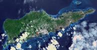
NASA's Terra spacecraft shows Saint Croix, a district of the U.S. Virgin Islands, in the Caribbean Sea.
PIA22894:
St. Croix, US Virgin Islands
Full Resolution:     TIFF (8.784 MB)     JPEG (453.6 kB)
Add Image to Favorite List 2018-12-13 Earth Terra
ASTER
1700x1200x3
NASA's Terra spacecraft shows the 2018 Kilauea, Hawaii eruption that began in May on Kilauea's East Rift Zone.
PIA22899:
2018 Kilauea East Rift Zone Eruption
Full Resolution:     TIFF (6.123 MB)     JPEG (272.4 kB)
Add Image to Favorite List 2018-12-21 Earth Terra
ASTER
2772x1252x3
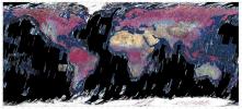
This mosaic was created from thumbnail browse images of data from NASA's Terra spacecraft.
PIA22979:
ASTER Global Mosaic
Full Resolution:     TIFF (7.881 MB)     JPEG (746.2 kB)
Add Image to Favorite List 2019-01-08 Earth Terra
ASTER
752x722x3
NASA's Terra spacecraft shows the largest building in the world located at the Boeing factory in Everett, Washington.
PIA23000:
Boeing Plant, Everett WA
Full Resolution:     TIFF (1.63 MB)     JPEG (147.1 kB)
Add Image to Favorite List 2019-01-17 Earth Terra
ASTER
904x815x3
NASA's Terra spacecraft obtained this ASTER image on Dec. 22, 2018, of Indonesia's Anak Krakatau volcano which erupted and partially collapsed.
PIA22821:
ASTER Images Post-eruption Anak Krakatau Volcano
Full Resolution:     TIFF (1.844 MB)     JPEG (64.95 kB)
Add Image to Favorite List 2019-01-23 Earth Terra
ASTER
3198x3258x3
NASA's Terra spacecraft shows Severnaya Zemlya, an archipelago in the Russian high Arctic. It was first charted in 1930.
PIA23018:
October Revolution Island, Russia
Full Resolution:     TIFF (28.69 MB)     JPEG (1.255 MB)
Add Image to Favorite List 2019-02-06 Earth Terra
ASTER
1152x864x3
NASA's Terra spacecraft shows the after image, acquired Feb. 1, 2019, of a dam burst at a Brazilian iron ore mine.
PIA22824:
NASA's ASTER Shows Brazilian City After Dam Disaster
Full Resolution:     TIFF (2.987 MB)     JPEG (176.7 kB)
Add Image to Favorite List 2019-02-07 Earth Terra
ASTER
1284x1056x3
NASA's Terra spacecraft shows Luxor, a city in Upper Egypt, along the Nile. It is the site of the ancient Egyptian city of Waset, known to the Greeks as Thebes.
PIA23060:
Luxor, Egypt
Full Resolution:     TIFF (4.069 MB)     JPEG (308.9 kB)
Add Image to Favorite List 2019-02-21 Earth Terra
ASTER
2427x2400x3
NASA's Terra spacecraft shows the Potrillo volcanic field, located on the Rio Grande Rift in southern New Mexico.
PIA23065:
Potrillo Volcanic Field, New Mexico
Full Resolution:     TIFF (17.48 MB)     JPEG (997.1 kB)
Add Image to Favorite List 2019-03-14 Earth Terra
ASTER
789x590x3
NASA's Terra spacecraft shows the Atlantic Ocean Road, an 8.3 kilometer road that runs through an archipelago in Eide and Averoy in More of Romsdal, Norway.
PIA23096:
Atlantic Ocean Road, Norway
Full Resolution:     TIFF (1.36 MB)     JPEG (110.5 kB)
Add Image to Favorite List 2019-03-28 Earth Terra
ASTER
3202x3673x3
NASA's Terra spacecraft shows Lake Karakul in northeast Tajikistan, a hypersaline lake with no external drainage, receiving less than 3 cm precipitation per year.
PIA23102:
Lake Karakul, Tajikistan
Full Resolution:     TIFF (26.71 MB)     JPEG (1.209 MB)
Add Image to Favorite List 2019-04-12 Earth Terra
ASTER
2600x1151x3
NASA's Terra spacecraft obtained this ASTER image on April 10, 2019, of Peru's Sabancaya stratovolcano.
PIA23143:
NASA's ASTER Images Sabancaya Volcano
Full Resolution:     TIFF (8.687 MB)     JPEG (443.8 kB)
Add Image to Favorite List 2019-04-15 Earth Terra
ASTER
2397x1885x3
NASA's Terra spacecraft shows Cape Horn, the southernmost point of the Tierra Del Fuego archipelago of Southern Chile.
PIA23118:
Cape Horn, Chile
Full Resolution:     TIFF (12.19 MB)     JPEG (534.4 kB)
Add Image to Favorite List 2019-04-29 Earth Terra
ASTER
1849x2418x3
NASA's Terra spacecraft shows on the border between Mongolia and China, southward draining ephemeral streams have carved a series of parallel channels.
PIA23196:
Alluvial Fan, China and Mongolia
Full Resolution:     TIFF (12.95 MB)     JPEG (734.2 kB)
Add Image to Favorite List 2019-05-23 Earth Terra
ASTER
3426x3501x3
NASA's Terra spacecraft shows Lake St. Clair connects Lake Huron, via the St. Clair River, to Lake Erie, via the Detroit River.
PIA23234:
Lake St. Clair, US and Canada
Full Resolution:     TIFF (33.91 MB)     JPEG (1.468 MB)
Add Image to Favorite List 2019-07-01 Earth Terra
ASTER
4200x1919x3
NASA's Terra spacecraft shows Raikoke volcanic island, near the center of the Kuril Islands in the Sea of Okhotsk in the northwest Pacific Ocean.
PIA23326:
Raikoke Island, Kuril Islands
Full Resolution:     TIFF (19.62 MB)     JPEG (623.5 kB)
Retrieve Previous Set  Jump to a Previous Set   Jump to a Previous Set   Jump to a Previous Set   Jump to a Previous Set   Jump to a Previous Set   Jump to a Previous Set   Jump to a Previous Set   Jump to a Previous Set   Jump to a Previous Set   Current Set   Retrieve Next Set 
 1-100   101-200   201-300   301-400   401-500   501-600   601-700   701-800   801-900   901-1000 
Currently displaying images: 901 - 1000 of 2588