Your search criteria found 2588 images
Target is Earth (and available satellites)
Go to PIAxxxxx:
Refine this list of images by:
Target:
Mission:
Spacecraft:
Instrument:
Click on an image for detailed information
Click on a column heading to sort in ascending or descending order
My
List
Addition Date Target Mission InstrumentSort Descending Size
Add Image to Favorite List 2001-10-22 Earth Terra
ASTER
1960x2100x3
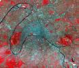
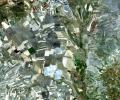
This image of Paris was acquired on July 23, 2000 by NASA's Terra satellite. Paris is also known as the City of Light.
PIA11164:
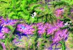
Saline Valley
Full Resolution:     TIFF (12.37 MB)     JPEG (1.34 MB)
Add Image to Favorite List 2001-10-22 Earth Terra
ASTER
3138x2611x3
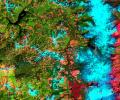
This image was acquired by NASA's Terra spacecraft on May 20, 2000 and shows an area along the west side of the Cascade Range in west central Oregon.
PIA11165:
Oregon Forests
Full Resolution:     TIFF (24.58 MB)     JPEG (2.054 MB)
Add Image to Favorite List 2001-10-22 Earth Terra
ASTER
340x256x3
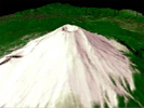
The nearly perfectly conical profile of Fuji, Japans highest mountain, soars 3,776 meters (12,388 feet) above sea level on southern Honshu, near Tokyo. This image was acquired by NASA's Terra spacecraft.
PIA11166:
Mt. Fuji, Japan Animation Icon
Full Resolution:     TIFF (261.6 kB)     JPEG (12.14 kB)
Add Image to Favorite List 2001-10-22 Earth Terra
ASTER
2280x3887x3
This image acquired by NASA's Terra satellite on July 5, 2000 covers the eastern part of the Strait of Gibraltar, separating Spain from Morocco. The promontory on the eastern side of the conspicuous Spanish port is the Rock of Gibraltar.
PIA11167:
Strait of Gibraltar
Full Resolution:     TIFF (26.62 MB)     JPEG (1.024 MB)
Add Image to Favorite List 2001-10-22 Earth Terra
ASTER
1528x1322x3
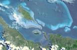
This image captures the tropical beauty of the major islands of the Little Bahama Bank, the most northerly of the island groups that comprise the Bahamas. The island at the west edge of the image is Grand Bahama Island. Image from NASA's Terra satellite.
PIA11168:
Paris
Full Resolution:     TIFF (6.071 MB)     JPEG (1.008 MB)
Add Image to Favorite List 2008-11-03 Earth Terra
ASTER
6630x5000x3
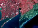
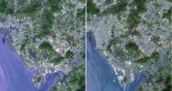
Three weeks after Hurricane Ike came ashore near Galveston, TX, residents returned to find their houses in ruins. Images were acquired by NASA's Terra satellite on September 28, right, and August 15, 2006, left.
PIA11394:
Aftermath of Hurricane Ike along Texas Coast
Full Resolution:     TIFF (99.45 MB)     JPEG (4.42 MB)
Add Image to Favorite List 2008-11-17 Earth Terra
ASTER
4070x8024x3
Byrd Glacier is a major glacier in Antarctica; it drains an extensive area of the polar plateau and flows eastward between the Britannia Range and the Churchill Mountains to discharge into the Ross Ice Shelf. This image is from NASA's Terra satellite.
PIA11419:
Byrd Glacier, Antarctica
Full Resolution:     TIFF (97.97 MB)     JPEG (7.07 MB)
Add Image to Favorite List 2008-10-16 Earth Terra
ASTER
1922x2982x3
Dense green vegetation gives way to pale fields in these satellite images of deforestation in Brazil's Amazon rainforest. This image is from NASA's Terra satellite.
PIA11420:
Mato Grosso, Brazil
Full Resolution:     TIFF (17.22 MB)     JPEG (1.446 MB)
Add Image to Favorite List 2009-01-09 Earth Terra
ASTER
3136x1656x3
NASA's Terra spacecraft monitored the migration of sand dunes in the Bodele depression of northern Chad from at various times from one month to 6.5 years
PIA11752:
Bodele Sand Dunes, Chad
Full Resolution:     TIFF (15.58 MB)     JPEG (879.5 kB)
Add Image to Favorite List 2009-02-18 Earth Terra
ASTER
3315x3324x3
On February 17, 2009, NASA's Terra satellite imaged bushfires burning in Victoria Australia.
PIA11806:
Australia Wildfires Extract a Heavy Toll in Lives, Land
Full Resolution:     TIFF (33.06 MB)     JPEG (1.678 MB)
Add Image to Favorite List 2009-04-19 Earth Terra
ASTER
2508x5460x3
The Spring, 2009 floods along the Red River between North Dakota and Minnesota affected cities in the two states, especially Fargo and Whitehead. NASA's Terra spacecraft acquired this image on April 9, 2009.
PIA11989:
North Dakota Floods
Full Resolution:     TIFF (41.12 MB)     JPEG (3.296 MB)
Add Image to Favorite List 2009-04-20 Earth Terra
ASTER
3235x2351x3
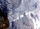
The Wilkins Ice Shelf, as seen by NASA's Terra spacecraft, on the western side of the Antarctic Peninsula, experienced multiple disintegration events in 2008.
PIA11991:
Wilkins Ice Shelf
Full Resolution:     TIFF (22.82 MB)     JPEG (984.9 kB)
Add Image to Favorite List 2009-02-09 Earth Terra
ASTER
2468x1992x3
Jamestown, located on Jamestown Island in the Virginia Colony, was founded on May 14, 1607. NASA's Terra spacecraft acquired this image on September 4, 2007.
PIA12055:
Jamestown, VA
Full Resolution:     TIFF (14.76 MB)     JPEG (918.7 kB)
Add Image to Favorite List 2009-02-20 Earth Terra
ASTER
3900x3764x3
The north coast of the Island of Hokkaido, Japan lies at the southern end of the Sea of Okhotsk. NASA's Terra spacecraft acquired this image on February 11, 2009.
PIA12056:
Hokkaido, Japan
Full Resolution:     TIFF (44.04 MB)     JPEG (1.775 MB)
Add Image to Favorite List 2009-03-02 Earth Terra
ASTER
2368x3020x3
The Palm Islands are artificial islands in Dubai, United Arab emirates on which major commercial and residential structures are being built. NASA's Terra spacecraft acquired this image on November 17 and December 10, 2008.
PIA12057:
Palm Islands, Dubai, UAE
Full Resolution:     TIFF (21.48 MB)     JPEG (700.7 kB)
Add Image to Favorite List 2009-03-16 Earth Terra
ASTER
2676x1918x3
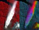
This image acquired by NASA's Terra spacecraft on March 6, 2009, shows early March eruptions of Karymsky volcano on Russia's Kamchatka Peninsula left the usually white snow a gray ashy color.
PIA12058:
Karymsky Volcano, Kamchatka
Full Resolution:     TIFF (15.41 MB)     JPEG (726.5 kB)
Add Image to Favorite List 2009-03-26 Earth Terra
ASTER
1949x2646x3
Grand Turk Island is an island in the Turks and Caicos Islands in the Caribbean, and contains the territory's capital, Cockburn Town. NASA's Terra spacecraft acquired this image on September 18, 2001.
PIA12059:
Grand Turk Island
Full Resolution:     TIFF (15.49 MB)     JPEG (591.2 kB)
Add Image to Favorite List 2009-04-03 Earth Terra
ASTER
3108x4319x3
The Musandam Peninsula is part of Oman, separated from the rest of the country by the United Arab Emirates. This image was acquired by NASA's Terra satellite on March 27, 2004.
PIA12060:
Musandam Peninsula, Oman
Full Resolution:     TIFF (40.27 MB)     JPEG (1.593 MB)
Add Image to Favorite List 2009-04-20 Earth Terra
ASTER
3708x2920x3
NASA's Terra spacecraft imaged the Indonesian islands of Komodo, Rintja, Padar, and Flores in the Komodo National Park. The Komodo dragon is the world's largest lizard species.
PIA12061:
Komodo National Park, Indonesia
Full Resolution:     TIFF (32.48 MB)     JPEG (1.387 MB)
Add Image to Favorite List 2009-05-15 Earth Terra
ASTER
3456x2736x3
Chaiten Volcano, Chile continues to erupt after first exploding in May 2008 following about 9,000 years of inactivity. This image from NASA's Terra spacecraft shows vegetation in red. You can clearly see the extent of the plume.
PIA12063:
Volcano Chaiten, Chile
Full Resolution:     TIFF (28.37 MB)     JPEG (1.285 MB)
Add Image to Favorite List 2009-06-02 Earth Terra
ASTER
2282x1772x3
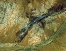
This image acquired by NASA's Terra spacecraft, shows the oldest material on Earth which has yet been dated by man is a zircon mineral of 4.4 billion years old from a sedimentary gneiss in the Jack Hills of the Narre Gneiss Terrane of Australia.
PIA12064:
Jack Hills, Australia
Full Resolution:     TIFF (12.15 MB)     JPEG (877.8 kB)
Add Image to Favorite List 2009-05-01 Earth Terra
ASTER
1446x803x3
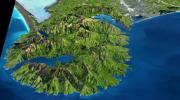
The Banks Peninsula, New Zealand was created by volcanic activity in the Miocene epoch about 10 million years ago. This image is from NASA's Terra spacecraft.
PIA12062:
Banks Peninsula, New Zealand
Full Resolution:     TIFF (3.49 MB)     JPEG (214.8 kB)
Add Image to Favorite List 2004-10-11 Earth Terra
ASTER
2771x3000x3
NASA's Terra spacecraft shows vast alluvial fan blossoms across the desolate landscape between two mountain ranges that form the southern border of the Taklimakan Desert in China's XinJiang Province.
PIA12070:
Alluvial Fan, China
Full Resolution:     TIFF (24.94 MB)     JPEG (1.935 MB)
Add Image to Favorite List 2009-06-29 Earth Terra
ASTER
4320x2160x3
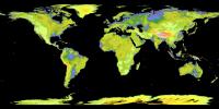
NASA and Japan's Ministry of Economy, Trade and Industry (METI) released the Advanced Spaceborne Thermal Emission and Reflection Radiometer (ASTER) Global Digital Elevation Model (GDEM) to the worldwide public on June 29, 2009.
PIA12090:
ASTER's Global Digital Elevation Model (GDEM)
Full Resolution:     TIFF (27.99 MB)     JPEG (1.153 MB)
Add Image to Favorite List 2009-06-29 Earth Terra
ASTER
1488x1493x3
Death Valley, Calif., has the lowest point in North America, Badwater at 85.5 meters (282 feet) below sea level. It is also the driest and hottest location in North America. This image is from NASA's Terra spacecraft.
PIA12091:
Death Valley, California
Full Resolution:     TIFF (6.677 MB)     JPEG (506.6 kB)
Add Image to Favorite List 2009-06-29 Earth Terra
ASTER
1556x1370x3
Onboard NASA's Terra spacecraft, the Advanced Spaceborne Thermal Emission and Reflection Radiometer data have revealed significant spatial variability in glacier flow in the Bhutan Himalayas.
PIA12092:
Himalayan Glaciers in Bhutan
Full Resolution:     TIFF (6.406 MB)     JPEG (432.9 kB)
Add Image to Favorite List 2009-06-29 Earth Terra
ASTER
1280x720x3
The Los Angeles Basin is bordered on the north by the San Gabriel Mountains. Other smaller basins are separated by smaller mountain ranges, like the Verdugo Hills, and the Santa Monica Mountains in this image from NASA's Terra spacecraft.
PIA12093:
Los Angeles Basin
Full Resolution:     TIFF (2.768 MB)     JPEG (316.6 kB)
Add Image to Favorite List 2009-06-29 Earth Terra
ASTER
1281x718x3
Data from JPL's Advanced Spaceborne Thermal Emission and Reflection Radiometer instrument on NASA's Terra satellite provides views of the L.A. Basin, San Francisco Bay and more.
PIA12094:
Cruising Over California Animation Icon
Full Resolution:     TIFF (2.762 MB)     JPEG (37.04 kB)
Add Image to Favorite List 2009-06-29 Earth Terra
ASTER
1280x720x3
Data from JPL's Advanced Spaceborne Thermal Emission and Reflection Radiometer instrument on NASA's Terra satellite provides views of the L.A. Basin, including Dodger Stadium, the L.A.X. airport and JPL.
PIA12095:
Cruising Over Los Angeles Animation Icon
Full Resolution:     TIFF (2.768 MB)     JPEG (86.7 kB)
Add Image to Favorite List 2009-08-18 Earth Terra
ASTER
1492x1488x3
JPL's Advanced Spaceborne Thermal Emission and Reflection Radiometer aboard NASA's Terra satellite, shows Lhasa, the traditional seat of the Dalai Lama and capital of the Tibet Autonomous Region in China.
PIA12177:
Lhasa, Tibet, China
Full Resolution:     TIFF (6.672 MB)     JPEG (548.2 kB)
Add Image to Favorite List 2009-09-08 Earth Terra
ASTER
3416x3492x3
JPL's Advanced Spaceborne Thermal Emission and Reflection Radiometer aboard NASA's Terra satellite captured this simulated natural color image of the Station fire, burning in the San Gabriel Mountains.
PIA12197:
Extent of Station Fire Burn Seen in New NASA Image
Full Resolution:     TIFF (35.79 MB)     JPEG (2.482 MB)
Add Image to Favorite List 2009-09-15 Earth Terra
ASTER
3920x2709x3
JPL's Advanced Spaceborne Thermal Emission and Reflection Radiometer aboard NASA's Terra satellite captured this simulated natural color image of the Station fire burning in the San Gabriel Mountains.
PIA12199:
Station Fire Burns in the San Gabriel Mountains Above Los Angeles
Full Resolution:     TIFF (31.86 MB)     JPEG (2.289 MB)
Add Image to Favorite List 2009-10-02 Earth Terra
ASTER
1652x1260x3
The Guiberson Fire in Ventura County, west of Los Angeles, burned more than 16,000 acres (25 square miles) before firefighters were able to contain the blaze on Sept. 28, 2009. This image was acquired by NASA's Terra spacecraft.
PIA12250:
Guiberson Fire, Ventura County, Calif.
Full Resolution:     TIFF (6.255 MB)     JPEG (535.3 kB)
Add Image to Favorite List 2009-09-01 Earth Terra
ASTER
1200x1000x3
The world's largest solar power tower recently began operating outside Seville, Spain -- and it marks a historic moment in the saga of renewable energy. This image was acquired by NASA's Terra spacecraft.
PIA12303:
Solar Power, Seville, Spain
Full Resolution:     TIFF (3.604 MB)     JPEG (314.5 kB)
Add Image to Favorite List 2009-09-21 Earth Terra
ASTER
6230x3300x3
Shenzhen is a city of sub-provincial administrative status in southern China's Guangdong province, immediately north of Hong Kong, and located in the Pearl River Delta. This image was acquired by NASA's Terra spacecraft.
PIA12304:
Shenzhen, PRC
Full Resolution:     TIFF (61.68 MB)     JPEG (4.722 MB)
Add Image to Favorite List 2009-10-05 Earth Terra
ASTER
1789x1431x3
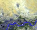
NASA's Terra spacecraft shows Timbuktu in the West African Nation of Mali, about 15 km north of the Niger River, at the intersection of an east-west and a north-south Trans Saharan trade route across the Sahara.
PIA12305:
Timbuktu, Mali
Full Resolution:     TIFF (7.692 MB)     JPEG (462.1 kB)
Add Image to Favorite List 2010-01-28 Earth Terra
ASTER
2910x1887x3
In this image, taken by NASA's Terra spacecraft, six marine clusters represent the main diversity of coral reefs and associated ecosystems in the French Pacific Ocean archipelago of New Caledonia.
PIA12502:
Lagoons of New Caledonia
Full Resolution:     TIFF (16.47 MB)     JPEG (630.7 kB)
Add Image to Favorite List 2009-10-22 Earth Terra
ASTER
2356x2239x3
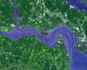
Sault Ste. Marie is the name of two cities on Saint Mary's River, separating Canada and the State of Michigan in the United States. This image was acquired by NASA's Terra spacecraft on June 10, 2007.
PIA12460:
Sault Ste. Marie
Full Resolution:     TIFF (15.84 MB)     JPEG (939.8 kB)
Add Image to Favorite List 2009-11-02 Earth Terra
ASTER
3900x4331x3
The McMurdo Dry Valleys are a row of valleys west of McMurdo Sound, Antarctica. They are so named because of their extremely low humidity and lack of snow and ice cover. This image was acquired December 8, 2002 by NASA's Terra spacecraft.
PIA12461:
Dry Valleys, Antarctica
Full Resolution:     TIFF (50.67 MB)     JPEG (2.02 MB)
Add Image to Favorite List 2009-12-08 Earth Terra
ASTER
5250x2434x3
The Yellow River is the second-longest river in China, and the sixth longest in the world and makes many dramatic shifts over time. This image was taken with the ASTER instrument aboard NASA's Terra spacecraft in 2009.
PIA12472:
Yellow River Delta, China
Full Resolution:     TIFF (38.34 MB)     JPEG (1.671 MB)
Add Image to Favorite List 2010-01-11 Earth Terra
ASTER
3892x2344x3
This image, from NASA's Advanced Spaceborne Thermal Emission and Reflection Radiometer instrument aboard Terra, shows Kerch, one of the most ancient cities of the Ukraine.
PIA12487:
Kerch, Ukraine
Full Resolution:     TIFF (27.37 MB)     JPEG (1.121 MB)
Add Image to Favorite List 2010-01-18 Earth Terra
ASTER
3266x3374x3
An instrument on NASA's Terra spacecraft captured a simulated natural color image of the Port-au-Prince, Haiti, area, two days after a devastating earthquake.
PIA12495:
Haiti Earthquake Landslides
Full Resolution:     TIFF (33.06 MB)     JPEG (1.889 MB)
Add Image to Favorite List 2010-01-22 Earth Terra
ASTER
2500x2500x3
NASA's Terra spacecraft captures a clear sky image of the region of the recent Haiti earthquake.
PIA12498:
ASTER Captures Clear Sky Image of Haiti Earthquake Region
Full Resolution:     TIFF (18.77 MB)     JPEG (1.289 MB)
Add Image to Favorite List 2010-03-24 Earth Terra
ASTER
1516x1962x3
In this simulated natural color image of Huron, South Dakota, captured by NASA's Terra spacecraft on March 20, 2010, frozen lakes and ponds appear blue, bare fields are tan, and fields with minor vegetation are gray-green.
PIA12878:
Huron, South Dakota
Full Resolution:     TIFF (8.939 MB)     JPEG (632.3 kB)
Add Image to Favorite List 2010-04-05 Earth Terra
ASTER
2500x3000x3
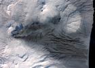
Sheveluch Volcano in Kamchatka, Siberia, is one of the frequently active volcanoes located in eastern Siberia. In this image from NASA's Terra spacecraft, brownish ash covers the southern part of the mountain, under an ash-laden vertical eruption plume.
PIA13010:
Sheveluch Volcano, Kamchatka, Russia
Full Resolution:     TIFF (22.52 MB)     JPEG (1.502 MB)
Add Image to Favorite List 2010-04-09 Earth Terra
ASTER
4000x4200x3
This image from NASA's Terra spacecraft shows where a magnitude 7.2 earthquake struck in Mexico's Baja, California at shallow depth along the principal plate boundary between the North American and Pacific plates on April 4, 2010.
PIA13027:
NASA Satellite Imagery Shows Sparse Population of Region Near Baja, California Earthquake
Full Resolution:     TIFF (50.4 MB)     JPEG (2.788 MB)
Add Image to Favorite List 2010-04-16 Earth Terra
ASTER
2066x1788x3
This image from NASA's Terra spacecraft shows the planned city of Brasilia, the capital of Brazil, with a population of about 3.6 million for its metropolitan area.
PIA13045:
Brasilia, Brazil
Full Resolution:     TIFF (11.1 MB)     JPEG (802.9 kB)
Add Image to Favorite List 2010-04-19 Earth Terra
ASTER
3908x3132x3
On Monday, April 19, 2010, the Advanced Spaceborne Thermal Emission and Reflection Radiometer (ASTER) instrument onboard NASA's Terra spacecraft obtained this image of the continuing eruption of Iceland's Eyjafjallajökull volcano.
PIA13049:
NASA Satellite Tracks Continued Eruption of Iceland Volcano
Full Resolution:     TIFF (17.84 MB)     JPEG (669 kB)
Add Image to Favorite List 2010-04-23 Earth Terra
ASTER
1530x700x3
This image from NASA's Terra spacecraft shows the ash plume of Iceland's Eyjafyallajökull Volcano on April 19, 2010. The eruption plume and drifting veil of ash appear to be homogeneous.
PIA13062:
NASA's ASTER Instrument Analyzes Ash Plume of Iceland's Eyjafyallajökull Volcano
Full Resolution:     TIFF (3.219 MB)     JPEG (142.2 kB)
Add Image to Favorite List 2010-05-03 Earth Terra
ASTER
5275x6928x3
This image, from NASA's Terra spacecraft, was acquired May 1, 2010. An explosion destroyed the Deepwater Horizon oil platform operating in the offshore in Gulf of Mexico on April 20, 2010.
PIA13085:
ASTER Images Gulf of Mexico Oil Spill
Full Resolution:     TIFF (109.6 MB)     JPEG (7.882 MB)
Add Image to Favorite List 2010-05-03 Earth Terra
ASTER
2664x2108x3
This image from NASA's Terra spacecraft shows the Kuk Early Agricultural Site in the western highlands of New Guinea. It is an excellent example of transformation of agricultural practices over time.
PIA13090:
Kuk, New Guinea
Full Resolution:     TIFF (16.86 MB)     JPEG (1.336 MB)
Add Image to Favorite List 2010-05-04 Earth Terra
ASTER
940x607x1
NASA's Terra spacecraft captured this image of the growing oil spill in the Gulf of Mexico on May 1, 2010. On April 20, 2010, an explosion destroyed the Deepwater Horizon oil platform operating offshore in the Gulf of Mexico.
PIA13091:
ASTER Views the Gulf of Mexico Oil Spill in Infrared (May 1)
Full Resolution:     TIFF (571.4 kB)     JPEG (116.6 kB)
Add Image to Favorite List 2010-05-05 Earth Terra
ASTER
950x486x3
NASA's Terra spacecraft captured this pair of images of Iceland's Eyjafyallajökull volcano on May 3, 2010. On this day, Ireland closed its airspace for several hours due to presence of ash over the country.
PIA13093:
ASTER Images Iceland's Eyjafyallajökull Volcano
Full Resolution:     TIFF (1.387 MB)     JPEG (69.67 kB)
Add Image to Favorite List 2010-05-07 Earth Terra
ASTER
1368x2791x1
NASA's Terra spacecraft captured this image of the growing oil spill in the Gulf of Mexico on May 7, 2010. The thickest parts of the oil spill appear as dark grey, filamentous masses in the southern part of the image, extending off of the bottom.
PIA13107:
ASTER Views the Gulf of Mexico Oil Spill in Infrared (May 7)
Full Resolution:     TIFF (3.823 MB)     JPEG (292 kB)
Add Image to Favorite List 2010-05-26 Earth Terra
ASTER
2800x2100x3
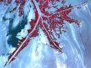
Oil from the Deepwater Horizon spill laps around the mouth of the Mississippi River Delta in this May 24, 2010, image from NASA's Terra spacecraft. The oil appears silver, while vegetation is red.
PIA13165:
NASA Satellite Spots Oil at Mississippi Delta's Mouth
Full Resolution:     TIFF (17.64 MB)     JPEG (1.013 MB)
Add Image to Favorite List 2010-09-02 Earth Terra
ASTER
2361x2746x3
Oslo, the capital and largest city in Norway, as seen by the Advanced Spaceborne Thermal Emission and Reflection Radiometer instrument aboard NASA's Terra spacecraft.
PIA13364:
Oslo, Norway
Full Resolution:     TIFF (19.47 MB)     JPEG (1.282 MB)
Add Image to Favorite List 2010-08-03 Earth Terra
ASTER
1452x1200x3
NASA's Terra spacecraft captured this image of the wildfire near Palmdale, Calif. on August 1, 2010 called the Crown fire. The burned areas appear in shades of gray in this simulated natural color image.
PIA13312:
ASTER Views California's Crown Fire
Full Resolution:     TIFF (5.237 MB)     JPEG (470.4 kB)
Add Image to Favorite List 2010-08-12 Earth Terra
ASTER
1548x1000x3
This image of Petermann Glacier and the new iceberg was acquired from NASA's Terra spacecraft on Aug. 12, 2010. On Aug. 5, 2010, an enormous chunk of ice broke off the Petermann Glacier along the northwestern coast of Greenland.
PIA13319:
ASTER Views Large Calving Event at Petermann Glacier, Greenland
Full Resolution:     TIFF (4.652 MB)     JPEG (216.1 kB)
Add Image to Favorite List 2010-08-20 Earth Terra
ASTER
4159x5176x3
NASA's Terra spacecraft captured this cloud-free image over the city of Sukkur, Pakistan, on Aug. 18, 2010. Sukkur, located in southeastern Pakistan's Sindh Province, is visible as the grey, urbanized area in the lower left center of the image.
PIA13343:
ASTER Captures New Image of Pakistan Flooding
Full Resolution:     TIFF (64.58 MB)     JPEG (4.916 MB)
Add Image to Favorite List 2010-09-02 Earth Terra
ASTER
2908x2936x3
The Advanced Spaceborne Thermal Emission and Reflection Radiometer instrument aboard NASA's Terra spacecraft captured this image of the Rio Tinto river in southwestern Spain which originates in the Sierra Morena mountains of Andalusia.
PIA13365:
Rio Tinto, Spain
Full Resolution:     TIFF (25.61 MB)     JPEG (2.167 MB)
Add Image to Favorite List 2010-09-07 Earth Terra
ASTER
4003x11340x3
On Sept. 3, 2010, NASA's Terra spacecraft captured this image strip over the Indus River, Pakistan, where severe flooding caused a major humanitarian crisis.
PIA13368:
ASTER Maps Continued Pakistan Flooding (False Color)
Full Resolution:     TIFF (136.2 MB)     JPEG (7.985 MB)
Add Image to Favorite List 2010-09-07 Earth Terra
ASTER
4003x11340x3
On Sept. 3, 2010, when NASA's Terra spacecraft captured this image strip over the Indus River in Pakistan, severe flooding was still causing a major humanitarian crisis in Pakistan. The city of Hyderabad is near the middle of the image.
PIA13369:
ASTER Maps Continued Pakistan Flooding
Full Resolution:     TIFF (136.2 MB)     JPEG (7.149 MB)
Add Image to Favorite List 2010-09-13 Earth Terra
ASTER
1757x1777x3
Folds in the lower reaches of valley glaciers can be caused by powerful surges of tributary ice streams. This phenomenon is spectacularly displayed by the Sustina Glacier in the Alaska Range as seen by NASA's Terra spacecraft.
PIA13382:
Susitna Glacier, Alaska
Full Resolution:     TIFF (9.381 MB)     JPEG (530.7 kB)
Add Image to Favorite List 2010-09-17 Earth Terra
ASTER
1604x1120x3
The Advanced Spaceborne Thermal Emission and Reflection Radiometer (ASTER) instrument aboard NASA's Terra spacecraft captured this image of the Fourmile Canyon fire west of Boulder Colo., on Sept. 17, 2010; it was 100 percent contained.
PIA13393:
ASTER Maps Fourmile Canyon Fire Near Boulder, Colo.
Full Resolution:     TIFF (5.399 MB)     JPEG (405.6 kB)
Add Image to Favorite List 2010-09-29 Earth Terra
ASTER
2316x3288x3
NASA's Terra spacecraft captured this image of the Twitchell Canyon fire, a lightning-caused blaze burning in Utah, which has consumed more than 40,000 acres since it began on July 20, 2010.
PIA13432:
ASTER Views Twitchell Canyon Fire, Utah
Full Resolution:     TIFF (22.87 MB)     JPEG (1.164 MB)
Add Image to Favorite List 2010-10-05 Earth Terra
ASTER
1400x1556x3
NASA's Terra spacecraft captured this image north of the present town of Al Hillal, Iraq, in the fertile plain between the Tigris and the Euphrates Rivers, where the site of the legendary city of Babylon lies.
PIA13436:
Babylon, Iraq
Full Resolution:     TIFF (6.548 MB)     JPEG (625.3 kB)
Add Image to Favorite List 2010-10-11 Earth Terra
ASTER
3196x3372x3
NASA's Terra spacecraft captured this image of the Ouachita Mountains in southeast Oklahoma. The Ouachitas are fold mountains, formed about 300 million years ago when the South American Plate drifted northward, colliding with the North American Plate.
PIA13466:
Ouachita Mtns., Oklahoma
Full Resolution:     TIFF (32.33 MB)     JPEG (2.699 MB)
Add Image to Favorite List 2010-10-11 Earth Terra
ASTER
2256x958x3
The ASTER instrument onboard Terra's spacecraft imaged the toxic sludge spill in Hungary on Oct. 11, 2010. A million cubic meters (35 million cubic feet) of red sludge spilled from a reservoir at an alumina plant in Ajka in western Hungary.
PIA13467:
ASTER Images Hungary Toxic Sludge Spill
Full Resolution:     TIFF (6.492 MB)     JPEG (438.1 kB)
Add Image to Favorite List 2010-11-03 Earth Terra
ASTER
1725x1440x3
The ASTER instrument onboard NASA's Terra's spacecraft imaged the hot volcanic flow that resulted from collapse of the summit lava dome from the Merapi volcano in Indonesia that erupted on Oct. 26, 2010.
PIA13567:
Merapi Volcano, Indonesia
Full Resolution:     TIFF (7.464 MB)     JPEG (506.3 kB)
Add Image to Favorite List 2010-11-08 Earth Terra
ASTER
1536x1497x3
The ASTER instrument onboard NASA's Terra's spacecraft imaged the Khyber Pass, a mountain pass that links Afghanistan and Pakistan. Throughout its history it has been an important trade route between Central Asia and South Asia.
PIA13605:
Khyber Pass, Afghanistan-Pakistan
Full Resolution:     TIFF (6.91 MB)     JPEG (605.7 kB)
Add Image to Favorite List 2010-11-10 Earth Terra
ASTER
2700x2214x3
On Nov. 8, 2010, the ASTER instrument onboard NASA's Terra spacecraft captured an image of the hot volcanic flows from Merapi volcano that resulted from continued collapse of the summit lava dome, and the ensuing release of ash plumes.
PIA13607:
Merapi Volcano Continues its Destructive Eruption
Full Resolution:     TIFF (17.95 MB)     JPEG (545 kB)
Add Image to Favorite List 2010-11-18 Earth Terra
ASTER
4320x2645x3
This thermal infrared image from NASA's Terra spacecraft of Merapi's continuing eruption has been processed to reveal the dominant presence of volcanic ash in the eruption plume and clouds, displayed in dark red. The warm volcanic flow appears bright.
PIA13634:
ASTER Images Merapi's Continuing Eruption
Full Resolution:     TIFF (34.28 MB)     JPEG (1.574 MB)
Add Image to Favorite List 2010-12-01 Earth Terra
ASTER
1460x1480x3
This perspective view from the Advanced Spaceborne Thermal Emission and Reflection Radiometer instrument aboard NASA's Terra spacecraft shows the magnificent natural landscape of Salzkammergut, Austria.
PIA13640:
Hallstatt, Austria
Full Resolution:     TIFF (6.494 MB)     JPEG (468.3 kB)
Add Image to Favorite List 2010-12-14 Earth Terra
ASTER
529x686x3
SP Crater, a volcanic cone and flow in Arizona, is visible in this image obtained by the Advanced Spaceborne Thermal Emission and Reflection Radiometer (ASTER) instrument on NASA's Terra spacecraft.
PIA13700:
SP Crater, Arizona
Full Resolution:     TIFF (1.09 MB)     JPEG (64.08 kB)
Add Image to Favorite List 2010-12-16 Earth Terra
ASTER
3816x3808x3
This image from NASA's Terra spacecraft shows a northwest area of Saudi Arabia, Harrat Lunayyir, that reveals that the area is unexpectedly volcanically active.
PIA13722:
Harrat Lunayyir, Saudi Arabia
Full Resolution:     TIFF (43.59 MB)     JPEG (2.168 MB)
Add Image to Favorite List 2010-12-17 Earth Terra
ASTER
1230x1107x3
This image from NASA's Terra spacecraft was acquired on Dec. 9, 2010 and shows Israel's Carmel region near the city of Haifa where a deadly forest fire raged from Dec.3 to Dec.6, 2010; the burned areas appear in dark gray.
PIA13732:
Fire in Haifu, Israel
Full Resolution:     TIFF (4.089 MB)     JPEG (317.2 kB)
Add Image to Favorite List 2011-01-07 Earth Terra
ASTER
1024x801x3
On Jan. 7, 2011, NASA's Terra spacecraft captured this image of the inundated city of Rockhampton, Queensland, Australia. Torrential rains in NE Australia caused the Fitzroy River to overflow its banks and flood much of the city.
PIA13775:
Flooding in Rockhampton, Queensland, Australia
Full Resolution:     TIFF (2.464 MB)     JPEG (160.1 kB)
Add Image to Favorite List 2011-01-10 Earth Terra
ASTER
3375x3069x3
This image captured by NASA's Terra spacecraft is of the Jizzax Province in eastern Uzbekistan, one of the main agricultural regions of the country. Uzbekistan is the world's sixth largest producer and second-largest exporter of cotton.
PIA13777:
Jizzax Province, Uzbekistan
Full Resolution:     TIFF (31.07 MB)     JPEG (2.648 MB)
Add Image to Favorite List 2011-01-15 Earth Terra
ASTER
1289x1127x3
On Jan. 14, 2011, NASA's Terra spacecraft captured this image of the inundated city of St. George, Queensland, Australia. Torrential rains in northeastern Australia caused the Balonne River to overflow its banks and flood much of the city.
PIA13785:
ASTER Images Continuing Flooding in Australia
Full Resolution:     TIFF (4.363 MB)     JPEG (192.6 kB)
Add Image to Favorite List 2011-01-18 Earth Terra
ASTER
2118x1917x3
On January 17, 2011, the Advanced Spaceborne Thermal Emission and Reflection Radiometer (ASTER) instrument on NASA's Terra spacecraft captured this image of the inundation west of Brisbane, Queensland, Australia.
PIA13810:
NASA Satellite Images Flooding Near Brisbane, Australia
Full Resolution:     TIFF (12.2 MB)     JPEG (876.1 kB)
Add Image to Favorite List 2011-01-19 Earth Terra
ASTER
1549x1523x3
On Jan. 18, 2011, NASA's Terra spacecraft captured this 3-D perspective image of the city of Nova Friburgo, Brazil. A week of torrential rains triggered a series of deadly mudslides and floods. More details about this image at the Photojournal.
PIA13815:
NASA Spacecraft Captures Image of Brazil Flooding
Full Resolution:     TIFF (7.09 MB)     JPEG (373.1 kB)
Add Image to Favorite List 2011-01-24 Earth Terra
ASTER
1188x1015x3
On Jan. 21, 2011, the NASA's Terra spacecraft captured this image of the flooding along the Balonne River and the town of Surat in southeastern Queensland, Australia.
PIA13812:
NASA Images Illustrate Extent of Australia's Flooding Woes
Full Resolution:     TIFF (3.622 MB)     JPEG (236.3 kB)
Add Image to Favorite List 2011-01-26 Earth Terra
ASTER
3540x2489x3
NASA's Terra spacecraft captured this image of the city of Arkhangelsk (or Archangel in English) and administrative capital of Archangelsk Oblast, Russia. It is situated on both banks of the Dvina River near where it flows into the White Sea.
PIA13824:
Arkhangelsk, Russia
Full Resolution:     TIFF (26.43 MB)     JPEG (1.328 MB)
Add Image to Favorite List 2011-01-27 Earth Terra
ASTER
445x435x1
This nighttime thermal infrared image from NASA's Terra spacecraft shows Shiveluch volcano, one of the largest and most active volcanoes in Russia's Kamchatka Peninsula; the bright, hot summit lava dome is evident in the center of the image.
PIA13827:
NASA Spacecraft Captures Fury of Russian Volcano
Full Resolution:     TIFF (194 kB)     JPEG (37.76 kB)
Add Image to Favorite List 2011-02-14 Earth Terra
ASTER
1409x1455x3
This image from NASA's Terra spacecraft shows an area outside of Bogota, Colombia, one of the country's two major flower growing areas.
PIA13852:
Bogota, Colombia
Full Resolution:     TIFF (6.162 MB)     JPEG (516.8 kB)
Add Image to Favorite List 2011-02-24 Earth Terra
ASTER
1533x1484x3
On Feb. 23, 2011, NASA's Terra spacecraft imaged the Christchurch region on New Zealand's South Island; this region was rocked by a powerful magnitude 6.3 earthquake.
PIA13882:
NASA Spacecraft Images Region Devastated by New Zealand Quake
Full Resolution:     TIFF (6.837 MB)     JPEG (529.1 kB)
Add Image to Favorite List 2011-03-03 Earth Terra
ASTER
2829x2796x3
On Feb. 25, 2011, NASA's Terra spacecraft captured this image of a large ash-laden eruption plume drifting towards the northeast from Kizimen volcano, an isolated stratovolcano, in Kamchatka, Russia.
PIA13888:
Kizimen Volcano, Kamchatka
Full Resolution:     TIFF (23.73 MB)     JPEG (1.049 MB)
Add Image to Favorite List 2011-03-15 Earth Terra
ASTER
3790x3122x3
This before-and-after image pair acquired by NASA's Terra spacecraft of the Japan coastal cities of Ofunato and Kesennuma reveals changes to the landscape that are likely due to the effects of the tsunami on March 11, 2011. The new image is on the left.
PIA13915:
NASA's ASTER Images More Effects of Japan Tsunami
Full Resolution:     TIFF (35.5 MB)     JPEG (2.11 MB)
Add Image to Favorite List 2011-03-24 Earth Terra
ASTER
1506x1486x3
Located 600 km south of Algiers, Algeria in the heart of the Sahara Desert, the five ksour (fortified villages) of the M'Zab Valley form an extraordinarily homogenous ensemble in this image captured by NASA's Terra spacecraft.
PIA13945:
M'zab Valley, Algeria
Full Resolution:     TIFF (6.726 MB)     JPEG (579.9 kB)
Add Image to Favorite List 2011-04-06 Earth Terra
ASTER
1472x1483x3
This image of the Mountain Pass rare open-pit earth mine was acquired by NASA's Terra spacecraft in southeastern California near the Nevada border.
PIA13979:
Mountain Pass Mine, California
Full Resolution:     TIFF (6.561 MB)     JPEG (505.8 kB)
Add Image to Favorite List 2011-04-12 Earth Terra
ASTER
1106x707x3
NASA's Terra spacecraft acquired this image of the City of Luxembourg, one of Europe's greatest fortified states. With a population of about 90,000, the city is the capital of the Grand Duchy of Luxembourg.
PIA14035:
Luxembourg
Full Resolution:     TIFF (2.349 MB)     JPEG (233.3 kB)
Add Image to Favorite List 2011-04-21 Earth Terra
ASTER
1534x2421x3
NASA's Terra spacecraft shows the annual spring thaw in the upper Midwest is underway. Snow-covered ground contrasts with the dark tones of water under broken cloud cover. Along the Red River in North Dakota, floodwaters are moving northward into Canada.
PIA14045:
NASA Satellite Images Annual Spring Thaw, Red River, North Dakota
Full Resolution:     TIFF (3.718 MB)     JPEG (475.5 kB)
Add Image to Favorite List 2011-04-27 Earth Terra
ASTER
3735x3648x3
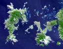
This image, acquired by NASA's Terra spacecraft, is of the Aaland archipelago at the mouth of the Gulf of Bothnia which belongs to Finland, though it enjoys autonomy from Helsinki and locals speak Swedish.
PIA14088:
Aaland Archipelago, Finland
Full Resolution:     TIFF (40.88 MB)     JPEG (2.018 MB)
Add Image to Favorite List 2011-05-04 Earth Terra
ASTER
747x1140x3
This image, acquired by NASA's Terra spacecraft on May 1, 2011, shows more than 314,000 acres burned in west Texas. The 2011 fire season in Texas is of historic proportions.
PIA14136:
ASTER Images Record Texas Wildfire
Full Resolution:     TIFF (2.558 MB)     JPEG (188.2 kB)
Add Image to Favorite List 2011-05-04 Earth Terra
ASTER
645x1077x3
NASA's Terra spacecraft acquired this image on April 30, 2011, showing flooding along the Mississippi River at its junction with the Des Moines River near Keokuk, Iowa.
PIA14137:
ASTER Images Midwest Flooding
Full Resolution:     TIFF (2.086 MB)     JPEG (182.1 kB)
Add Image to Favorite List 2011-05-06 Earth Terra
ASTER
2433x4120x3
From April 25-28, 2011, one of the largest outbreaks of tornadoes ever recorded ripped across the Southern, Midwestern and Eastern United States. NASA's Terra spacecraft shows the scar the tornado left across Birmingham, Alabama.
PIA14143:
ASTER Images Aftermath of U.S. Tornado Outbreak
Full Resolution:     TIFF (30.11 MB)     JPEG (2.444 MB)
Add Image to Favorite List 2011-05-10 Earth Terra
ASTER
2037x1270x3
Surrounding the town of El Ejido, Almeria Province, southern Spain is a sea of greenhouses, stretching for tens of kilometers as shown in this image from NASA's Terra spacecraft.
PIA14146:
Almeria, Spain
Full Resolution:     TIFF (7.771 MB)     JPEG (539.6 kB)
Add Image to Favorite List 2011-05-10 Earth Terra
ASTER
3311x4200x3
NASA's Terra spacecraft shows the resultant flooding of farmland west of the Mississippi 20 miles south of the Mississippi River levee breach. U.S. Army Corps of Engineers detonated explosives at the Birds Point levee near Wyatt, Missouri, on May 2, 2011.
PIA14147:
ASTER Images Flooding from Mississippi River Levee Breach
Full Resolution:     TIFF (41.72 MB)     JPEG (1.362 MB)
Add Image to Favorite List 2011-05-16 Earth Terra
ASTER
709x800x3
At the time NASA's Terra spacecraft acquired this image, the Mississippi River had reached a level of 53 feet (16.2 meters), 3 feet (1 meter) above the major flood stage. Flood water had already inundated parts of Vicksburg, Mississippi.
PIA14151:
NASA Spacecraft Eyes Mississippi Flooding
Full Resolution:     TIFF (1.704 MB)     JPEG (149 kB)
Add Image to Favorite List 2011-05-19 Earth Terra
ASTER
1728x2512x3
NASA's Terra spacecraft shows the water flow after the U.S. Army Corps of Engineers opened the Morganza Spillway, a flood control structure along the western bank of the Mississippi River in Louisiana, to ease flooding along levee systems on May 14, 2011.
PIA14155:
NASA Images Mississippi River Flooding in Louisiana
Full Resolution:     TIFF (13.04 MB)     JPEG (836.2 kB)
Retrieve Previous Set  Jump to a Previous Set   Jump to a Previous Set   Jump to a Previous Set   Jump to a Previous Set   Jump to a Previous Set   Jump to a Previous Set   Current Set   Jump to a Following Set   Jump to a Following Set   Jump to a Following Set   Retrieve Next Set 
 1-100   101-200   201-300   301-400   401-500   501-600   601-700   701-800   801-900   901-1000 
Currently displaying images: 601 - 700 of 2588