Click on an image for detailed information
Click on a column heading to sort in ascending or descending order

My
List |
Addition Date
|
Target
|
Mission
|
Instrument
|
Size
|

|
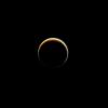
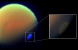
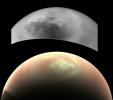
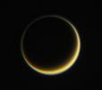
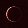
2013-12-23 |
Titan
|
Cassini-Huygens
|
ISS - Narrow Angle
|
890x890x3 |
|
-
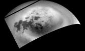
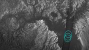
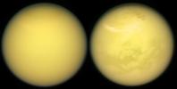
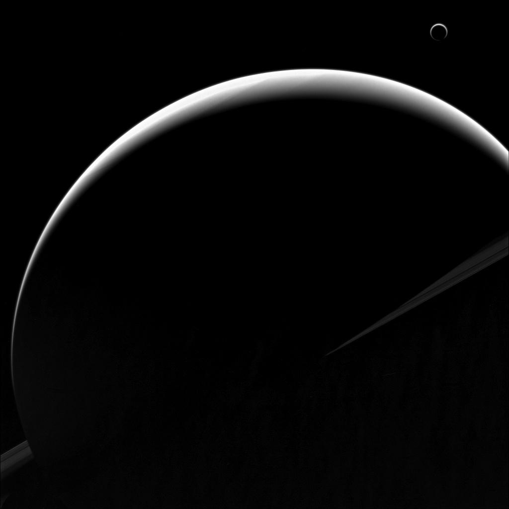
PIA17180:
-
The Halo
Full Resolution:
TIFF
(2.377 MB)
JPEG
(16 kB)
|
|
|
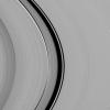
2013-12-23 |
S Rings
|
Cassini-Huygens
|
ISS - Narrow Angle
|
980x980x1 |
|
-
PIA17173:
-
The Synchronicity of Rhythms
Full Resolution:
TIFF
(961.6 kB)
JPEG
(96.34 kB)
|
|
|
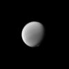
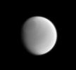
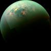
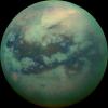
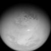
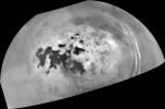
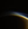
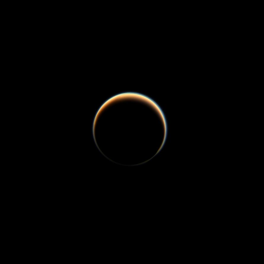
2014-01-13 |
Titan
|
Cassini-Huygens
|
ISS - Narrow Angle
|
987x987x1 |
|
-
PIA17151:
-
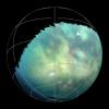
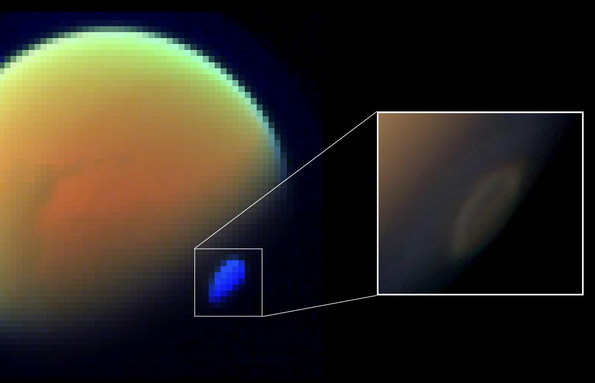
Titan's Polar Atmosphere
Full Resolution:
TIFF
(975.4 kB)
JPEG
(16.6 kB)
|
|
|
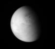
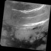
2014-04-07 |
Titan
|
Cassini-Huygens
|
ISS - Wide Angle
|
773x682x1 |
|
-
PIA17159:
-
Looking Down on Lakes
Full Resolution:
TIFF
(528 kB)
JPEG
(16.58 kB)
|
|
|
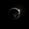
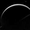
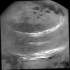
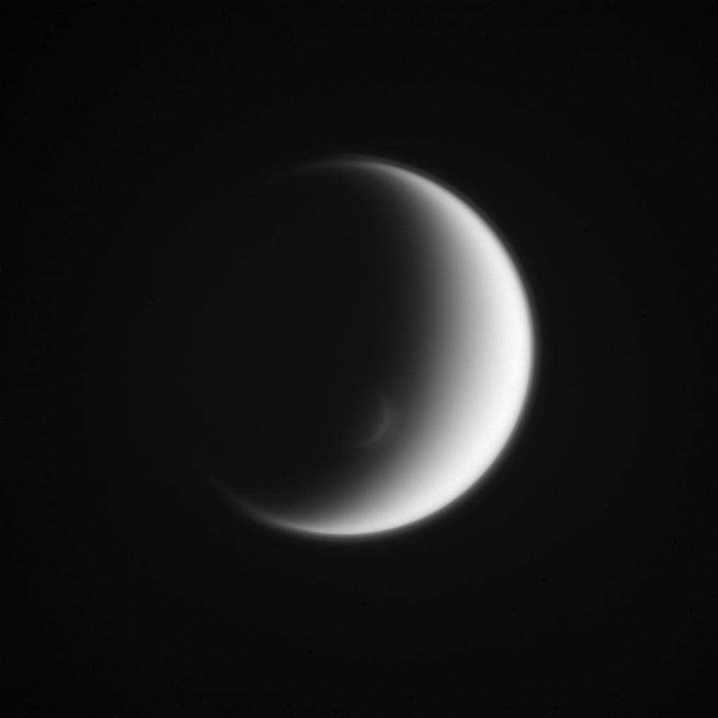
2014-05-05 |
Titan
|
Cassini-Huygens
|
ISS - Wide Angle
|
1020x1020x1 |

|
-
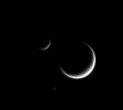
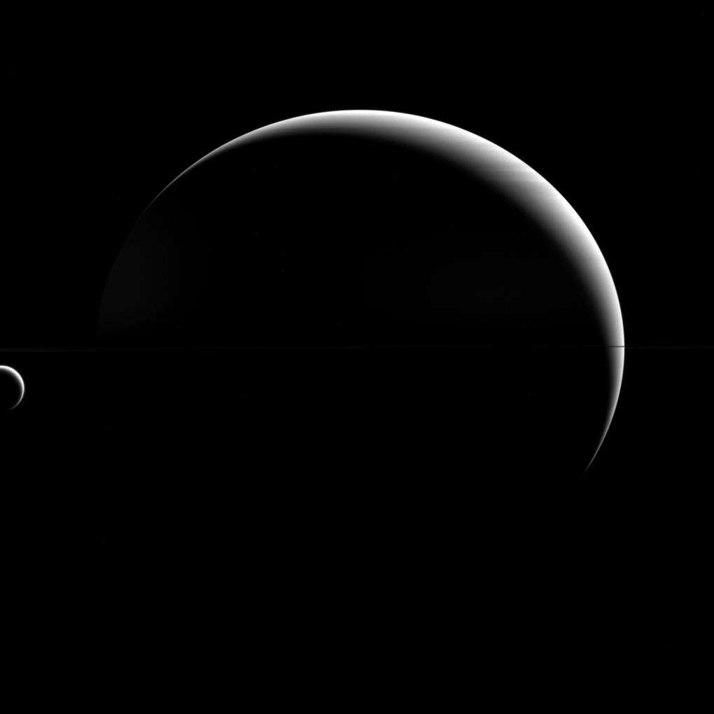
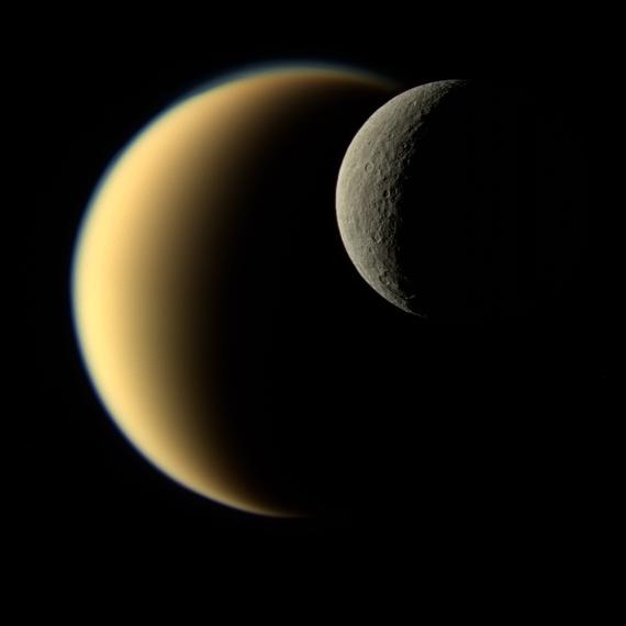
PIA17163:
-
Titan's Crescents
Full Resolution:
TIFF
(1.042 MB)
JPEG
(21.13 kB)
|
|
|
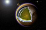
2014-03-15 |
Titan
|
Cassini-Huygens
|
|
2780x1836x3 |
|
-
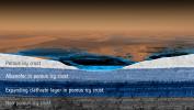
PIA14445:
-
Layers of Titan (Artist's Concept)
Full Resolution:
TIFF
(15.32 MB)
JPEG
(343 kB)
|
|
|
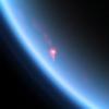
2014-05-27 |
Titan
|
Cassini-Huygens
|
Visual and Infrared Mapping Spectrometer
|
4600x4600x3 |
|
-
PIA18410:
-
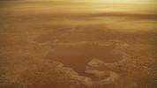
Cassini Observes Sunsets on Titan (Artist's Rendering)
Full Resolution:
TIFF
(63.52 MB)
JPEG
(428.5 kB)
|
|
|
2014-06-02 |
Titan
|
Cassini-Huygens
|
ISS - Wide Angle
|
788x729x1 |
|
-
PIA17169:
-
High Vortex
Full Resolution:
TIFF
(575.3 kB)
JPEG
(11.53 kB)
|
|
|
2014-06-23 |
Titan
|
Cassini-Huygens
|
ISS - Narrow Angle
|
768x711x1 |
|
-
PIA17168:
-
Subtle Titan
Full Resolution:
TIFF
(546.8 kB)
JPEG
(11.52 kB)
|
|
|
2014-08-12 |
Titan
|
Cassini-Huygens
|
Imaging Science Subsystem
|
727x727x1 |
|
-
PIA18420:
-
Clouds Over Ligeia Mare on Titan

Full Resolution:
TIFF
(529.3 kB)
JPEG
(63.24 kB)
|
|
|
2014-08-12 |
Titan
|
Cassini-Huygens
|
Imaging Science Subsystem
|
1307x784x1 |
|
-
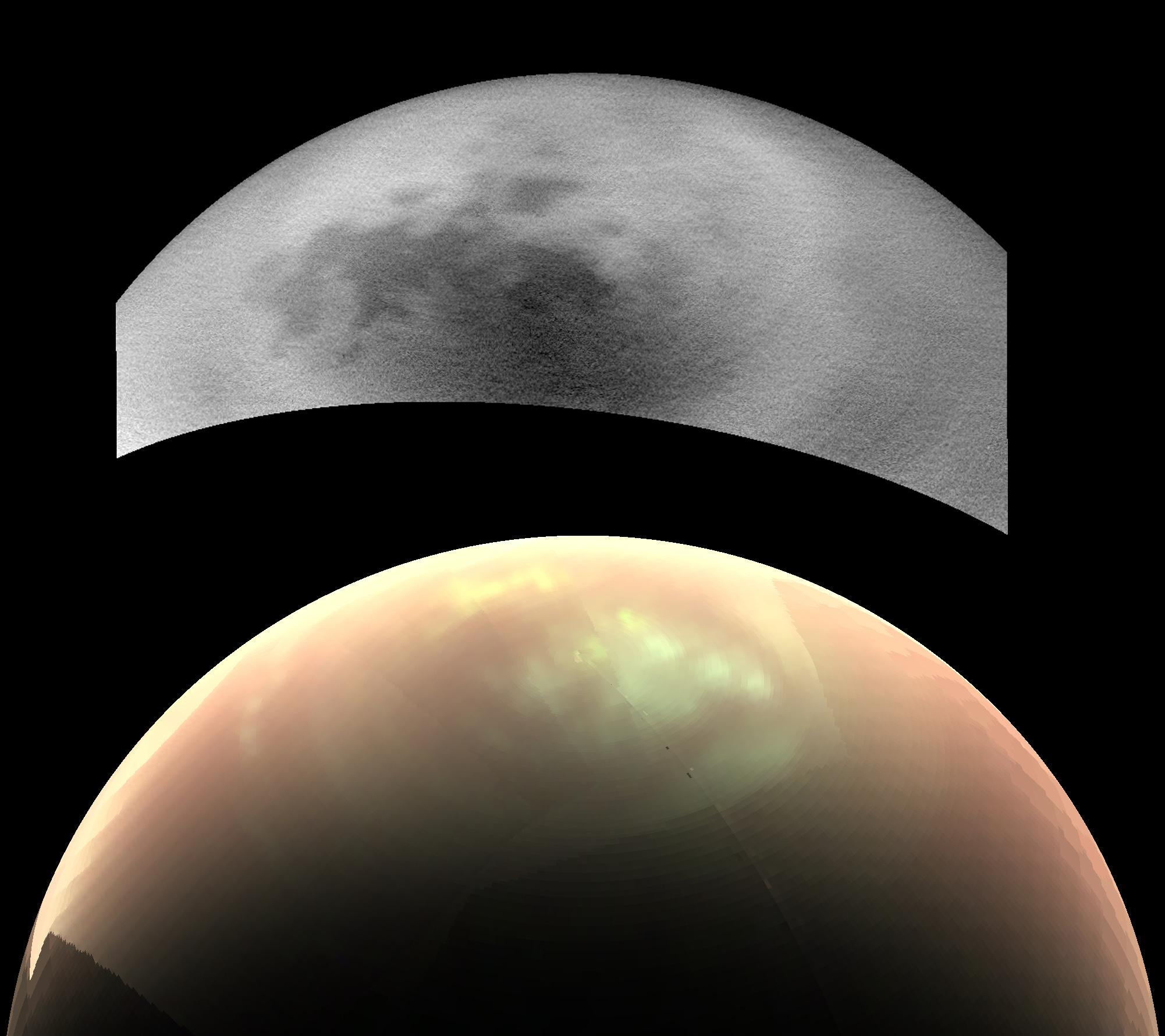
PIA18421:
-
Northern Clouds Return to Titan
Full Resolution:
TIFF
(1.026 MB)
JPEG
(115.6 kB)
|
|
|
2014-09-03 |
Titan
|
Cassini-Huygens
|
|
1800x1019x3 |
|
-
PIA18417:
-
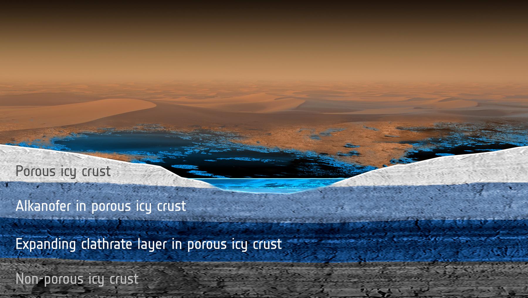
Titan's Subsurface Reservoirs (Artist's Concept)
Full Resolution:
TIFF
(5.505 MB)
JPEG
(230.1 kB)
|
|
|
2014-09-29 |
Titan
|
Cassini-Huygens
|
Radar Mapper
|
2000x658x1 |
|
-
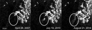
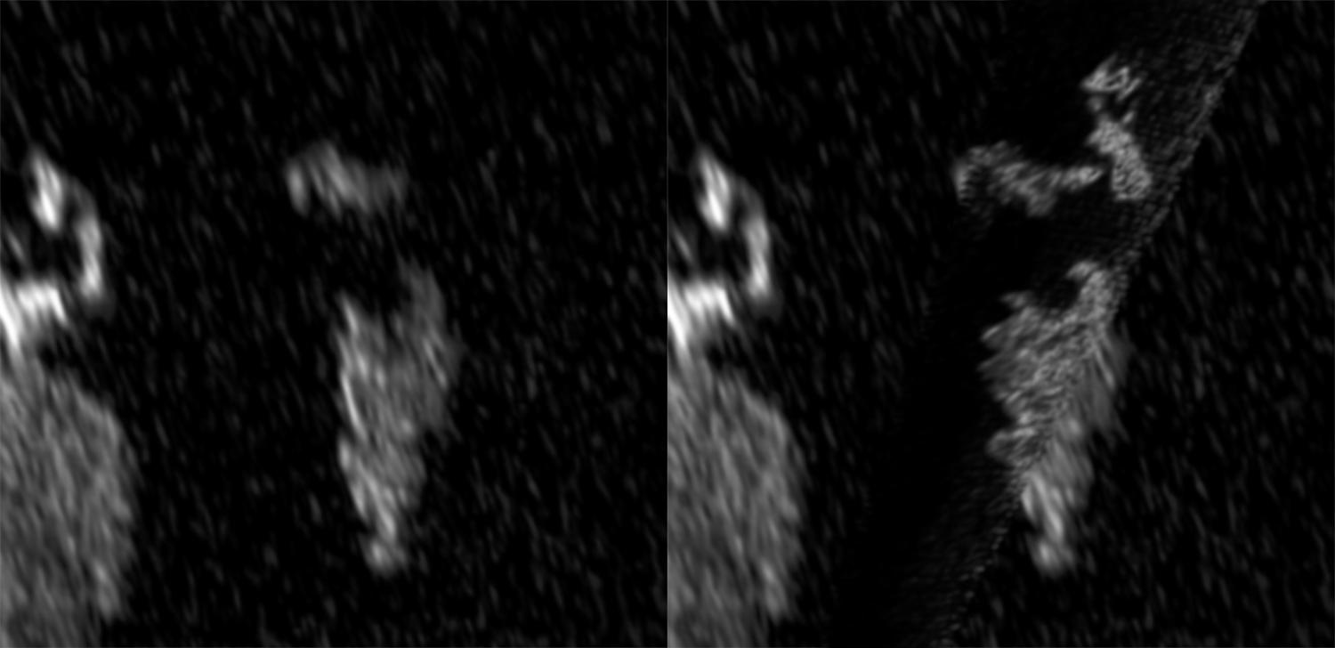
PIA18430:
-
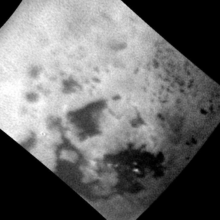
Mysterious Changing Feature in Ligeia Mare
Full Resolution:
TIFF
(1.318 MB)
JPEG
(124.8 kB)
|
|
|
2014-10-01 |
Titan
|
Cassini-Huygens
|
ISS - Wide Angle
Visual and Infrared Mapping Spectrometer
|
1203x774x3 |
|
-
PIA18431:
-
Spectral Map of Titan with Polar Vortex
Full Resolution:
TIFF
(2.795 MB)
JPEG
(41.83 kB)
|
|
|
2014-10-30 |
Titan
|
Cassini-Huygens
|
Visual and Infrared Mapping Spectrometer
|
2002x2002x3 |
|
-
PIA18432:
-
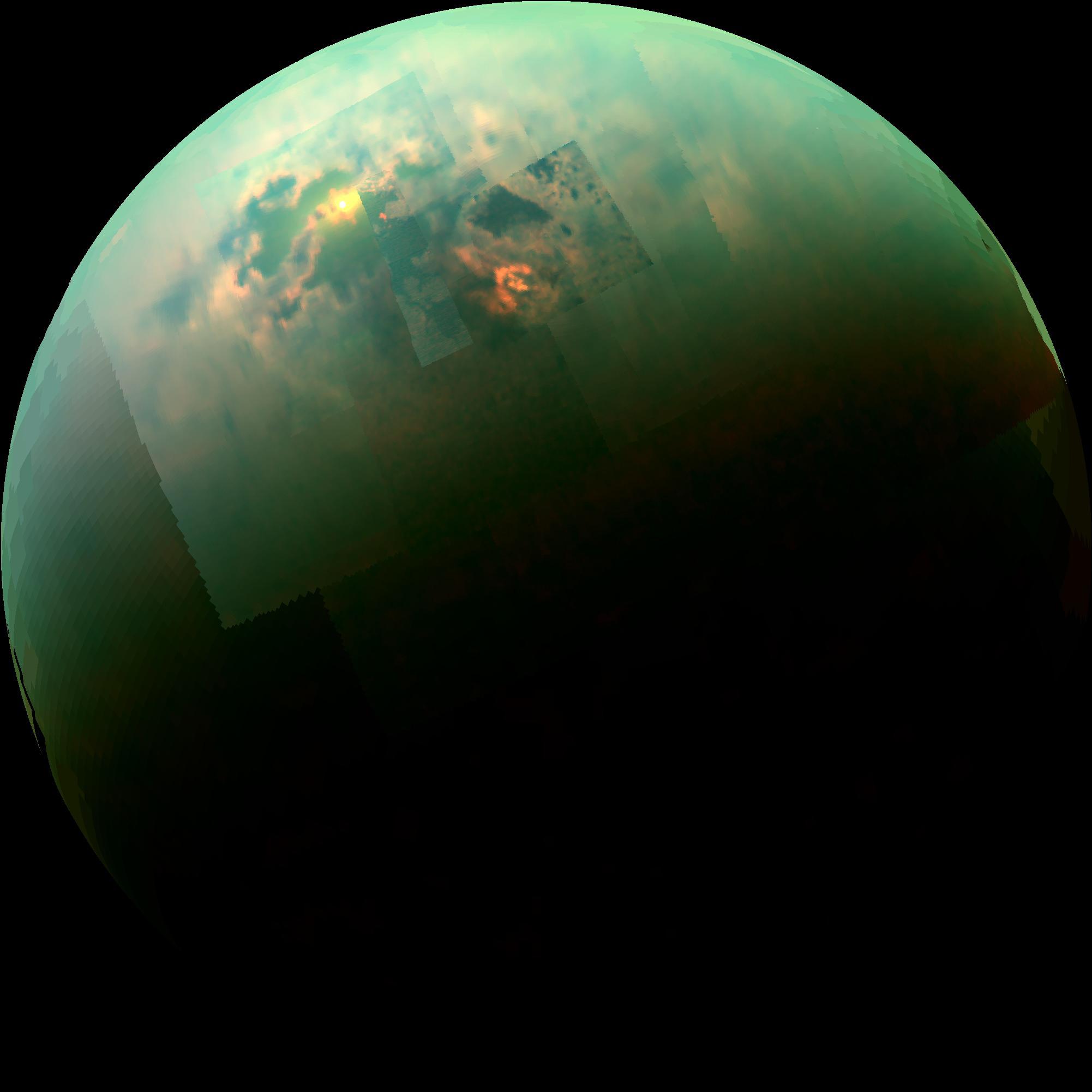
Specular Spectacular
Full Resolution:
TIFF
(12.03 MB)
JPEG
(127.3 kB)
|
|
|
2014-10-30 |
Titan
|
Cassini-Huygens
|
Visual and Infrared Mapping Spectrometer
|
640x640x3 |
|
-
PIA18433:
-
Sunglint on a Hydrocarbon Lake
Full Resolution:
TIFF
(1.229 MB)
JPEG
(17.58 kB)
|
|
|
2014-11-03 |
Titan
|
Cassini-Huygens
|
ISS - Wide Angle
|
1024x1024x1 |
|
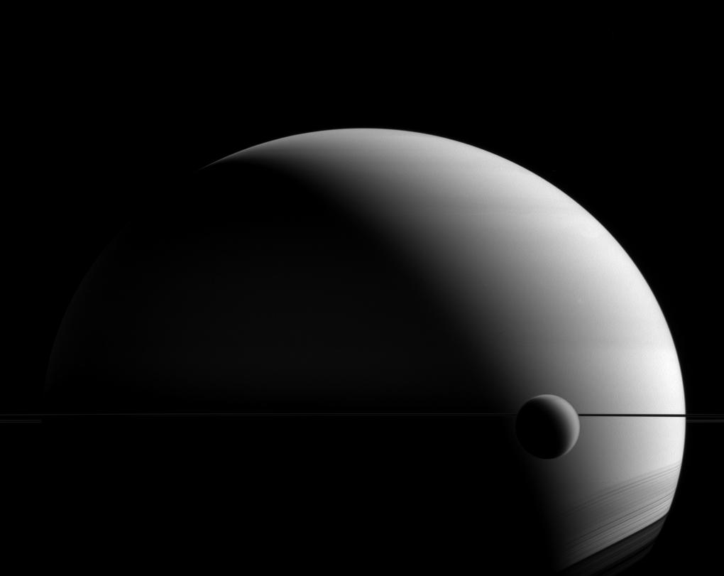
-
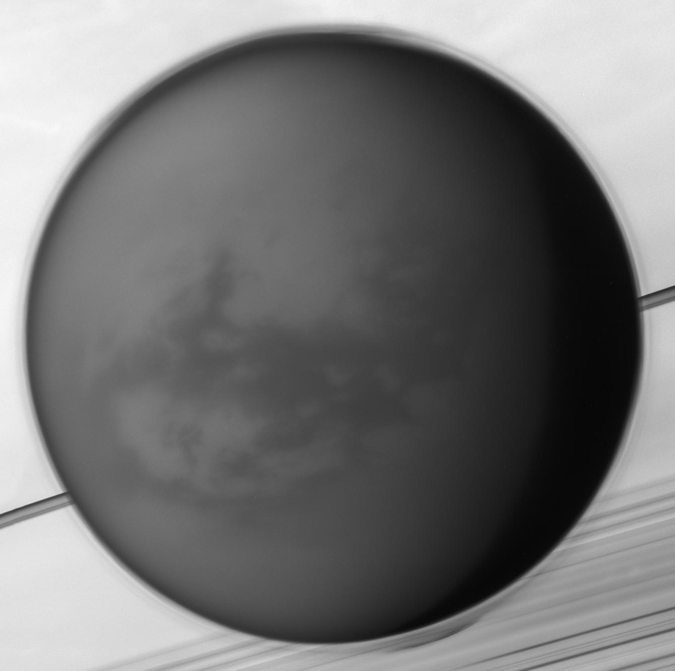
PIA18291:
-
Mimicking the Moon
Full Resolution:
TIFF
(1.05 MB)
JPEG
(28.14 kB)
|
|
|
2014-11-10 |
Titan
|
Cassini-Huygens
|
Radar Mapper
|
1600x900x3 |
|
-
PIA19046:
-
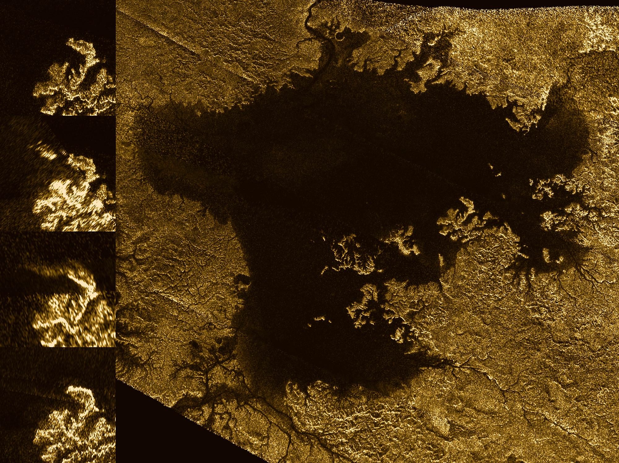
Plumbing Coastal Depths in Titan's Kraken Mare
Full Resolution:
TIFF
(4.322 MB)
JPEG
(276.3 kB)
|
|
|
2014-11-10 |
Titan
|
Cassini-Huygens
|
Radar Mapper
|
1500x728x1 |

|
-
PIA19047:
-
Bright Feature Appears in Titan's Kraken Mare
Full Resolution:
TIFF
(1.093 MB)
JPEG
(64.03 kB)
|
|
|
2015-01-28 |
Titan
|
Cassini-Huygens
|
|
2240x1520x3 |
|
-
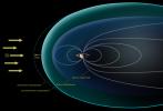
PIA19055:
-
Titan Observed Naked in the Solar Wind
Full Resolution:
TIFF
(10.22 MB)
JPEG
(154.6 kB)
|
|
|
2015-02-12 |
Titan
|
Cassini-Huygens
|
Radar Mapper
|
2980x1285x1 |

|
-
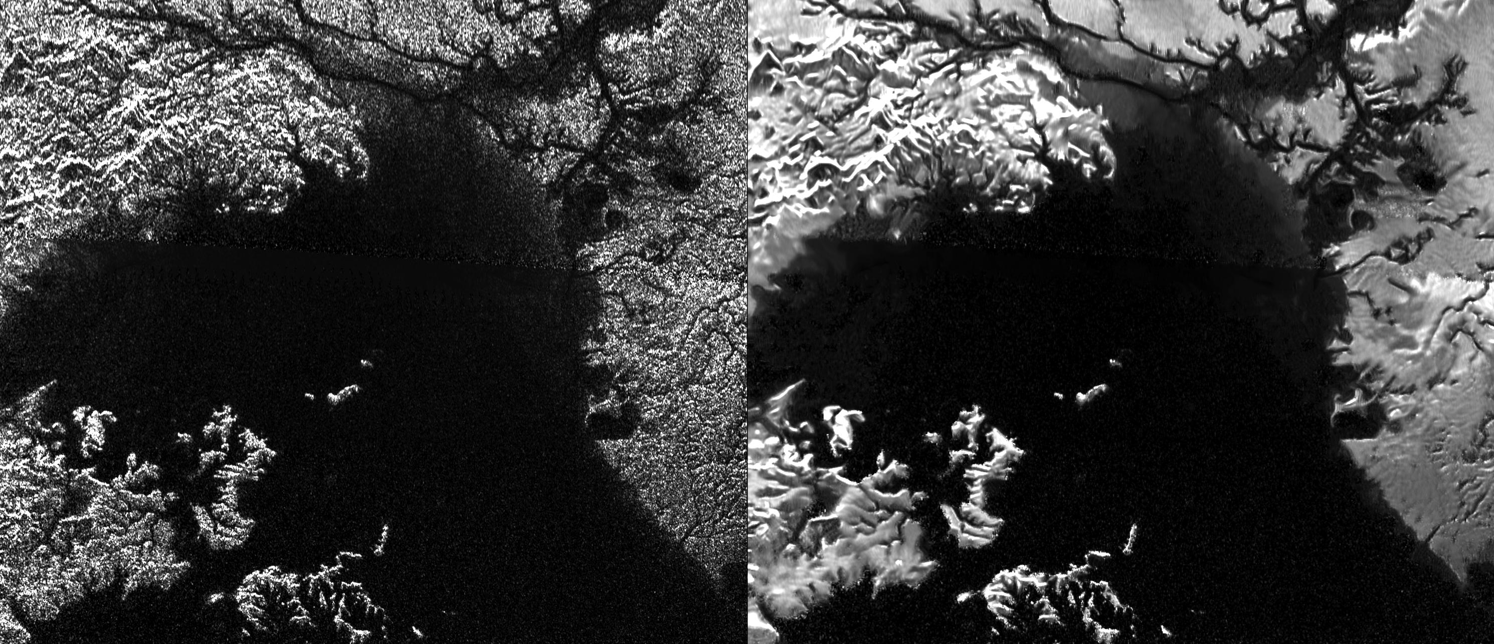
PIA19052:
-
Despeckling Ligea Mare
Full Resolution:
TIFF
(3.835 MB)
JPEG
(694.9 kB)
|
|
|
2015-02-12 |
Titan
|
Cassini-Huygens
|
Radar Mapper
|
1286x642x1 |
|
-
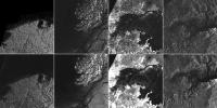
PIA19053:
-
Titan Despeckled Montage
Full Resolution:
TIFF
(826.7 kB)
JPEG
(166.4 kB)
|
|
|
2015-02-12 |
Titan
|
Cassini-Huygens
|
Radar Mapper
|
1407x843x1 |
|
-
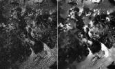
PIA19054:
-
Leilah Fluctus Despeckled
Full Resolution:
TIFF
(1.188 MB)
JPEG
(320.9 kB)
|
|
|
2015-03-02 |
Titan
|
Cassini-Huygens
|
ISS - Narrow Angle
|
881x761x1 |

|
-
PIA18309:
-
Frozen Paradise
Full Resolution:
TIFF
(671.3 kB)
JPEG
(17.53 kB)
|
|
|
2016-07-29 |
Titan
|
Cassini-Huygens
|
Radar Mapper
|
460x618x1 |

|
-
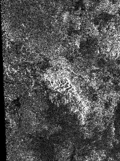
PIA20709:
-
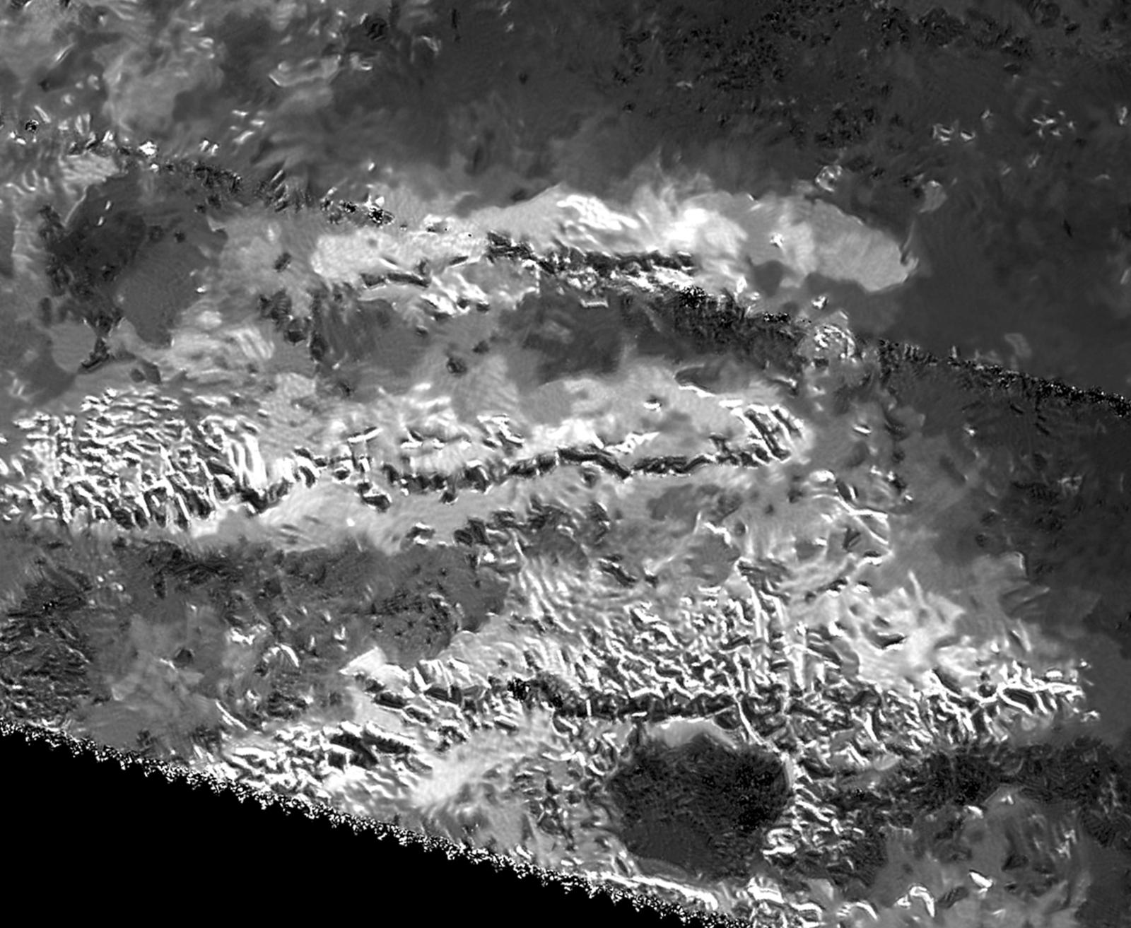
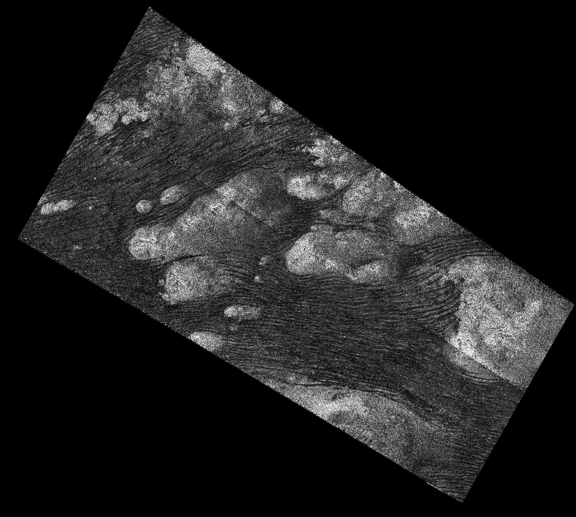
Ridge of Jagged Peaks on Titan
Full Resolution:
TIFF
(284.8 kB)
JPEG
(114.3 kB)
|
|
|
2016-07-29 |
Titan
|
Cassini-Huygens
|
Radar Mapper
|
811x716x1 |
|
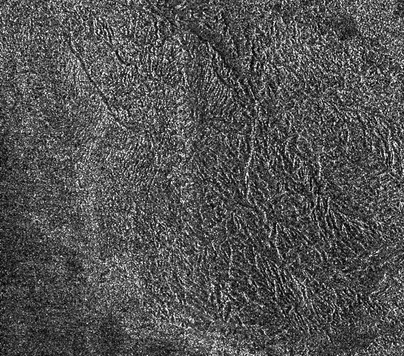
-
PIA20708:
-
A Titanic Labyrinth
Full Resolution:
TIFF
(581.5 kB)
JPEG
(270.5 kB)
|
|
|
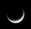
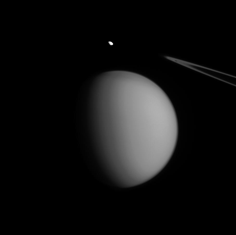
2015-06-22 |
Titan
|
Cassini-Huygens
|
ISS - Narrow Angle
|
744x663x1 |
|
-
PIA18322:
-
Triple Crescents
Full Resolution:
TIFF
(494 kB)
JPEG
(8.66 kB)
|
|
|
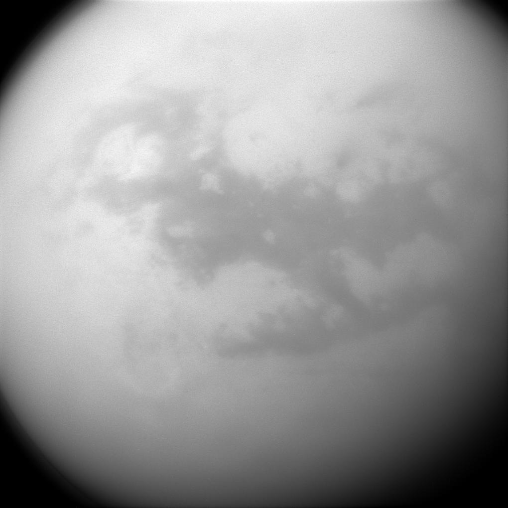
2015-07-13 |
Titan
|
Cassini-Huygens
|
ISS - Wide Angle
|
1020x1020x1 |

|
-
PIA18326:
-
Not So Titanic
Full Resolution:
TIFF
(1.042 MB)
JPEG
(18.97 kB)
|
|
|
2015-09-28 |
Titan
|
Cassini-Huygens
|
ISS - Wide Angle
|
1020x811x1 |

|
-
PIA18335:
-
Veiled Worlds
Full Resolution:
TIFF
(303.4 kB)
JPEG
(20.84 kB)
|
|
|
2015-10-05 |
Titan
|
Cassini-Huygens
|
ISS - Narrow Angle
|
981x978x1 |

|
-
PIA18338:
-
Titan's Accent Mark
Full Resolution:
TIFF
(256 kB)
JPEG
(17.52 kB)
|
|
|
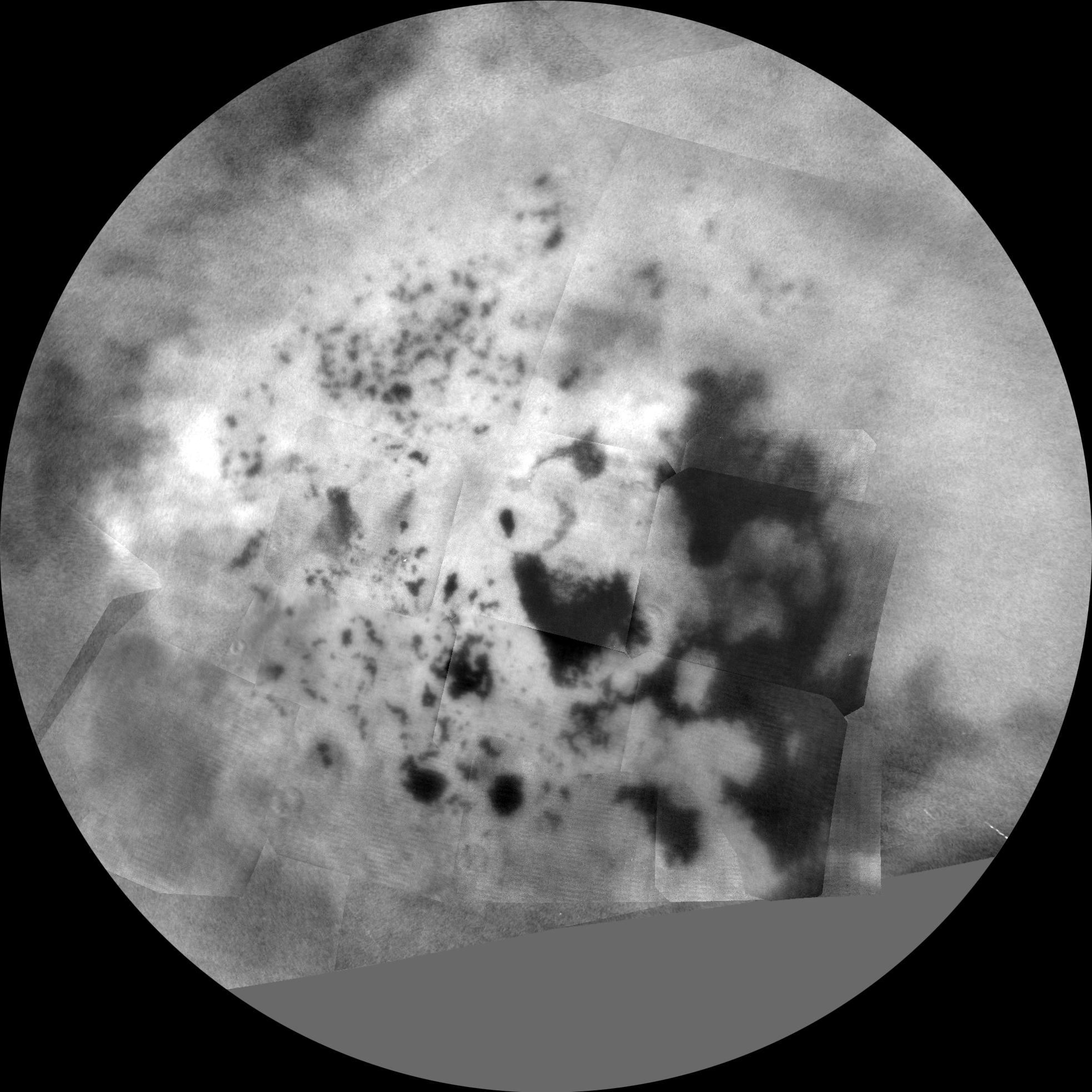
2015-10-09 |
Titan
|
Cassini-Huygens
|
Imaging Science Subsystem
|
1966x1966x1 |
|
-
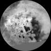
PIA19657:
-
Titan Polar Maps - 2015
Full Resolution:
TIFF
(2.92 MB)
JPEG
(370.3 kB)
|
|
|
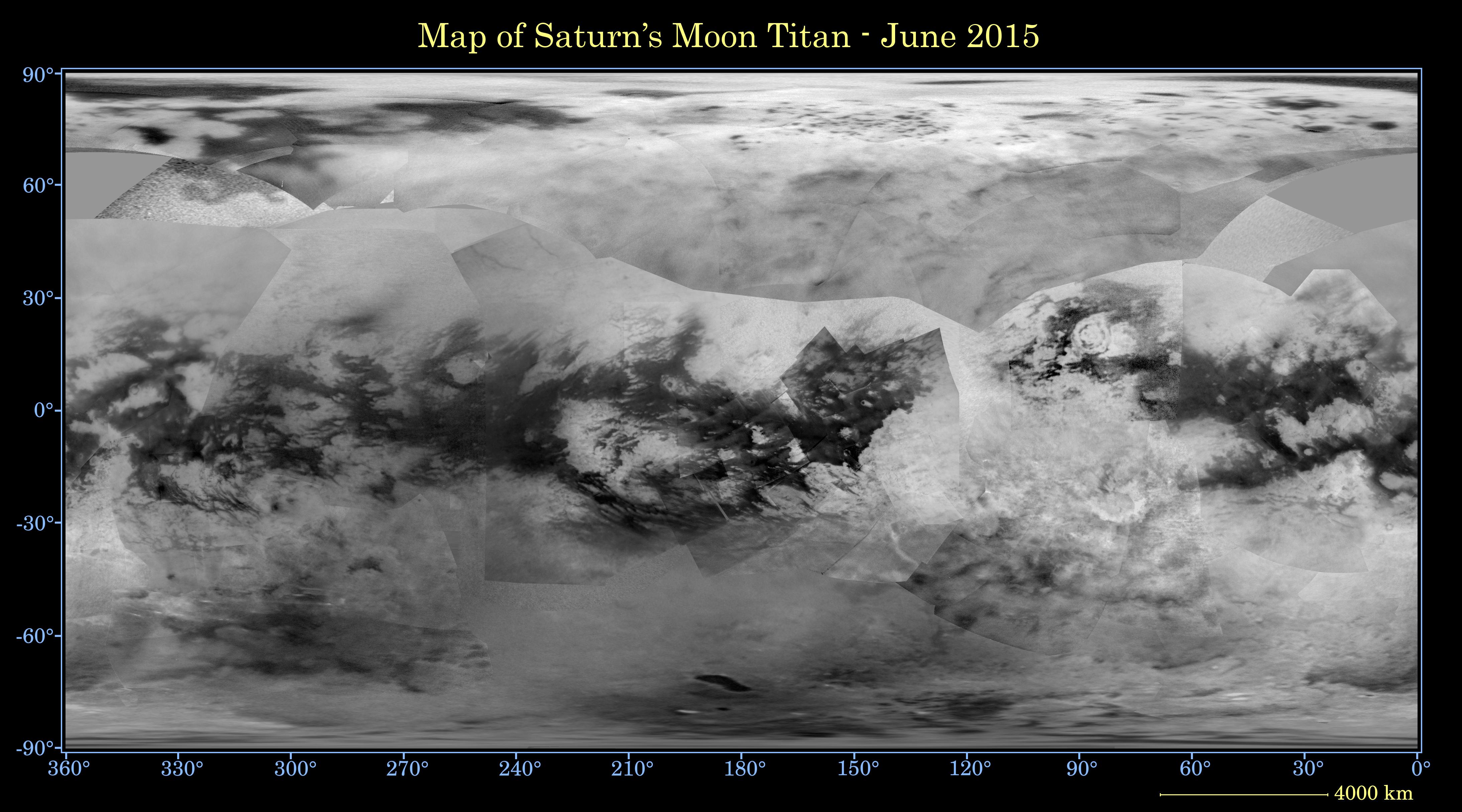
2015-10-09 |
Titan
|
Cassini-Huygens
|
Imaging Science Subsystem
|
4374x2430x3 |
|
-
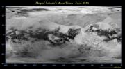
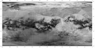
PIA19658:
-
Titan Global Map - June 2015
Full Resolution:
TIFF
(11.77 MB)
JPEG
(1.004 MB)
|
|
|
2015-11-02 |
Titan
|
Cassini-Huygens
|
ISS - Narrow Angle
|
1020x1020x1 |

|
-
PIA18341:
-
Dunelands of Titan
Full Resolution:
TIFF
(998.6 kB)
JPEG
(66.2 kB)
|
|
|
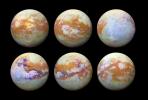
2015-12-04 |
Titan
|
Cassini-Huygens
|
Visual and Infrared Mapping Spectrometer
|
2002x2002x3 |
|
-
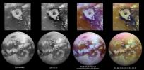
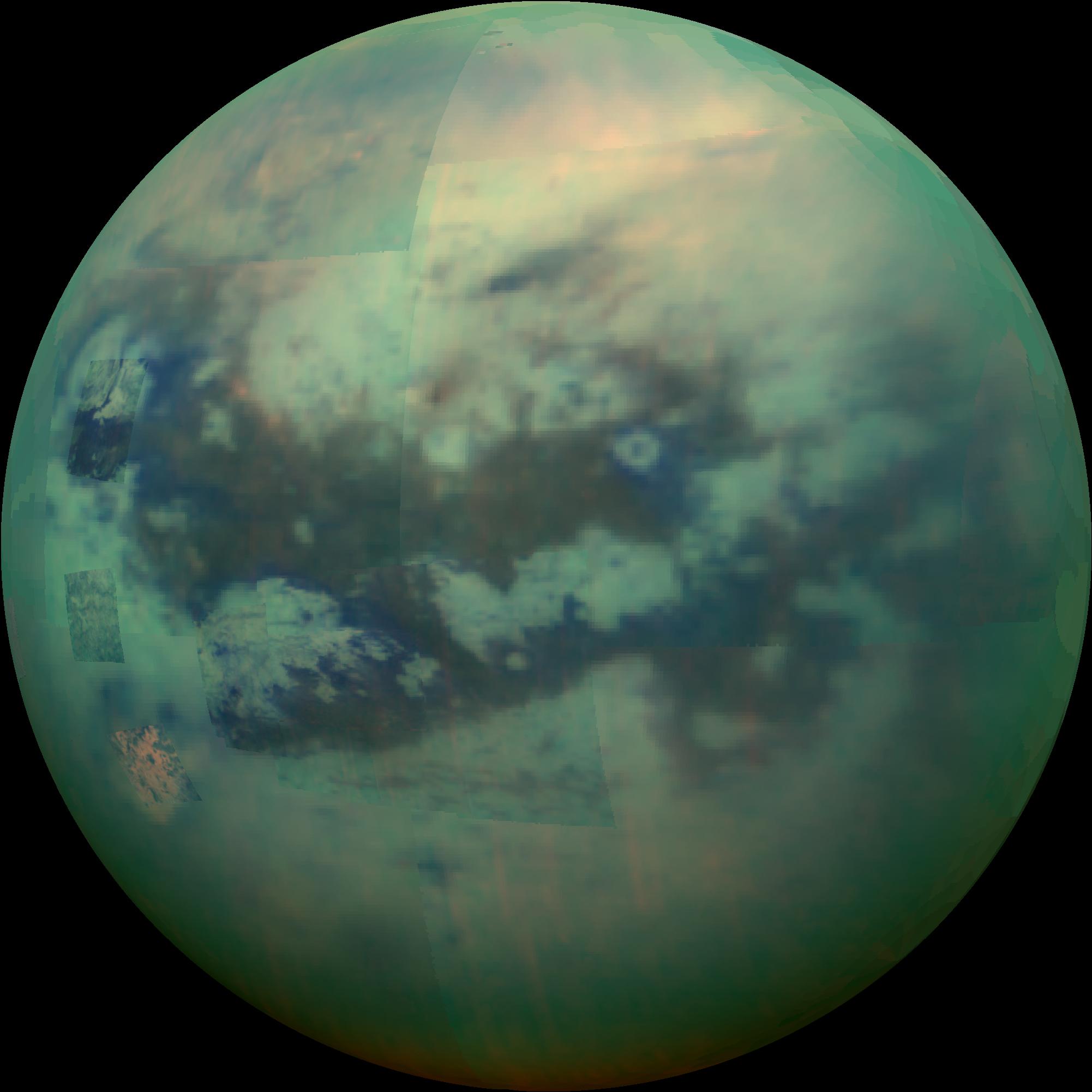
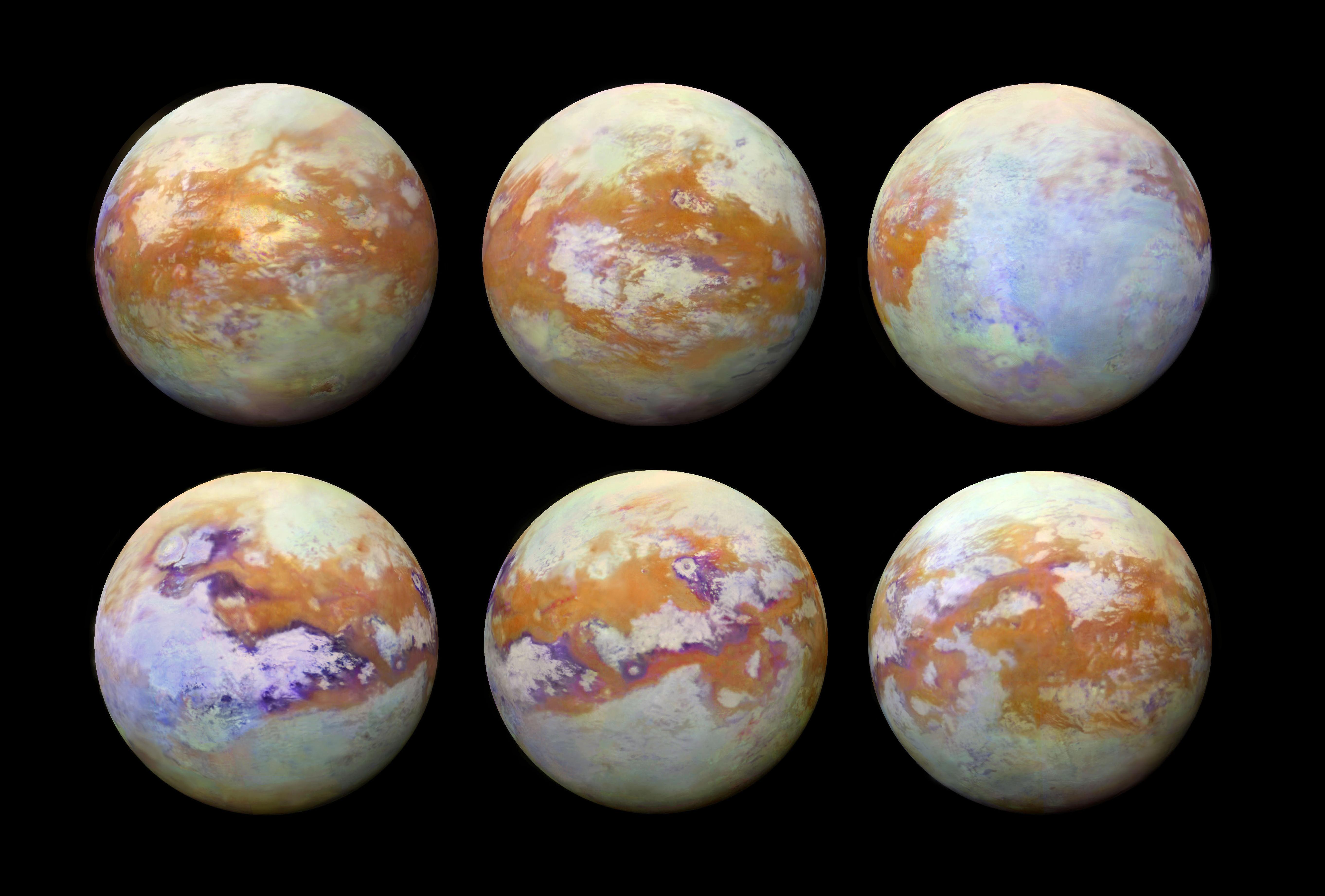
PIA20016:
-
Peering Through Titan's Haze
Full Resolution:
TIFF
(6.69 MB)
JPEG
(160.3 kB)
|
|
|
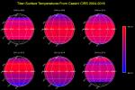
2016-02-18 |
Titan
|
Cassini-Huygens
|
Composite Infrared Spectrometer
|
1216x810x3 |
|
-
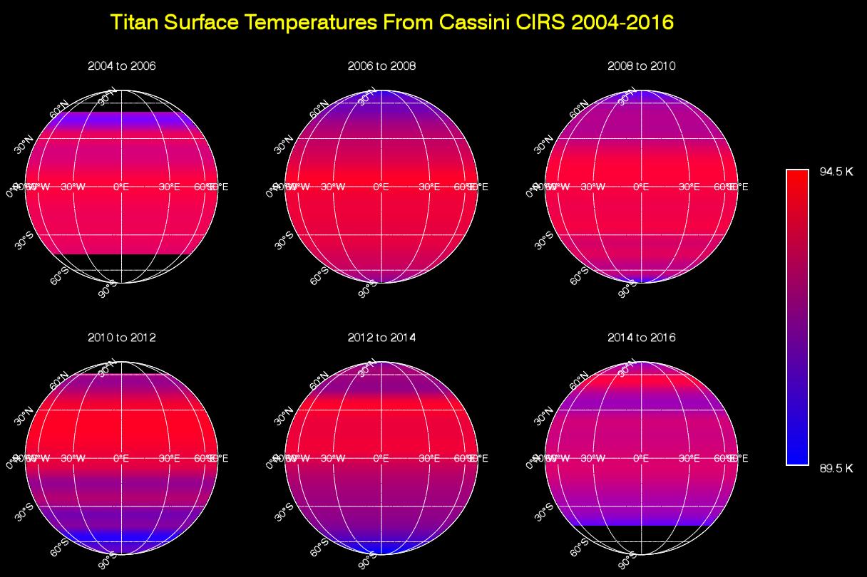
PIA20020:
-
Titan Temperature Lag Maps & Animation
Full Resolution:
TIFF
(346.1 kB)
JPEG
(124.2 kB)
|
|
|
2016-03-02 |
Titan
|
Cassini-Huygens
|
Radar Mapper
|
2000x1496x3 |
|
-
PIA20021:
-
Mystery Feature Evolves in Titan's Ligeia Mare
Full Resolution:
TIFF
(7.761 MB)
JPEG
(753.8 kB)
|
|
|
2016-03-24 |
Titan
|
Cassini-Huygens
|
Radar Mapper
|
1600x1313x1 |

|
-
PIA20023:
-
Radar View of Titan's Tallest Mountains
Full Resolution:
TIFF
(2.032 MB)
JPEG
(264.3 kB)
|
|
|
2016-03-24 |
Titan
|
Cassini-Huygens
|
Radar Mapper
Visual and Infrared Mapping Spectrometer
|
4043x2021x3 |
|
-
PIA20024:
-
Mountains of Titan Map - 2016 Update
Full Resolution:
TIFF
(17.24 MB)
JPEG
(1.082 MB)
|
|
|
2016-03-24 |
Titan
|
Cassini-Huygens
|
Visual and Infrared Mapping Spectrometer
|
5675x2780x3 |
|
-
PIA20022:
-
Working Toward 'Seamless' Infrared Maps of Titan
Full Resolution:
TIFF
(23.51 MB)
JPEG
(1.041 MB)
|
|
|
2016-04-26 |
Titan
|
Cassini-Huygens
|
|
3508x2480x3 |

|
-
PIA20026:
-
Organic Compounds in Titan's Seas and Lakes
Full Resolution:
TIFF
(2.079 MB)
JPEG
(255.9 kB)
|
|
|
2016-06-06 |
Titan
|
Cassini-Huygens
|
ISS - Wide Angle
|
1020x863x1 |
|
-
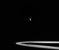
PIA20484:
-
Rings Interrupted
Full Resolution:
TIFF
(331.6 kB)
JPEG
(20.09 kB)
|
|
|
2016-08-29 |
Titan
|
Cassini-Huygens
|
Imaging Science Subsystem
|
8546x4442x3 |
|
-
PIA20713:
-
Map of Titan with Labeled Features
Full Resolution:
TIFF
(34.2 MB)
JPEG
(3.187 MB)
|
|
|
2016-09-07 |
Titan
|
Cassini-Huygens
|
Radar Mapper
|
1896x1701x1 |

|
-
PIA20710:
-
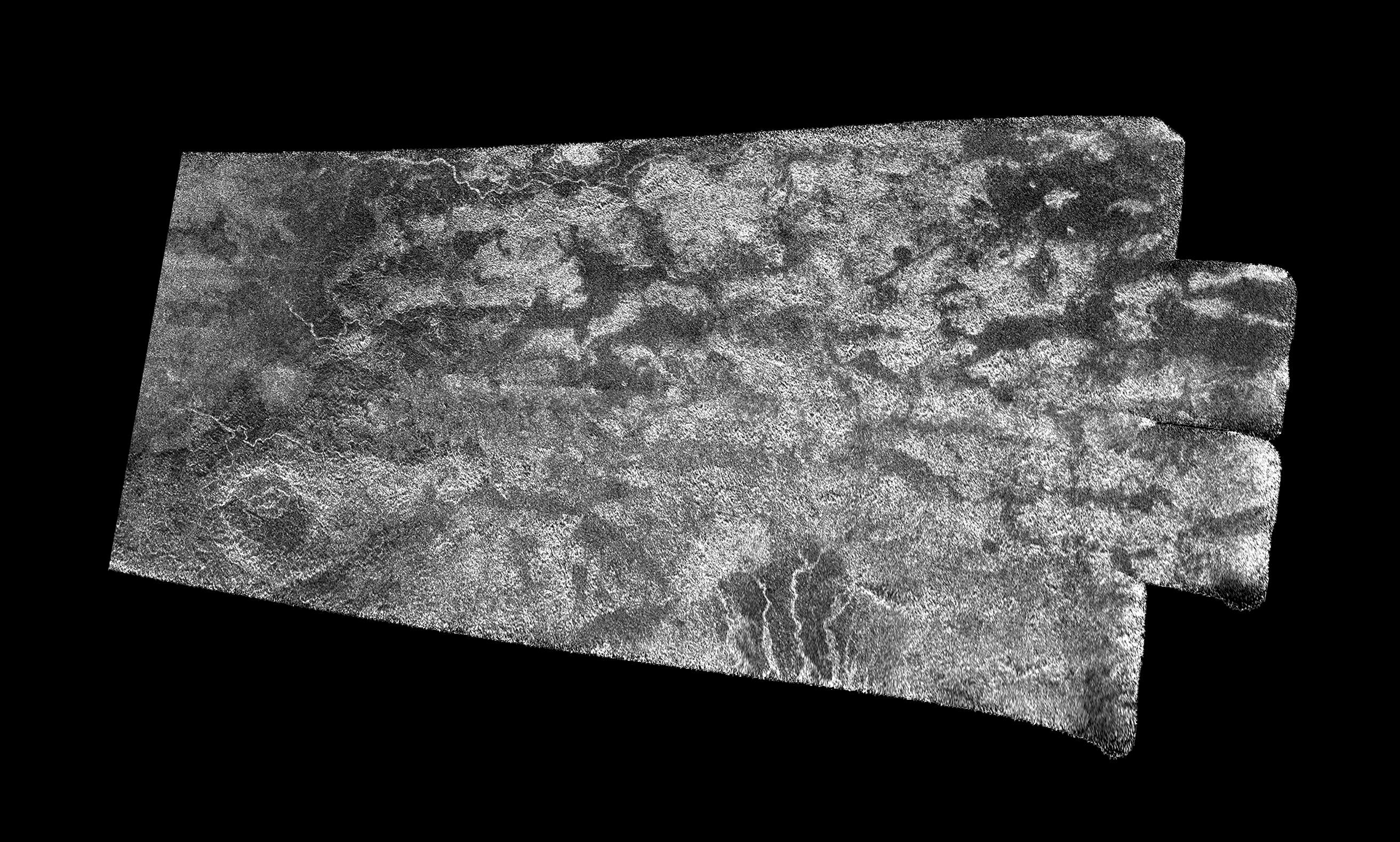
Flowing Dunes of Shangri-La
Full Resolution:
TIFF
(1.775 MB)
JPEG
(534 kB)
|
|
|
2016-09-07 |
Titan
|
Cassini-Huygens
|
Radar Mapper
|
1920x2048x1 |

|
-
PIA20711:
-
Flowing Dunes of Shangri-La (Denoised)
Full Resolution:
TIFF
(1.628 MB)
JPEG
(338.2 kB)
|
|
|
2016-09-07 |
Titan
|
Cassini-Huygens
|
Radar Mapper
|
2625x1580x1 |

|
-
PIA20712:
-
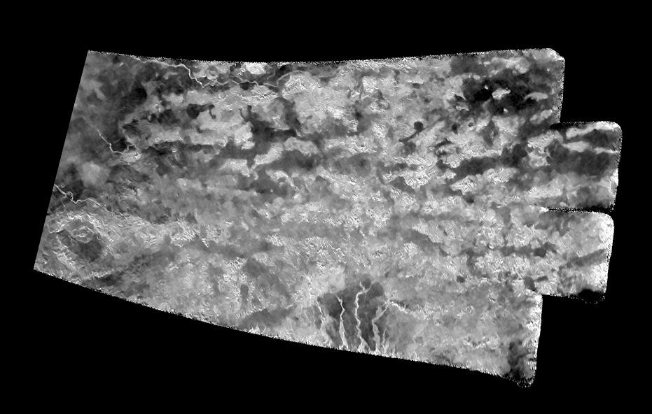
The 'Xanadu Annex' on Titan
Full Resolution:
TIFF
(2.684 MB)
JPEG
(800.5 kB)
|
|
|
2016-09-07 |
Titan
|
Cassini-Huygens
|
Radar Mapper
|
931x592x1 |

|
-
PIA20714:
-
The 'Xanadu Annex' on Titan (Denoised)
Full Resolution:
TIFF
(318.7 kB)
JPEG
(75.71 kB)
|
|
|
2016-09-20 |
Titan
|
Cassini-Huygens
|
|
2548x1650x3 |
|
-
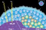
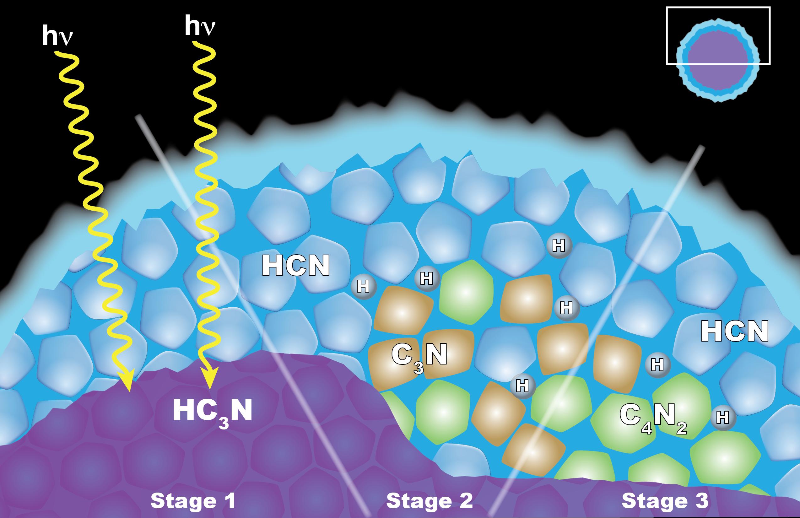
PIA20715:
-
"Solid State" Chemistry in Titan Ice Particles
Full Resolution:
TIFF
(5.136 MB)
JPEG
(269.2 kB)
|
|
|
2016-11-04 |
Titan
|
Cassini-Huygens
|
ISS - Narrow Angle
|
980x980x1 |
|
-
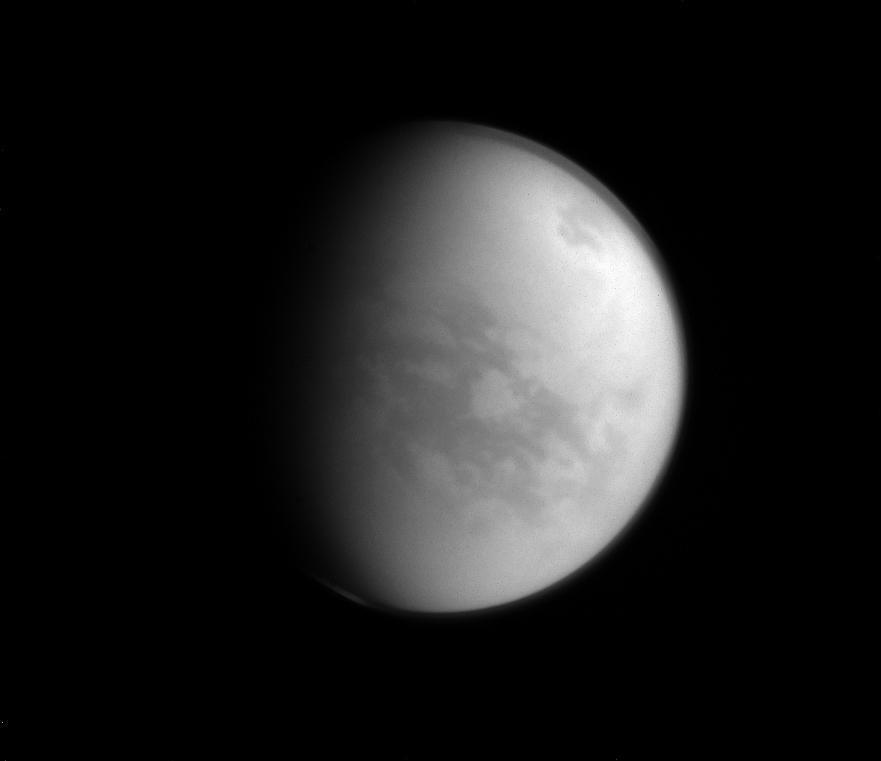
PIA21051:
-
Watching Summer Clouds on Titan
Full Resolution:
TIFF
(753.4 kB)
JPEG
(113.1 kB)
|
|
|
2016-12-21 |
Titan
|
Cassini-Huygens
|
Imaging Science Subsystem
|
2002x1781x3 |
|
-
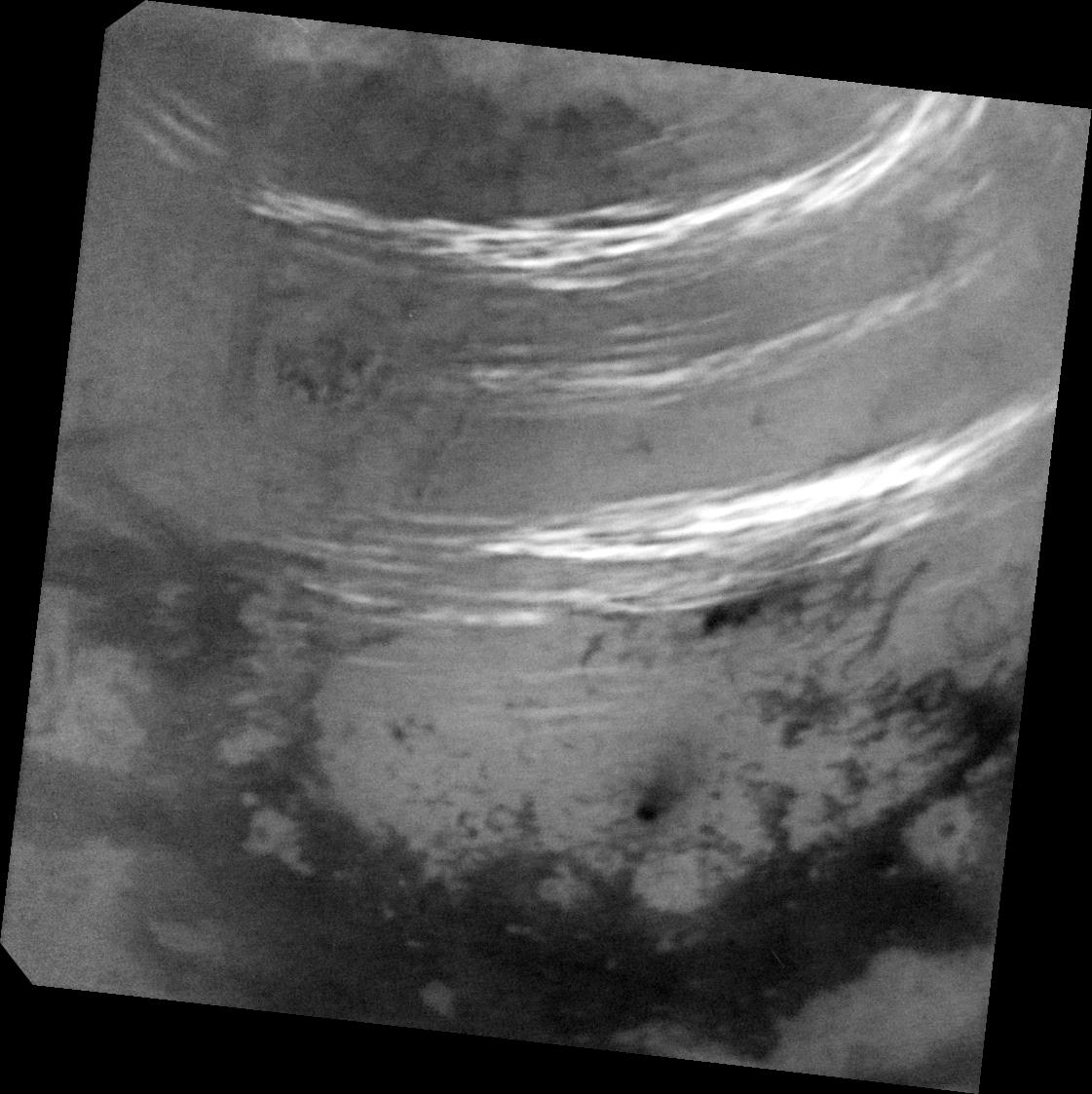
PIA21054:
-
Titan's Mystery Clouds
Full Resolution:
TIFF
(3.844 MB)
JPEG
(219.8 kB)
|
|
|
2017-01-02 |
Titan
|
Cassini-Huygens
|
ISS - Narrow Angle
|
1024x1024x1 |
|
-
PIA20516:
-
Send in the Clouds
Full Resolution:
TIFF
(795.6 kB)
JPEG
(58.94 kB)
|
|
|
2017-05-09 |
Titan
|
Cassini-Huygens
|
Imaging Science Subsystem
|
1121x1123x1 |
|
-
PIA21610:
-
Titan's Northern Summer Clouds
Full Resolution:
TIFF
(1.112 MB)
JPEG
(138.1 kB)
|
|
|
2017-03-15 |
Titan
|
Cassini-Huygens
|
ISS - Narrow Angle
|
1828x1200x1 |
|
-
PIA21434:
-
Titan: Kraken and Ligeia In Sharper Focus
Full Resolution:
TIFF
(1.573 MB)
JPEG
(202.8 kB)
|
|
|
2017-05-09 |
Titan
|
Cassini-Huygens
|
Imaging Science Subsystem
|
1041x1041x1 |
|
-
PIA21450:
-
Cloud Bands Streak Across Titan
Full Resolution:
TIFF
(1.037 MB)
JPEG
(121.9 kB)
|
|
|
2007-04-26 |
Titan
|
Cassini-Huygens
|
Radar Mapper
|
6209x634x1 |
|
-
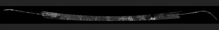
PIA04391:
Titan Radar Swath (T-29 Flyby - April 26, 2007)
Full Resolution:
TIFF
(1.662 MB)
JPEG
(348.5 kB)
|
|
|
2007-10-02 |
Titan
|
Cassini-Huygens
|
Radar Mapper
|
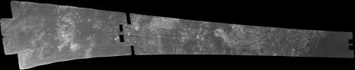
18944x2048x1 |
|
-
PIA04390:
Titan Radar Swath (T-36 Flyby - Oct. 2, 2007)
Full Resolution:
TIFF
(17.17 MB)
JPEG
(4.914 MB)
|
|
|
2008-02-22 |
Titan
|
Cassini-Huygens
|
Radar Mapper
|
4000x1923x1 |

|
-
PIA04392:
-
Titan Radar Swath (T-41 Flyby - Feb. 22, 2008)
Full Resolution:
TIFF
(2.375 MB)
JPEG
(629.2 kB)
|
|
|
2008-12-21 |
Titan
|
Cassini-Huygens
|
Radar Mapper
|
6912x3030x1 |
|
-
PIA04393:
-
Titan Radar Swath (T-49 Flyby - Dec. 21, 2008)
Full Resolution:
TIFF
(3.639 MB)
JPEG
(1.043 MB)
|
|
|
2009-02-07 |
Titan
|
Cassini-Huygens
|
Radar Mapper
|
13440x1408x1 |
|
-
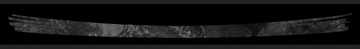
PIA04394:
Titan Radar Swath (T-50 Flyby - Feb. 7, 2009)
Full Resolution:
TIFF
(7.549 MB)
JPEG
(2.394 MB)
|
|
|
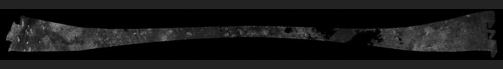
2009-05-21 |
Titan
|
Cassini-Huygens
|
Radar Mapper
|
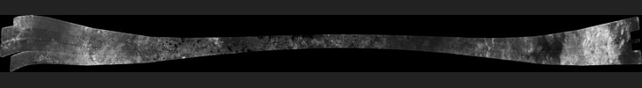
19584x1920x1 |
|
-
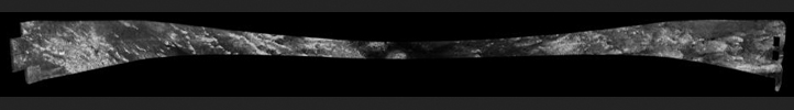
PIA04395:
Titan Radar Swath (T-55 Flyby - May 21, 2009)
Full Resolution:
TIFF
(18.25 MB)
JPEG
(5.111 MB)
|
|
|
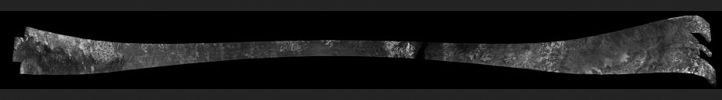
2009-06-06 |
Titan
|
Cassini-Huygens
|
Radar Mapper
|
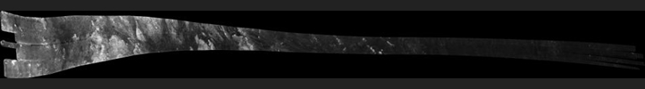
19456x1920x1 |
|
-
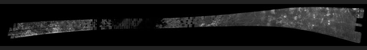
PIA04396:
Titan Radar Swath (T-56 Flyby - June 6, 2009)
Full Resolution:
TIFF
(18.07 MB)
JPEG
(5.091 MB)
|
|
|
2009-06-22 |
Titan
|
Cassini-Huygens
|
Radar Mapper
|
18816x1536x1 |
|
-
PIA04397:
Titan Radar Swath (T-57 Flyby - June 22, 2009)
Full Resolution:
TIFF
(7.828 MB)
JPEG
(2.507 MB)
|
|
|
2009-07-08 |
Titan
|
Cassini-Huygens
|
Radar Mapper
|
768x349x1 |

|
-
PIA04398:
-
Titan Radar Swath (T-58 Flyby - July 8, 2009)
Full Resolution:
TIFF
(221.9 kB)
JPEG
(49.56 kB)
|
|
|
2009-07-24 |
Titan
|
Cassini-Huygens
|
Radar Mapper
|
12288x1408x1 |
|
-
PIA04399:
Titan Radar Swath (T-59 Flyby - July. 24, 2009)
Full Resolution:
TIFF
(6.674 MB)
JPEG
(2.059 MB)
|
|
|
2009-08-25 |
Titan
|
Cassini-Huygens
|
Radar Mapper
|
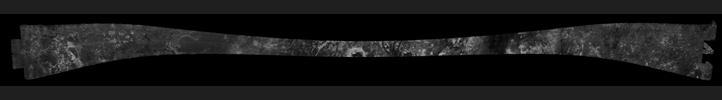
19200x2048x1 |
|
-
PIA06677:
Titan Radar Swath (T-61 Flyby - Aug. 25, 2009)
Full Resolution:
TIFF
(18.06 MB)
JPEG
(5.284 MB)
|
|
|
2009-12-28 |
Titan
|
Cassini-Huygens
|
Radar Mapper
|
15360x1792x1 |
|
-
PIA06678:
Titan Radar Swath (T-64 Flyby - Dec. 28, 2009)
Full Resolution:
TIFF
(11.43 MB)
JPEG
(3.356 MB)
|
|
|
2005-02-15 |
Titan
|
Cassini-Huygens
|
Radar Mapper
|
16768x2688x1 |

|
-
PIA04389:
Titan Radar Swath (T-3 Flyby - Feb. 15, 2005)
Full Resolution:
TIFF
(18.88 MB)
JPEG
(5.264 MB)
|
|
|
2005-09-07 |
Titan
|
Cassini-Huygens
|
Radar Mapper
|
6162x1222x1 |
|
-
PIA01855:
Titan Radar Swath (T-7 Flyby - Sept. 7, 2005)
Full Resolution:
TIFF
(5.025 MB)
JPEG
(1.32 MB)
|
|
|
2005-10-28 |
Titan
|
Cassini-Huygens
|
Radar Mapper
|
17610x3153x1 |

|
-
PIA03068:
Titan Radar Swath (T-8 Flyby, Oct. 28, 2005)
Full Resolution:
TIFF
(17.59 MB)
JPEG
(4.557 MB)
|
|
|
2006-10-09 |
Titan
|
Cassini-Huygens
|
Radar Mapper
|
19620x1774x1 |
|
-
PIA03187:
Titan Radar Swath (T-19 Flyby - Oct. 9, 2006)
Full Resolution:
TIFF
(19.03 MB)
JPEG
(5.221 MB)
|
|
|
2006-12-12 |
Titan
|
Cassini-Huygens
|
Radar Mapper
|
15971x1676x1 |
|
-
PIA04308:
Titan Radar Swath (T-21 Flyby - Dec. 12, 2006)
Full Resolution:
TIFF
(12.45 MB)
JPEG
(3.269 MB)
|
|
|
2007-01-13 |
Titan
|
Cassini-Huygens
|
Radar Mapper
|
19200x1920x1 |
|
-
PIA00928:
Titan Radar Swath (T-23 Flyby - Jan. 13, 2007)
Full Resolution:
TIFF
(17.2 MB)
JPEG
(4.487 MB)
|
|
|
2007-12-20 |
Titan
|
Cassini-Huygens
|
Radar Mapper
|
16640x1920x1 |
|
-
PIA01854:
Titan Radar Swath (T-39 Flyby - Dec. 20, 2007)
Full Resolution:
TIFF
(14.13 MB)
JPEG
(4.306 MB)
|
|
|
2010-07-07 |
Titan
|
Cassini-Huygens
|
Radar Mapper
|
14165x894x1 |
|
-
PIA06679:
Titan Radar Swath (T-71 Flyby - July 7, 2010)
Full Resolution:
TIFF
(6.765 MB)
JPEG
(1.677 MB)
|
|
|
2008-12-05 |
Titan
|
Cassini-Huygens
|
Radar Mapper
|
16363x1543x1 |

|
-
PIA00699:
Titan Radar Swath (T-48 Flyby - Dec. 5, 2008)
Full Resolution:
TIFF
(4.783 MB)
JPEG
(1.184 MB)
|
|
|
2010-01-12 |
Titan
|
Cassini-Huygens
|
Radar Mapper
|
9179x3260x1 |
|
-
PIA00927:
-
Titan Radar Swath (T-65 Flyby - Jan. 12, 2010)
Full Resolution:
TIFF
(4.485 MB)
JPEG
(1.197 MB)
|
|
|
2017-06-14 |
Titan
|
Cassini-Huygens
|
ISS - Narrow Angle
|
2205x2092x1 |

|
-
PIA21615:
-
Northern Summer on Titan
Full Resolution:
TIFF
(2.422 MB)
JPEG
(124.5 kB)
|
|
|
2017-08-11 |
Titan
|
Cassini-Huygens
|
Imaging Science Subsystem
|
2024x1024x3 |
|
-
PIA21624:
-
Two Titans
Full Resolution:
TIFF
(4.063 MB)
JPEG
(72.98 kB)
|
|
|
2017-08-11 |
Titan
|
Cassini-Huygens
|
Radar Mapper
|
14594x2578x1 |

|
-
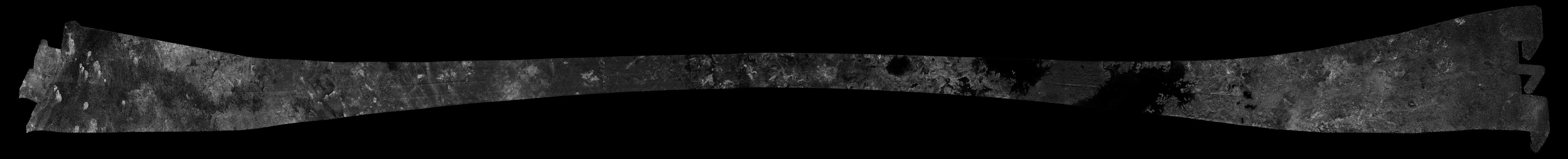
PIA21626:
Cassini's Final Titan Radar Swath
Full Resolution:
TIFF
(10.77 MB)
JPEG
(3.532 MB)
|
|
|
2017-08-11 |
Titan
|
Cassini-Huygens
|
ISS - Narrow Angle
|
836x731x3 |
|
-
PIA21625:
-
Highlighting Titan's Hazes
Full Resolution:
TIFF
(692.3 kB)
JPEG
(17.39 kB)
|
|
|
2017-09-15 |
Titan
|
Cassini-Huygens
|
ISS - Narrow Angle
|
1024x1024x3 |

|
-
PIA21890:
-
A Last Look at Titan
Full Resolution:
TIFF
(2.643 MB)
JPEG
(31.57 kB)
|
|
|
2018-01-15 |
Titan
|
Cassini-Huygens
|
ISS - Wide Angle
|
997x1007x3 |
|
-
PIA21902:
-
Twilight Haze
Full Resolution:
TIFF
(1.143 MB)
JPEG
(24.96 kB)
|
|
|
2018-02-05 |
Titan
|
Cassini-Huygens
|
ISS - Narrow Angle
|
570x570x3 |

|
-
PIA21904:
-
Contrasting Crescents
Full Resolution:
TIFF
(346.2 kB)
JPEG
(12.7 kB)
|
|
|
2018-05-21 |
Titan
|
Cassini-Huygens
|
ISS - Narrow Angle
|
1337x1329x1 |

|
-
PIA19642:
-
A World All Its Own
Full Resolution:
TIFF
(1.656 MB)
JPEG
(71.7 kB)
|
|
|
2018-07-18 |
Titan
|
Cassini-Huygens
|
Visual and Infrared Mapping Spectrometer
|
5448x3686x3 |
|
-
PIA21923:
-
Seeing Titan with Infrared Eyes
Full Resolution:
TIFF
(30.68 MB)
JPEG
(900.4 kB)
|
|
|
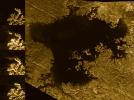
2018-09-13 |
Titan
|
Cassini-Huygens
|
ISS - Narrow Angle
|
3604x2695x1 |

|
-
PIA22481:
-
Titan Lakes
Full Resolution:
TIFF
(6.701 MB)
JPEG
(1.067 MB)
|
|
|
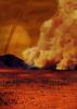
2018-09-24 |
Titan
|
Cassini-Huygens
|
|
2480x3508x3 |
|
-
PIA22482:
-
Dust Storms Raised by Strong Winds on Titan (Artist's Concept)
Full Resolution:
TIFF
(22.72 MB)
JPEG
(790.4 kB)
|
|
|
2018-09-24 |
Titan
|
Cassini-Huygens
|
Visual and Infrared Mapping Spectrometer
|
1250x1250x3 |
|
-
PIA22483:
-
Spotting Dust Storms on Titan
Full Resolution:
TIFF
(1.103 MB)
JPEG
(1.206 MB)
|
|
|
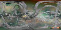
2018-09-24 |
Titan
|
Cassini-Huygens
|
Visual and Infrared Mapping Spectrometer
|
13008x9984x3 |

|
-
PIA22484:
-
Dust Storms on Titan
Full Resolution:
TIFF
(86.64 MB)
JPEG
(4.45 MB)
|
|
|
2018-12-06 |
Titan
|
Cassini-Huygens
|
Imaging Science Subsystem
|
5760x2880x1 |

|
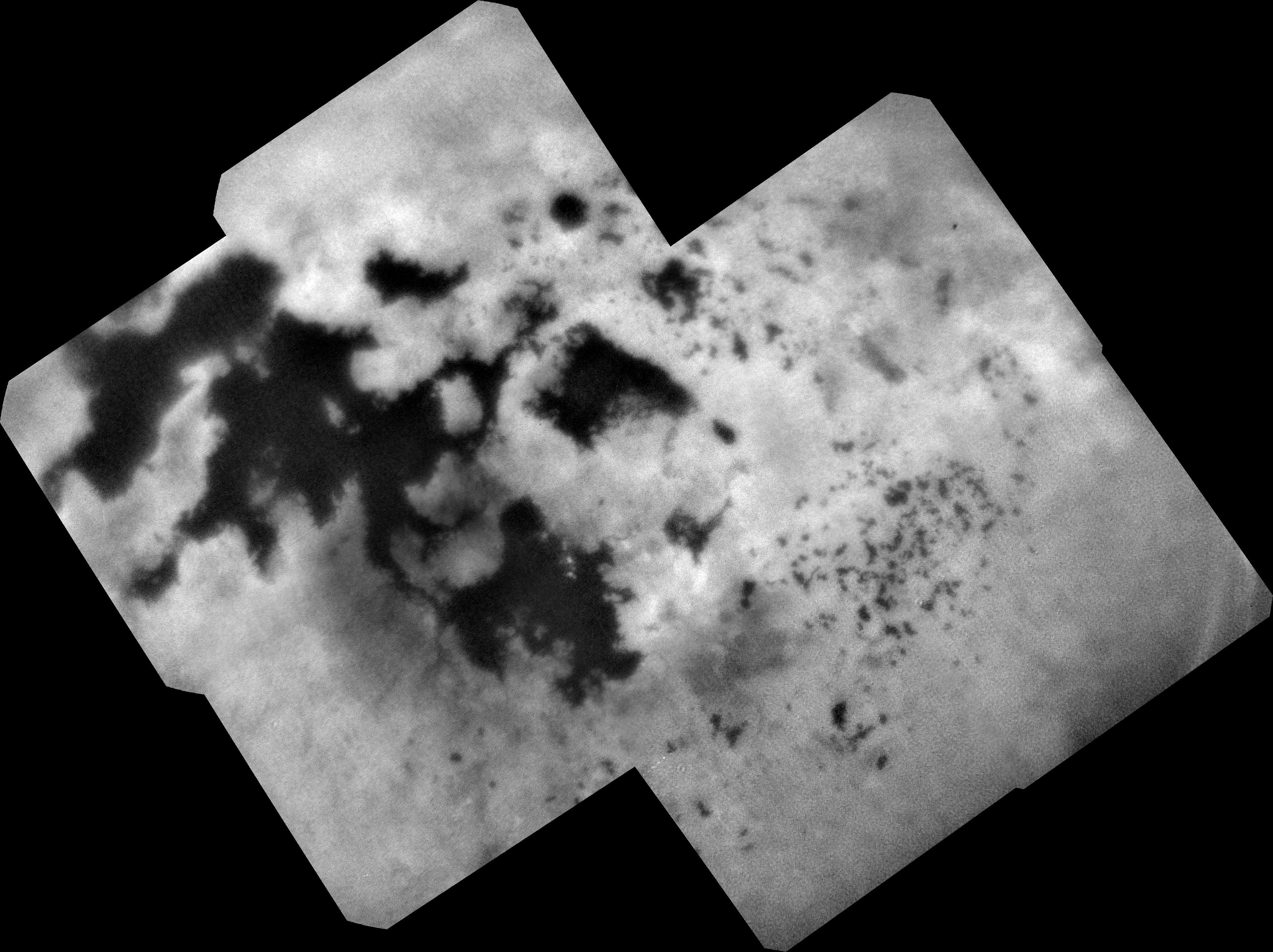
-
PIA22770:
-
Titan Mosaic: The Surface Under the Haze
Full Resolution:
TIFF
(10.95 MB)
JPEG
(891 kB)
|
|
|
2019-09-06 |
Titan
|
Cassini-Huygens
|
|
3840x2160x3 |
|
-
PIA23172:
-
Titan's Rimmed Lakes (Artist's Concept)
Full Resolution:
TIFF
(17.55 MB)
JPEG
(790.3 kB)
|
|
|
2019-11-18 |
Titan
|
Cassini-Huygens
|
Imaging Science Subsystem
Radar Mapper
|
6604x3746x3 |
|
-
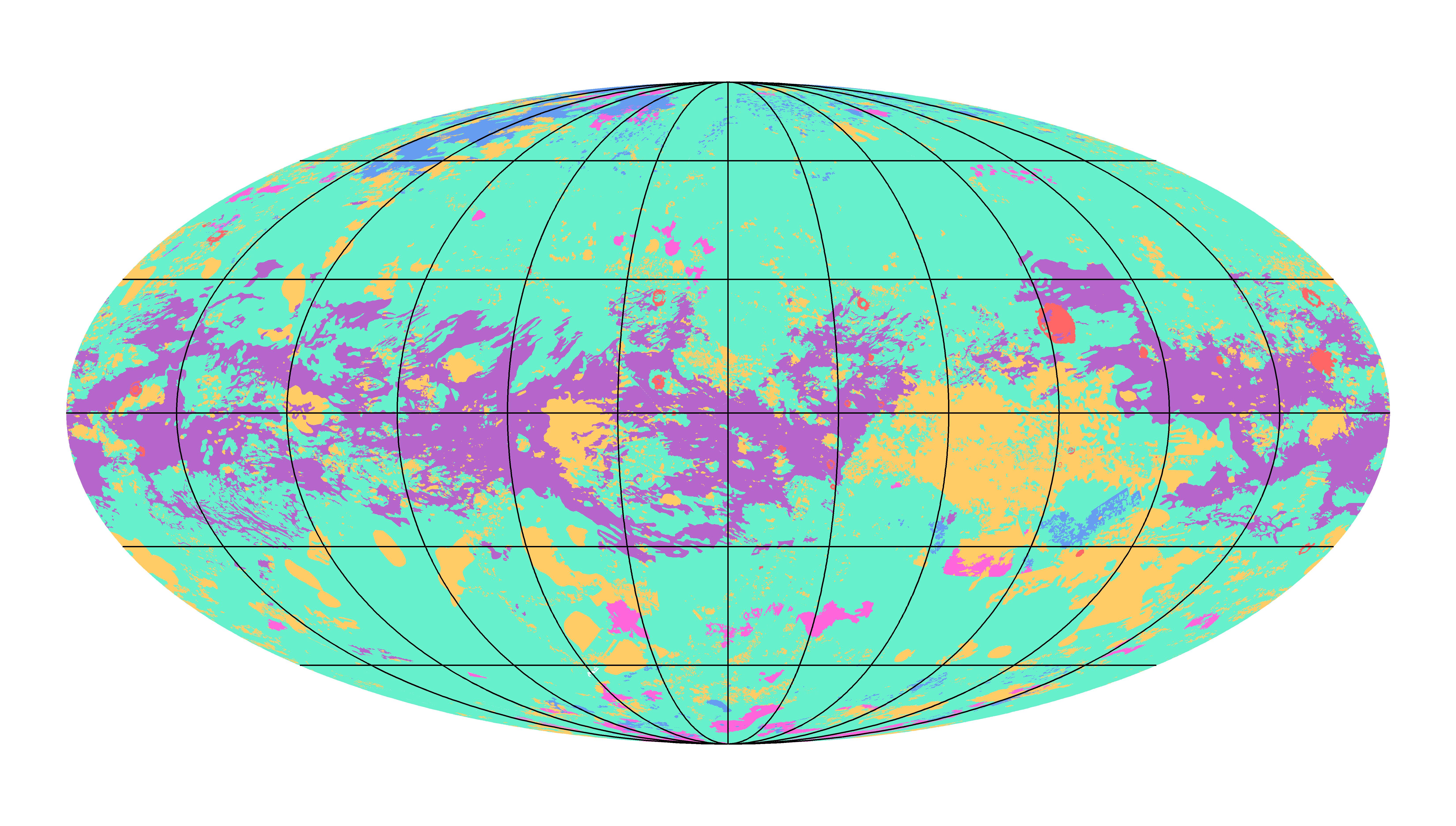
PIA23174:
-
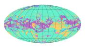
First Global Geologic Map of Titan
Full Resolution:
TIFF
(8.721 MB)
JPEG
(2.02 MB)
|
|
|
2011-04-08 |
Saturn
|
Cassini-Huygens
Galileo
|
Radar Mapper
Solid-State Imaging
|
1620x909x1 |
|
-
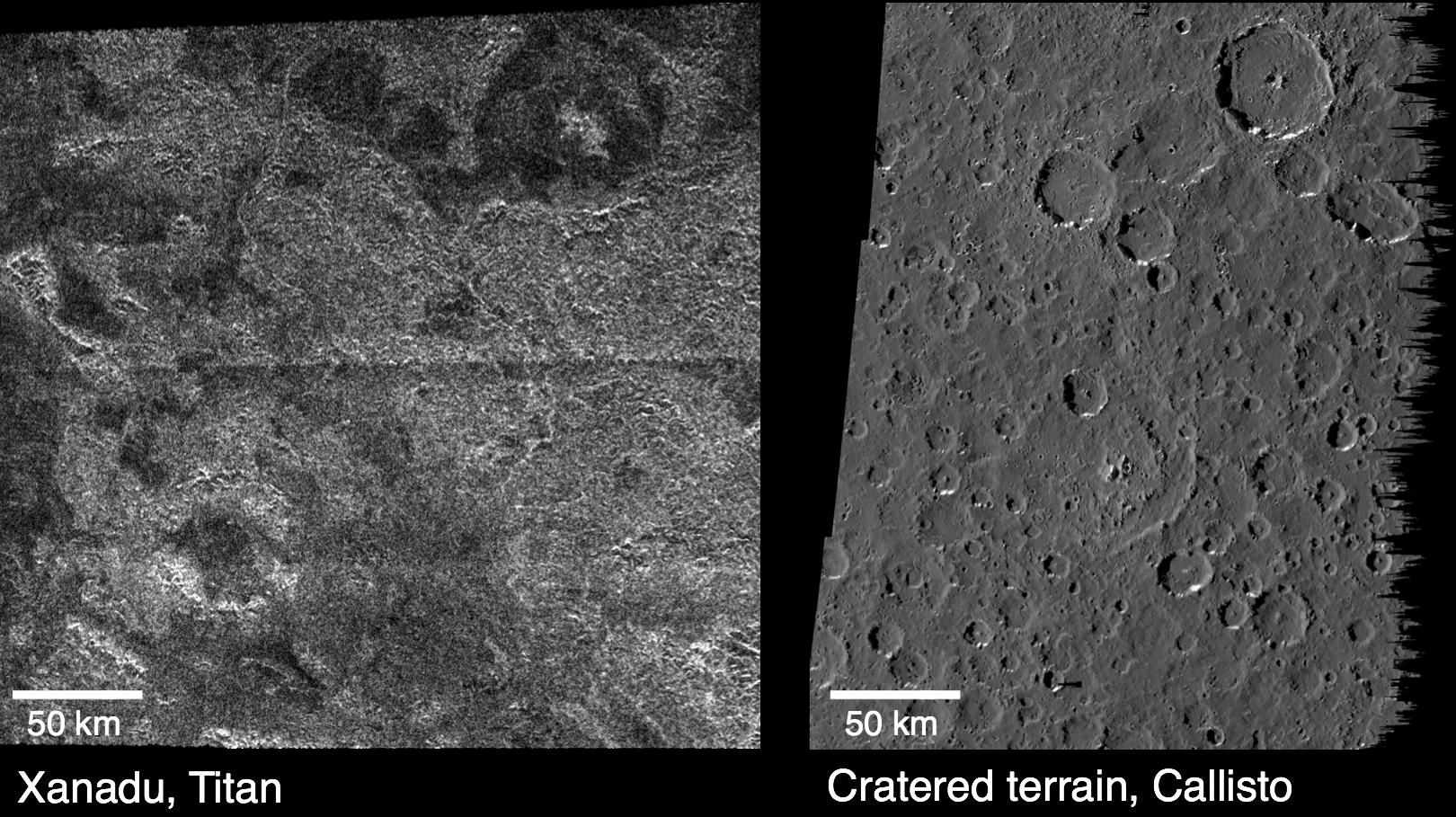
PIA13896:
-
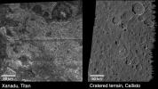
Titan and Callisto
Full Resolution:
TIFF
(1.474 MB)
JPEG
(315.9 kB)
|
|
|
2012-01-23 |
Titan
|
Cassini-Huygens
Terra
|
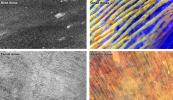
ASTER
Radar Mapper
|
1770x1026x3 |
|
-
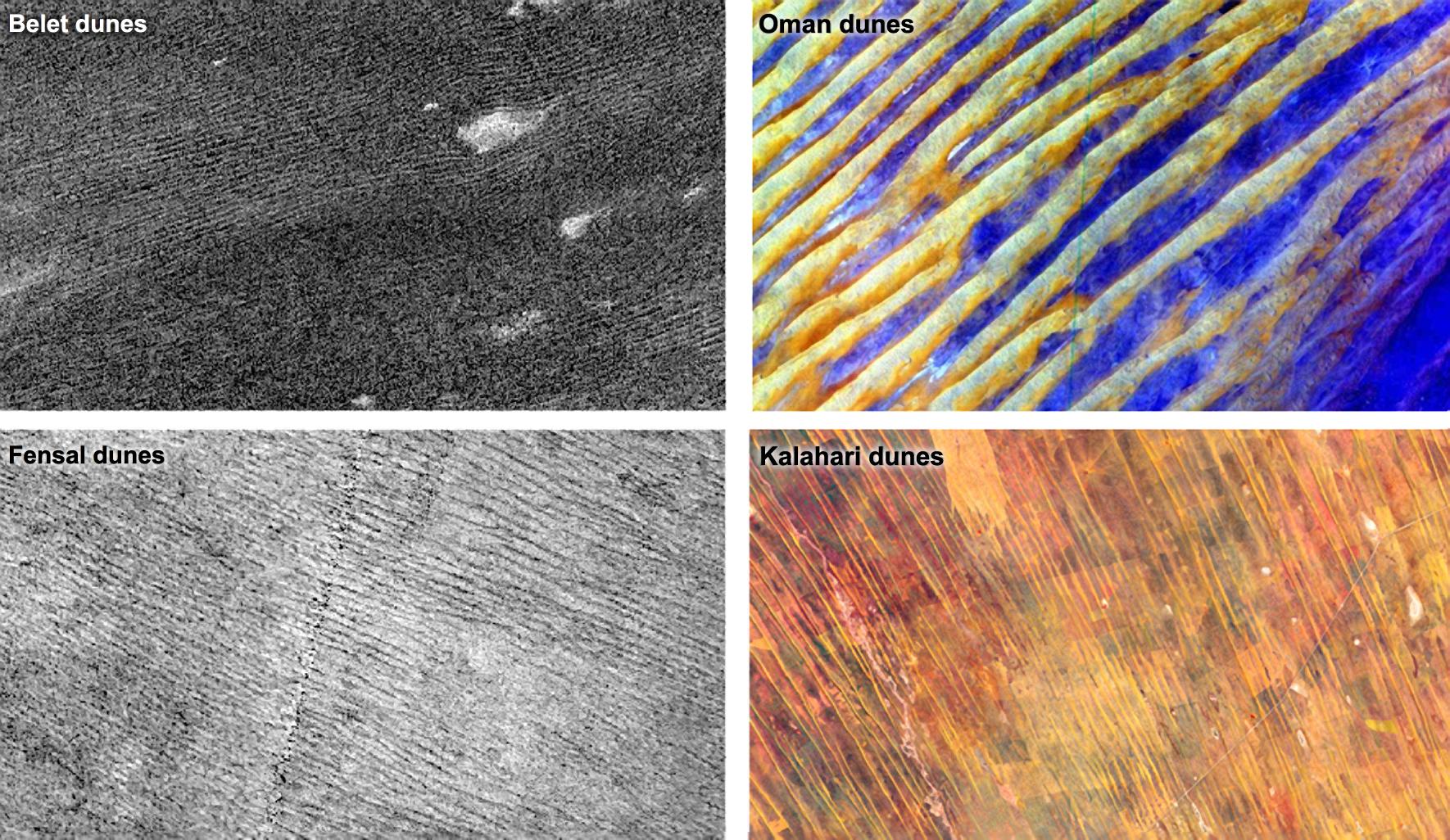
PIA15225:
-
Dune Patterns
Full Resolution:
TIFF
(5.457 MB)
JPEG
(421.9 kB)
|
|
|
1998-09-26 |
Titan
|
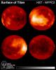
Hubble Space Telescope
|
WFPC2
|
600x750x3 |
|
-
PIA01465:
-
Hubble Observes Surface of Titan
Full Resolution:
TIFF
(564.6 kB)
JPEG
(37.66 kB)
|
|
|
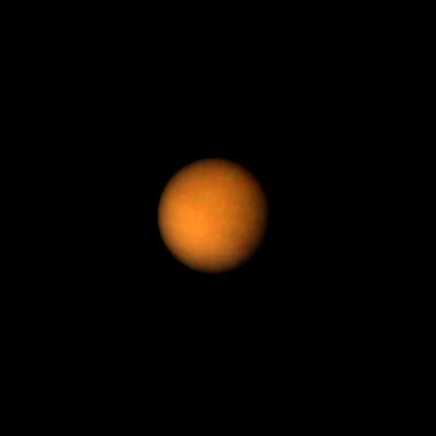
1997-09-25 |
Titan
|
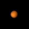
Voyager
|
VG ISS - Narrow Angle
|
400x400x3 |
|
-
PIA00733:
-
Titan's Brighter Southern Hemisphere
Full Resolution:
TIFF
(37.73 kB)
JPEG
(4.127 kB)
|
|
|
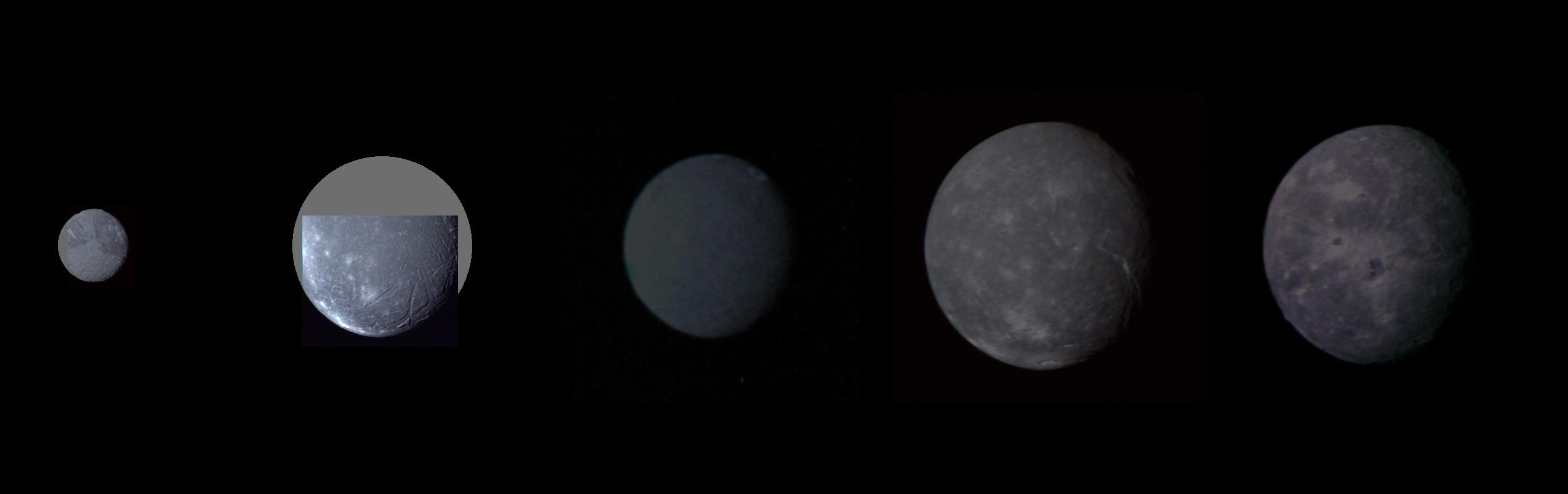
1999-08-20 |
Oberon
|
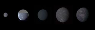
Voyager
|
VG ISS - Narrow Angle
|
2537x800x3 |
|
-
PIA01361:
-
Uranus - Montage of Uranus' Five Largest Satellites
Full Resolution:
TIFF
(1.533 MB)
JPEG
(59.14 kB)
|
|
|
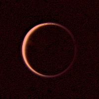
1999-02-23 |
Titan
|
Voyager
|
VG ISS - Wide Angle
|
200x200x3 |
|
-
PIA01393:
-
Night Side of Titan
Full Resolution:
TIFF
(50.26 kB)
JPEG
(5.725 kB)
|
|
|
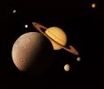
1998-10-30 |
Saturn
|
Voyager
|
|
2351x2015x3 |
|
-
PIA01482:
-
Saturn System Montage
Full Resolution:
TIFF
(6.822 MB)
JPEG
(194.2 kB)
|
|
|
1999-05-08 |
Titan
|
Voyager
|
|
1296x960x3 |

|
-
PIA01532:
-
Titan's Cloud Systems
Full Resolution:
TIFF
(1.339 MB)
JPEG
(38.87 kB)
|
|
|
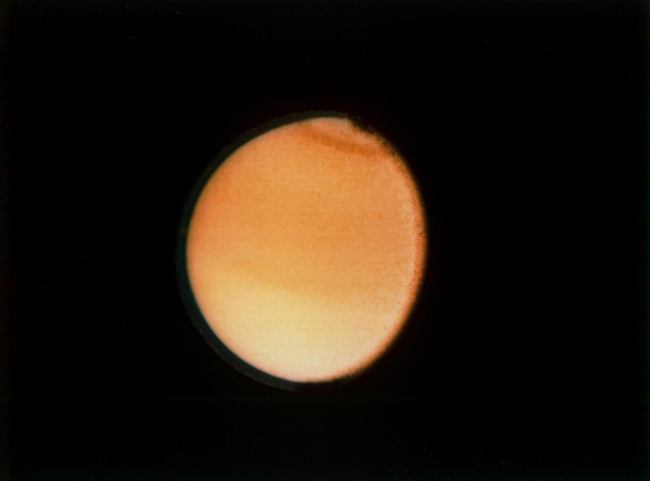
1999-05-08 |
Titan
|
Voyager
|
|
1715x1825x3 |

|
-
PIA01533:
-
Titan Haze
Full Resolution:
TIFF
(7.91 MB)
JPEG
(172.2 kB)
|


