Your search criteria found
346
images
Target is Moon
Go to PIAxxxxx:
Refine this list of images by:
Target:
Earth
Mars
Moon
S Rings
Vesta
Mission:
2001 Mars Odyssey
Apollo
Apollo 12
Cassini-Huygens
Chandrayaan-1
Deep Impact
Deep Space Program Science Experiment (DSPSE)
Galileo
Goldstone Deep Space Network (DSN)
Gravity Recovery and Interior Laboratory (GRAIL)
Hubble Space Telescope
Lunar Flashlight
Lunar Orbiter
Lunar Reconnaissance Orbiter (LRO)
MESSENGER
Mariner Venus Mercury (Mariner 10)
Mars Cube One (MarCO)
Mars Global Surveyor (MGS)
Mars Reconnaissance Orbiter (MRO)
Ranger 7
Ranger 9
Surveyor 1
Surveyor 5
Surveyor 7
Terra
Voyager
Spacecraft:
2001 Mars Odyssey
Cassini Orbiter
Chandrayaan-1
Clementine 1
Deep Impact
GRAIL Spacecraft
Galileo Orbiter
Lunar Flashlight
Lunar Orbiter
Lunar Reconnaissance Orbiter
Lunar Reconnaissance Orbiter (LRO)
MESSENGER
Mariner 10
Mars Global Surveyor Orbiter
Mars Reconnaissance Orbiter (MRO)
Ranger 7
Ranger 9
SmallSat
Surveyor 1
Surveyor 5
Surveyor 7
Terra
Voyager 1
Instrument:
610 Millimeter Lunar Orbiter Camera
Cold Operable Lunar Deployable Arm (COLDArm)
Goldstone Solar System Radar
High Resolution Imaging Science Experiment (HiRISE)
Imaging Science Subsystem
Imaging Science Subsystem - Narrow Angle
Imaging Science Subsystem - Wide Angle
Lunar Orbit Laser Altimeter
Lunar Orbiter Laser Altimeter
Lunar Radiometer
Lunar Reconnaissance Orbiter Camera (NAC)
Lunar Reconnaissance Orbiter Camera (WAC)
Mars Color Imager (MARCI)
Mars Orbiter Camera (MOC)
Mercury Dual Imaging System - Wide Angle
Moon Mineralogy Mapper
MoonKAM
Multi-angle Imaging SpectroRadiometer (MISR)
Near Infrared Mapping Spectrometer
Solid-State Imaging
Star Tracker
TV Camera
Thermal Emission Imaging System
Ultraviolet/Visible Camera
VG Imaging Science Subsystem - Narrow Angle
Wide Field Planetary Camera 2
Click on an image for detailed information
Click on a column heading to sort in ascending or descending order
My
List
Addition Date
Target
Mission
Instrument
Size
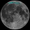
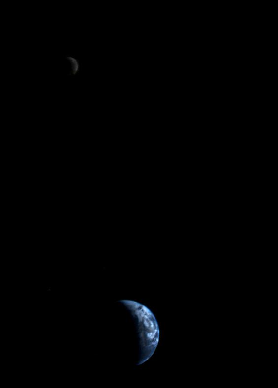
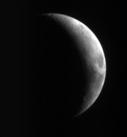
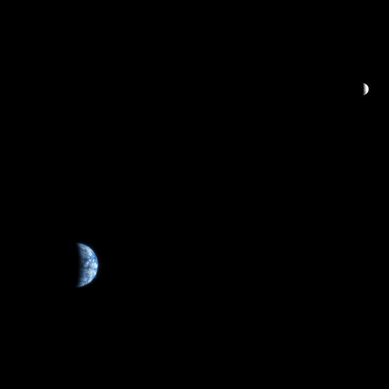
1996-08-29
Earth
Voyager
565x790x3
PIA00013:
Crescent Earth and Moon
Full Resolution:
TIFF
(49.07 kB)
JPEG
(9.171 kB)
1998-06-08
Moon
Galileo
3053x3053x3
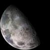
PIA00404:
Moon - North Polar Mosaic, Color
Full Resolution:
TIFF
(13.03 MB)
JPEG
(713.7 kB)
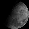
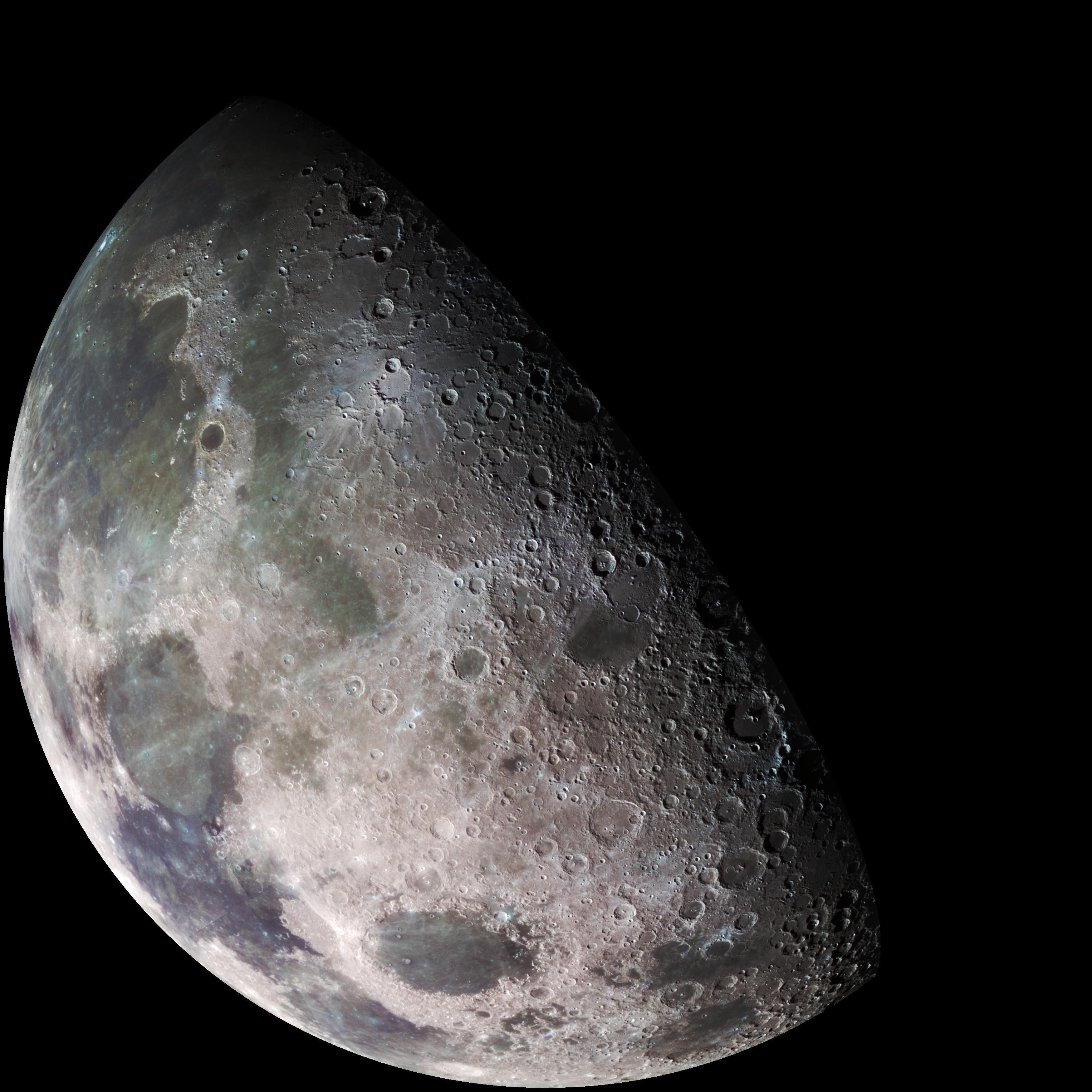
1998-06-08
Moon
Galileo
1986x1986x3
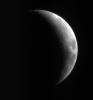
PIA00405:
Earth's Moon
Full Resolution:
TIFF
(8.683 MB)
JPEG
(403.3 kB)
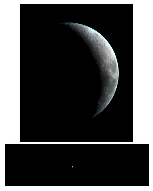
1999-12-21
Earth
Mariner Venus Mercury (Mariner 10)
922x749x3
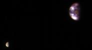
PIA02441:
Earth and Moon as Viewed by Mariner 10
Full Resolution:
TIFF
(388.4 kB)
JPEG
(32.07 kB)
1999-12-21
Moon
Mariner Venus Mercury (Mariner 10)
900x900x1
PIA02442:
Moon's North Pole
Full Resolution:
TIFF
(449.8 kB)
JPEG
(101 kB)
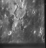
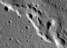
2000-11-04
Moon
Ranger 7
685x720x1
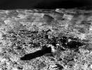
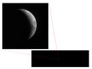
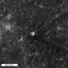
PIA02974:
Guericke Crater as seen by Ranger 7
Full Resolution:
TIFF
(506.4 kB)
JPEG
(84.03 kB)
2000-11-04
Moon
Ranger 7
720x707x1
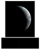
PIA02975:
First Image of the Moon taken by a U.S. Spacecraft
Full Resolution:
TIFF
(547.9 kB)
JPEG
(89.22 kB)
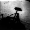
2000-11-04
Moon
Surveyor 1
2579x2563x1
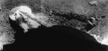
PIA02976:
Surveyor 1 Shadow
Full Resolution:
TIFF
(4.593 MB)
JPEG
(573.5 kB)
2000-11-04
Moon
Surveyor 7
625x480x1
PIA02977:
Photomosaic of Tycho Crater - Surveyor 7
Full Resolution:
TIFF
(234.2 kB)
JPEG
(99.64 kB)
2000-11-04
Moon
Surveyor 5
873x414x1
PIA02978:
Surveyor 5 Footpad Resting on the Lunar Soil
Full Resolution:
TIFF
(220.4 kB)
JPEG
(54.29 kB)
2007-12-11
Moon
GRAIL
1778x1000x3
PIA10130:
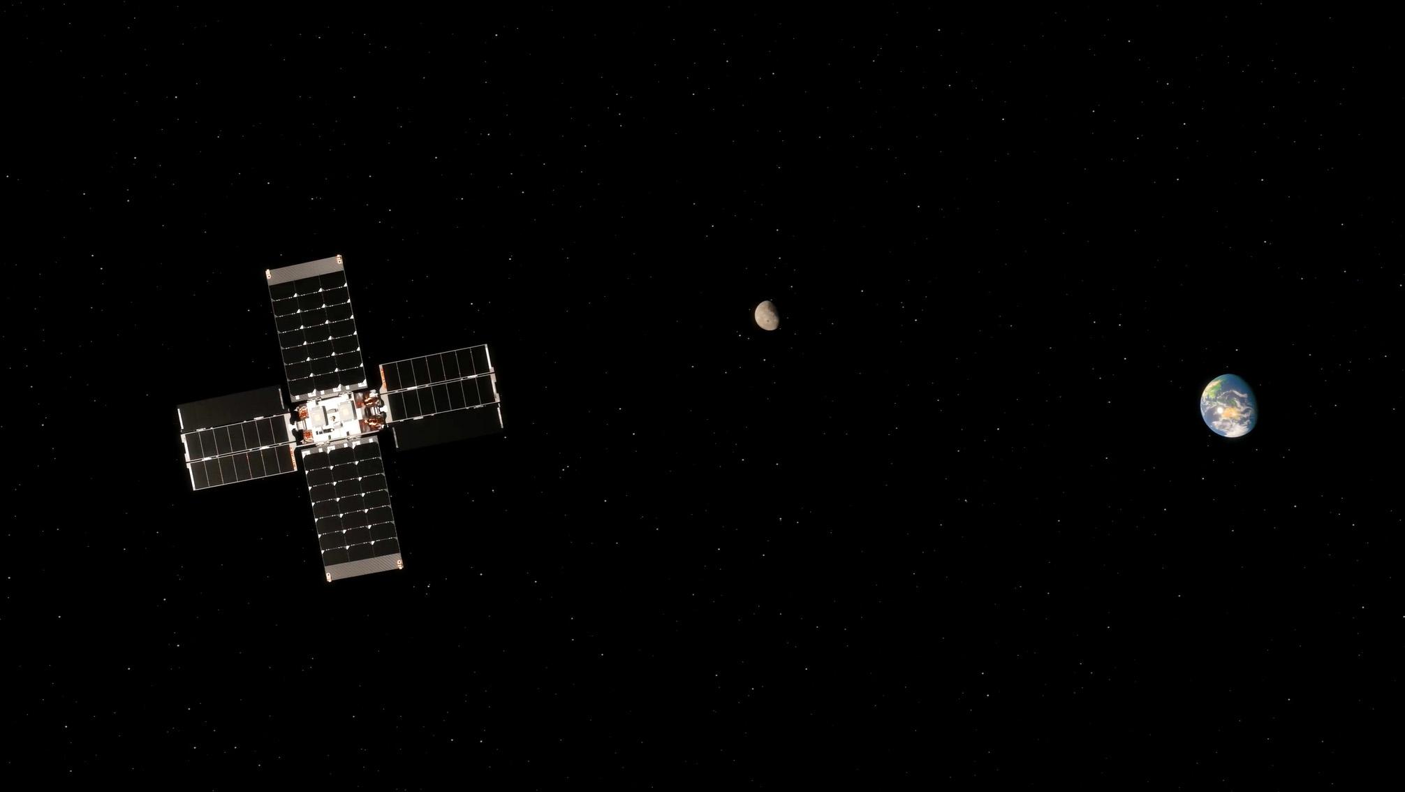
New NASA Mission to Reveal Moon's Internal Structure and Evolution (Artist's Concept)
Full Resolution:
TIFF
(5.342 MB)
JPEG
(117.2 kB)
2009-05-18
Moon
GRAIL
6000x4000x3
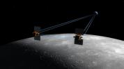
PIA12009:
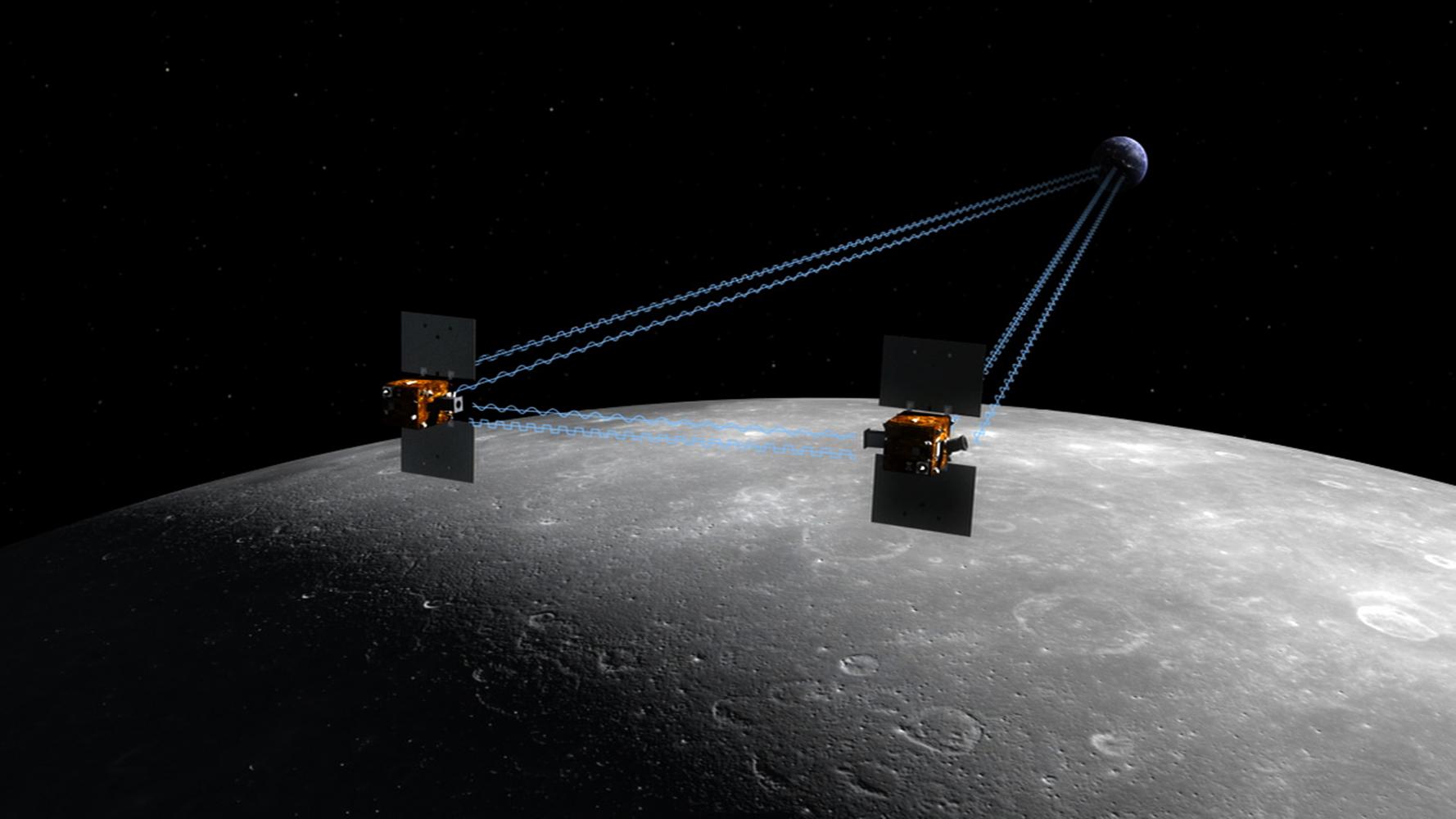
GRAIL's Twin Spacecraft fly in Tandem Around the Moon (Artist's Concept)
Full Resolution:
TIFF
(72 MB)
JPEG
(1.186 MB)
2009-05-18
Moon
GRAIL
8000x7500x3
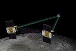
PIA12010:
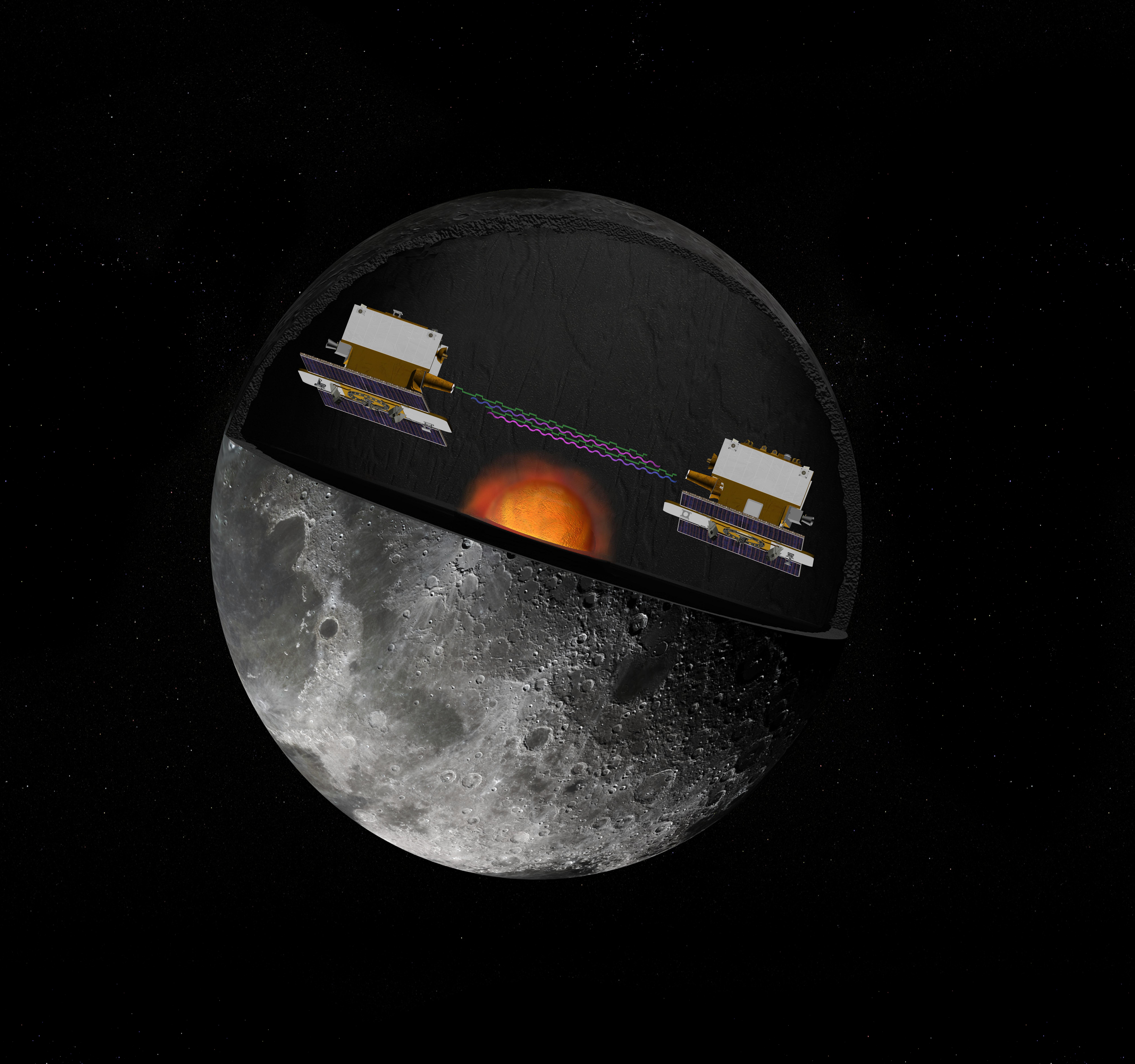
GRAIL's Twin Spacecraft -- Crust to Core (Artist's Concept)
Full Resolution:
TIFF
(180 MB)
JPEG
(2.615 MB)
2009-09-24
Moon
Deep Impact
1000x750x3
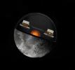
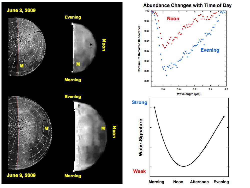
PIA12222:
Water Abundances Change with Time of Day
Full Resolution:
TIFF
(2.253 MB)
JPEG
(86.12 kB)
2009-09-24
Moon
Deep Impact
1000x750x3
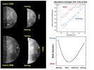
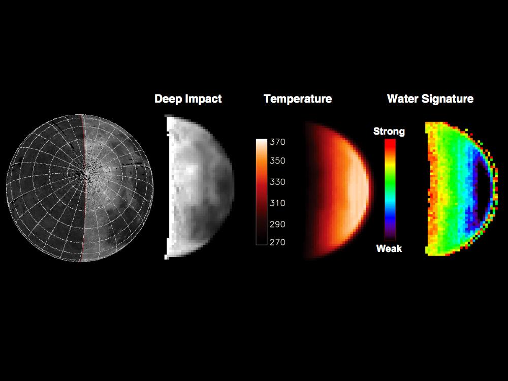
PIA12223:
Water Abundance Dependent on Temperature
Full Resolution:
TIFF
(2.253 MB)
JPEG
(61.51 kB)
2009-09-24
Moon
Deep Impact
1000x495x3
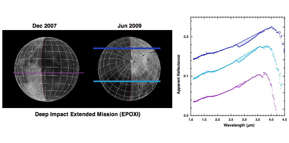
PIA12224:
Deep Impact Identifies Water on the Lunar Surface
Full Resolution:
TIFF
(1.487 MB)
JPEG
(60.06 kB)
2009-09-24
Moon
910x521x3
PIA12236:
How to Find Water on the Moon
Full Resolution:
TIFF
(1.424 MB)
JPEG
(67.3 kB)
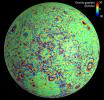
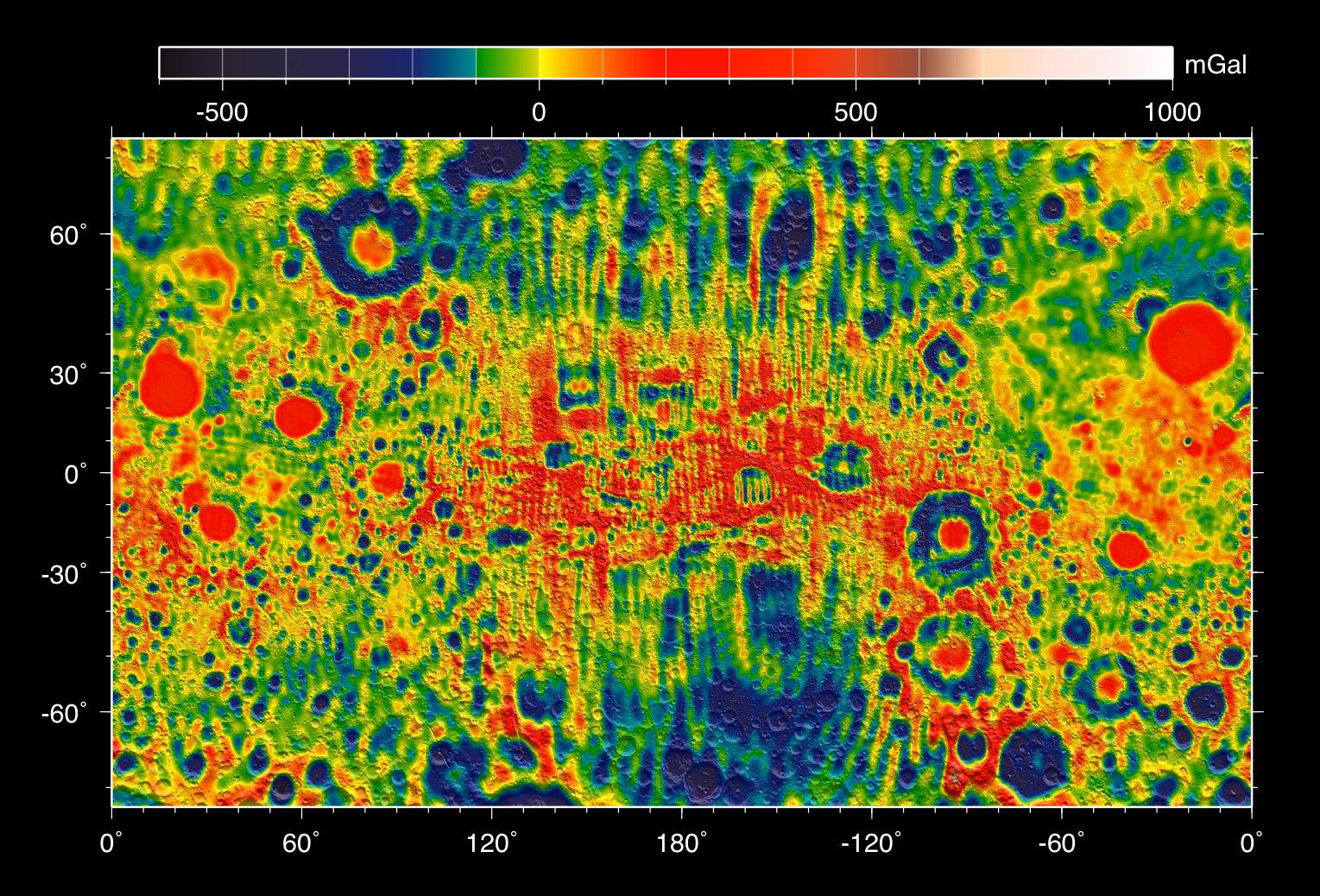
2012-12-05
Moon
GRAIL
4532x1967x3
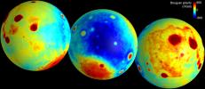
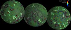
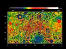
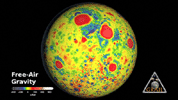
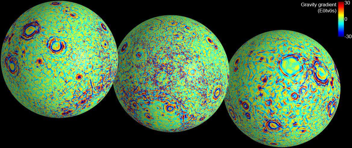
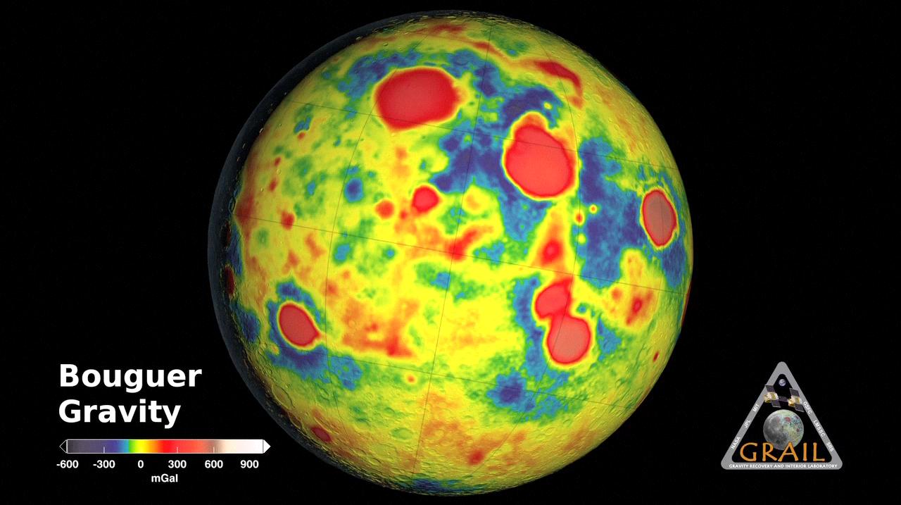
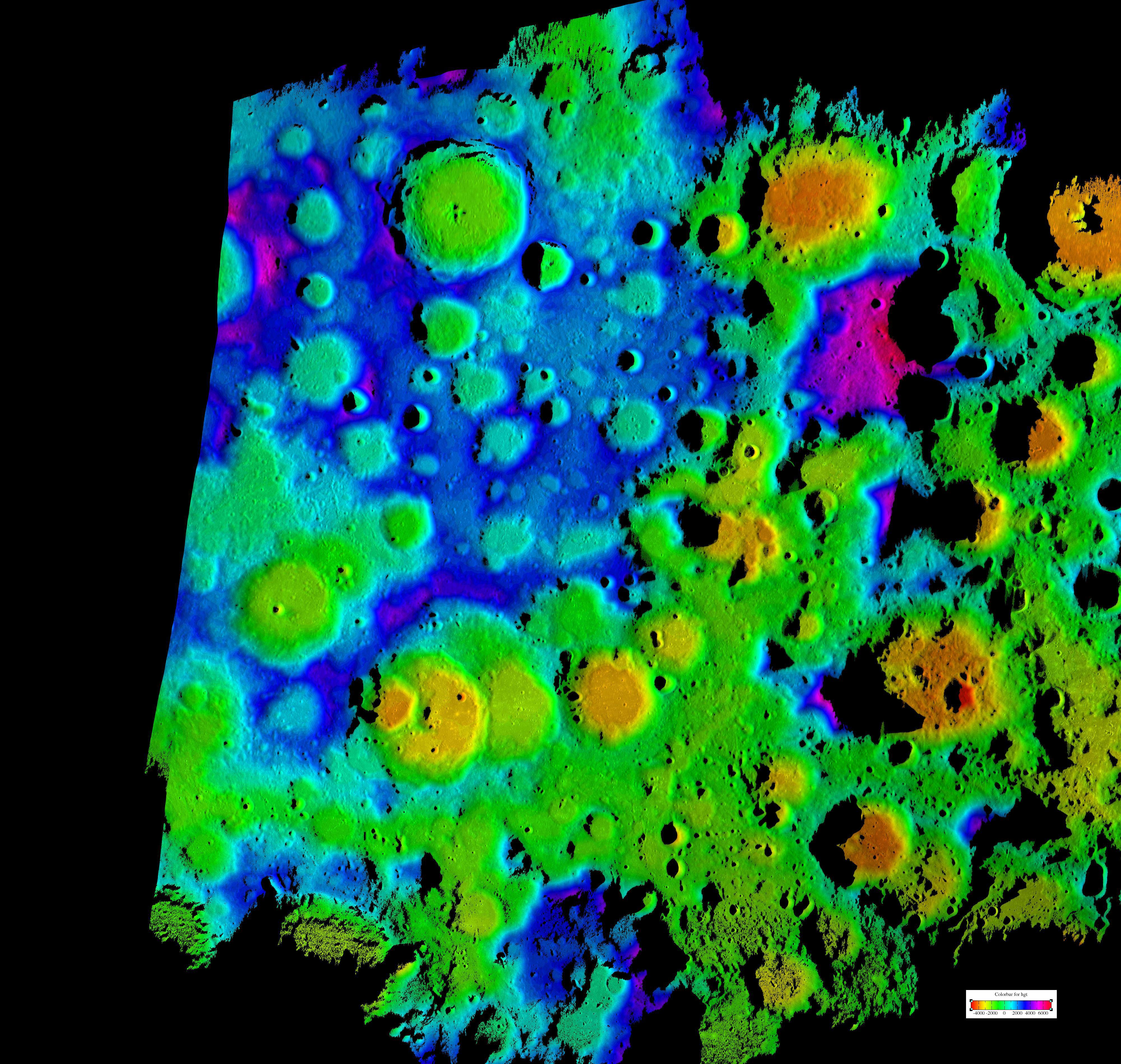
PIA16578:
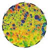
Gravity of the Moon's Crust
Full Resolution:
TIFF
(26.76 MB)
JPEG
(504.8 kB)
2012-12-05
Moon
GRAIL
1169x492x3
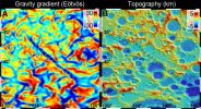
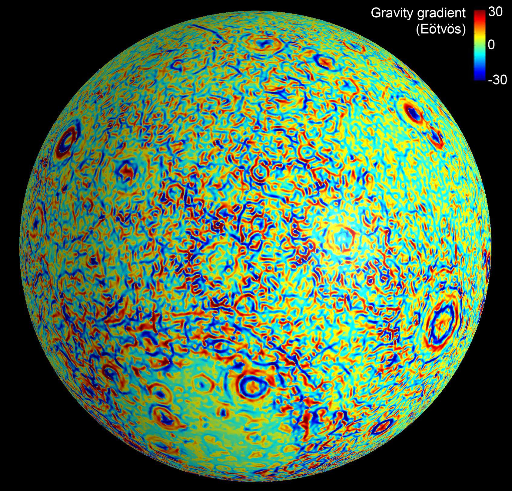
PIA16579:
GRAIL's Gravity Gradients
Full Resolution:
TIFF
(1.726 MB)
JPEG
(173.3 kB)
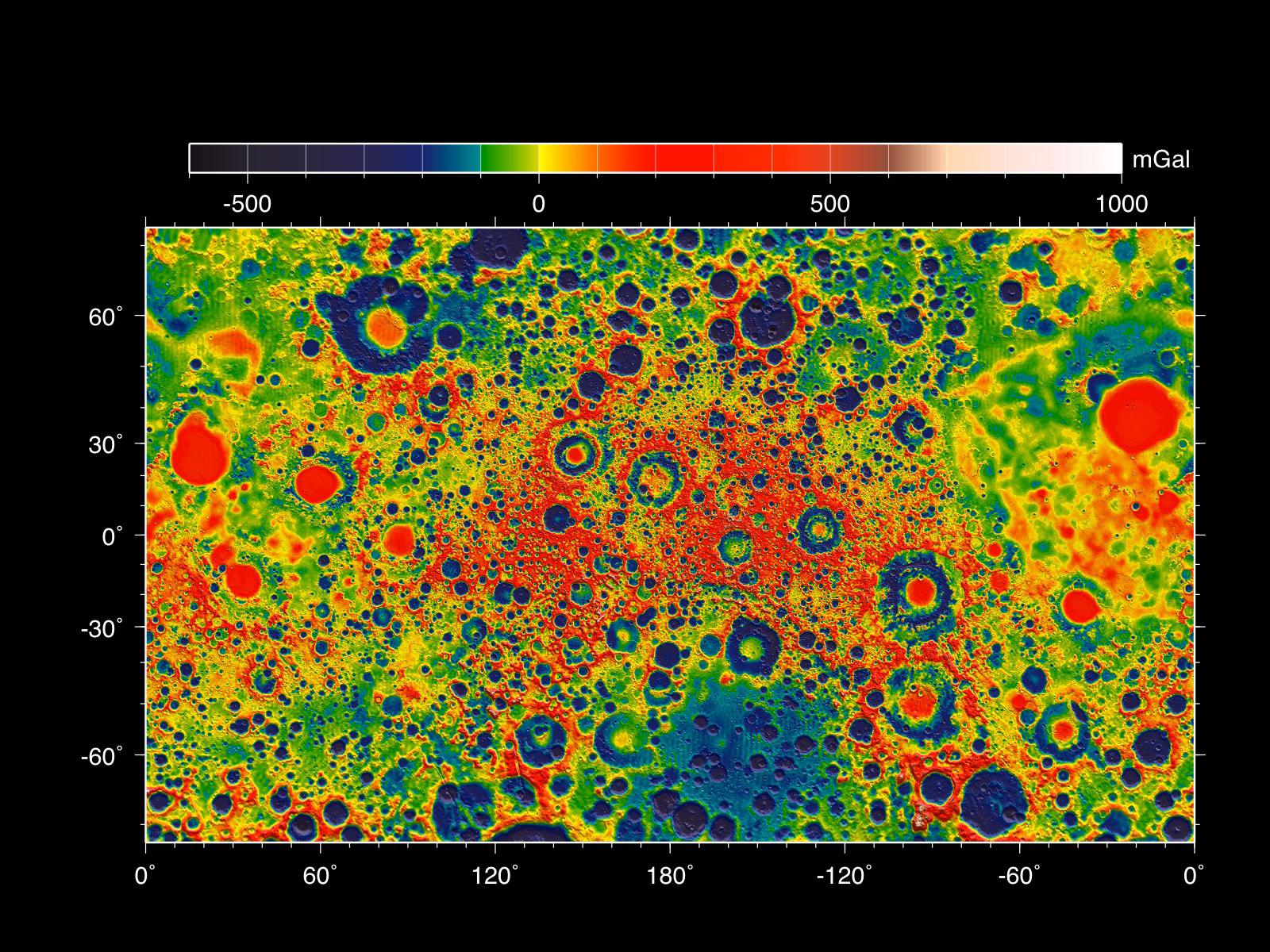
2012-12-05
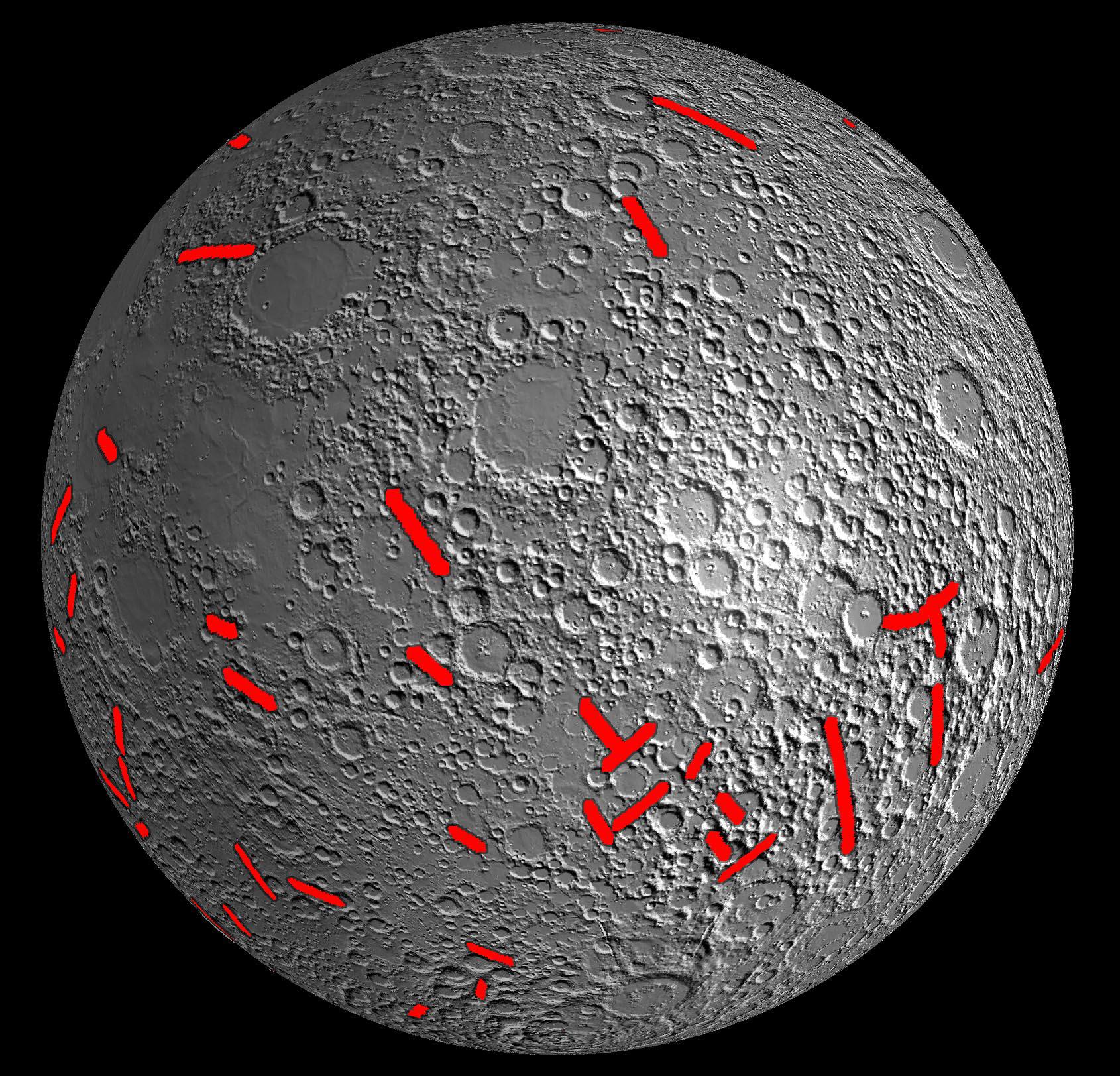
Moon
GRAIL
4532x1967x3
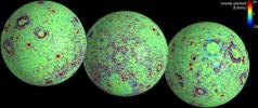
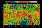
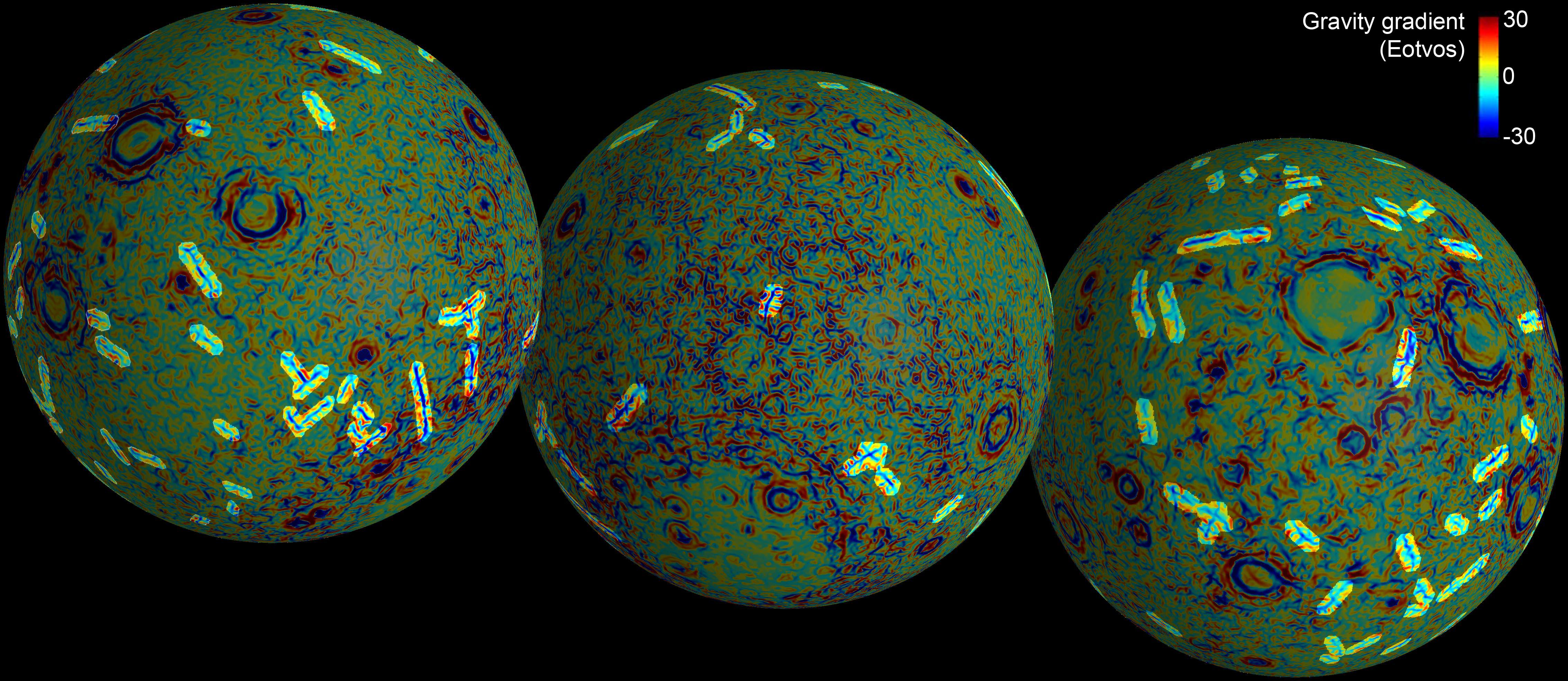
PIA16580:
Linear Gravity Anomalies
Full Resolution:
TIFF
(26.76 MB)
JPEG
(1.128 MB)
2012-12-05
Moon
GRAIL
Lunar Reconnaissance Orbiter (LRO)
1065x578x3
PIA16581:
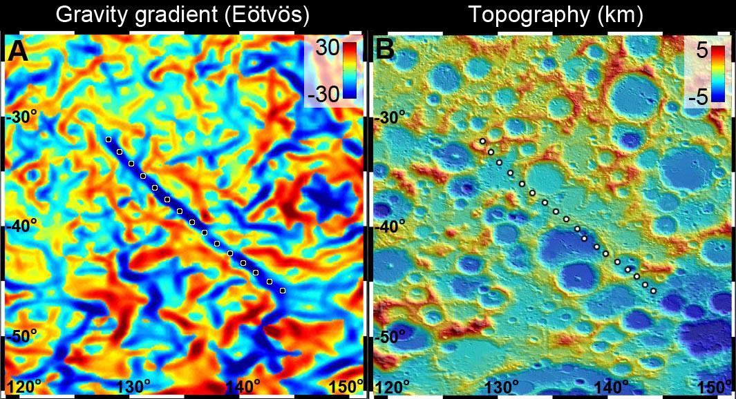
GRAIL Spots Gravity Anomaly
Full Resolution:
TIFF
(1.848 MB)
JPEG
(167 kB)
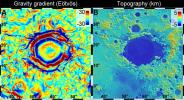
2012-12-05
Moon
GRAIL
Lunar Reconnaissance Orbiter (LRO)
1065x578x3
PIA16582:
Gravity Anomaly Intersects Moon Basin
Full Resolution:
TIFF
(1.848 MB)
JPEG
(167.8 kB)
2012-12-05
Moon
GRAIL
3051x1614x3
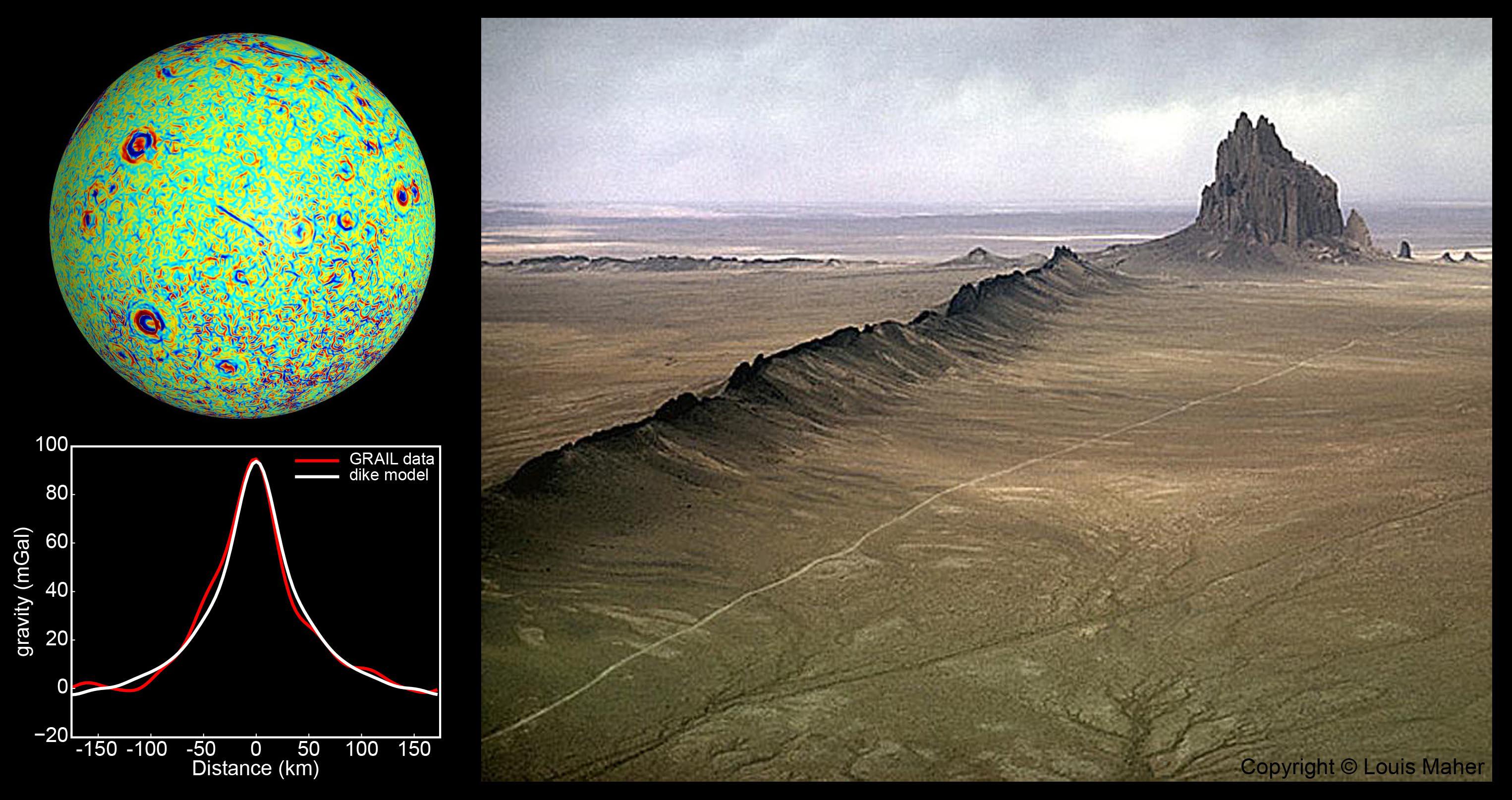
PIA16583:
GRAIL Identifies Moon Dikes
Full Resolution:
TIFF
(14.78 MB)
JPEG
(525.4 kB)
2012-12-05
Moon
GRAIL
1690x1623x3
PIA16585:
Lunar Gravity Gradients
Full Resolution:
TIFF
(8.232 MB)
JPEG
(613.4 kB)
2012-12-05
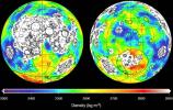
Moon
GRAIL
1529x1038x3
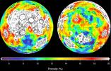
PIA16586:
Moon Gravity Field Using Prospector Data
Full Resolution:
TIFF
(4.763 MB)
JPEG
(406.2 kB)
2012-12-05
Moon
GRAIL
1600x1200x3
PIA16587:
GRAIL's Gravity Field of the Moon
Full Resolution:
TIFF
(5.762 MB)
JPEG
(476 kB)
2012-12-05
Moon
GRAIL
1440x919x3
PIA16588:
Closer Look at Lunar Highland Crust
Full Resolution:
TIFF
(3.972 MB)
JPEG
(312.4 kB)
2012-12-05
Moon
GRAIL
Lunar Reconnaissance Orbiter (LRO)
1475x975x3
PIA16589:
Mapping Lunar Highlands
Full Resolution:
TIFF
(4.316 MB)
JPEG
(323.3 kB)
2012-12-05
Moon
GRAIL
1278x718x3
PIA16622:
GRAIL's Gravity Tour of the Moon
Full Resolution:
TIFF
(2.754 MB)
JPEG
(114.8 kB)
2012-12-05
Moon
GRAIL
1914x1077x3
PIA16621:
Map of Moon's Crust
Full Resolution:
TIFF
(6.187 MB)
JPEG
(173.7 kB)
2012-12-05
Moon
GRAIL
1280x717x3
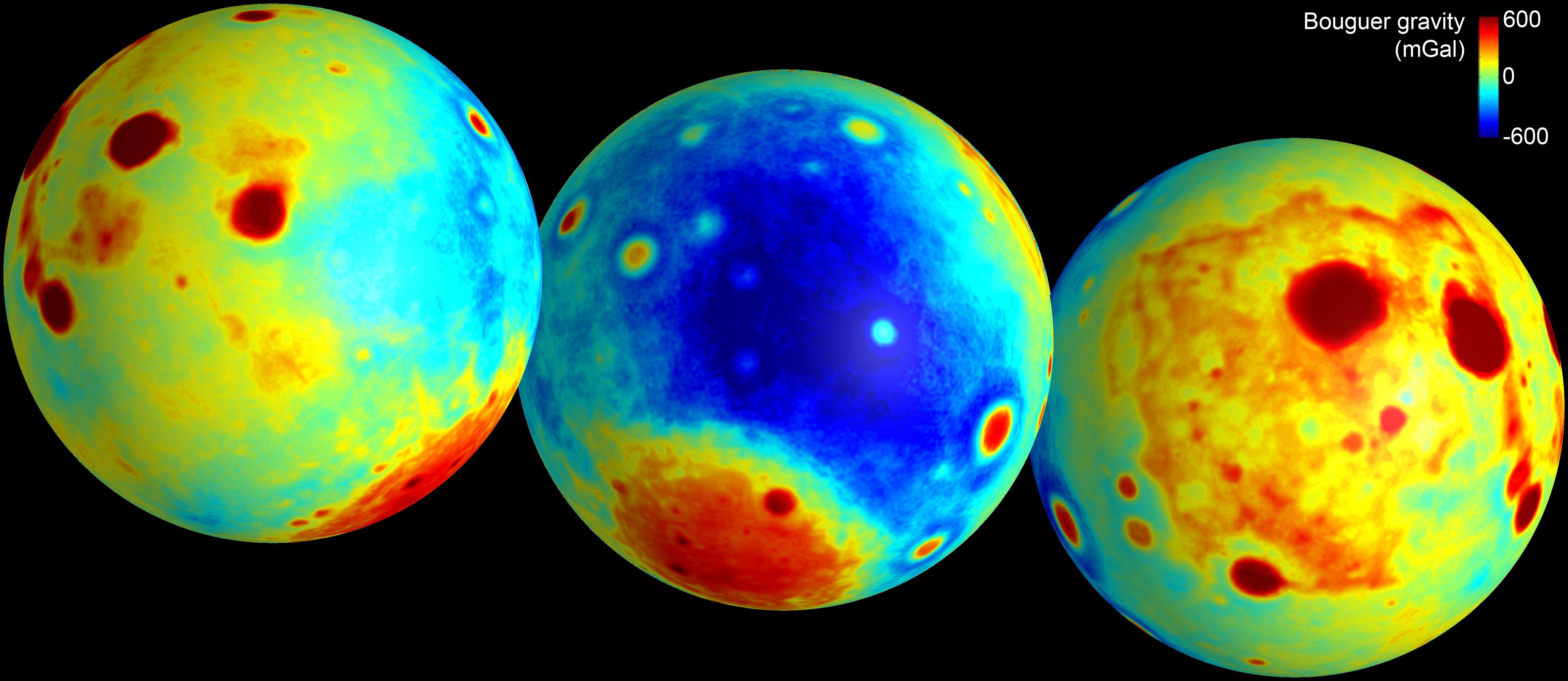
PIA16623:
GRAIL's 'Bouguer' Gravity Moon Map
Full Resolution:
TIFF
(2.754 MB)
JPEG
(95.48 kB)
2012-12-05
Moon
GRAIL
Lunar Reconnaissance Orbiter (LRO)
1038x658x3
PIA16600:
Mapping Lunar Highlands
Full Resolution:
TIFF
(2.05 MB)
JPEG
(154.1 kB)
2012-12-13
Moon
GRAIL
Lunar Reconnaissance Orbiter (LRO)
1280x720x1
PIA16492:
Last Flight for GRAIL's Twin Spacecraft
Full Resolution:
TIFF
(922.8 kB)
JPEG
(116.3 kB)
2012-12-13
Moon
GRAIL
Lunar Reconnaissance Orbiter (LRO)
1636x671x3
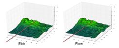
PIA16493:
Ebb and Flow's Final Moments
Full Resolution:
TIFF
(3.295 MB)
JPEG
(114.2 kB)
2012-12-13
Moon
GRAIL
1230x1242x3
PIA16494:
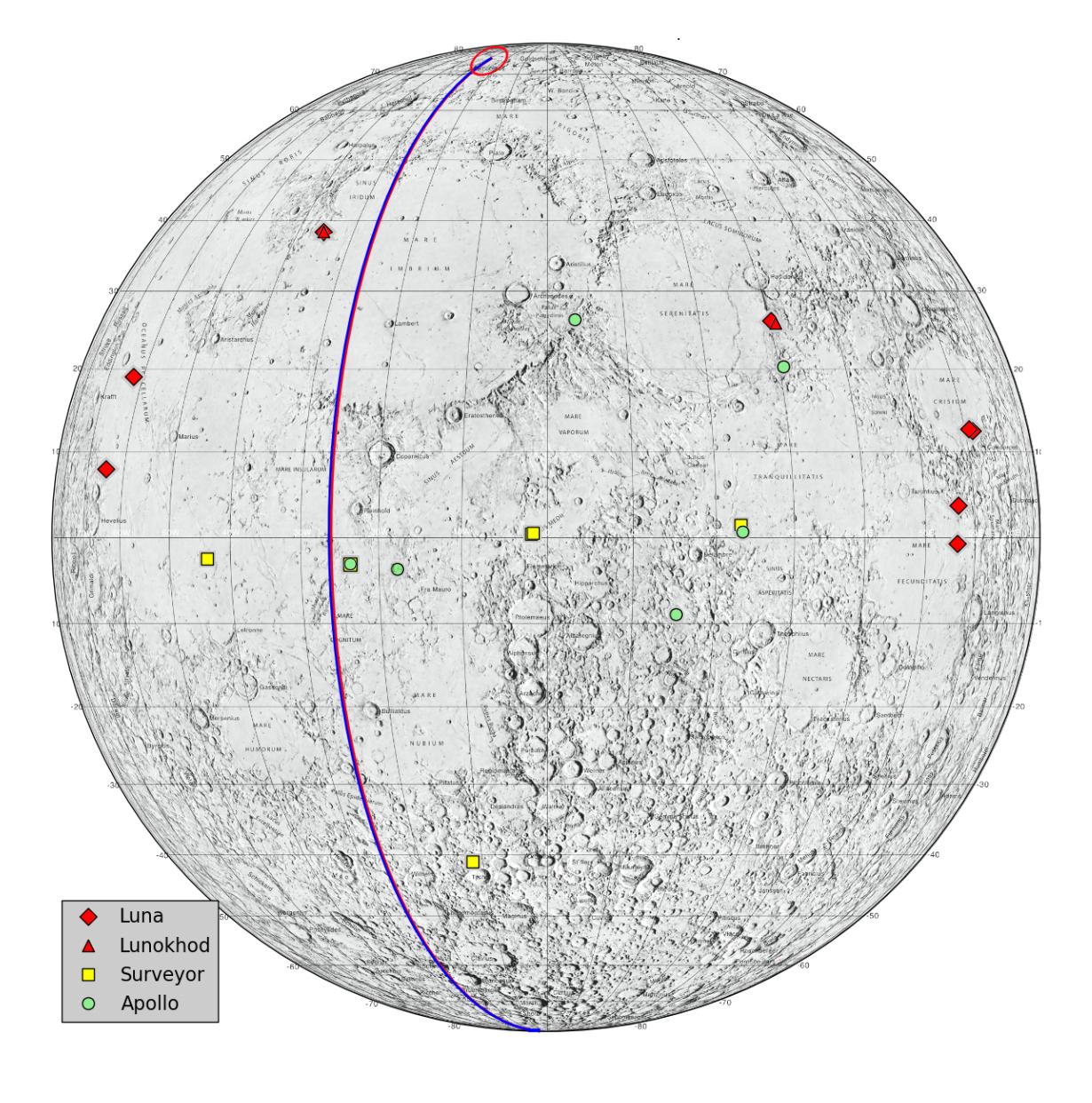
Lunar Heritage Sites and GRAIL's Final Mile
Full Resolution:
TIFF
(4.585 MB)
JPEG
(279 kB)
2012-12-13
Moon
GRAIL
Lunar Reconnaissance Orbiter (LRO)
367x268x1
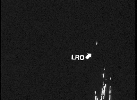
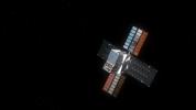
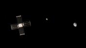
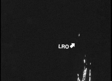
PIA16602:
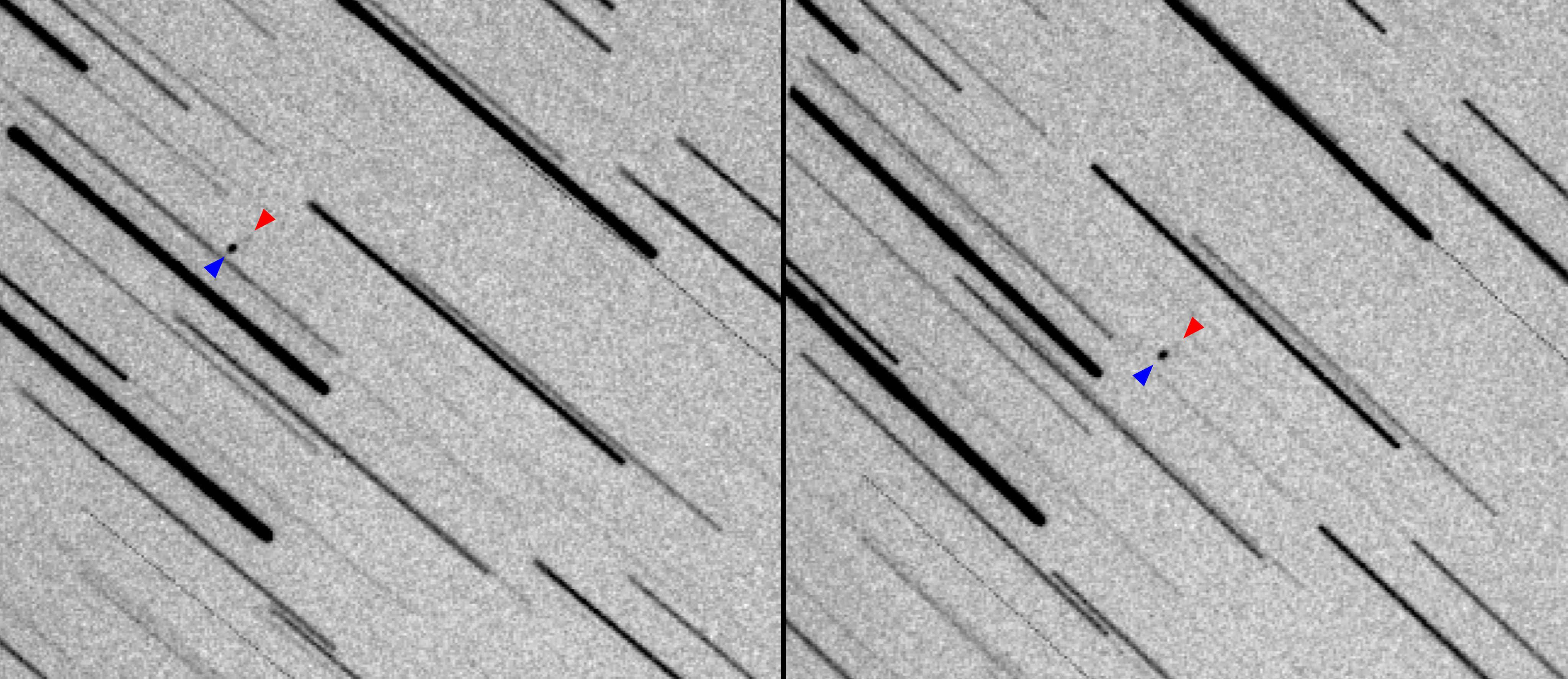
Spacecraft Observes Another Spacecraft at the Moon
Full Resolution:
TIFF
(98.68 kB)
JPEG
(9.264 kB)
2012-12-13
Moon
GRAIL
Lunar Reconnaissance Orbiter (LRO)
1702x998x3
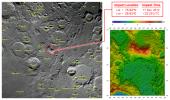
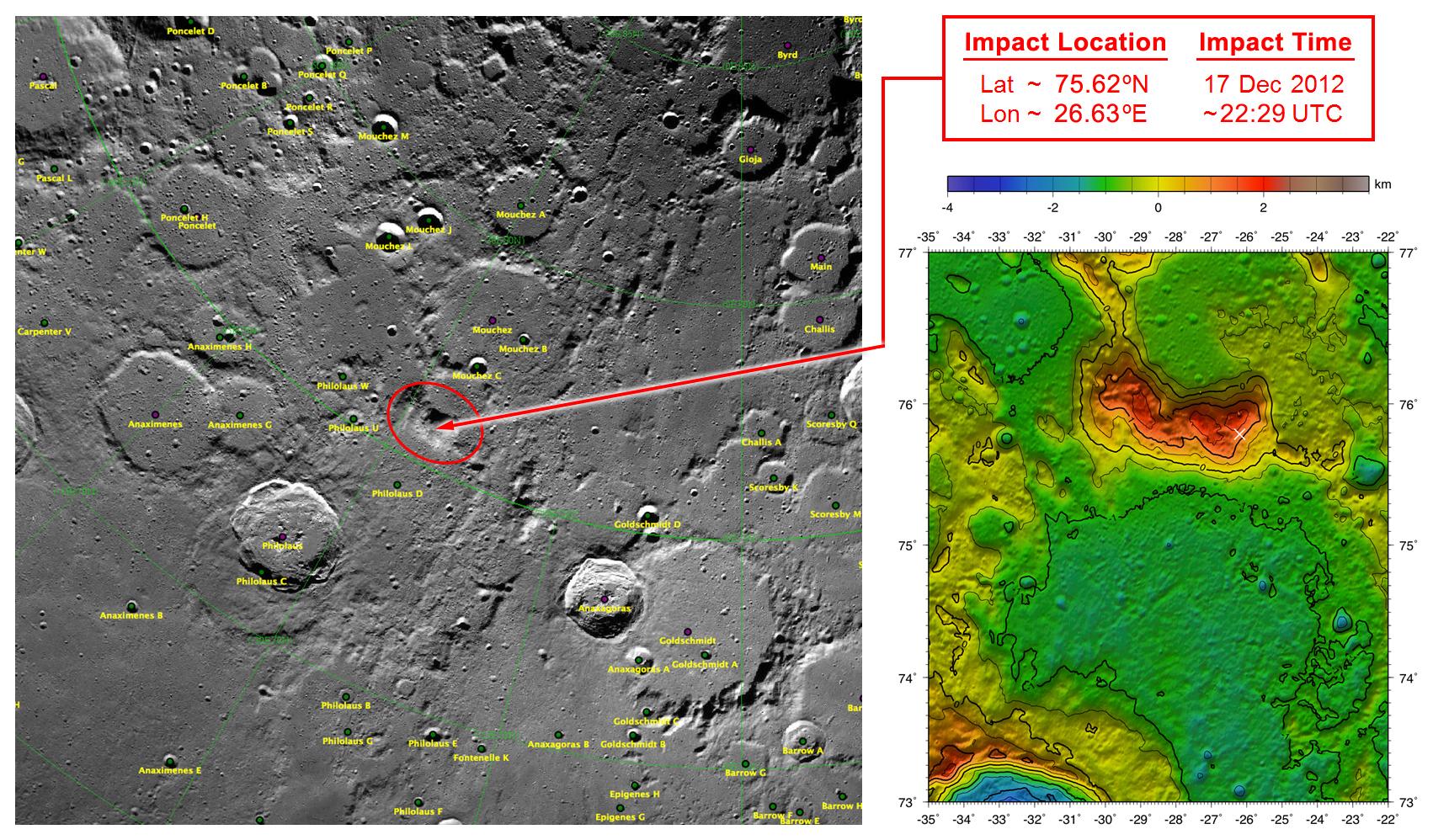
PIA16603:
GRAIL's Final Resting Spot
Full Resolution:
TIFF
(5.098 MB)
JPEG
(409 kB)
2013-03-19
Moon
GRAIL
2022x2040x3
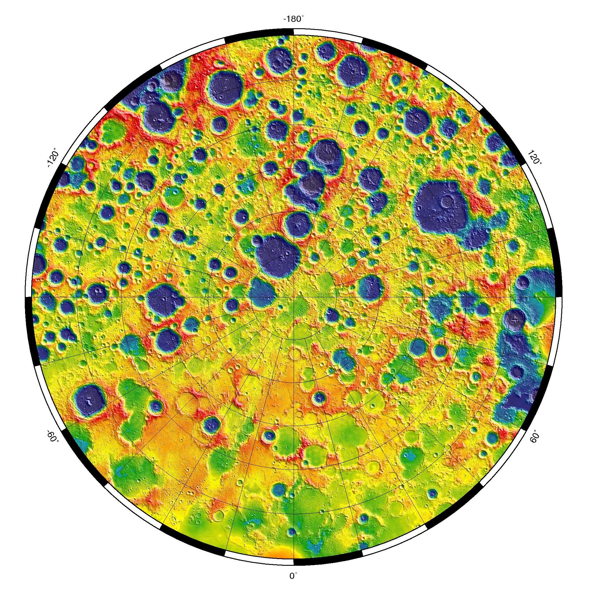
PIA16896:
Gravity at the Moon's North Pole
Full Resolution:
TIFF
(12.38 MB)
JPEG
(1.121 MB)
2013-03-25
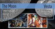
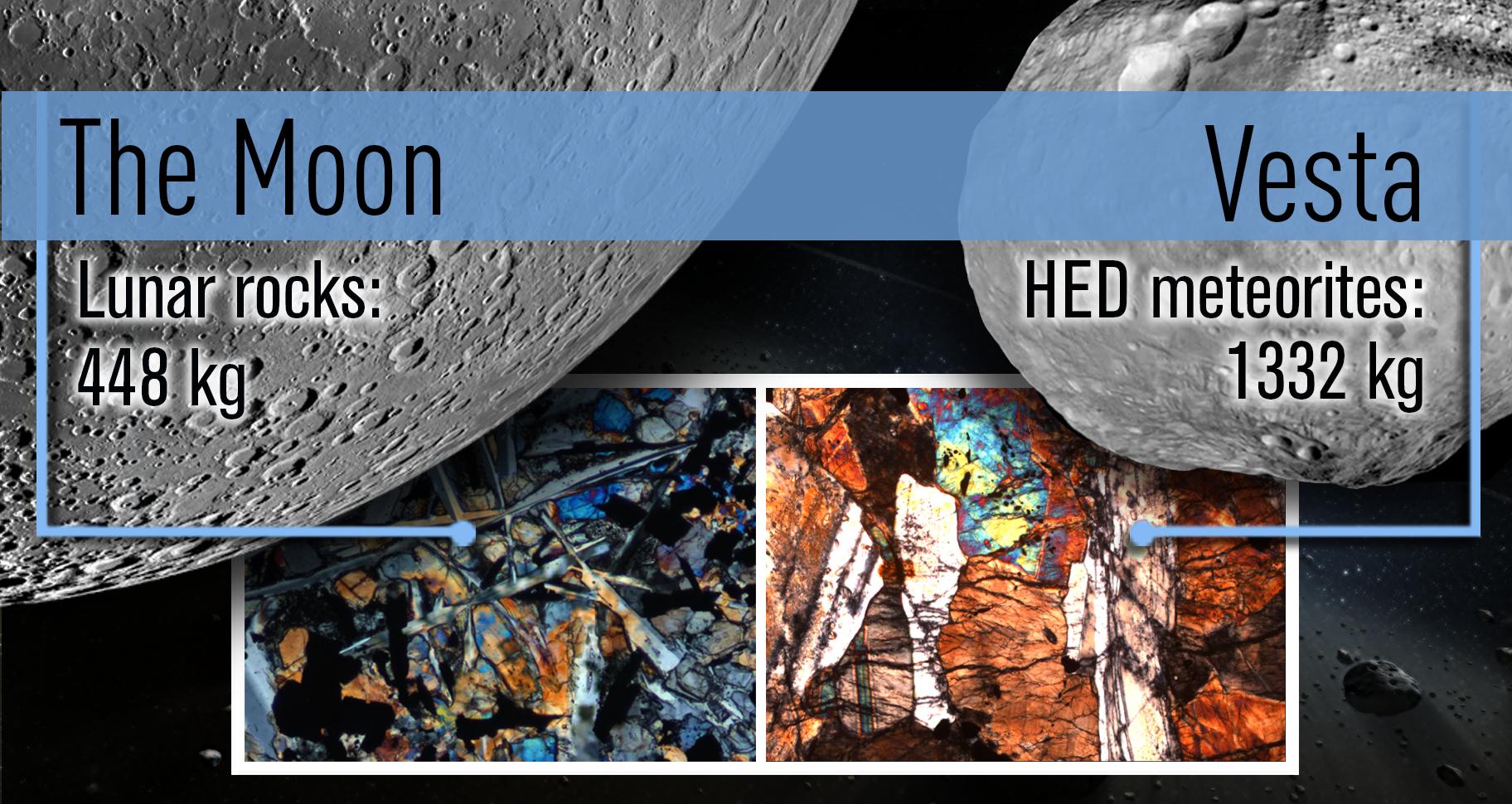
Vesta
Dawn
Lunar Reconnaissance Orbiter (LRO)
1824x970x3
PIA16841:
A Shared Bombardment History
Full Resolution:
TIFF
(5.31 MB)
JPEG
(301.9 kB)
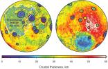
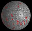
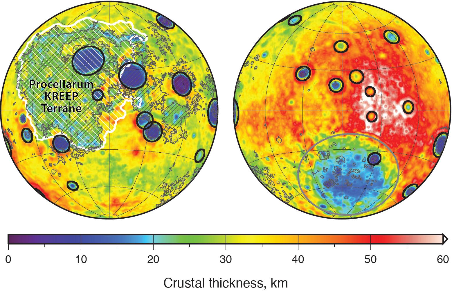
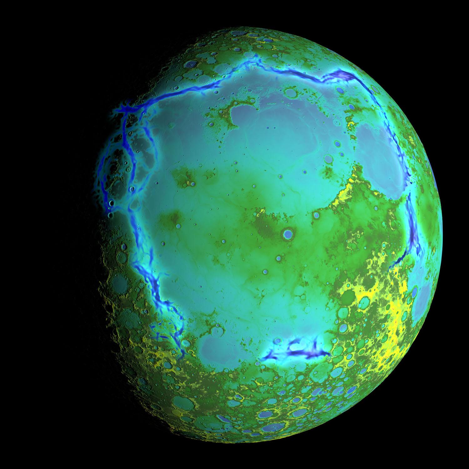
2013-11-08
Moon
GRAIL
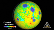
1557x1001x3
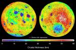
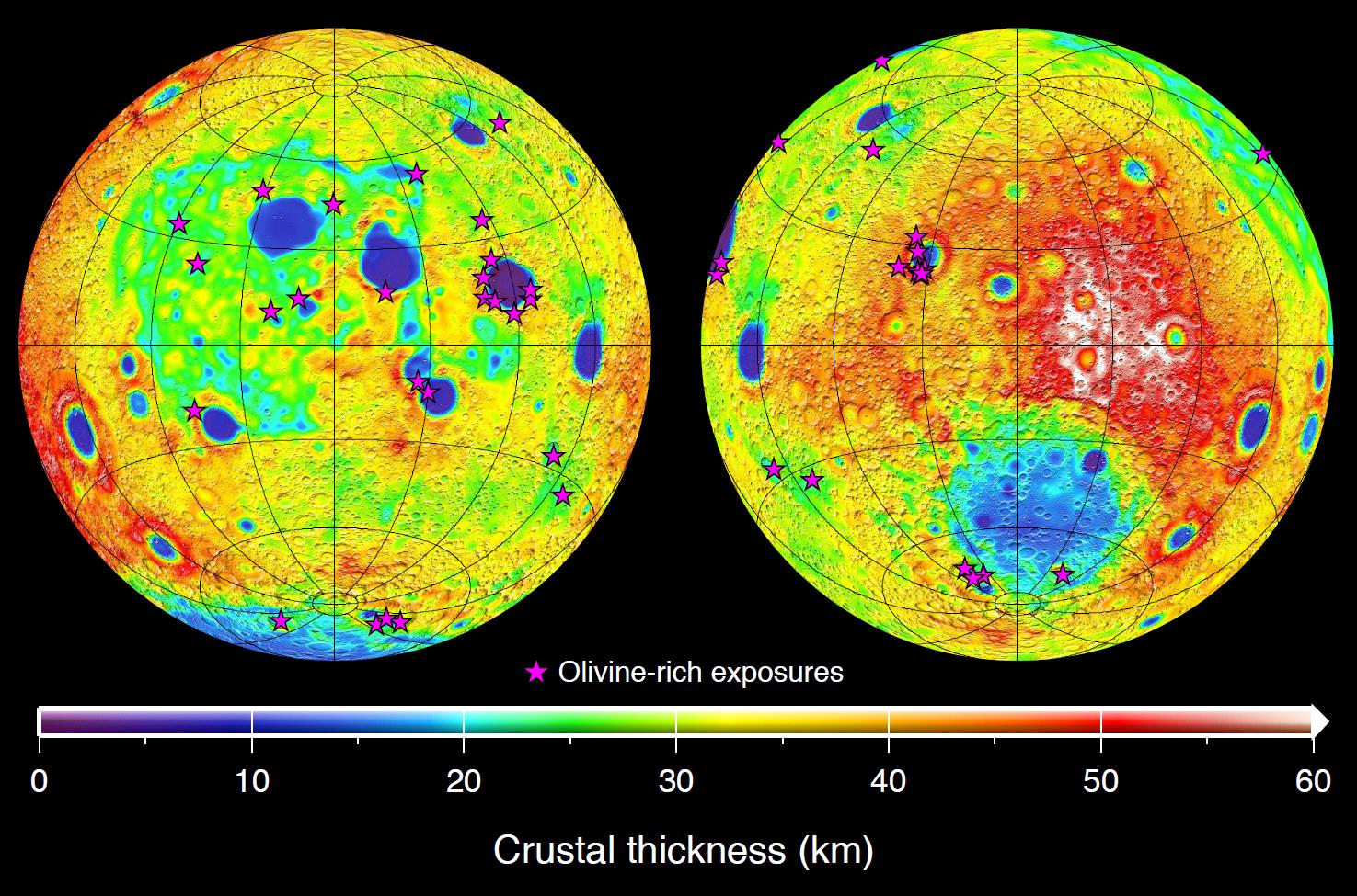
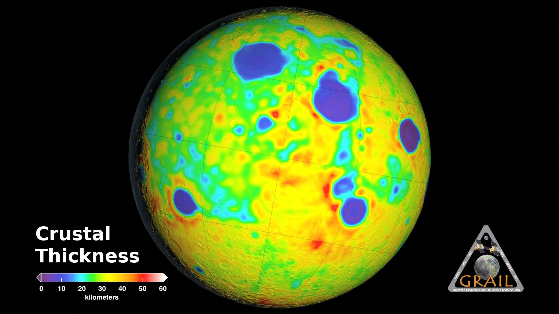
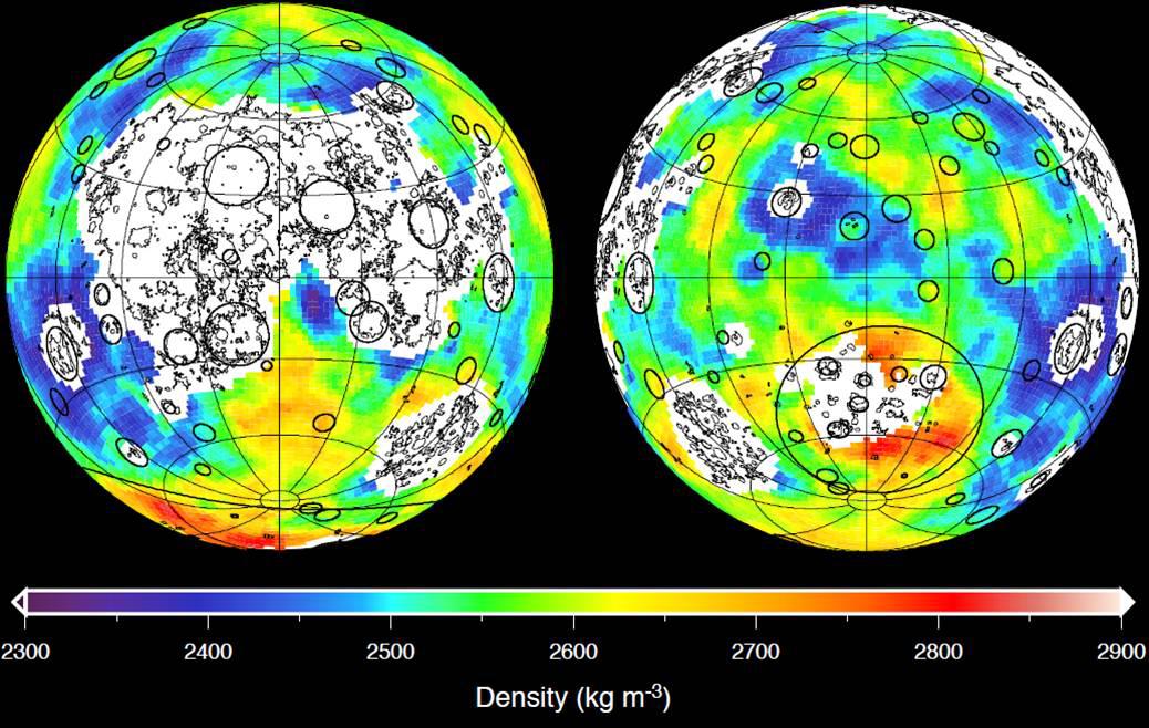
PIA17674:
Moon Crustal Thickness
Full Resolution:
TIFF
(4.678 MB)
JPEG
(288 kB)
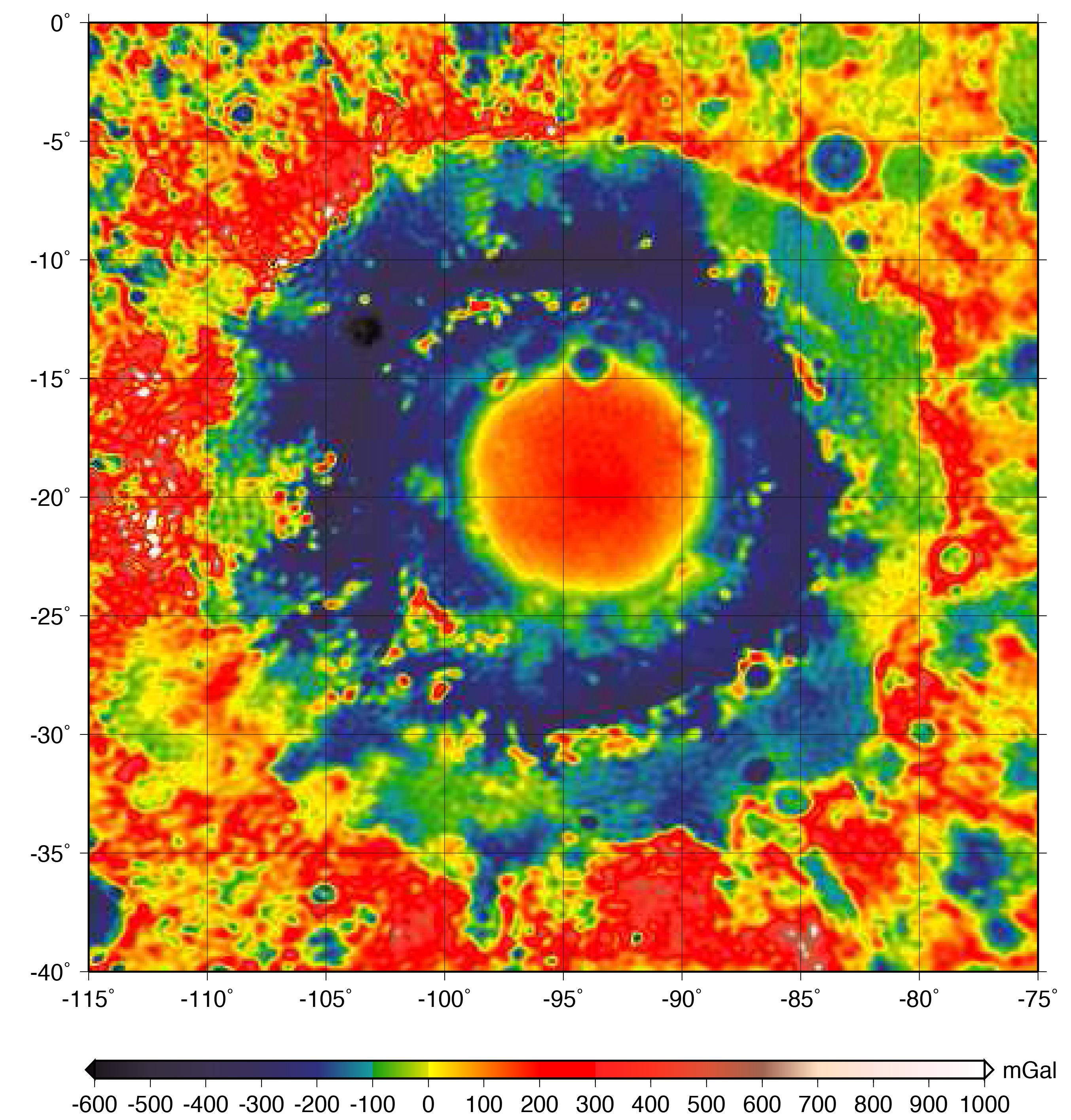
2016-10-27
Moon
GRAIL
2707x2832x3
PIA21050:
GRAIL Gravity Map of Orientale Basin
Full Resolution:
TIFF
(17.62 MB)
JPEG
(990.3 kB)
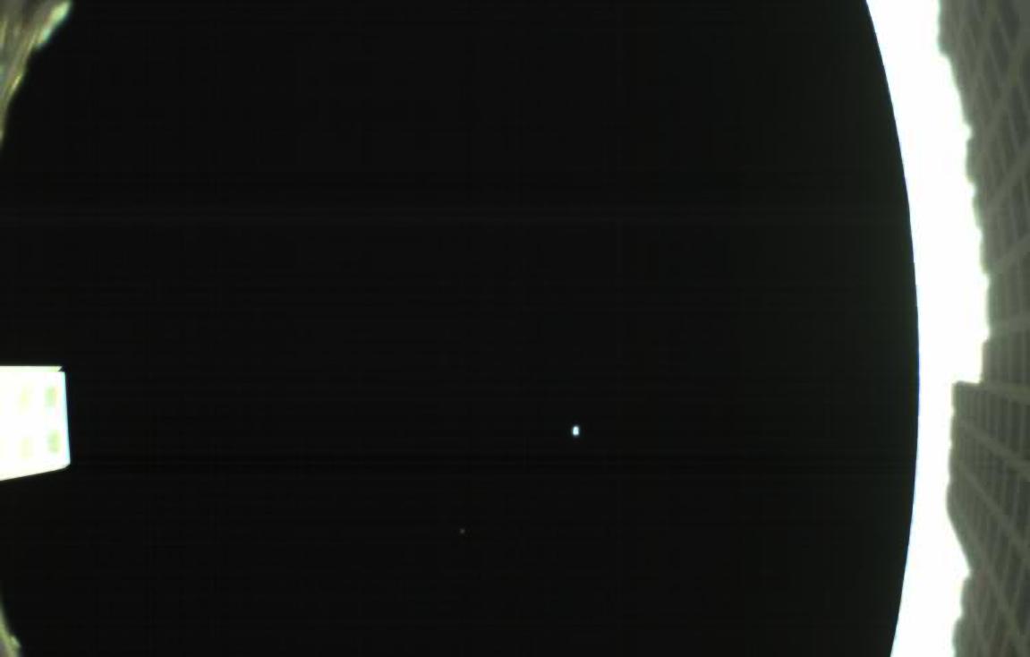
2018-05-15
Earth
MarCO
1151x734x3
PIA22323:
First Image from MarCO-B
Full Resolution:
TIFF
(715.4 kB)
JPEG
(26.32 kB)
2019-05-13
Moon
Lunar Reconnaissance Orbiter (LRO)
1100x1100x3
PIA23209:
The Moon's Mare Frigoris
Full Resolution:
TIFF
(1.288 MB)
JPEG
(268 kB)
2019-05-13
Moon
Lunar Reconnaissance Orbiter (LRO)
1407x1009x1
PIA23210:
Wrinkle Ridges on the Moon
Full Resolution:
TIFF
(1.421 MB)
JPEG
(195.6 kB)
2019-05-13
Moon
Lunar Reconnaissance Orbiter (LRO)
1631x1010x1
PIA23236:
Lobate Scarps on the Moon
Full Resolution:
TIFF
(1.649 MB)
JPEG
(267.7 kB)
2019-05-13
Moon
Lunar Reconnaissance Orbiter (LRO)
1222x988x1
PIA23237:
Graben on the Moon
Full Resolution:
TIFF
(1.209 MB)
JPEG
(200.8 kB)
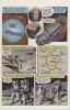
2019-11-20
Moon
Apollo 12
711x1113x3
PIA23552:
Apollo 12 Graphic Novel
Full Resolution:
TIFF
(2.375 MB)
JPEG
(165.5 kB)
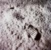
2021-04-21
Moon
Apollo
3294x3226x3
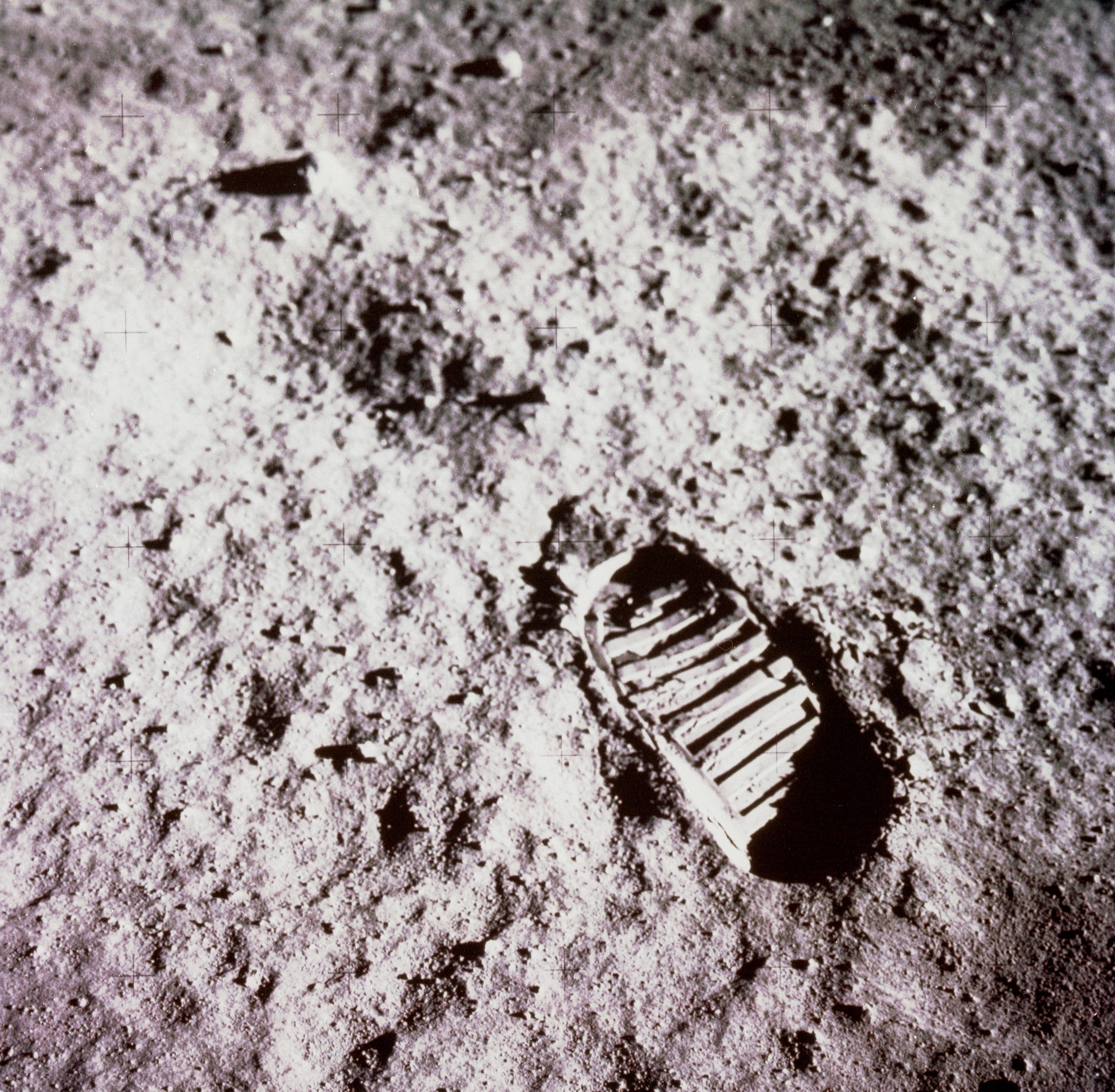
PIA24439:
Apollo Footprint
Full Resolution:
TIFF
(31.89 MB)
JPEG
(1.648 MB)
2022-12-12
Moon
Lunar Flashlight
2947x1661x3
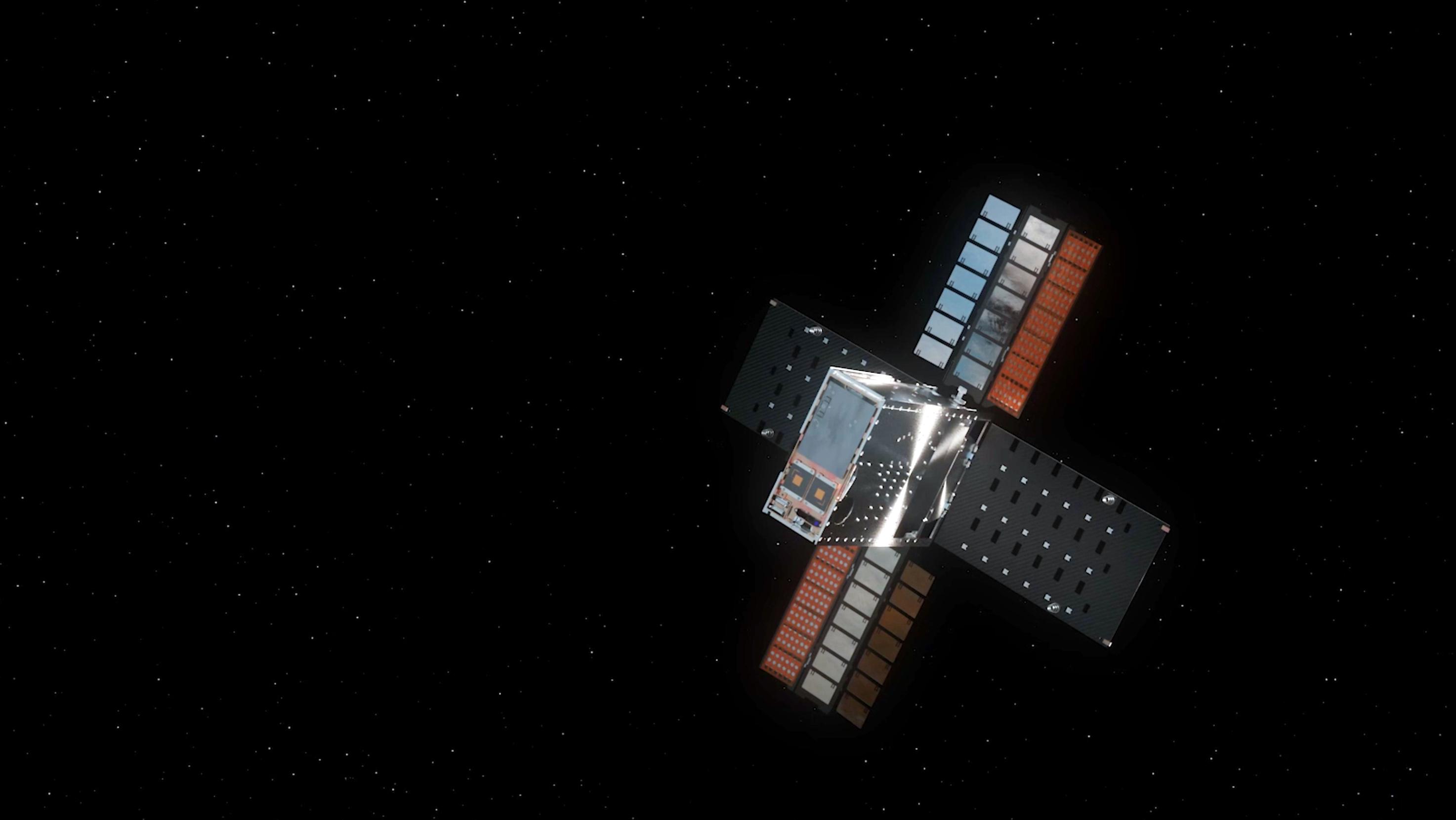
PIA25626:
Lunar Flashlight With Solar Arrays Deployed (Illustration)
Full Resolution:
TIFF
(2.111 MB)
JPEG
(156.3 kB)
2022-12-23
Moon
Lunar Flashlight
4096x1773x3
PIA25257:
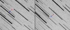
NASA's Lunar Flashlight Spotted From Earth on Its Way to the Moon
Full Resolution:
TIFF
(9.384 MB)
JPEG
(755.8 kB)
2023-01-12
Moon
Lunar Flashlight
2012x1134x3
PIA25258:
Lunar Flashlight's Trajectory Correction Maneuver (Illustration)
Full Resolution:
TIFF
(572.4 kB)
JPEG
(72.68 kB)
1998-06-03
Moon
Lunar Orbiter
610 Millimeter Lunar Orbiter Camera
2000x1100x1
PIA00094:
Limb of Copernicus Impact Crater
Full Resolution:
TIFF
(1.449 MB)
JPEG
(361.9 kB)
2022-02-01
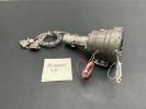
Moon
Cold Operable Lunar Deployable Arm (COLDArm)
4032x3024x3
PIA24567:
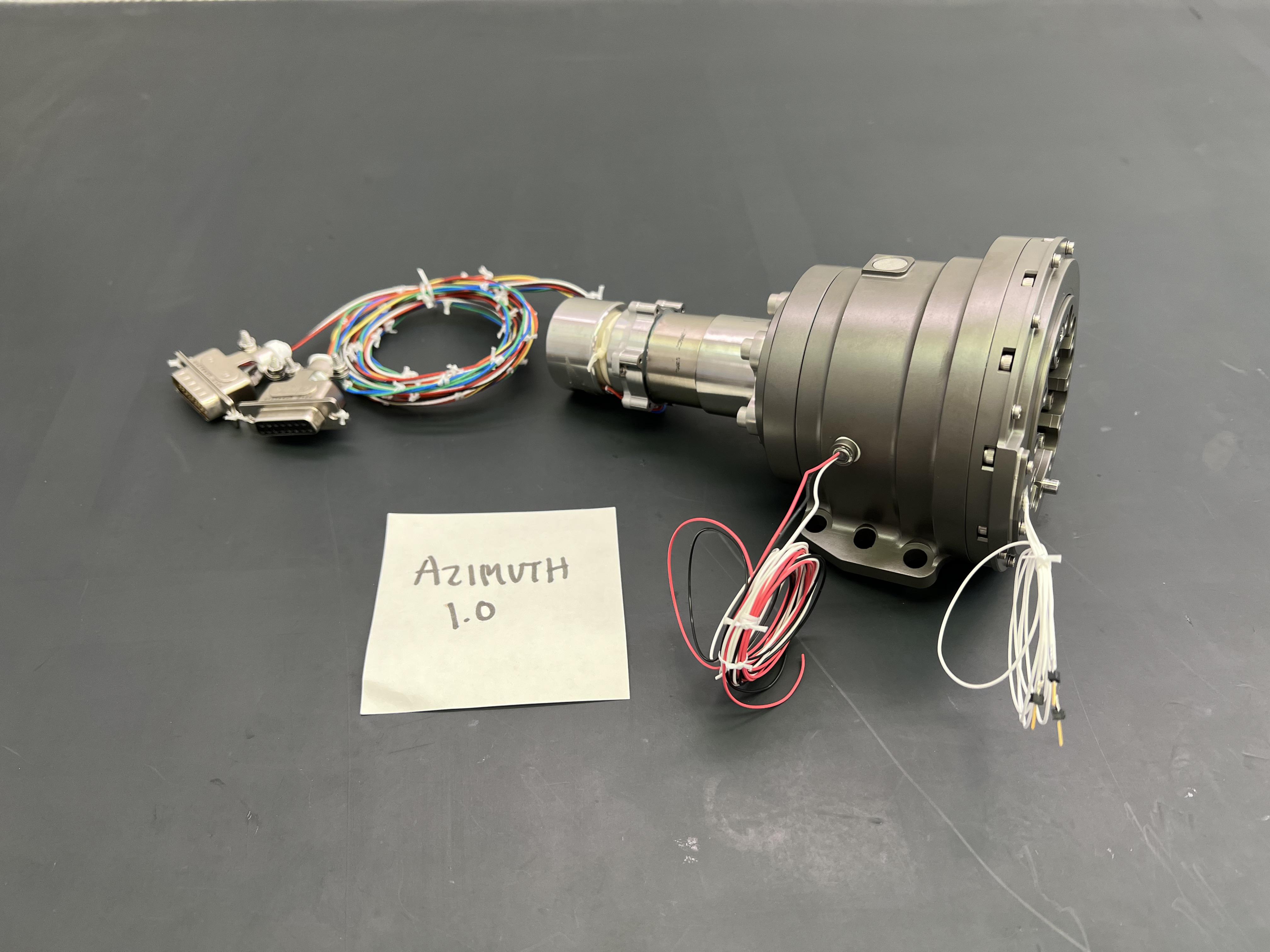
NASA Integrates Gear Motors for Robotic Arm on Future Lunar Missions
Full Resolution:
TIFF
(21.13 MB)
JPEG
(1.048 MB)
2022-12-05
Moon
Cold Operable Lunar Deployable Arm (COLDArm)
8256x5504x3
PIA25316:
Testing NASA's Cold Operable Lunar Deployable Arm (COLDArm)
Full Resolution:
TIFF
(86.02 MB)
JPEG
(3.31 MB)
2022-12-05
Moon
Cold Operable Lunar Deployable Arm (COLDArm)
5504x8256x3
PIA25317:
NASA's COLDArm at Lunar Regolith Simulant Test Bed
Full Resolution:
TIFF
(73.9 MB)
JPEG
(2.899 MB)
2022-12-05
Moon
Cold Operable Lunar Deployable Arm (COLDArm)
8256x5504x3
PIA25318:
Close-Up on COLDArm's Titanium 3D-Printed Scoop
Full Resolution:
TIFF
(83.65 MB)
JPEG
(3.662 MB)
2023-12-20
Moon
Cold Operable Lunar Deployable Arm (COLDArm)
8272x6200x3
PIA26162:
NASA's COLDArm in Thermal Vacuum Testing
Full Resolution:
TIFF
(131.8 MB)
JPEG
(8.23 MB)
2009-06-18
Moon
Goldstone Deep Space Network (DSN)
Goldstone Solar System Radar
4000x3796x3
PIA12077:
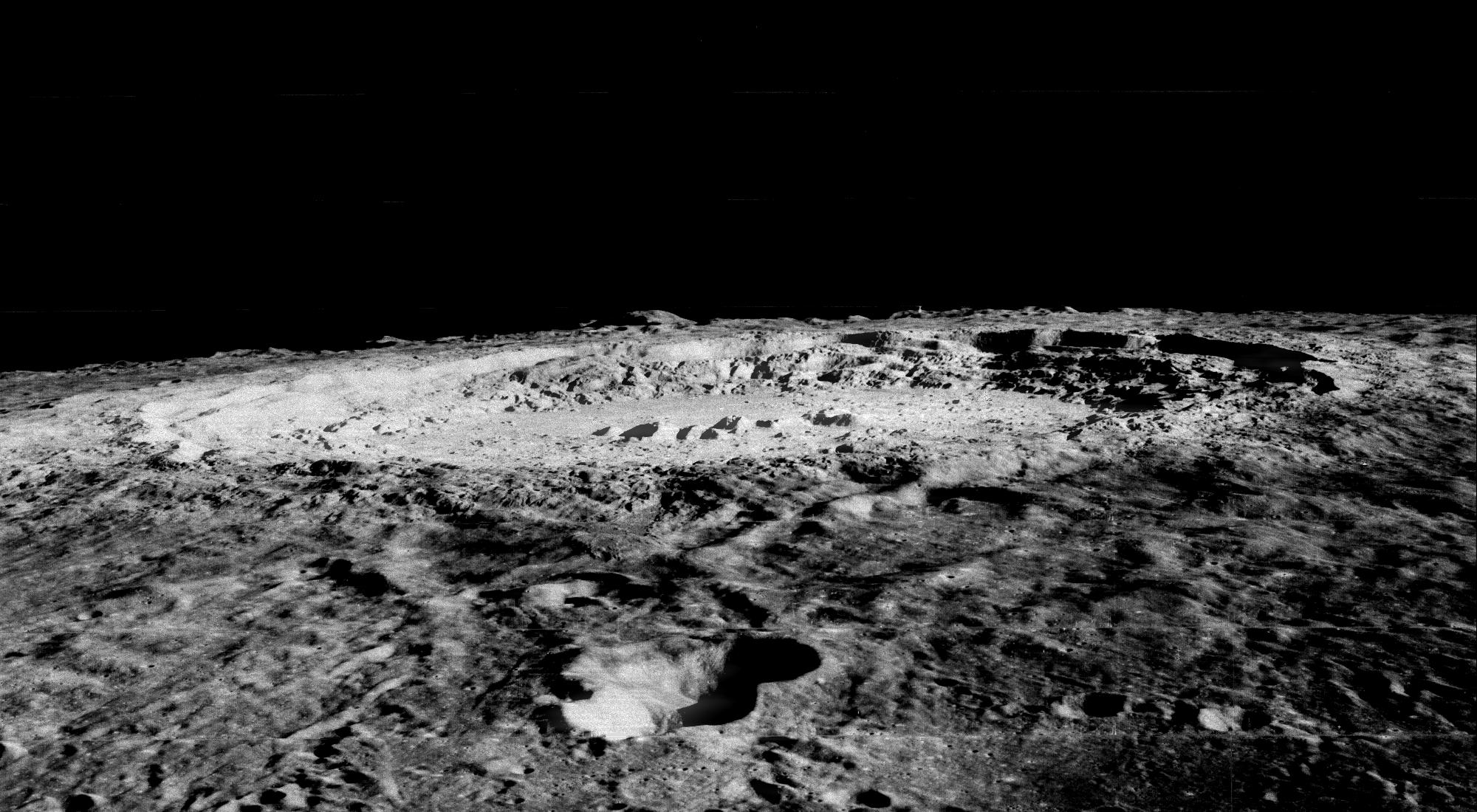
Moon's Rugged South Polar Region Composite
Full Resolution:
TIFF
(45.55 MB)
JPEG
(1.896 MB)
2005-09-10
Moon
Mars Reconnaissance Orbiter (MRO)
HiRISE
410x443x1
PIA08002:
High-Resolution Mars Camera Test Image of Moon
Full Resolution:
TIFF
(182.1 kB)
JPEG
(6.301 kB)
2005-09-10
Moon
Mars Reconnaissance Orbiter (MRO)
HiRISE
2999x2249x3
PIA08005:
Full-Frame Reference for Test Photo of Moon
Full Resolution:
TIFF
(20.23 MB)
JPEG
(167.9 kB)
2005-09-13
Moon
Mars Reconnaissance Orbiter (MRO)
HiRISE
532x663x3
PIA08004:
High-Resolution Mars Camera Test Image of Moon (Infrared)
Full Resolution:
TIFF
(1.059 MB)
JPEG
(16.63 kB)
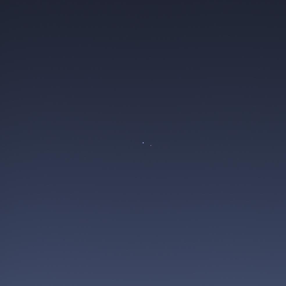
2008-03-03
Earth
Mars Reconnaissance Orbiter (MRO)
HiRISE
800x800x3
PIA10244:
Earth and Moon as Seen from Mars
Full Resolution:
TIFF
(1.922 MB)
JPEG
(11.74 kB)
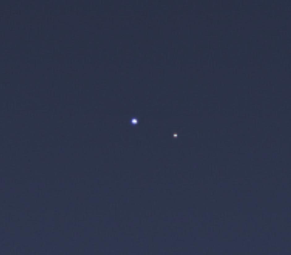
2017-01-06
Earth
Mars Reconnaissance Orbiter (MRO)
HiRISE
657x358x3
PIA21260:
Earth and Its Moon, as Seen From Mars
Full Resolution:
TIFF
(213.9 kB)
JPEG
(7.02 kB)
2013-07-22
Earth
Cassini-Huygens
Imaging Science Subsystem
984x984x3
PIA14949:
One Special Day in the Life of Planet Earth
Full Resolution:
TIFF
(2.906 MB)
JPEG
(16.8 kB)
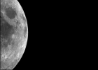
1999-09-10
Moon
Cassini-Huygens
ISS - Narrow Angle
1084x1025x1
PIA02321:
Single Still Image
Full Resolution:
TIFF
(655.5 kB)
JPEG
(96.1 kB)
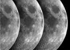
1999-09-10
Moon
Cassini-Huygens
ISS - Narrow Angle
1424x1024x1
PIA02322:
Triptych of the Moon
Full Resolution:
TIFF
(1.407 MB)
JPEG
(189.1 kB)
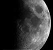
1999-09-01
Moon
Cassini-Huygens
ISS - Narrow Angle
712x512x1
PIA02323:
Narrow Angle Movie
Full Resolution:
1999-09-01
Moon
Cassini-Huygens
ISS - Wide Angle
413x300x1
PIA02324:
Wide Angle Movie
Full Resolution:
2013-07-22
Earth
Cassini-Huygens
ISS - Wide Angle
941x826x3
PIA17170:
One Special Day in the Life of Planet Earth -- Close-Up
Full Resolution:
TIFF
(2.333 MB)
JPEG
(16.07 kB)
2013-07-22
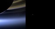
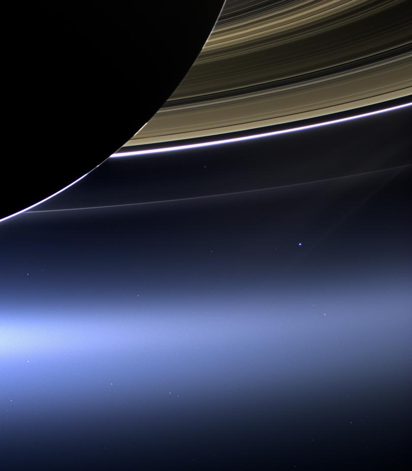
S Rings
Cassini-Huygens
ISS - Wide Angle
838x958x3
PIA17171:
The Day the Earth Smiled: Sneak Preview
Full Resolution:
TIFF
(2.409 MB)
JPEG
(43.81 kB)
2013-07-22
S Rings
MESSENGER
Cassini-Huygens
ISS - Wide Angle
MDIS - Wide Angle
1799x958x3
PIA17038:
Two Views of Home
Full Resolution:
TIFF
(5.172 MB)
JPEG
(67.76 kB)
2014-10-01
Moon
GRAIL
Lunar Reconnaissance Orbiter (LRO)
Lunar Orbit Laser Altimeter
1500x1500x3
PIA18822:
Gravity Gradients Frame Oceanus Procellarum
Full Resolution:
TIFF
(6.753 MB)
JPEG
(203.5 kB)
2012-12-05
Moon
GRAIL
Lunar Reconnaissance Orbiter (LRO)
Lunar Orbiter Laser Altimeter
1690x1623x3
PIA16584:
Moon Dike Map
Full Resolution:
TIFF
(8.232 MB)
JPEG
(590.6 kB)
2010-09-16
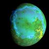
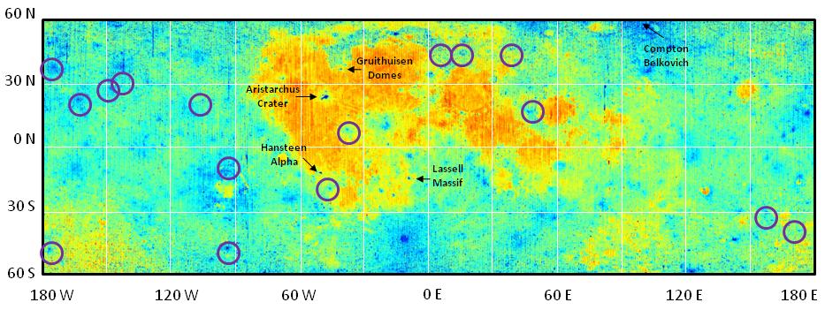
Moon
Lunar Reconnaissance Orbiter (LRO)
Lunar Radiometer
933x351x3
PIA13391:
Diviner Global Composition
Full Resolution:
TIFF
(984.1 kB)
JPEG
(85.5 kB)
2009-07-02
Moon
Lunar Reconnaissance Orbiter (LRO)
Lunar Reconnaissance Orbiter Camera (NAC)
1000x1000x1
PIA12884:
First LROC Images
Full Resolution:
TIFF
(1.001 MB)
JPEG
(160.3 kB)
2009-07-07
Moon
Lunar Reconnaissance Orbiter (LRO)
Lunar Reconnaissance Orbiter Camera (NAC)
1000x1000x1
PIA12886:
Scanning Towards the North Pole
Full Resolution:
TIFF
(1.001 MB)
JPEG
(128.2 kB)
2009-07-03
Moon
Lunar Reconnaissance Orbiter (LRO)
Lunar Reconnaissance Orbiter Camera (NAC)
1000x1000x1
PIA12885:
Swooping over the Lunar Highlands
Full Resolution:
TIFF
(1.001 MB)
JPEG
(192.9 kB)
2009-07-10
Moon
Lunar Reconnaissance Orbiter (LRO)
Lunar Reconnaissance Orbiter Camera (NAC)
1000x1000x1
PIA12887:
The Fractured Floor of Compton
Full Resolution:
TIFF
(1.001 MB)
JPEG
(146.3 kB)
2009-07-17
Moon
Lunar Reconnaissance Orbiter (LRO)
Lunar Reconnaissance Orbiter Camera (NAC)
936x592x1
PIA12889:
LROC's First Look at the Apollo Landing Sites
Full Resolution:
TIFF
(554.9 kB)
JPEG
(40.3 kB)
2009-07-21
Moon
Lunar Reconnaissance Orbiter (LRO)
Lunar Reconnaissance Orbiter Camera (NAC)
1000x1000x3
PIA12890:
The Moon in 3-D
Full Resolution:
TIFF
(3.004 MB)
JPEG
(145.4 kB)
2009-07-27
Moon
Lunar Reconnaissance Orbiter (LRO)
Lunar Reconnaissance Orbiter Camera (NAC)
1000x1000x1
PIA12891:
Relative Timing of Geologic Events in Mare Frigoris
Full Resolution:
TIFF
(1.001 MB)
JPEG
(104.6 kB)
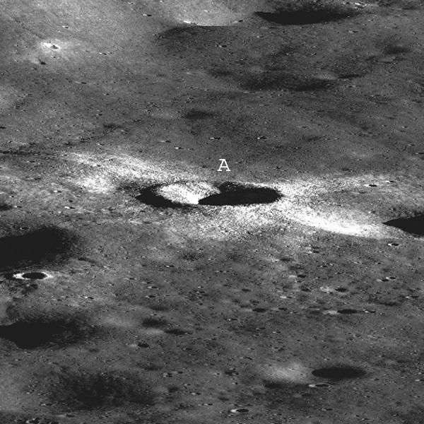
2009-08-03
Moon
Lunar Reconnaissance Orbiter (LRO)
Lunar Reconnaissance Orbiter Camera (NAC)
1000x1000x1
PIA12893:
Bright Crater Rays and Boulders
Full Resolution:
TIFF
(1.001 MB)
JPEG
(109.6 kB)
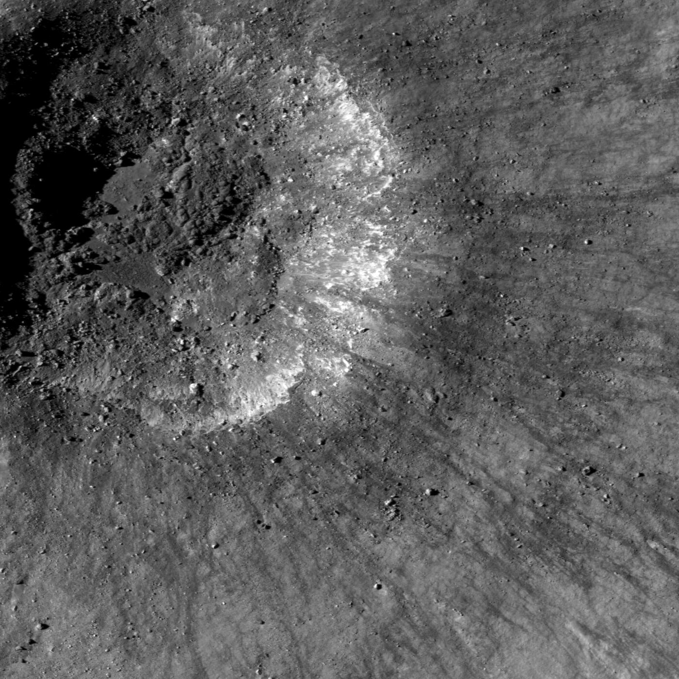
2009-07-28
Moon
Lunar Reconnaissance Orbiter (LRO)
Lunar Reconnaissance Orbiter Camera (NAC)
1500x1500x1
PIA12892:
Terraced Wall in B�rg Crater
Full Resolution:
TIFF
(2.253 MB)
JPEG
(213.6 kB)
2009-08-04
Moon
Lunar Reconnaissance Orbiter (LRO)
Lunar Reconnaissance Orbiter Camera (NAC)
1000x1000x1
PIA12894:
Hummocks and Blocks and Craters
Full Resolution:
TIFF
(1.001 MB)
JPEG
(170.8 kB)
2009-08-05
Moon
Lunar Reconnaissance Orbiter (LRO)
Lunar Reconnaissance Orbiter Camera (NAC)
1000x1000x1
PIA12895:
Stream of Secondary Craters
Full Resolution:
TIFF
(1.001 MB)
JPEG
(181.3 kB)
2009-08-18
Moon
Lunar Reconnaissance Orbiter (LRO)
Lunar Reconnaissance Orbiter Camera (NAC)
1200x1200x1
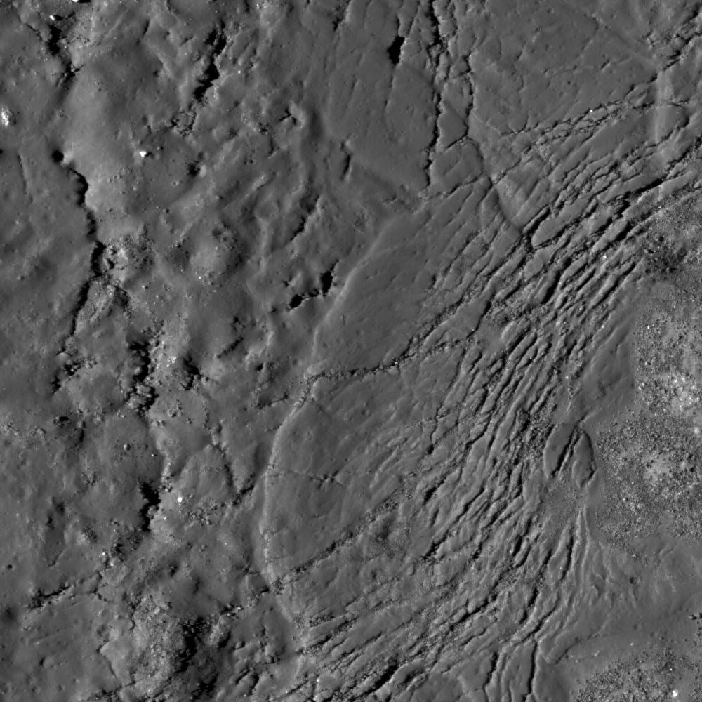
PIA12896:
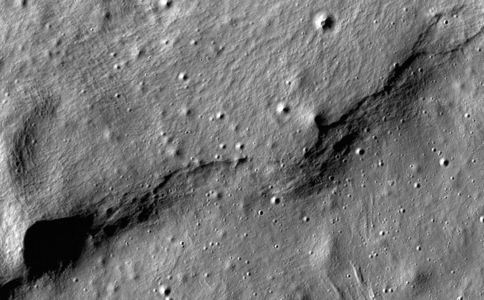
Rille within a Rille
Full Resolution:
TIFF
(1.442 MB)
JPEG
(166.3 kB)
2009-08-19
Moon
Lunar Reconnaissance Orbiter (LRO)
Lunar Reconnaissance Orbiter Camera (NAC)
1500x1500x1
PIA12897:
Trail of Discovery at Fra Mauro
Full Resolution:
TIFF
(2.253 MB)
JPEG
(315 kB)
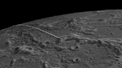
2009-08-21
Moon
Lunar Reconnaissance Orbiter (LRO)
Lunar Reconnaissance Orbiter Camera (NAC)
1000x1000x1
PIA12898:
Necho Crater
Full Resolution:
TIFF
(1.001 MB)
JPEG
(152 kB)
2009-08-25
Moon
Lunar Reconnaissance Orbiter (LRO)
Lunar Reconnaissance Orbiter Camera (NAC)
600x600x1
PIA12900:
First LROC Stereo Results
Full Resolution:
TIFF
(360.6 kB)
JPEG
(76.02 kB)
2009-08-31
Moon
Lunar Reconnaissance Orbiter (LRO)
Lunar Reconnaissance Orbiter Camera (NAC)
1400x1400x1
PIA12901:
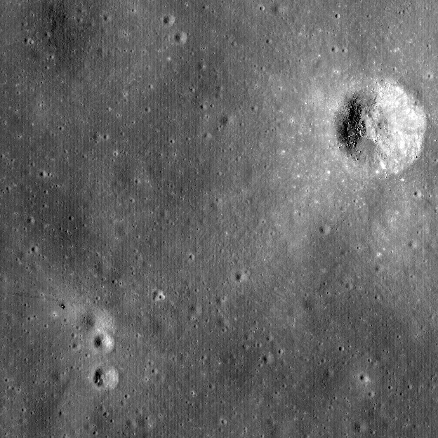
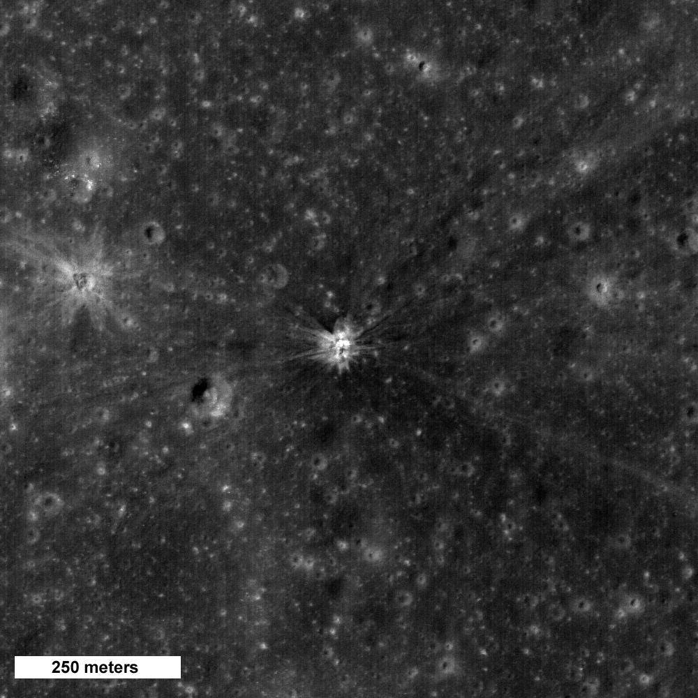
Recent Impact
Full Resolution:
TIFF
(1.962 MB)
JPEG
(359.5 kB)
2009-09-01
Moon
Lunar Reconnaissance Orbiter (LRO)
Lunar Reconnaissance Orbiter Camera (NAC)
1600x1600x1
PIA12902:
Uplift, Boulders of Tsiolkovskiy
Full Resolution:
TIFF
(2.563 MB)
JPEG
(333.7 kB)
2009-09-03
Moon
Lunar Reconnaissance Orbiter (LRO)
Lunar Reconnaissance Orbiter Camera (NAC)
800x800x1
PIA12903:
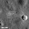
First Look: Apollo 12 and Surveyor 3
Full Resolution:
TIFF
(640.9 kB)
JPEG
(100.5 kB)
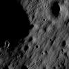
2009-10-06
Moon
Lunar Reconnaissance Orbiter (LRO)
Lunar Reconnaissance Orbiter Camera (NAC)
1000x1000x1
PIA12904:
Where Moscoviense meets the Highlands
Full Resolution:
TIFF
(1.001 MB)
JPEG
(77.32 kB)
2009-09-17
Moon
Lunar Reconnaissance Orbiter (LRO)
Lunar Reconnaissance Orbiter Camera (NAC)
350x350x1
PIA12905:
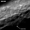
Lunar South Pole - Out of the Shadows
Full Resolution:
TIFF
(122.9 kB)
JPEG
(19.07 kB)
2009-09-18
Moon
Lunar Reconnaissance Orbiter (LRO)
Lunar Reconnaissance Orbiter Camera (NAC)
350x350x1
PIA12906:
Milichius A
Full Resolution:
TIFF
(122.9 kB)
JPEG
(21.63 kB)
2009-09-21
Moon
Lunar Reconnaissance Orbiter (LRO)
Lunar Reconnaissance Orbiter Camera (NAC)
1200x1200x1
PIA12907:
Commissioning Sequences Pave the Way
Full Resolution:
TIFF
(1.442 MB)
JPEG
(217.4 kB)
2009-09-28
Moon
Lunar Reconnaissance Orbiter (LRO)
Lunar Reconnaissance Orbiter Camera (NAC)
1000x1000x1
PIA12908:
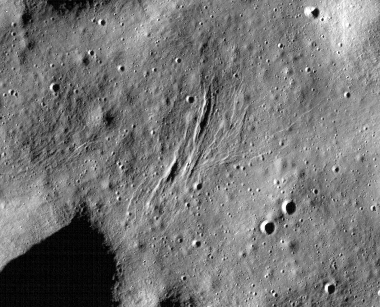
Rima Ariadaeus - A Linear Rille
Full Resolution:
TIFF
(1.001 MB)
JPEG
(156.8 kB)
2009-09-29
Moon
Lunar Reconnaissance Orbiter (LRO)
Lunar Reconnaissance Orbiter Camera (NAC)
800x800x1
PIA12909:
Apollo 11: Second Look
Full Resolution:
TIFF
(640.9 kB)
JPEG
(113.6 kB)
2009-09-30
Moon
Lunar Reconnaissance Orbiter (LRO)
Lunar Reconnaissance Orbiter Camera (NAC)
1000x1000x1
PIA12910:
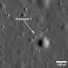
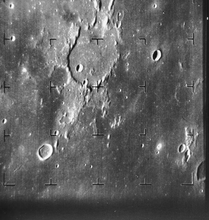
Surveyor 1 -- America's First Soft Lunar Landing
Full Resolution:
TIFF
(1.001 MB)
JPEG
(143.4 kB)
2009-10-08
Moon
Lunar Reconnaissance Orbiter (LRO)
Lunar Reconnaissance Orbiter Camera (NAC)
1000x1000x1
PIA12911:
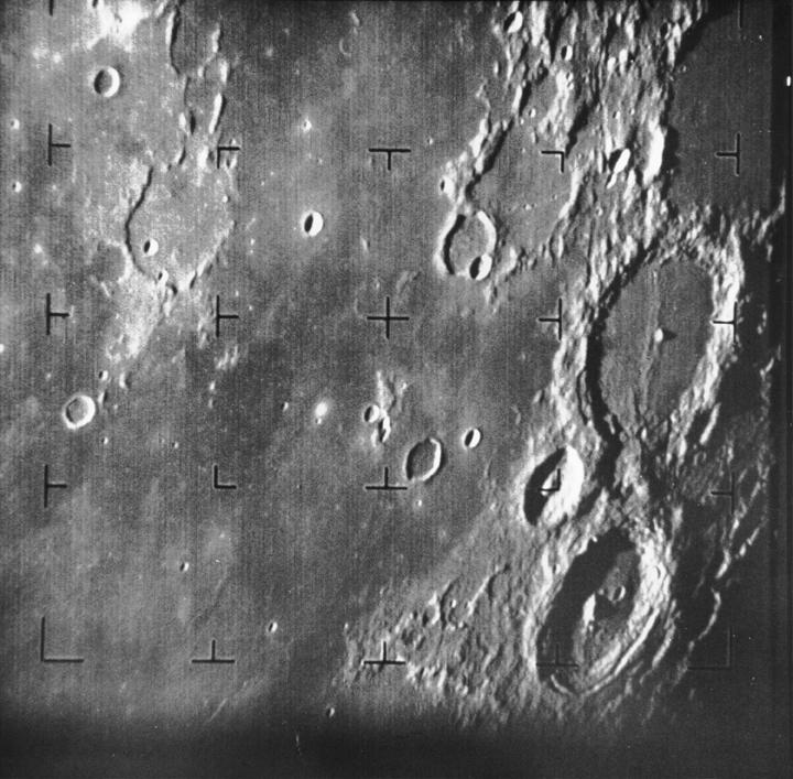
Apollo 14 S-IVB Impact Crater
Full Resolution:
TIFF
(1.001 MB)
JPEG
(170 kB)
1-100
101-200
201-300
301-400
Currently displaying images:
1 - 100
of 346


