|
Your search criteria found 2277 images Target is Earth |
| My List |
Addition Date
|
Target | Mission | Instrument | Size |

|
2016-06-15 | Earth |
Terra |
ASTER |
3652x4200x3 |
|
|||||
|
|
2016-06-14 | Earth |
Earth Observing System (EOS) |
AVIRIS Hyperion Hyperspectral Imager |
1600x900x3 |
|
|||||
|
|
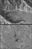
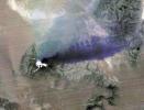
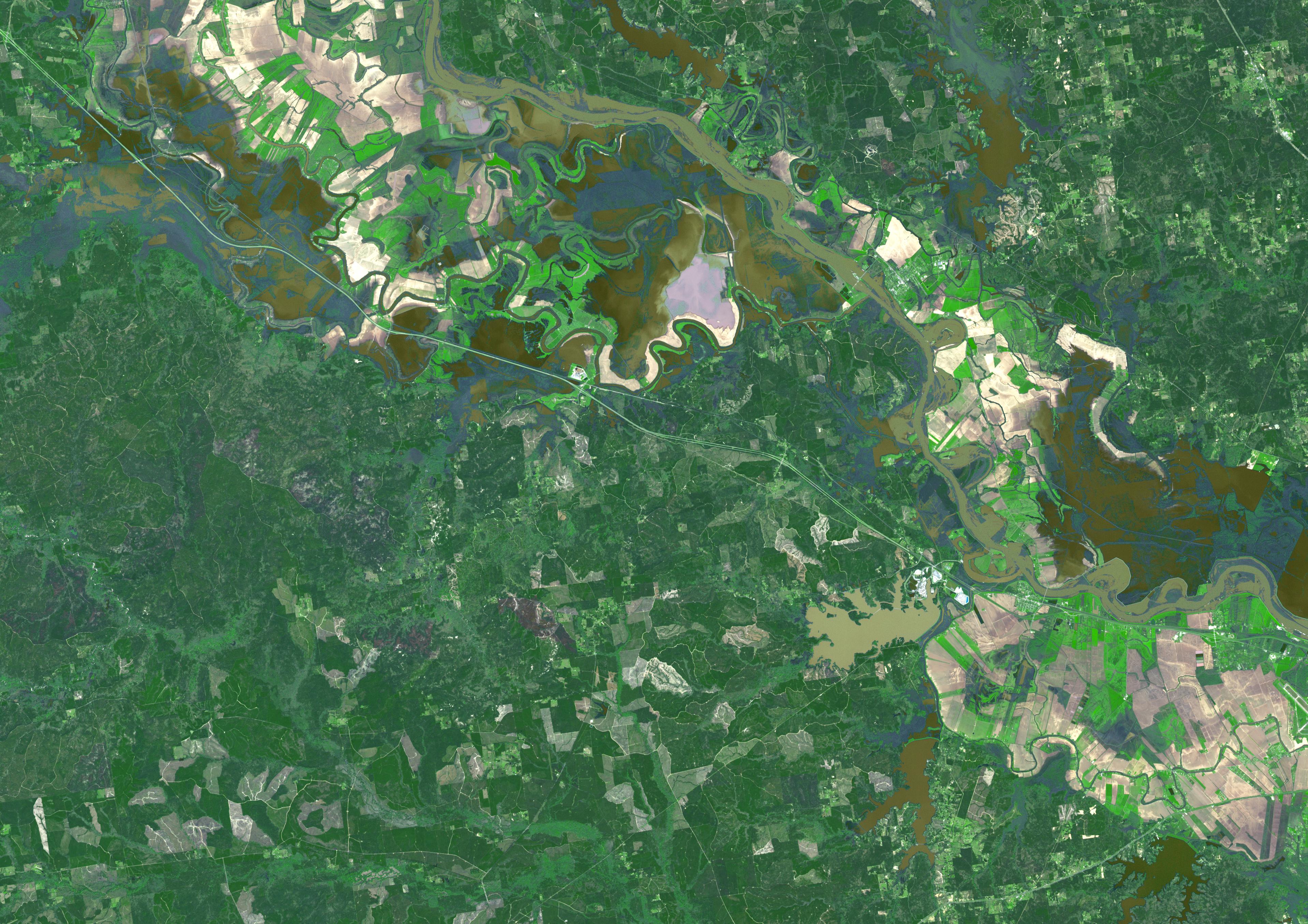
2016-05-27 | Earth |
Terra |
ASTER |
2415x2022x3 |
|
|||||
|
|
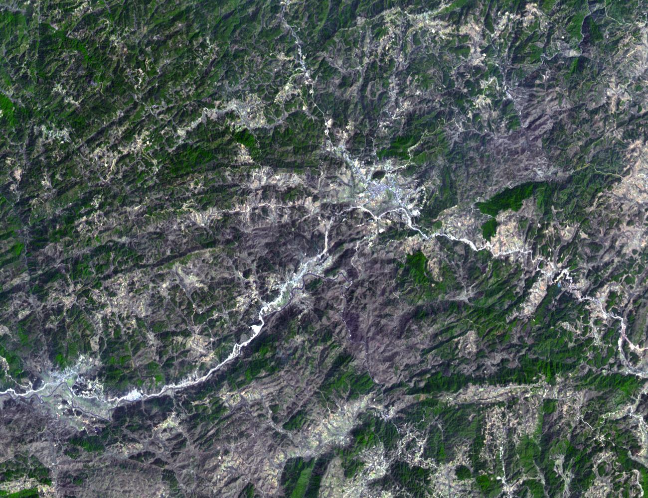
2016-05-24 | Earth |
Terra |
ASTER |
1507x1482x3 |
|
|||||
|
|
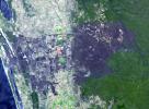
2016-05-18 | Earth |
Terra |
ASTER |
1335x894x3 |
|
|||||
|
|
2016-05-13 | Earth |
Terra |
ASTER |
2800x1400x3 |
|
|||||
|
|
2016-05-11 | Earth |
Aqua |
AIRS |
914x569x3 |
|
|||||
|
|
2016-05-11 | Earth |
Terra |
MISR |
3000x2223x3 |
|
|||||
|
|
2016-05-10 | Earth |
Terra |
ASTER |
544x568x3 |
|
|||||
|
|
2016-04-20 | Earth |
Terra |
ASTER |
1569x1479x3 |

|
|||||
|
|
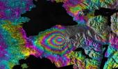
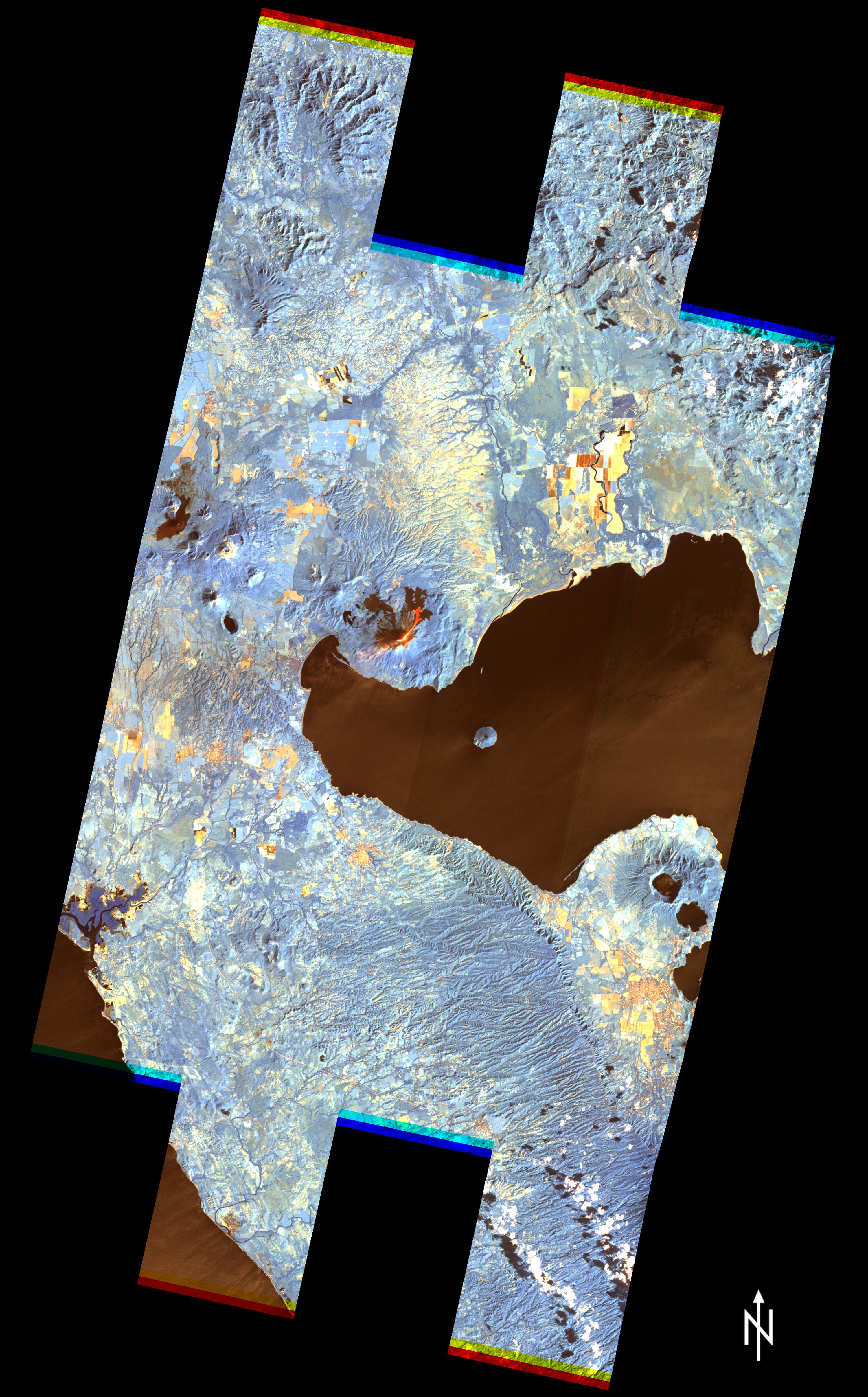
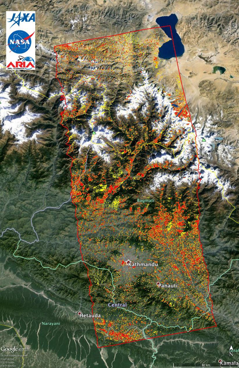
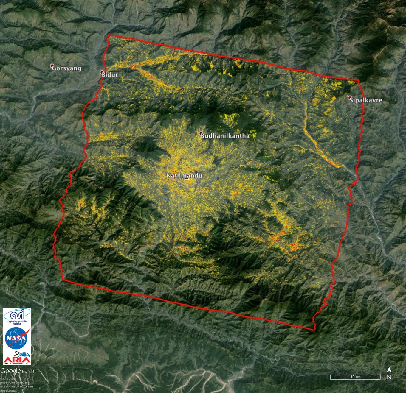
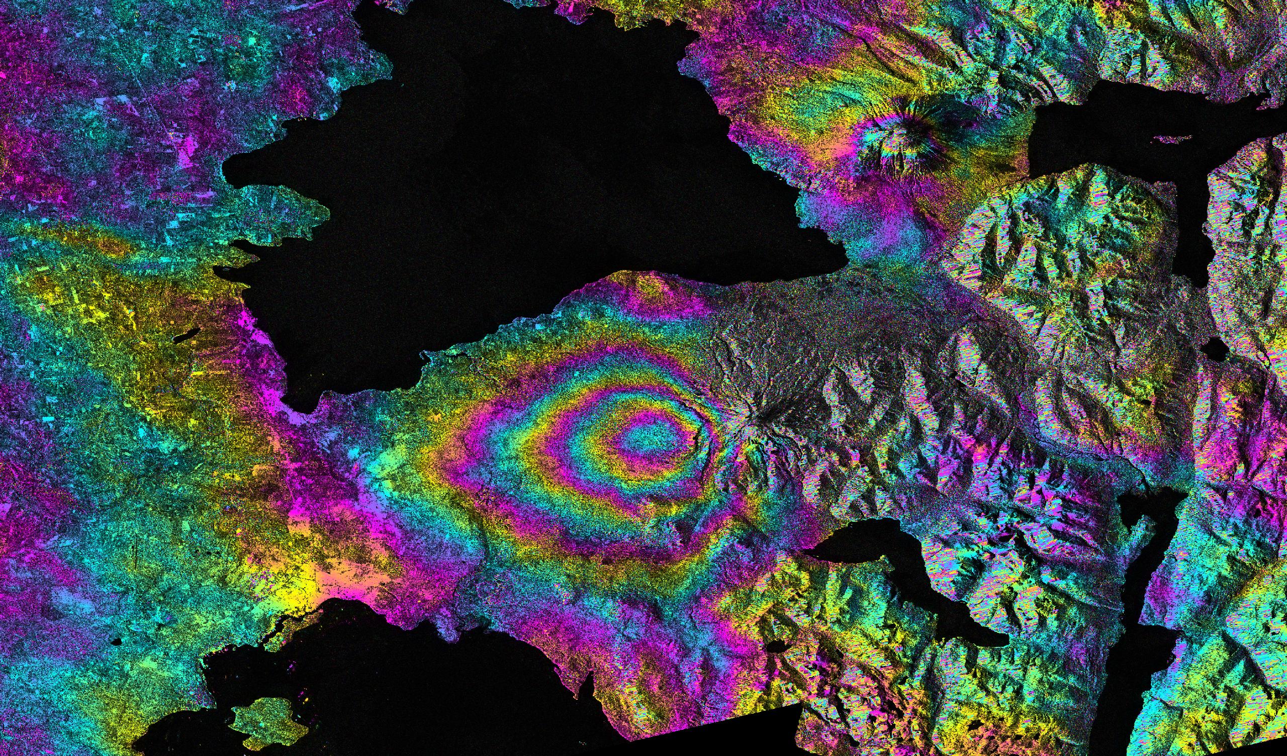
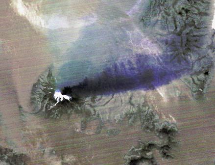
2016-04-20 | Earth |
ARIA |
PALSAR-2 |
970x759x3 |

|
|||||
|
|
2016-03-21 | Earth |
Terra |
ASTER |
3836x2710x3 |
|
|||||
|
|
2016-03-16 | Earth |
Terra |
ASTER |
1300x1000x3 |
|
|||||
|
|
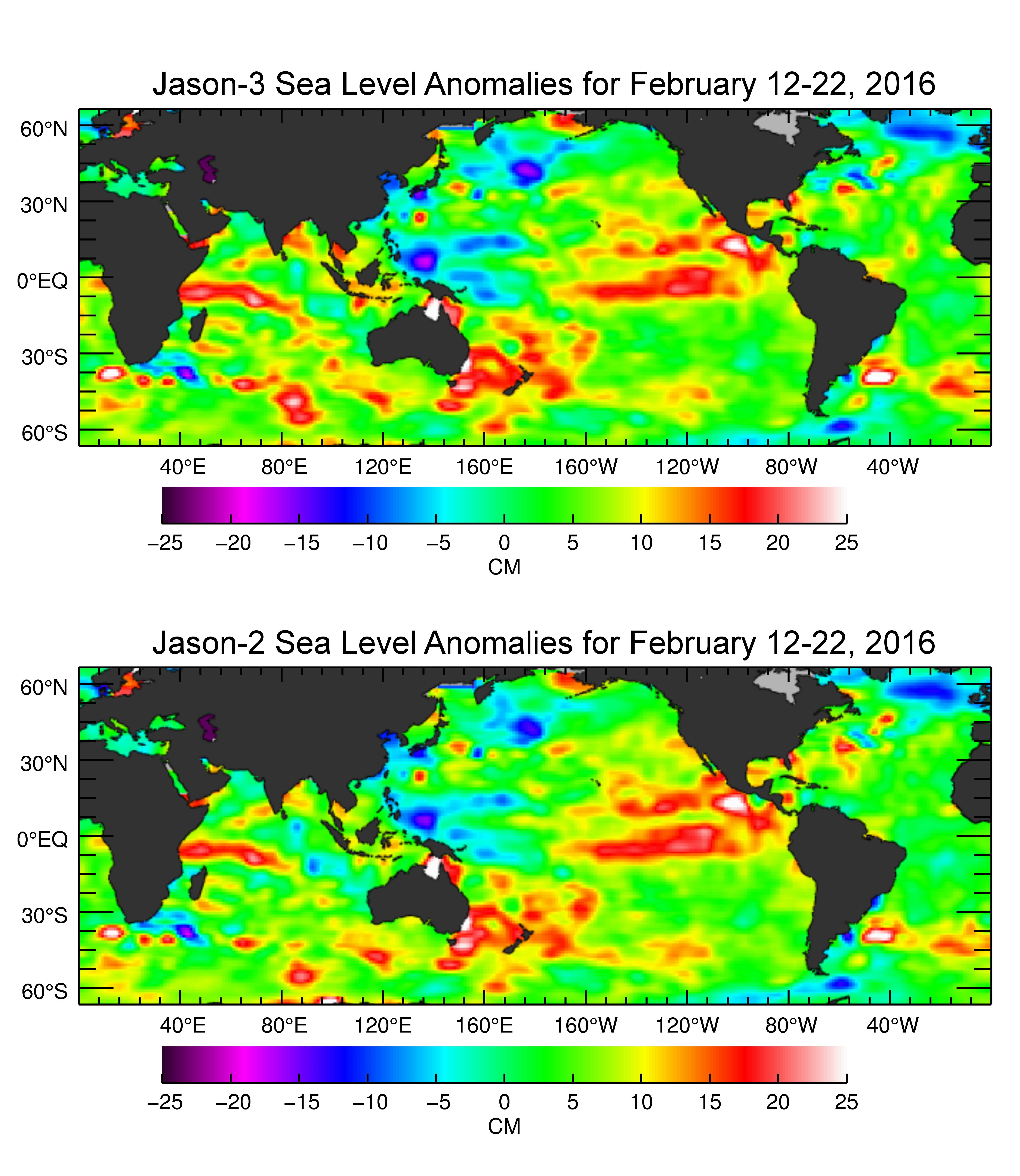
2016-03-16 | Earth |
Jason-3 |
4769x5500x3 | |
|
|||||
|
|
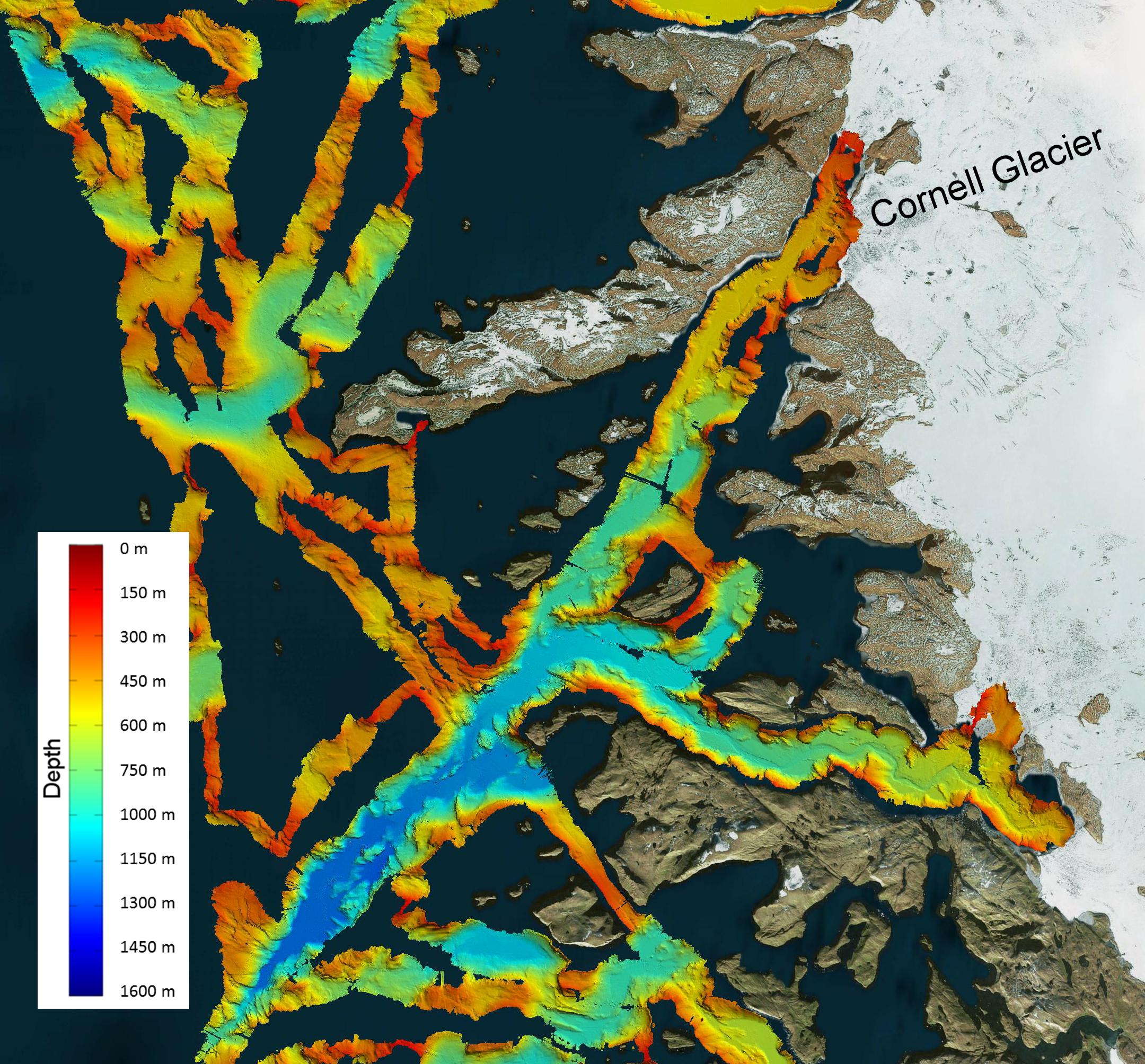
2016-03-08 | Earth |
OMG |
2160x2008x3 | |
|
|||||
|
|
2016-03-02 | Earth |
Terra |
ASTER |
1238x1108x3 |
|
|||||
|
|
2016-02-29 | Earth |
Terra |
ASTER |
1800x2304x3 |
|
|||||
|
|
2016-02-16 | Earth |
Terra |
ASTER |
3790x3400x3 |
|
|||||
|
|
2016-02-05 | Earth |
UAVSAR |
L-Band UAVSAR |
1800x2344x1 |
|
|||||
|
|
2016-02-05 | Earth |
UAVSAR |
L-Band UAVSAR |
1800x882x1 |
|
|||||
|
|
2016-02-05 | Earth |
UAVSAR |
L-Band UAVSAR |
1041x1043x1 |
|
|||||
|
|
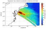
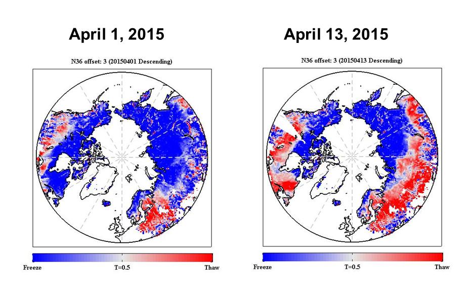
2016-01-28 | Earth |
RapidScat |
ISS-RapidScat |
682x593x3 |
|
|||||
|
|
2016-01-27 | Earth |
UAVSAR |
L-Band UAVSAR |
1800x2721x1 |
|
|||||
|
|
2016-01-25 | Earth |
RapidScat |
ISS-RapidScat |
751x479x3 |
|
|||||
|
|
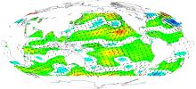
2016-01-21 | Earth |
RapidScat |
ISS-RapidScat |
1532x696x3 |
|
|||||
|
|
2016-01-20 | Earth |
Terra |
ASTER |
2532x2544x3 |

|
|||||
|
|
2016-01-19 | Earth |
Terra |
ASTER |
3592x2652x3 |
|
|||||
|
|
2016-01-15 | Earth |
Terra |
ASTER |
4224x4846x3 |
|
|||||
|
|
2016-01-07 | Earth |
Terra |
ASTER |
3640x3300x3 |
|
|||||
|
|
2015-12-09 | Earth |
Terra |
ASTER |
1600x1200x3 |
|
|||||
|
|
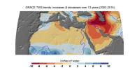
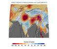
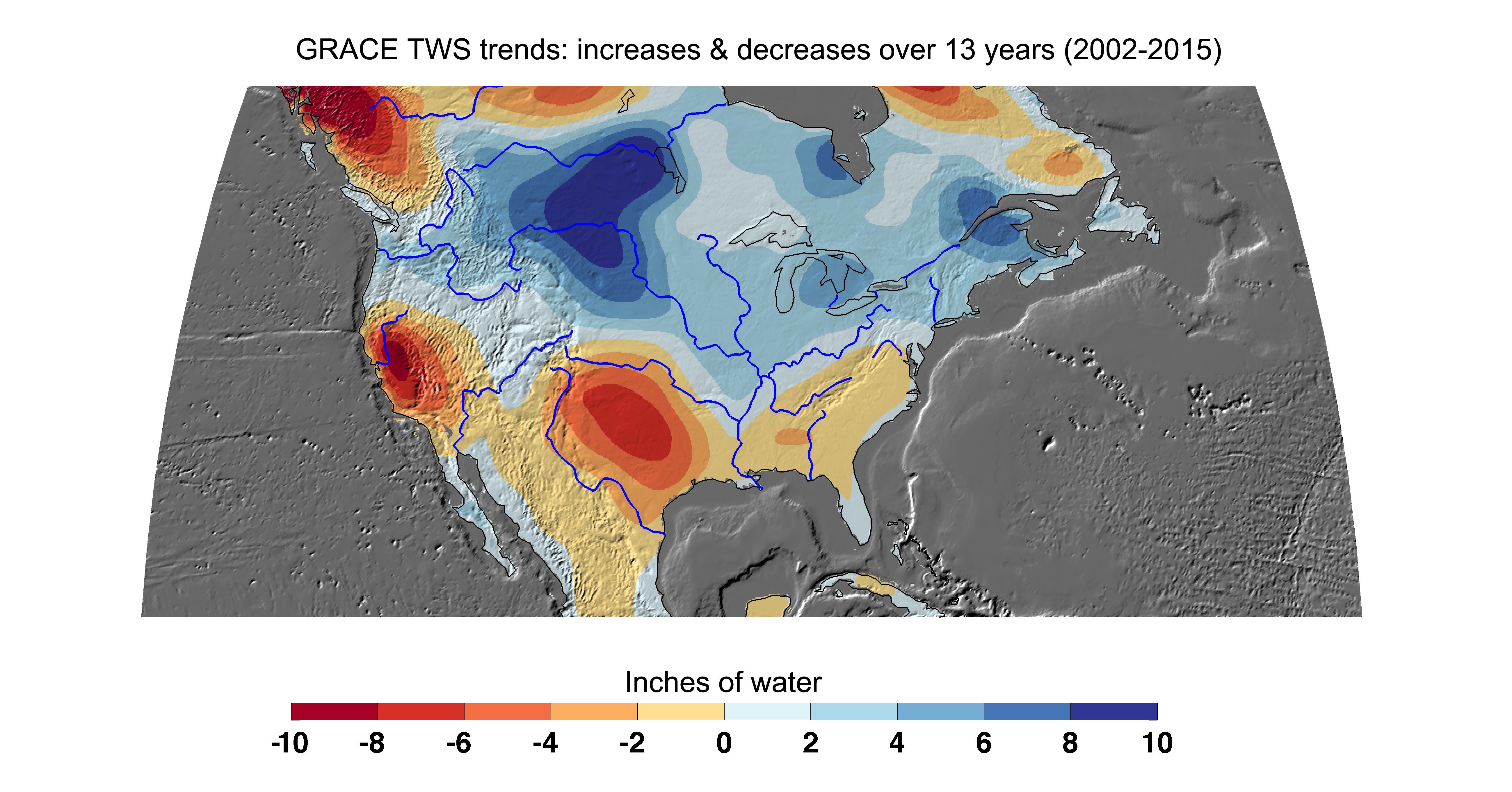
2015-12-08 | Earth |
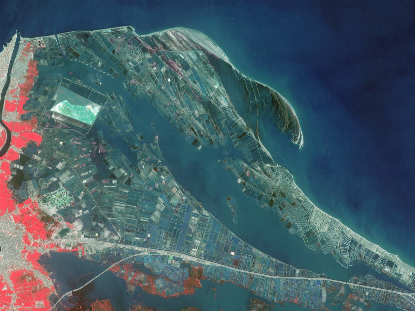
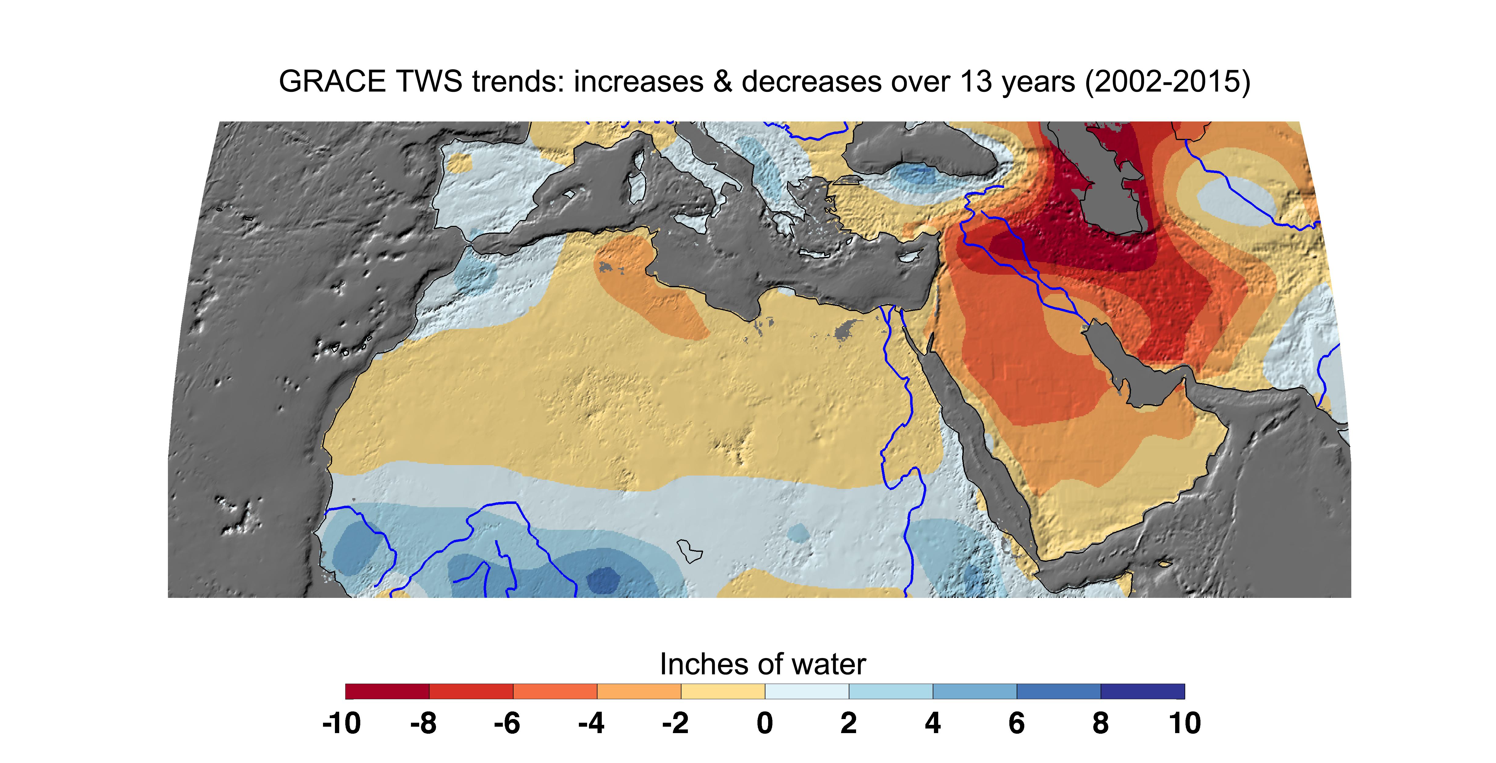
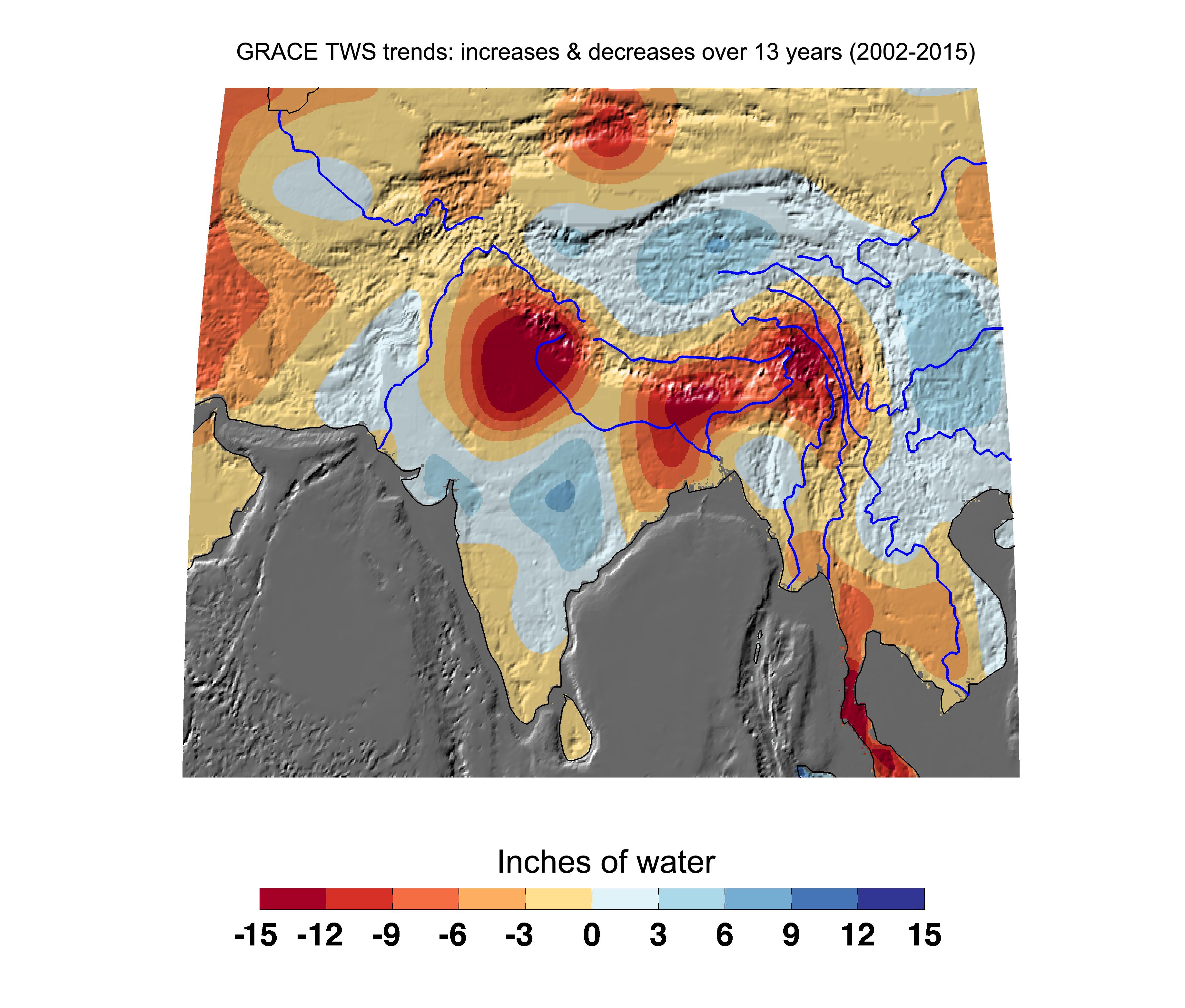
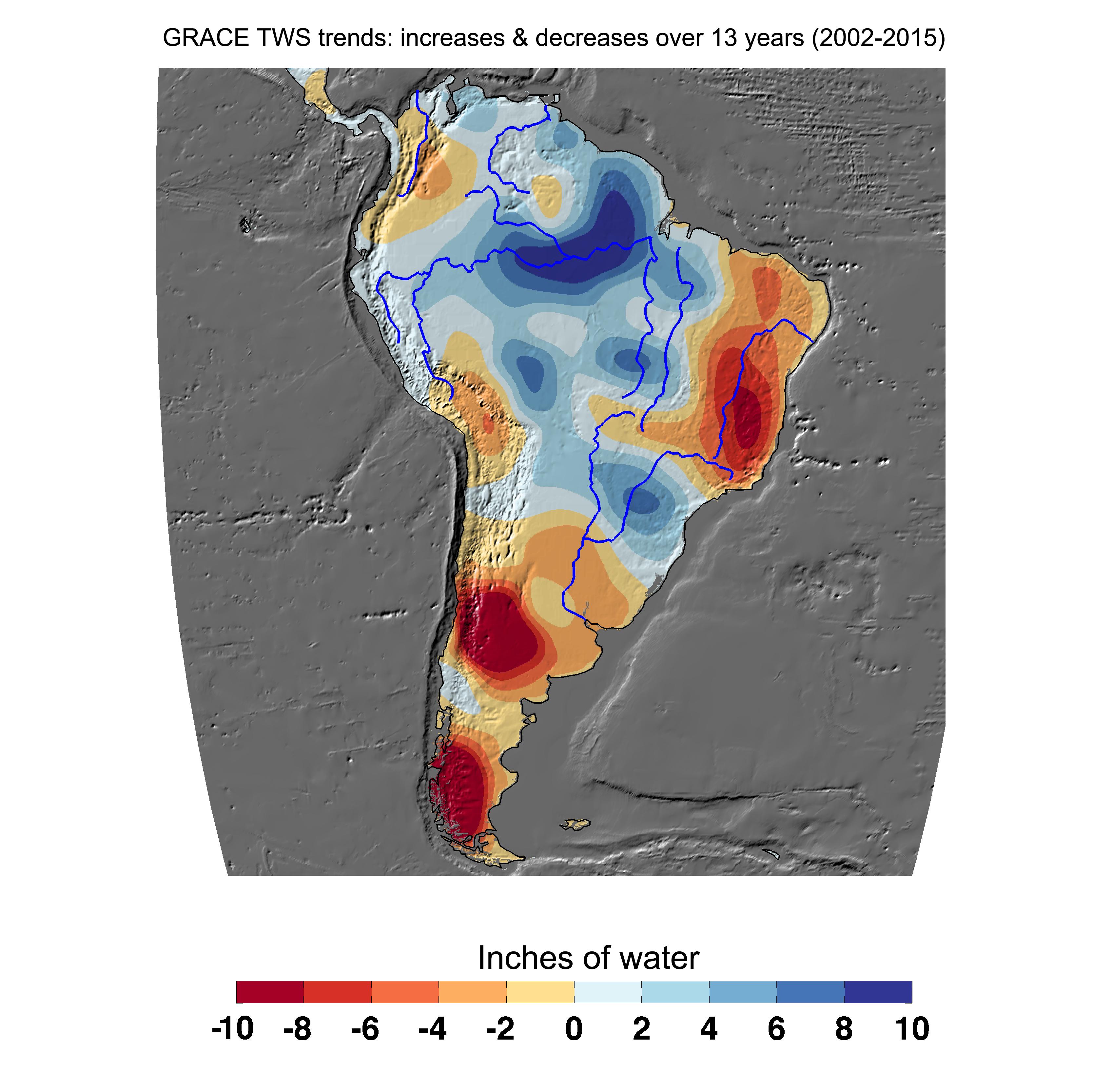
GRACE |
K-Band Ranging System |
4900x2500x3 |
|
|||||
|
|
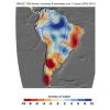
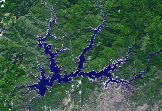
2015-12-08 | Earth |
GRACE |
K-Band Ranging System |
3675x3127x3 |
|
|||||
|
|
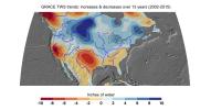
2015-12-08 | Earth |
GRACE |
K-Band Ranging System |
3335x3332x3 |
|
|||||
|
|
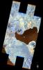
2015-12-08 | Earth |
GRACE |
K-Band Ranging System |
5198x2724x3 |
|
|||||
|
|
2015-12-07 | Earth |
Earth Observing-1 (EO-1) |
Advanced Land Imager (ALI) |
3000x4828x3 |
|
|||||
|
|
2015-11-23 | Earth | 3090x2506x3 | ||
|
|||||
|
|
2015-11-23 | Earth | 2550x1769x3 | ||
|
|||||
|
|
2015-11-23 | Earth | 3090x2506x3 | ||
|
|||||
|
|
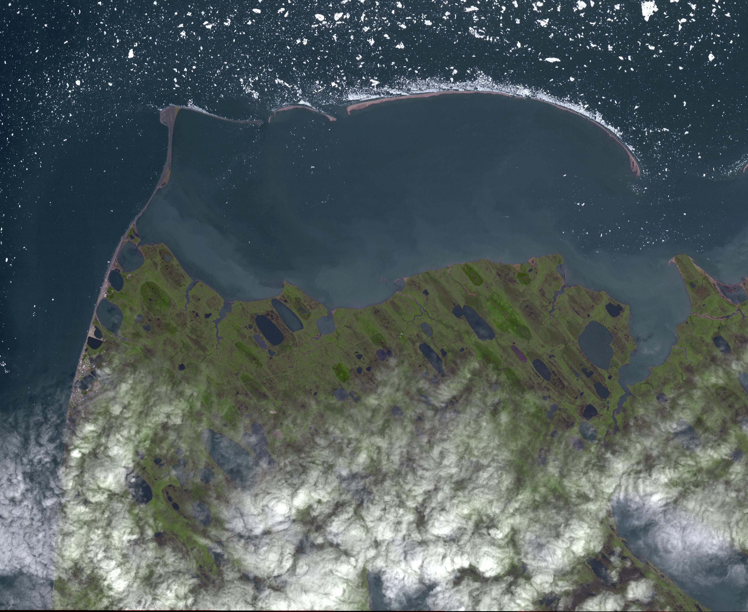
2015-11-16 | Earth |
Terra |
ASTER |
2997x1845x3 |
|
|||||
|
|
2015-11-14 | Earth |
Terra |
ASTER |
1583x749x3 |
|
|||||
|
|
2015-11-06 | Earth |
RapidScat |
ISS-RapidScat |
2816x2134x3 |
|
|||||
|
|
2015-11-02 | Earth |
Terra |
ASTER |
1678x2134x3 |
|
|||||
|
|
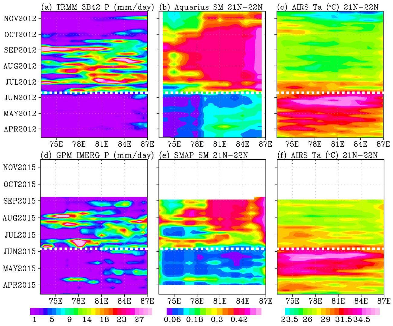
2015-10-30 | Earth |
Aquarius |
AIRS |
2400x1800x3 |

|
|||||
|
|
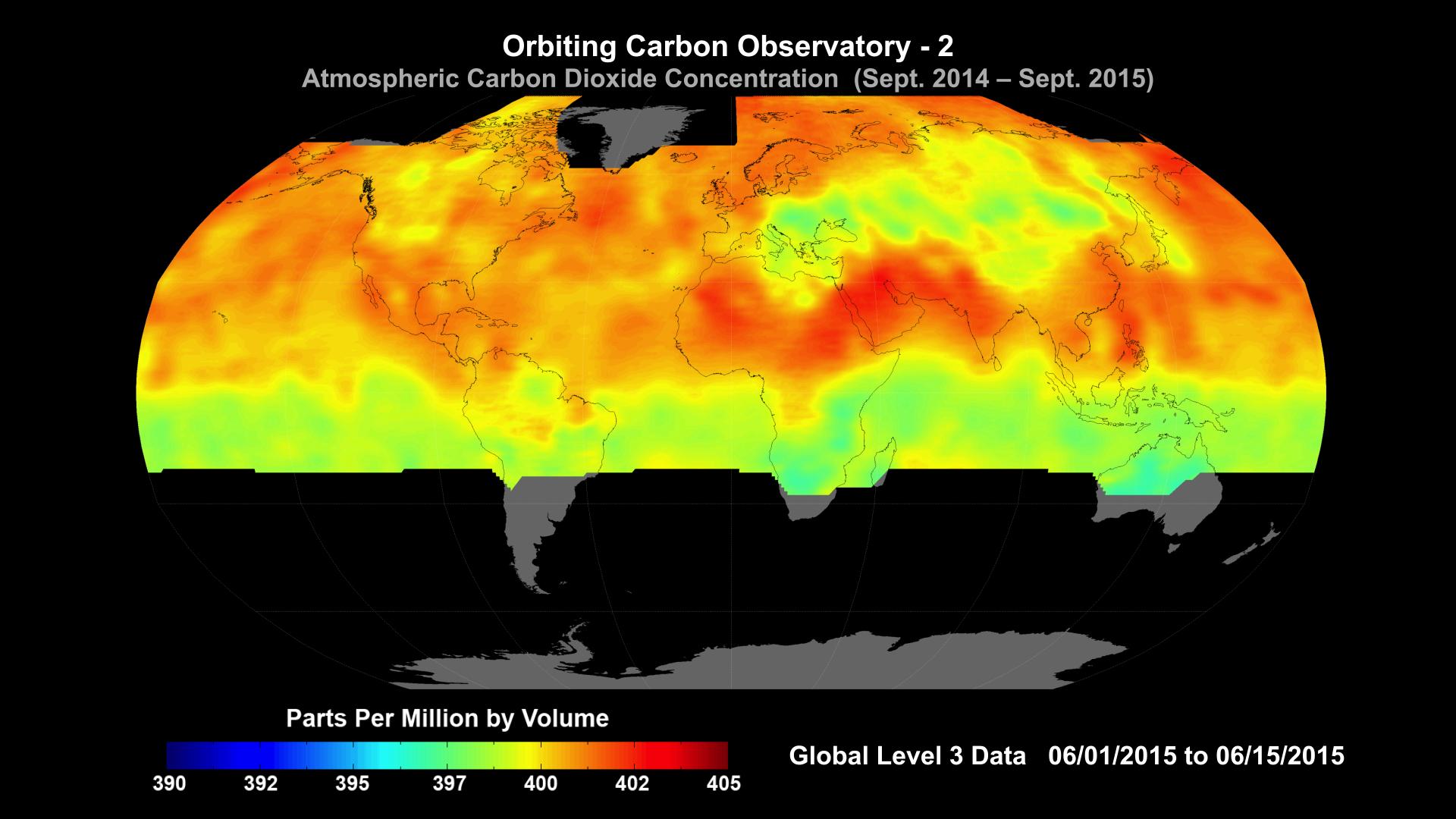
2015-10-29 | Earth |
OCO-2 |
OCO-2 |
1920x1080x3 |

|
|||||
|
|
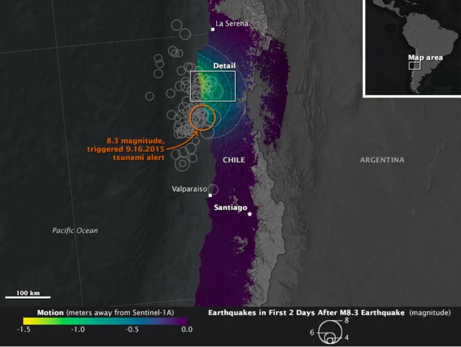
2015-10-27 | Earth |
Terra |
ASTER |
732x734x3 |

|
|||||
|
|
2015-10-23 | Earth |
RapidScat |
ISS-RapidScat |
584x593x3 |
|
|||||
|
|
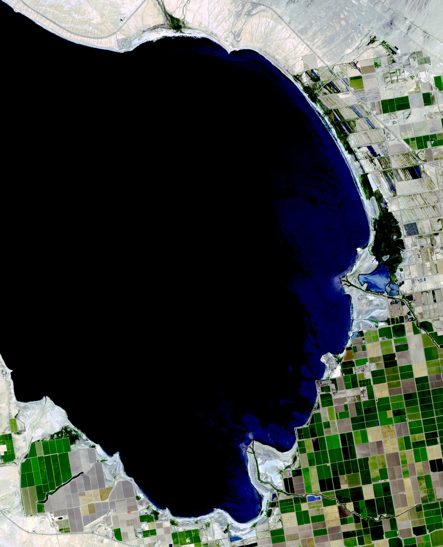
2015-10-21 | Earth |
Terra |
MISR |
1356x1682x3 |
|
|||||
|
|
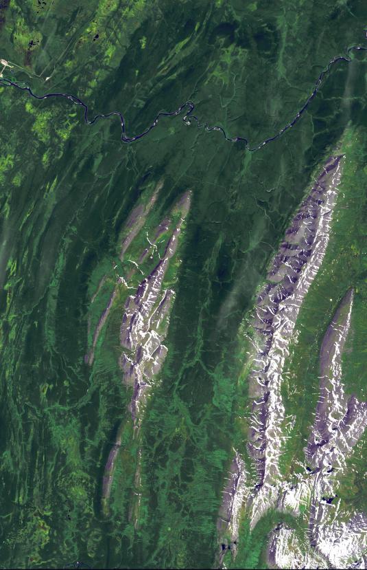
2015-10-20 | Earth |
Terra |
ASTER |
2034x3059x3 |
|
|||||
|
|
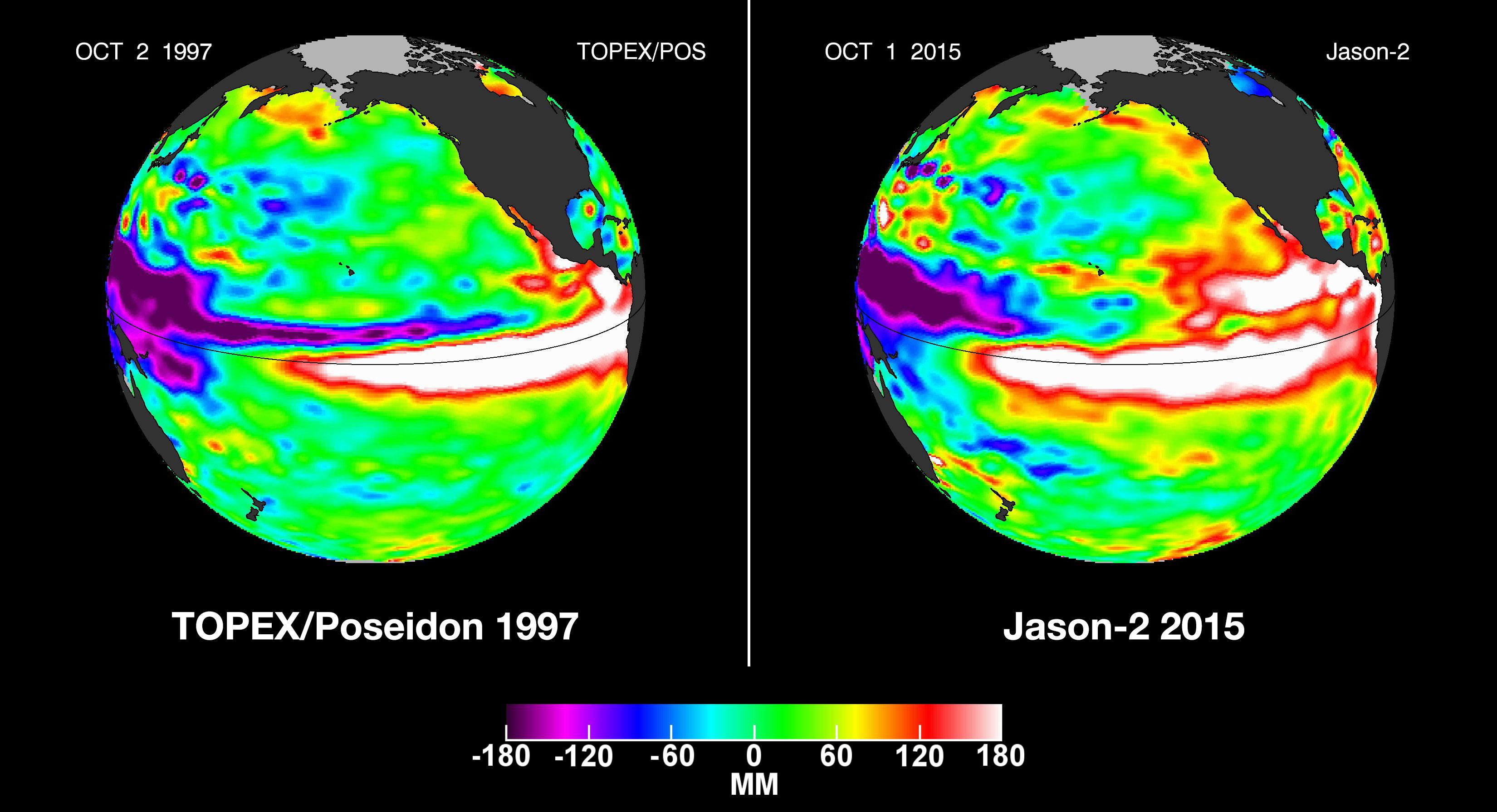
2015-10-19 | Earth |
OSTM/Jason-2 |
Altimeter |
3300x1791x3 |
|
|||||
|
|
2015-10-12 | Earth |
Earth Observatory |
C-Band SAR |
898x676x3 |
|
|||||
|
|
2015-10-08 | Earth |
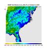
SMAP |
1093x1153x3 | |
|
|||||
|
|
2015-10-06 | Earth |
Terra |
ASTER |
535x829x3 |
|
|||||
|
|
2015-09-23 | Earth |
Terra |
ASTER |
1700x2100x3 |
|
|||||
|
|
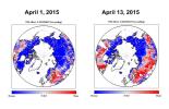
2015-09-12 | Earth |
Aqua Aquarius SMAP |
1299x1078x3 | |
|
|||||
|
|
2015-09-10 | Earth |
Terra |
ASTER |
2574x2109x3 |

|
|||||
|
|
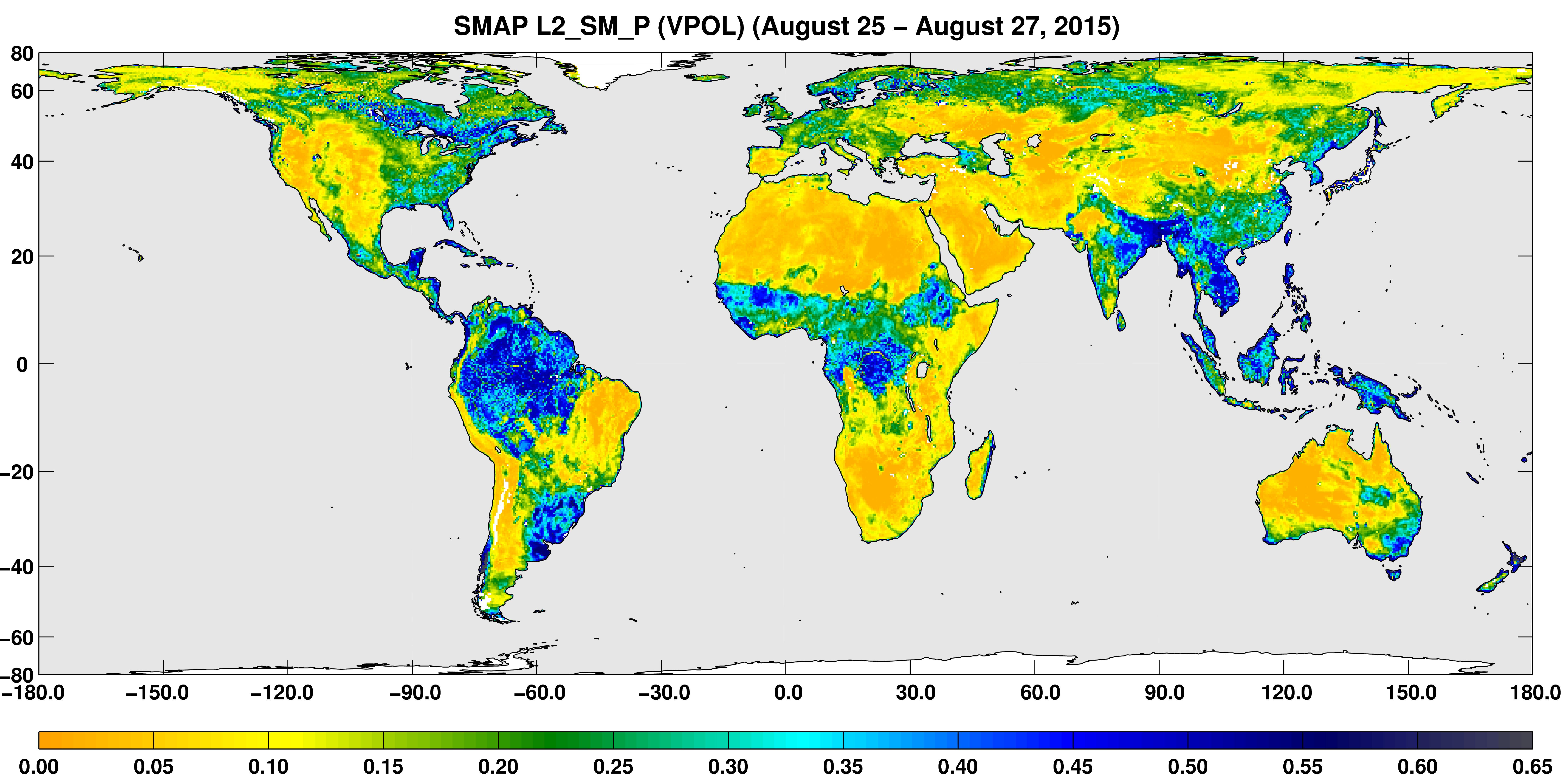
2015-09-09 | Earth |
SMAP |
Passive Active L-band System |
1248x1830x3 |
|
|||||
|
|
2015-09-02 | Earth |
SMAP |
7592x3775x3 | |
|
|||||
|
|
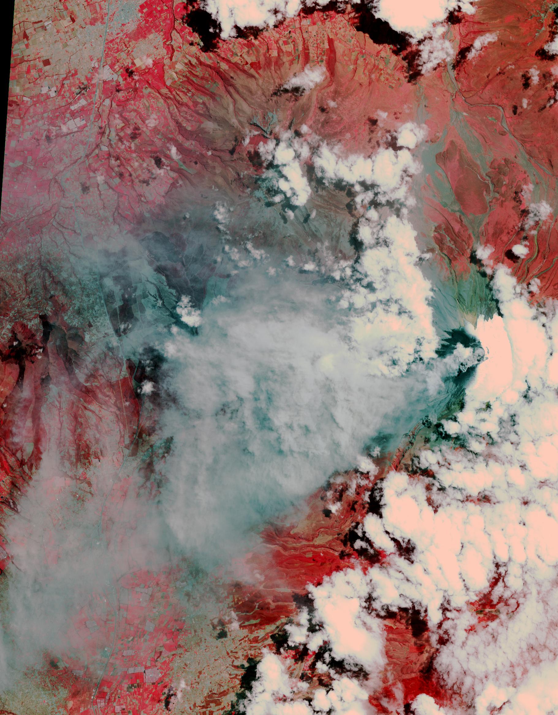
2015-08-25 | Earth |
Terra |
ASTER |
1821x2333x3 |
|
|||||
|
|
2015-08-25 | Earth |
Terra |
ASTER |
4236x9873x3 |
|
|
|||||
|
|
2015-08-21 | Earth |
Terra |
ASTER |
1260x1134x3 |

|
|||||
|
|
2015-08-19 | Earth |
Terra |
ASTER |
1734x1928x3 |
|
|||||
|
|
2015-08-10 | Earth |
Terra |
ASTER |
540x749x3 |
|
|||||
|
|
2015-07-27 | Earth |
Terra |
ASTER |
992x834x3 |
|
|||||
|
|
2015-07-20 | Earth |
Terra |
ASTER |
1900x1500x3 |

|
|||||
|
|
2015-07-10 | Earth |
California Laboratory for Atmospheric Remote Sensing (CLARS) Hyperspectral Thermal Emission Spectrometer (HyTES) |
828x634x3 | |
|
|||||
|
|
2015-06-29 | Earth |
Terra |
ASTER |
535x685x3 |
|
|||||
|
|
2015-06-17 | Earth |
Terra |
ASTER |
535x365x3 |
|
|||||
|
|
2015-06-16 | Earth |
GRACE |
3315x2066x3 | |
|
|||||
|
|
2015-06-12 | Earth |
Terra |
ASTER |
3192x1972x3 |
|
|||||
|
|
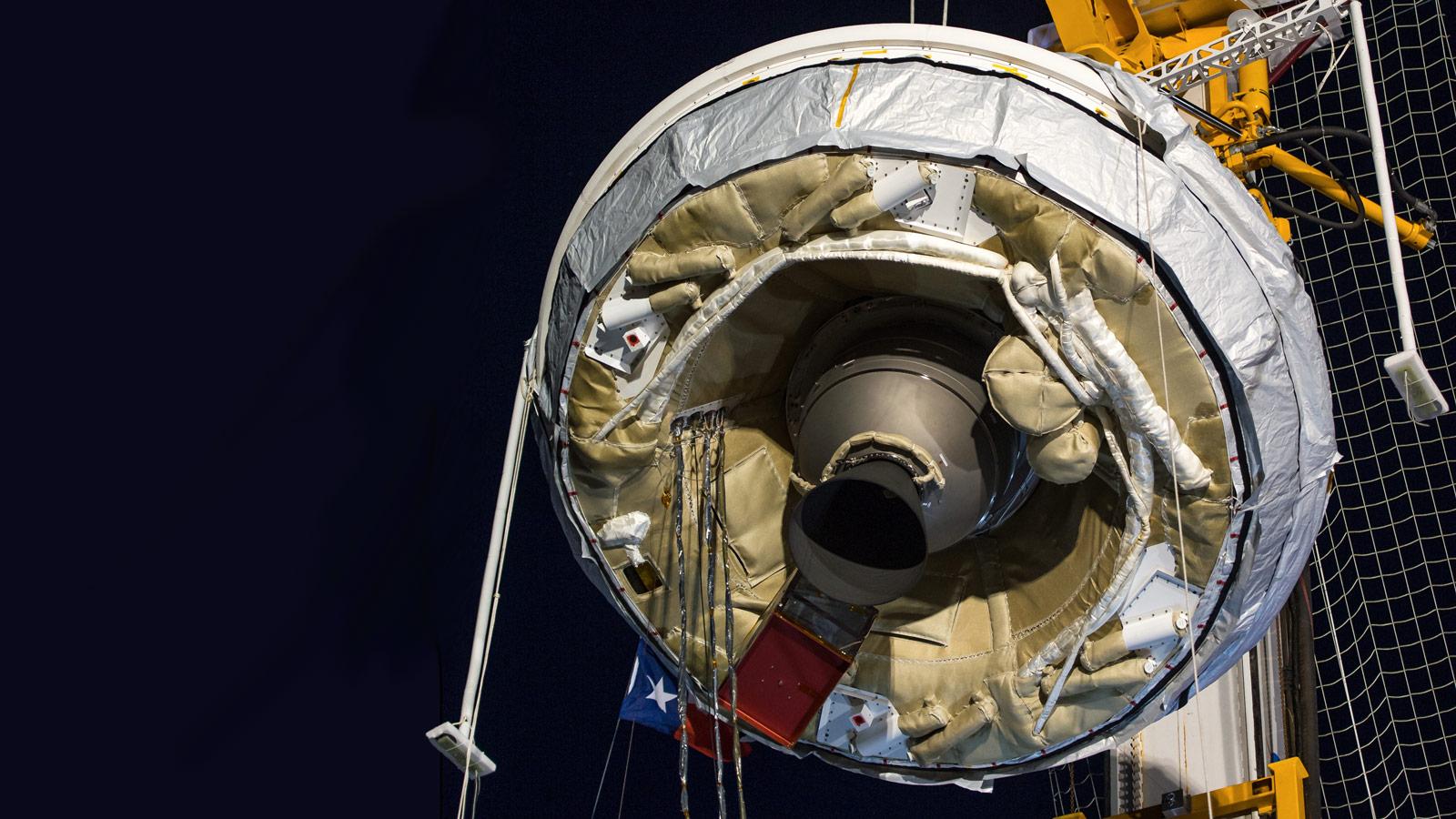
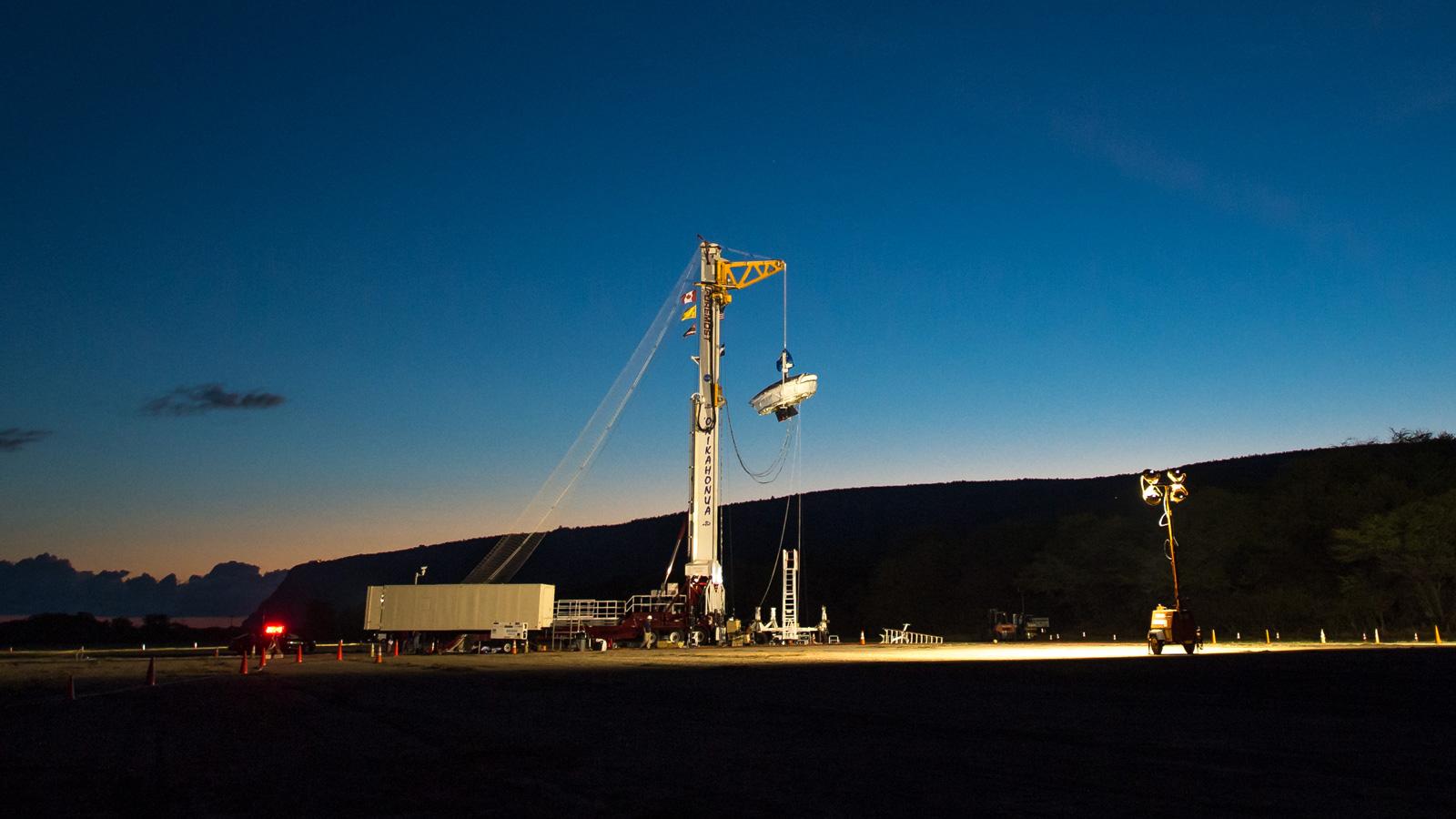
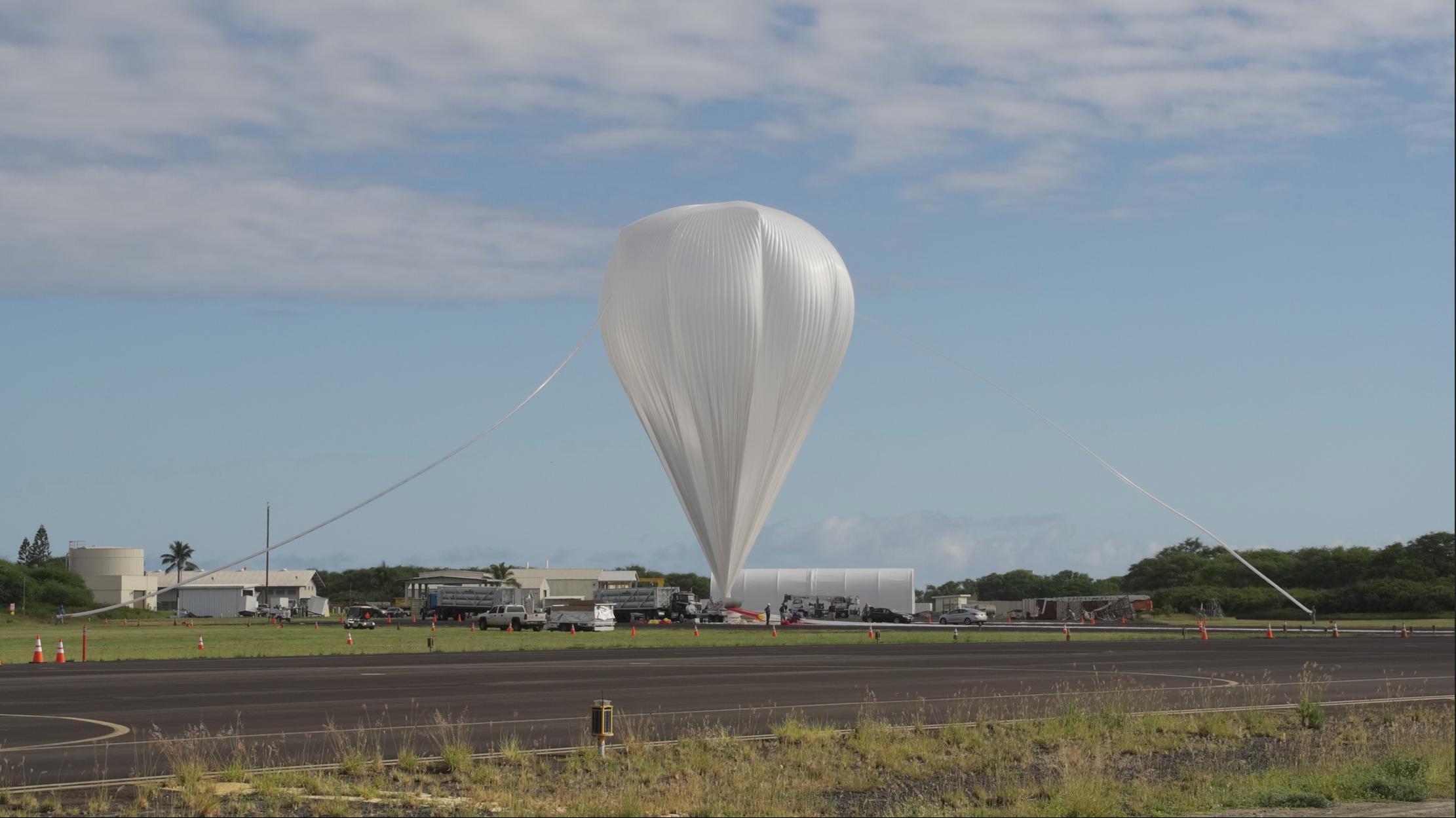
2015-06-11 | Earth |
LDSD |
4747x3391x3 | |
|
|||||
|
|
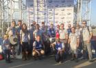
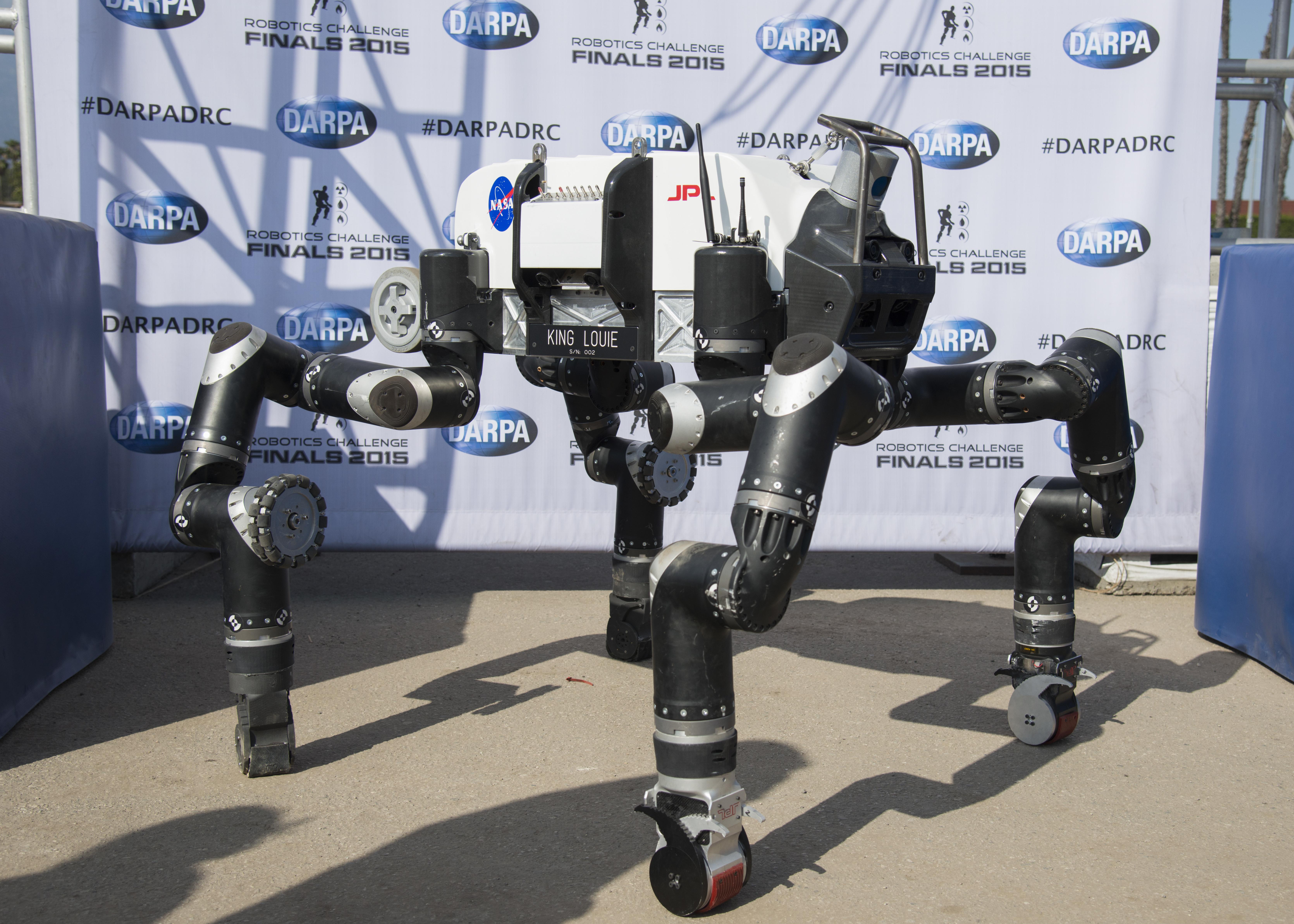
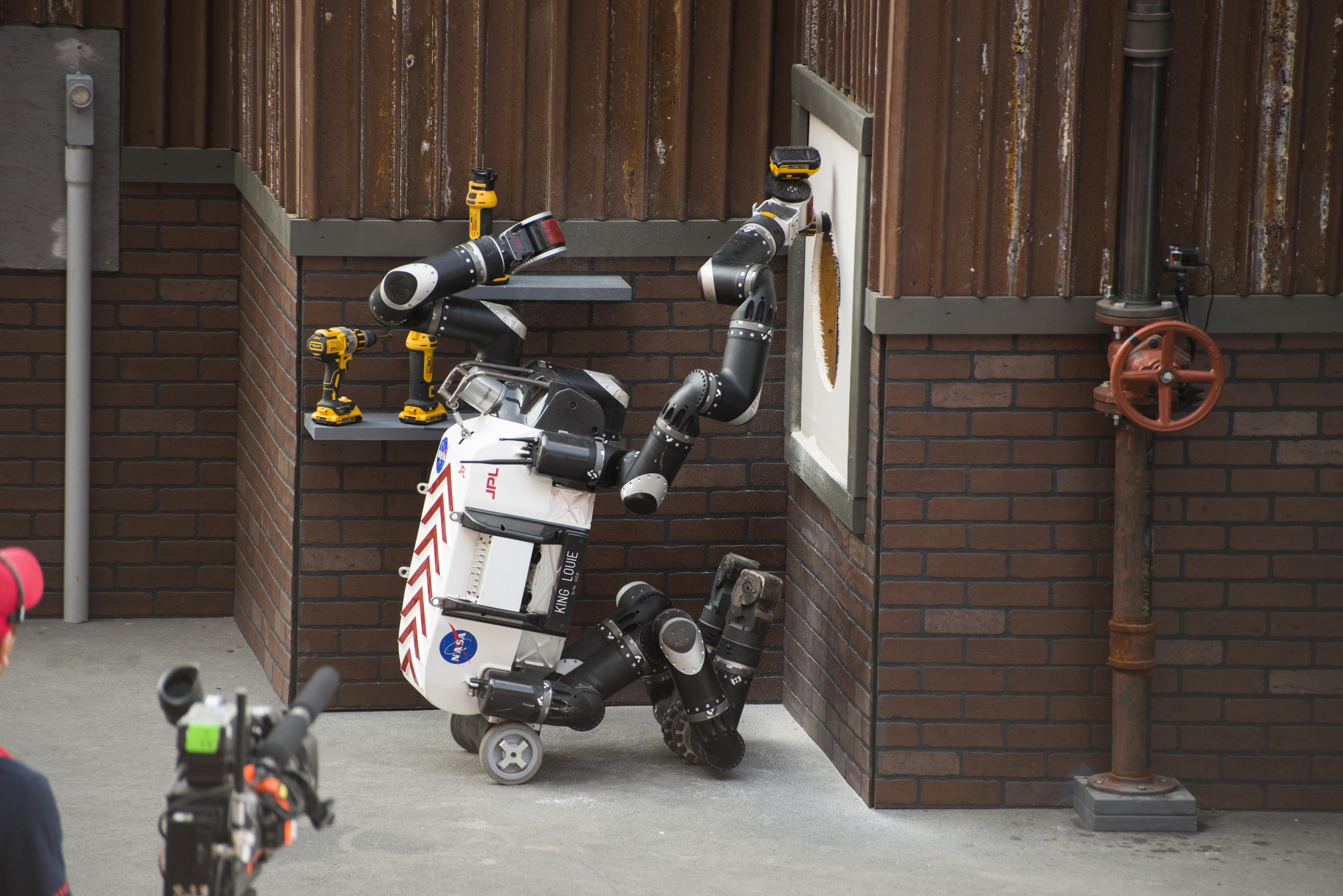
2015-06-09 | Earth |
RoboSimian |
2771x1979x3 | |
|
|||||
|
|
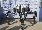
2015-06-09 | Earth |
RoboSimian |
6681x4772x3 | |
|
|||||
|
|
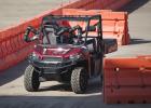
2015-06-09 | Earth |
RoboSimian |
7360x4912x3 | |

|
|||||
|
|
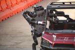
2015-06-09 | Earth |
RoboSimian |
7360x4912x3 | |

|
|||||
|
|
2015-06-09 | Earth |
RoboSimian |
5476x3911x3 | |
|
|||||
|
|
2015-06-09 | Earth |
RoboSimian |
7360x4912x3 | |
|
|||||
|
|
2015-06-09 | Earth |
LDSD |
1600x900x3 | |
|
|||||
|
|
2015-06-05 | Earth |
LDSD |
1600x900x3 | |

|
|||||
|
|
2015-06-05 | Earth |
LDSD |
1600x900x3 | |
|
|||||
|
|
2015-06-02 | Earth |
Terra |
ASTER |
2448x1380x3 |
|
|||||
|
|
2015-05-27 | Earth |
Terra |
ASTER |
3108x4504x3 |
|
|||||
|
|
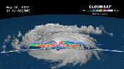
2015-05-22 | Earth |
CloudSat |
MODIS |
960x540x3 |
|
|||||
|
|
2015-05-19 | Earth |
SMAP |
9105x11395x3 | |
|
|||||
|
|
2015-05-19 | Earth |
SMAP |
13492x6783x3 | |
|
|||||
|
|
2015-05-13 | Earth |
Terra |
ASTER |
710x623x3 |
|
|||||
|
|
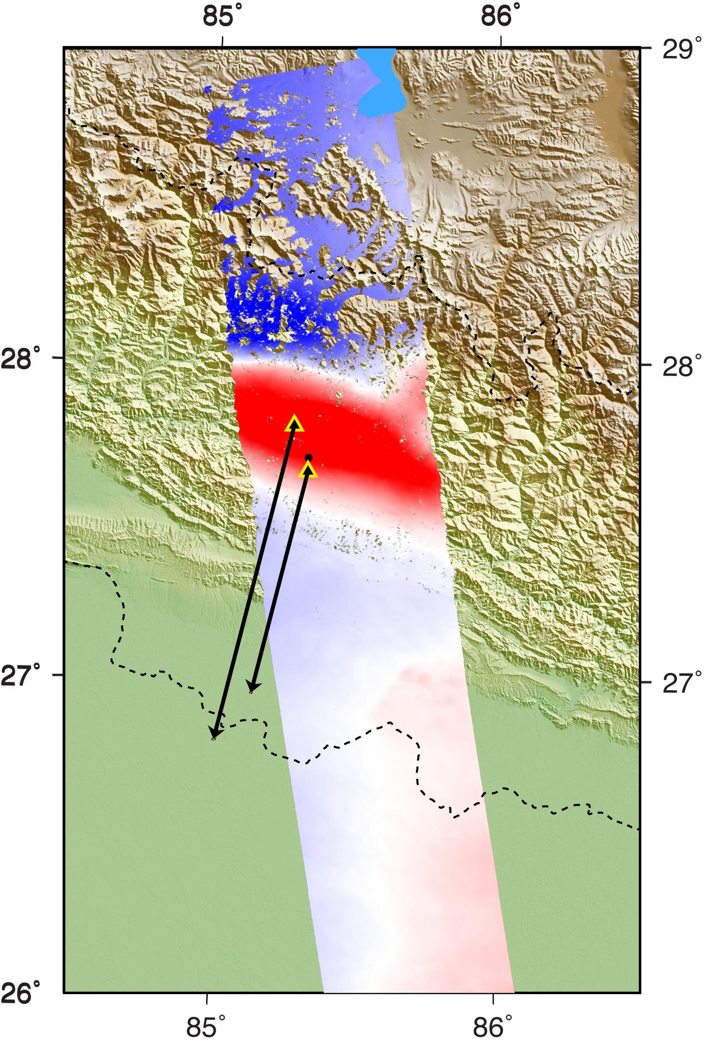
2015-05-11 | Earth |
ARIA |
PALSAR-2 |
822x1263x3 |
|
|||||
|
|
2015-05-11 | Earth |
LDSD |
2222x1249x3 | |
|
|||||
|
|
2015-05-11 | Earth | 1041x694x3 | ||
|
|||||
|
|
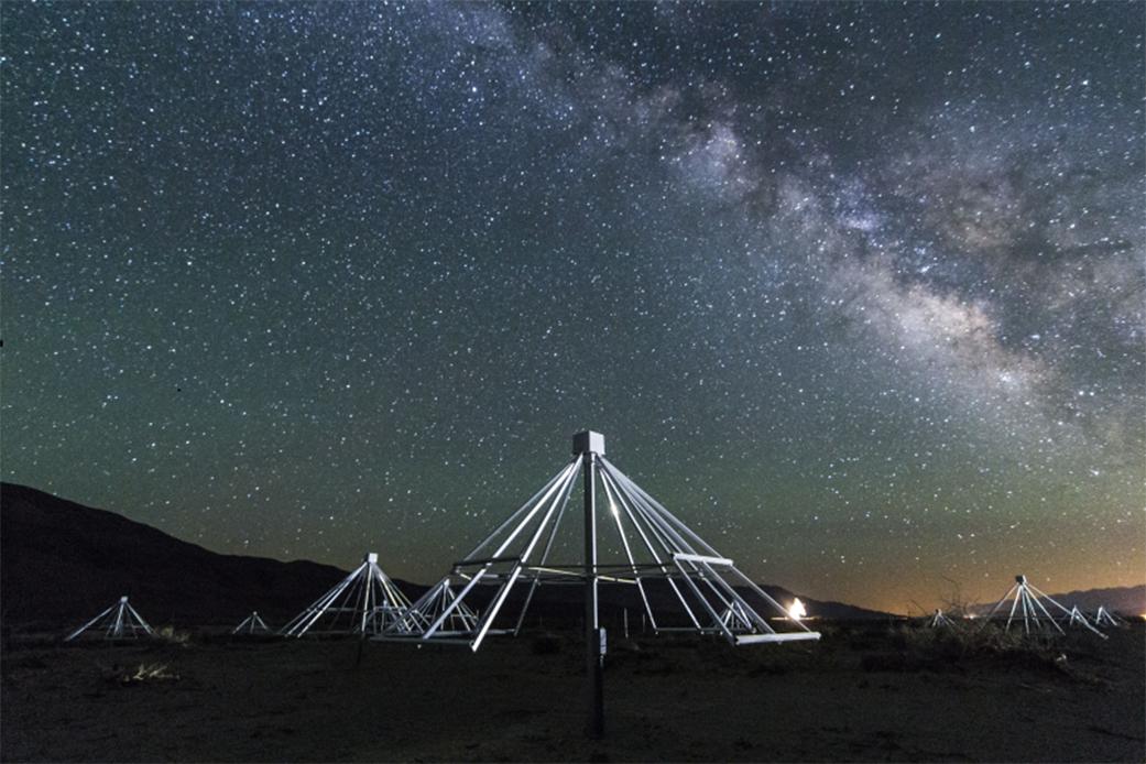
2015-05-07 | Earth |
ARIA |
PALSAR-2 |
1402x2048x3 |
|
|||||
|
|
2015-05-07 | Earth |
Aqua |
AIRS |
737x467x3 |
|
|||||
|
|
2015-05-06 | Earth |
SMAP |
2999x3006x3 | |
|
|||||
|
|
2015-05-04 | Earth |
ARIA |
2054x1024x3 | |

|
|||||
|
|
2015-05-04 | Earth |
ARIA |
PALSAR-2 |
713x1047x3 |
|
|||||
|
|
2015-05-02 | Earth |
ARIA |
C-SAR Sensor |
2048x1152x3 |

|
|||||
|
|
2015-05-01 | Earth |
ARIA |
X-band Interferometric Synthetic Aperture Radar |
1362x1320x3 |
|
|||||
|
|
2015-04-29 | Earth |
SMAP |
931x602x3 | |
|
|||||
|
|
2015-04-29 | Earth |
C-SAR Sensor |
2560x1504x3 | |
|
|||||
|
|
2015-04-27 | Earth |
Terra |
ASTER |
439x336x3 |
|
|||||
|
|
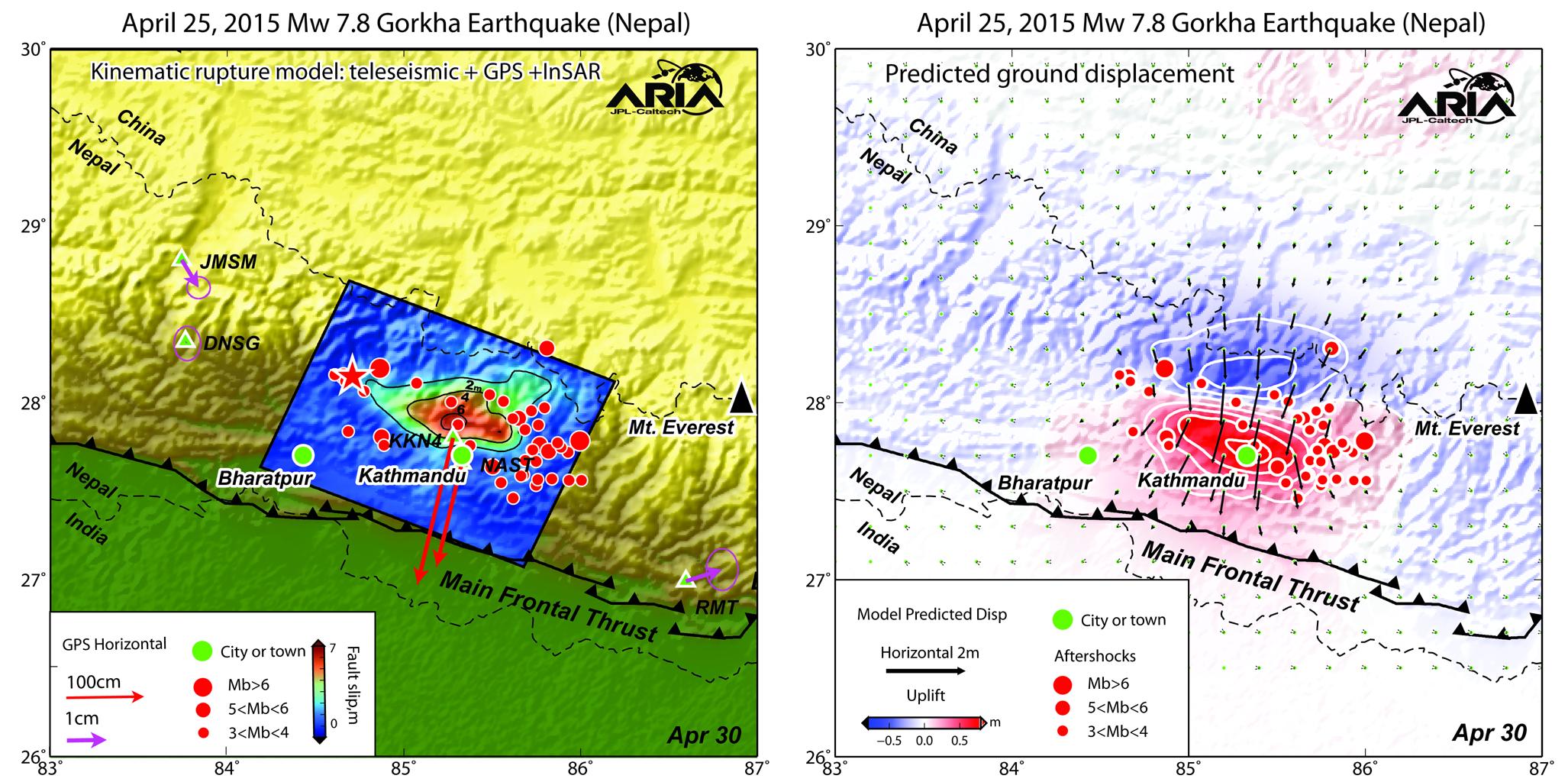
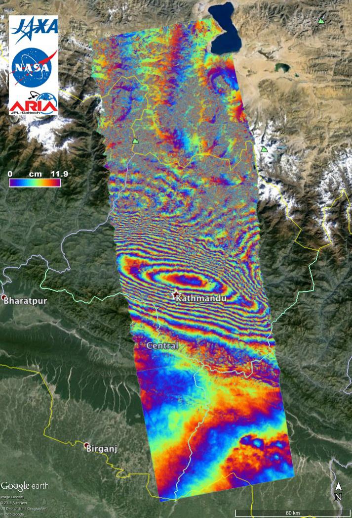
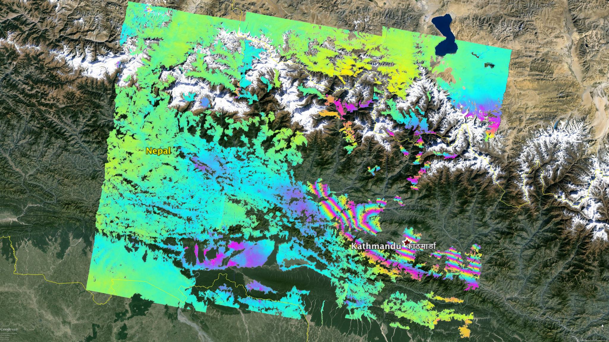
2015-04-24 | Earth |
Terra |
ASTER |
3547x2896x3 |
|
|||||
|
|
2015-04-22 | Earth | 1271x671x3 | ||
|
|||||

|
 |
|
|
|
|
 |
 |
|
|
|

|
| 1-100 | 101-200 | 201-300 | 301-400 | 401-500 | 501-600 | 601-700 | 701-800 | 801-900 | 901-1000 |
| Currently displaying images: 501 - 600 of 2277 |