Your search criteria found 2277 images
Target is Earth
Go to PIAxxxxx:
Refine this list of images by:
Target:
Mission:
Spacecraft:
Instrument:
Click on an image for detailed information
Click on a column heading to sort in ascending or descending order
My
List
Addition DateSort Descending Target Mission Instrument Size
Add Image to Favorite List 2002-02-28 Earth Landsat
Shuttle Radar Topography Mission (SRTM)
C-Band Interferometric Radar
Thematic Mapper
1958x799x3
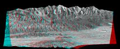
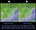
Mount San Antonio (more commonly known as Mount Baldy) crowns the San Gabriel Mountains northeast of Los Angeles, Calif., in this anaglyph from NASA's Shuttle Radar Topography Mission. 3D glasses are necessary to view this image.
PIA03345:
Anaglyph, Metro Los Angeles, Calif.: Malibu to Mount Baldy
Full Resolution:     TIFF (3.198 MB)     JPEG (298.8 kB)
Add Image to Favorite List 2002-03-06 Earth Terra
MISR
1500x1282x3
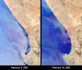
At Elands Bay in South Africa's Western Cape province, about 1000 tons of rock lobsters beached themselves during February 2002 when NASA's Terra satellite acquired these images.
PIA03447:
Red Tide Strands South African Rock Lobsters
Full Resolution:     TIFF (5.909 MB)     JPEG (242.3 kB)
Add Image to Favorite List 2002-03-12 Earth Terra
ASTER
1208x797x3
The Barringer Meteorite Crater (also known as 'Meteor Crater') is a gigantic hole in the middle of the arid sandstone of the Arizona desert. This image was acquired by NASA's Terra satellite on May 17, 2001.
PIA03490:
Meteor Crater, AZ
Full Resolution:     TIFF (2.53 MB)     JPEG (218 kB)
Add Image to Favorite List 2002-03-13 Earth Terra
MISR
1328x1229x3
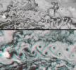
Marine stratocumulus clouds frequently form parallel rows, or 'cloud streets,' along the direction of wind flow. NASA's Terra spacecraft captured this stereo image of Jan Mayen island's Beerenberg volcano. 3D glasses are necessary to view this image.
PIA03448:
A Vortex Street in the Arctic
Full Resolution:     TIFF (4.249 MB)     JPEG (272 kB)
Add Image to Favorite List 2002-03-20 Earth Terra
MISR
1026x688x3
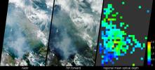
These data products from NASA's Terra satellite document the presence of airborne particulates on March 13, 2002, during Terra orbit 11880. At least once a year for a period lasting from a week to several months, northern Sumatra is obscured by smoke and
PIA03449:
Smoke over Sumatra, Indonesia
Full Resolution:     TIFF (933.4 kB)     JPEG (71.97 kB)
Add Image to Favorite List 2002-03-27 Earth Terra
MISR
1017x1444x3
The Thwaites Ice Tongue is a large sheet of glacial ice extending from the West Antarctic mainland into the southern Amundsen Sea. A large crack in the Thwaites Tongue was discovered in imagery from NASA's Terra satellite on Mar. 10 & 24, 2002.
PIA03700:
Icebergs Adrift in the Amundsen Sea
Full Resolution:     TIFF (3.61 MB)     JPEG (263.8 kB)
Add Image to Favorite List 2002-03-29 Earth Shuttle Radar Topography Mission (SRTM)
C-Band Interferometric Radar
7200x7200x3
The confluence of the Mississippi, Missouri and Illinois rivers are shown in this view of the St. Louis area from NASA's Shuttle Radar Topography Mission.
PIA03346:
Shaded Relief with Color as Height, St. Louis, Missouri
Full Resolution:     TIFF (173.3 MB)     JPEG (15.1 MB)
Add Image to Favorite List 2002-04-03 Earth Terra
MISR
1152x1500x3
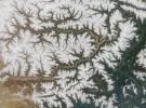
This region of central Asia is situated at the juncture of Mongolia, China and Russia. This image from NASA's Terra satellite is MISR Mystery Image Quiz #7.
PIA03701:
Where on Earth...? MISR Mystery Image Quiz #7:
Torey Lakes, Central Asia

Full Resolution:     TIFF (5.454 MB)     JPEG (303.4 kB)
Add Image to Favorite List 2002-04-03 Earth Terra
ASTER
1100x1750x3
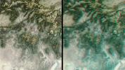
Ashokan Reservoir in New York, is seen in this pair of images acquired by NASA's Terra satellite on September 18, 2000 and February 3, 2002.
PIA03491:
New York State
Full Resolution:     TIFF (3.654 MB)     JPEG (519.1 kB)
Add Image to Favorite List 2002-04-04 Earth Shuttle Radar Topography Mission (SRTM)
C-Band Interferometric Radar
6000x8000x3
The diversity of landforms that make up the state of California is evident in this rendition of the 3-D topography of the state from NASA's Shuttle Radar Topography Mission.
PIA03347:
Shaded Relief with Color as Height, California Mosaic with Insets
Full Resolution:     TIFF (87.66 MB)     JPEG (6.901 MB)
Add Image to Favorite List 2002-04-05 Earth Landsat
Shuttle Radar Topography Mission (SRTM)
C-Band Interferometric Radar
Thematic Mapper
3000x2063x3
Most of Los Angeles, California is visible in this computer-generated north-northeast perspective viewed by from NASA's Shuttle Radar Topography Mission from above the Pacific Ocean.
PIA03348:
Perspective View with Landsat Overlay, Los Angeles Basin
Full Resolution:     TIFF (17.61 MB)     JPEG (953.1 kB)
Add Image to Favorite List 2002-04-10 Earth Terra
MISR
1106x675x3
Both single and multi-angle views of the breakup of the northern section of the Larsen B ice shelf are shown in this image pair fromNASA's Terra satellite. The Larsen B ice shelf collapsed and broke away from the Antarctic Peninsula during February and Ma
PIA03702:
Unique Views of a Shattered Ice Shelf
Full Resolution:     TIFF (2.264 MB)     JPEG (173.3 kB)
Add Image to Favorite List 2002-04-17 Earth Terra
MISR
1280x680x3
Florida's Everglades is a region of broad, slow-moving sheets of water flowing southward over low-lying areas from Lake Okeechobeeto the Gulf of Mexico. These images fromNASA's Terra satellite show the Everglades region on January 16, 2002.
PIA03703:
Southern Florida's River of Grass
Full Resolution:     TIFF (3.176 MB)     JPEG (208.8 kB)
Add Image to Favorite List 2002-04-19 Earth Terra
ASTER
1597x1082x3
This image, acquired on May 28, 2000 by NASA's Terra satellite, shows ground near one of theThree Sisters volcanoes in the Cascade Mountains of west-central Oregon.
PIA03492:
Cascade Mtns. Oregon
Full Resolution:     TIFF (3.096 MB)     JPEG (292.4 kB)
Add Image to Favorite List 2002-04-19 Earth Terra
ASTER
1200x600x3
Chiliques volcano in Chile shows a hot spot in the summit crater and several others along the upper flanks of the edifice, indicating volcanic activity. NASA's Terra satellite acquired this image on May 24, 2000.
PIA03493:
Chiliques Volcano, Chile
Full Resolution:     TIFF (1.548 MB)     JPEG (103.7 kB)
Add Image to Favorite List 2002-04-22 Earth Shuttle Radar Topography Mission (SRTM)
C-Band Interferometric Radar
7200x7200x3
The Bosporus (also spelled Bosphorus) is a strait that connects the Black Sea with the Sea of Marmara in the center of this view of northwest Turkey, taken during NASA's Shuttle Radar Topography Mission.
PIA03349:
Shaded Relief and Radar Image with Color as Height, Bosporus Strait and Istanbul, Turkey
Full Resolution:     TIFF (88.77 MB)     JPEG (9.383 MB)
Add Image to Favorite List 2002-04-24 Earth Terra
MISR
1020x651x3
The structure of tightly packed 'closed cells' in a layer of marine stratocumulus over the southeastern Pacific Ocean are highlighted in these views from NASA's Terra satellite.
PIA03704:
Closed Small Cell Clouds in the South Pacific
Full Resolution:     TIFF (694.7 kB)     JPEG (123.1 kB)
Add Image to Favorite List 2002-05-01 Earth Terra
MISR
2060x1242x3
This pair of images, acquired 16 days apart by NASA's Terra satellite in 2002 and 2007, covers the Liaoning region of China and parts of northern and western Korea, comparing a relatively clear day and an extremely dusty day.
PIA03705:
Dust Obscures Liaoning Province, China
Full Resolution:     TIFF (6.024 MB)     JPEG (205.1 kB)
Add Image to Favorite List 2002-05-07 Earth Terra
ASTER
1200x600x3
These images acquired by NASA's Terra satellite are of La Plata, Maryland.
PIA03494:
La Plata, Maryland
Full Resolution:     TIFF (3.1 MB)     JPEG (253.9 kB)
Add Image to Favorite List 2002-05-08 Earth Terra
MISR
1532x1408x3
On May 2, 2002, numerous fires in southern Mexico sent smoke drifting northward over the Gulf of Mexico. These views from NASA's Terra satellite illustrate the smoke extent over parts of the Gulf and the southern Mexican states of Tabasco, Campeche and Ch
PIA03706:
Smoke from Fires in Southern Mexico
Full Resolution:     TIFF (3.367 MB)     JPEG (189.6 kB)
Add Image to Favorite List 2002-05-10 Earth Terra
MISR
538x818x3
A category F4 tornado tore through La Plata, Maryland on April 28, 2002, killing 5 and injuring more than 100 people. This image from NASA's Terra satellite was acquired on May 1, 2002.
PIA03707:
Tornado Cuts Through La Plata, Maryland
Full Resolution:     TIFF (1.009 MB)     JPEG (148.9 kB)
Add Image to Favorite List 2002-05-15 Earth Terra
MISR
1079x802x3
The mighty river featured in this image is called the Yarlung Tsangpo in China, and is then known as the Dikrong during its passage through India's state of Arunachal Pradesh. This image from NASA's Terra satellite is MISR Mystery Image Quiz #8.
PIA03708:
Where on Earth...? MISR Mystery Image Quiz #8:
Yarlung Tsangpo River, China

Full Resolution:     TIFF (2.709 MB)     JPEG (225.4 kB)
Add Image to Favorite List 2002-05-22 Earth Terra
MISR
1063x1565x3
Large smoke plumes were produced by the Blackjack complex fire in southeastern Georgia's Okefenokee Swamp as seen by the MISR instrument aboard NASA's Terra spacecraft May 8, 2002. 3D glasses are necessary to view this image.
PIA03709:
Okefenokee Swamp Fire, Georgia
Full Resolution:     TIFF (4.625 MB)     JPEG (247.1 kB)
Add Image to Favorite List 2002-05-29 Earth Terra
MISR
1100x872x3
NASA's Terra satellite shows the shape and size of cellular patterns within marine stratocumulus cloud layers can change dramatically with the prevailing meteorological conditions.
PIA03710:
Closed Large Cell Clouds in the South Pacific
Full Resolution:     TIFF (2.559 MB)     JPEG (138.3 kB)
Add Image to Favorite List 2002-06-11 Earth Terra
ASTER
3594x3819x3
As the Mississippi River enters the Gulf of Mexico, it loses energy and dumps its load of sediment that it has carried on its journey through the mid continent as shown in this image from NASA's Terra spacecraft.
PIA03497:
Mississippi River Delta
Full Resolution:     TIFF (46.09 MB)     JPEG (3.446 MB)
Add Image to Favorite List 2002-06-11 Earth Terra
ASTER
2840x2155x3
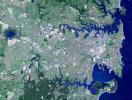
This image of Sydney, Australia was acquired on October 12, 2002 by the Advanced Spaceborne Thermal Emission and Reflection Radiometer (ASTER) on NASA's Terra satellite.
PIA03498:
Sydney, Australia
Full Resolution:     TIFF (22.68 MB)     JPEG (2.19 MB)
Add Image to Favorite List 2002-06-12 Earth Terra
MISR
1660x933x3
The mountains and desert plateaus of northwest Colorado are shown in this anaglyph from the MISR instrument aboard NASA's Terra spacecraft. 3D glasses are necessary to view this image.
PIA03711:
Spectacular Mountain Views of Northwest Colorado
Full Resolution:     TIFF (5.47 MB)     JPEG (442.1 kB)
Add Image to Favorite List 2002-06-14 Earth Aqua
AIRS
2144x1184x3
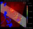
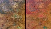
These four images of the Mediterranean were obtained concurrently on June 14, 2002 from the three instruments that make up the Atmospheric Infrared Sounder experiment system aboard NASA's Aqua spacecraft.
PIA00326:
AIRS First Light Data: Eastern Mediterranean, June 14, 2002
Full Resolution:     TIFF (4.752 MB)     JPEG (184.6 kB)
Add Image to Favorite List 2002-06-18 Earth Terra
ASTER
2146x2349x3
This image was acquired on June 16, 2002 by NASA's Terra satellite and shows the Hayman forest fire in the Pike National Forest, Colorado.
PIA03499:
Hayman Fire, Colorado
Full Resolution:     TIFF (7.811 MB)     JPEG (952.3 kB)
Add Image to Favorite List 2002-06-19 Earth Terra
MISR
1632x582x3
On June 10, 2002 the Moon obscured the central portion of the solar disk in a phenomenon known as an annular solar eclipse as NASA's Terra satellite flew over the Pacific.
PIA03712:
Darkened Skies over the Pacific
Full Resolution:     TIFF (800.2 kB)     JPEG (79.16 kB)
Add Image to Favorite List 2002-06-26 Earth Terra
MISR
1276x1050x3
The Hayman fire, situated about 65 kilometers southwest of Denver, Colorado, is the largest fire ever recorded in that state. The images were captured on June 9, 2002 by NASA's Terra satellite.
PIA03713:
Smoke from Colorado Wildfires
Full Resolution:     TIFF (1.64 MB)     JPEG (184.2 kB)
Add Image to Favorite List 2002-07-03 Earth TOPEX/Poseidon
Altimeter
900x900x3
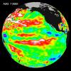
The Pacific Ocean doesn't show signs of anything that looks like the whopper El Niño of 1997-1998, according to information from NASA's U.S.-French ocean-observing satellite Topex/Poseidon.
PIA03850:
Pacific Ocean in Holding Pattern for El Niño
Full Resolution:     TIFF (1.608 MB)     JPEG (124 kB)
Add Image to Favorite List 2002-07-03 Earth Aqua
AIRS
362x814x3
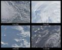
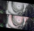
These four images of Tropical Cyclone Ramasun were obtained July 3, 2002 by the Atmospheric Infrared Sounder experiment system onboard NASA's Aqua spacecraft.
PIA00341:
AIRS First Light Data: Typhoon Ramasun, July 3, 2002
Full Resolution:     TIFF (680 kB)     JPEG (54.25 kB)
Add Image to Favorite List 2002-07-03 Earth Terra
MISR
1214x1700x3
Devon Island is situated in an isolated part of Canada's Nunavut Territory, and is usually considered to be the largest uninhabited island in the world. These images were acquired by NASA's Terra satellite on June 28, 2001.
PIA03714:
Mars Researchers Rendezvous on Remote Arctic Island
Full Resolution:     TIFF (6.404 MB)     JPEG (518.2 kB)
Add Image to Favorite List 2002-07-05 Earth QuikScat
SeaWinds Scatterometer
640x568x3
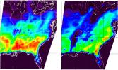
As super Typhoon Bilis, equal in strength to a category 5 hurricane, bore down on Taiwan, these images from August 21, 2000, show the massive storm's most devastating components: rain and wind.
PIA01048:
Typhoon Bilis
Full Resolution:     TIFF (166 kB)     JPEG (122.5 kB)
Add Image to Favorite List 2002-07-10 Earth Terra
MISR
1960x1600x3
This island is Bouvet Island (or Bouvetøya) and is a territory of Norway. This image from NASA's Terra satellite is MISR Mystery Image Quiz #9.
PIA03715:
Where on Earth...? MISR Mystery Image Quiz #9:
Bouvet Island, Norway

Full Resolution:     TIFF (6.148 MB)     JPEG (350.8 kB)
Add Image to Favorite List 2002-07-11 Earth Shuttle Radar Topography Mission (SRTM)
C-Band Interferometric Radar
7200x3600x3
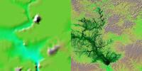
These two images show exactly the same area, Lake Balbina near Manaus, Brazil as seen by NASA's Shuttle Radar Topography Mission.
PIA03350:
Shaded Relief with Height as Color, Lake Balbina, near Manaus, Brazil
Full Resolution:     TIFF (71.37 MB)     JPEG (5.478 MB)
Add Image to Favorite List 2002-07-11 Earth Shuttle Radar Topography Mission (SRTM)
C-Band Interferometric Radar
7200x3601x3
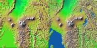
Volcanic, tectonic, erosional and sedimentary landforms are all evident in these images from NASA's Shuttle Radar Topography Mission of a region along the East African Rift at Lake Kivu. The area shown covers parts of Congo, Rwanda and Uganda.
PIA03351:
Shaded Relief with Height as Color, Virunga and Nyiragongo Volcanoes and the East African Rift Valley
Full Resolution:     TIFF (78.98 MB)     JPEG (5.492 MB)
Add Image to Favorite List 2002-07-11 Earth Shuttle Radar Topography Mission (SRTM)
C-Band Interferometric Radar
7200x3600x3
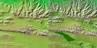
These two images show exactly the same area, part of the Kunlun fault in northern Tibet as seen by NASA's Shuttle Radar Topography Mission.
PIA03352:
Shaded Relief with Height as Color, Kunlun fault, east-central Tibet
Full Resolution:     TIFF (74.87 MB)     JPEG (5.561 MB)
Add Image to Favorite List 2002-07-11 Earth Shuttle Radar Topography Mission (SRTM)
C-Band Interferometric Radar
7200x3600x3
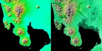
These two images show exactly the same area, Manila Bay and nearby volcanoes on Luzon Island in the Philippines as seen by NASA's Shuttle Radar Topography Mission.
PIA03353:
Shaded Relief with Height as Color, Manila Bay, Philippines
Full Resolution:     TIFF (53.59 MB)     JPEG (4.092 MB)
Add Image to Favorite List 2002-07-11 Earth Shuttle Radar Topography Mission (SRTM)
C-Band Interferometric Radar
7200x3410x3
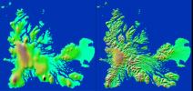
These two images show exactly the same area, Kerguelen Island in the southern Indian Ocean as seen by NASA's Shuttle Radar Topography Mission.
PIA03354:
Shaded Relief with Height as Color, Kerguelen Island, south Indian Ocean
Full Resolution:     TIFF (32.41 MB)     JPEG (2.381 MB)
Add Image to Favorite List 2002-07-13 Earth Aqua
AIRS
1536x1536x3
These images, taken over northern Europe on July 20, 2002, depict a few of the different views of Earth and its atmosphere that are produced by the Atmospheric Infrared Sounder experiment system operating on NASA's Aqua spacecraft.
PIA00345:
AIRS First Light Data: Northern Europe, July 20, 2002
Full Resolution:     TIFF (3.093 MB)     JPEG (182.1 kB)
Add Image to Favorite List 2002-07-16 Earth Terra
ASTER
3885x2852x3
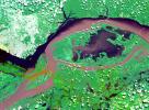
This image from NASA's Terra spacecraft shows the junctions of the Amazon and the Rio Negro Rivers at Manaus, Brazil.
PIA03851:
Manaus, Brazil
Full Resolution:     TIFF (37.82 MB)     JPEG (2.893 MB)
Add Image to Favorite List 2002-07-17 Earth Terra
MISR
1806x1070x3
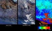
Mexico City has one of the world's most serious air pollution problems. These images from NASA's Terra satellite were captured on April 9 and December 5, 2001.
PIA03716:
A Hazy Day in Mexico City
Full Resolution:     TIFF (4.875 MB)     JPEG (285.2 kB)
Add Image to Favorite List 2002-07-24 Earth Terra
MISR
1811x2182x3
The central portion of Russia's East Siberian Sea, including one of the New Siberian Islands, Novaya Sibir, are portrayed in these views from data acquired on May 28, 2002 by NASA's Terra satellite.
PIA03717:
Distinguishing Clouds from Ice over the East Siberian Sea, Russia
Full Resolution:     TIFF (5.682 MB)     JPEG (565.9 kB)
Add Image to Favorite List 2002-07-25 Earth Terra
ASTER
3924x2394x3
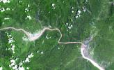
This image from NASA's Terra spacecraft shows a 60 km stretch of the Yangtze River in China, including the Xiling Gorge, the eastern of the three gorges. At left of image is the construction site of theThree Gorges Dam, the world's largest.
PIA03852:
Three Gorges Dam, China
Full Resolution:     TIFF (32.99 MB)     JPEG (2.964 MB)
Add Image to Favorite List 2002-07-31 Earth Terra
MISR
1351x1348x3
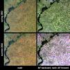
These images from NASA's Terra satellite were captured on May 31 and July 18, 2002 and show Russia's Saratov Oblast (province), located in the southeastern portion of the East-European plain, in the Lower Volga River Valley.
PIA03718:
Summer Harvest in Saratov, Russia
Full Resolution:     TIFF (4.347 MB)     JPEG (486.5 kB)
Add Image to Favorite List 2002-07-31 Earth Terra
ASTER
1028x798x3
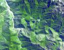
The ruins of Machu Picchu, rediscovered in 1911 by Hiram Bingham, are one of the most beautiful and enigmatic ancient sites in the world. This image was acquired by NASA's Terra satellite on June 25, 2001.
PIA03853:
Machu Picchu, Peru
Full Resolution:     TIFF (3.095 MB)     JPEG (270 kB)
Add Image to Favorite List 2002-08-06 Earth Terra
ASTER
3124x2554x3
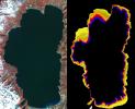
This image acquired by NASA's Terra satellite llustrates the state of gradually decreasing water clarity at Lake Tahoe, one of the clearest lakes in the world.
PIA03854:
NASA Images Show Decreased Clarity in Lake Tahoe's Water
Full Resolution:     TIFF (6.831 MB)     JPEG (703 kB)
Add Image to Favorite List 2002-08-07 Earth Terra
MISR
1069x970x3
This montage is a natural-color view of the Caribbean Sea east of the Yucatan Peninsula as seen by NASA's Terra satellite.
PIA03719:
A Hard Look at Thin Clouds
Full Resolution:     TIFF (2.909 MB)     JPEG (154.1 kB)
Add Image to Favorite List 2002-08-14 Earth Terra
MISR
1548x1256x3
The image was acquired by NASA's Terra satellite on March 11, 2002, and is centered west of the Marshall Islands. Enewetak Atoll is discernible through thin cloud as the turquoise band near the right-hand edge of the image.
PIA03720:
Cloud Arcs in the Western Pacific
Full Resolution:     TIFF (4.871 MB)     JPEG (316.7 kB)
Add Image to Favorite List 2002-08-21 Earth Terra
MISR
1964x2808x3
As of July 31, 2002, global multi-angle, multi-spectral radiance products were made available from the MISR instrument aboard NASA's Terra satellite.
PIA03721:
MISR Global Images See the Light of Day
Full Resolution:     TIFF (10.38 MB)     JPEG (910.9 kB)
Add Image to Favorite List 2002-08-22 Earth TOPEX/Poseidon
Altimeter
900x900x3
NASA's Topex/Poseidon image of sea-surface heights was taken during a 10-day collection cycle ending August 7, 2002. There had been a series of warm Kelvin waves--eastward-moving ocean waves that cross the equatorial Pacific
PIA03855:
Watching for the Next El Niño
Full Resolution:     TIFF (171.5 kB)     JPEG (116.4 kB)
Add Image to Favorite List 2002-08-22 Earth Terra
ASTER
2976x3942x3
This image acquired by NASA's Terra satellite on December 18, 2002 shows the Bisquit Fire in southwest Oregon.
PIA03856:
Biscuit Fire, OR
Full Resolution:     TIFF (38.28 MB)     JPEG (1.679 MB)
Add Image to Favorite List 2002-08-22 Earth Landsat
Shuttle Radar Topography Mission (SRTM)
C-Band Interferometric Radar
Thematic Mapper
1373x209x3
Mount Kilimanjaro, the highest point in Africa, reaches 5,895 meters (19,340 feet) above sea level, tall enough to maintain a permanent snow cap despite being just south of the equator.This image is from NASA's Shuttle Radar Topography Mission.
PIA03355:
Perspective with Landsat Overlay, Mount Kilimanjaro, Tanzania
Full Resolution:     TIFF (2.589 MB)     JPEG (275.5 kB)
Add Image to Favorite List 2002-08-28 Earth Terra
MISR
1392x805x3
These views from NASA's Terra satellite highlight a number of the land use, vegetation, and geological features found Johannesburg, Gauteng Province, South Africa.
PIA03722:
Highlights from Johannesburg, Gauteng Province, South Africa
Full Resolution:     TIFF (3.862 MB)     JPEG (313 kB)
Add Image to Favorite List 2002-08-29 Earth Shuttle Radar Topography Mission (SRTM)
C-Band Interferometric Radar
688x550x3
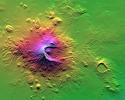
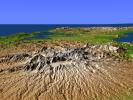
NASA's Shuttle Radar Topography Mission shows Mount Meru, an active volcano located just 70 kilometers (44 miles) west of Mount Kilimanjaro.
PIA03356:
Shaded Relief with Height as Color, Mount Meru, Tanzania
Full Resolution:     TIFF (1.264 MB)     JPEG (99.88 kB)
Add Image to Favorite List 2002-09-03 Earth Terra
ASTER
3966x3732x3
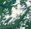
Aletsch Glacier, the largest glacier of Europe, covers more than 120 square kilometers (more than 45 square miles) in southern Switzerland. NASA's Terra satellite captured this image on July 23, 2001.
PIA03857:
Aletsch Glacier, Switzerland
Full Resolution:     TIFF (49.02 MB)     JPEG (3.103 MB)
Add Image to Favorite List 2002-09-04 Earth Terra
MISR
1058x1169x3
Pulau Kimaam, Pulau Dolok, Pulau Yos Sudarso, and Frederik Hendrik Island are all names used to refer to this island, which is part of the Indonesian province of West Papua. This image from NASA's Terra satellite is MISR Mystery Image Quiz #10.
PIA03723:
Where on Earth...? MISR Mystery Image Quiz #10:
Pulau Kimaam, West Papua

Full Resolution:     TIFF (3.411 MB)     JPEG (295.4 kB)
Add Image to Favorite List 2002-09-08 Earth Aqua
AIRS
641x469x3
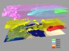
AIRS Retrieved Temperature Isotherms over Southern Europe viewed from the west, September 8, 2002. The isotherms in this map made from AIRS onboard NASA's Aqua satellite data show regions of the same temperature in the atmosphere.
PIA00513:
AIRS Retrieved Temperature Isotherms over Southern Europe
Full Resolution:     TIFF (903.1 kB)     JPEG (28.96 kB)
Add Image to Favorite List 2002-09-11 Earth Terra
MISR
682x730x3
One of the more destructive cyclones to emerge from the northern hemisphere 2002 summer storm season was Typhoon Sinlaku. This image from NASA's Terra satellite was acquired on September 5, 2002.
PIA03724:
Typhoon Sinlaku
Full Resolution:     TIFF (1.015 MB)     JPEG (157.7 kB)
Add Image to Favorite List 2002-09-12 Earth Landsat
Shuttle Radar Topography Mission (SRTM)
C-Band Interferometric Radar
Thematic Mapper
712x808x3
Mount Meru, Africa, is an active volcano located just 70 kilometers (44 miles) west of Mount Kilimanjaro as seen by from NASA's Shuttle Radar Topography Mission.
PIA03357:
Stereo Pair with Landsat Overlay, Mount Meru, Tanzania
Full Resolution:     TIFF (1.649 MB)     JPEG (145.2 kB)
Add Image to Favorite List 2002-09-12 Earth Landsat
Shuttle Radar Topography Mission (SRTM)
C-Band Interferometric Radar
Thematic Mapper
339x620x3
This anaglyph, from NASA's Shuttle Radar Topography Mission, is of Mount Meru, an active volcano located just 70 kilometers (44 miles) west of Mount Kilimanjaro. 3D glasses are necessary to view this image.
PIA03358:
Anaglyph with Landsat Overlay, Mount Meru, Tanzania
Full Resolution:     TIFF (602.1 kB)     JPEG (56.43 kB)
Add Image to Favorite List 2002-09-13 Earth Shuttle Radar Topography Mission (SRTM)
C-Band Interferometric Radar
3601x3601x3
An 8-kilometer (5-mile) wide crater of possible impact origin is shown in this view of an isolated part of the Bolivian Amazon from NASA's Shuttle Radar Topography Mission.
PIA03359:
Shaded Relief with Height as Color, Iturralde Structure, Bolivia
Full Resolution:     TIFF (38.9 MB)     JPEG (3.517 MB)
Add Image to Favorite List 2002-09-15 Earth Terra
ASTER
4850x7960x3
These images show dramatic change in the water at Dongting Lake in Hunan province, China between August and September of 2002. NASA's Terra satellite captured this image on September 2, 2002 and March 19, 2002.
PIA03858:
Dongting Lake, China
Full Resolution:     TIFF (107.1 MB)     JPEG (5.536 MB)
Add Image to Favorite List 2002-09-17 Earth Terra
ASTER
1192x998x3
This image of Iturralde Crater, Bolivia was acquired on June 29, 2001 by NASA's Terra satellite.
PIA03859:
Iturralde Crater, Bolivia
Full Resolution:     TIFF (3.573 MB)     JPEG (482.4 kB)
Add Image to Favorite List 2002-09-18 Earth Terra
MISR
1341x2060x3
The Greek islands of the Aegean Sea, scattered across 800 kilometers from north to south and between Greece and western Turkey, are uniquely situated at the intersection of Europe, Asia and Africa. This image from NASA's Terra satellite was acquired on Se
PIA03725:
Islands in the Midst of the World
Full Resolution:     TIFF (8.296 MB)     JPEG (411.5 kB)
Add Image to Favorite List 2002-09-19 Earth Landsat
Shuttle Radar Topography Mission (SRTM)
C-Band Interferometric Radar
Thematic Mapper
1009x1600x3
This anaglyph, from NASA's Shuttle Radar Topography Mission, is of Mount St Helens, Washington. 3D glasses are necessary to view this image.
PIA03360:
Anaglyph, Mount St Helens, Washington State
Full Resolution:     TIFF (4.217 MB)     JPEG (309 kB)
Add Image to Favorite List 2002-09-19 Earth Landsat
Shuttle Radar Topography Mission (SRTM)
C-Band Interferometric Radar
Thematic Mapper
2174x2271x3
On May 18, 1980, Mount St. Helens, Washington, catastrophically erupted, causing the worst volcanic disaster in the recorded history of the United States. This image is from NASA's Shuttle Radar Topography Mission.
PIA03361:
Stereo Pair, Mount St Helens, Washington State
Full Resolution:     TIFF (10.66 MB)     JPEG (779.8 kB)
Add Image to Favorite List 2002-09-24 Earth Terra
ASTER
2576x2308x3
Four hundred bridges cross the labyrinth of canals that form the 120 islands of Venice, situated in a saltwater lagoon between the mouths of the Po and Piave rivers in northeast Italy. This image was acquired by NASA's Terra satellite on December 9, 2001.
PIA03860:
Venice, Italy
Full Resolution:     TIFF (17.56 MB)     JPEG (2.723 MB)
Add Image to Favorite List 2002-09-25 Earth Terra
MISR
1268x1390x3
These views of Hurricane Isidore were acquired by NASA's Terra satellite on September 20, 2002 as it flooded western Cuba and swept westward to Mexico's Yucatan Peninsula.
PIA03726:
The Clouds of Isidore
Full Resolution:     TIFF (2.718 MB)     JPEG (563.5 kB)
Add Image to Favorite List 2002-09-26 Earth Aqua
AIRS
674x740x3
Hurricane Isidore as seen by the Atmospheric Infrared Sounding System (AIRS) on NASA's Aqua in 2002.
PIA00350:
Hurricane Isadore
Full Resolution:     TIFF (1.498 MB)     JPEG (83.06 kB)
Add Image to Favorite List 2002-09-26 Earth Shuttle Radar Topography Mission (SRTM)
C-Band Interferometric Radar
1200x1200x3
This anaglyph, from NASA's Shuttle Radar Topography Mission, is of the Iturralde Structure, Bolivia, a possible impact crater. 3D glasses are necessary to view this image.
PIA03362:
Anaglyph: Shaded Relief and Height as Brightness, Iturralde Structure, Bolivia
Full Resolution:     TIFF (3.729 MB)     JPEG (366.1 kB)
Add Image to Favorite List 2002-09-26 Earth Shuttle Radar Topography Mission (SRTM)
C-Band Interferometric Radar
1016x865x3
An 8-kilometer (5-mile) wide crater of possible impact origin is shown in this stereoscopic view of an isolated part of the Bolivian Amazon from NASA's Shuttle Radar Topography Mission.
PIA03363:
Stereo Pair with ASTER Image, Iturralde Structure, Bolivia
Full Resolution:     TIFF (2.168 MB)     JPEG (186.8 kB)
Add Image to Favorite List 2002-10-02 Earth Aqua
AIRS
699x419x3
Tropical Storm Isidore was born in mid-September, 2000 north of Venezuela. This images is from Atmospheric Infrared Sounding System (AIRS) on NASA's Aqua.
PIA00365:
Flooding Resulting From Hurricane Isidore, Comparing Data from September 12 and 28, 2002
Full Resolution:     TIFF (327.8 kB)     JPEG (71.12 kB)
Add Image to Favorite List 2002-10-02 Earth Terra
MISR
2400x1086x3
These images acquired in 2002 from NASA's Terra satellite show smoke over Rondonia, Brazil.
PIA03727:
Smoke over Rondonia, Brazil
Full Resolution:     TIFF (5.422 MB)     JPEG (282.9 kB)
Add Image to Favorite List 2002-10-09 Earth Terra
MISR
3584x3252x3
This anaglyph from the MISR instrument aboard NASA's Terra spacecraft shows Hurricane Lili headed for Louisiana on October 2, 2002. 3D glasses are necessary to view this image.
PIA03728:
Hurricane Lili Heads for Louisiana Landfall
Full Resolution:     TIFF (24.35 MB)     JPEG (921.7 kB)
Add Image to Favorite List 2002-10-11 Earth Airborne Synthetic Aperture Radar (AIRSAR)
AirSAR
1064x976x3
This image, taken by NASA's Airborne Synthetic Aperture Radar in 2002, is of Cambodia's Angkor region revealing a temple (upper-right) not depicted on early 19th Century French archeological survey maps and American topographic maps.
PIA03866:
Radar Image with Color as Height, Sman Teng, Temple, Cambodia
Full Resolution:     TIFF (3.122 MB)     JPEG (295.3 kB)
Add Image to Favorite List 2002-10-11 Earth Airborne Synthetic Aperture Radar (AIRSAR)
AirSAR
670x671x3
This radar image, taken by NASA's Airborne Synthetic Aperture Radar in 2002, shows the Old Khmer Road (Inrdratataka-Bakheng causeway) in Cambodia.
PIA03867:
Radar Image with Color as Height, Old Khmer Road, Cambodia
Full Resolution:     TIFF (1.356 MB)     JPEG (127.8 kB)
Add Image to Favorite List 2002-10-11 Earth Airborne Synthetic Aperture Radar (AIRSAR)
AirSAR
1288x976x3
This radar image, taken by NASA's Airborne Synthetic Aperture Radar in 2002, shows Lovea, Cambodia.
PIA03868:
Radar Image with Color as Height, Lovea, Cambodia
Full Resolution:     TIFF (3.777 MB)     JPEG (360.3 kB)
Add Image to Favorite List 2002-10-11 Earth Airborne Synthetic Aperture Radar (AIRSAR)
AirSAR
1288x976x3
This radar image, taken by NASA's Airborne Synthetic Aperture Radar in 2002, shows Hariharalaya, the ancient 9th Century A.D. capitol of the Khmer in Cambodia in the upper center portion.
PIA03869:
Radar Image with Color as Height, Hariharalaya, Cambodia
Full Resolution:     TIFF (3.778 MB)     JPEG (440.6 kB)
Add Image to Favorite List 2002-10-11 Earth Airborne Synthetic Aperture Radar (AIRSAR)
AirSAR
949x867x3
This radar image, taken by NASA's Airborne Synthetic Aperture Radar in 2002, shows Ancharn Kuy, Cambodia.
PIA03870:
Radar Image with Color as Height, Ancharn Kuy, Cambodia
Full Resolution:     TIFF (2.476 MB)     JPEG (312.7 kB)
Add Image to Favorite List 2002-10-11 Earth Airborne Synthetic Aperture Radar (AIRSAR)
AirSAR
1898x1734x3
This radar image, taken by NASA's Airborne Synthetic Aperture Radar in 2002, shows Nokor Pheas Trapeng, Cambodia.
PIA03871:
Radar Image with Color as Height, Nokor Pheas Trapeng, Cambodia
Full Resolution:     TIFF (3.296 MB)     JPEG (1.12 MB)
Add Image to Favorite List 2002-10-15 Earth Terra
ASTER
4812x4642x3
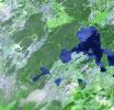
This image of Yellowstone National Park was acquired on July 2, 2001 by NASA's Terra satellite.
PIA03875:
Yellowstone Park
Full Resolution:     TIFF (67.01 MB)     JPEG (6.522 MB)
Add Image to Favorite List 2002-10-16 Earth Terra
MISR
742x861x3
These images from NASA's Terra satellite portray the Amery Ice Shelf front on October 6, 2001 (top) and September 29, 2002 (bottom), and illustrate changes that took place over the year elapsed between the two views.
PIA03729:
Amery Ice Shelf's "Loose Tooth" Gets Looser
Full Resolution:     TIFF (1.696 MB)     JPEG (92.43 kB)
Add Image to Favorite List 2002-10-22 Earth Shuttle Radar Topography Mission (SRTM)
C-Band Interferometric Radar
9600x9000x3
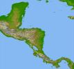
Panama, Costa Rica, Nicaragua, El Salvador, Honduras, Guatemala, Belize, southern Mexico and parts of Cuba and Jamaica are all seen in this image from NASA's Shuttle Radar Topography Mission.
PIA03364:
Colored Height and Shaded Relief, Central America
Full Resolution:     TIFF (84.57 MB)     JPEG (8.603 MB)
Add Image to Favorite List 2002-10-22 Earth Terra
ASTER
2720x1670x3
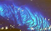
This image from NASA's Terra spacecraft shows features that look like folded material are carbonate sand dunes in the shallow waters of Tarpum Bay, southwest of Eleuthera Island in the Bahamas.
PIA03877:
Tarpum Bay, Bahamas
Full Resolution:     TIFF (10.64 MB)     JPEG (522.8 kB)
Add Image to Favorite List 2002-10-23 Earth Terra
MISR
1180x764x3
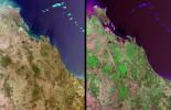
Queensland, Australia. This image, acquired on November 19, 2001 from NASA's Terra satellite, is MISR Mystery Image Quiz #11.
PIA03730:
Where on Earth...? MISR Mystery Image Quiz #11:
Queensland, Australia

Full Resolution:     TIFF (2.443 MB)     JPEG (154.5 kB)
Add Image to Favorite List 2002-10-25 Earth Landsat
Shuttle Radar Topography Mission (SRTM)
C-Band Interferometric Radar
Thematic Mapper
1152x870x3
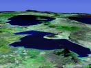
This perspective view acquired by NASA's Shuttle Radar Topography Mission from data collected in the year 2000 shows Lakes Managua and Nicaragua near the Pacific coast of Nicaragua.
PIA03365:
Perspective View with Landsat Overlay, Lakes Managua and Nicaragua
Full Resolution:     TIFF (2.87 MB)     JPEG (172 kB)
Add Image to Favorite List 2002-10-25 Earth Landsat
Shuttle Radar Topography Mission (SRTM)
C-Band Interferometric Radar
Thematic Mapper
1152x870x3
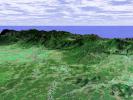
This perspective view taken in February 2000 from NASA's Landsat and Shuttle Radar Topography Mission shows the Caribbean coastal plain of Costa Rica, with the Cordillera Central rising in the background.
PIA03366:
Perspective View with Landsat Overlay, Costa Rica
Full Resolution:     TIFF (3.01 MB)     JPEG (220.9 kB)
Add Image to Favorite List 2002-10-25 Earth Landsat
Shuttle Radar Topography Mission (SRTM)
C-Band Interferometric Radar
Thematic Mapper
1152x870x3
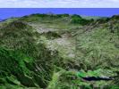
This perspective view taken in February 2000 from NASA's Landsat and Shuttle Radar Topography Mission shows the capital city of San Jose, Costa Rica, the gray area in the center of the image.
PIA03367:
Perspective View with Landsat Overlay, San Jose, Costa Rica
Full Resolution:     TIFF (3.01 MB)     JPEG (210.8 kB)
Add Image to Favorite List 2002-10-25 Earth Shuttle Radar Topography Mission (SRTM)
C-Band Interferometric Radar
1152x870x3
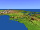
This perspective view from NASA's Shuttle Radar Topography Mission, acquired on February 2000, shows the Panama Canal with the Gulf of Panama in the foreground and the Caribbean Sea in the distance.
PIA03368:
Perspective View with Color-Coded Shaded Relief, Panama Canal
Full Resolution:     TIFF (1.584 MB)     JPEG (141.6 kB)
Add Image to Favorite List 2002-10-25 Earth Shuttle Radar Topography Mission (SRTM)
C-Band Interferometric Radar
1152x870x3
This perspective view from NASA's Shuttle Radar Topography Mission, acquired on February 2000, shows central Panama, with the remnants of the extinct volcano El Valle in the foreground and the Caribbean Sea in the distance.
PIA03369:
Perspective View with Color-Coded Shaded Relief, Central Panama
Full Resolution:     TIFF (2.588 MB)     JPEG (192.8 kB)
Add Image to Favorite List 2002-10-29 Earth Terra
ASTER
1400x1100x3
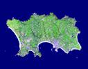
The Isle of Jersey (officially called the Bailiwick of Jersey) is the largest Channel Island, positioned in the Bay of Mont St Michel off the north-west coast of France. This image was acquired by NASA's Terra satellite on September 23, 2000.
PIA03879:
Isle of Jersey
Full Resolution:     TIFF (2.241 MB)     JPEG (236.9 kB)
Add Image to Favorite List 2002-10-30 Earth Terra
MISR
2328x1614x3
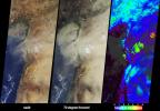
These images from NASA's Terra satellite, captured on October 18, 2002, display a large dust plume extended across countries bordering the eastern Mediterranean Sea.
PIA03731:
Dust Shrouds the Eastern Mediterranean
Full Resolution:     TIFF (7.947 MB)     JPEG (501.8 kB)
Add Image to Favorite List 2002-11-01 Earth Shuttle Radar Topography Mission (SRTM)
Terra
ASTER
C-Band Interferometric Radar
1152x870x3
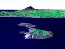
Italy's Mount Etna and the Aeolian Islands are the focus of this perspective view from NASA's Terra spacecraft. The image is looking south with the islands of Lipari and Vulcano in the foreground and Etna with its dark lava flows on the skyline.
PIA03370:
Perspective View, Mt. Etna, Italy & the Aeolian Islands
Full Resolution:     TIFF (1.534 MB)     JPEG (86.35 kB)
Add Image to Favorite List 2002-11-01 Earth Shuttle Radar Topography Mission (SRTM)
Terra
ASTER
C-Band Interferometric Radar
1152x870x3
Italy's Mount Etna is the focus of this perspective from NASA's Terra spacecraft. The city of Catania is barely visible behind Etna on the bay at the upper left.
PIA03371:
Perspective View, Mt. Etna, Italy
Full Resolution:     TIFF (2.617 MB)     JPEG (148.7 kB)
Add Image to Favorite List 2002-11-06 Earth Terra
MISR
1506x847x3
The height and southward extent of the ash plume emanating from Sicily's Mount Etna volcano on October 27, 2002 are captured in these four image panels from NASA's Terra spacecraft.
PIA03732:
Sicily's October Sky
Full Resolution:     TIFF (3.316 MB)     JPEG (236.5 kB)
Add Image to Favorite List 2002-11-07 Earth Terra
ASTER
2730x2694x3
This image was acquired on October 29, 2002 by NASA's Terra satellite of the Soufriere Hills volcano on Montserrat in the Caribbean.
PIA03880:
Soufriere Hills Volcano
Full Resolution:     TIFF (17.55 MB)     JPEG (964.6 kB)
Add Image to Favorite List 2002-11-07 Earth Terra
ASTER
3388x5100x3
On Sunday, November 3, 2002, Mt. Etna's ash-laden plume was imaged by NASA's Terra satellite. The plume is seen blowing toward the south-southeast, over the city and airport of Catania, Sicily.
PIA03881:
Mt. Etna, Italy
Full Resolution:     TIFF (51.84 MB)     JPEG (2.133 MB)
Retrieve Previous Set  Jump to a Previous Set   Jump to a Previous Set   Jump to a Previous Set   Jump to a Previous Set   Jump to a Previous Set   Jump to a Previous Set   Current Set   Jump to a Following Set   Jump to a Following Set   Jump to a Following Set   Retrieve Next Set 
 1-100   101-200   201-300   301-400   401-500   501-600   601-700   701-800   801-900   901-1000 
Currently displaying images: 601 - 700 of 2277