Your search criteria found 2277 images
Target is Earth
Go to PIAxxxxx:
Refine this list of images by:
Target:
Mission:
Spacecraft:
Instrument:
Click on an image for detailed information
Click on a column heading to sort in ascending or descending order
My
List
Addition Date Target Mission Instrument SizeSort Descending
Add Image to Favorite List 2007-08-15 Earth Aqua
AIRS
1000x1000x3
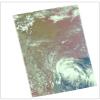
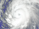
Visible image of Tropical Storm Erin, the Atlantic Ocean 210 miles south of Galveston, Texas, August, 2007, from the Atmospheric Infrared Sounder (AIRS) instrument onboard NASA's Aqua satellite.
PIA10647:
Tropical Storm Erin
Full Resolution:     TIFF (3.004 MB)     JPEG (123.6 kB)
Add Image to Favorite List 2007-08-18 Earth Aqua
AIRS
1000x1000x3
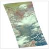
Visible image of Typhoon Sepat, western Pacific Ocean, southeast coast of China, August, 2007, from the Atmospheric Infrared Sounder (AIRS) instrument onboard NASA's Aqua satellite.
PIA10648:
Typhoon Sepat
Full Resolution:     TIFF (3.004 MB)     JPEG (130.3 kB)
Add Image to Favorite List 2007-08-24 Earth Terra
ASTER
1600x3000x3
Astana is the capital and second largest city of Kazakhstan. It was founded as a fort in 1824 on the Ishim River by Siberian Cossacks, and became a railway junction in the early 20th century. This image is from NASA's Terra satellite.
PIA10612:
Astana, Kazakhstan
Full Resolution:     TIFF (14.42 MB)     JPEG (977.7 kB)
Add Image to Favorite List 2007-08-31 Earth Terra
ASTER
369x518x3
On July 21, 2007, the world's most active volcano, Kilauea on Hawaii's Big Island, produced a fissure eruption from the Pu'u O'o vent, which fed an open lava channel and lava flows toward the east. This image is from NASA's Terra satellite.
PIA09968:
Lava Flow at Kilauea, Hawaii
Full Resolution:     TIFF (574.3 kB)     JPEG (37.96 kB)
Add Image to Favorite List 2007-09-03 Earth Aqua
AIRS
900x695x3
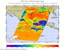
These infrared and microwave images were created with data retrieved by the Atmospheric Infrared Sounder (AIRS) on NASA's Aqua satellite, and show the remnants of the former Hurricane Felix over Central America, September, 2007.
PIA10649:
Hurricane Felix
Full Resolution:     TIFF (1.879 MB)     JPEG (124.9 kB)
Add Image to Favorite List 2007-09-04 Earth Terra
ASTER
752x846x3
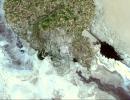
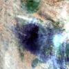
NASA's Terra satellite captured this image of fires in southern Greece.
PIA09969:
Fire in Southern Greece
Full Resolution:     TIFF (1.911 MB)     JPEG (151.3 kB)
Add Image to Favorite List 2007-09-07 Earth QuikScat
SeaWinds Scatterometer
1820x1560x3
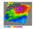
NASA's QuikScat satellite acquired this image of Category One Typhoon Fitow on Sept. 6, 2007, prior to the storm making landfall in Japan.
PIA09978:
NASA Measures Fitow's Winds by Satellite
Full Resolution:     TIFF (8.53 MB)     JPEG (711.1 kB)
Add Image to Favorite List 2007-09-11 Earth Aqua
AIRS
1280x720x3
A series of fires across Greece in August of 2007 burned 469,000 acres, visualized here by the Atmospheric Infrared Sounder (AIRS) on NASA's Aqua satellite.
PIA09923:
Visualization of Fires in Greece as seen by the Atmospheric Infrared Sounder Animation Icon
Full Resolution:     TIFF (2.768 MB)     JPEG (115.7 kB)
Add Image to Favorite List 2007-09-14 Earth Terra
ASTER
3066x3186x3
The Uvs Nuur Basin in Mongolia and the Russian Federation is the northernmost of the enclosed basins of Central Asia. It takes its name from Uvs Nuur Lake, a large, shallow and very saline lake. This image is from NASA's Terra satellite.
PIA10613:
Uvs Nuur, Mongolia
Full Resolution:     TIFF (29.31 MB)     JPEG (1.59 MB)
Add Image to Favorite List 2007-09-20 Earth Terra
ASTER
2000x1600x3
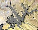
The white ring around Lake Powell tells the story. The surface is down 98 feet. This is critical, because Powell, Lake Mead, and other lakes along the Colorado River provide water for millions of people in five states. Image from NASA's Terra satellite.
PIA10614:
Lake Powell
Full Resolution:     TIFF (9.613 MB)     JPEG (644.7 kB)
Add Image to Favorite List 2007-10-02 Earth Terra
ASTER
1605x2700x3
The Naica mine in Chihuahua, Mexico, with its enormous gypsum crystals, may well be called the 'Queen of the Giant Crystals localities.' This image was acquired by NASA's Terra satellite on February 16, 2004.
PIA10615:
Naica Mine, Chihuahua, Mexico
Full Resolution:     TIFF (13.02 MB)     JPEG (962.6 kB)
Add Image to Favorite List 2007-10-12 Earth Terra
ASTER
3718x7302x3
The Curonian Spit in Lithuania and the Russian Federation was inscribed as a UNESCO World Heritage Site in 2000. This image is from NASA's Terra satellite.
PIA10616:
Curonian Spit, Lithuania and Russia
Full Resolution:     TIFF (81.45 MB)     JPEG (3.138 MB)
Add Image to Favorite List 2007-10-23 Earth Aqua
AIRS
1000x1000x3
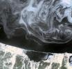
Smoke from multiple wildfires burning in Southern California in October, 2007, can be seen in this false-color image from the Atmospheric Infrared Sounder (AIRS) instrument onboard NASA's Aqua satellite.
PIA10088:
Swirls of Smoke and Dust Blow Out to Sea
Full Resolution:     TIFF (3.004 MB)     JPEG (103.4 kB)
Add Image to Favorite List 2007-10-23 Earth QuikScat
SeaWinds Scatterometer
800x875x3
The scope and extent of the strong Santa Ana wind event in Southern California the week of Oct. 21, 2007, is visible in this image from NASA's QuikScat satellite.
PIA10089:
NASA's QuikScat Maps Southern California's Destructive Santa Ana Winds
Full Resolution:     TIFF (702.5 kB)     JPEG (223.2 kB)
Add Image to Favorite List 2007-10-24 Earth Terra
MISR
4432x2880x3
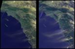
NASA's Terra spacecraft showed hot, dry Santa Ana winds blowing through the Los Angeles and San Diego areas on Sunday October 21, 2007.
PIA10090:
MISR Multi-angle Views of Sunday Morning Fires
Full Resolution:     TIFF (38.29 MB)     JPEG (703.1 kB)
Add Image to Favorite List 2007-10-25 Earth Terra
ASTER
1403x1127x3
This image from NASA's Terra satellite shows the Morenci open-pit copper mine in southeast Arizona, North America's leading producer of copper.
PIA10617:
Morenci Mine, AZ
Full Resolution:     TIFF (4.753 MB)     JPEG (409.6 kB)
Add Image to Favorite List 2007-11-07 Earth Jason-1
Altimeter
900x900x3
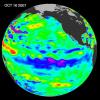
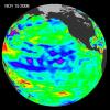
The tropical Pacific Ocean remains in the grips of a cool La Niña, as shown by data of sea-level heights from mid-October of 2007, collected by NASA's U.S-French Jason altimetric satellite.
PIA10110:
La Niña Persists
Full Resolution:     TIFF (2.433 MB)     JPEG (103.4 kB)
Add Image to Favorite List 2007-11-08 Earth Terra
ASTER
3000x5002x3
The October 2007 wildfires, including the Witch Wildland fire, plagued southern California and were some of the worst on record. Image from NASA's Terra satellite.
PIA10112:
Witch Wildland Fire, California
Full Resolution:     TIFF (45.02 MB)     JPEG (4.805 MB)
Add Image to Favorite List 2007-11-13 Earth Terra
ASTER
3804x3450x3
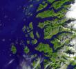
The Arctic Circle cuts through the western coast of Norway and the Saltfjellet-Svartisen National Park. This image was acquired by NASA's Terra satellite on August 23, 2006.
PIA10618:
Saltfjellet-Svartisen Park, Norway
Full Resolution:     TIFF (39.37 MB)     JPEG (1.597 MB)
Add Image to Favorite List 2007-11-26 Earth Terra
ASTER
3000x1700x3
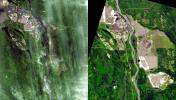
Near Fort McMurray, Alberta, Canada, on the east bank of the Athabasca River, are found the Steepbank and Millennium open pit mines. These images were acquired by NASA's Terra satellite on September 22, 2000 and July 31, 2007.
PIA10619:
Millennium Open Pit Mine, Alberta, Canada
Full Resolution:     TIFF (15.3 MB)     JPEG (936.1 kB)
Add Image to Favorite List 2007-12-11 Earth Terra
ASTER
3792x3796x3
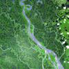
The Mackenzie River in the Northwest Territories, Canada, with its headstreams the Peace and Finley, is the longest river in North America. This image was acquired by NASA's Terra satellite on August 4, 2005.
PIA10620:
Mackenzie River Delta, Canada
Full Resolution:     TIFF (43.18 MB)     JPEG (2.795 MB)
Add Image to Favorite List 2007-12-11 Earth GRACE
K-Band Ranging System
1200x1200x3
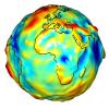
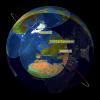
This visualization of a gravity model was created with data from NASA's Gravity Recovery and Climate Experiment and shows variations in the gravity field across Africa and Europe.
PIA12104:
Global Gravity: Africa and Europe
Full Resolution:     TIFF (4.325 MB)     JPEG (127.7 kB)
Add Image to Favorite List 2008-01-17 Earth Terra
ASTER
2319x2037x3
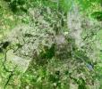
Delhi is the second largest metropolis in India, with a population of 16 million and is located in northern India along the banks of the Yamuna River. This image was acquired by NASA's Terra satellite on September 22, 2003.
PIA10621:
Delhi, India
Full Resolution:     TIFF (14.19 MB)     JPEG (1.504 MB)
Add Image to Favorite List 2008-01-30 Earth Terra
ASTER
3047x7555x3
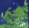
The Belcher Islands are an archipelago in Hudson Bay in Canada, belonging to the territory of Nunavit. The hamlet of Sanikiluaq is on the north coast of Flaherty Island. This image was acquired by NASA's Terra satellite on 18 September 2006.
PIA10622:
Belcher Islands, Canada
Full Resolution:     TIFF (69.06 MB)     JPEG (2.072 MB)
Add Image to Favorite List 2008-02-07 Earth Terra
ASTER
626x464x3
Anatahan is a stratovolcano that erupted in May 2003, forming a new crater. This image is from NASA's Terra satellite.
PIA10623:
Anatahan Volcano, Mariana Islands
Full Resolution:     TIFF (872.6 kB)     JPEG (46.37 kB)
Add Image to Favorite List 2008-02-08 Earth CloudSat
Cloud Profiling Radar (CPR)
682x850x3
NASA's CloudSat satellite made a nighttime overpass of the thunderstorms responsible for the tornadic outbreak over Kentucky, Tennessee, and Mississippi on Tuesday, February 5, 2008.
PIA10236:
CloudSat Profiles Tornadic Outbreak
Full Resolution:     TIFF (1.741 MB)     JPEG (104.8 kB)
Add Image to Favorite List 2008-02-19 Earth Terra
ASTER
1607x1480x3
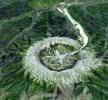
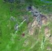
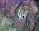
The Kondyor Massif is located in Eastern Siberia, Russia, north of the city of Khabarovsk. It is a rare form of igneous intrusion called alkaline-ultrabasic massif and it is full of rare minerals. This image is from NASA's Terra satellite.
PIA10624:
Kondyor Massif, Russia
Full Resolution:     TIFF (7.147 MB)     JPEG (530.2 kB)
Add Image to Favorite List 2008-02-29 Earth Terra
ASTER
1666x1772x3
If you live in Europe and buy roses, the chance is good that they were grown in Kenya -- specifically, in one of the colossal greenhouses that blot out the once wild shores of Lake Naivasha, 90km north-west of Nairobi. Image from NASA's Terra satellite.
PIA10625:
Lake Naivasha, Kenya
Full Resolution:     TIFF (8.871 MB)     JPEG (451.1 kB)
Add Image to Favorite List 2008-03-03 Earth Mars Reconnaissance Orbiter (MRO)
HiRISE
800x800x3
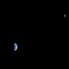
This is an image of Earth and the moon, acquired on October 3, 2007 by NASA's Mars Reconnaissance Orbiter from 88 million miles away.
PIA10244:
Earth and Moon as Seen from Mars
Full Resolution:     TIFF (1.922 MB)     JPEG (11.74 kB)
Add Image to Favorite List 2008-03-10 Earth Terra
ASTER
1596x1509x3
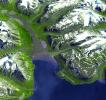
Longyearbyen is the administrative center of Svalbard and is located on Spitsbergen, the largest island of the Svalbard archipelago, part of the Kingdom of Norway. NASA's Terra satellite captured this image on July 12, 2003.
PIA10626:
Longyearbyen, Svalbard, Norway
Full Resolution:     TIFF (7.237 MB)     JPEG (503.1 kB)
Add Image to Favorite List 2008-03-12 Earth Aqua
AIRS
4196x2747x3
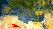
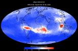
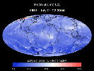
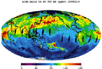
The Atmospheric Infrared Sounder instrument onboard NASA's Aqua satellite shows mean carbon monoxide at 500 millibar, September 22-29, 2002 AIRS Mean Carbon Monoxide at 500 Millibar, September 22-29, 2002.
PIA10241:
AIRS Mean Carbon Monoxide at 500 Millibar, September 22-29, 2002
Full Resolution:     TIFF (34.58 MB)     JPEG (798.8 kB)
Add Image to Favorite List 2008-03-17 Earth Aqua
AIRS
1428x1836x3
Water vapor is the dominant greenhouse gas in our atmosphere. Mean clear air precipitable water, 500mb to top of atmosphere from the Atmospheric Infrared Sounder (AIRS) instrument onboard NASA's Aqua satellite.
PIA10242:
Mean Clear Air Precipitable Water, 500mb to TOA from AIRS data
Full Resolution:     TIFF (7.88 MB)     JPEG (295.5 kB)
Add Image to Favorite List 2008-03-21 Earth Terra
ASTER
2505x2463x3
Norilsk is a major city in Krasnoyarsk Krai, Russia, and the northernmost city in Siberia. NASA's Terra satellite captured this image on July 21, 2000.
PIA10627:
Norilsk, Siberia
Full Resolution:     TIFF (18.53 MB)     JPEG (1.2 MB)
Add Image to Favorite List 2008-04-01 Earth Terra
ASTER
2536x2104x3
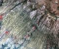
Along the western flank of the Andes, 400 km SE of Lima Peru, erosion has carved the mountain slopes into long, narrow serpentine ridges. NASA's Terra satellite captured this image on September 28, 2004.
PIA10628:
Western Slope of Andes, Peru
Full Resolution:     TIFF (16.02 MB)     JPEG (1.374 MB)
Add Image to Favorite List 2008-04-04 Earth Terra
ASTER
393x416x3
On the night of March 25, 2008, the Advanced Spaceborne Thermal Emission and Reflection Radiometer instrument on NASA's Terra satellite captured these thermal infrared images of Kilauea volcano on Hawaii's Big Island. Kilauea was active at two locations.
PIA10365:
Hawaii's Kilauea Volcano Belches a Toxic Brew
Full Resolution:     TIFF (491.3 kB)     JPEG (27.74 kB)
Add Image to Favorite List 2008-04-08 Earth Terra
ASTER
1250x1091x3
The Nardò Ring is a striking visual feature from space, and astronauts have photographed it several times. The Ring is a race car test track in Italy. This image was acquired by NASA's Terra satellite on August 17. 2007.
PIA10629:
Nardò Ring, Italy
Full Resolution:     TIFF (4.096 MB)     JPEG (336.8 kB)
Add Image to Favorite List 2008-04-21 Earth Terra
ASTER
1832x3276x3
Jordan's leading industry and export commodities are phosphate and potash, ranked in the top three in the world. These are used to make fertilizer. This image was acquired by NASA's Terra satellite on September 17, 2005.
PIA10630:
Phosphate Mines, Jordan
Full Resolution:     TIFF (18.03 MB)     JPEG (949.6 kB)
Add Image to Favorite List 2008-04-22 Earth Jason-1
Altimeter
900x900x3
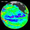
One of the strongest La Niñas in many years is slowly weakening but continues to blanket the Pacific Ocean near the equator, as shown by sea-level height data collected by NASA's U.S.-French Jason oceanographic satellite.
PIA10377:
Larger Pacific Climate Event Helps Current La Niña Linger
Full Resolution:     TIFF (2.433 MB)     JPEG (103 kB)
Add Image to Favorite List 2008-04-30 Earth Terra
ASTER
900x720x3
The Diomede Islands consisting of the western island Big Diomede, and the eastern island Little Diomede are two rocky islands located in the middle of the Bering Strait between Russia and Alaska. This image was acquired by NASA's Terra satellite.
PIA10631:
Diomede Islands, Bering Straight
Full Resolution:     TIFF (1.946 MB)     JPEG (67.39 kB)
Add Image to Favorite List 2008-05-09 Earth Terra
ASTER
3732x2427x3
Al Jazirah (also Gezira) is one of the 26 states of Sudan. The state lies between the Blue Nile and the White Nile in the east-central region of the country. This image was acquired December 25, 2006 by NASA's Terra spacecraft.
PIA11079:
Al Jazirah, Sudan
Full Resolution:     TIFF (27.17 MB)     JPEG (2.287 MB)
Add Image to Favorite List 2008-05-23 Earth Terra
ASTER
1735x1511x3
Nuuk (or Gadthab) is the capital and largest city of Greenland. It is located at the mouth of the Nuup Kangerlua inlet on the west coast of Greenland. This image was acquired August 2, 2004 by NASA's Terra spacecraft.
PIA11080:
Nuuk, Greenland
Full Resolution:     TIFF (7.877 MB)     JPEG (433.8 kB)
Add Image to Favorite List 2008-05-30 Earth Terra
ASTER
800x295x3
On May 2, 2008 Chile's Chaiten Volcano erupted after 9,000 years of inactivity. NASA's Terra spacecraft captured this image on May 28, 2008.
PIA11081:
Chaiten Volcano, Chile
Full Resolution:     TIFF (709 kB)     JPEG (45.79 kB)
Add Image to Favorite List 2008-06-06 Earth Terra
ASTER
1761x1054x3
This image acquired by NASA's Terra satellite May 12, 2008, shows faults within the mountains, but near and almost parallel the mountain front, northwest of the city of Chengdu.
PIA10772:
Sichuan Earthquake in China
Full Resolution:     TIFF (5.577 MB)     JPEG (375.9 kB)
Add Image to Favorite List 2008-06-18 Earth Terra
ASTER
2706x2134x3
This image acquired by NASA's Terra satellite on December 18, 2002 shows the East African rift -- places where the earth's crust has formed deep fissures and the plates have begun to move apart.
PIA11082:
East African Rift
Full Resolution:     TIFF (17.34 MB)     JPEG (1.272 MB)
Add Image to Favorite List 2008-06-30 Earth Terra
ASTER
3858x2484x3
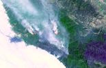
Fires near Big Sur, Calif., continued to burn unchecked when the Advanced Spaceborne Thermal Emission and Reflection Radiometer (ASTER) instrument on NASA's Terra satellite captured this image on Sunday, June 29, 2008.
PIA10925:
Fires Burning near Big Sur, California
Full Resolution:     TIFF (28.75 MB)     JPEG (1.261 MB)
Add Image to Favorite List 2008-07-02 Earth Terra
MISR
1267x1187x3
Lightning strikes have sparked more than a thousand fires in northern California. Cape Mendocino is at the center of the image and Mt. Shasta is near the upper right.
PIA10927:
Smoke Blankets Northern California
Full Resolution:     TIFF (4.517 MB)     JPEG (100.6 kB)
Add Image to Favorite List 2008-07-06 Earth Goldstone Deep Space Network (DSN)
Deep Space Network Antenna
1148x1119x3
Night shot of the 70m antenna at Goldstone, California. The parabolic dish is 70m (230 ft.) in diameter. The Goldstone Deep Space Communications Complex, located in the Mojave Desert in California, is one of three complexes which comprise NASA's DSN.
PIA10953:
70m Antenna at Goldstone, California
Full Resolution:     TIFF (3.859 MB)     JPEG (120 kB)
Add Image to Favorite List 2008-07-15 Earth OSTM/Jason-2
Advanced Microwave Radiometer (AMR)
2400x2772x3
NASA's Ocean Surface Topography Mission/Jason-2 satellite shows the amount of water vapor in the atmosphere beneath the satellite during the period June 22, 2008, to June 29, 2008.
PIA10954:
Global Views of Atmospheric Water Vapor:
First Data from OSTM/Jason-2's Advanced Microwave Radiometer

Full Resolution:     TIFF (19.98 MB)     JPEG (537.4 kB)
Add Image to Favorite List 2008-07-18 Earth Terra
ASTER
1639x1611x3
L'Anse aux Meadows is a site on the northernmost tip of the island of Newfoundland, located in the Province of Newfoundland and Labrador, Canada, where the remains of a Viking village were discovered in 1960. This image is from NASA's Terra satellite.
PIA11083:
L'Anse Aux Meadows, Newfoundland
Full Resolution:     TIFF (7.934 MB)     JPEG (468.6 kB)
Add Image to Favorite List 2008-07-22 Earth Aqua
AIRS
1026x577x3
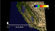
Carbon monoxide from California's wildfire, a visualization created using data from the Atmospheric Infrared Sounder (AIRS) on NASA's Aqua satellite, June-July, 2008.
PIA10973:
Carbon Monoxide from California's Wildfire - a Visualization Created Using Data from NASA's Atmospheric Infrared Sounder Animation Icon
Full Resolution:     TIFF (1.779 MB)     JPEG (61.13 kB)
Add Image to Favorite List 2008-07-23 Earth Terra
ASTER
1503x2214x3
The Yolla Bolly Complex Wildland Fire was started on June 21, 2008 by a lightning strike. This image was acquired by NASA's Terra spacecraft. The burned area is charcoal-colored, surrounding forest and vegetation is red. Smoke is light blue-gray.
PIA10975:
Yolla Bolly Complex Wildland Fire
Full Resolution:     TIFF (10 MB)     JPEG (733.5 kB)
Add Image to Favorite List 2008-07-31 Earth Jason-1
Altimeter
919x699x3
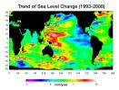
Data from NASA's Jason satellite shows warming water and melting land ice have raised global mean sea level 4.5 centimeters (1.7 inches) from 1993 to 2008. But the rise is by no means uniform.
PIA11002:
Portrait of a Warming Ocean and Rising Sea Levels:
Trend of Sea Level Change 1993-2008

Full Resolution:     TIFF (644.9 kB)     JPEG (104.2 kB)
Add Image to Favorite List 2008-08-06 Earth Aqua
AIRS
727x329x3
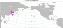
Transport of dust from China Dust Storm of April 2006, from the Atmospheric Infrared Sounder (AIRS) on NASA's Aqua satellite.
PIA11009:
Transport of Dust from China Dust Storm of April 2006 Animation Icon
Full Resolution:     TIFF (718.7 kB)     JPEG (30.38 kB)
Add Image to Favorite List 2008-08-08 Earth Terra
ASTER
3656x4124x3
NASA's Terra spacecraft shows the Rub' al Khali, one of the largest sand deserts in the world, encompassing most of the southern third of the Arabian Peninsula; it includes parts of Oman, United Arab Emirates, and Yemen.
PIA11084:
Rub' al Khali, Arabia
Full Resolution:     TIFF (45.23 MB)     JPEG (3.202 MB)
Add Image to Favorite List 2008-08-13 Earth Aqua
AIRS
321x239x3
Hurricane Isabel isotherms as the storm moved across the Atlantic Ocean in September, 2003, from the Atmospheric Infrared Sounder (AIRS) on NASA's Aqua satellite.
PIA11032:
Hurricane Isabel Isotherms Animation Icon
Full Resolution:     TIFF (230.6 kB)     JPEG (8.968 kB)
Add Image to Favorite List 2008-08-13 Earth Aqua
AIRS
319x240x3
Supertyphoon Pongsona isotherms as it hit the island of Guam, December of 2002, from the Atmospheric Infrared Sounder (AIRS) on NASA's Aqua satellite.
PIA11033:
Supertyphoon Pongsona Isotherms Animation Icon
Full Resolution:     TIFF (230.2 kB)     JPEG (9.715 kB)
Add Image to Favorite List 2008-08-14 Earth Aqua
AIRS
640x480x3
A series of maps of the transport of carbon monoxide generated by Alaska Fires, July 2004, created by data from the Atmospheric Infrared Sounder (AIRS) on NASA's Aqua satellite.
PIA11034:
Transport of Carbon Monoxide Generated by Alaska Fires, July 2004 Animation Icon
Full Resolution:     TIFF (922.8 kB)     JPEG (44.52 kB)
Add Image to Favorite List 2008-08-28 Earth Terra
ASTER
3832x2956x3
The Colorado River ends its 2330 km journey in the Gulf of Mexico in Baja California. NASA's Terra spacecraft acquired this image on May 29, 2006.
PIA11085:
Colorado River Delta
Full Resolution:     TIFF (33.98 MB)     JPEG (1.911 MB)
Add Image to Favorite List 2008-09-04 Earth ISS EarthKam
Electronic Still Camera
3060x2036x3
This image from NASA's EarthKAM is of Hawke's Bay, one of the 12 local government regions of eastern North Island, New Zealand. It includes larger cities, such as Hastings and Napier.
PIA11014:
North Island, New Zealand
Full Resolution:     TIFF (18.69 MB)     JPEG (1.303 MB)
Add Image to Favorite List 2008-09-04 Earth ISS EarthKam
Electronic Still Camera
3060x2036x3
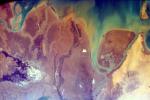
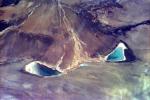
The impermanent waterways shown here from NASA's EarthKAM are part of Oued Irharrhar, which appear to be carrying sulfur (yellow) and iron (red) deposits. The city of Amguid is located on these waterways, and all lie in the Mouydir Mountains in Algeria.
PIA11015:
Algeria
Full Resolution:     TIFF (18.69 MB)     JPEG (1.659 MB)
Add Image to Favorite List 2008-09-04 Earth ISS EarthKam
Electronic Still Camera
3060x2036x3
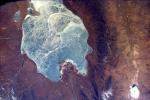
The light corner of the image from NASA's EarthKAM is Lake Torrens, an ephemeral salt lake in South Australia. The twisted strata visible here is part of a rocky desert area in the Australian Outback.
PIA11016:
South Australia, Australia
Full Resolution:     TIFF (18.69 MB)     JPEG (1.711 MB)
Add Image to Favorite List 2008-09-04 Earth ISS EarthKam
Electronic Still Camera
3060x2036x3
The Andes Mountains, part of the Southern Cordillera formed from subduction zone volcanism at the convergent boundary of the Nazca plate and the South American plate. This image is from NASA's EarthKAM.
PIA11017:
Aracar Volcano, Andes Mountains, Argentina near Chile Border
Full Resolution:     TIFF (18.69 MB)     JPEG (1.265 MB)
Add Image to Favorite List 2008-09-04 Earth ISS EarthKam
Electronic Still Camera
3060x2036x3
This image from NASA's EarthKAM is of Sakhalin Island, located just north of Japan and east of the Khabarovski and Primorski Krai of the Russian Far East. With the Kuril Islands, it forms Sakhalin Province.
PIA11018:
Sakhalin Island, Russia
Full Resolution:     TIFF (18.69 MB)     JPEG (1.377 MB)
Add Image to Favorite List 2008-09-04 Earth ISS EarthKam
Electronic Still Camera
3060x2036x3
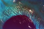
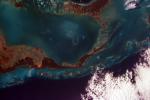
This extraordinary image captures the meeting place of the deep waters of the Tongue of the Ocean and the much shallower, completely submerged Grand Bahama Bank. This image is from NASA's EarthKAM.
PIA11019:
Tongue of the Ocean and Grand Bahama Bank
Full Resolution:     TIFF (18.69 MB)     JPEG (1.05 MB)
Add Image to Favorite List 2008-09-04 Earth ISS EarthKam
Electronic Still Camera
3060x2036x3
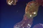
This image of the Galapagos Islands captures two large shield volcanoes on Isla Isabella, the largest and least inhabited island in the Galapagos chain. This image is from NASA's EarthKAM.
PIA11020:
Isla Isabella, Galapagos Island
Full Resolution:     TIFF (18.69 MB)     JPEG (873.7 kB)
Add Image to Favorite List 2008-09-04 Earth ISS EarthKam
Electronic Still Camera
3060x2036x3
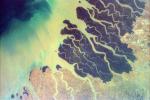
This image from NASA's EarthKAM is of the northern end of the Persian Gulf and the broad delta complex of the Tigris, Euphrates, Shatt al Arab, and Karun rivers has captured the arid-looking wetlands of northeast Kuwait (Bubiyan Island).
PIA11021:
The Persian Gulf and the Delta of the Tigris and Euphrates Rivers, Kuwait, Iraq, and Iran
Full Resolution:     TIFF (18.69 MB)     JPEG (1.299 MB)
Add Image to Favorite List 2008-09-05 Earth ISS EarthKam
Electronic Still Camera
3060x2036x3
This image from NASA's EarthKAM captures almost all of Quinghai, the largest lake in China. It is located in the Quinghai Province on the Quinghai Tibetan Plateau.
PIA11061:
Frozen Lake Quinghai Nanshan, Northern China
Full Resolution:     TIFF (18.69 MB)     JPEG (1.217 MB)
Add Image to Favorite List 2008-09-05 Earth ISS EarthKam
Electronic Still Camera
3060x2036x3
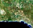
This image from NASA's EarthKAM shows Lisbon, the capital of Portugal. The superb natural harbor at Lisbon is a commercially important European port handling much of the import-export traffic for Portugal and Spain.
PIA11062:
Contrails over Lisbon, Portugal
Full Resolution:     TIFF (18.69 MB)     JPEG (1.138 MB)
Add Image to Favorite List 2008-09-05 Earth ISS EarthKam
Electronic Still Camera
3060x2036x3
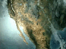
This is an image of the southern portion of the Baja California Peninsula taken by NASA's EarthKAM on February 12, 2000. The Pacific Ocean lies to the west and the Gulf of California to the east.
PIA11063:
Southern Tip of Baja California, Mexico
Full Resolution:     TIFF (18.69 MB)     JPEG (1.229 MB)
Add Image to Favorite List 2008-09-05 Earth ISS EarthKam
Electronic Still Camera
3060x2036x3
The distinctive curve of Cape Cod, Massachusetts and the greater Boston urban area are very clear of the northeastern coast of the United States in this image from NASA's EarthKAM.
PIA11064:
Cape Cod, Massachusetts
Full Resolution:     TIFF (18.69 MB)     JPEG (1.008 MB)
Add Image to Favorite List 2008-09-05 Earth ISS EarthKam
Electronic Still Camera
3060x2036x3
This is an image from NASA's EarthKAM of the Rio Gurupi in the Brazilian state of Maranhao and its delta. It is the only open sea delta in the Americas and has more than 70 islands of various sizes.
PIA11065:
Delta of the Gurupi, Maracacume, and Tiriacu Rivers, Brazil
Full Resolution:     TIFF (18.69 MB)     JPEG (731 kB)
Add Image to Favorite List 2008-09-05 Earth ISS EarthKam
Electronic Still Camera
3060x2036x3
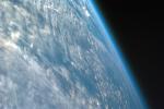
This highly oblique image shot over northwestern part of the African continent captures the curvature of the Earth and shows its atmosphere as seen by NASA's EarthKAM. You can see clouds and even the occasional thunderhead.
PIA11066:
Oblique Shot of Earth
Full Resolution:     TIFF (18.69 MB)     JPEG (460.9 kB)
Add Image to Favorite List 2008-09-05 Earth ISS EarthKam
Electronic Still Camera
3060x2036x3
This image captures the beauty of a major alluvial fan in Tsinghai, a province located in Northwestern China. This archival image was taken from NASA's Space Shuttle in 1997 as part of its ISS EarthKAM mission.
PIA11067:
Alluvial fan in China
Full Resolution:     TIFF (18.69 MB)     JPEG (854 kB)
Add Image to Favorite List 2008-09-05 Earth ISS EarthKam
Electronic Still Camera
3060x2036x3
This image from NASA's EarthKAM captures the tropical beauty of the major islands of the Little Bahama Bank, the most northerly of the island groups that comprise the Bahamas.
PIA11068:
Atlantic (maybe Caribbean Sea) Ocean and Islands
Full Resolution:     TIFF (18.69 MB)     JPEG (475.3 kB)
Add Image to Favorite List 2008-09-05 Earth ISS EarthKam
Electronic Still Camera
3060x2036x3
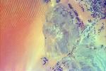
This image from NASA's EarthKAM shows pivot irrigation near the city of As Sulayyil (Sulayel), Saudi Arabia. The edge of the Rub' al-Khali or Empty Quarter is visible in the southeast.
PIA11069:
Sand Dunes and Center-Pivot Irrigation in Saudi Arabia
Full Resolution:     TIFF (18.69 MB)     JPEG (886.2 kB)
Add Image to Favorite List 2008-09-05 Earth ISS EarthKam
Electronic Still Camera
3060x2036x3
Parts of the vast Ganges delta, in fact the world's largest, lie in both Bangladesh and the State of West Bengal, India as seen by NASA's EarthKAM.
PIA11070:
Ganges River Delta
Full Resolution:     TIFF (18.69 MB)     JPEG (852 kB)
Add Image to Favorite List 2008-09-11 Earth QuikScat
SeaWinds Scatterometer
2344x926x3
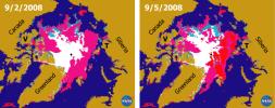
 This pair of sea ice maps was derived from radar data from NASA's QuikScat satellite scatterometer during September, 2008 showing the Arctic Sea along the Northern Sea Route and the Northwest Passage.
PIA11086:
Recent State of Arctic Sea Ice
Full Resolution:     TIFF (6.519 MB)     JPEG (290.8 kB)
Add Image to Favorite List 2008-09-16 Earth Terra
ASTER
3190x2810x3
This image acquired by NASA's Terra spacecraft is of the northernmost land in the world is located in Pearyland, Greenland. This is a land of permanent snows, glaciers, and 24-hours of daylight during the summer months.
PIA11169:
Northern Greenland
Full Resolution:     TIFF (26.89 MB)     JPEG (1.555 MB)
Add Image to Favorite List 2008-09-17 Earth Aqua
AIRS
638x478x3
The Atmospheric Infrared Sounder (AIRS) onboard NASA's Aqua satellite collects data and creates a temperature profile, September, 2008, represented by a blue beam as it sweeps back and forth through the atmosphere down to the surface of the Earth.
PIA11171:
AIRS Collects Data and Creates a Temperature Profile Animation Icon
Full Resolution:     TIFF (916.1 kB)     JPEG (39.04 kB)
Add Image to Favorite List 2008-09-22 Earth Aqua
AIRS
1777x948x3
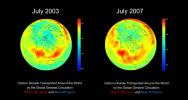
AIRS global distribution of mid-tropospheric carbon dioxide at 8-13 km altitudes between July 2003 and 2007, from the Atmospheric Infrared Sounder (AIRS) insturment onboard NASA's Aqua satellite.
PIA11186:
AIRS Global Distribution of Mid-Tropospheric Carbon Dioxide at 8-13 km Altitudes
Full Resolution:     TIFF (5.062 MB)     JPEG (146.6 kB)
Add Image to Favorite List 2008-09-24 Earth Aqua
AIRS
5000x3750x3
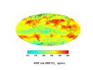
This image, created with data acquired by the Atmospheric Infrared Sounder instrument during July 2008, shows large scale patterns of carbon dioxide concentrations that are transported around the Earth by the general circulation of the atmosphere.
PIA11194:
Global Carbon Dioxide Transport from AIRS Data, July 2008
Full Resolution:     TIFF (56.25 MB)     JPEG (715.3 kB)
Add Image to Favorite List 2008-09-24 Earth OSTM/Jason-2
Altimeter
1225x710x3
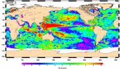
This image shows mean sea-level anomaly data from NASA's OSTM/Jason-2 for the period July 21, 2008, to July 31, 2008.
PIA11197:
Newest Ocean-Observing Satellite Records Recent Sea Level Changes
Full Resolution:     TIFF (872.5 kB)     JPEG (211.1 kB)
Add Image to Favorite List 2008-09-30 Mars Phoenix
MECA
1160x504x1
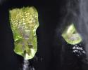
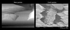
The image on the left is a particle of Martian soil observed with the atomic force microscope on NASA's Phoenix Mars Lander. For comparison, the image on the right is a type of terrestrial soil on Earth viewed with a scanning electron microscope.
PIA11206:
Mars Particle and Terrestrial Soil, Compared Microscopically
Full Resolution:     TIFF (585.4 kB)     JPEG (55.27 kB)
Add Image to Favorite List 2008-09-30 Earth Phoenix
1228x910x1
A scanning electron microscope captured this image of terresterial soil containing a phyllosilicate mineral from Koua Bocca, Ivory Coast, West Africa. This soil shares some similarities with Martian soil scooped by NASA's Phoenix Lander.
PIA11207:
Terrestrial Clay under Microscope
Full Resolution:     TIFF (1.119 MB)     JPEG (140.7 kB)
Add Image to Favorite List 2008-10-16 Earth Terra
ASTER
1922x2982x3
Dense green vegetation gives way to pale fields in these satellite images of deforestation in Brazil's Amazon rainforest. This image is from NASA's Terra satellite.
PIA11420:
Mato Grosso, Brazil
Full Resolution:     TIFF (17.22 MB)     JPEG (1.446 MB)
Add Image to Favorite List 2008-11-03 Earth Terra
ASTER
6630x5000x3
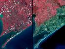
Three weeks after Hurricane Ike came ashore near Galveston, TX, residents returned to find their houses in ruins. Images were acquired by NASA's Terra satellite on September 28, right, and August 15, 2006, left.
PIA11394:
Aftermath of Hurricane Ike along Texas Coast
Full Resolution:     TIFF (99.45 MB)     JPEG (4.42 MB)
Add Image to Favorite List 2008-11-03 Earth Aqua
AIRS
3840x2160x3
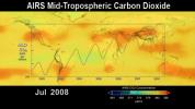
This image shows the distribution and amount of carbon dioxide in Earth's mid-troposphere in July 2008 as measured by the Atmospheric Infrared Sounder (AIRS) instrument onboard NASA's Aqua satellite.
PIA11395:
AIRS Carbon Dioxide with Mauna Loa Carbon Dioxide Overlaid
Full Resolution:     TIFF (24.88 MB)     JPEG (534 kB)
Add Image to Favorite List 2008-11-17 Earth Terra
ASTER
4070x8024x3
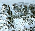
Byrd Glacier is a major glacier in Antarctica; it drains an extensive area of the polar plateau and flows eastward between the Britannia Range and the Churchill Mountains to discharge into the Ross Ice Shelf. This image is from NASA's Terra satellite.
PIA11419:
Byrd Glacier, Antarctica
Full Resolution:     TIFF (97.97 MB)     JPEG (7.07 MB)
Add Image to Favorite List 2008-11-18 Earth Aqua
AIRS
1024x576x3
This visualization from the Atmospheric Infrared Sounder (AIRS) on NASA's Aqua satellite shows variations in the three dimensional distribution of water vapor in the atmosphere during the summer and fall of 2005.
PIA11424:
Water Vapor Transport, June through November 2005 (Movie) Animation Icon
Full Resolution:     TIFF (1.772 MB)     JPEG (54.12 kB)
Add Image to Favorite List 2008-12-13 Earth Jason-1
Altimeter
900x900x3
This image of sea-surface height measurements from NASA's U.S./French Jason-1 oceanography satellite shows the Pacific Ocean remains locked in a strong, cool phase of the Pacific Decadal Oscillation.
PIA11710:
Oscillation Rules as the Pacific Cools
Full Resolution:     TIFF (2.433 MB)     JPEG (102.9 kB)
Add Image to Favorite List 2009-01-09 Earth Terra
ASTER
3136x1656x3
NASA's Terra spacecraft monitored the migration of sand dunes in the Bodele depression of northern Chad from at various times from one month to 6.5 years
PIA11752:
Bodele Sand Dunes, Chad
Full Resolution:     TIFF (15.58 MB)     JPEG (879.5 kB)
Add Image to Favorite List 2009-02-06 Earth Jason-1
OSTM/Jason-2
Altimeter
1074x1074x3
This image is a 'family portrait' of Topex/Poseidon, Jason-1 and Ocean Surface Topography Mission/Jason-2 (OSTM/Jason-2), NASA satellites that have measured global sea surface heights since 1992.
PIA11794:
Altimeter Family Portrait: Topex/Poseidon, Jason-1 and OSTM/Jason-2
Full Resolution:     TIFF (3.465 MB)     JPEG (131 kB)
Add Image to Favorite List 2009-02-09 Earth Terra
ASTER
2468x1992x3
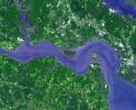
Jamestown, located on Jamestown Island in the Virginia Colony, was founded on May 14, 1607. NASA's Terra spacecraft acquired this image on September 4, 2007.
PIA12055:
Jamestown, VA
Full Resolution:     TIFF (14.76 MB)     JPEG (918.7 kB)
Add Image to Favorite List 2009-02-18 Earth Terra
ASTER
3315x3324x3
On February 17, 2009, NASA's Terra satellite imaged bushfires burning in Victoria Australia.
PIA11806:
Australia Wildfires Extract a Heavy Toll in Lives, Land
Full Resolution:     TIFF (33.06 MB)     JPEG (1.678 MB)
Add Image to Favorite List 2009-02-19 Earth Aqua
AIRS
764x522x3
Carbon monoxide from the Australian fires of February, 2009, as seen by the Atmospheric Infrared Sounder (AIRS) on NASA's Aqua satellite.
PIA11807:
Carbon Monoxide from the Australian Fires of Feb 2009 as seen by AIRS Animation Icon
Full Resolution:     TIFF (1.198 MB)     JPEG (92.37 kB)
Add Image to Favorite List 2009-02-20 Earth Terra
ASTER
3900x3764x3
The north coast of the Island of Hokkaido, Japan lies at the southern end of the Sea of Okhotsk. NASA's Terra spacecraft acquired this image on February 11, 2009.
PIA12056:
Hokkaido, Japan
Full Resolution:     TIFF (44.04 MB)     JPEG (1.775 MB)
Add Image to Favorite List 2009-03-02 Earth Terra
ASTER
2368x3020x3
The Palm Islands are artificial islands in Dubai, United Arab emirates on which major commercial and residential structures are being built. NASA's Terra spacecraft acquired this image on November 17 and December 10, 2008.
PIA12057:
Palm Islands, Dubai, UAE
Full Resolution:     TIFF (21.48 MB)     JPEG (700.7 kB)
Add Image to Favorite List 2009-03-16 Earth Terra
ASTER
2676x1918x3
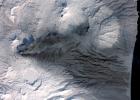
This image acquired by NASA's Terra spacecraft on March 6, 2009, shows early March eruptions of Karymsky volcano on Russia's Kamchatka Peninsula left the usually white snow a gray ashy color.
PIA12058:
Karymsky Volcano, Kamchatka
Full Resolution:     TIFF (15.41 MB)     JPEG (726.5 kB)
Add Image to Favorite List 2009-03-26 Earth Terra
ASTER
1949x2646x3
Grand Turk Island is an island in the Turks and Caicos Islands in the Caribbean, and contains the territory's capital, Cockburn Town. NASA's Terra spacecraft acquired this image on September 18, 2001.
PIA12059:
Grand Turk Island
Full Resolution:     TIFF (15.49 MB)     JPEG (591.2 kB)
Add Image to Favorite List 2009-03-26 Earth Jason-1
OSTM/Jason-2
Altimeter
3508x2479x3
This is the first global map of ocean surface topography produced with data from the interleaved tandem mission of NASA's Jason-1 and Ocean Surface Topography Mission (OSTM)/Jason-2 satellites.
PIA11859:
First Jason-1 and OSTM/Jason-2 Tandem Global View
Full Resolution:     TIFF (26.09 MB)     JPEG (1.128 MB)
Retrieve Previous Set  Jump to a Previous Set   Jump to a Previous Set   Jump to a Previous Set   Jump to a Previous Set   Jump to a Previous Set   Jump to a Previous Set   Jump to a Previous Set   Jump to a Previous Set   Jump to a Previous Set   Jump to a Previous Set   Retrieve Next Set 
 1-100   101-200   201-300   301-400   401-500   501-600   601-700   701-800   801-900   901-1000 
Currently displaying images: 1001 - 1100 of 2277