|
Your search criteria found 2277 images Target is Earth |
| My List |
Addition Date | Target | Mission |
Instrument
|
Size |

|
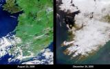
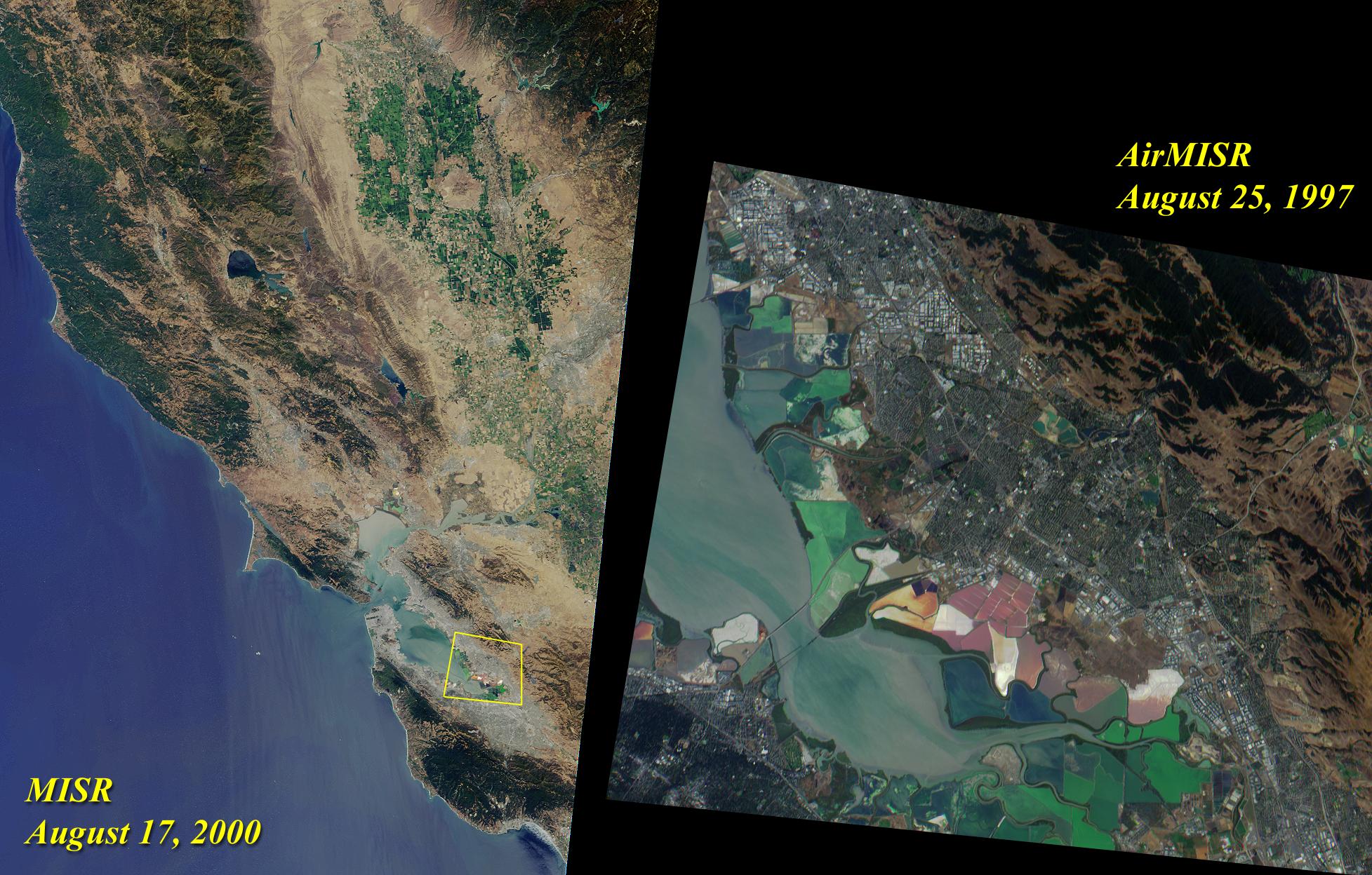
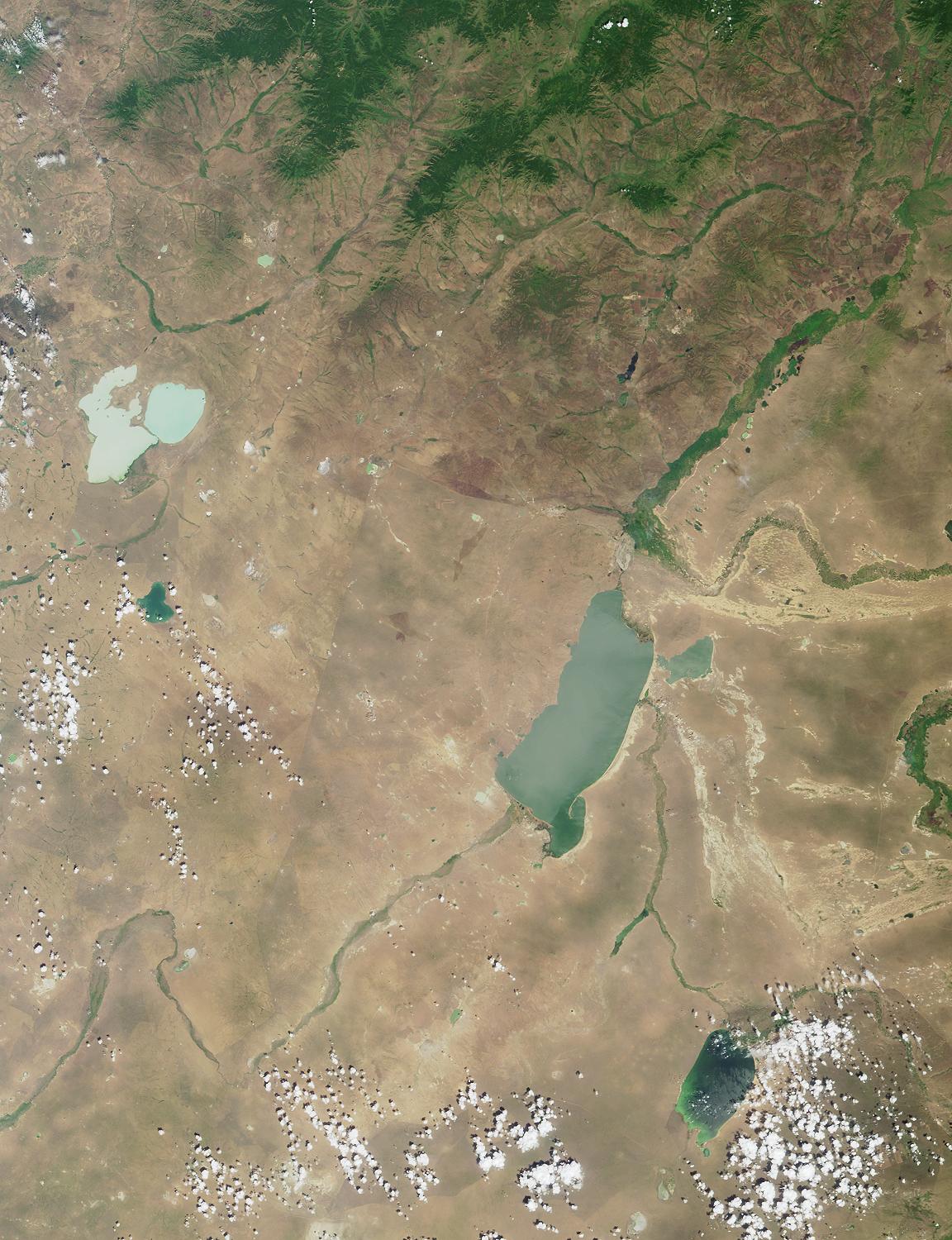
2000-08-23 | Earth |
Terra |
MISR |
1152x505x3 |

|
|||||
|
|
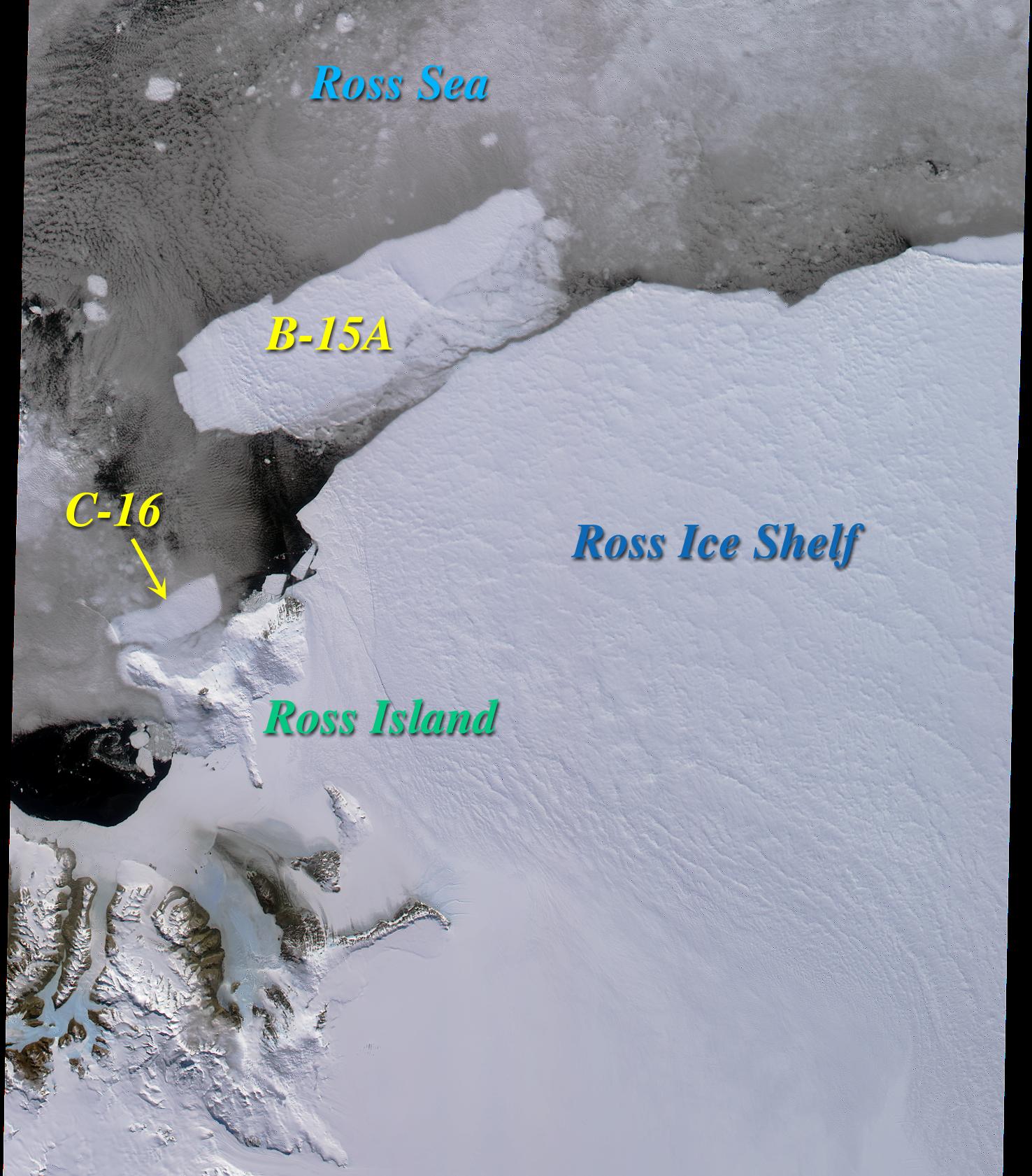
2000-08-30 | Earth |
Terra |
MISR |
1440x753x3 |
|
|||||
|
|
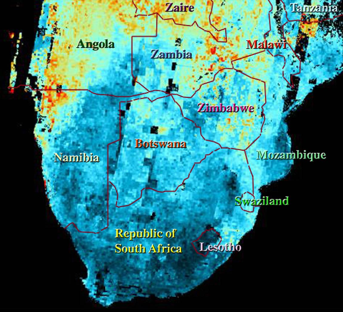
2000-09-06 | Earth |
Terra |
MISR |
1256x705x3 |
|
|||||
|
|
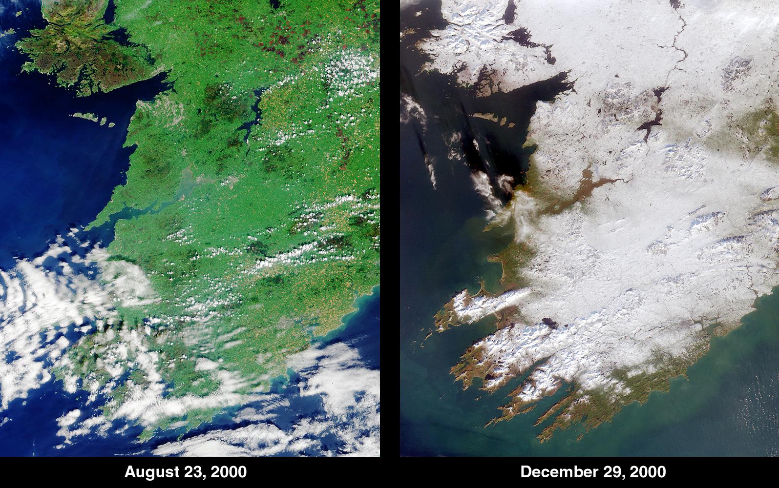
2000-09-13 | Earth |
Terra |
MISR |
500x549x3 |
|
|||||
|
|
2000-09-20 | Earth |
Terra |
MISR |
826x560x3 |

|
|||||
|
|
2000-09-27 | Earth |
Terra |
MISR |
1148x819x3 |
|
|||||
|
|
2000-10-04 | Earth |
Terra |
MISR |
1149x750x3 |
|
|||||
|
|
2000-10-11 | Earth |
Terra |
MISR |
2259x894x3 |
|
|||||
|
|
2000-10-18 | Earth |
Terra |
MISR |
1728x1043x3 |
|
|||||
|
|
2000-10-25 | Earth |
Terra |
MISR |
2094x1092x3 |

|
|||||
|
|
2000-11-03 | Earth |
Terra |
MISR |
1256x1097x3 |
|
|||||
|
|
2000-11-08 | Earth |
Terra |
MISR |
1606x1293x3 |
|
|||||
|
|
2000-11-15 | Earth |
Terra |
MISR |
1918x1424x3 |
|
|||||
|
|
2000-11-22 | Earth |
Terra |
MISR |
670x1005x3 |
|
|||||
|
|
2000-11-29 | Earth |
Terra |
MISR |
1591x1382x3 |

|
|||||
|
|
2000-12-06 | Earth |
Terra |
MISR |
1011x1422x3 |
|
|||||
|
|
2000-12-13 | Earth |
Terra |
MISR |
1600x1261x3 |
|
|||||
|
|
2000-12-20 | Earth |
Terra |
MISR |
1955x1248x3 |
|
|||||
|
|
2000-12-27 | Earth |
Terra |
MISR |
1488x1564x3 |
|
|||||
|
|
2001-01-03 | Earth |
Terra |
MISR |
1476x1681x3 |
|
|||||
|
|
2001-01-10 | Earth |
Terra |
MISR |
1149x1046x3 |

|
|||||
|
|
2001-01-17 | Earth |
Terra |
MISR |
1595x1000x3 |
|
|||||
|
|
2001-01-24 | Earth |
Terra |
MISR |
1567x1354x3 |
|
|||||
|
|
2001-02-07 | Earth |
Terra |
MISR |
1639x1810x3 |
|
|||||
|
|
2001-02-14 | Earth |
Terra |
MISR |
876x1056x3 |
|
|||||
|
|
2001-02-21 | Earth |
Terra |
MISR |
1500x867x3 |
|
|||||
|
|
2001-02-28 | Earth |
Terra |
MISR |
954x839x3 |
|
|||||
|
|
2001-03-07 | Earth |
Terra |
MISR |
1604x1745x3 |
|
|||||
|
|
2001-03-14 | Earth |
Terra |
MISR |
1349x1277x3 |
|
|||||
|
|
2001-03-21 | Earth |
Terra |
MISR |
1513x1590x3 |
|
|||||
|
|
2001-03-28 | Earth |
Terra |
MISR |
2000x1315x3 |
|
|||||
|
|
2002-10-23 | Earth |
Terra |
MISR |
1180x764x3 |
|
|||||
|
|
2001-04-04 | Earth |
Terra |
MISR |
990x1792x3 |
|
|||||
|
|
2001-04-11 | Earth |
Terra |
MISR |
1629x1816x3 |
|
|||||
|
|
2001-04-18 | Earth |
Terra |
MISR |
1925x1219x3 |
|
|||||
|
|
2001-04-25 | Earth |
Terra |
MISR |
2023x1621x3 |
|
|||||
|
|
2001-05-02 | Earth |
Terra |
MISR |
1750x1502x3 |
|
|||||
|
|
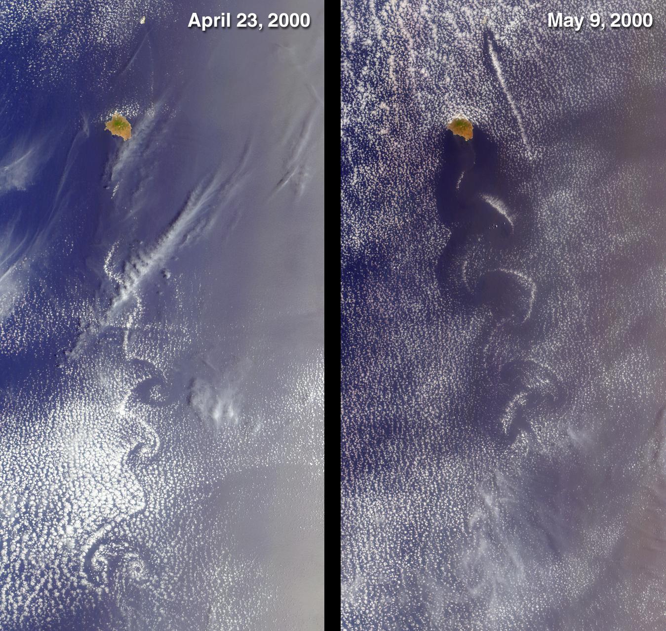
2001-05-09 | Earth |
Terra |
MISR |
1845x1701x3 |
|
|||||
|
|
2001-05-16 | Earth |
Terra |
MISR |
1536x1579x3 |
|
|||||
|
|
2001-05-23 | Earth |
Terra |
MISR |
1300x1550x3 |
|
|||||
|
|
2001-05-30 | Earth |
Terra |
MISR |
1870x1280x3 |
|
|||||
|
|
2001-06-13 | Earth |
Terra |
MISR |
923x798x3 |
|
|||||
|
|
2001-06-20 | Earth |
Terra |
MISR |
1356x1932x3 |
|
|||||
|
|
2001-06-27 | Earth |
Terra |
MISR |
1595x1553x3 |
|
|||||
|
|
2001-07-02 | Earth |
Terra |
MISR |
1215x1191x3 |

|
|||||
|
|
2001-07-11 | Earth |
Terra |
MISR |
1434x1232x3 |
|
|||||
|
|
2001-07-18 | Earth |
Terra |
MISR |
1712x1204x3 |
|
|||||
|
|
2001-07-25 | Earth |
Terra |
MISR |
1594x1444x3 |
|
|||||
|
|
2001-08-01 | Earth |
Terra |
MISR |
1736x1328x3 |
|
|||||
|
|
2001-08-08 | Earth |
Terra |
MISR |
1292x1044x3 |
|
|||||
|
|
2001-08-15 | Earth |
Terra |
MISR |
1290x890x3 |
|
|||||
|
|
2001-08-22 | Earth |
Terra |
MISR |
1480x1952x3 |
|
|||||
|
|
2001-09-05 | Earth |
Terra |
MISR |
1223x1208x3 |
|
|||||
|
|
2001-09-13 | Earth |
Terra |
MISR |
1268x1908x3 |
|
|||||
|
|
2001-09-19 | Earth |
Terra |
MISR |
1737x981x3 |
|
|||||
|
|
2001-09-26 | Earth |
Terra |
MISR |
1290x1510x3 |
|
|||||
|
|
2001-10-04 | Earth |
Terra |
MISR |
1700x1456x3 |
|
|||||
|
|
2001-10-10 | Earth |
Terra |
MISR |
730x900x3 |
|
|||||
|
|
2001-10-17 | Earth |
Terra |
MISR |
846x606x3 |

|
|||||
|
|
2001-10-24 | Earth |
Terra |
MISR |
1864x1659x3 |
|
|||||
|
|
2001-10-31 | Earth |
Terra |
MISR |
1605x1650x3 |
|
|||||
|
|
2001-11-07 | Earth |
Terra |
MISR |
1276x1731x3 |
|
|||||
|
|
2001-11-14 | Earth |
Terra |
MISR |
822x432x3 |
|
|||||
|
|
2001-11-21 | Earth |
Terra |
MISR |
1940x1200x3 |
|
|||||
|
|
2001-11-28 | Earth |
Terra |
MISR |
1698x2372x3 |
|
|||||
|
|
2001-12-05 | Earth |
Terra |
MISR |
1156x886x3 |
|
|||||
|
|
2001-12-12 | Earth |
Terra |
MISR |
1161x940x3 |
|
|||||
|
|
2001-12-19 | Earth |
Terra |
MISR |
1548x1713x3 |
|
|||||
|
|
2002-01-02 | Earth |
Terra |
MISR |
1484x1159x3 |
|
|||||
|
|
2002-01-09 | Earth |
Terra |
MISR |
2380x1360x3 |

|
|||||
|
|
2002-01-16 | Earth |
Terra |
MISR |
1728x1974x3 |
|
|||||
|
|
2002-01-23 | Earth |
Terra |
MISR |
2026x1366x3 |
|
|||||
|
|
2002-01-30 | Earth |
Terra |
MISR |
1534x1618x3 |
|
|||||
|
|
2002-02-06 | Earth |
Terra |
MISR |
1635x1038x3 |
|
|||||
|
|
2002-02-06 | Earth |
Terra |
MISR |
1500x1778x3 |
|
|||||
|
|
2002-02-13 | Earth |
Terra |
MISR |
1084x1300x3 |
|
|||||
|
|
2002-02-20 | Earth |
Terra |
MISR |
1684x1860x3 |
|
|||||
|
|
2002-02-27 | Earth |
Terra |
MISR |
2034x1128x3 |
|
|||||
|
|
2002-03-06 | Earth |
Terra |
MISR |
1500x1282x3 |
|
|||||
|
|
2002-03-13 | Earth |
Terra |
MISR |
1328x1229x3 |
|
|||||
|
|
2002-03-20 | Earth |
Terra |
MISR |
1026x688x3 |
|
|||||
|
|
2002-03-27 | Earth |
Terra |
MISR |
1017x1444x3 |
|
|||||
|
|
2002-04-03 | Earth |
Terra |
MISR |
1152x1500x3 |
|
|||||
|
|
2002-04-10 | Earth |
Terra |
MISR |
1106x675x3 |
|
|||||
|
|
2002-04-17 | Earth |
Terra |
MISR |
1280x680x3 |
|
|||||
|
|
2002-04-24 | Earth |
Terra |
MISR |
1020x651x3 |

|
|||||
|
|
2002-05-01 | Earth |
Terra |
MISR |
2060x1242x3 |

|
|||||
|
|
2002-05-08 | Earth |
Terra |
MISR |
1532x1408x3 |
|
|||||
|
|
2002-05-10 | Earth |
Terra |
MISR |
538x818x3 |
|
|||||
|
|
2002-05-15 | Earth |
Terra |
MISR |
1079x802x3 |
|
|||||
|
|
2002-05-22 | Earth |
Terra |
MISR |
1063x1565x3 |
|
|||||
|
|
2002-05-29 | Earth |
Terra |
MISR |
1100x872x3 |
|
|||||
|
|
2002-06-12 | Earth |
Terra |
MISR |
1660x933x3 |
|
|||||
|
|
2002-06-19 | Earth |
Terra |
MISR |
1632x582x3 |

|
|||||
|
|
2002-06-26 | Earth |
Terra |
MISR |
1276x1050x3 |
|
|||||
|
|
2002-07-03 | Earth |
Terra |
MISR |
1214x1700x3 |
|
|||||
|
|
2002-07-10 | Earth |
Terra |
MISR |
1960x1600x3 |
|
|||||
|
|
2002-07-17 | Earth |
Terra |
MISR |
1806x1070x3 |
|
|||||
|
|
2002-07-24 | Earth |
Terra |
MISR |
1811x2182x3 |
|
|||||
|
|
2002-07-31 | Earth |
Terra |
MISR |
1351x1348x3 |
|
|||||

|
 |
|
 |
 |
|
|
|
|
|
|

|
| 1-100 | 101-200 | 201-300 | 301-400 | 401-500 | 501-600 | 601-700 | 701-800 | 801-900 | 901-1000 |
| Currently displaying images: 201 - 300 of 2277 |