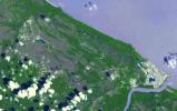
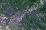
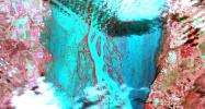
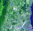
Your search criteria found 2277 images
Target is Earth
Go to PIAxxxxx:
Refine this list of images by:
Target:
Mission:
Spacecraft:
Instrument:
Click on an image for detailed information
Click on a column heading to sort in ascending or descending order
My
List
Addition Date Target Mission InstrumentSort Descending Size
Add Image to Favorite List 2012-04-03 Earth Terra
ASTER
2013x1573x3
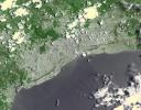
This image, acquired by NASA's Terra spacecraft, shows Santo Domingo, the capital of the Dominican Republic, founded in 1496 Christopher Columbus, it is the oldest continuously inhabited European settlement in the Americas.
PIA15532:
Santo Domingo, Dominican Republic
Full Resolution:     TIFF (9.512 MB)     JPEG (909 kB)
Add Image to Favorite List 2012-04-10 Earth Terra
ASTER
1340x1156x3
This image, acquired by NASA's Terra spacecraft, shows Fiji, hard hit by heavy rains in early 2012, causing flooding and landslides. Hardest hit was the western part of the main Island of Viti Levu, Fiji, and the principal city of Nadi.
PIA15557:
NASA Spacecraft Images Fiji Flooding
Full Resolution:     TIFF (4.652 MB)     JPEG (262.5 kB)
Add Image to Favorite List 2012-04-11 Earth Terra
ASTER
1306x1066x3
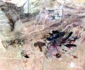
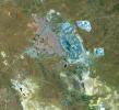
Acquired by NASA's Terra spacecraft, this image shows a mine in Baiyun Ebo, Inner Mongolia, China, the site of almost half the world's rare earth production. China is responsible for over 95% of global production of rare earth elements.
PIA13969:
Baiyun Ebo, China
Full Resolution:     TIFF (4.181 MB)     JPEG (302.1 kB)
Add Image to Favorite List 2012-04-13 Earth Terra
ASTER
3144x2880x3
Acquired by NASA's Terra spacecraft, this image shows the west coast of Greenland, one of Earth's premiere incubators for icebergs -- large blocks of land ice that break off from glaciers or ice shelves and float in the ocean.
PIA13970:
NASA Spacecraft Images One of Earth's Iceberg Incubators
Full Resolution:     TIFF (27.16 MB)     JPEG (1.458 MB)
Add Image to Favorite List 2012-04-27 Earth Terra
ASTER
351x827x3
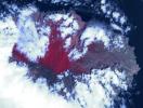
NASA's Terra spacecraft shows Popocatepetl, the nearly 18.000-foot-high volcano about 40 miles southeast of Mexico City, continuing to spew water vapor, gas, ashes and glowing rocks from its latest eruption, which started in mid-April 2012.
PIA15617:
ASTER Tracks Continuing Popocatepetl Eruption
Full Resolution:     TIFF (872 kB)     JPEG (50.42 kB)
Add Image to Favorite List 2012-04-30 Earth Terra
ASTER
4000x2400x3
Acquired by NASA's Terra spacecraft, this image shows the eastern end of the Gulf of Fonseca, in Honduras, originally the site of extensive wetlands ecosystem, dominated by six species of mangroves.
PIA15145:
Gulf of Fonseca, Honduras
Full Resolution:     TIFF (28.8 MB)     JPEG (1.656 MB)
Add Image to Favorite List 2012-05-15 Earth Terra
ASTER
1441x1281x3
Acquired by NASA's Terra spacecraft, this image shows the Three Gorges Dam which spans the Yangtze River in east-central China, and is the world's largest power station in terms of installed capacity.
PIA15655:
Three Gorges Dam, China
Full Resolution:     TIFF (5.548 MB)     JPEG (405.4 kB)
Add Image to Favorite List 2012-05-15 Earth Terra
ASTER
1878x1437x3
The Livermore and Spring Ranch fires near the Davis Mountain Resort, Texas, burned 13,000 and 11,000 acres respectively. When NASA's Terra spacecraft acquired this image on May 12, 2012, both fires had been contained.
PIA15657:
NASA Spacecraft Images Texas Wildfire
Full Resolution:     TIFF (8.108 MB)     JPEG (593.1 kB)
Add Image to Favorite List 2012-05-24 Earth Terra
ASTER
1576x960x3
Acquired by NASA's Terra spacecraft, this image shows the Yarlung Zangpo Grand Canyon (or Tsangpo Gorge) in Tibet, the deepest canyon in the world, and longer than the Grand Canyon.
PIA15775:
Yarlung Zangpo Grand Canyon, Tibet
Full Resolution:     TIFF (4.547 MB)     JPEG (387 kB)
Add Image to Favorite List 2012-06-07 Earth Terra
ASTER
678x1334x3
NASA's Terra spacecraft acquired this image on June 2, 2012 of Sheveluch, one of the most active volcanoes on the Kamchatka peninsula, with frequent explosive events that can disrupt air traffic over the northern Pacific.
PIA15792:
NASA Spacecraft Spots Large Eruption of Russian Volcano
Full Resolution:     TIFF (2.716 MB)     JPEG (101.5 kB)
Add Image to Favorite List 2012-05-30 Earth Terra
ASTER
1176x1118x3
NASA's Terra spacecraft acquired this image of Picher, Oklahoma which once boasted 20,000 people in this mining town in northeast Oklahoma. Now, after a 2009 tornado, and a federal cleanup program, the town is a modern-day ghost town.
PIA15821:
Picher, Oklahoma
Full Resolution:     TIFF (3.946 MB)     JPEG (239.4 kB)
Add Image to Favorite List 2012-06-25 Earth Terra
ASTER
2949x3723x3
Acquired by NASA's Terra spacecraft on June 25, 2012, this image shows the High Park fire west of Fort Collins, Colo. More than 83,000 acres have been burned and approximately 250 homes, the most in Colorado history.
PIA15832:
NASA Spacecraft Images Colorado's Most Destructive Wildfire to Date
Full Resolution:     TIFF (32.95 MB)     JPEG (1.146 MB)
Add Image to Favorite List 2012-07-06 Earth Terra
ASTER
1200x1000x3
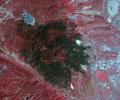
NASA's Terra spacecraft acquired this image of the Waldo Canyon Fire, west of Colorado Springs, Colo., being called the worst fire in Colorado history. Healthy vegetation is red, water is dark blue, streets and buildings are gray, and the burned areas are
PIA15847:
Colorado's Destructive Waldo Canyon Fire
Full Resolution:     TIFF (3.602 MB)     JPEG (261.3 kB)
Add Image to Favorite List 2012-07-09 Earth Terra
ASTER
1536x1507x3
NASA's Terra spacecraft acquired this image of Dawson, Canada. A boom town in 1898, discovery of gold in the Klondike fueled the massive influx of miners, merchants, and other support professions to this town on the Yukon River.
PIA15848:
Dawson, Canada
Full Resolution:     TIFF (6.947 MB)     JPEG (436.2 kB)
Add Image to Favorite List 2012-07-09 Earth Terra
ASTER
2201x3900x3
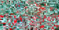
Acquired by NASA's Terra spacecraft on in 2011, this image shows the Wadi As-Sirhan Basin in northwest Saudi Arabia, which has been steadily developing agricultural fields using center pivot irrigation by tapping into fossil ground water.
PIA15849:
Wadi As-Sirhan, Saudi Arabia
Full Resolution:     TIFF (25.76 MB)     JPEG (1.298 MB)
Add Image to Favorite List 2012-08-02 Earth Terra
ASTER
1086x1002x3
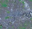
This simulated natural color image of London was acquired May 26, 2012 by NASA's Terra spacecraft. Major construction projects included the new 400-acre Olympic Park for the 2012 Summer Olympic Games.
PIA15897:
NASA Spacecraft Captures a Medal-Worthy Image of London
Full Resolution:     TIFF (3.266 MB)     JPEG (348.1 kB)
Add Image to Favorite List 2012-08-20 Earth Terra
ASTER
1588x1206x3
NASA's Terra spacecraft acquired this image, a birdseye view of the Canary Islands wildfire, on Aug. 17, 2012. The main town of San Sebastian can be seen on the eastern shore of the island.
PIA16076:
NASA Spacecraft Gets a Birdseye View of Canary Islands Wildfire
Full Resolution:     TIFF (5.748 MB)     JPEG (251.3 kB)
Add Image to Favorite List 2012-08-25 Earth Terra
ASTER
2620x1850x3
NASA's Terra spacecraft acquired this image on Aug. 24, 2012, 13 miles (20 kilometers) north of Vicksburg, Miss., as drought continued to afflict the U.S. Midwest, water levels of the Mississippi River approached historic lows.
PIA16097:
NASA Spacecraft Images Drought's Impacts on the Mighty Mississippi
Full Resolution:     TIFF (14.55 MB)     JPEG (829.7 kB)
Add Image to Favorite List 2012-09-06 Earth Terra
ASTER
2301x1207x3
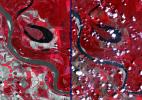
Two satellite images acquired by NASA's Terra spacecraft, obtained about 10 years apart, clearly illustrate the effects of the near-historic drought conditions in southwestern Kansas. Farmers are among the hardest hit.
PIA16102:
NASA Spacecraft Captures Effects of U.S. Drought
Full Resolution:     TIFF (8.335 MB)     JPEG (569 kB)
Add Image to Favorite List 2012-09-21 Earth Terra
ASTER
2512x3452x3
This image, acquired by NASA's Terra spacecraft, is of the Pole Creek fire southwest of Sisters, Ore., which had grown to 24,000 acres as of Sept. 20, 2012. No structures have been destroyed, and the fire is mostly confined to the national forest.
PIA15884:
NASA Spacecraft Images Oregon Wildfire
Full Resolution:     TIFF (26.02 MB)     JPEG (648 kB)
Add Image to Favorite List 2012-09-28 Earth Terra
ASTER
1124x1282x3
This image, acquired by NASA's Terra spacecraft, is of Vladivostok, the administrative center of Primorsky Krai, Russia, and home port of the Russian Pacific Fleet, situated at the head of the Golden Horn Bay, Vladivostok.
PIA16290:
Vladivostok, Russia
Full Resolution:     TIFF (4.325 MB)     JPEG (279.3 kB)
Add Image to Favorite List 2012-09-28 Earth Terra
ASTER
1447x879x3
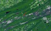
This image, acquired by NASA's Terra spacecraft, is of the abandoned town of Centralia, in eastern Pennsylvania's anthracite coal mining country.
PIA16291:
Centralia, Pennsylvania
Full Resolution:     TIFF (3.817 MB)     JPEG (321.8 kB)
Add Image to Favorite List 2012-09-28 Earth Terra
ASTER
988x1146x3
Baikonur, formerly Leninsk, is a city in Kazakhstan rented and administered by the Russian Federation to service the Baikonur Cosmodrome where Sputnik launched in 1957. This image was acquired by NASA's Terra spacecraft.
PIA16292:
Baikonur Cosmodrome, Kazakhstan
Full Resolution:     TIFF (3.398 MB)     JPEG (329.6 kB)
Add Image to Favorite List 2012-10-05 Earth Terra
ASTER
3015x2742x3
This image, acquired by NASA's Terra spacecraft, is of Brittany, a cultural region in the northwest of France.
PIA15007:
Brittany, France
Full Resolution:     TIFF (24.81 MB)     JPEG (1.091 MB)
Add Image to Favorite List 2012-10-22 Earth Terra
ASTER
800x600x3
Acquired by NASA's Terra spacecraft, this image shows ExxonMobil's Baytown refinery in Texas. With a refining capacity of over 560,000 barrels per day, it is the largest refinery in the United States.
PIA16295:
Baytown Refinery, Texas
Full Resolution:     TIFF (1.441 MB)     JPEG (103.8 kB)
Add Image to Favorite List 2012-11-12 Earth Terra
ASTER
1554x5122x3
This image, acquired by NASA's Terra spacecraft, is of the volcanic Ogasawara Islands. The islands were listed as a UNESCO World Heritage site, in recognition of an outstanding example of ongoing evolutionary processes in oceanic island ecosystems.
PIA15950:
Ogasawara Islands, Japan
Full Resolution:     TIFF (23.89 MB)     JPEG (603.3 kB)
Add Image to Favorite List 2012-11-26 Earth Terra
ASTER
925x775x3
Amsterdam is the largest city and the capital of the Netherlands. Its name derives from a dam in the river Amstel. Founded in the 12th century as a fishing village, Amsterdam was one of the most important ports in the world in the 17th century.
PIA16542:
Amsterdam, Netherlands
Full Resolution:     TIFF (2.152 MB)     JPEG (221.1 kB)
Add Image to Favorite List 2012-12-03 Earth Terra
ASTER
2343x1862x3
Plosky Tolbachik volcano, in Russia's far eastern Kamchatka peninsula, erupted on Nov. 27, 2012 for the first time in 35 years, sending clouds of ash almost 10,000 feet into the sky. This image was acquired by NASA's Terra spacecraft.
PIA16590:
NASA's Terra Spacecraft Captures Russian Volcano Eruption
Full Resolution:     TIFF (13.09 MB)     JPEG (690.7 kB)
Add Image to Favorite List 2012-12-07 Earth Terra
ASTER
1508x1288x3
Acquired by NASA's Terra spacecraft, this image shows Heilongjiang, a province of China located in the northeastern part of the country. Farms are small and long skinny rectangles in shape, surrounding regularly spaced villages.
PIA16596:
Heilongjiang Province, China
Full Resolution:     TIFF (5.829 MB)     JPEG (482.5 kB)
Add Image to Favorite List 2013-01-12 Earth Terra
ASTER
2877x2736x3
This image, acquired by NASA's Terra spacecraft on Mar. 17, 2012, is of Jebel Uweinat, a mountain range in the area of the Egyptian-Sudanese-Libyan border. It is reportedly one of the driest places on earth.
PIA16679:
Jebel Uweinat
Full Resolution:     TIFF (23.63 MB)     JPEG (909.8 kB)
Add Image to Favorite List 2013-01-16 Earth Terra
ASTER
1563x2055x3
Plosky Tolbachik volcano in Russia's far eastern Kamchatka peninsula erupted on Nov. 27, 2012, for the first time in 35 years, sending clouds of ash to the height of more than 9,800 feet (3,000 meters) in this image from NASA's Terra spacecraft.
PIA16741:
NASA's Terra Spacecraft Images Russian Volcanic Eruption
Full Resolution:     TIFF (9.639 MB)     JPEG (455.7 kB)
Add Image to Favorite List 2013-01-29 Earth Terra
ASTER
4284x8520x3
NASA's Terra spacecraft flew over South Africa and Zimbabwe where week-long torrential rains swelled the Limpopo River in Jan. 2013.
PIA16772:
NASA Satellite Images Severe Flooding in Mozambique
Full Resolution:     TIFF (109.6 MB)     JPEG (7.229 MB)
Add Image to Favorite List 2013-01-30 Earth Terra
ASTER
863x2010x3
NASA's Terra spacecraft flew over Jakarta, the capital and largest city of Indonesia. The population of the Jakarta conurbation is over 28 million, making it perhaps the largest metropolitan area in the world in terms of inhabitants.
PIA16776:
Jakarta, Indonesia
Full Resolution:     TIFF (5.206 MB)     JPEG (393.5 kB)
Add Image to Favorite List 2013-02-19 Earth Terra
ASTER
989x691x3
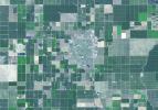
Wasco, California advertises itself as the 'Rose Capital of the World'; over 8000 acres are devoted to cultivation of existing and new varieties of roses, shipped to every state in the U.S. and all over the world.
PIA16855:
Wasco, California
Full Resolution:     TIFF (2.051 MB)     JPEG (118.7 kB)
Add Image to Favorite List 2013-02-05 Earth Terra
ASTER
1505x1174x3
This 3-D view was created from data acquired Feb. 4, 2013 by NASA's Terra spacecraft showing a massive wildfire which damaged Australia's largest optical astronomy facility, the Siding Spring Observatory.
PIA16783:
NASA Spacecraft Captures 3-D View of Massive Australian Wildfire
Full Resolution:     TIFF (5.303 MB)     JPEG (356.6 kB)
Add Image to Favorite List 2013-02-08 Earth Terra
ASTER
3414x2546x3
The Bushveld Igneous Complex (BIC) is a large layered igneous intrusion within the earth's crust, exposed at the edge of the Transvaal Basin in South Africa. Numerous mines, tailings piles, and leach ponds are shown in blue.
PIA16788:
Bushveld Igneous Complex, South Africa
Full Resolution:     TIFF (26.09 MB)     JPEG (1.736 MB)
Add Image to Favorite List 2013-02-15 Earth Terra
ASTER
1911x1800x3
NASA's Terra spacecraft reveals the still-active lava flows in the snowy winter landscape of Plosky Tolbachik volcano, which erupted for the first time in 35 years on Nov. 27, 2012, in Russia's far eastern Kamchatka Peninsula.
PIA16824:
NASA Satellite Captures New Russian Volcanic Eruption
Full Resolution:     TIFF (10.32 MB)     JPEG (442.7 kB)
Add Image to Favorite List 2013-03-15 Earth Terra
ASTER
2931x3045x3
Acquired by NASA's Terra spacecraft, this image shows Hamelin Pool Marine Nature Reserve, located in the Shark Bay World Heritage Site in Western Australia.
PIA16894:
Shark Bay, Australia
Full Resolution:     TIFF (26.79 MB)     JPEG (1.144 MB)
Add Image to Favorite List 2013-03-25 Earth Terra
ASTER
1200x1000x3
NASA's Terra spacecraft shows the Akashi Kaikyo Bridge (or Pearl Bridge), the longest central span of any suspension bridge in the world, at 1991 meters, connecting the city of Kobe, Japan with Iwaja on Awaji Island by crossing the busy Akashi Strait.
PIA16905:
Akashi Kaikyo Bridge, Japan
Full Resolution:     TIFF (3.602 MB)     JPEG (266.1 kB)
Add Image to Favorite List 2013-04-04 Earth Terra
ASTER
1015x667x3
NASA's Terra spacecraft captured Kuwait's Failaka Island, located 50 km southeast of the spot where the Tigris and Euphrates Rivers empty into the Persian Gulf.
PIA16944:
Failaka Island, Kuwait
Full Resolution:     TIFF (2.032 MB)     JPEG (58.53 kB)
Add Image to Favorite List 2013-04-05 Earth Terra
ASTER
1706x1796x3
NASA's Terra spacecraft captured this view of severe flooding in La Plata, Argentina, on April 4, 2013. Torrential rains and record flash flooding has killed more than 50 and left thousands homeless, according to news reports.
PIA16945:
NASA Spacecraft Eyes Severe Flooding in Argentina
Full Resolution:     TIFF (9.196 MB)     JPEG (583.5 kB)
Add Image to Favorite List 2013-04-10 Earth Terra
ASTER
1547x1483x3
On April 9, 2013 at 11:52 GMT, this image acquired by NASA's Terra spacecraft, shows the location of a magnitude 6.3 earthquake hit southwestern Iran's Bushehr province near the town of Kaki.
PIA16946:
NASA Spacecraft Image Shows Location of Iranian Earthquake
Full Resolution:     TIFF (6.885 MB)     JPEG (853.7 kB)
Add Image to Favorite List 2013-04-16 Earth Terra
ASTER
2832x2982x3
This image of the river-delineated border between western Brazil's Acre province, and northwestern Bolivia's Pando Department, demarcates a remarkable difference in land use and development practices as seen by NASA's Terra spacecraft.
PIA16991:
Brazil-Bolivia Border
Full Resolution:     TIFF (25.35 MB)     JPEG (2.142 MB)
Add Image to Favorite List 2013-04-22 Earth Terra
ASTER
1531x1472x3
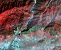
This image from NASA's Terra spacecraft highlights the epicenter of a powerful magnitude 6.6 earthquake which struck Sichuan Province in southwest China on April 20, 2013. Vegetation is displayed in red; clouds and snow are in white.
PIA16994:
NASA Spacecraft Shows Location of China Quake
Full Resolution:     TIFF (6.763 MB)     JPEG (518.8 kB)
Add Image to Favorite List 2013-05-02 Earth Terra
ASTER
718x2376x3
This image from NASA's Terra spacecraft shows Macquarie Island which lies halfway between New Zealand and Antarctica, and is part of Tasmania.
PIA16980:
Macquarie Island, Australia
Full Resolution:     TIFF (5.12 MB)     JPEG (158.9 kB)
Add Image to Favorite List 2013-05-21 Earth Terra
ASTER
1576x1453x3
This image from NASA's Terra spacecraft shows Moscow, the capital city of Russia, the northernmost megacity in the world, the most populous in Europe, and with a population of over 11,000,000, the 6th largest city proper in the world.
PIA16988:
Moscow, Russia
Full Resolution:     TIFF (6.872 MB)     JPEG (859.8 kB)
Add Image to Favorite List 2013-05-21 Earth Terra
ASTER
2020x3315x3
Alaska's Pavlof volcano, located along Alaska's Aleutian Peninsula, sent a low-level ash plume north-northeast about 37.3 miles (60 kilometers) on May 19, 2013, when this image was acquired NASA's Terra spacecraft.
PIA16995:
Prolific Alaska Volcano Spews Ash in New Eruption
Full Resolution:     TIFF (20.1 MB)     JPEG (882.9 kB)
Add Image to Favorite List 2013-06-05 Earth Terra
ASTER
922x637x3
The Newcastle-Moore EF-5 tornado ripped through central Oklahoma on May 20, 2013, killing 24 people and leaving behind more than $2 billion in damage. This image was acquired NASA's Terra spacecraft on June 2, 2013.
PIA16488:
NASA Spacecraft Captures Swath of Destruction from Deadly Oklahoma Tornado
Full Resolution:     TIFF (1.763 MB)     JPEG (160.5 kB)
Add Image to Favorite List 2013-06-05 Earth Terra
ASTER
1402x883x3
This image from NASA's Terra spacecraft shows the town of Kourou, which sits at the mouth of the Kourou River, French Guiana.
PIA17099:
Kouru, French Guiana
Full Resolution:     TIFF (3.716 MB)     JPEG (179.8 kB)
Add Image to Favorite List 2013-06-21 Earth Terra
ASTER
2616x1746x3
This image, acquired by NASA's Terra spacecraft, is of the Carstens, Calif. wildfire which continues to burn in the foothills west of Yosemite National Park. Vegetation is displayed in green and burned and bare areas are dark to light gray.
PIA17292:
NASA Spacecraft Images Wildfire Near Yosemite National Park
Full Resolution:     TIFF (13.71 MB)     JPEG (958.7 kB)
Add Image to Favorite List 2013-06-25 Earth Terra
ASTER
1158x2904x3
This image from NASA's Terra spacecraft shows North Stradbroke Island, 30 km southeast of Brisbane, Australia, one of the largest sand islands in the world.
PIA17112:
North Stradbroke Island, Australia
Full Resolution:     TIFF (10.09 MB)     JPEG (421.3 kB)
Add Image to Favorite List 2013-07-08 Earth Terra
ASTER
3558x1900x3
This image, acquired by NASA's Terra satellite on July 6, 2013, shows heavy rains, which began in mid-June, resulting in major flooding along the Parana River in Argentina.
PIA17376:
Flooding Along Parana River
Full Resolution:     TIFF (20.29 MB)     JPEG (1.439 MB)
Add Image to Favorite List 2013-07-09 Earth Terra
ASTER
1578x1716x3
This image from NASA's Terra spacecraft shows the town of Kirkenes in northernmost Norway, with its 3400 inhabitants, as they prepare for an expected boom as a shipping hub, as global warming has led to the opening up of the Northern Sea Route.
PIA17312:
Kirkenes, Norway
Full Resolution:     TIFF (8.127 MB)     JPEG (659.2 kB)
Add Image to Favorite List 2013-07-15 Earth Terra
ASTER
2626x3773x3
This image acquired by NASA's Terra spacecraft shows the Sulaiman fold-thrust belt in northwestern Pakistan, a linear or arcuate belt in which compression has produced a combination of thrust faults and folds.
PIA17391:
Sulaiman Fold Belt, Pakistan
Full Resolution:     TIFF (29.73 MB)     JPEG (1.861 MB)
Add Image to Favorite List 2013-08-16 Earth Terra
ASTER
2523x2922x3
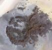
Radially symmetrical, star dunes dominate the Grand Erg Oriental of the Algerian Sahara, as depicted in this image acquired October 27, 2012 acquired by NASA's Terra spacecraft.
PIA17411:
Star Dunes, Algeria
Full Resolution:     TIFF (22.12 MB)     JPEG (1.491 MB)
Add Image to Favorite List 2013-08-23 Earth Terra
ASTER
1026x949x3
This image, acquired by NASA's Terra spacecraft, is of the CERN Large Hadron Collider, the world's largest and highest-energy particle accelerator laying beneath the French-Swiss border northwest of Geneva (yellow circle).
PIA17434:
CERN Collider, France-Switzerland
Full Resolution:     TIFF (2.922 MB)     JPEG (325.5 kB)
Add Image to Favorite List 2013-09-11 Earth Terra
ASTER
2982x3573x3
In the desert of southern Kuwait, three oil fields spread out across the empty landscape as seen by NASA's Terra spacecraft.
PIA17459:
Kuwait Oil Fields
Full Resolution:     TIFF (31.98 MB)     JPEG (1.46 MB)
Add Image to Favorite List 2013-09-12 Earth Terra
ASTER
3906x4518x3
This image, acquired by NASA's Terra spacecraft, shows the Rim Fire in and around Yosemite National Park in California after it was 80 percent contained.
PIA15639:
NASA Spacecraft Captures New Image of Third-Largest Wildfire in California History
Full Resolution:     TIFF (52.96 MB)     JPEG (1.606 MB)
Add Image to Favorite List 2013-09-24 Earth Terra
ASTER
2003x3287x3
This image, acquired by NASA's Terra spacecraft, shows the Cordoba province of northern Argentina, struck by wildfires caused by high temperatures and strong winds.
PIA17504:
NASA Spacecraft Images Destructive Argentine Wildfire
Full Resolution:     TIFF (19.76 MB)     JPEG (1.663 MB)
Add Image to Favorite List 2013-09-24 Earth Terra
ASTER
1540x1472x3
This image, acquired by NASA's Terra spacecraft, shows the epicenter of a magnitude 7.7 earthquake which struck south-central Pakistan on Sept. 24, 2013, in Pakistan's Makran fold belt.
PIA17505:
Region Hit by Large Pakistan Quake as Shown by NASA Spacecraft
Full Resolution:     TIFF (6.803 MB)     JPEG (654.9 kB)
Add Image to Favorite List 2013-09-26 Earth Terra
ASTER
1460x1470x3
This image, acquired by NASA's Terra spacecraft, shows Kathmandu, the capital of Nepal, with a population of about 2.5 million inhabitants for the greater metropolitan area.
PIA17513:
Kathmandu, Nepal
Full Resolution:     TIFF (6.441 MB)     JPEG (572.8 kB)
Add Image to Favorite List 2013-10-17 Earth Terra
ASTER
1866x1632x3
This image, acquired by NASA's Terra spacecraft, is of Canyonlands National Park, Utah, a showcase of geology in the southwest desert of the United States.
PIA17539:
Canyonlands National Park, Utah
Full Resolution:     TIFF (9.139 MB)     JPEG (910.1 kB)
Add Image to Favorite List 2013-10-23 Earth Terra
ASTER
1063x932x3
This image, acquired by NASA's Terra spacecraft, is of the ancient city of Uruk is located in present-day Iraq, on an abandoned channel of the Euphrates River.
PIA17576:
Ancient Uruk, Iraq
Full Resolution:     TIFF (2.973 MB)     JPEG (306.8 kB)
Add Image to Favorite List 2013-11-05 Earth Terra
ASTER
3684x3780x3
This image, acquired by NASA's Terra spacecraft, shows the Namib Desert, a coastal desert in southern Africa. This portion in central Namibia consists entirely of linear and longitudinal sand dunes.
PIA17632:
Namib Desert, Namibia
Full Resolution:     TIFF (41.79 MB)     JPEG (2.037 MB)
Add Image to Favorite List 2013-11-19 Earth Terra
ASTER
1553x1483x3
This image, acquired by NASA's Terra spacecraft, shows the mountains of Chattanooga, Tennessee.
PIA17696:
150th Anniversary of the Battle of Chattanooga, Tennessee
Full Resolution:     TIFF (6.912 MB)     JPEG (532.9 kB)
Add Image to Favorite List 2013-11-20 Earth Terra
ASTER
960x900x3
On Nov. 8, 2013, NASA's Terra spacecraft acquired this image of Super Typhoon Haiyan as it tore across the central Philippines, leaving a trail of destruction in its path. Among the worst-hit areas is eastern Leyte island and the city of Tacloban.
PIA17700:
NASA Spacecraft Shows Before/After of Typhoon Haiyan's Devastation
Full Resolution:     TIFF (2.593 MB)     JPEG (137.3 kB)
Add Image to Favorite List 2013-11-22 Earth Terra
ASTER
2598x2147x3
On Nov. 14, 2013, NASA's Terra spacecraft spied a fire scar west of Wollongong, New South Wales, from the Hall Road fire in New South Wales, Australia. October 2013 brought the worst fires seen in Australia's New South Wales in many decades.
PIA17721:
Australian Wildfire, NASA Spacecraft Image Aftermath
Full Resolution:     TIFF (16.74 MB)     JPEG (1.057 MB)
Add Image to Favorite List 2013-12-05 Earth Terra
ASTER
1054x959x3
On May 30, 2013, NASA's Terra spacecraft acquired this image of the largest solar plant of its kind in the world started producing power in southern California's Mojave Desert near the Nevada border.
PIA17746:
Ivanpah Solar Energy Plant, California
Full Resolution:     TIFF (3.034 MB)     JPEG (129.6 kB)
Add Image to Favorite List 2013-12-18 Earth Terra
ASTER
350x350x1
This image acquired by NASA's Terra spacecraft is of Mount Etna, on the Italian island of Sicily, Europe's most active volcano, where its latest series of eruptions has continued for weeks.
PIA17789:
Lava Flows from Latest Eruption of Mount Etna Spotted by NASA's Terra Spacecraft
Full Resolution:     TIFF (122.8 kB)     JPEG (16.98 kB)
Add Image to Favorite List 2013-12-16 Earth Terra
ASTER
1330x1554x3
Logging operations have left a striking checkerboard pattern in the landscape along the Idaho-Montana border, sandwiched between Clearwater and Bitterroot National Forests as seen in this image acquired by NASA's Terra spacecraft.
PIA17788:
Idaho-Montana Logging
Full Resolution:     TIFF (6.203 MB)     JPEG (583 kB)
Add Image to Favorite List 2014-01-08 Earth Terra
ASTER
1466x1347x3
This image acquired by NASA's Terra spacecraft is of Kalgoorlie-Boulder, a city in the Goldfields-Esperance region of Western Australia.
PIA17852:
Kalgoorlie-Boulder, Australia
Full Resolution:     TIFF (5.926 MB)     JPEG (526.7 kB)
Add Image to Favorite List 2014-01-22 Earth Terra
ASTER
1097x3072x3
This image acquired by NASA's Terra spacecraft is of the Kingdom of Bahrain, a small island country near the western shore of the Persian Gulf.
PIA17899:
Kingdom of Bahrain
Full Resolution:     TIFF (10.11 MB)     JPEG (356.5 kB)
Add Image to Favorite List 2014-01-28 Earth Terra
ASTER
1200x1000x3
On Jan. 16, 2014, NASA's Terra spacecraft acquired this image of a wildfire broke that out in the mountains above the Los Angeles suburbs of Glendora and Azusa.
PIA17923:
NASA's Terra Spacecraft Images Destructive Colby Fire East of Los Angeles
Full Resolution:     TIFF (3.602 MB)     JPEG (342.4 kB)
Add Image to Favorite List 2014-02-05 Earth Terra
ASTER
1509x1447x3
This image acquired by NASA's Terra spacecraft shows the Sochi Olympic Park Coastal Cluster, the circular area on the shoreline in the bottom center of the image, which was built for Olympic indoor sports.
PIA17970:
Sochi, Russia Winter Olympic Sites (Coastal Cluster)
Full Resolution:     TIFF (6.553 MB)     JPEG (367.7 kB)
Add Image to Favorite List 2014-02-05 Earth Terra
ASTER
1512x1458x3
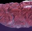
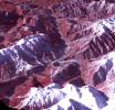
The 2014 Winter Olympic ski runs may be rated double black diamond, but they're not quite as steep as they appear in this image acquired by NASA's Terra spacecraft, of the skiing and snowboarding sites for the Sochi Winter Olympic Games.
PIA17971:
Sochi, Russia Winter Olympic Sites (Mountain Cluster)
Full Resolution:     TIFF (6.616 MB)     JPEG (438.9 kB)
Add Image to Favorite List 2014-02-05 Earth Terra
ASTER
2974x2147x3
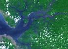
This image acquired by NASA's Terra spacecraft is of the Sierra Leone estuary, which became a focal point for trade and interaction between Africans and Europeans because of its exceptional harbor, starting in the mid-15th century.
PIA17977:
Sierra Leone Estuary
Full Resolution:     TIFF (19.16 MB)     JPEG (856.5 kB)
Add Image to Favorite List 2014-02-11 Earth Terra
ASTER
2100x2210x3
This image acquired by NASA's Terra spacecraft is of Mount Sinabung, a stratovolcano located in Indonesia. In late 2013, a lava dome formed on the summit. In early January 2014, the volcano erupted, and it erupted again in early February.
PIA17978:
Angry Indonesian Volcano Imaged by NASA Spacecraft
Full Resolution:     TIFF (13.93 MB)     JPEG (800.8 kB)
Add Image to Favorite List 2014-02-11 Earth Terra
ASTER
1459x1318x3
This image acquired by NASA's Terra spacecraft is of Mt. Etna, Europe's most active volcano, as it continued its latest eruptive activity with a new lava flow from the recently formed southeast crater.
PIA17979:
Latest Activity at Europe's Most Active Volcano Captured by NASA Spacecraft
Full Resolution:     TIFF (5.771 MB)     JPEG (317.1 kB)
Add Image to Favorite List 2014-02-19 Earth Terra
ASTER
3114x1915x3
This image acquired by NASA's Terra spacecraft depicts the high water levels and flooding along the Thames River west of London as record-breaking rains covered the United Kingdom in January and February.
PIA17989:
U.K. Flooding Captured by NASA Spacecraft
Full Resolution:     TIFF (17.9 MB)     JPEG (1.517 MB)
Add Image to Favorite List 2014-02-23 Earth Terra
ASTER
1767x1536x3
On Feb. 13, 2014, violent eruption of Kelud stratovolcano in Java, Indonesia sent volcanic ash covering an area of 70,000 square miles, prompting the evacuation of tens of thousands of people. This image is from NASA's Terra spacecraft.
PIA18020:
Ashy Aftermath of Indonesian Volcano Eruption seen by NASA Spacecraft
Full Resolution:     TIFF (8.146 MB)     JPEG (462.6 kB)
Add Image to Favorite List 2014-02-26 Earth Terra
ASTER
2244x2334x3
NASA's Terra spacecraft shows that extremely heavy seasonal rains have fallen on northern Bolivia since October 2013. The worst affected province is Beni in the northeastern part of the country.
PIA18031:
NASA Spacecraft Eyes Bolivian Flooding
Full Resolution:     TIFF (15.72 MB)     JPEG (1.011 MB)
Add Image to Favorite List 2014-02-12 Earth Terra
ASTER
504x336x3
Ambrym volcano in Vanuatu is one of the most active volcanoes in the world. A large summit caldera contains two active vent complexes, Marum and Benbow is seen in this February 12, 2014 nighttime thermal infrared image from NASA's Terra spacecraft.
PIA18067:
Nighttime Look at Ambrym Volcano, Vanuatu by NASA Spacecraft
Full Resolution:     TIFF (508.4 kB)     JPEG (19.25 kB)
Add Image to Favorite List 2014-03-04 Earth Terra
ASTER
832x677x3
This image from NASA's Terra spacecraft shows the Vatican City State, a sovereign city-state, whose area is a 44 hectare walled enclave west of the Tiber River, within the city of Rome.
PIA18068:
Vatican City State
Full Resolution:     TIFF (1.691 MB)     JPEG (217.4 kB)
Add Image to Favorite List 2014-03-17 Earth Terra
ASTER
1451x1919x3
This image acquired by NASA's Terra spacecraft shows Arizona, Calif., which produces 60% of the total copper mined in the United States.
PIA18136:
Arizona Copper
Full Resolution:     TIFF (8.357 MB)     JPEG (539.6 kB)
Add Image to Favorite List 2014-03-27 Earth Terra
Landsat
ASTER
1610x1454x3
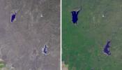
Stark effects of a California drought on agriculture can be clearly seen in these two February images acquired in 2014 and 2003 by NASA's Terra spacecraft.
PIA18187:
Stark Effects of California Drought on Agriculture seen by NASA Spacecraft
Full Resolution:     TIFF (7.025 MB)     JPEG (502.2 kB)
Add Image to Favorite List 2014-03-26 Earth Terra
ASTER
1382x1386x3
NASA's Terra spacecraft views central South Dakota, where the Missouri River forms a meander bend, creating Lake Sharpe. Eventually, the Missouri River will cut through the skinny peninsula, creating a shorter path.
PIA18204:
Lake Sharpe, South Dakota
Full Resolution:     TIFF (5.749 MB)     JPEG (313.2 kB)
Add Image to Favorite List 2014-04-07 Earth Terra
ASTER
861x720x3
Located in the fertile agricultural region of Argentina's Pampas is a guitar-shaped forest made up of cypress and eucalyptus trees as seen by NASA's Terra spacecraft.
PIA18207:
Argentina Forest
Full Resolution:     TIFF (1.861 MB)     JPEG (98.52 kB)
Add Image to Favorite List 2014-04-28 Earth Terra
ASTER
1868x2097x3
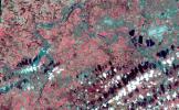
Karst topography is a geological formation shaped by the dissolution of layers of soluble rock such as limestone. A good example is found in Guangxi Province in southeast China, as seen by NASA's Terra spacecraft.
PIA18230:
Karst Landscape, China
Full Resolution:     TIFF (11.76 MB)     JPEG (857.2 kB)
Add Image to Favorite List 2014-04-28 Earth Terra
ASTER
1517x1446x3
On Friday, April 26, 2014, an avalanche on Mount Everest killed at least 13 Sherpa guides. NASA's Terra spacecraft looked toward the northeast, with Mount Everest (center), and Lhotse, the fourth-highest mountain on Earth, on the skyline to right center.
PIA18046:
Deadly Everest Avalanche Site Spotted by NASA Spacecraft
Full Resolution:     TIFF (6.583 MB)     JPEG (327.9 kB)
Add Image to Favorite List 2014-05-01 Earth Terra
ASTER
4400x4000x3
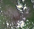
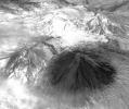
On April 28, 2014, NASA's Terra spacecraft spotted signs of activity at Ubinas volcano in the Peruvian Andes. The appearance of a new lava dome in March 2014 and frequent ash emissions are signs of increasing activity at this volcano.
PIA18245:
Ubinas Volcano Activity in Peruvian Andes
Full Resolution:     TIFF (52.83 MB)     JPEG (2.566 MB)
Add Image to Favorite List 2014-05-09 Earth Terra
ASTER
1782x1754x3
The Nagarjuna Sagar Dam on India's Krishna River is the largest masonry dam in operation in the world. This image is from NASA's Terra spacecraft.
PIA18373:
Nagarjuna Sagar Dam, India
Full Resolution:     TIFF (9.381 MB)     JPEG (513.8 kB)
Add Image to Favorite List 2014-06-12 Earth Terra
ASTER
3816x2292x3
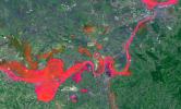
In May 2014, historic floods inundated Serbia and neighboring countries, causing major population displacements and property destruction. This image was acquired by NASA's Terra spacecraft.
PIA18051:
Historic Serbian Floods Eyed by NASA Spacecraft
Full Resolution:     TIFF (26.25 MB)     JPEG (1.819 MB)
Add Image to Favorite List 2014-05-20 Earth Terra
ASTER
1504x1267x1
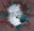
Winter still grips the volcanoes on Russia's Kamchatka peninsula. NASA's Terra spacecraft acquired this image showing the mantle of white, disturbed by dark ash entirely covering Sheveluch volcano from recent eruptions.
PIA18379:
NASA Spacecraft Spots Signs of Erupting Russian Volcano
Full Resolution:     TIFF (1.908 MB)     JPEG (297.3 kB)
Add Image to Favorite List 2014-05-16 Earth Terra
ASTER
687x798x3
This image from NASA's Terra spacecraft shows the Bangladeshi coast north of Chittagong, where ships from around the world are beached and dismantled.
PIA18258:
Shipbreaking, Bangladesh
Full Resolution:     TIFF (1.645 MB)     JPEG (124.2 kB)
Add Image to Favorite List 2014-05-27 Earth Terra
ASTER
2855x2360x3
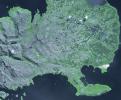
This image from NASA's Terra spacecraft shows the Kerguelen Islands (also known as the Desolation Islands), which are part of the French Southern and Antarctic lands. The islands are among the most isolated places on Earth.
PIA18253:
Kerguelen Islands
Full Resolution:     TIFF (20.22 MB)     JPEG (997.1 kB)
Add Image to Favorite List 2014-06-10 Earth Terra
ASTER
1188x793x3
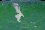
On May 26, 2014, an enormous landslide came roaring from above in a sparsely inhabited area of Mesa County, Arizona, near the town of Collbran. This image was acquired by NASA's Terra spacecraft.
PIA18050:
Giant Arizona Landslide Spotted by NASA Spacecraft
Full Resolution:     TIFF (2.828 MB)     JPEG (108.6 kB)
Add Image to Favorite List 2014-06-09 Earth Terra
ASTER
1336x2153x3
Lake Afrera is a hypersaline lake located in the Danakil Depression in northern Ethiopia where rock salt has been mined for centuries. This image was acquired by NASA's Terra spacecraft.
PIA18515:
Lake Afrera, Ethiopia
Full Resolution:     TIFF (8.632 MB)     JPEG (416.1 kB)
Add Image to Favorite List 2014-06-25 Earth Terra
ASTER
2049x1824x3
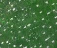
This image from NASA's Terra spacecraft shows Palouse, a rich farming area of some 7,000 square kilometers, reminiscent of Tuscany. But instead of vineyards, the main crops are wheat and rapeseed.
PIA18494:
Palouse, WA
Full Resolution:     TIFF (11.22 MB)     JPEG (793.4 kB)
Add Image to Favorite List 2014-07-14 Earth Terra
ASTER
1532x1469x3
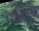
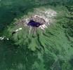
This image from NASA's Terra spacecraft shows Baektu Mountain, an active volcano on the border between North Korea and China. Rising to 2744 m, its summit caldera is filled with a crater lake, Heaven Lake.
PIA18507:
Baektu Mountain, China & North Korea
Full Resolution:     TIFF (6.754 MB)     JPEG (406.7 kB)
Add Image to Favorite List 2014-07-23 Earth Terra
ASTER
2620x1500x3
The effects of California's severe multiyear drought are seen in this pair of images acquired by NASA's Terra spacecraft of the area northeast of Madera, in the Sierra Nevada Moutains foothills between Yosemite National Park and the San Joaquin Valley.
PIA18627:
Images Show Severity of California Drought
Full Resolution:     TIFF (11.79 MB)     JPEG (498.8 kB)
Retrieve Previous Set  Jump to a Previous Set   Jump to a Previous Set   Jump to a Previous Set   Jump to a Previous Set   Jump to a Previous Set   Jump to a Previous Set   Jump to a Previous Set   Current Set   Jump to a Following Set   Jump to a Following Set   Retrieve Next Set 
 1-100   101-200   201-300   301-400   401-500   501-600   601-700   701-800   801-900   901-1000 
Currently displaying images: 701 - 800 of 2277