Click on an image for detailed information
Click on a column heading to sort in ascending or descending order

My
List |
Addition Date
|
Target
|
Mission
|
Instrument
|
Size
|

|
2010-12-17 |
Mars
|
Mars Exploration Rover (MER)
Mars Reconnaissance Orbiter (MRO)
|
CTX
|
1460x1080x3 |
|
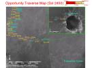
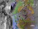
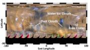
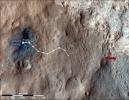
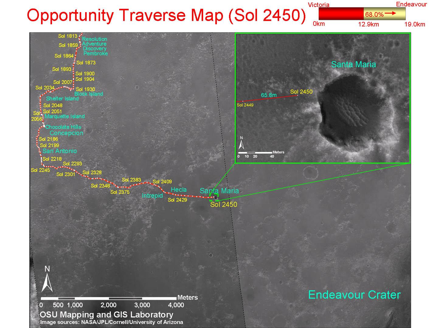
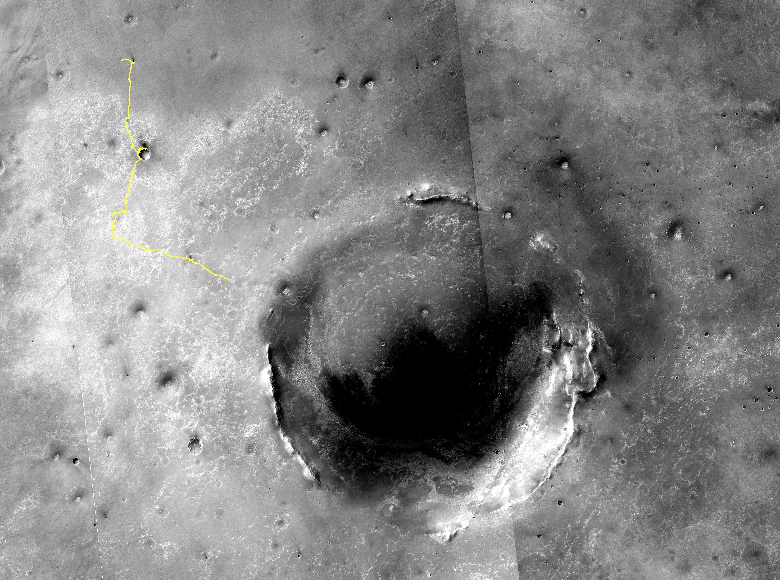
-
PIA13731:
-
Opportunity Traverse Map, Sol 2450
Full Resolution:
TIFF
(4.739 MB)
JPEG
(178 kB)
|
|
|
2010-12-20 |
Mars
|
Mars Reconnaissance Orbiter (MRO)
|
HiRISE
|
2560x1920x3 |

|
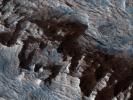
-
PIA13724:
-
Nili Fossae Trough, Candidate MSL Landing Site
Full Resolution:
TIFF
(14.76 MB)
JPEG
(844 kB)
|
|
|
2011-01-04 |
Mars
|
Mars Exploration Rover (MER)
Mars Reconnaissance Orbiter (MRO)
|
HiRISE
|
1347x1277x1 |

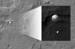
|
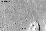
-
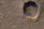
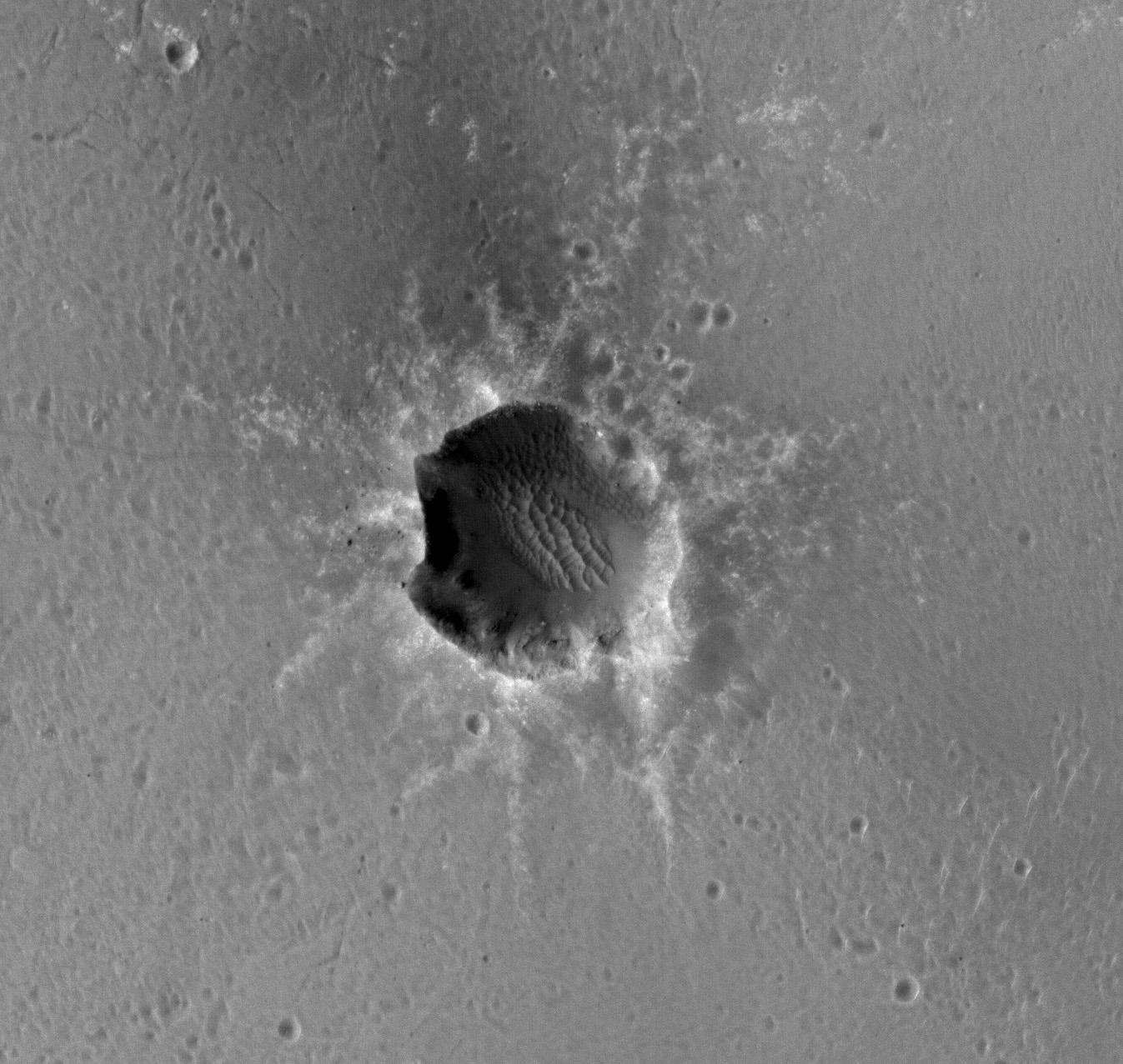
PIA13754:
-
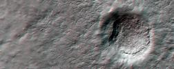
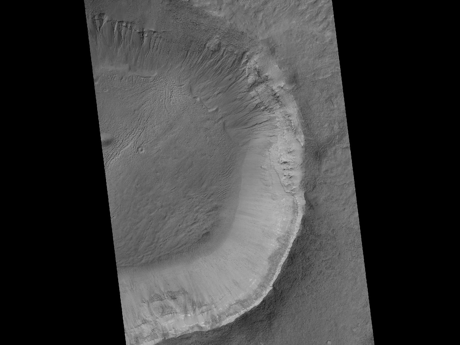
Mars Orbiter Sees Rover Opportunity at Crater Edge
Full Resolution:
TIFF
(1.722 MB)
JPEG
(195 kB)
|
|
|
2011-01-05 |
Mars
|
Mars Reconnaissance Orbiter (MRO)
|
HiRISE
|
2560x1920x3 |
|
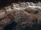
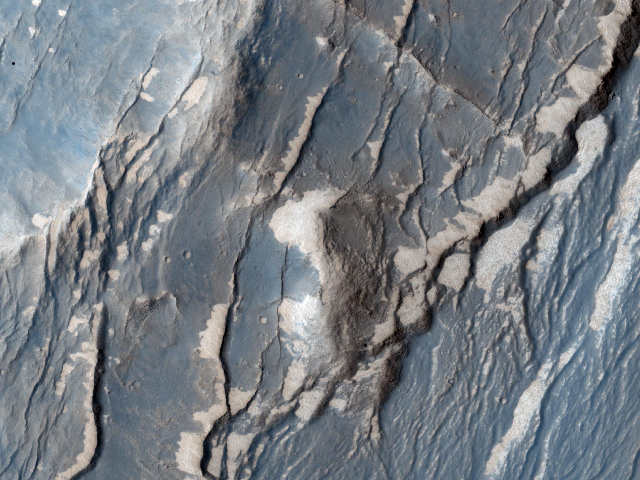
-
PIA13725:
-
Layered Bedrock in Candor Chasma
Full Resolution:
TIFF
(14.76 MB)
JPEG
(831.1 kB)
|
|
|
2011-01-12 |
Mars
|
Mars Reconnaissance Orbiter (MRO)
|
HiRISE
|
2560x1920x3 |
|
-
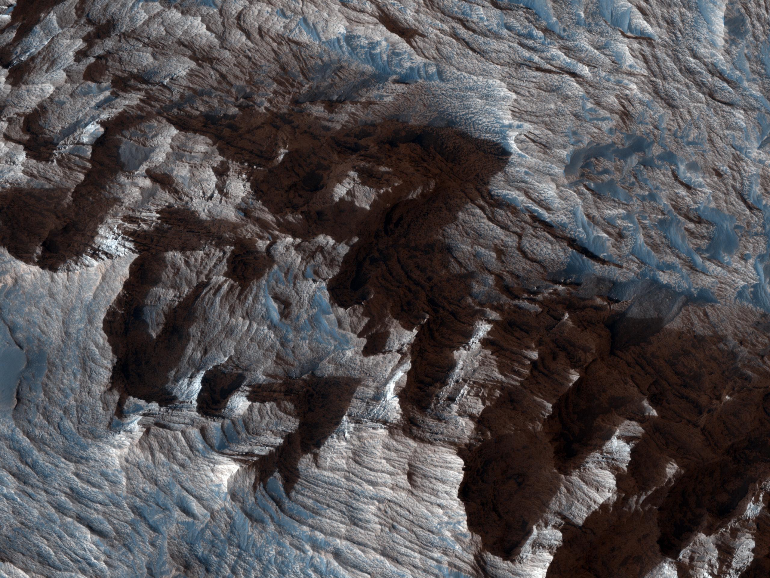
PIA13726:
-
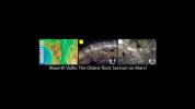
Layers Exposed in Crater Near Mawrth Vallis
Full Resolution:
TIFF
(14.76 MB)
JPEG
(650.8 kB)
|
|
|
2011-01-21 |
Mars
|
Mars Reconnaissance Orbiter (MRO)
|
HiRISE
|
2560x1920x3 |
|
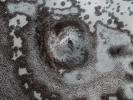
-
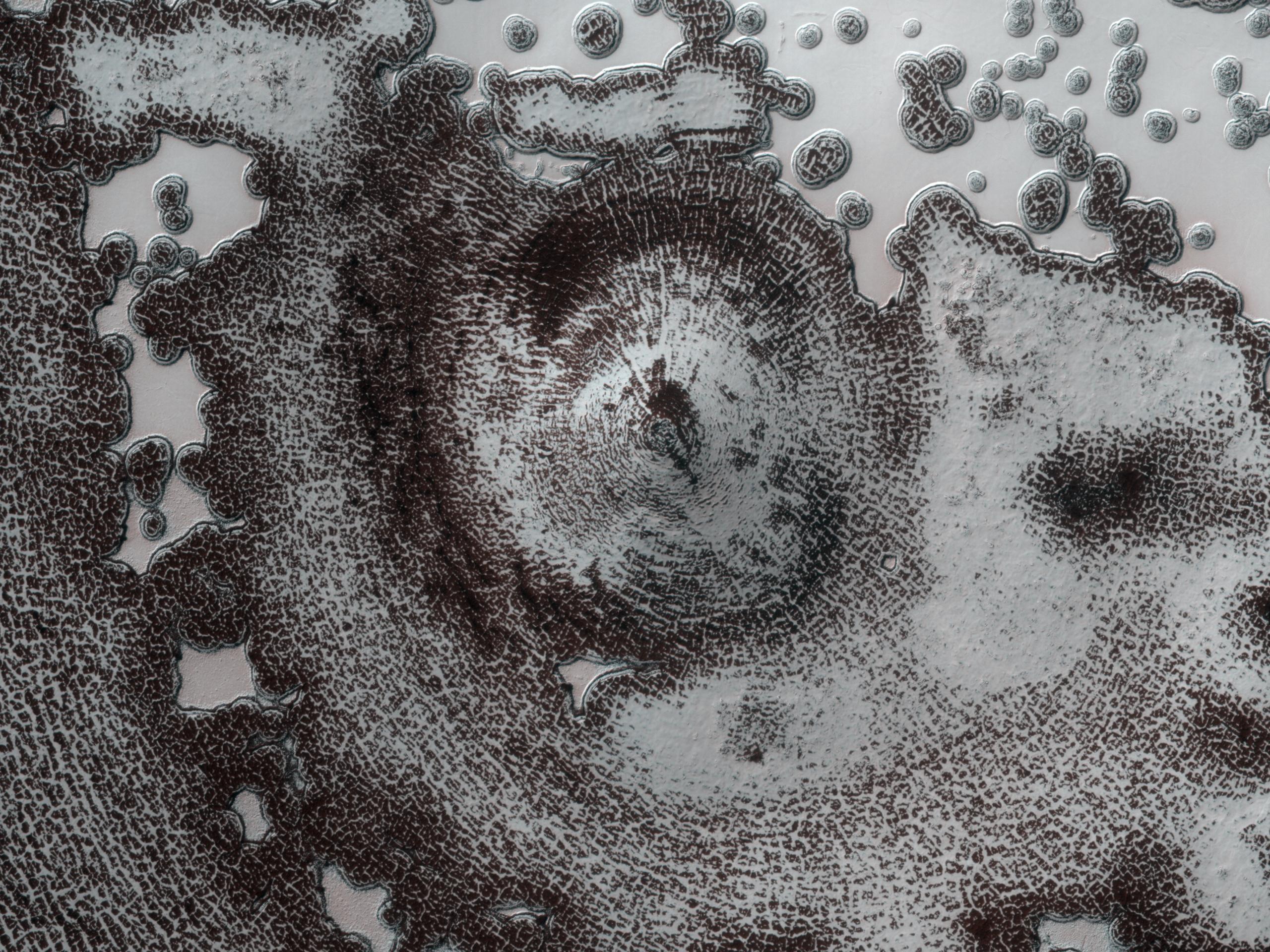
PIA13727:
-
Circular Feature in South Polar Residual Cap
Full Resolution:
TIFF
(14.76 MB)
JPEG
(937.3 kB)
|
|
|
2011-02-02 |
Mars
|
Mars Reconnaissance Orbiter (MRO)
|
HiRISE
|
2560x1920x3 |

|
-
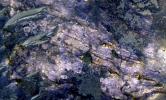
PIA13728:
-
Thumbprint Texture on Dark Dunes in Rabe Crater
Full Resolution:
TIFF
(14.76 MB)
JPEG
(553.7 kB)
|
|
|
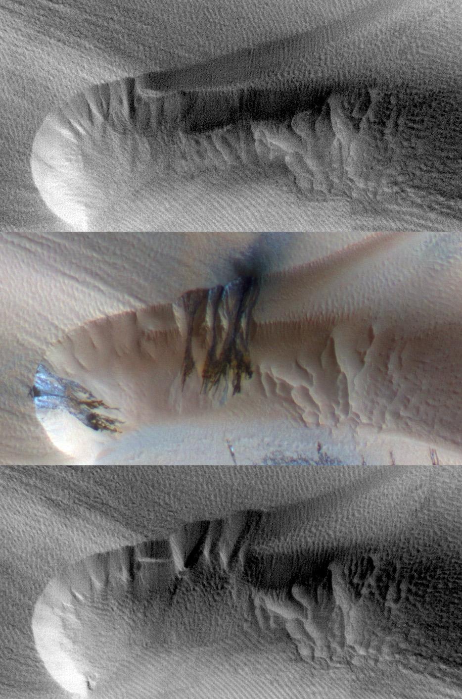
2011-02-03 |
Mars
|
Mars Reconnaissance Orbiter (MRO)
|
HiRISE
|
934x1412x3 |
|
-
PIA13797:
-
Seasonal Changes in Northern Mars Dune Field
Full Resolution:
TIFF
(3.962 MB)
JPEG
(221.3 kB)
|
|
|
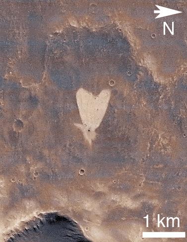
2011-02-14 |
Mars
|
Mars Reconnaissance Orbiter (MRO)
|
CTX
|
377x487x3 |
|
-
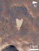
PIA13798:
-
Heart-Shaped Feature in Arabia Terra
Full Resolution:
TIFF
(185.6 kB)
JPEG
(41.39 kB)
|
|
|
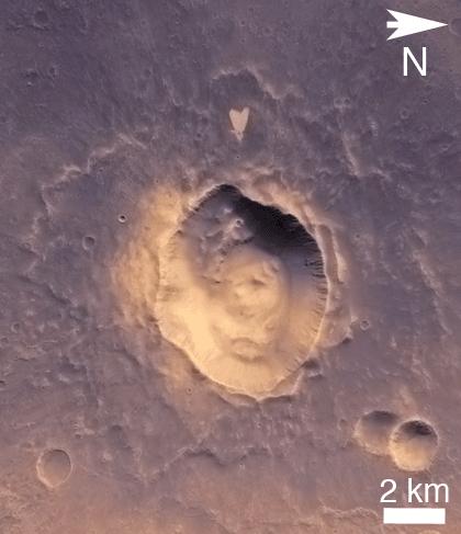
2011-02-14 |
Mars
|
Mars Reconnaissance Orbiter (MRO)
|
CTX
|
420x487x3 |

|
-
PIA13799:
-
Heart-Shaped Feature in Arabia Terra (Wide View)
Full Resolution:
TIFF
(206.5 kB)
JPEG
(25.93 kB)
|
|
|
2011-03-08 |
Mars
|
Mars Reconnaissance Orbiter (MRO)
|
CRISM
HiRISE
|
995x599x3 |
|
-
PIA13800:
-
Fractures in Carbonate-Bearing Rocks at Mars' Huygens Basin
Full Resolution:
TIFF
(1.791 MB)
JPEG
(139 kB)
|
|
|
2011-03-09 |
Mars
|
Mars Exploration Rover (MER)
Mars Reconnaissance Orbiter (MRO)
|
HiRISE
|
2254x1522x3 |
|
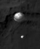
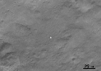
-
PIA13803:
-
Opportunity is Still Smiling
Full Resolution:
TIFF
(10.3 MB)
JPEG
(1.155 MB)
|
|
|
2011-03-09 |
Mars
|
Mars Reconnaissance Orbiter (MRO)
|
HiRISE
|
2560x1920x3 |
|
-
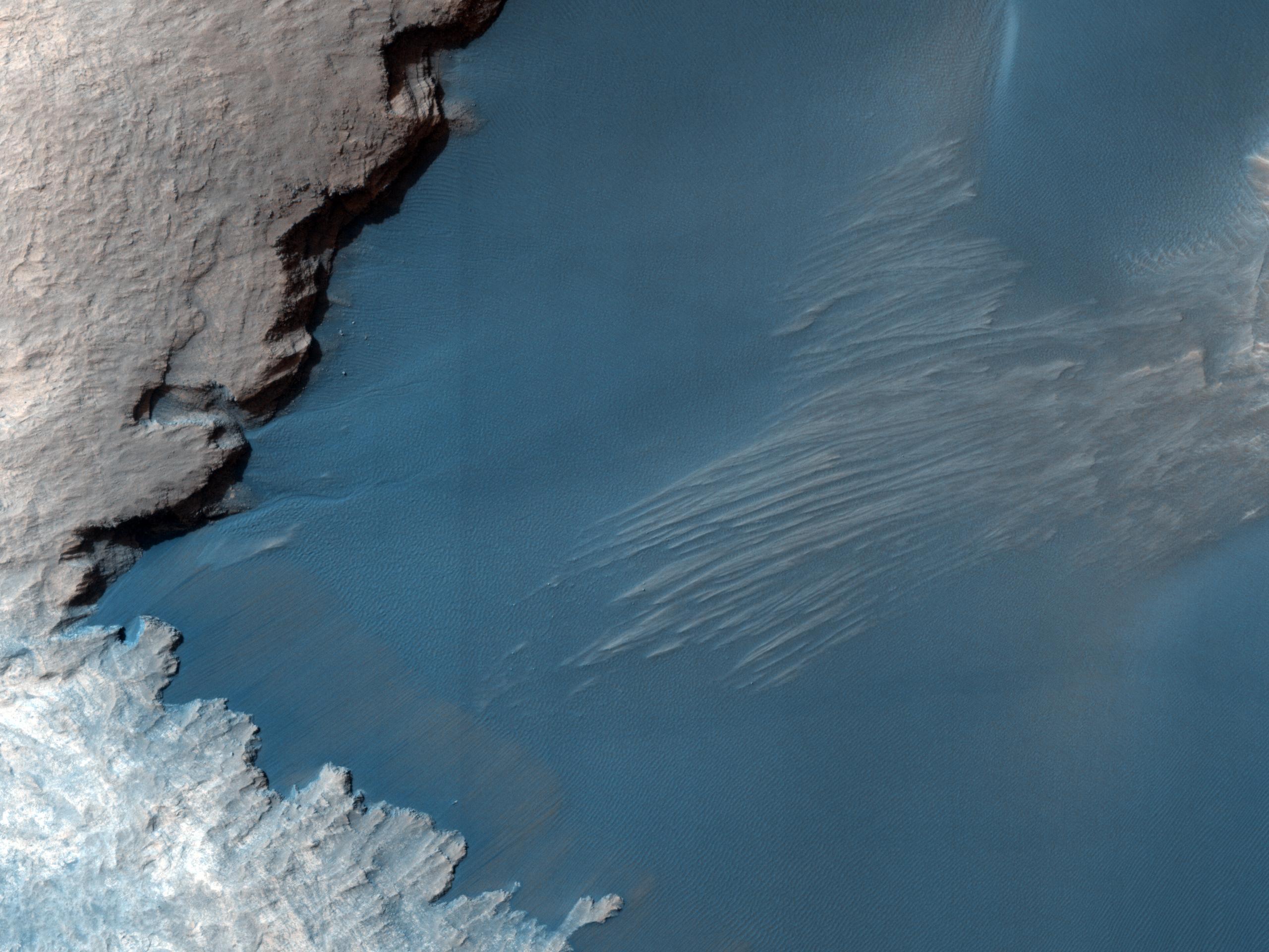
PIA13802:
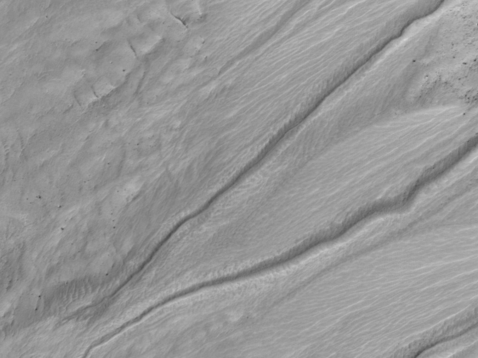
-
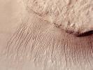
True Gullies on Mars
Full Resolution:
TIFF
(14.76 MB)
JPEG
(1.255 MB)
|
|
|
2011-04-21 |
Mars
|
Mars Reconnaissance Orbiter (MRO)
|
Shallow Subsurface Radar (SHARAD)
|
1775x380x1 |
|
-
PIA13985:
-
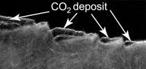
Cross Section of Buried Carbon-Dioxide Ice on Mars
Full Resolution:
TIFF
(675.5 kB)
JPEG
(116.5 kB)
|
|
|
2011-04-21 |
Mars
|
Mars Reconnaissance Orbiter (MRO)
|
Shallow Subsurface Radar (SHARAD)
|
9380x8299x3 |

|
-
PIA13986:
-
Thickness Map of Buried Carbon-Dioxide Deposit
Full Resolution:
TIFF
(233.5 MB)
JPEG
(4.87 MB)
|
|
|
2011-04-21 |
Mars
|
Mars Reconnaissance Orbiter (MRO)
|
HiRISE
|
2497x2054x1 |
|
-
PIA13987:
-
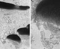
Pitting from Sublimation of Underlying Dry-Ice Layer
Full Resolution:
TIFF
(5.135 MB)
JPEG
(856.6 kB)
|
|
|
2011-06-08 |
Mars
|
Mars Exploration Rover (MER)
Mars Reconnaissance Orbiter (MRO)
|
HiRISE
|
8192x5789x3 |
|
-
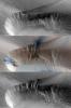
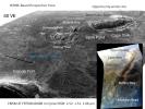
PIA14134:
-
Opportunity's First Goal at Endeavour Crater: 'Spirit Point'
Full Resolution:
TIFF
(47.47 MB)
JPEG
(3.48 MB)
|
|
|
2011-06-08 |
Mars
|
Mars Exploration Rover (MER)
Mars Reconnaissance Orbiter (MRO)
|
CTX
|
2948x2193x3 |
|
-
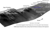
PIA14135:
-
Eagle to Endeavour: Opportunity's Path, Sol 2609
Full Resolution:
TIFF
(19.4 MB)
JPEG
(1.319 MB)
|
|
|
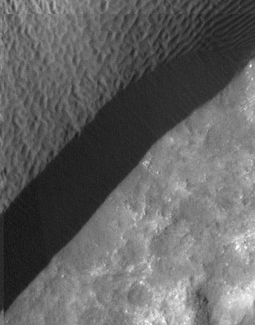
2011-07-15 |
Mars
|
Mars Reconnaissance Orbiter (MRO)
|
HiRISE
|
2560x1920x3 |
|
-
PIA14459:
-
Erosion Features near the South Pole of Mars
Full Resolution:
TIFF
(14.76 MB)
JPEG
(1.003 MB)
|
|
|
2011-07-15 |
Mars
|
Mars Reconnaissance Orbiter (MRO)
|
HiRISE
|
840x333x3 |
|
-
PIA14460:
-
Erosion Features near the South Pole of Mars (Anaglyph)
Full Resolution:
TIFF
(840.3 kB)
JPEG
(78.15 kB)
|
|
|
2011-07-15 |
Mars
|
Mars Reconnaissance Orbiter (MRO)
|
HiRISE
|
2560x1920x3 |

|
-
PIA14461:
-
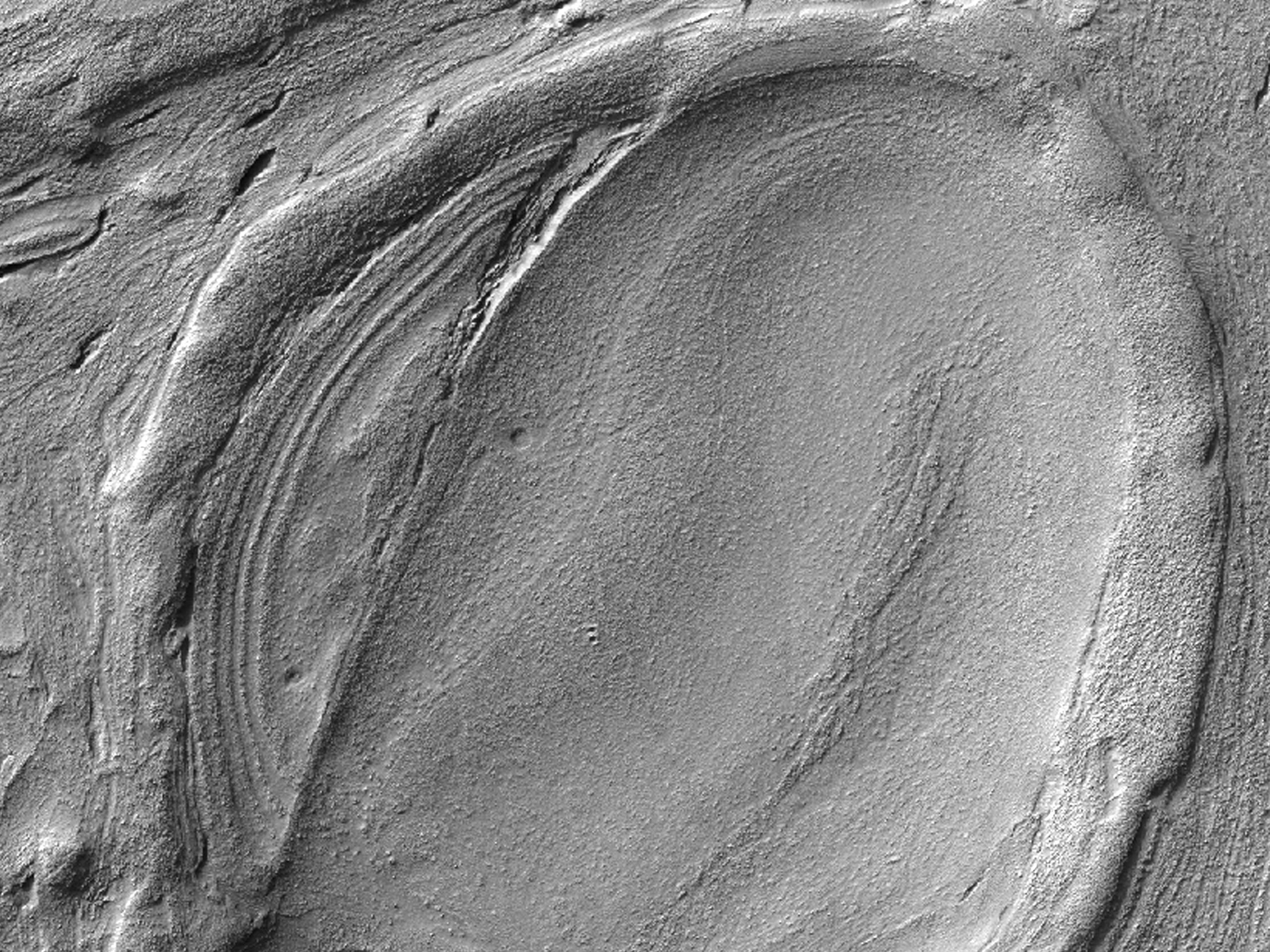
Faults in Claritas Fossae
Full Resolution:
TIFF
(14.76 MB)
JPEG
(655.1 kB)
|
|
|
2011-07-15 |
Mars
|
Mars Reconnaissance Orbiter (MRO)
|
HiRISE
|
2560x1920x3 |
|
-
PIA14462:
-
Small Mounds in Chryse Planitia
Full Resolution:
TIFF
(14.76 MB)
JPEG
(818.8 kB)
|
|
|
2011-07-22 |
Mars
|
Mars Science Laboratory (MSL)
|
HiRISE
|
1920x1080x3 |

|
-
PIA14296:
-
Lower Portion of Mound Inside Gale Crater
Full Resolution:
TIFF
(6.23 MB)
JPEG
(219.5 kB)
|
|
|
2011-07-22 |
Mars
|
Mars Science Laboratory (MSL)
|
HiRISE
|
1920x1080x3 |
|
-
PIA14297:
-
Rock Layers in Lower Mound in Gale Crater
Full Resolution:
TIFF
(6.23 MB)
JPEG
(157.1 kB)
|
|
|
2011-07-22 |
Mars
|
Mars Science Laboratory (MSL)
|
HiRISE
|
1920x1080x3 |
|
-
PIA14298:
-
Rock Types in Gale Crater
Full Resolution:
TIFF
(6.23 MB)
JPEG
(221.8 kB)
|
|
|
2011-07-22 |
Mars
|
Mars Science Laboratory (MSL)
|
HiRISE
|
1280x720x3 |
|
-
PIA14300:
-
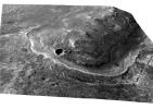
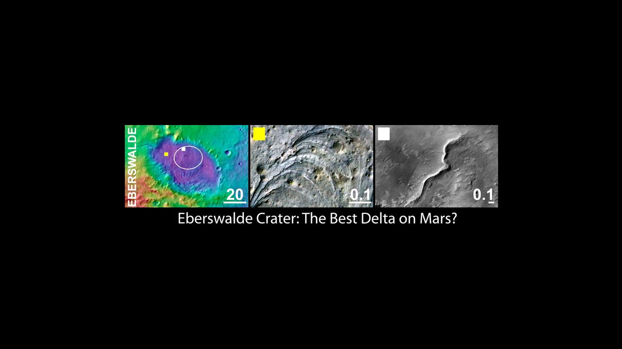
Eberswalde Crater, a Finalist Not Selected as Landing Site for Curiosity
Full Resolution:
TIFF
(2.768 MB)
JPEG
(53.99 kB)
|
|
|
2011-07-22 |
Mars
|
Mars Science Laboratory (MSL)
|
HiRISE
|
1280x720x3 |
|
-
PIA14301:
-
Gale Crater, the Selected Landing Site for Curiosity
Full Resolution:
TIFF
(2.768 MB)
JPEG
(50.68 kB)
|
|
|
2011-07-22 |
Mars
|
Mars Science Laboratory (MSL)
|
HiRISE
|
1280x720x3 |

|
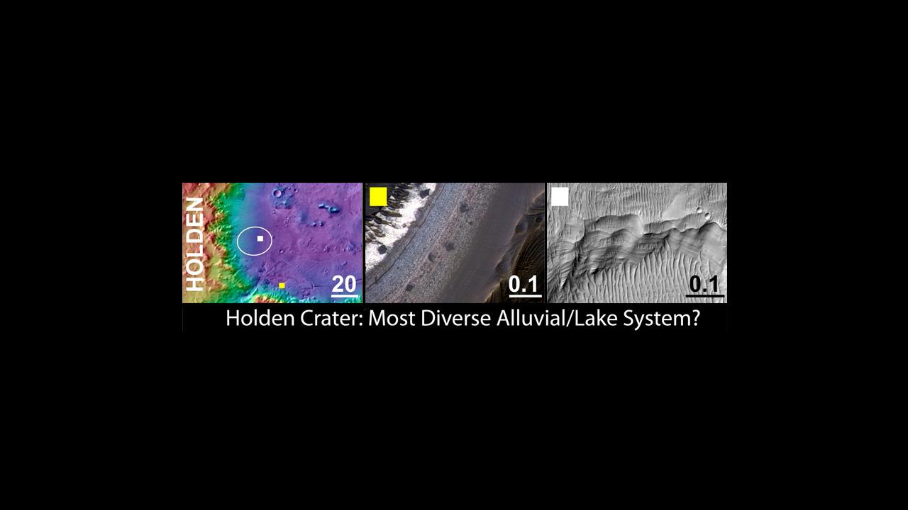
-
PIA14302:
-
Holden Crater, a Finalist Not Selected as Landing Site for Curiosity
Full Resolution:
TIFF
(2.768 MB)
JPEG
(53.81 kB)
|
|
|
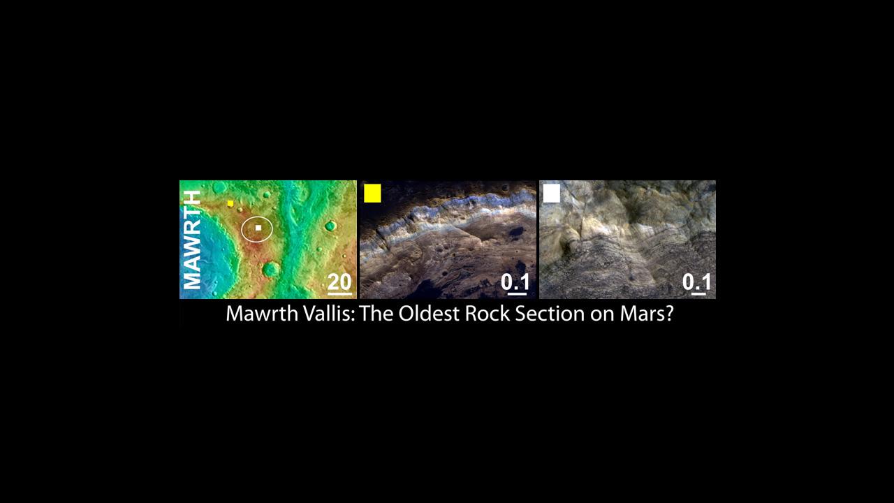
2011-07-22 |
Mars
|
Mars Science Laboratory (MSL)
|
HiRISE
|
1280x720x3 |
|
-
PIA14303:
-
Mawrth Vallis, a Finalist Not Selected as a Landing Site for Curiosity
Full Resolution:
TIFF
(2.768 MB)
JPEG
(53.93 kB)
|
|
|
2011-07-22 |
Mars
|
Mars Science Laboratory (MSL)
|
HiRISE
|
868x655x3 |
|
-
PIA14307:
-
Cemented Fractures in Mountain Inside Gale Crater on Mars
Full Resolution:
TIFF
(1.708 MB)
JPEG
(100.7 kB)
|
|
|
2011-08-04 |
Mars
|
Mars Reconnaissance Orbiter (MRO)
|
HiRISE
|
1839x1518x3 |
|
-
PIA14472:
-
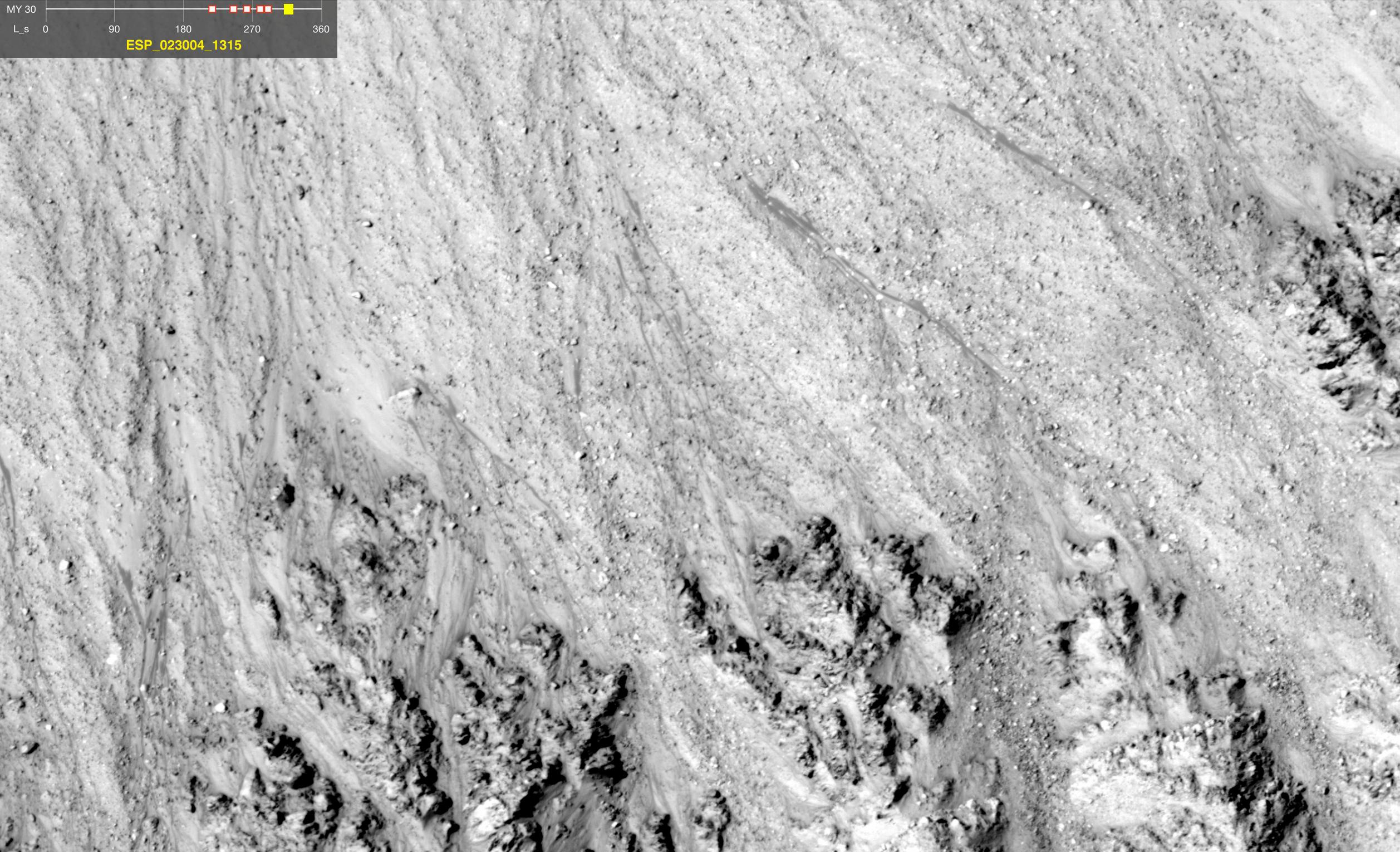
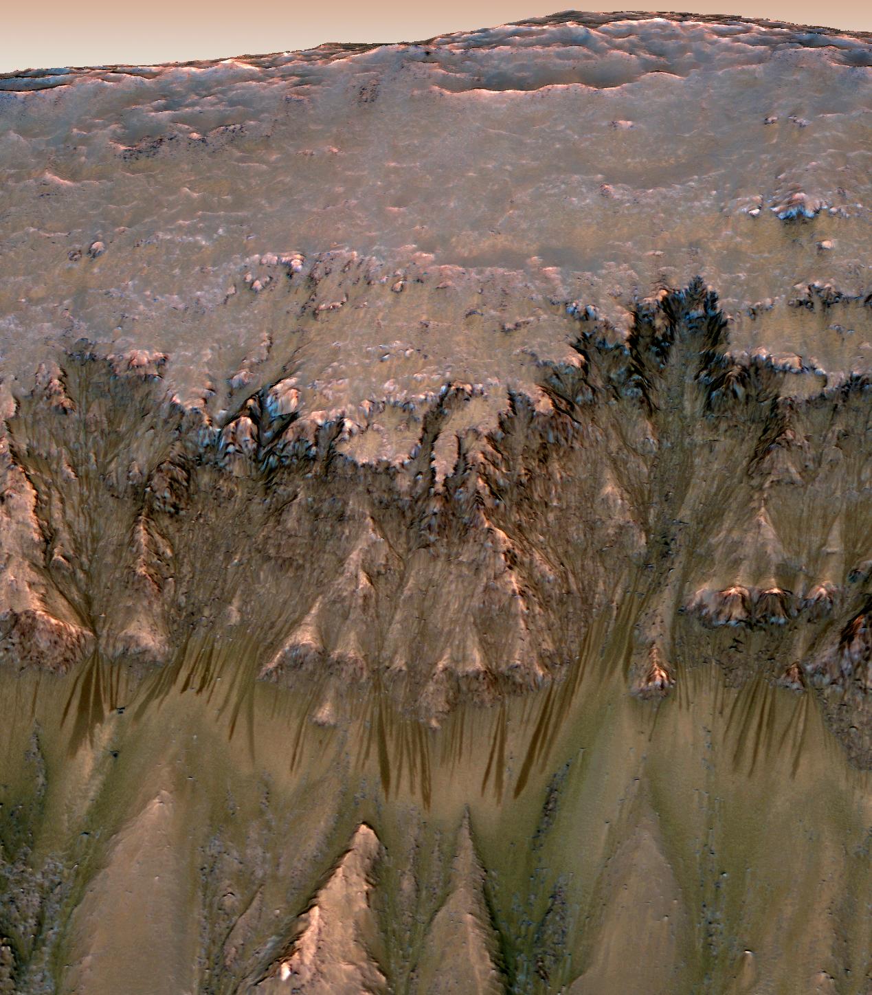
Warm-Season Flows on Slope in Newton Crater (Six-Image Sequence)
Full Resolution:
TIFF
(2.796 MB)
JPEG
(373.5 kB)
|
|
|
2011-08-04 |
Mars
|
Mars Reconnaissance Orbiter (MRO)
|
HiRISE
|
1917x1528x3 |
|
-
PIA14473:
-
Warm-Season Flows on Slope in Newton Crater (Five-Image Sequence)
Full Resolution:
TIFF
(2.934 MB)
JPEG
(471.7 kB)
|
|
|
2011-08-04 |
Mars
|
Mars Reconnaissance Orbiter (MRO)
|
HiRISE
|
1642x1534x3 |

|
-
PIA14474:
-
Dark Flows in Newton Crater Extending During Summer (Six-Image Sequence)
Full Resolution:
TIFF
(2.524 MB)
JPEG
(394.1 kB)
|
|
|
2011-08-04 |
Earth
|
Mars Reconnaissance Orbiter (MRO)
|
HiRISE
|
1578x1065x3 |

|
-
PIA14475:
-
Warm-Season Flows on Slope in Horowitz Crater (Eight-Image Sequence)
Full Resolution:
TIFF
(1.684 MB)
JPEG
(231.7 kB)
|
|
|
2011-08-04 |
Mars
|
Mars Reconnaissance Orbiter (MRO)
|
HiRISE
|
2453x2033x3 |
|
-
PIA14476:
-
Warm-Season Flows on Slope in Horowitz Crater (Nine-Image Sequence)
Full Resolution:
TIFF
(4.994 MB)
JPEG
(594.9 kB)
|
|
|
2011-08-04 |
Mars
|
Mars Reconnaissance Orbiter (MRO)
|
HiRISE
|
2147x1319x3 |
|
-
PIA14477:
-
Warm-Season Flows on Steep Slope in Slope in Terra Cimmeria (Eight-Image Sequence)
Full Resolution:
TIFF
(2.837 MB)
JPEG
(404.1 kB)
|
|
|
2011-08-04 |
Mars
|
Mars Reconnaissance Orbiter (MRO)
|
HiRISE
|
2515x1530x3 |
|
-
PIA14478:
-
Warm-Season Flows in Well-Preserved Crater in Terra Sirenum (Six-Image Sequence)
Full Resolution:
TIFF
(3.854 MB)
JPEG
(597.1 kB)
|
|
|
2011-08-04 |
Mars
|
Mars Reconnaissance Orbiter (MRO)
|
HiRISE
|
1269x1448x3 |
|
-
PIA14479:
-
Oblique View of Warm Season Flows in Newton Crater
Full Resolution:
TIFF
(5.519 MB)
JPEG
(285.1 kB)
|
|
|
2011-08-04 |
Mars
|
Mars Reconnaissance Orbiter (MRO)
|
HiRISE
|
1600x1200x1 |
|
-
PIA14501:
-
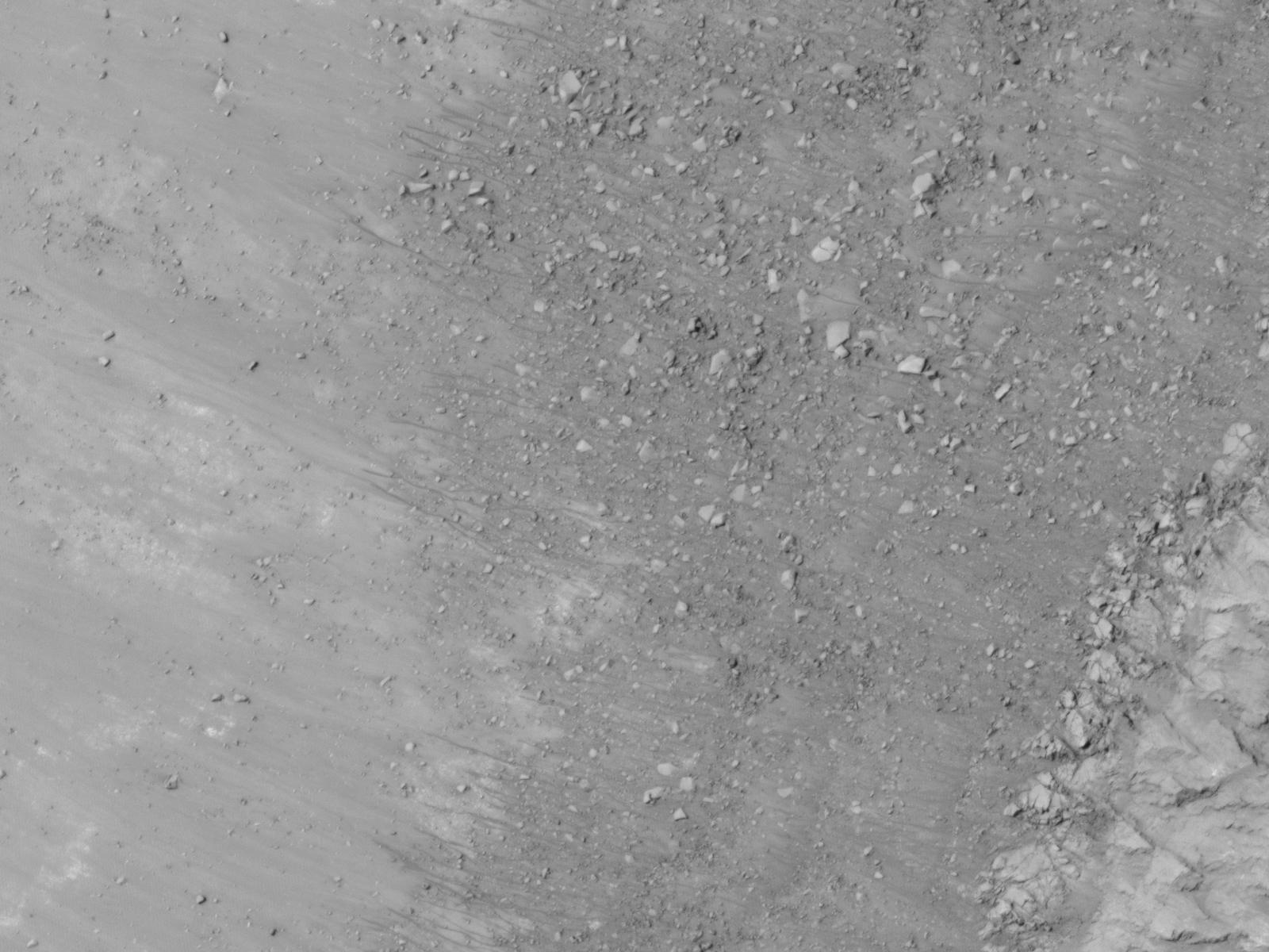
Gullies and Newly Identified Flow Features in Same Mars Crater
Full Resolution:
TIFF
(1.922 MB)
JPEG
(196.2 kB)
|
|
|
2011-08-04 |
Mars
|
Mars Reconnaissance Orbiter (MRO)
|
HiRISE
|
1600x1200x1 |
|
-
PIA14502:
-
Site of Warm Season Flows in Mars Crater
Full Resolution:
TIFF
(1.922 MB)
JPEG
(209.1 kB)
|
|
|
2011-08-04 |
Mars
|
Mars Reconnaissance Orbiter (MRO)
|
HiRISE
|
1600x1200x1 |
|
-
PIA14503:
-
Changes in a Gully in a Mars Crater (Two-Image Comparison)
Full Resolution:
TIFF
(1.922 MB)
JPEG
(136.2 kB)
|
|
|
2011-08-05 |
Mars
|
Mars Exploration Rover (MER)
|
CTX
|
943x1989x3 |
|
-
PIA14504:
-
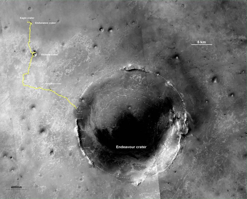
Opportunity's Route to Endeavour Crater
Full Resolution:
TIFF
(5.635 MB)
JPEG
(260 kB)
|
|
|
2011-08-05 |
Mars
|
Mars Exploration Rover (MER)
|
CTX
|
943x759x3 |
|
-
PIA14505:
-
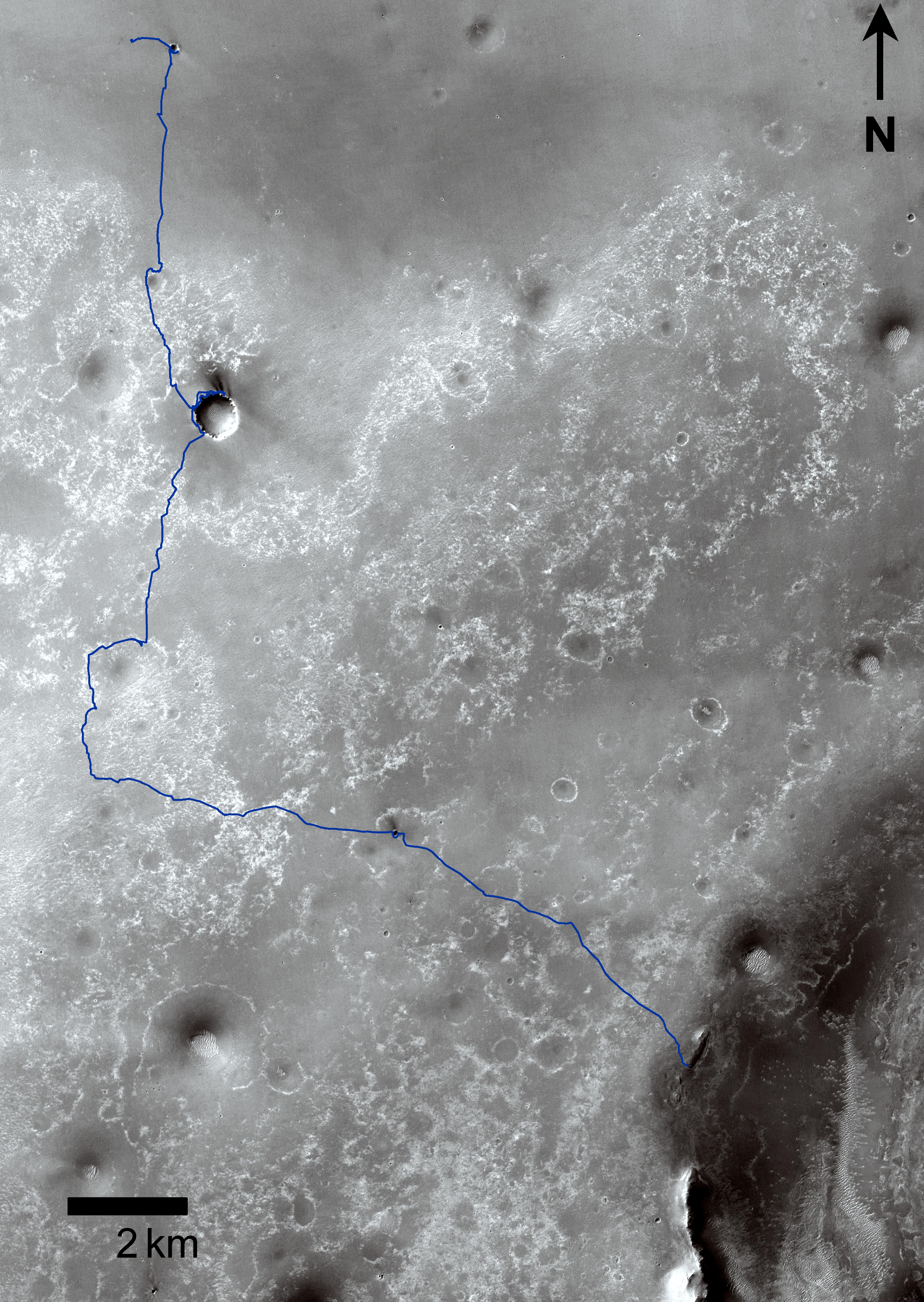
Opportunity's Route to Endeavour Crater (Wide View)
Full Resolution:
TIFF
(2.15 MB)
JPEG
(101 kB)
|
|
|
2011-09-01 |
Mars
|
Mars Exploration Rover (MER)
Mars Reconnaissance Orbiter (MRO)
|
CTX
|
5664x7979x3 |
|
-
PIA14536:
-
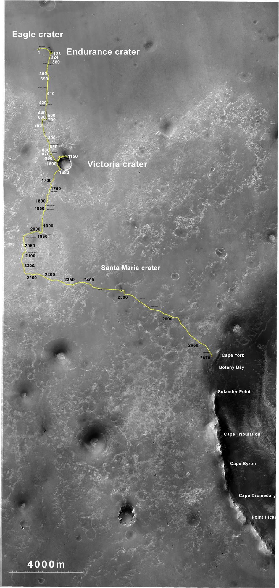
Opportunity Traverses Through 2,700 Martian Days
Full Resolution:
TIFF
(45.26 MB)
JPEG
(6.766 MB)
|
|
|
2011-09-01 |
Mars
|
Mars Exploration Rover (MER)
Mars Reconnaissance Orbiter (MRO)
|
HiRISE
|
8192x5786x3 |
|
-
PIA14537:
-
Opportunity's First Neighborhood on Rim of Endeavour
Full Resolution:
TIFF
(142.2 MB)
JPEG
(5.631 MB)
|
|
|
2011-10-05 |
Mars
|
Mars Reconnaissance Orbiter (MRO)
|
HiRISE
|
2560x1920x3 |
|
-
PIA14890:
-
Colorful Central Peak in an Unnamed Crater
Full Resolution:
TIFF
(14.76 MB)
JPEG
(581.1 kB)
|
|
|
2011-11-02 |
Mars
|
Mars Reconnaissance Orbiter (MRO)
|
CRISM
|
2000x2000x3 |
|
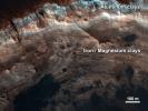
-
PIA14764:
-
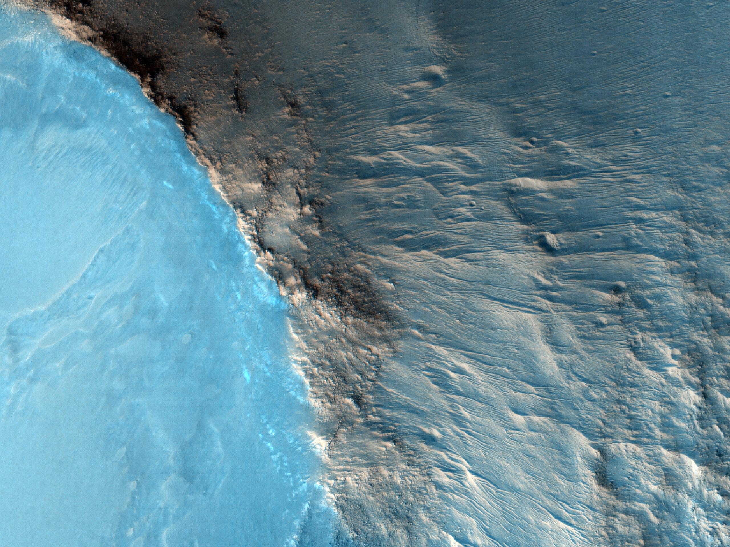
Clay Minerals in Craters and Escarpments on Mars
Full Resolution:
TIFF
(12.02 MB)
JPEG
(262.6 kB)
|
|
|
2011-11-17 |
Mars
|
Mars Reconnaissance Orbiter (MRO)
|
HiRISE
|
920x1016x1 |
|
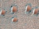
-
PIA14876:
-
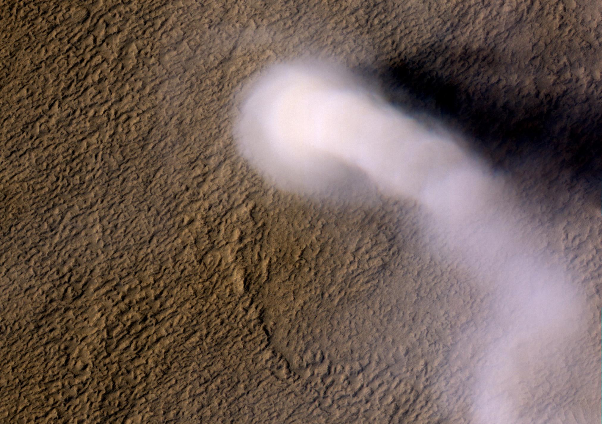
Blowing in the Martian Wind

Full Resolution:
TIFF
(936 kB)
JPEG
(106.7 kB)
|
|
|
2011-11-17 |
Mars
|
Mars Reconnaissance Orbiter (MRO)
|
HiRISE
|
781x1019x1 |
|
-
PIA14877:
-
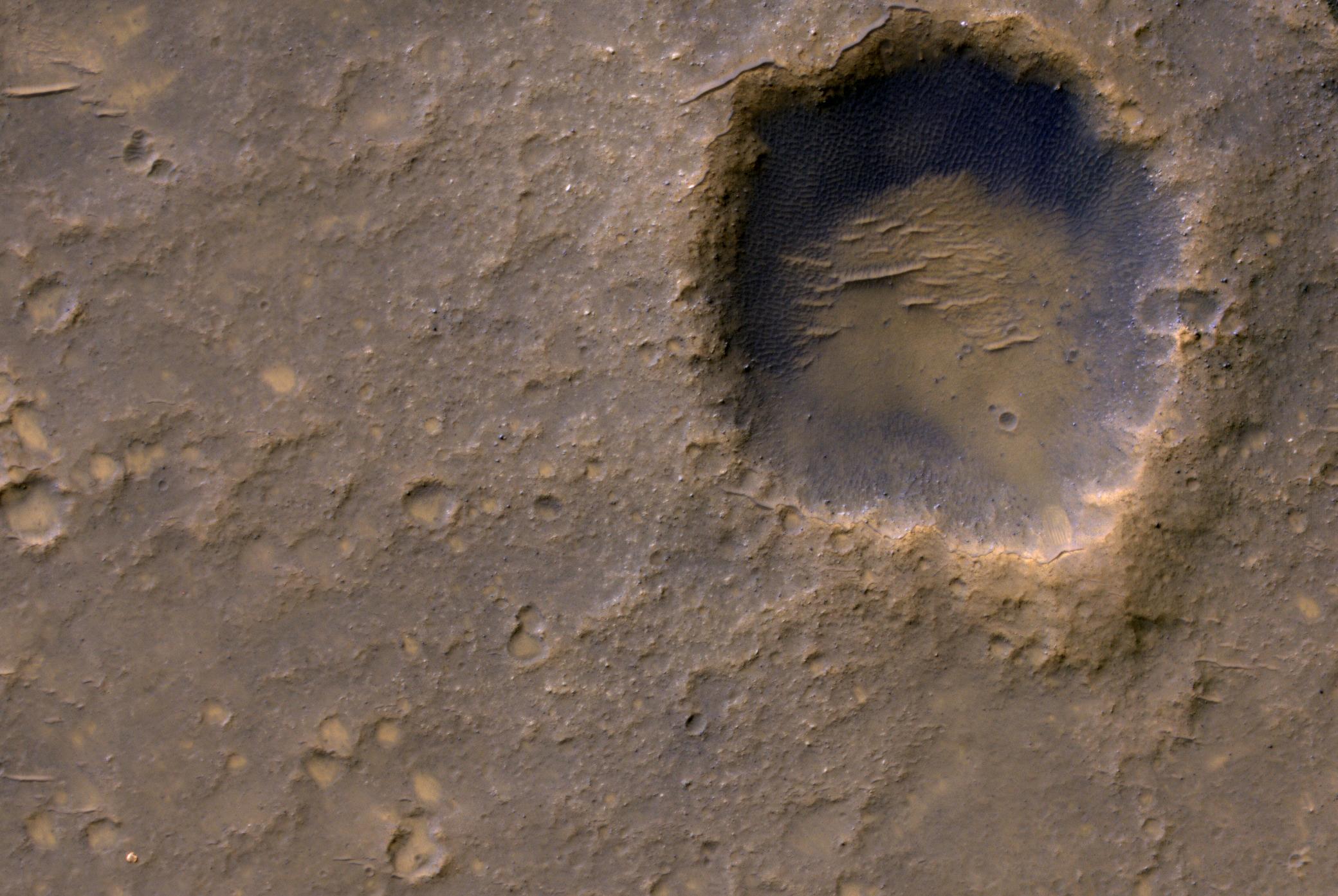
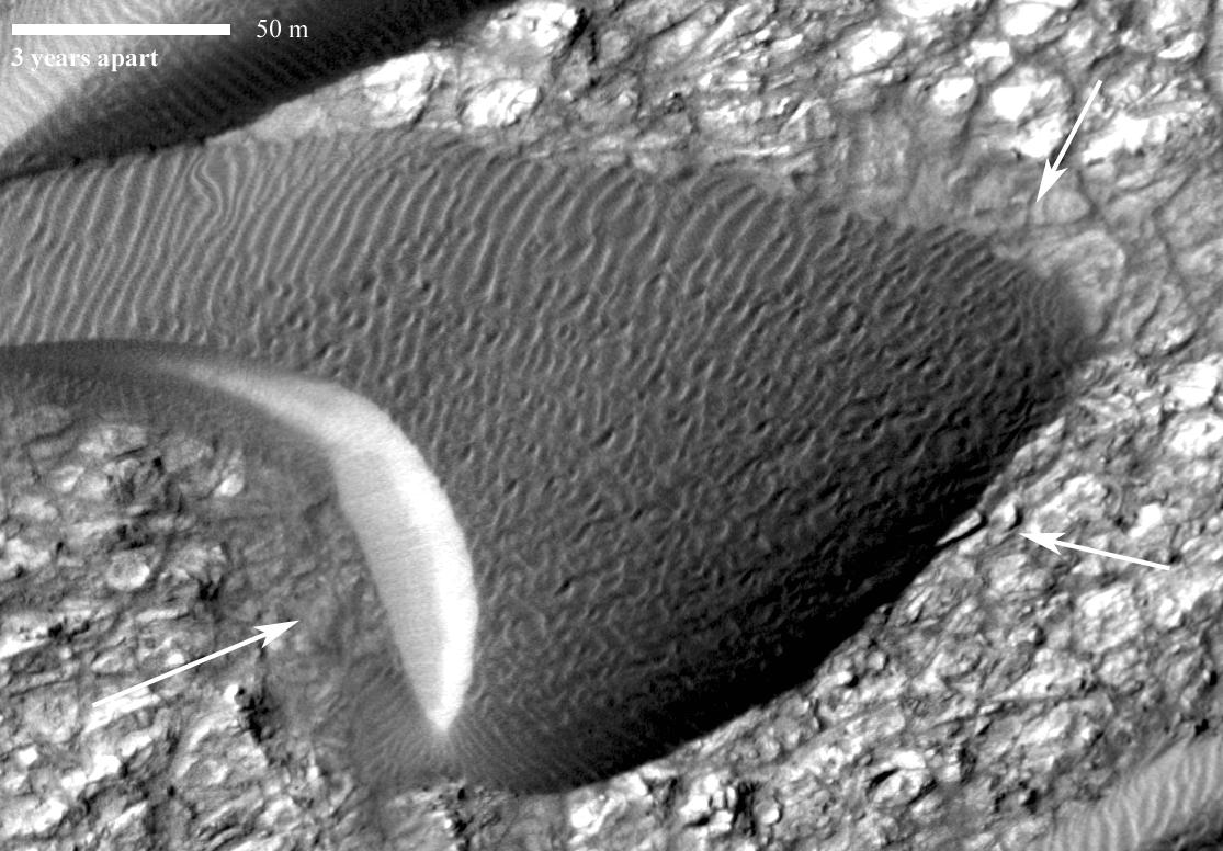
Shifting Sand in Herschel Crater
Full Resolution:
TIFF
(796.9 kB)
JPEG
(171.2 kB)
|
|
|
2011-11-17 |
Mars
|
Mars Reconnaissance Orbiter (MRO)
|
HiRISE
|
738x604x1 |
|
-
PIA14878:
-
Rippling Dune Front in Herschel Crater on Mars
Full Resolution:
TIFF
(446.4 kB)
JPEG
(72.31 kB)
|
|
|
2011-11-17 |
Mars
|
Mars Reconnaissance Orbiter (MRO)
|
HiRISE
|
878x1120x1 |
|
-
PIA14879:
-
Rippling Dune Front in Herschel Crater on Mars
Full Resolution:
TIFF
(984.6 kB)
JPEG
(119.5 kB)
|
|
|
2011-11-17 |
Mars
|
Mars Reconnaissance Orbiter (MRO)
|
HiRISE
|
1225x925x1 |
|
-
PIA14880:
-
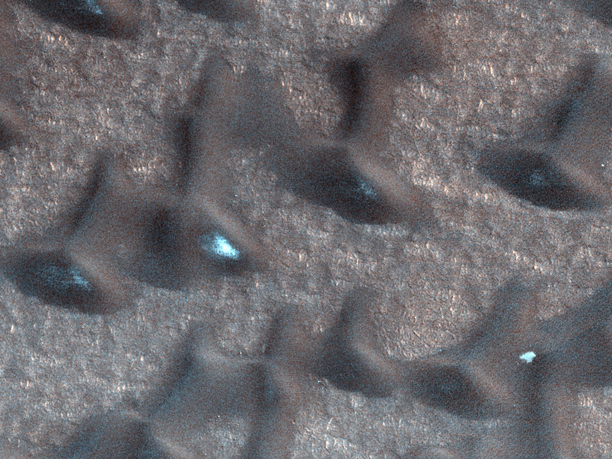
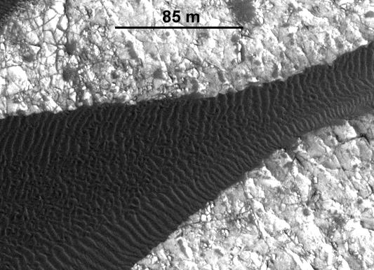
Movement in Martian Dune Field
Full Resolution:
TIFF
(1.135 MB)
JPEG
(144.5 kB)
|
|
|
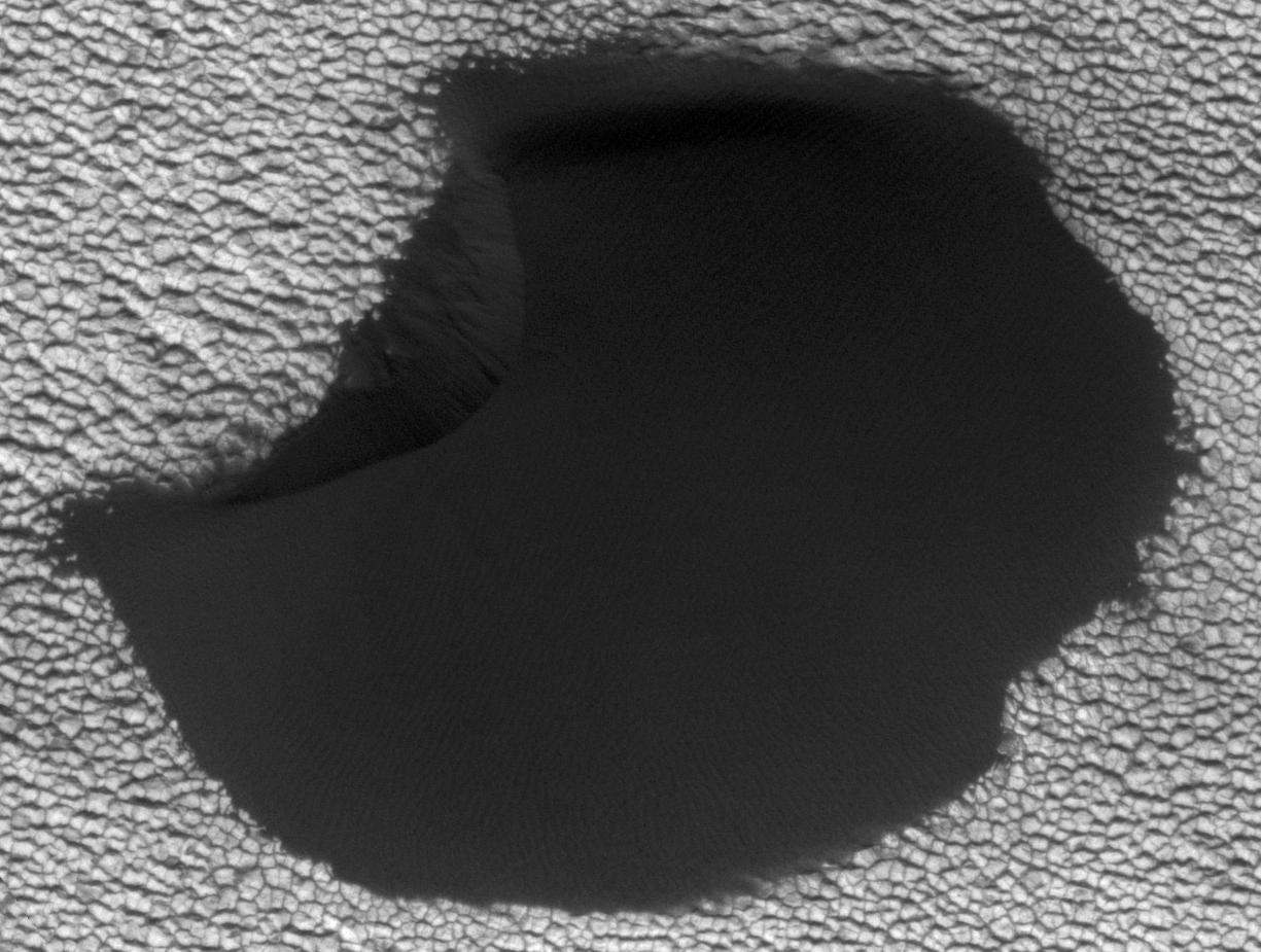
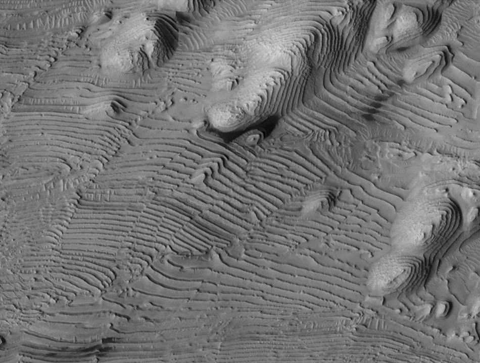
2011-11-21 |
Mars
|
Mars Reconnaissance Orbiter (MRO)
|
HiRISE
|
950x720x1 |
|
-
PIA15092:
-
Rhythmic Layering in Danielson Crater on Mars
Full Resolution:
TIFF
(685 kB)
JPEG
(113.5 kB)
|
|
|
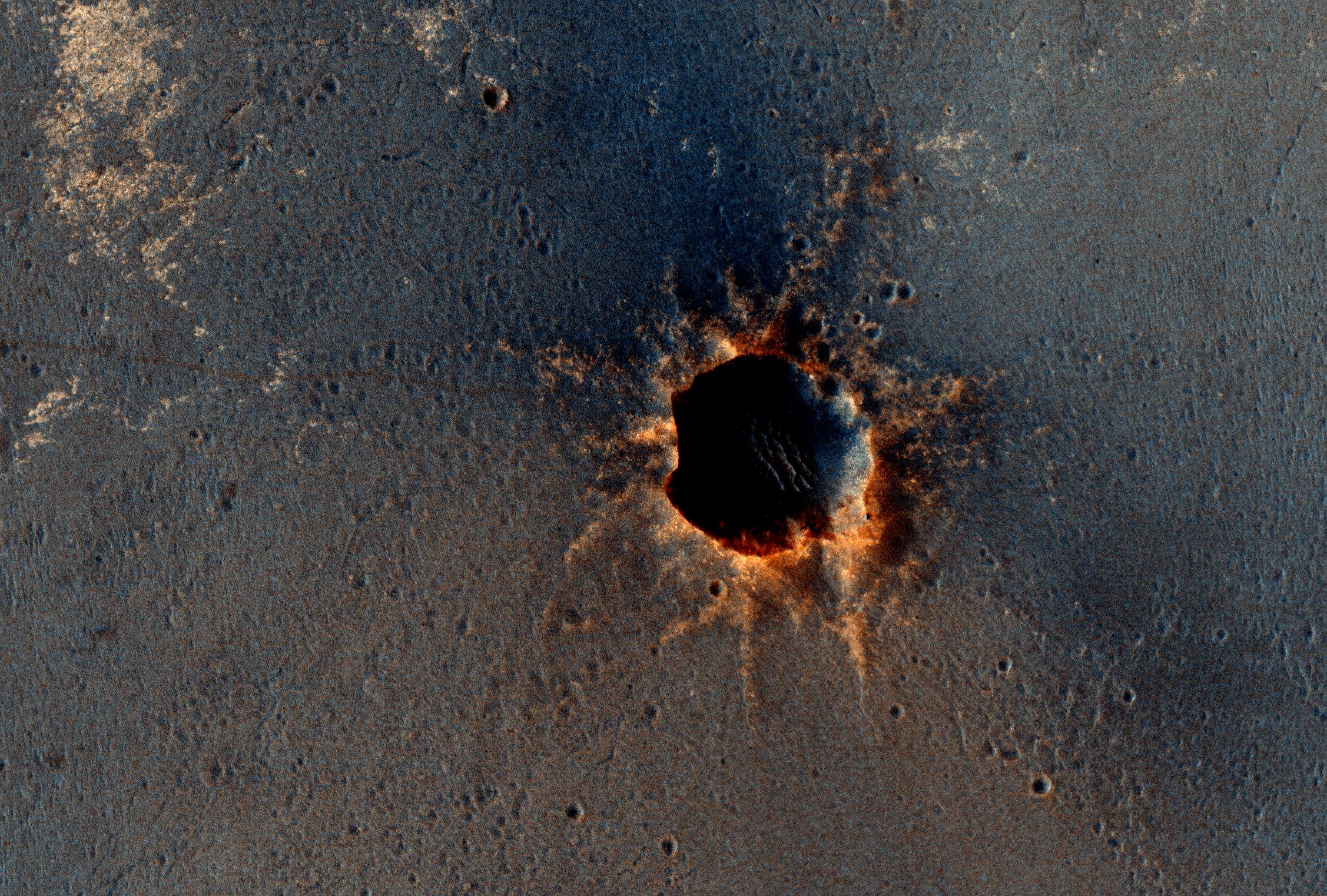
2011-11-21 |
Mars
|
Mars Reconnaissance Orbiter (MRO)
|
HiRISE
|
923x690x3 |
|
-
PIA15096:
-
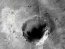
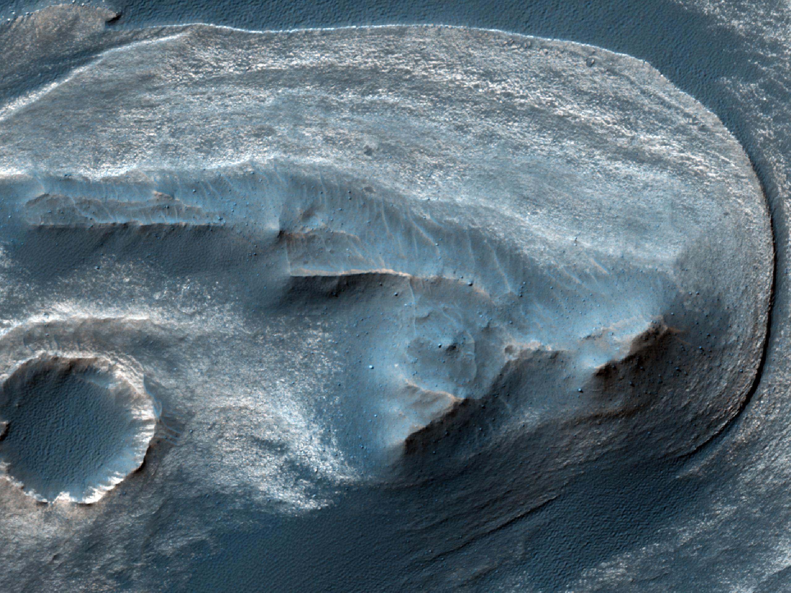
Fresh Crater Revealing Buried Ice
Full Resolution:
TIFF
(1.914 MB)
JPEG
(132.1 kB)
|
|
|
2011-11-21 |
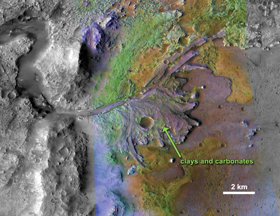
Mars
|
Mars Reconnaissance Orbiter (MRO)
|
CRISM
CTX
|
935x720x3 |
|
-
PIA15097:
-
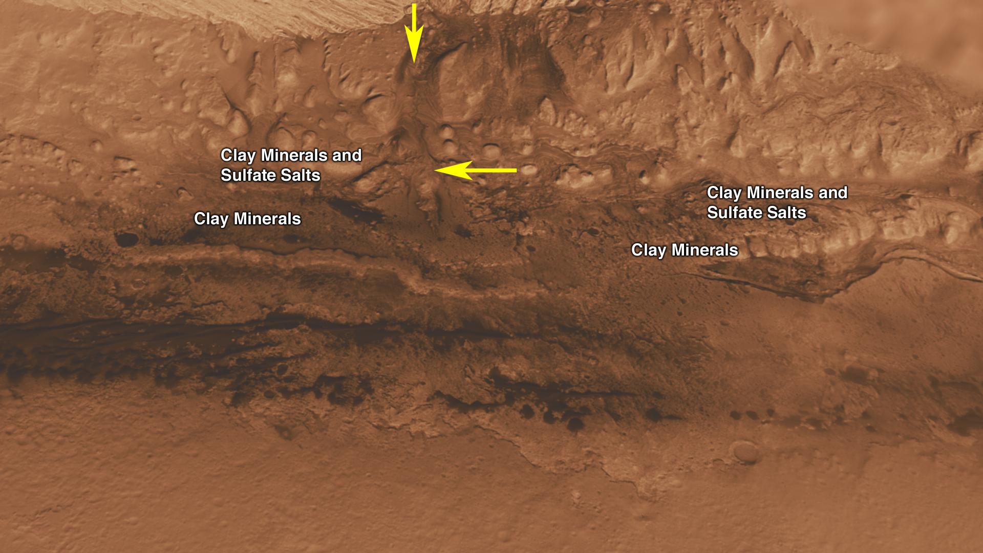
Chemical Alteration by Water, Jezero Crater Delta
Full Resolution:
TIFF
(2.023 MB)
JPEG
(132 kB)
|
|
|
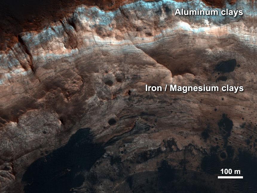
2011-11-21 |
Mars
|
Mars Reconnaissance Orbiter (MRO)
|
HiRISE
|
860x647x3 |
|
-
PIA15098:
-
Chemical Alteration by Water, Mawrth Vallis
Full Resolution:
TIFF
(1.671 MB)
JPEG
(95.97 kB)
|
|
|
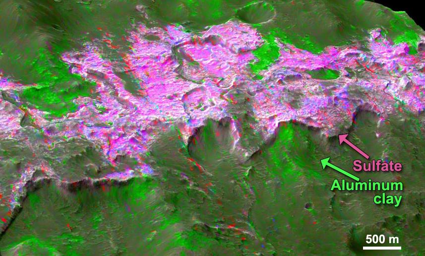
2011-11-21 |
Mars
|
Mars Reconnaissance Orbiter (MRO)
|
CRISM
CTX
|
857x517x3 |

|
-
PIA15099:
-
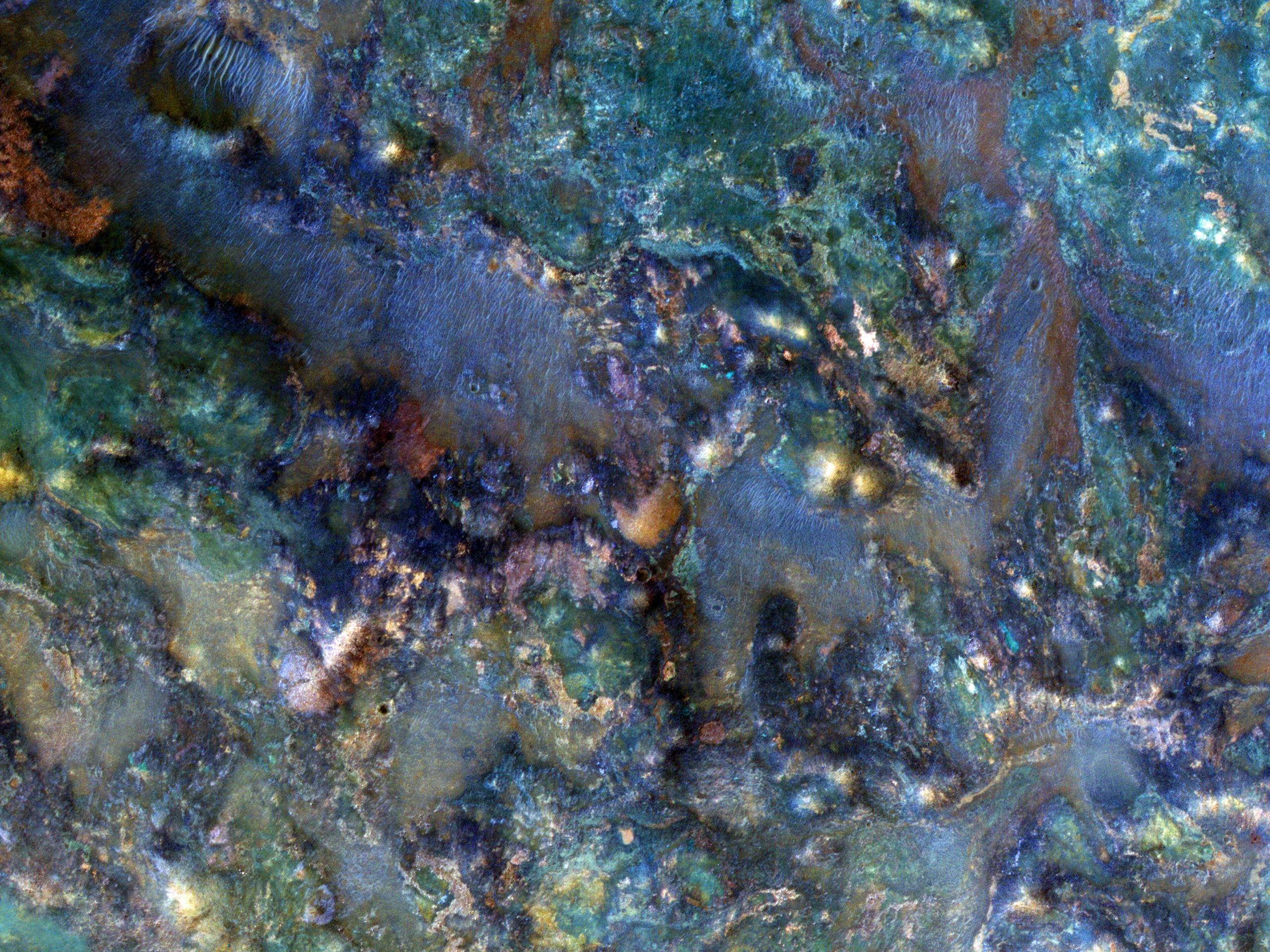
Sulfates and Clays in Columbus Crater, Mars
Full Resolution:
TIFF
(1.331 MB)
JPEG
(97.63 kB)
|
|
|
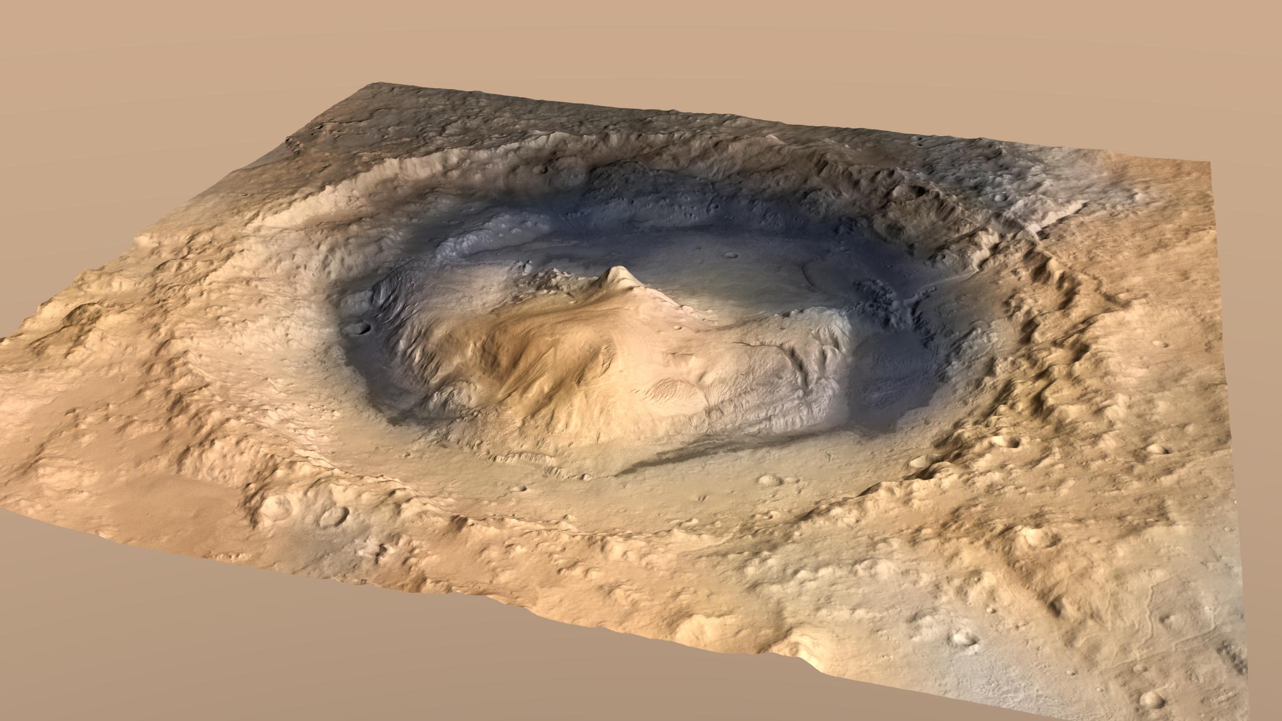
2011-11-28 |
Mars
|
Mars Science Laboratory (MSL)
|
Contact Camera (CTX)
High Resolution Stereo Camera
|
2560x1440x3 |

|
-
PIA15101:
-
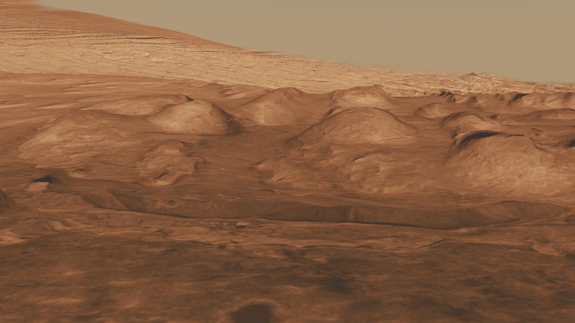
Oblique View of Gale Crater, Mars, with Vertical Exaggeration
Full Resolution:
TIFF
(11.07 MB)
JPEG
(338 kB)
|
|
|
2011-11-28 |
Mars
|
Mars Science Laboratory (MSL)
|
Contact Camera (CTX)
High Resolution Stereo Camera
|
628x355x3 |
|
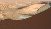
-
PIA15102:
-
Cross Section of Gale Crater, Mars (Artist's Concept)
Full Resolution:
TIFF
(669.8 kB)
JPEG
(35.94 kB)
|
|
|
2011-12-07 |
Mars
|
Mars Reconnaissance Orbiter (MRO)
|
HiRISE
|
2560x1920x3 |
|
-
PIA14861:
-
Edge of North Polar Erg
Full Resolution:
TIFF
(14.76 MB)
JPEG
(1.041 MB)
|
|
|
2011-12-07 |
Mars
|
Mars Reconnaissance Orbiter (MRO)
|
HiRISE
|
8192x4774x3 |
|
-
PIA15111:
-
West Rim of Endeavour with Vertical Exaggeration
Full Resolution:
TIFF
(117.3 MB)
JPEG
(3.007 MB)
|
|
|
2011-12-07 |
Mars
|
Mars Reconnaissance Orbiter (MRO)
|
HiRISE
|
960x720x3 |
|
-
PIA15112:
-
'Botany Bay' and 'Cape York' with Vertical Exaggeration
Full Resolution:
TIFF
(2.077 MB)
JPEG
(144.3 kB)
|
|
|
2012-01-05 |
Mars
|
Mars Exploration Rover (MER)
Mars Reconnaissance Orbiter (MRO)
|
HiRISE
|
700x560x1 |
|
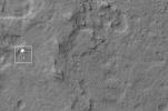
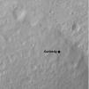
-
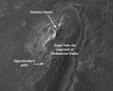
PIA15276:
-
Locator Map for 'Greeley Haven' on Endeavour Rim
Full Resolution:
TIFF
(392.6 kB)
JPEG
(56.54 kB)
|
|
|
2012-01-25 |
Mars
|
Mars Reconnaissance Orbiter (MRO)
|
HiRISE
|
2023x2008x3 |
|
-
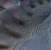
PIA15283:
-
Dunes in Noachis Terra Region of Mars
Full Resolution:
TIFF
(12.2 MB)
JPEG
(593 kB)
|
|
|
2012-02-08 |
Mars
|
Mars Exploration Rover (MER)
Mars Reconnaissance Orbiter (MRO)
|
HiRISE
|
2080x1393x3 |
|
-
PIA15038:
-
Spirit Lander and Bonneville Crater in Color
Full Resolution:
TIFF
(8.704 MB)
JPEG
(354.7 kB)
|
|
|
2012-02-08 |
Mars
|
Mars Reconnaissance Orbiter (MRO)
Phoenix
|
HiRISE
|
552x445x3 |
|
-
PIA15039:
-
Phoenix Back Shell After Second Martian Winter
Full Resolution:
TIFF
(738.1 kB)
JPEG
(44.71 kB)
|
|
|
2012-02-13 |
Mars
|
Mars Reconnaissance Orbiter (MRO)
Phoenix
|
HiRISE
|
411x372x3 |
|
-
PIA15110:
-
Phoenix Lander After Second Martian Winter
Full Resolution:
TIFF
(459.4 kB)
JPEG
(38.67 kB)
|
|
|
2012-03-07 |
Mars
|
Mars Reconnaissance Orbiter (MRO)
|
HiRISE
|
2093x1389x3 |
|
-
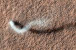
PIA15116:
-
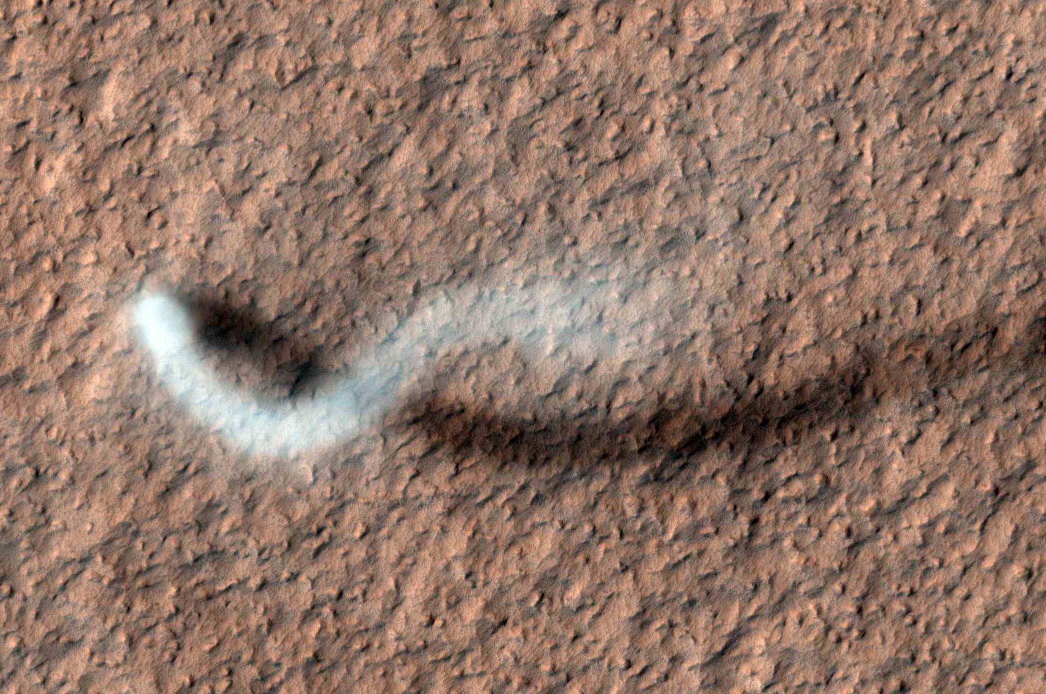
The Serpent Dust Devil of Mars
Full Resolution:
TIFF
(8.733 MB)
JPEG
(520.7 kB)
|
|
|
2012-03-28 |
Mars
|
Mars Reconnaissance Orbiter (MRO)
|
HiRISE
|
2560x1920x1 |

|
-
PIA14431:
-
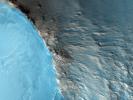
Lava Lamp Terrain on the Floor of Hellas Basin
Full Resolution:
TIFF
(4.921 MB)
JPEG
(862.1 kB)
|
|
|
2012-03-29 |
Mars
|
Mars Reconnaissance Orbiter (MRO)
|
HiRISE
|
2560x1920x3 |
|
-
PIA14432:
-
Cratered Dune Forms
Full Resolution:
TIFF
(14.76 MB)
JPEG
(645.6 kB)
|
|
|
2012-03-30 |
Mars
|
Mars Reconnaissance Orbiter (MRO)
|
HiRISE
|
2560x1920x3 |
|
-
PIA14433:
-
Summer is on Its Way
Full Resolution:
TIFF
(14.76 MB)
JPEG
(1.028 MB)
|
|
|
2012-04-02 |
Mars
|
Mars Reconnaissance Orbiter (MRO)
|
HiRISE
|
2560x1920x3 |
|
-
PIA14434:
-
A Wild Assortment of Jumbled Rocks
Full Resolution:
TIFF
(14.76 MB)
JPEG
(1.005 MB)
|
|
|
2012-04-04 |
Mars
|
Mars Reconnaissance Orbiter (MRO)
|
HiRISE
|
2024x1426x3 |
|
-
PIA15545:
-
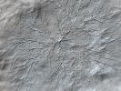
Mars' Whirling Dust Devil
Full Resolution:
TIFF
(8.67 MB)
JPEG
(423.6 kB)
|
|
|
2012-05-09 |
Mars
|
Mars Reconnaissance Orbiter (MRO)
|
HiRISE
|
1115x776x1 |
|
-
PIA15295:
-
Advancing Dune in Nili Patera, Mars
Full Resolution:
TIFF
(866.4 kB)
JPEG
(143.5 kB)
|
|
|
2012-05-09 |
Mars
|
Mars Reconnaissance Orbiter (MRO)
|
HiRISE
|
533x386x1 |
|
-
PIA15680:
-
Ripple Movement on Sand Dune in Nili Patera, Mars
Full Resolution:
TIFF
(206.2 kB)
JPEG
(50.09 kB)
|
|
|
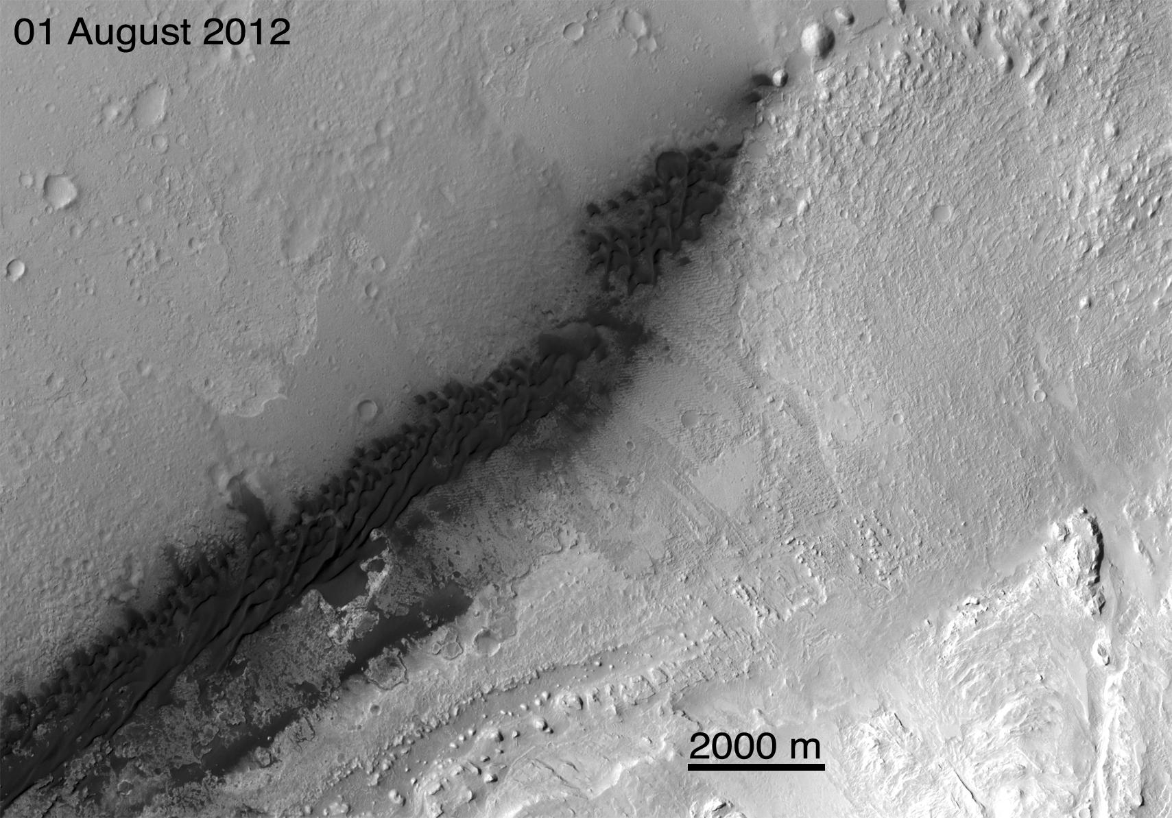
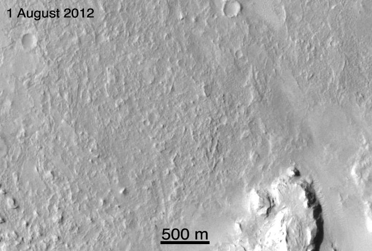
2012-08-02 |
Mars
|
Mars Reconnaissance Orbiter (MRO)
|
MARCI
|
1300x1400x3 |
|
-
PIA15959:
-
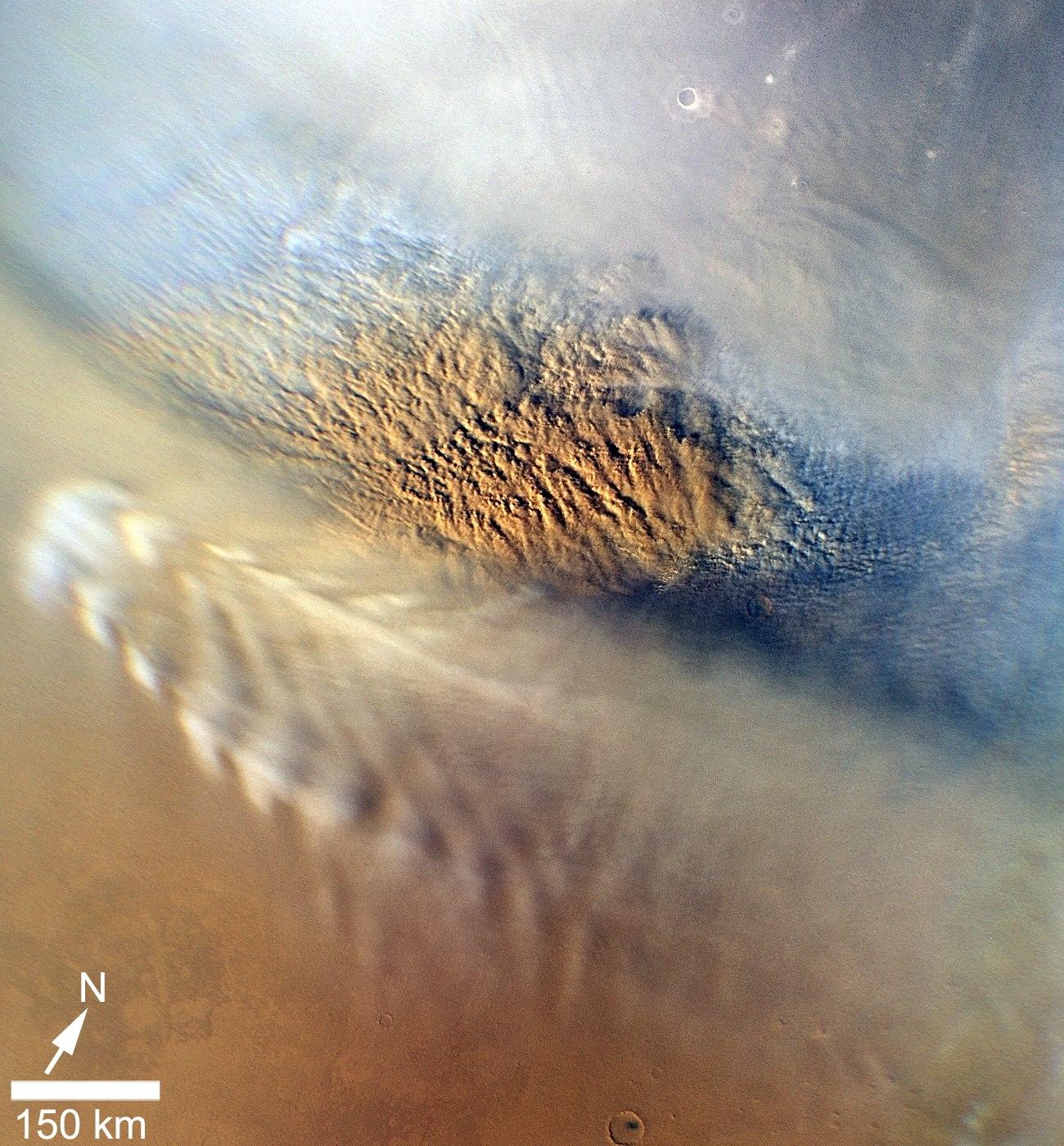
Martian Dust Storm
Full Resolution:
TIFF
(5.462 MB)
JPEG
(402.9 kB)
|
|
|
2012-08-04 |
Mars
|
Mars Reconnaissance Orbiter (MRO)
Mars Science Laboratory (MSL)
|
MARCI
|
3258x1817x3 |

|
-
PIA15962:
-
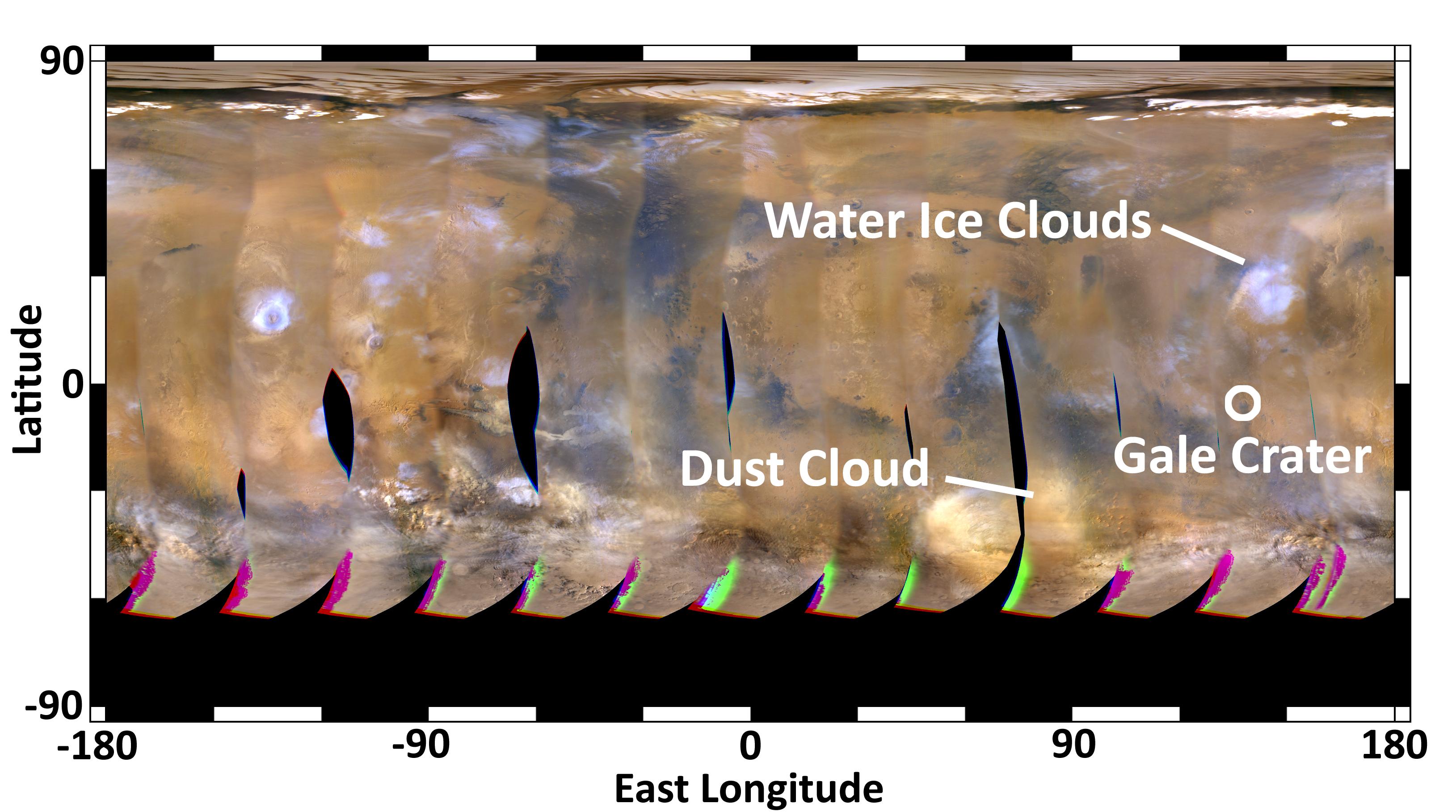
Mars Weather Map, Aug. 2, 2012
Full Resolution:
TIFF
(17.77 MB)
JPEG
(500.2 kB)
|
|
|
2012-08-04 |
Mars
|
Mars Reconnaissance Orbiter (MRO)
Mars Science Laboratory (MSL)
|
MARCI
|
3258x1817x3 |
|
-
PIA15963:
-
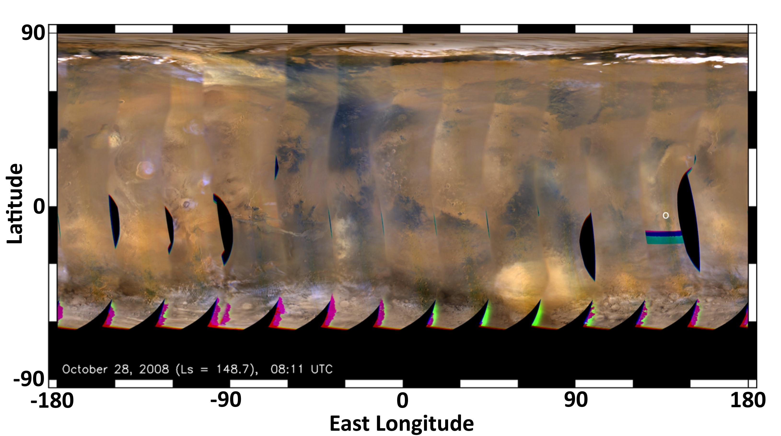
Mars Weather Map, 2008
Full Resolution:
TIFF
(17.77 MB)
JPEG
(354 kB)
|
|
|
2012-08-05 |
Mars
|
Mars Reconnaissance Orbiter (MRO)
Mars Science Laboratory (MSL)
|
MARCI
|
3258x1817x3 |
|
-
PIA15968:
-
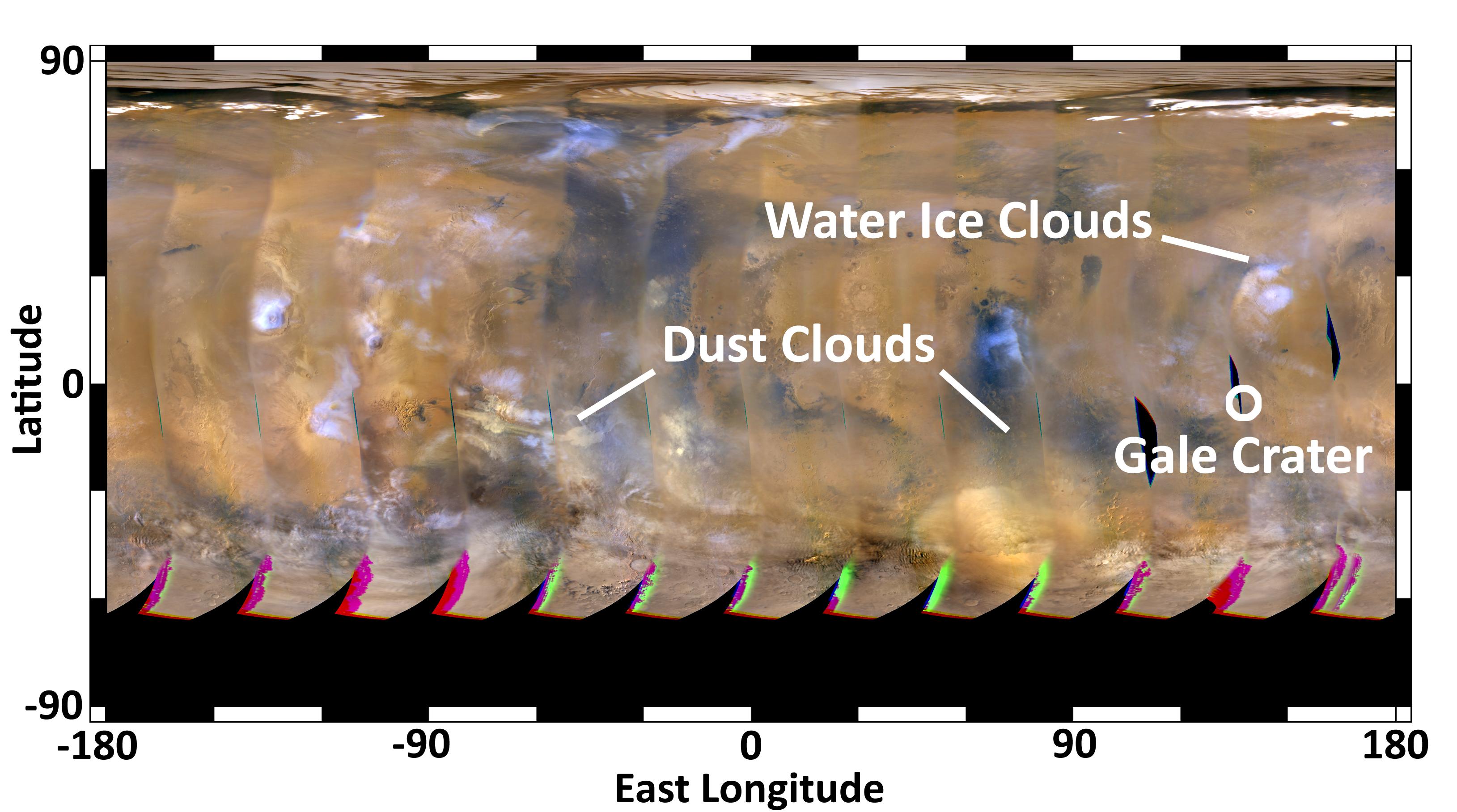
Mars Weather Map, Aug. 4, 2012
Full Resolution:
TIFF
(17.77 MB)
JPEG
(485.6 kB)
|
|
|
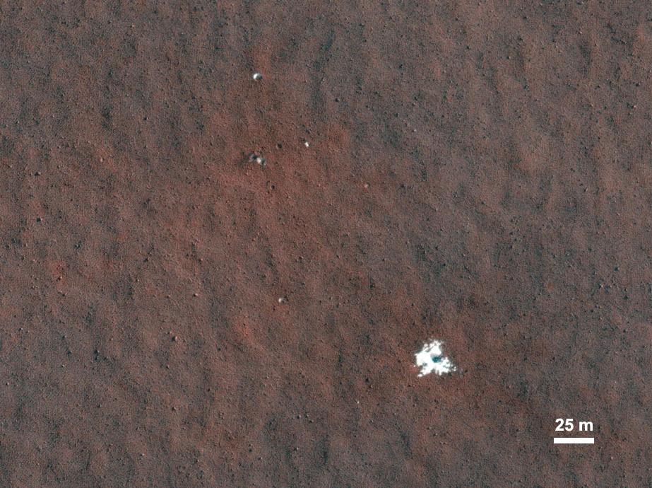
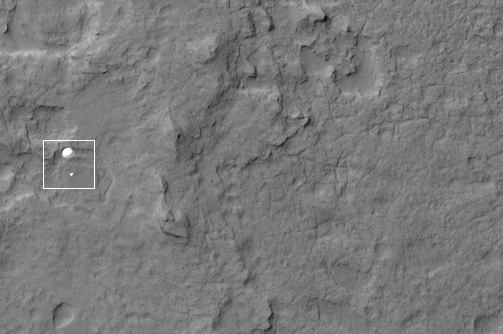
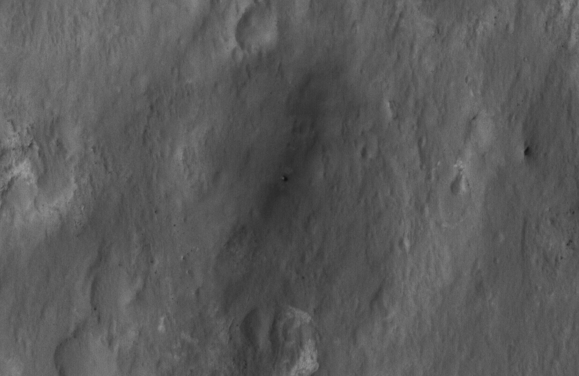
2012-08-06 |
Mars
|
Mars Reconnaissance Orbiter (MRO)
Mars Science Laboratory (MSL)
|
HiRISE
|
911x601x1 |
|
-
PIA15978:
-
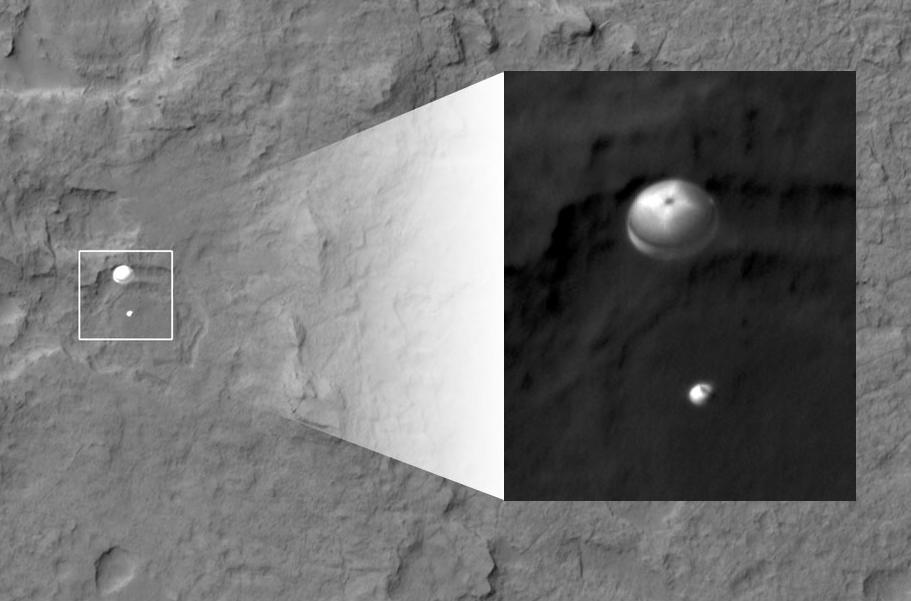
Curiosity Spotted on Parachute by Orbiter
Full Resolution:
TIFF
(548.3 kB)
JPEG
(51.73 kB)
|
|
|
2012-08-06 |
Mars
|
Mars Reconnaissance Orbiter (MRO)
Mars Science Laboratory (MSL)
|
HiRISE
|
176x215x1 |
|
-
PIA15979:
-
Curiosity Spotted on Parachute by Orbiter
Full Resolution:
TIFF
(38.1 kB)
JPEG
(2.85 kB)
|
|
|
2012-08-06 |
Mars
|
Mars Reconnaissance Orbiter (MRO)
Mars Science Laboratory (MSL)
|
HiRISE
|
2047x1357x1 |
|
-
PIA15980:
-
Curiosity Spotted on Parachute by Orbiter
Full Resolution:
TIFF
(2.781 MB)
JPEG
(251.3 kB)
|
|
|
2012-08-06 |
Mars
|
Mars Reconnaissance Orbiter (MRO)
Mars Science Laboratory (MSL)
|
HiRISE
|
2048x9645x1 |
|
-
PIA15983:
-
Curiosity Flying Over Mars
Full Resolution:
TIFF
(19.77 MB)
JPEG
(2.527 MB)
|
|
|
2012-08-07 |
Mars
|
Mars Reconnaissance Orbiter (MRO)
Mars Science Laboratory (MSL)
|
HiRISE
|
2000x1300x1 |
|
-
PIA15997:
-
Final Resting Spot for Curiosity's Heat Shield
Full Resolution:
TIFF
(2.603 MB)
JPEG
(270.9 kB)
|
|
|
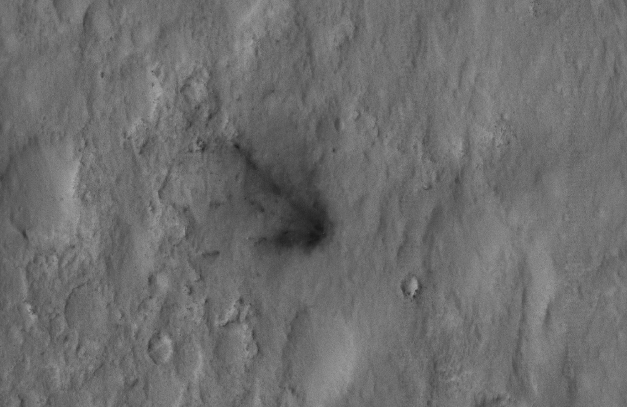
2012-08-07 |
Mars
|
Mars Reconnaissance Orbiter (MRO)
Mars Science Laboratory (MSL)
|
HiRISE
|
882x996x1 |

|
-
PIA15998:
-
Evidence of a Job Well Done
Full Resolution:
TIFF
(879.6 kB)
JPEG
(59.95 kB)
|
|
|
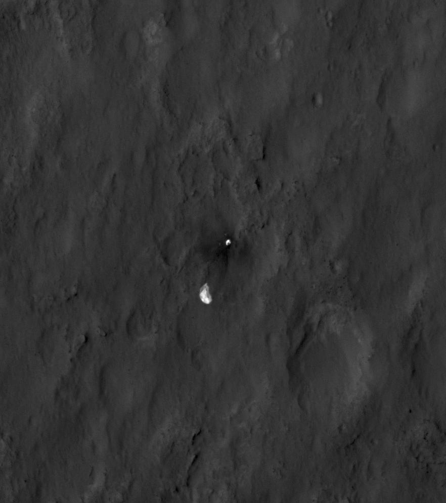
2012-08-07 |
Mars
|
Mars Reconnaissance Orbiter (MRO)
Mars Science Laboratory (MSL)
|
HiRISE
|
2000x1300x1 |

|
-
PIA15999:
-
Signs of the Sky Crane's Impact
Full Resolution:
TIFF
(2.603 MB)
JPEG
(282.5 kB)
|
|
|
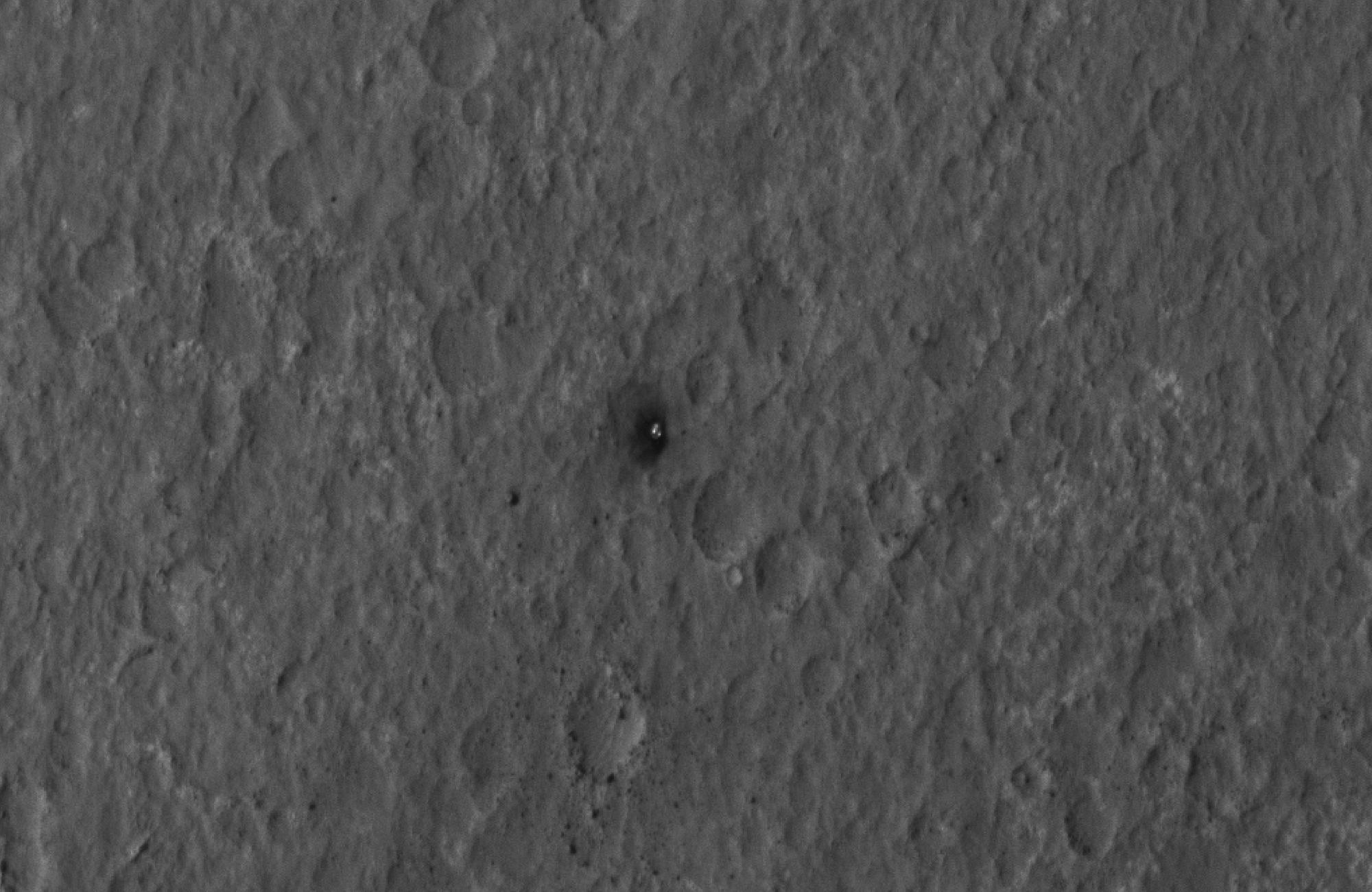
2012-08-07 |
Mars
|
Mars Reconnaissance Orbiter (MRO)
Mars Science Laboratory (MSL)
|
HiRISE
|
2000x1300x1 |
|
-
PIA16000:
-
Curiosity Spotted!
Full Resolution:
TIFF
(2.603 MB)
JPEG
(249.2 kB)
|
|
|
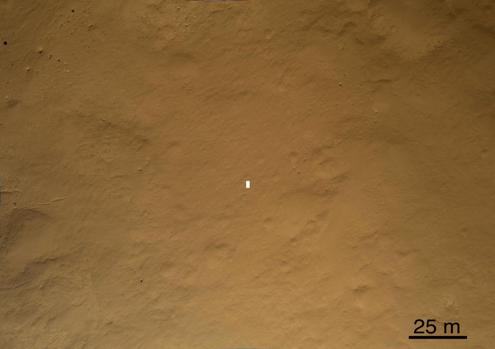
2012-08-08 |
Mars
|
Mars Reconnaissance Orbiter (MRO)
Mars Science Laboratory (MSL)
|
CTX
|
1709x1193x1 |
|
-
PIA16014:
-
Before and After Curiosity's Touchdown
Full Resolution:
TIFF
(2.041 MB)
JPEG
(305.4 kB)
|
|
|
2012-08-08 |
Mars
|
Mars Reconnaissance Orbiter (MRO)
Mars Science Laboratory (MSL)
|
CTX
|
758x511x1 |

|
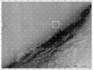
-
PIA16015:
-
Ballasts Hitting the Surface, Close-Up (with arrows)
Full Resolution:
TIFF
(388 kB)
JPEG
(58.05 kB)
|
|
|
2012-08-08 |
Mars
|
Mars Reconnaissance Orbiter (MRO)
Mars Science Laboratory (MSL)
|
CTX
|
758x511x1 |
|
-
PIA16016:
-
Ballasts Hitting the Surface, Close-Up
Full Resolution:
TIFF
(388 kB)
JPEG
(58 kB)
|
|
|
2012-08-08 |
Mars
|
Mars Reconnaissance Orbiter (MRO)
Mars Science Laboratory (MSL)
|
HiRISE
MARDI
|
1665x1174x3 |
|
-
PIA16019:
-
A Better Look of the Martian Surface
Full Resolution:
TIFF
(5.867 MB)
JPEG
(153.7 kB)
|
|
|
2012-08-09 |
Mars
|
Mars Reconnaissance Orbiter (MRO)
Mars Science Laboratory (MSL)
|
HiRISE
|
724x720x1 |
|
-
PIA16030:
-
Curiosity's Quad
Full Resolution:
TIFF
(522 kB)
JPEG
(63.57 kB)
|
|
|
2012-08-09 |
Mars
|
Mars Reconnaissance Orbiter (MRO)
Mars Science Laboratory (MSL)
|
HiRISE
|
862x650x3 |
|
-
PIA16031:
-
Staking out Curiosity's Landing Site
Full Resolution:
TIFF
(1.682 MB)
JPEG
(99.91 kB)
|
|
|
2012-08-10 |
Mars
|
Mars Reconnaissance Orbiter (MRO)
Mars Science Laboratory (MSL)
|
MARCI
|
1449x1087x3 |
|
-
PIA16037:
-
Mars Weather Map, Aug. 5
Full Resolution:
TIFF
(4.727 MB)
JPEG
(123.9 kB)
|
|
|
2012-08-14 |
Mars
|
Mars Reconnaissance Orbiter (MRO)
Mars Science Laboratory (MSL)
|
HiRISE
|
1511x13401x3 |
|
-
PIA16056:
-
A Whole New World for Curiosity
Full Resolution:
TIFF
(60.77 MB)
JPEG
(2.358 MB)
|
|
|
2012-08-14 |
Mars
|
Mars Reconnaissance Orbiter (MRO)
Mars Science Laboratory (MSL)
|
HiRISE
|
3022x2515x3 |
|
-
PIA16057:
-
Curiosity in Exaggerated Color
Full Resolution:
TIFF
(22.81 MB)
JPEG
(1.151 MB)
|
|
|
2012-08-31 |
Mars
|
Mars Reconnaissance Orbiter (MRO)
Mars Science Laboratory (MSL)
|
HiRISE
|
2800x1800x1 |
|
-
PIA15696:
-
Orbiter View of Curiosity From Nearly Straight Overhead
Full Resolution:
TIFF
(5.047 MB)
JPEG
(578.1 kB)
|
|
|
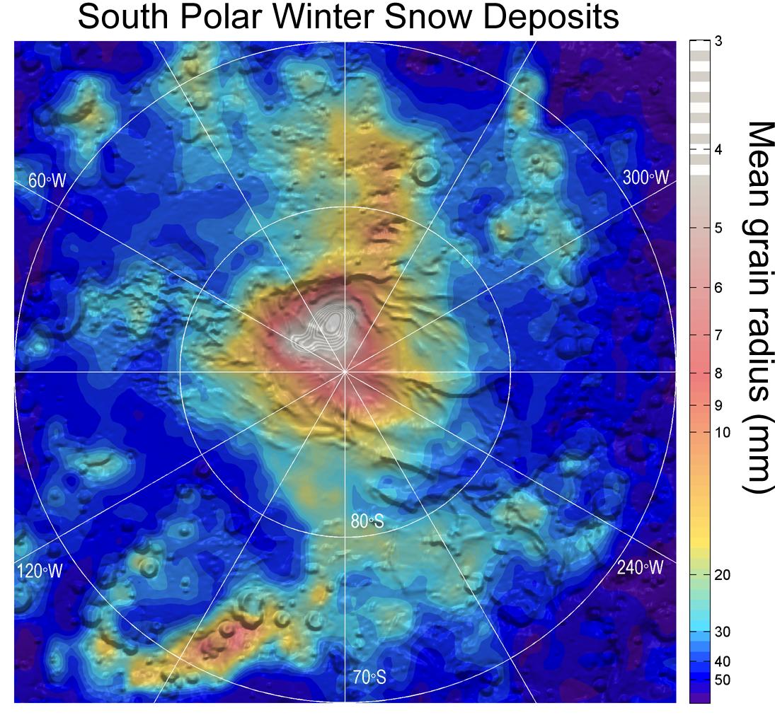
2012-09-11 |
Mars
|
Mars Reconnaissance Orbiter (MRO)
|
MCS
|
1095x1018x3 |

|
-
PIA16138:
-
Carbon-Dioxide Snowfall on Mars
Full Resolution:
TIFF
(3.346 MB)
JPEG
(184.6 kB)
|
|
|
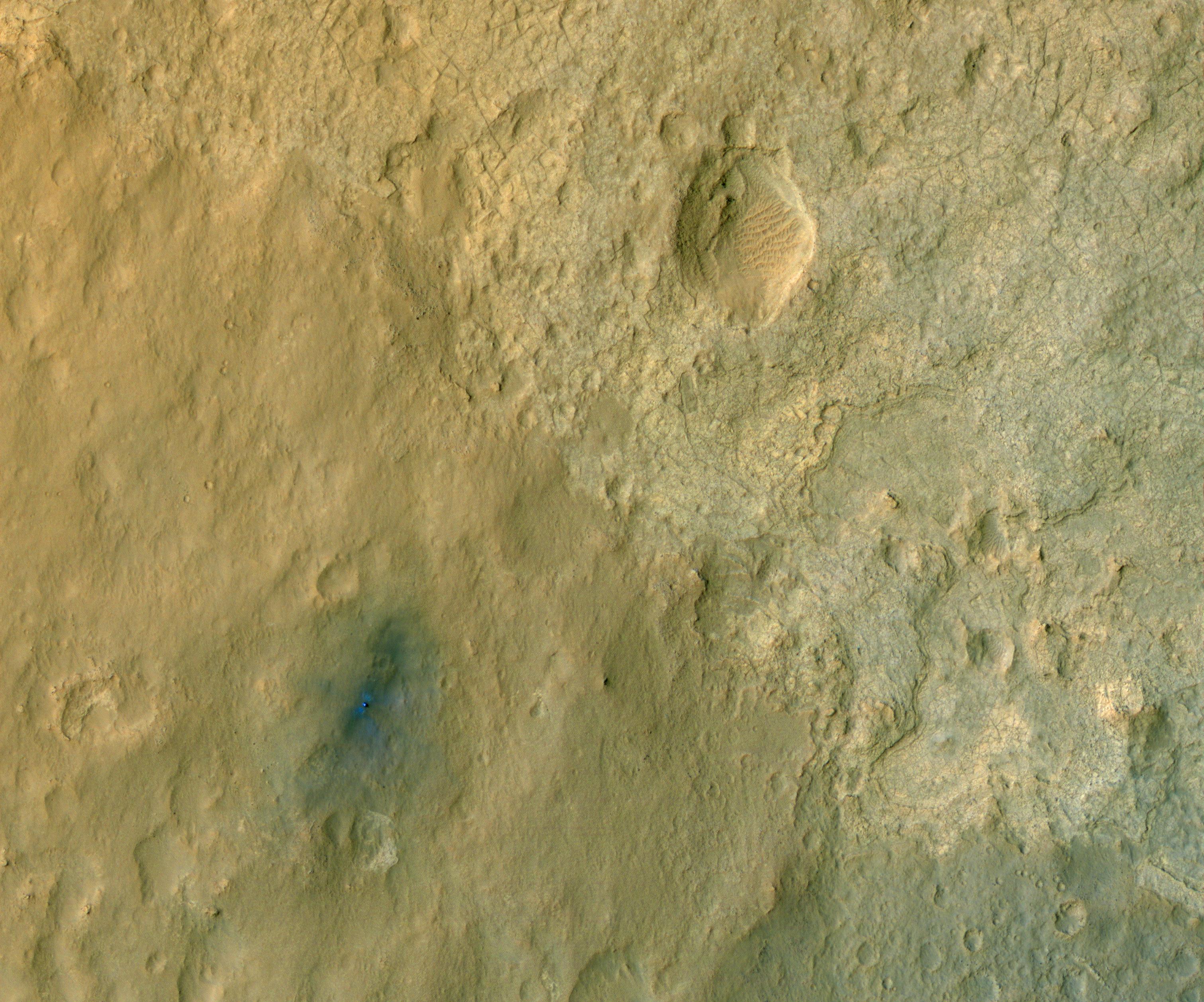
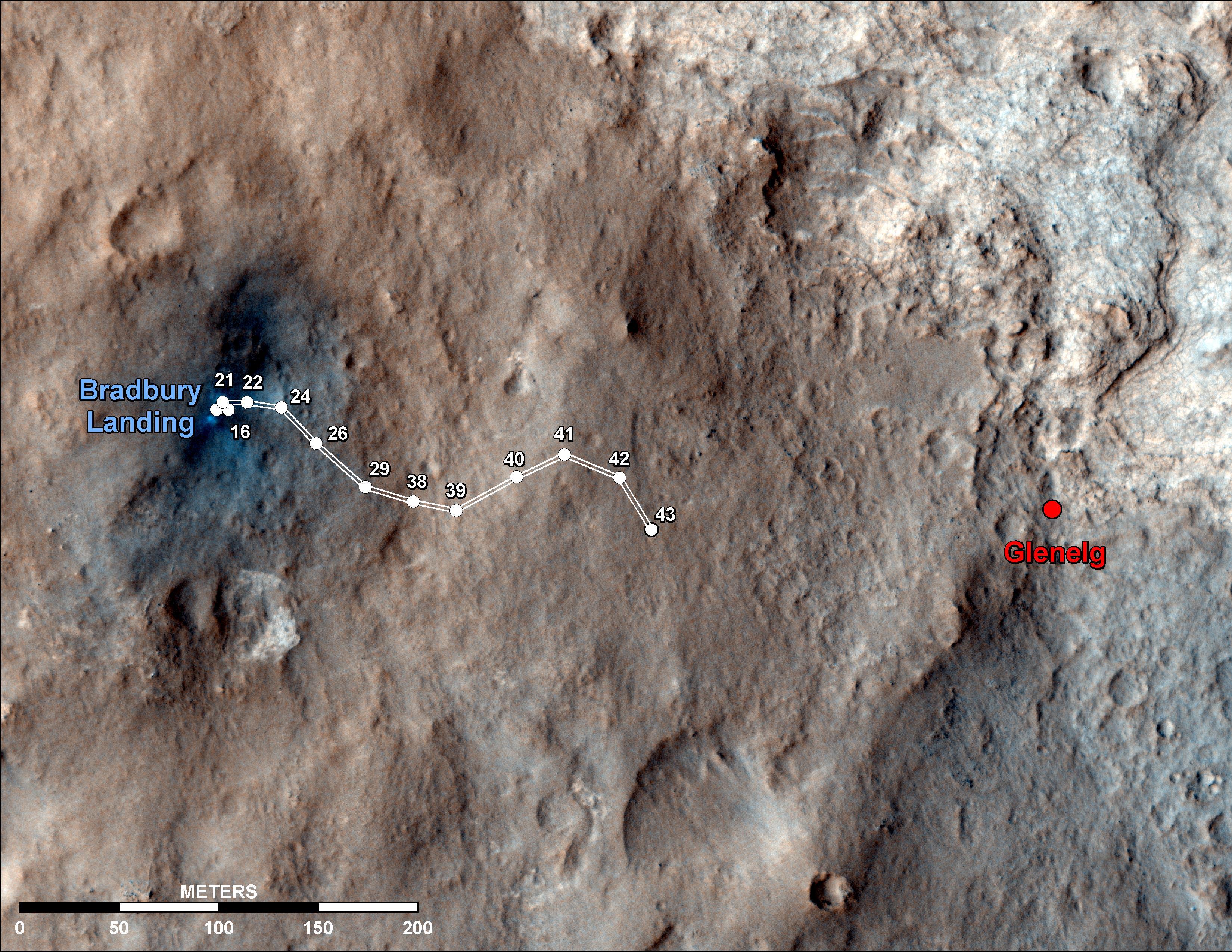
2012-09-19 |
Mars
|
Mars Reconnaissance Orbiter (MRO)
Mars Science Laboratory (MSL)
|
HiRISE
|
3300x2550x3 |
|
-
PIA16153:
-
Curiosity Traverse Map Through Sol 43
Full Resolution:
TIFF
(25.26 MB)
JPEG
(1.57 MB)
|
|
|
2012-09-20 |
Vesta
|
Dawn
Mars Reconnaissance Orbiter (MRO)
|
Framing Camera
HiRISE
|
2535x840x1 |
|
-
PIA16185:
-
Pitted Terrain on Mars and Vesta
Full Resolution:
TIFF
(2.132 MB)
JPEG
(388.1 kB)
|


