|
Your search criteria found 10 images |
| My List |
Addition Date | Target | Mission |
Instrument
|
Size |

|
2024-04-16 | Mars |
Mars Helicopter |
8256x5504x3 | |

|
|||||
|
|
2024-04-17 | Mars |
Mars Helicopter |
8256x5504x3 | |

|
|||||
|
|
2024-04-17 | Mars |
Mars Helicopter |
8256x5504x3 | |

|
|||||
|
|
2024-04-17 | Mars |
Mars Helicopter |
8256x5504x3 | |

|
|||||
|
|
2024-04-17 | Mars |
Mars Helicopter |
8256x5504x3 | |

|
|||||
|
|
2024-04-17 | Io |
Juno |
JunoCam |
2296x2296x3 |
|
|||||
|
|
2024-04-18 | Io |
Juno |
JunoCam |
1070x450x3 |
|
|||||
|
|
2024-04-18 | Io |
Juno |
JunoCam |
1059x452x3 |

|
|||||
|
|
2024-04-18 | Jupiter |
Juno |
JunoCam |
1734x623x3 |
|
|||||
|
|
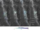
2024-04-15 | Earth |
SWOT |
KaRIn |
1440x1090x3 |
|
|||||
| Currently displaying images: 1 - 10 of 10 |