Your search criteria found
1894
images
Mission
Go to PIAxxxxx:
Refine this list of images by:
Target:
Earth
Jupiter
Mars
Phobos
Spacecraft:
Mars Global Surveyor Orbiter
Mars Pathfinder Lander
Opportunity
Phoenix Mars Lander
Spirit
Instrument:
Magnetometer
Mars Horizon Sensor Assembly
Mars Orbiter Camera (MOC)
Mars Orbiter Laser Altimeter
Microscopic Imager
Miniature Thermal Emission Spectrometer
Navigation Camera
Panoramic Camera
Radar System
Radio Science Subsystem
Thermal Emission Spectrometer
Click on an image for detailed information
Click on a column heading to sort in ascending or descending order
My
List
Addition Date
Target
Mission
Instrument
Size
1999-08-26
Mars
Mars Global Surveyor (MGS)
Viking
1600x900x3
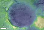
PIA02314:
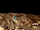
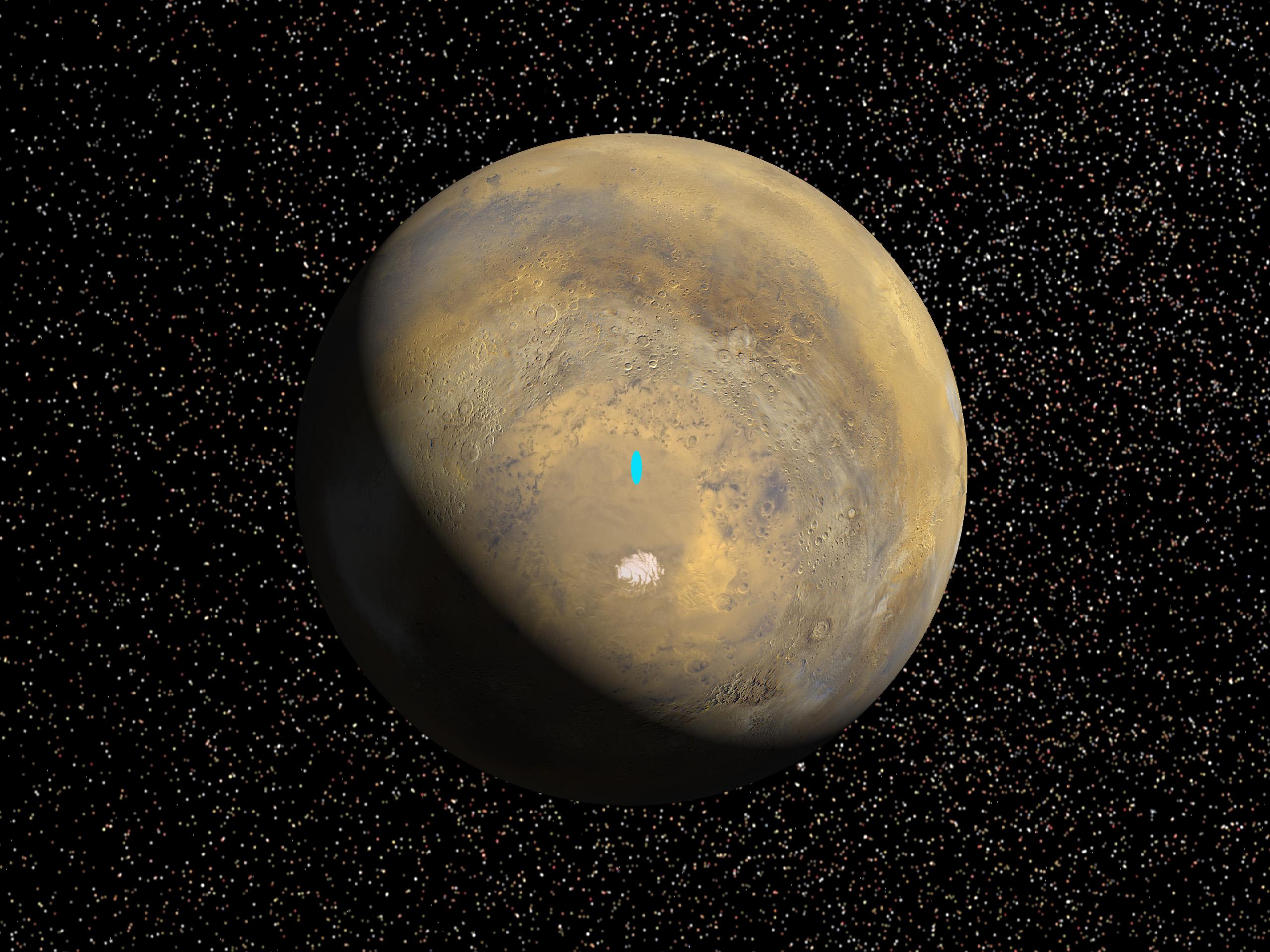
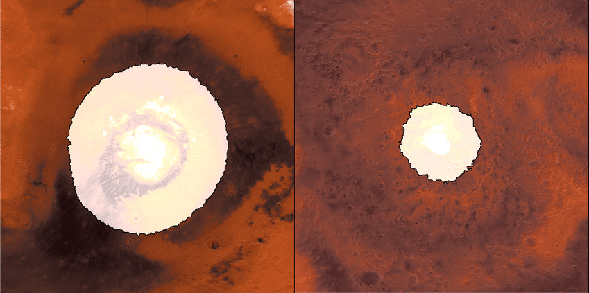
Proposed Mars Polar Lander Landing Site (Flat Map)
Full Resolution:
TIFF
(3.895 MB)
JPEG
(258.4 kB)
1999-08-26
Mars
Mars Global Surveyor (MGS)
Viking
2560x1920x3
PIA02315:
Proposed Mars Polar Lander Landing Site (Global Perspective)
Full Resolution:
TIFF
(7.41 MB)
JPEG
(513.2 kB)
1999-08-26
Mars
Mars Global Surveyor (MGS)
Viking
2560x1920x3
PIA02316:
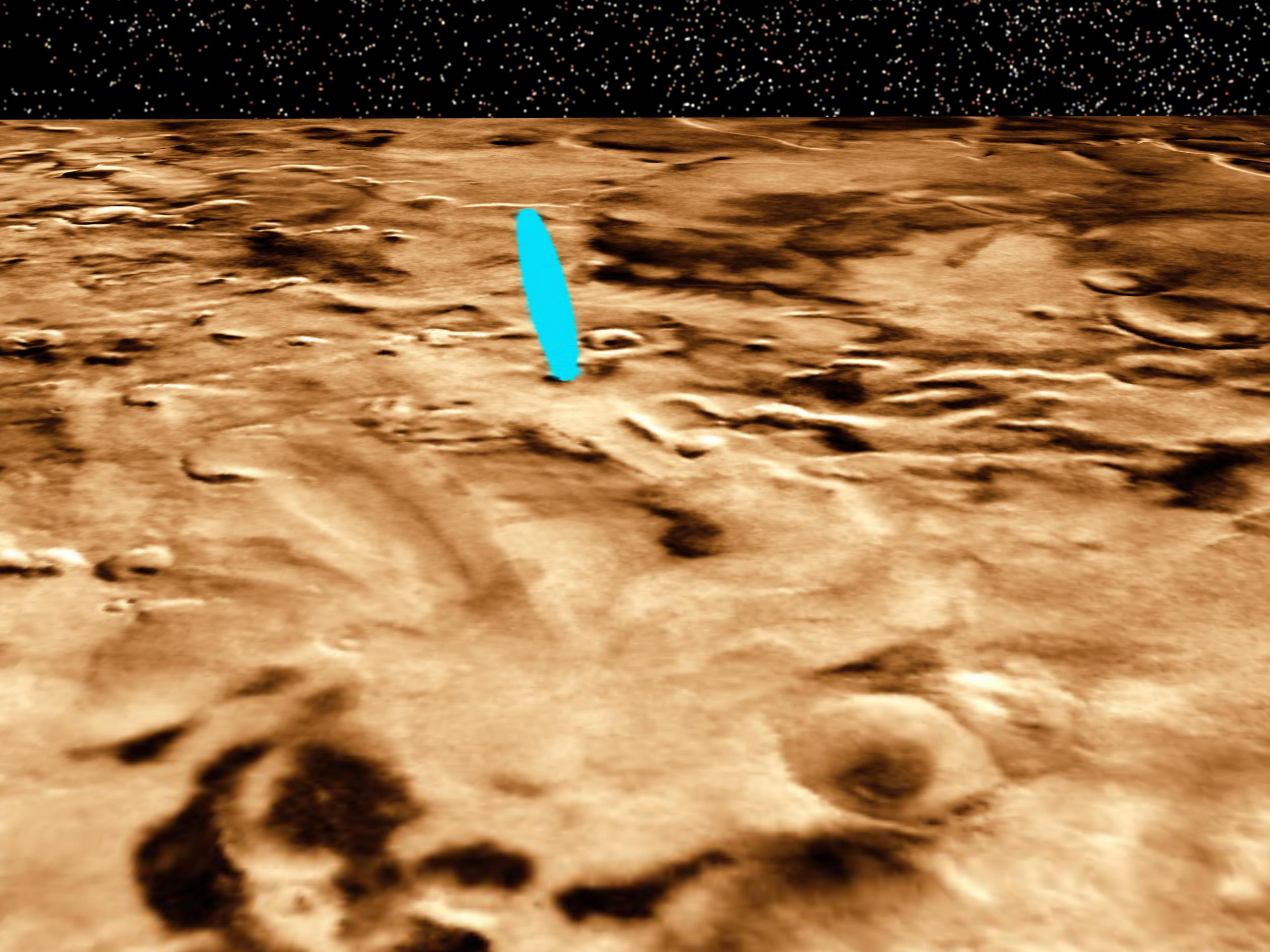
Proposed Mars Polar Lander Landing Site (Perspective View 1)
Full Resolution:
TIFF
(11.63 MB)
JPEG
(436.4 kB)
1999-08-26
Mars
Mars Global Surveyor (MGS)
Viking
2560x1920x3
PIA02317:
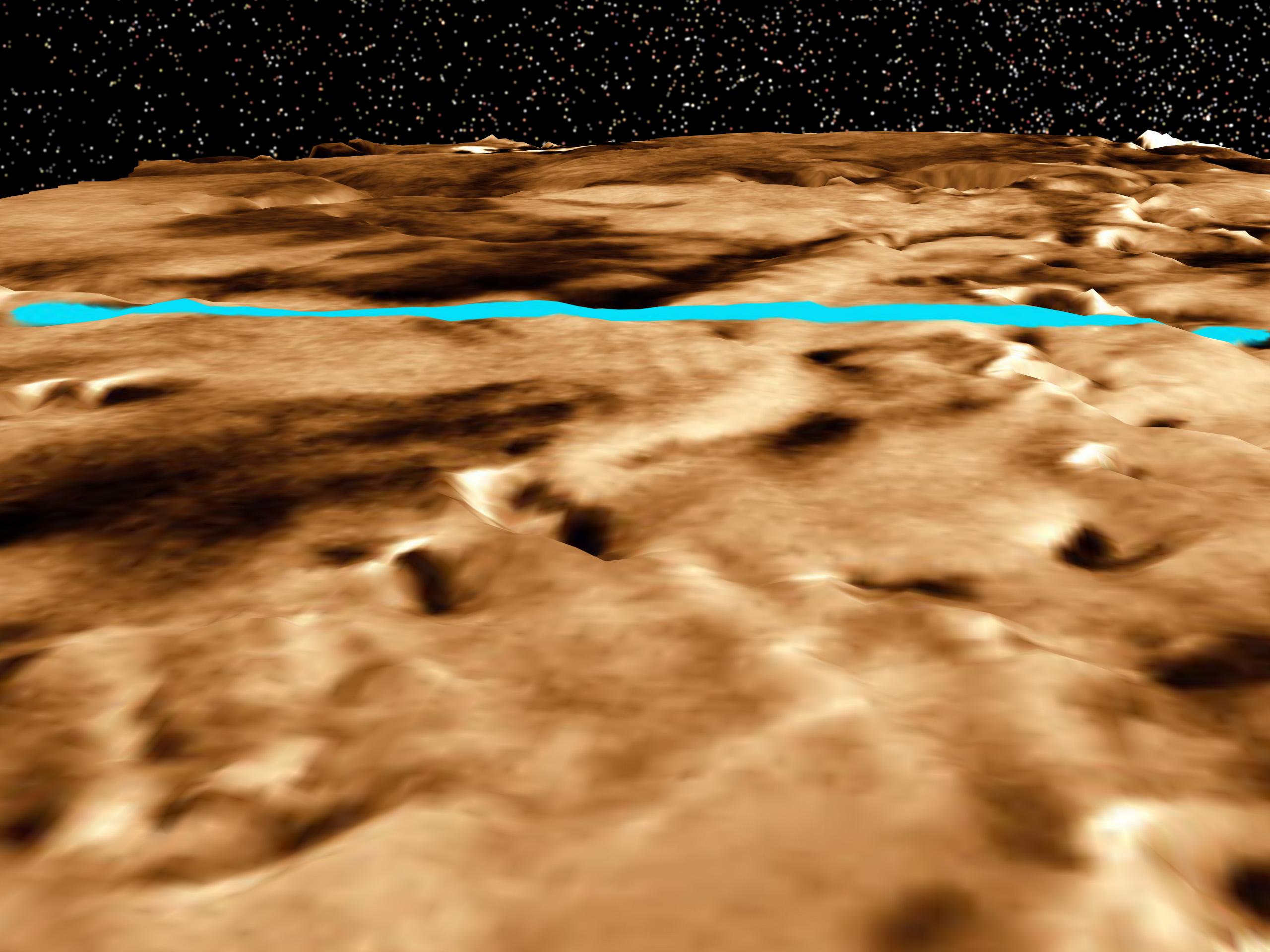
Proposed Mars Polar Lander Landing Site (Perspective View 2)
Full Resolution:
TIFF
(10.63 MB)
JPEG
(353 kB)
1999-08-26
Mars
Mars Global Surveyor (MGS)
Viking
1280x960x3
PIA02318:
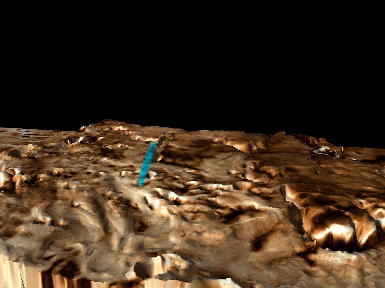
Proposed Mars Polar Lander Landing Site (Perspective View 3)
Full Resolution:
TIFF
(2.251 MB)
JPEG
(110.4 kB)
2001-01-17
Mars
Mars Global Surveyor (MGS)
4000x2769x3
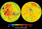
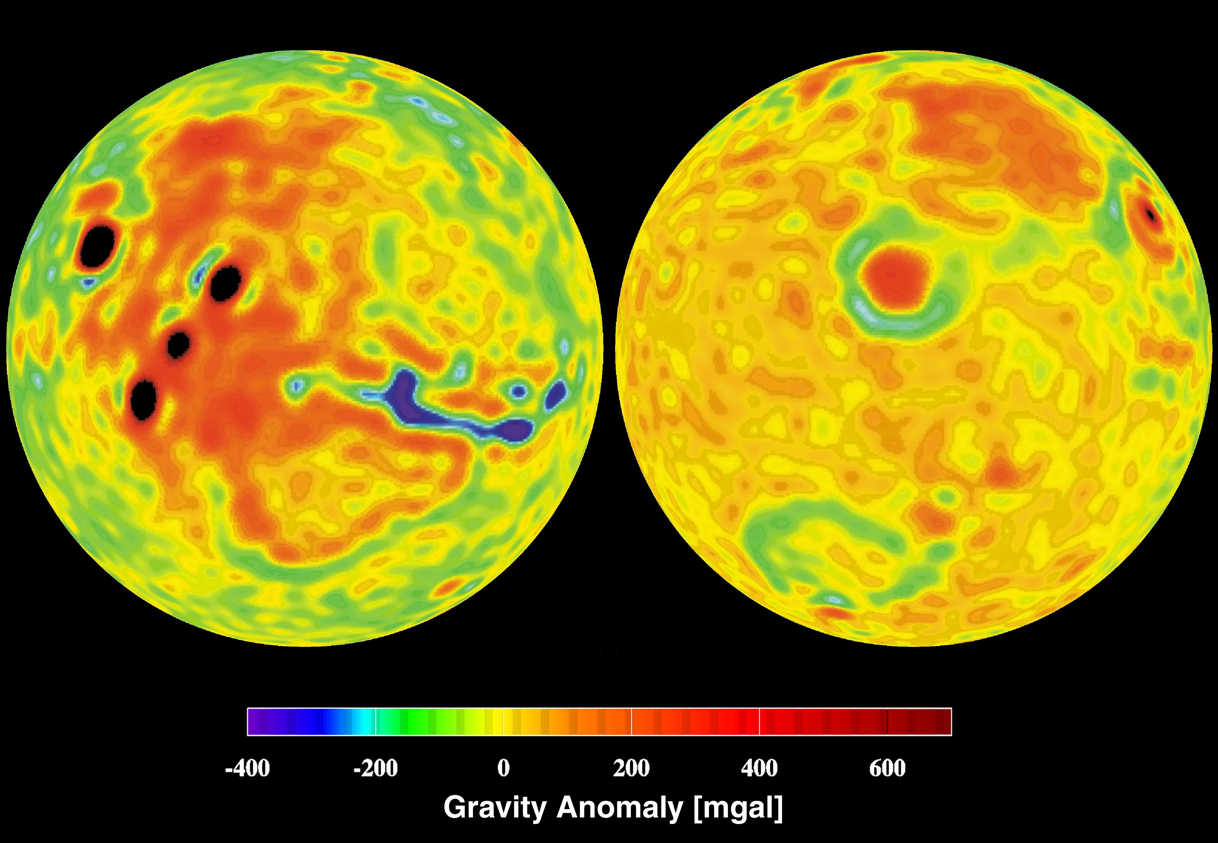
PIA02817:
Mars Gravity Anomoly Map
Full Resolution:
TIFF
(16.6 MB)
JPEG
(619.8 kB)
2010-01-27
Mars
Mars Global Surveyor (MGS)
6000x6958x3
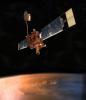
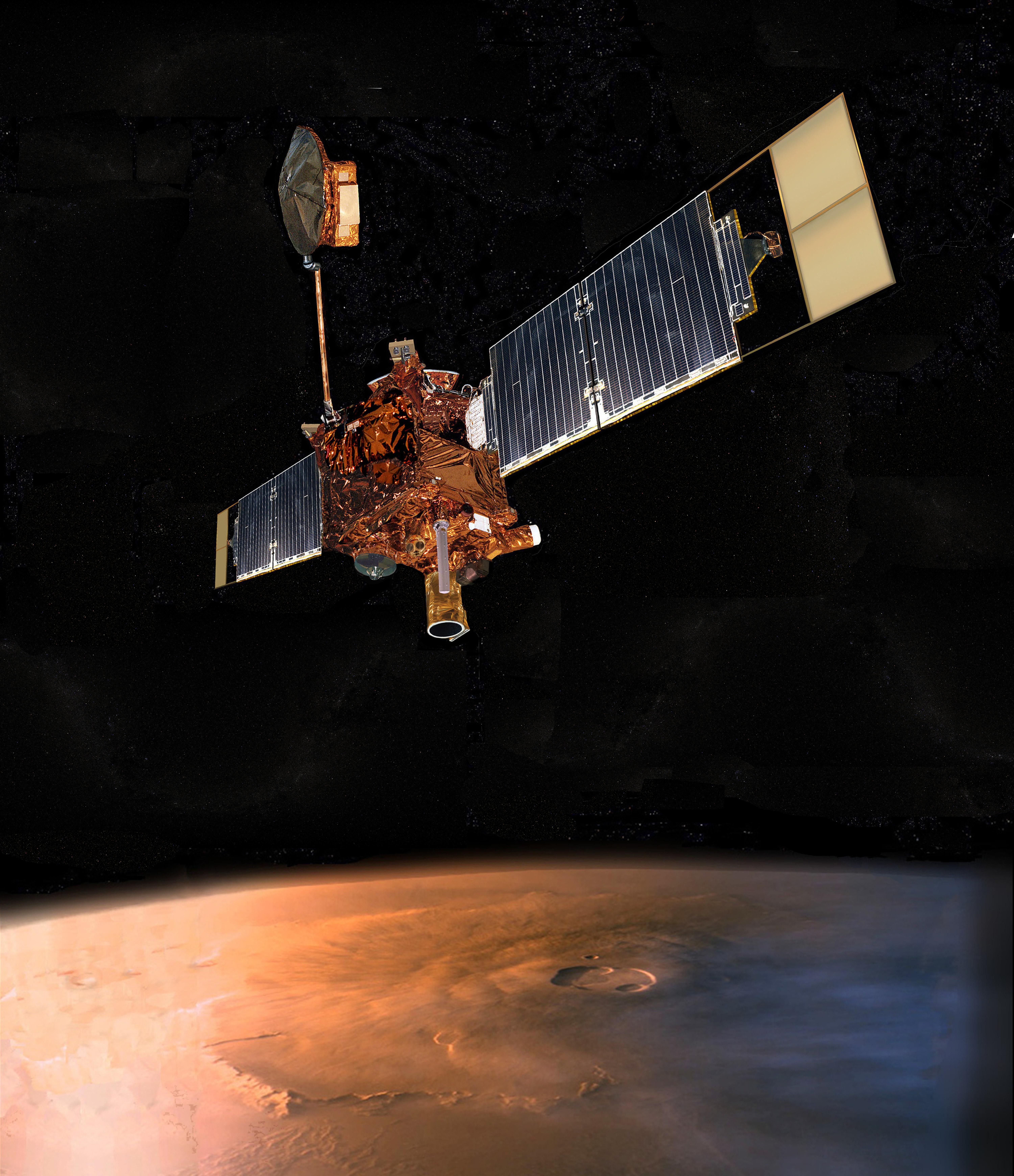
PIA17486:
Mars Global Surveyor (Artist's Concept)
Full Resolution:
TIFF
(125.3 MB)
JPEG
(4.604 MB)
2004-02-09
Mars
Mars Global Surveyor (MGS)
Mars Exploration Rover (MER)
5440x5400x3
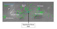
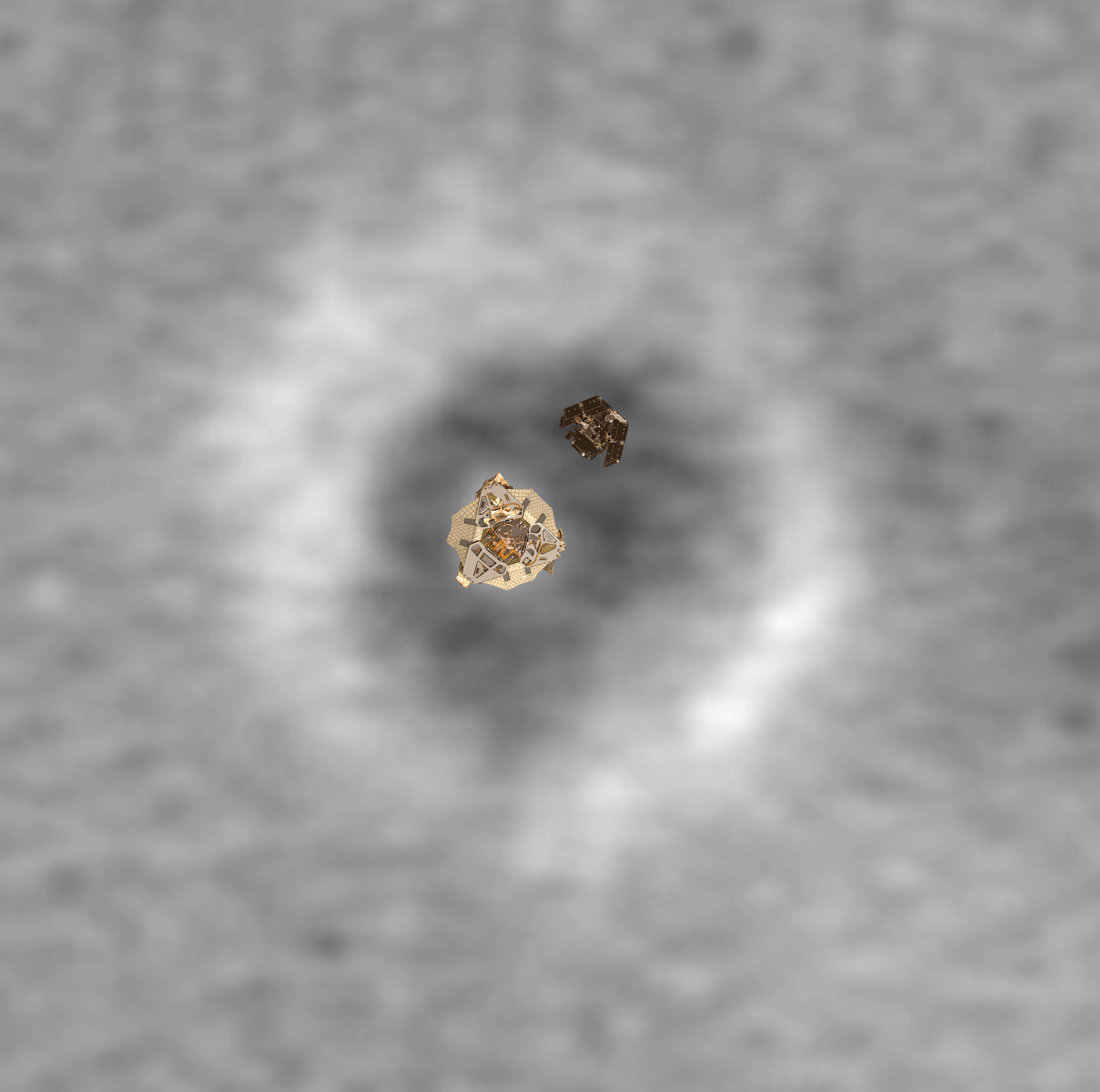
PIA05231:
Top View of a Computer Graphic Model of the Opportunity Lander and Rover
Full Resolution:
TIFF
(12.76 MB)
JPEG
(723 kB)
2010-12-16
Mars
Mars Express (MEX)
Mars Global Surveyor (MGS)
Mars Reconnaissance Orbiter (MRO)
Altimeter
CRISM
Visible and Infrared Mineralogical Mapping Spectrometer
2999x1515x3
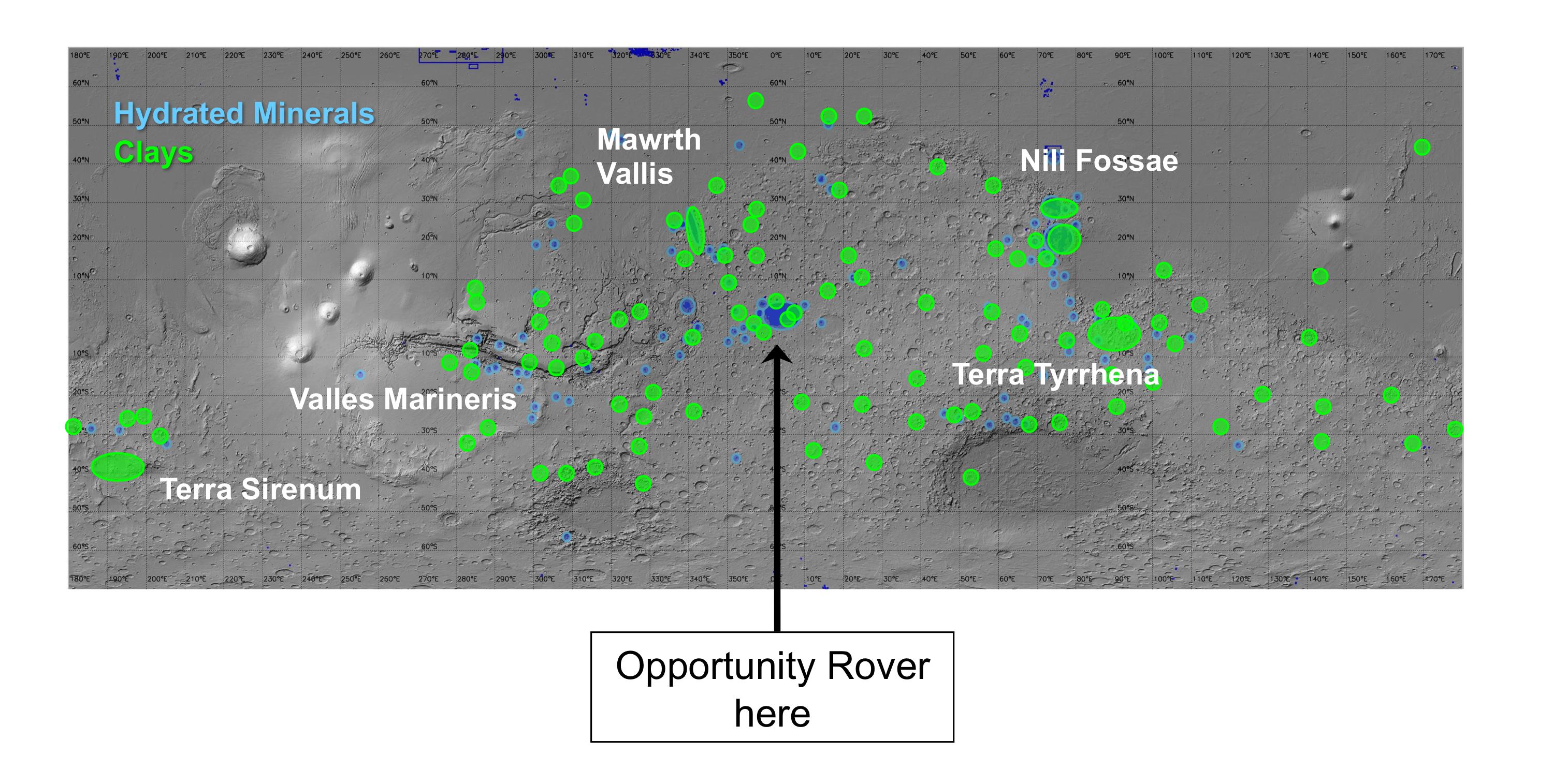
PIA13703:
Regions of Mars with Clays and Hydrated Minerals Identified from Orbit
Full Resolution:
TIFF
(13.63 MB)
JPEG
(581.5 kB)
2019-11-12
Mars
Mars Reconnaissance Orbiter (MRO)
Mars Express (MEX)
Mars Global Surveyor (MGS)
CRISM
CTX
MOLA
High Resolution Stereo Camera
3663x2535x3
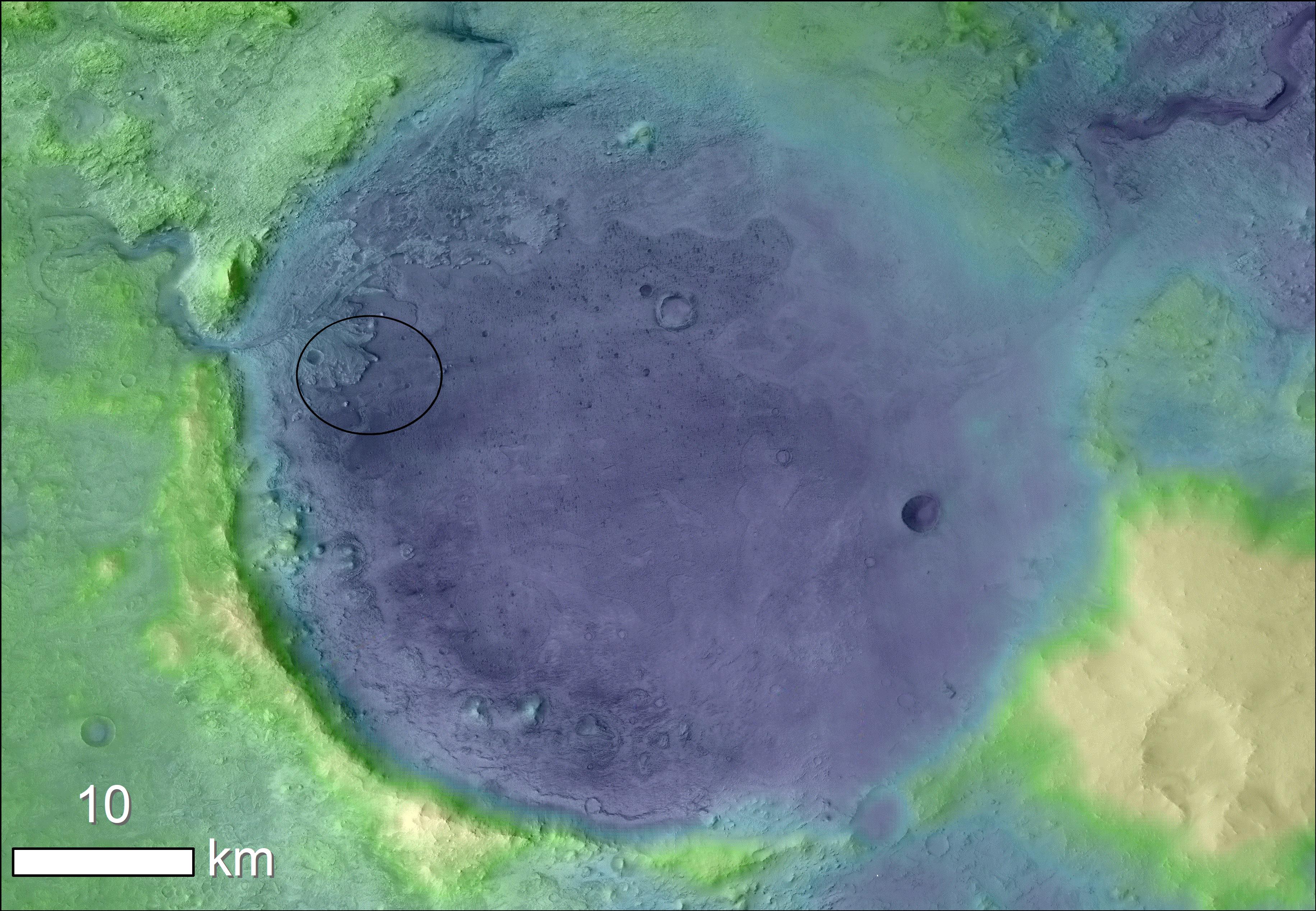
PIA23511:
Jezero Crater's Ancient Lakeshore
Full Resolution:
TIFF
(16.31 MB)
JPEG
(2.37 MB)
2006-10-16
Mars
Mars Global Surveyor (MGS)
Mars Reconnaissance Orbiter (MRO)
CTX
Mars Color Imager (MARCI)
2219x2219x3
PIA01929:
Map of Context Camera's North Polar Coverage During Checkout
Full Resolution:
TIFF
(14.79 MB)
JPEG
(408.2 kB)
2006-04-13
Mars
Mars Global Surveyor (MGS)
Mars Reconnaissance Orbiter (MRO)
CTX
Mars Orbiter Camera
5056x5222x1
PIA08068:
First Context Camera Image of Mars
Full Resolution:
TIFF
(26.44 MB)
JPEG
(1.394 MB)
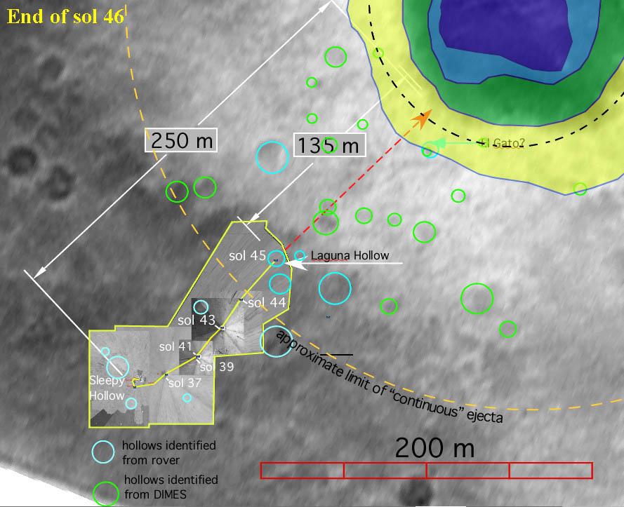
2004-01-13
Mars
Mars Global Surveyor (MGS)
Mars Exploration Rover (MER)
Descent Image Motion Estimation System (DIMES)
Mars Orbiter Camera (MOC)
2996x4584x3
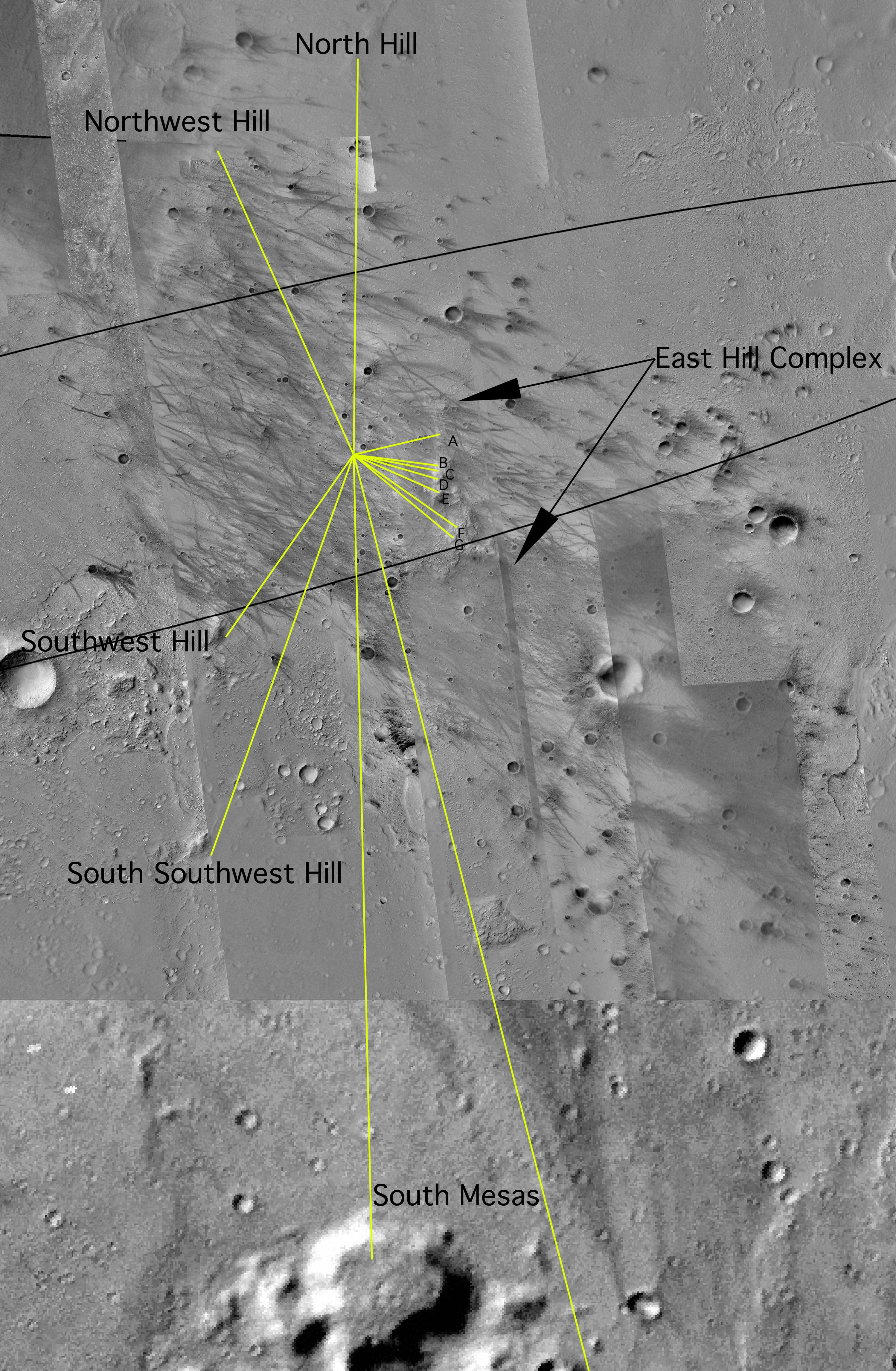
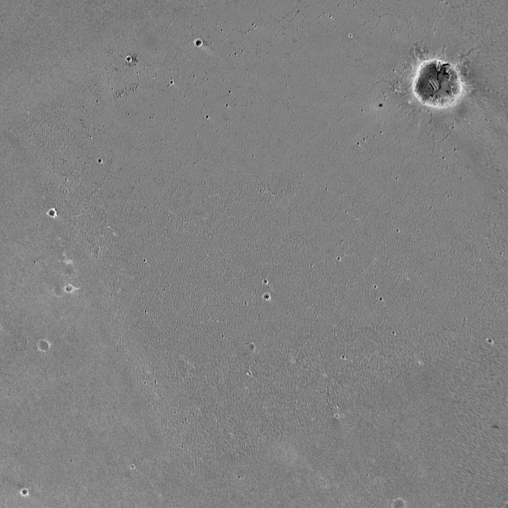
PIA05059:
Map of Hills on the Horizon
Full Resolution:
TIFF
(19.24 MB)
JPEG
(2.046 MB)
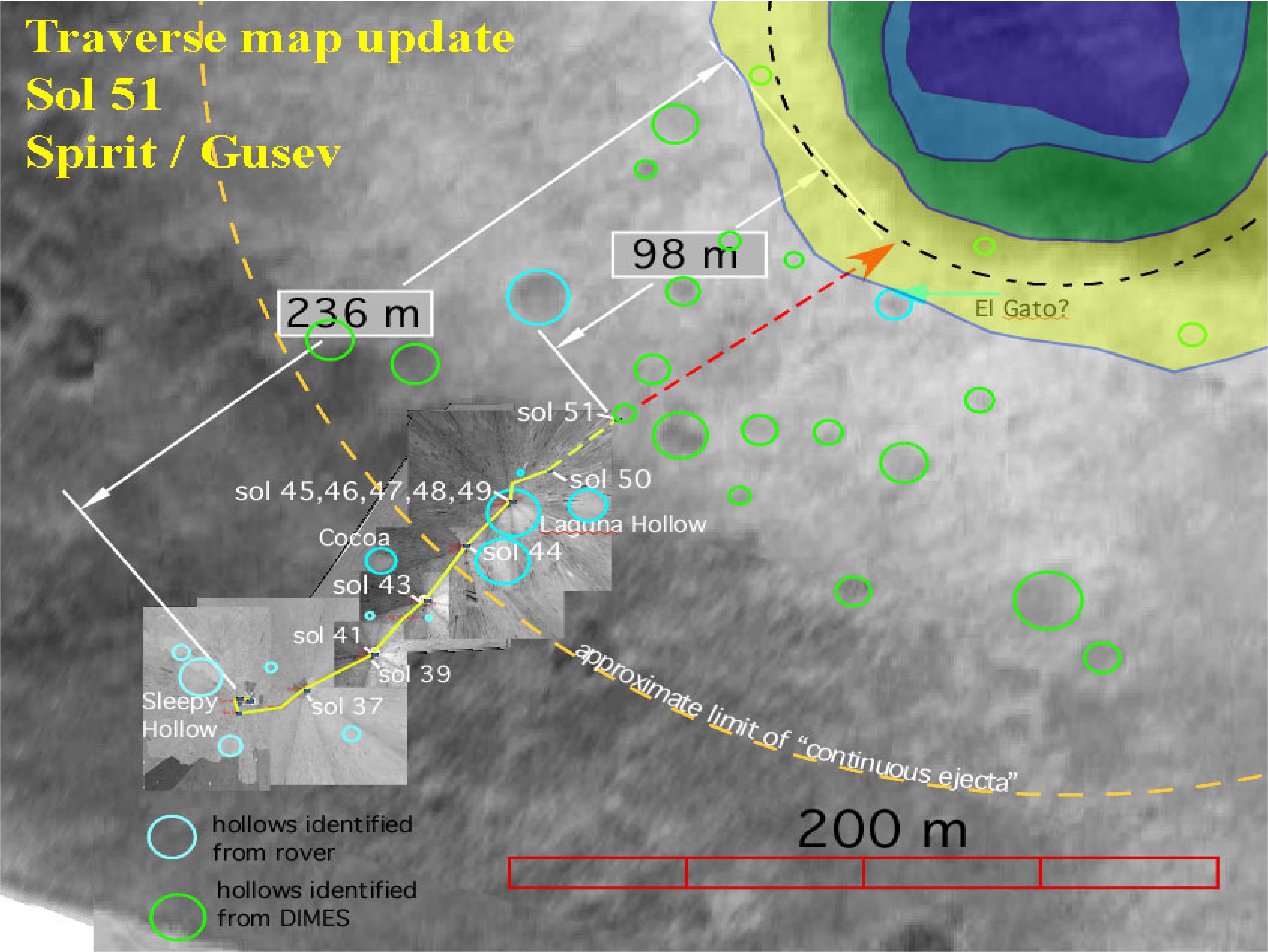
2004-01-28
Mars
Mars Global Surveyor (MGS)
Mars Exploration Rover (MER)
Descent Image Motion Estimation System (DIMES)
Mars Orbiter Camera (MOC)
1700x1700x1
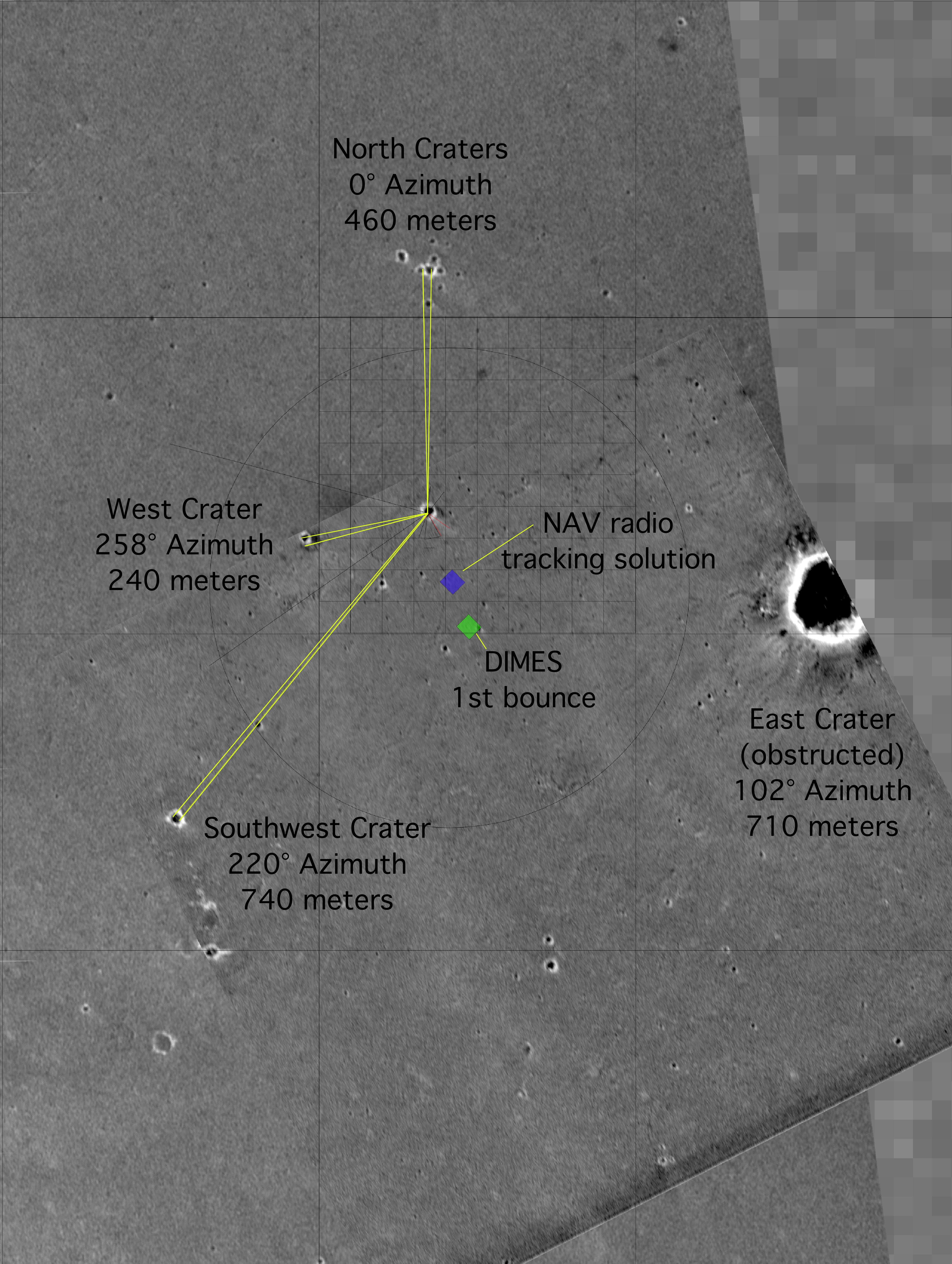
PIA05165:
Challenger Memorial Station, Meridiani Planum, Mars
Full Resolution:
TIFF
(2.513 MB)
JPEG
(403.8 kB)
2004-02-19
Mars
Mars Global Surveyor (MGS)
Mars Exploration Rover (MER)
Descent Image Motion Estimation System (DIMES)
Mars Orbiter Camera (MOC)
889x723x3
PIA05329:
Halfway There
Full Resolution:
TIFF
(1.261 MB)
JPEG
(85.96 kB)
2004-02-26
Mars
Mars Global Surveyor (MGS)
Mars Exploration Rover (MER)
Descent Image Motion Estimation System (DIMES)
Mars Orbiter Camera (MOC)
5760x4328x3
PIA05448:
Getting Closer
Full Resolution:
TIFF
(32 MB)
JPEG
(1.508 MB)
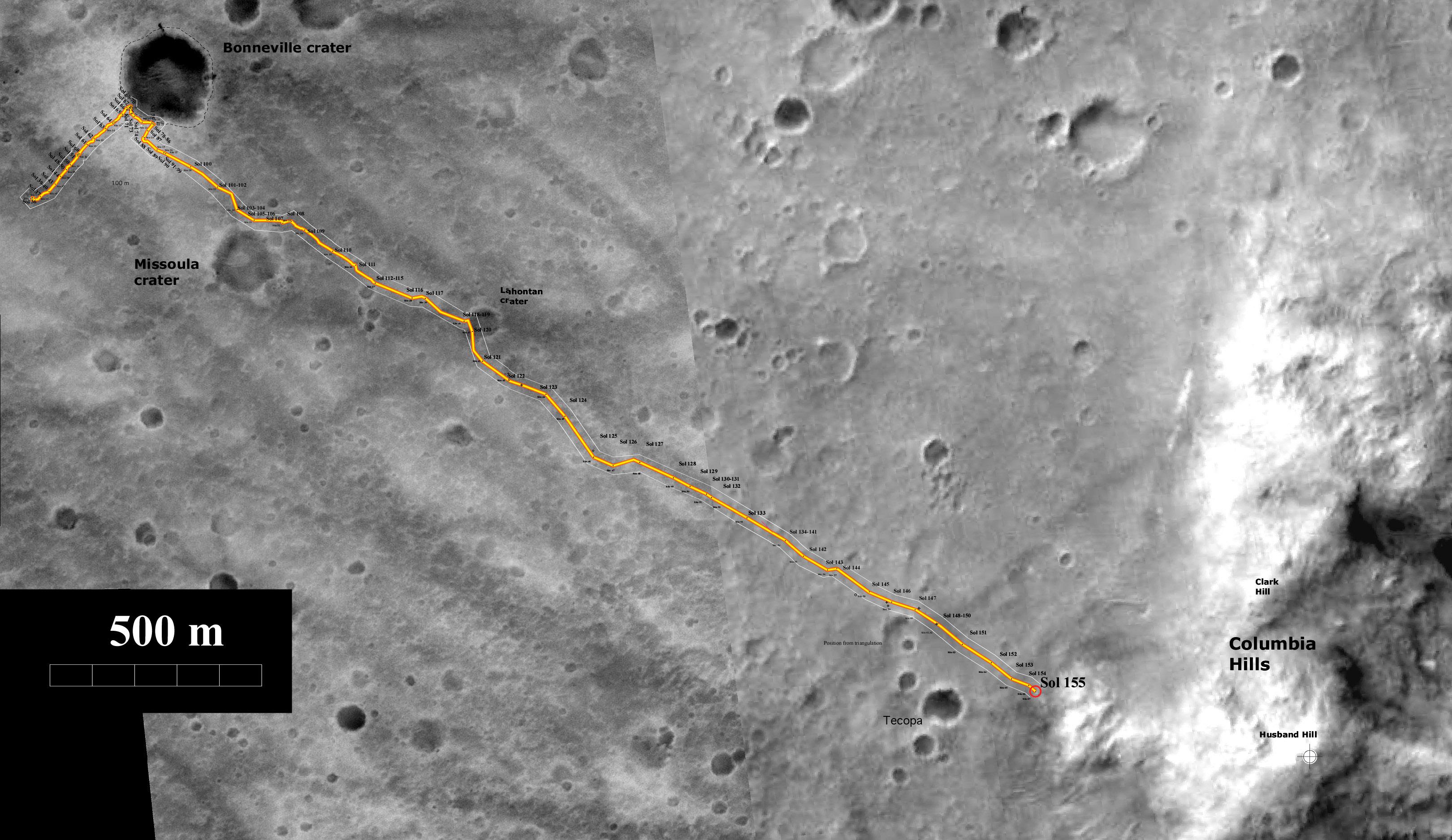
2004-06-15
Mars
Mars Global Surveyor (MGS)
Mars Exploration Rover (MER)
Descent Image Motion Estimation System (DIMES)
Mars Orbiter Camera (MOC)
3240x1875x3
PIA06269:
Spirit's Trip to the Hills
Full Resolution:
TIFF
(8.321 MB)
JPEG
(755.2 kB)
2004-06-03
Mars
Mars Global Surveyor (MGS)
Mars Exploration Rover (MER)
Descent Image Motion Estimation System (DIMES)
Mars Orbiter Camera (MOC)
Navigation Camera
Panoramic Camera
4004x4000x1
PIA06020:
Endurance Road Map
Full Resolution:
TIFF
(7.341 MB)
JPEG
(811.3 kB)
2004-01-23
Mars
Mars Global Surveyor (MGS)
Mars Exploration Rover (MER)
Descent Image Motion Estimation System (DIMES)
Mars Orbiter Camera (MOC)
Panoramic Camera
640x480x1
PIA05131:
Spirit Lightens the Load
Full Resolution:
TIFF
(302.4 kB)
JPEG
(32.79 kB)
2004-02-09
Mars
2001 Mars Odyssey
Mars Global Surveyor (MGS)
Mars Exploration Rover (MER)
Descent Image Motion Estimation System (DIMES)
Mars Orbiter Camera (MOC)
Thermal Emission Imaging System
4000x5308x3
PIA05228:
"X" Marks the Spot
Full Resolution:
TIFF
(11.63 MB)
JPEG
(2.084 MB)
2005-03-30
Mars
Mars Exploration Rover (MER)
Mars Global Surveyor (MGS)
2001 Mars Odyssey
Descent Image Motion Estimation System (DIMES)
Mars Orbiter Camera
Thermal Emission Imaging System
2392x1823x3
PIA07506:
Opportunity's Fast Progress Southward
Full Resolution:
TIFF
(5.086 MB)
JPEG
(406.4 kB)
2005-12-05
Mars
Mars Global Surveyor (MGS)
Mars Exploration Rover (MER)
2001 Mars Odyssey
Descent Image Motion Estimation System (DIMES)
Mars Orbiter Camera
Thermal Emission Imaging System
1415x2044x3
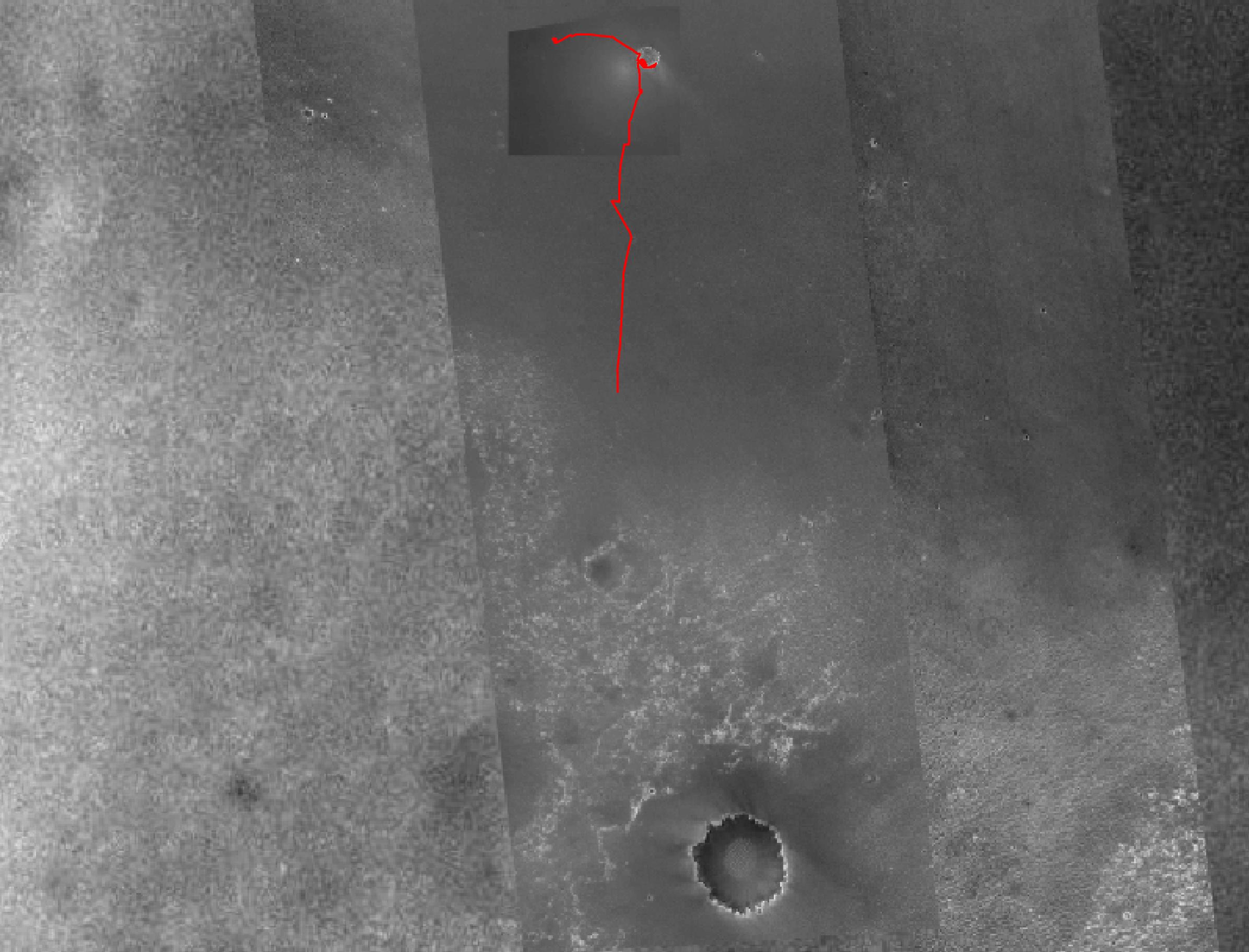
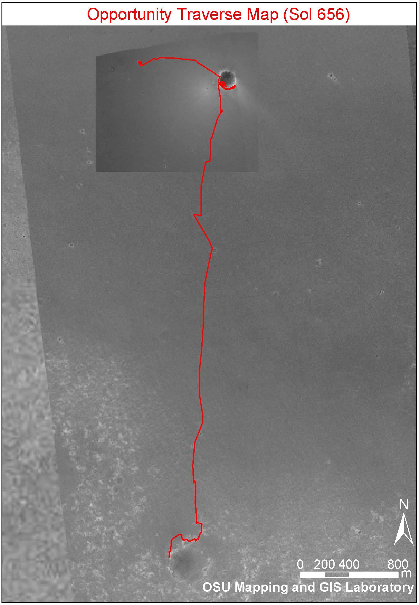
PIA03609:
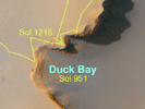
Opportunity Traverse Map, Sol 656
Full Resolution:
TIFF
(8.693 MB)
JPEG
(249.9 kB)
2005-12-05
Mars
2001 Mars Odyssey
Mars Global Surveyor (MGS)
Mars Exploration Rover (MER)
Descent Image Motion Estimation System (DIMES)
Mars Orbiter Camera
Thermal Emission Imaging System
1411x2043x3
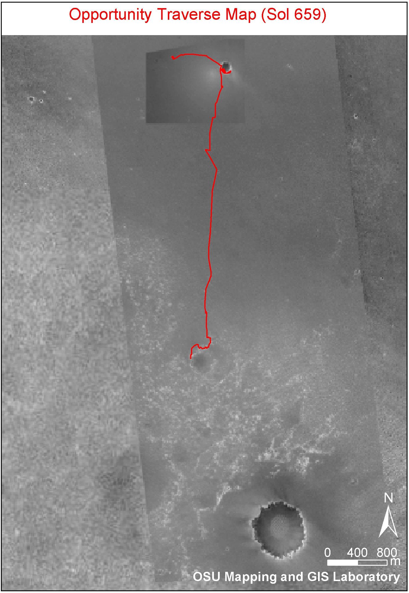
PIA03616:
Partway to 'Victoria'
Full Resolution:
TIFF
(8.665 MB)
JPEG
(265.7 kB)
2004-02-18
Mars
Mars Global Surveyor (MGS)
Mars Exploration Rover (MER)
Hazcam
Mars Orbiter Camera (MOC)
Panoramic Camera
2014x1482x1
PIA05304:
Dragging Its Foot
Full Resolution:
TIFF
(2.505 MB)
JPEG
(202.4 kB)
2007-06-28
Mars
Mars Global Surveyor (MGS)
Mars Exploration Rover (MER)
Mars Reconnaissance Orbiter (MRO)
HiRISE
Mars Orbiter Camera (MOC)
636x479x3
PIA09689:
Opportunity's Long Road to Victoria (Animation)
Full Resolution:
TIFF
(915.1 kB)
JPEG
(31.22 kB)
2013-06-11
Mars
2001 Mars Odyssey
Mars Reconnaissance Orbiter (MRO)
Mars Global Surveyor (MGS)
HiRISE
Mars Orbiter Camera (MOC)
THEMIS
960x608x3
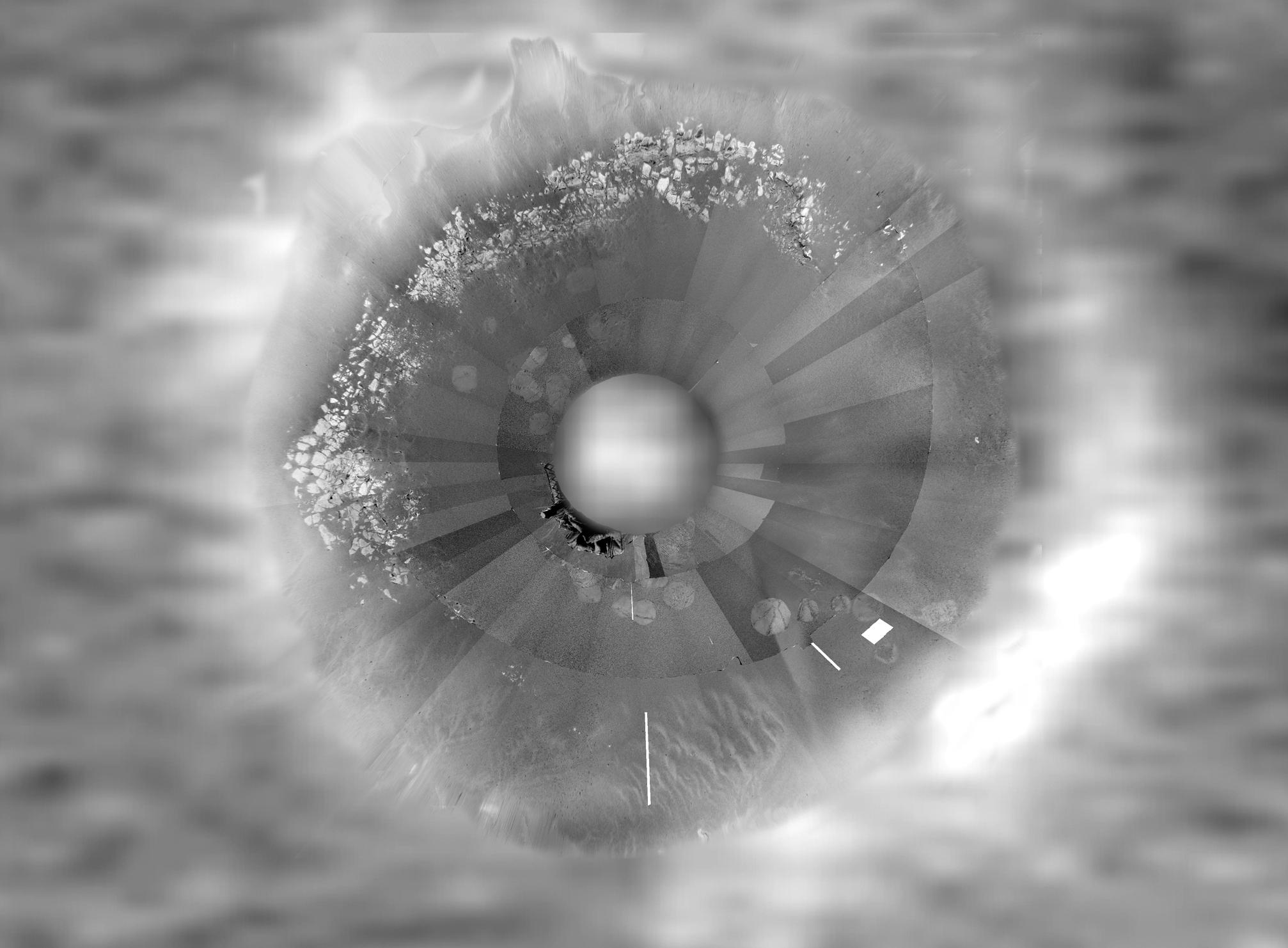
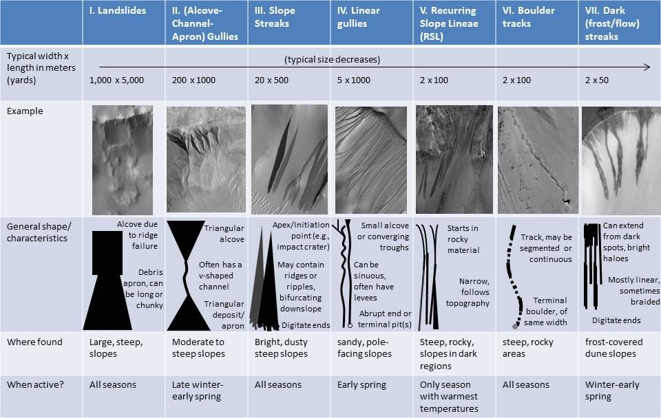
PIA17079:
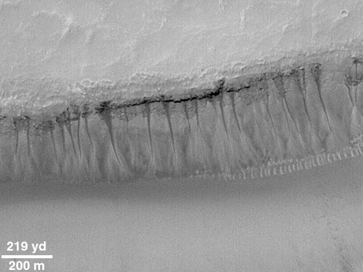
Martian Features Formed When Material Moves Downslope
Full Resolution:
TIFF
(1.752 MB)
JPEG
(100.9 kB)
1997-10-13
Mars
Mars Global Surveyor (MGS)
Magnetometer
762x609x3
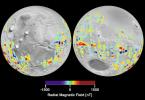
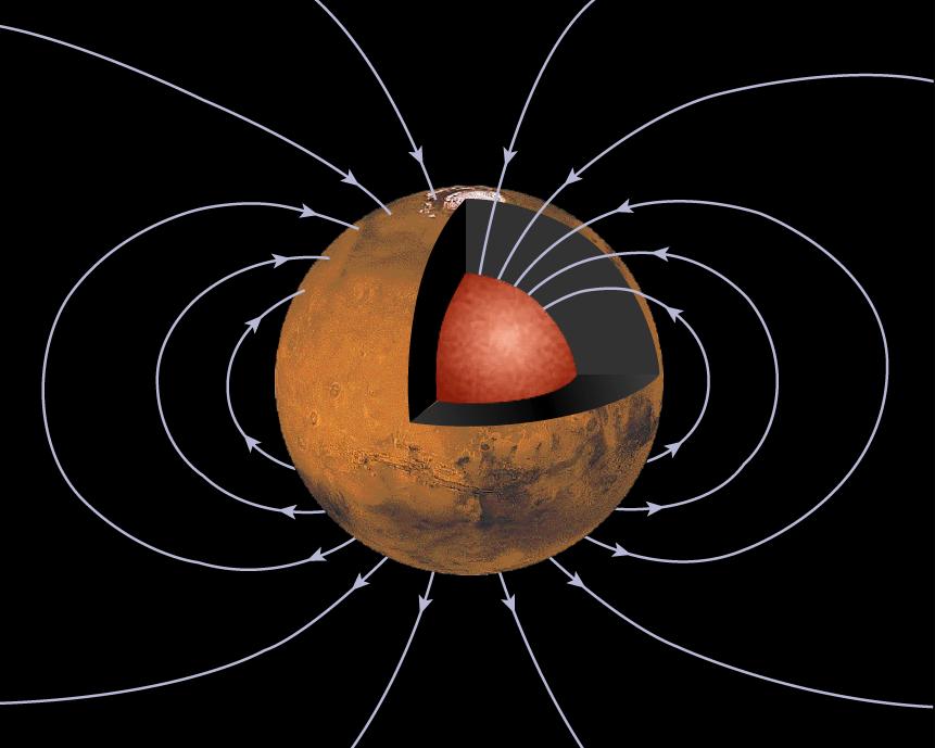
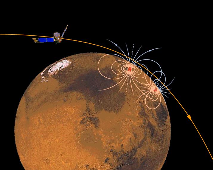
PIA00946:
Orientation and Magnitude of Mars' Magnetic Field
Full Resolution:
TIFF
(178.7 kB)
JPEG
(31.52 kB)
1997-10-13
Mars
Mars Global Surveyor (MGS)
Magnetometer
861x689x3
PIA00947:
Mars' Inner Core
Full Resolution:
TIFF
(232.6 kB)
JPEG
(51.04 kB)
1997-10-13
Mars
Mars Global Surveyor (MGS)
Magnetometer
905x723x3
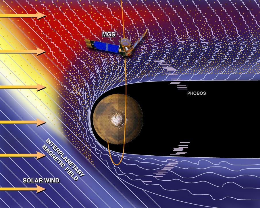
PIA00948:
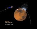
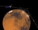
Mars and the Solar Wind
Full Resolution:
TIFF
(1.197 MB)
JPEG
(146.1 kB)
1997-10-13
Mars
Mars Global Surveyor (MGS)
Magnetometer
715x572x3
PIA00949:
Magnetic Sources in the Crust of Mars
Full Resolution:
TIFF
(360.8 kB)
JPEG
(50.93 kB)
1997-11-10
Mars
Mars Global Surveyor (MGS)
Magnetometer
996x746x3
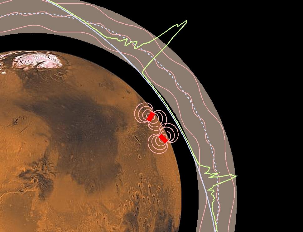
PIA01015:
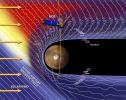
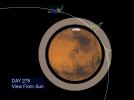
Martian Ionosphere
Full Resolution:
TIFF
(567.3 kB)
JPEG
(56.81 kB)
1997-11-10
Mars
Mars Global Surveyor (MGS)
Magnetometer
972x744x3
PIA01016:
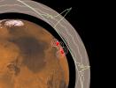
Magnetic Anomalies on Mars
Full Resolution:
TIFF
(1.073 MB)
JPEG
(78.09 kB)
1999-05-03
Mars
Mars Global Surveyor (MGS)
Magnetometer
1152x879x3
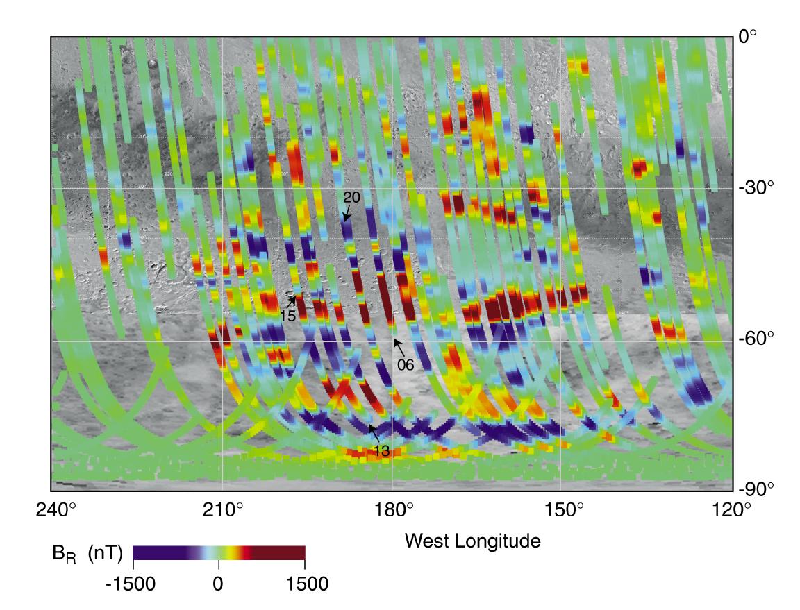
PIA02008:
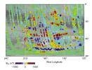
Magnetic Strips Preserve Record of Ancient Mars
Full Resolution:
TIFF
(1.369 MB)
JPEG
(147.9 kB)
1999-06-23
Mars
Mars Global Surveyor (MGS)
Magnetometer
1700x1144x3
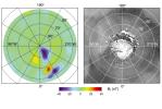
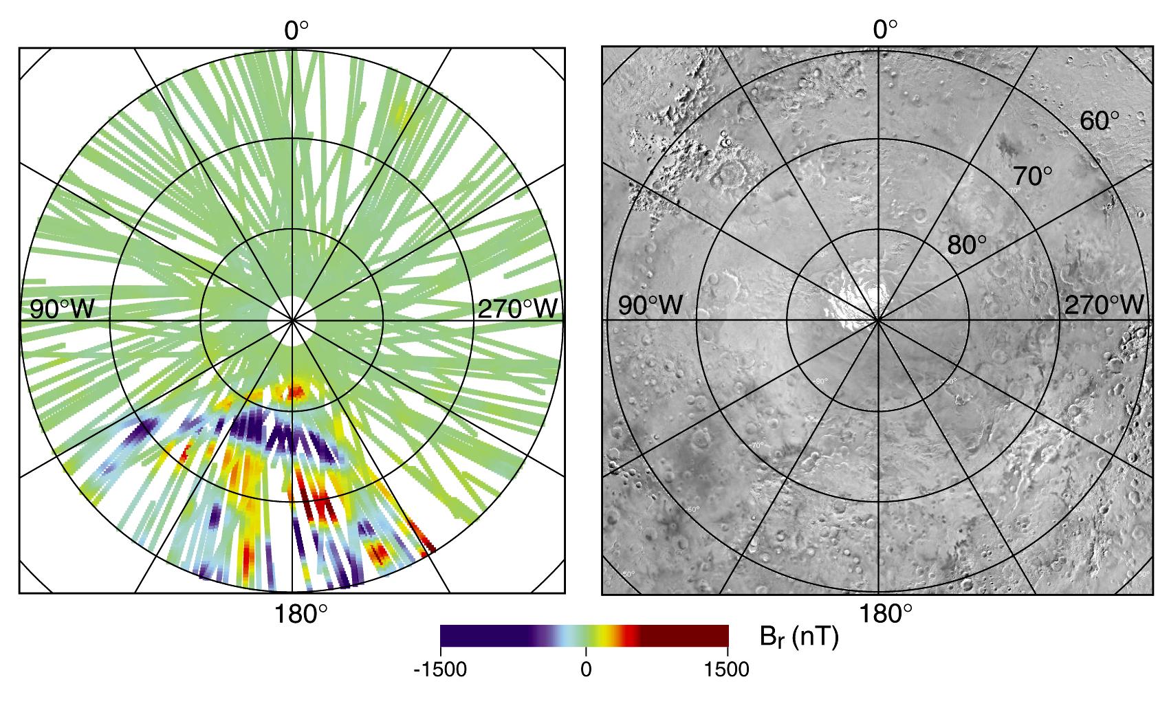
PIA02050:
North Polar Magnetic Anomaly Map (MAG/ER)
Full Resolution:
TIFF
(1.938 MB)
JPEG
(213.7 kB)
1999-06-23
Mars
Mars Global Surveyor (MGS)
Magnetometer
1700x1046x3
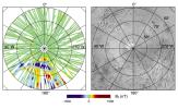
PIA02051:
South Polar Magnetic Anomaly Map (MAG/ER)
Full Resolution:
TIFF
(1.582 MB)
JPEG
(306.9 kB)
1999-06-23
Mars
Mars Global Surveyor (MGS)
Magnetometer
1900x1400x3
PIA02058:
Electron and Magnetic Field Observations (MAG/ER)
Full Resolution:
TIFF
(321.1 kB)
JPEG
(232.6 kB)
1999-06-23
Mars
Mars Global Surveyor (MGS)
Magnetometer
1900x1450x3
PIA02059:
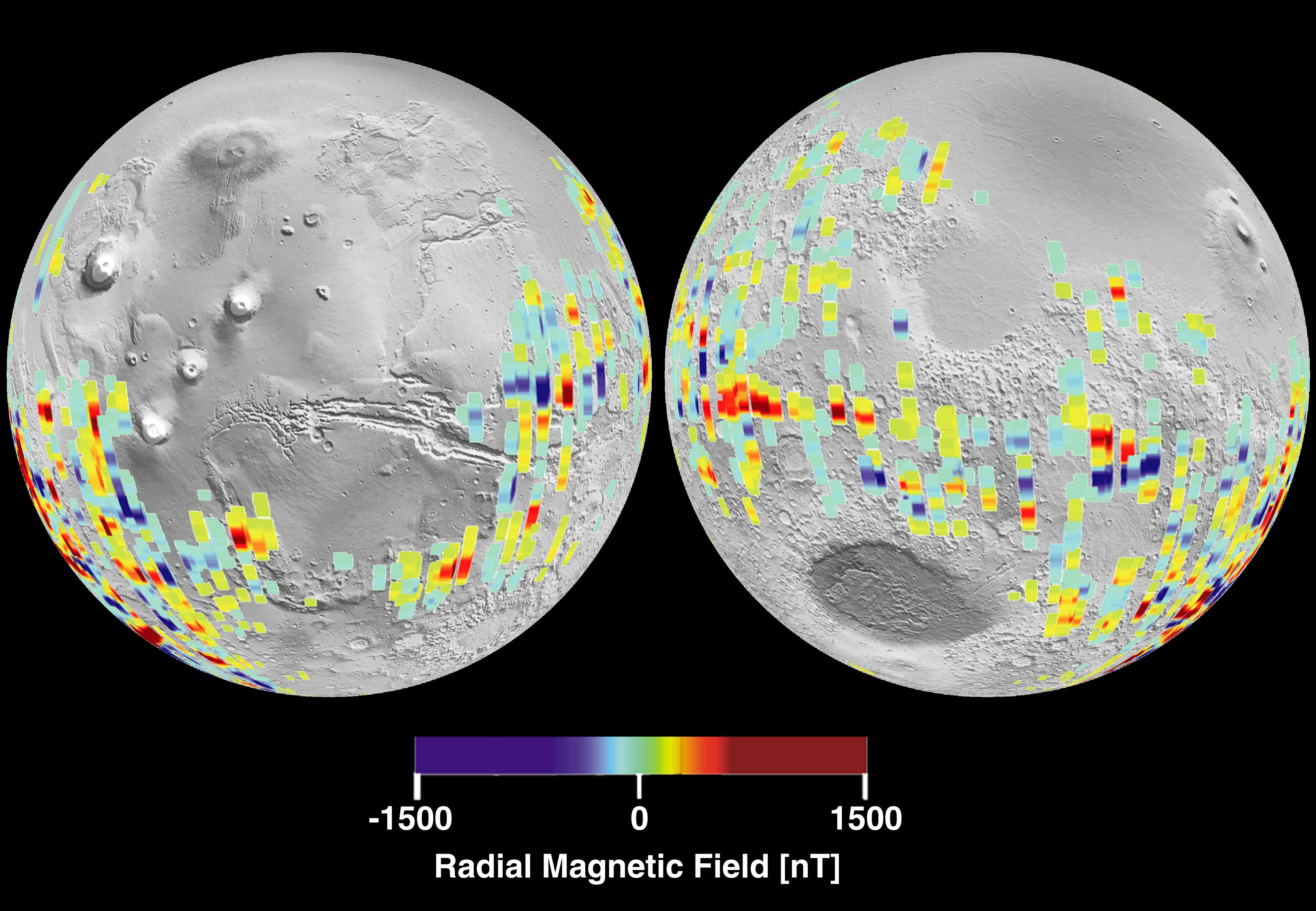
Global Map of Magnetic Anomalies (MAG/ER)
Full Resolution:
TIFF
(4.138 MB)
JPEG
(445.2 kB)
2001-01-17
Mars
Mars Global Surveyor (MGS)
Magnetometer
4000x2769x3
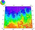
PIA02819:
Mars Crustal Magnetic Field Remnants
Full Resolution:
TIFF
(11.85 MB)
JPEG
(959.2 kB)
2005-11-30
Mars
Mars Express (MEX)
Mars Global Surveyor (MGS)
Mars Advanced Radar for Subsurface and Ionospheric Sounding (MARSIS)
Mars Orbiter Laser Altimeter
788x683x3
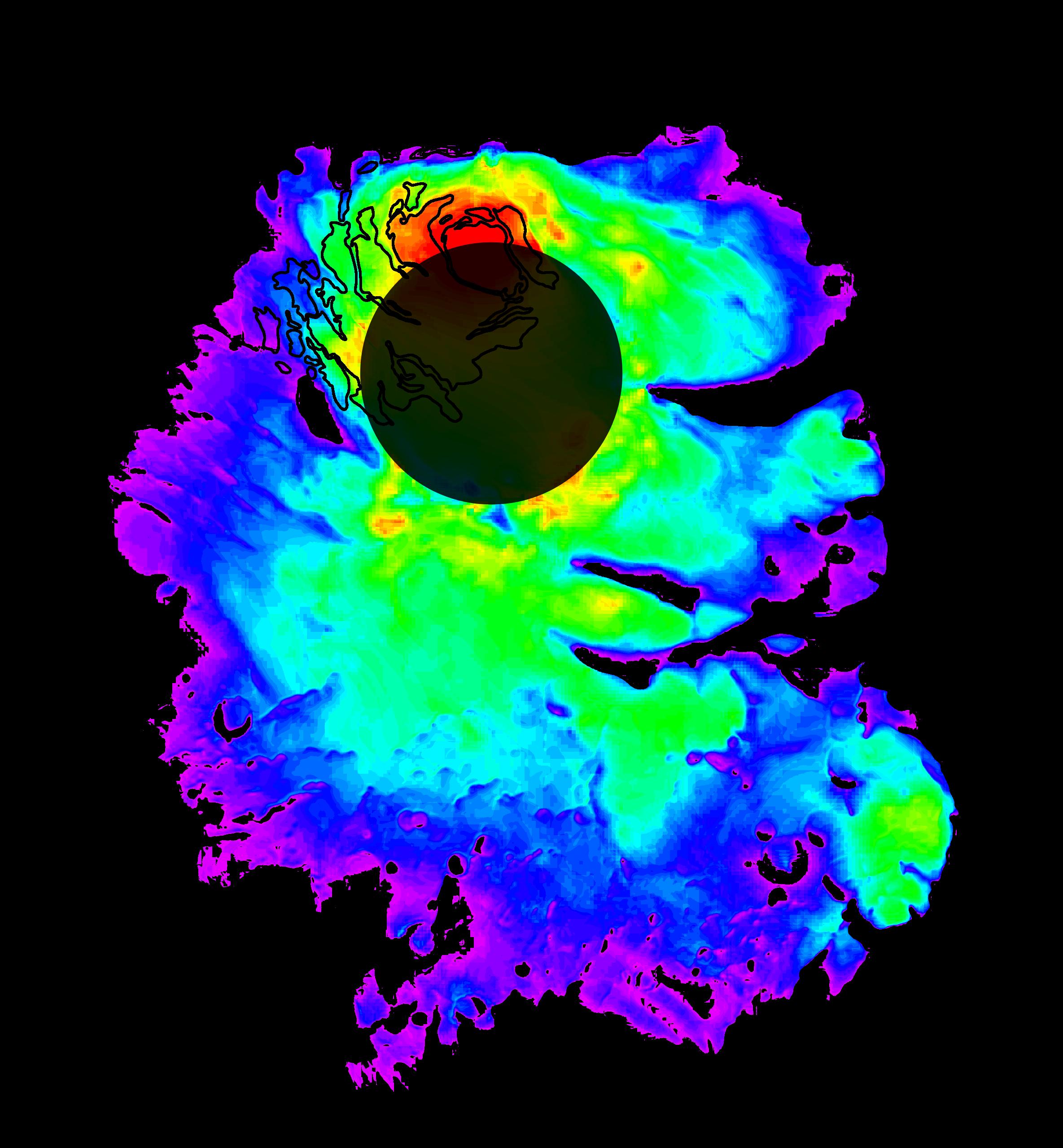
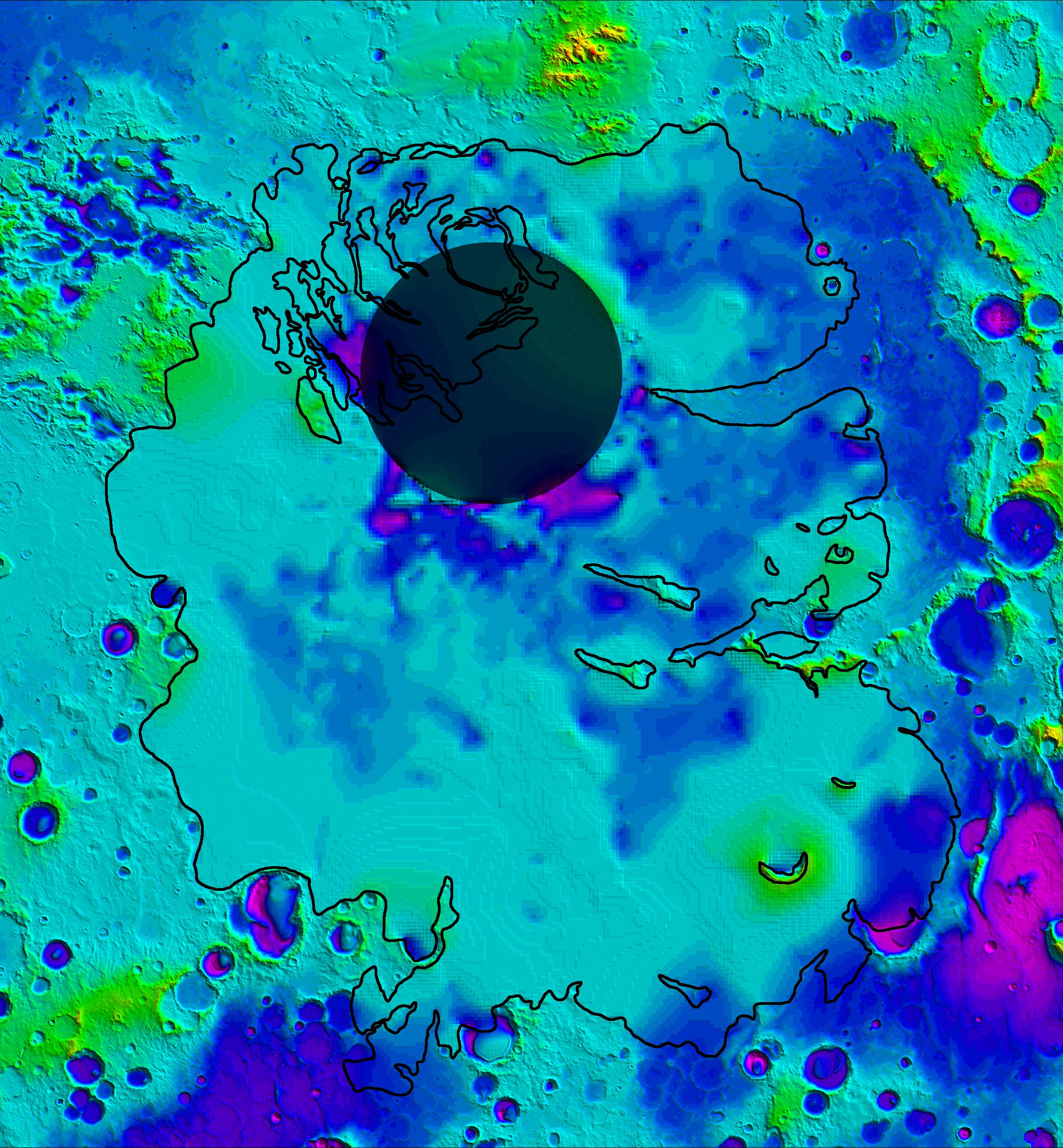
PIA03237:
Topographic Map of Chryse Planitia with Location of Possible Buried Basin
Full Resolution:
TIFF
(1.617 MB)
JPEG
(106.2 kB)
2005-11-30
Mars
Mars Express (MEX)
Mars Global Surveyor (MGS)
MARSIS
Mars Orbiter Laser Altimeter
979x666x3
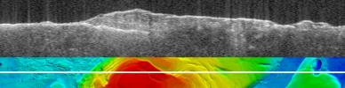
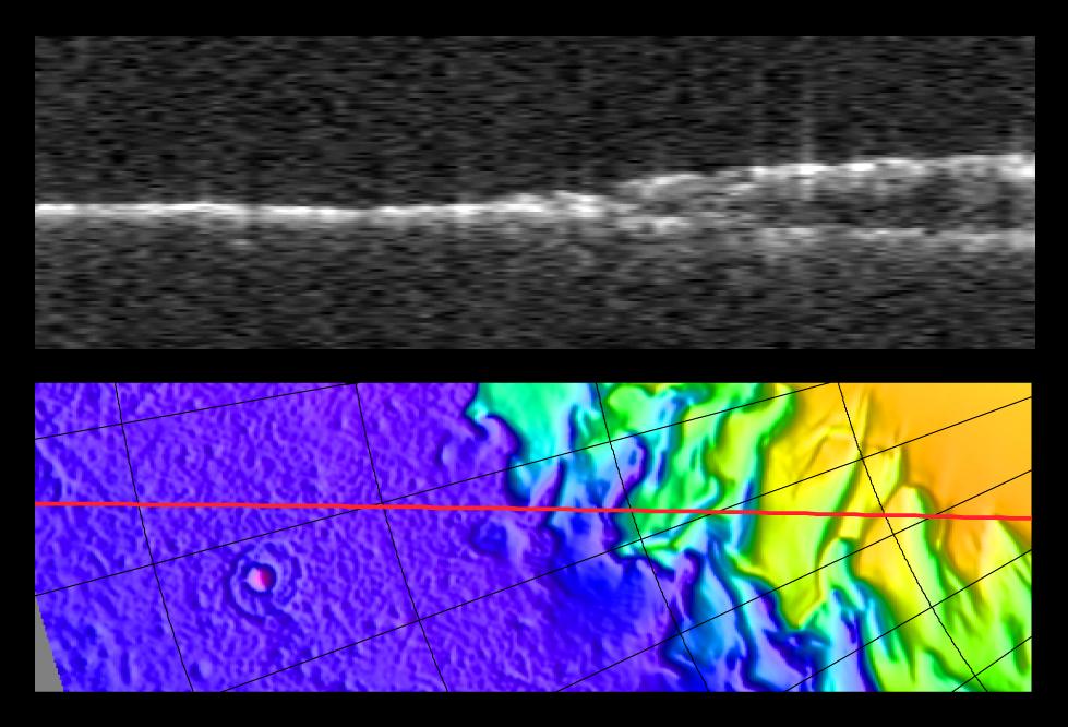
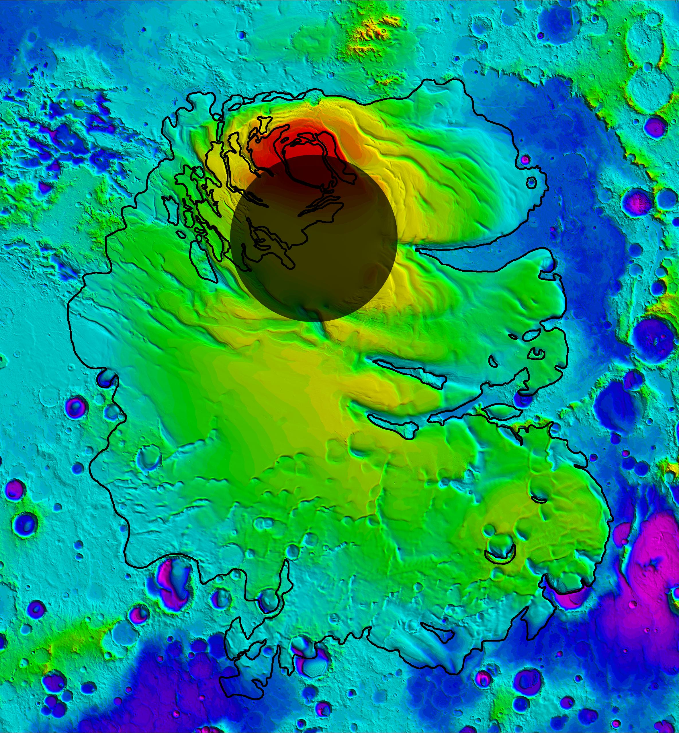
PIA03235:
Radargram of Mars' North Polar Layered Deposits with Topographic Map
Full Resolution:
TIFF
(1.959 MB)
JPEG
(95.14 kB)
2007-03-15
Mars
Mars Express (MEX)
Mars Global Surveyor (MGS)
MARSIS
Mars Orbiter Laser Altimeter
1784x460x3
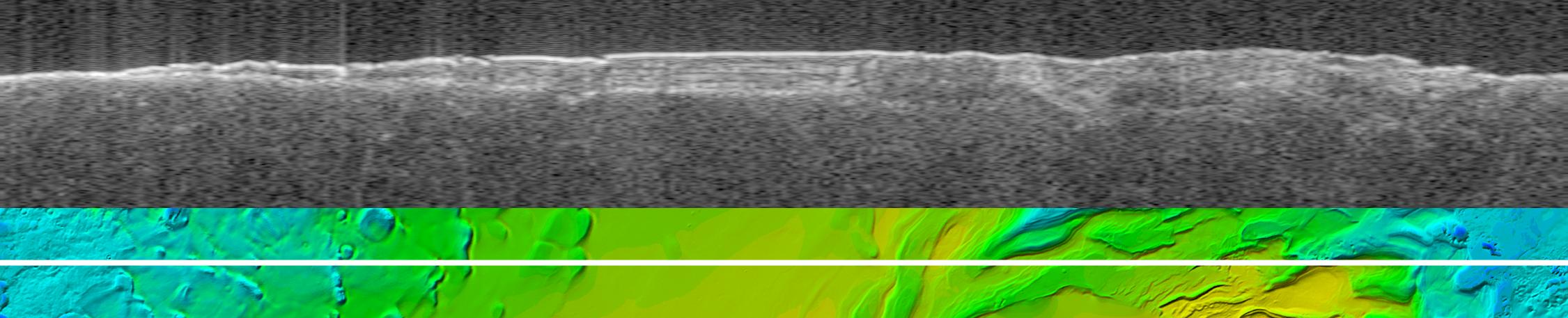
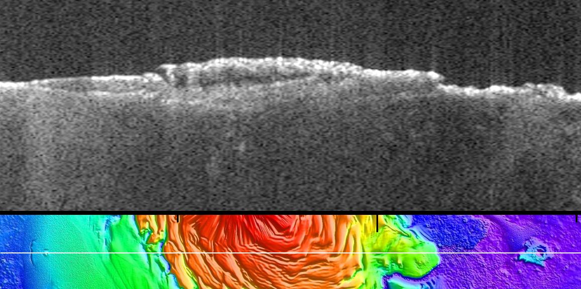
PIA09222:
Bright Lower Echo in Radargram of South Polar Layered Deposits
Full Resolution:
TIFF
(2.466 MB)
JPEG
(124.4 kB)
2007-03-15
Mars
Mars Express (MEX)
Mars Global Surveyor (MGS)
MARSIS
Mars Orbiter Laser Altimeter
2251x457x3
PIA09223:
Virtual Slice Through Icy Layered Deposits Near Mars' South Pole
Full Resolution:
TIFF
(3.09 MB)
JPEG
(149.5 kB)
2007-03-15
Mars
Mars Express (MEX)
Mars Global Surveyor (MGS)
MARSIS
Mars Orbiter Laser Altimeter
2369x2558x3
PIA09224:
Thickness of Mars' South Polar Layered Deposits
Full Resolution:
TIFF
(18.2 MB)
JPEG
(462.9 kB)
2007-03-15
Mars
Mars Express (MEX)
Mars Global Surveyor (MGS)
MARSIS
Mars Orbiter Laser Altimeter
2369x2558x3
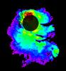
PIA09225:
Lower Boundary of Icy Layers Covering Mars' South Polar Region
Full Resolution:
TIFF
(18.2 MB)
JPEG
(938.3 kB)
2007-03-15
Mars
Mars Express (MEX)
Mars Global Surveyor (MGS)
MARSIS
Mars Orbiter Laser Altimeter
2369x2558x3
PIA09226:
Upper Surface of Icy Layers Covering Mars' South Polar Region
Full Resolution:
TIFF
(18.2 MB)
JPEG
(1.033 MB)
2011-12-19
Mars
Mars Express (MEX)
Mars Global Surveyor (MGS)
MARSIS
MOLA
1157x577x3
PIA15117:
Radargram of Mars North Polar Plateau from Mars Express
Full Resolution:
TIFF
(2.005 MB)
JPEG
(120 kB)
2019-12-10
Mars
2001 Mars Odyssey
Mars Reconnaissance Orbiter (MRO)
Mars Global Surveyor (MGS)
MCS
THEMIS
1614x720x3
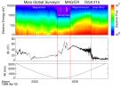
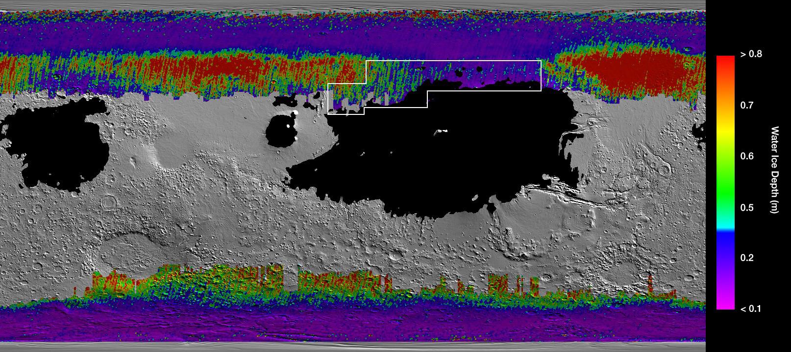
PIA23514:
A Water Ice Map for Mars
Full Resolution:
TIFF
(2.369 MB)
JPEG
(311.5 kB)
2018-08-06
Mars
Mars Reconnaissance Orbiter (MRO)
Mars Global Surveyor (MGS)
MCS
Thermal Emission Spectrometer
849x423x3
PIA22546:
Growth and Retreat of the CO2 Ice at the Martian Poles
Full Resolution:
TIFF
(562.4 kB)
JPEG
(383.2 kB)
2006-04-13
Mars
Mars Global Surveyor (MGS)
Mars Reconnaissance Orbiter (MRO)
MARCI
Mars Orbiter Camer
1409x1056x3
PIA08067:
View of Argyre Basin from Test of Mars Color Image
Full Resolution:
TIFF
(4.472 MB)
JPEG
(60.47 kB)
2006-10-16
Mars
Mars Global Surveyor (MGS)
Mars Reconnaissance Orbiter (MRO)
MARCI
Mars Orbiter Camera
2219x2219x3
PIA01928:
Mars Polar Cap During Transition Phase Instrument Checkout
Full Resolution:
TIFF
(14.79 MB)
JPEG
(323.7 kB)
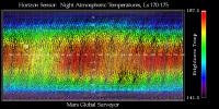
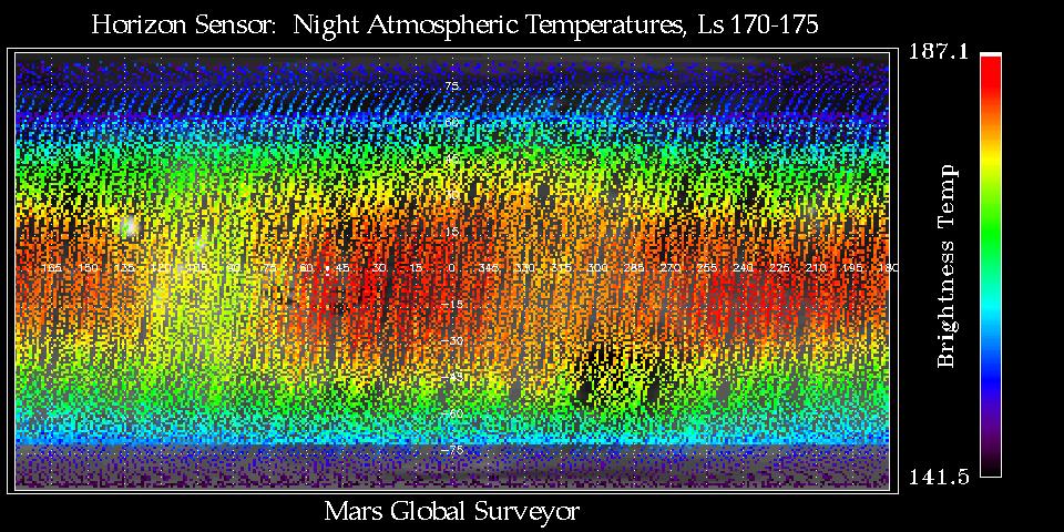
1999-09-18
Mars
Mars Global Surveyor (MGS)
Mars Horizon Sensor Assembly
960x480x3
PIA02335:
Thermal Wave Phenomena
Full Resolution:
TIFF
(168.1 kB)
JPEG
(191.6 kB)
1997-07-04
Mars
Mars Global Surveyor (MGS)
Mars Orbiter Camera (MOC)
512x512x1
PIA00606:
Mars Global Surveyor Approach Image
Full Resolution:
TIFF
(8.131 kB)
JPEG
(4.696 kB)
1997-07-04
Mars
Mars Global Surveyor (MGS)
Mars Orbiter Camera (MOC)
640x480x1
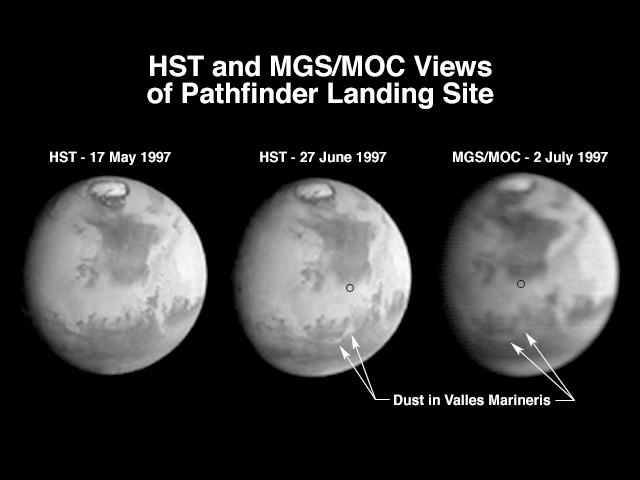
PIA00607:
Hubble and Mars Global Surveyor Views of Dust Storm on Mars
Full Resolution:
TIFF
(86.26 kB)
JPEG
(27.45 kB)
1998-03-13
Mars
Mars Global Surveyor (MGS)
Mars Orbiter Camera (MOC)
573x906x1
PIA00800:
Medusae Fossae #1
Full Resolution:
TIFF
(291.2 kB)
JPEG
(136.8 kB)
1998-03-13
Mars
Mars Global Surveyor (MGS)
Mars Orbiter Camera (MOC)
573x906x1
PIA00801:
Medusae Fossae #2
Full Resolution:
TIFF
(280.2 kB)
JPEG
(129.4 kB)
1998-03-13
Mars
Mars Global Surveyor (MGS)
Mars Orbiter Camera (MOC)
450x699x1
PIA00802:
Hebes Chasma #1
Full Resolution:
TIFF
(155.5 kB)
JPEG
(72.56 kB)
1998-03-13
Mars
Mars Global Surveyor (MGS)
Mars Orbiter Camera (MOC)
450x699x1
PIA00803:
Hebes Chasma #2
Full Resolution:
TIFF
(160 kB)
JPEG
(71.49 kB)
1998-03-13
Mars
Mars Global Surveyor (MGS)
Mars Orbiter Camera (MOC)
645x701x1
PIA00804:
Crommelin Crater #1
Full Resolution:
TIFF
(201.9 kB)
JPEG
(78.6 kB)
1998-03-13
Mars
Mars Global Surveyor (MGS)
Mars Orbiter Camera (MOC)
645x701x1
PIA00805:
Crommelin Crater #2
Full Resolution:
TIFF
(224.5 kB)
JPEG
(87.85 kB)
1998-03-13
Mars
Mars Global Surveyor (MGS)
Mars Orbiter Camera (MOC)
477x441x1
PIA00806:
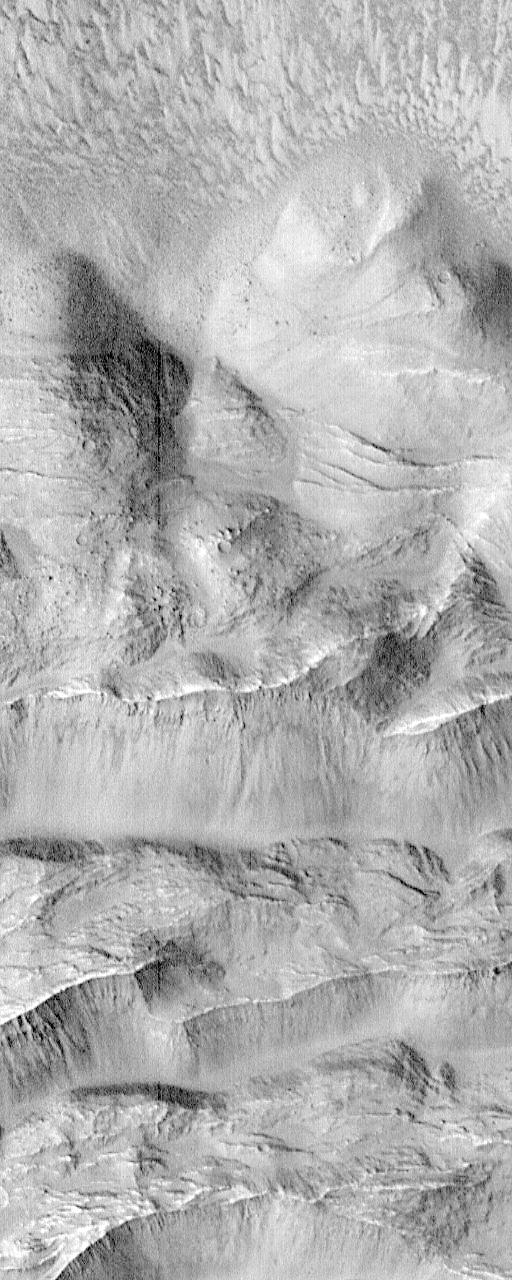
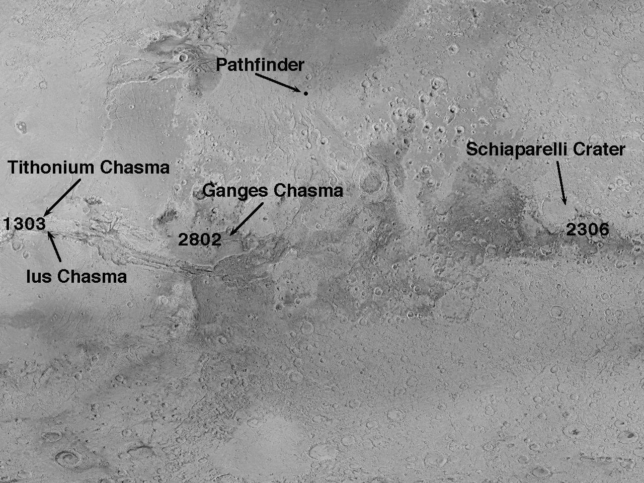
Tithonium Chasma/Ius Chasma
Full Resolution:
TIFF
(110.4 kB)
JPEG
(46.77 kB)
1998-03-13
Mars
Mars Global Surveyor (MGS)
Mars Orbiter Camera (MOC)
477x441x1
PIA00807:
Candor Chasma
Full Resolution:
TIFF
(109.9 kB)
JPEG
(47.99 kB)
1998-03-13
Mars
Mars Global Surveyor (MGS)
Mars Orbiter Camera (MOC)
855x616x1
PIA00808:
Ridges in Mars' South Polar Region
Full Resolution:
TIFF
(227.3 kB)
JPEG
(73.71 kB)
1998-03-13
Mars
Mars Global Surveyor (MGS)
Mars Orbiter Camera (MOC)
592x568x1
PIA00809:
Textures in South Polar Ice Cap #1
Full Resolution:
TIFF
(173.4 kB)
JPEG
(76.65 kB)
1998-03-13
Mars
Mars Global Surveyor (MGS)
Mars Orbiter Camera (MOC)
592x568x1
PIA00810:
Textures in South Polar Ice Cap #2
Full Resolution:
TIFF
(147.8 kB)
JPEG
(52.01 kB)
1998-03-13
Mars
Mars Global Surveyor (MGS)
Mars Orbiter Camera (MOC)
1200x1194x1
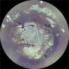
PIA00811:
South Polar Region
Full Resolution:
TIFF
(402.9 kB)
JPEG
(109.9 kB)
1998-03-13
Mars
Mars Global Surveyor (MGS)
Mars Orbiter Camera (MOC)
1200x1194x3
PIA00812:
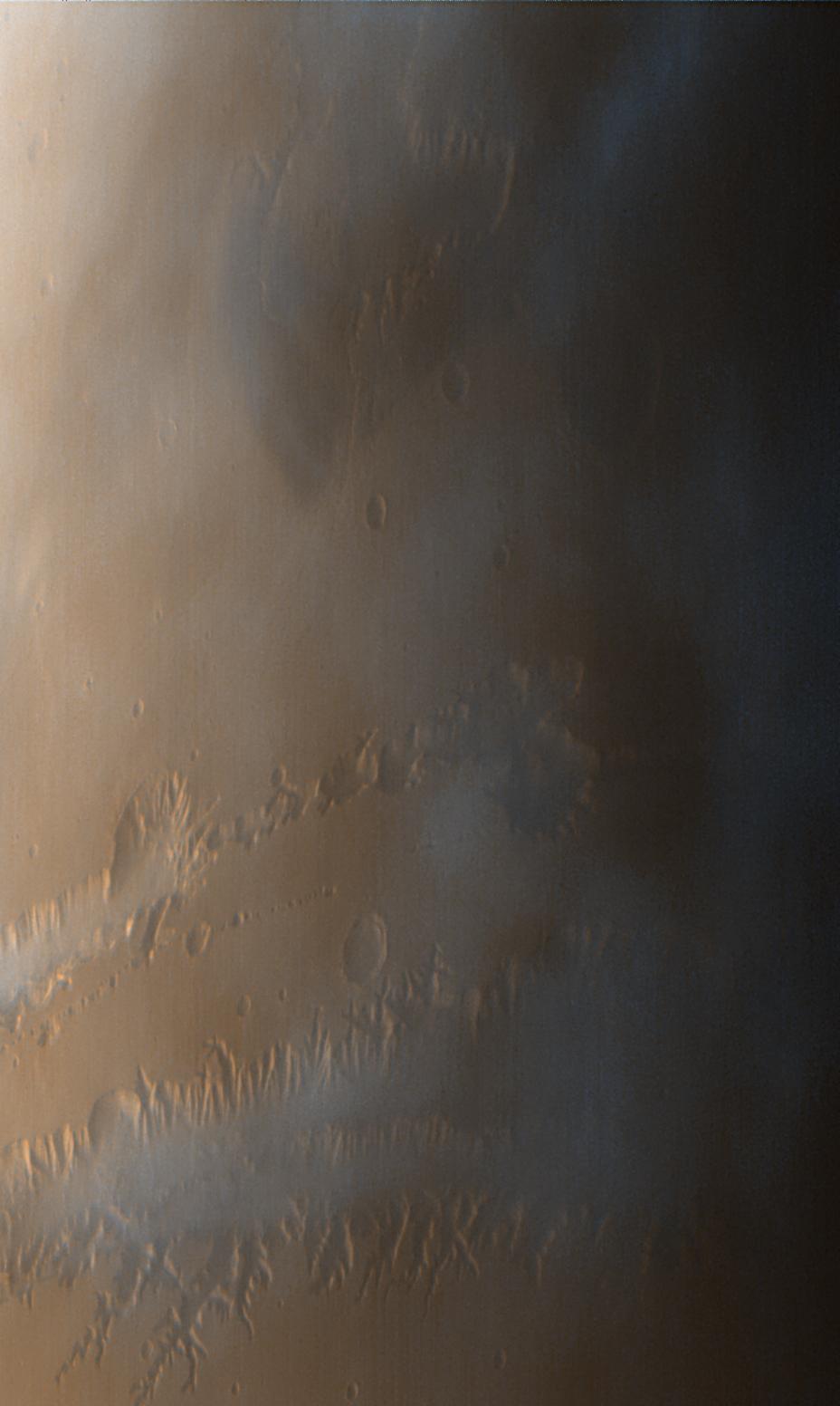
Clouds over Tharsis
Full Resolution:
TIFF
(439 kB)
JPEG
(75.45 kB)
1998-03-13
Mars
Mars Global Surveyor (MGS)
Mars Orbiter Camera (MOC)
1200x1194x1
PIA00813:
1997 Martian Dust Storm
Full Resolution:
TIFF
(310.8 kB)
JPEG
(77.07 kB)
1998-03-13
Mars
Mars Global Surveyor (MGS)
Mars Orbiter Camera (MOC)
1356x9216x3
PIA00814:
Coprates Chasma
Full Resolution:
TIFF
(23.13 MB)
JPEG
(1.279 MB)
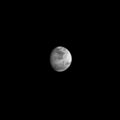
1997-08-22
Mars
Mars Global Surveyor (MGS)
Mars Orbiter Camera (MOC)
512x512x1
PIA00910:
MGS Approach Image - Syrtis Major Region
Full Resolution:
TIFF
(54.19 kB)
JPEG
(9.769 kB)
1997-08-22
Mars
Mars Global Surveyor (MGS)
Mars Orbiter Camera (MOC)
512x512x1
PIA00911:
MGS Approach Image - Chryse Planitia
Full Resolution:
TIFF
(52.54 kB)
JPEG
(9.599 kB)
1997-08-22
Mars
Mars Global Surveyor (MGS)
Mars Orbiter Camera (MOC)
512x512x1
PIA00912:
MGS Approach Image - Elysium Region
Full Resolution:
TIFF
(54.8 kB)
JPEG
(9.524 kB)
1997-09-10
Mars
Mars Global Surveyor (MGS)
Mars Orbiter Camera (MOC)
512x512x1
PIA00929:
MGS Approach Image - 172.4� W Longitude
Full Resolution:
TIFF
(42.96 kB)
JPEG
(8.111 kB)
1997-09-10
Mars
Mars Global Surveyor (MGS)
Mars Orbiter Camera (MOC)
512x512x1
PIA00930:
MGS Approach Image - 262.3� W Longitude
Full Resolution:
TIFF
(42.21 kB)
JPEG
(8.863 kB)
1997-09-10
Mars
Mars Global Surveyor (MGS)
Mars Orbiter Camera (MOC)
512x512x1
PIA00931:
MGS Approach Image - 352.2� W Longitude
Full Resolution:
TIFF
(44.39 kB)
JPEG
(9.87 kB)
1997-09-10
Mars
Mars Global Surveyor (MGS)
Mars Orbiter Camera (MOC)
512x512x1
PIA00932:
MGS Approach Image - 82.1� W Longitude
Full Resolution:
TIFF
(44.85 kB)
JPEG
(9.484 kB)
1997-09-10
Mars
Mars Global Surveyor (MGS)
Mars Orbiter Camera (MOC)
512x512x1
PIA00933:
MGS Approach Image - 217.4� W Longitude
Full Resolution:
TIFF
(45.74 kB)
JPEG
(9.268 kB)
1997-09-10
Mars
Mars Global Surveyor (MGS)
Mars Orbiter Camera (MOC)
512x512x1
PIA00934:
MGS Approach Image - 307.3� W Longitude
Full Resolution:
TIFF
(46.05 kB)
JPEG
(9.347 kB)
1997-09-10
Mars
Mars Global Surveyor (MGS)
Mars Orbiter Camera (MOC)
512x512x1
PIA00935:
MGS Approach Image - 37.2� W Longitude
Full Resolution:
TIFF
(47.3 kB)
JPEG
(9.643 kB)
1997-09-10
Mars
Mars Global Surveyor (MGS)
Mars Orbiter Camera (MOC)
512x512x1
PIA00936:
MGS Approach Image - 127.2� W Longitude
Full Resolution:
TIFF
(48.34 kB)
JPEG
(9.972 kB)
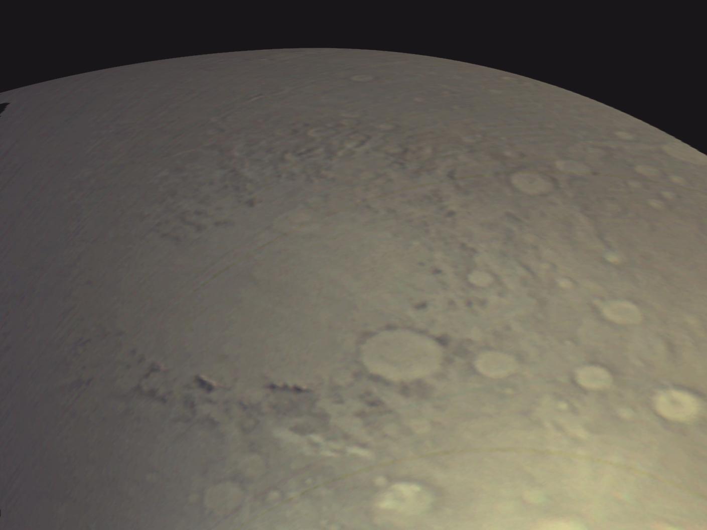
1997-10-02
Mars
Mars Global Surveyor (MGS)
Mars Orbiter Camera (MOC)
2198x1328x1
PIA00941:
MGS Views of Labyrinthus Noctis
Full Resolution:
TIFF
(1.163 MB)
JPEG
(260.3 kB)
1997-10-02
Mars
Mars Global Surveyor (MGS)
Mars Orbiter Camera (MOC)
2637x1686x1
PIA00942:
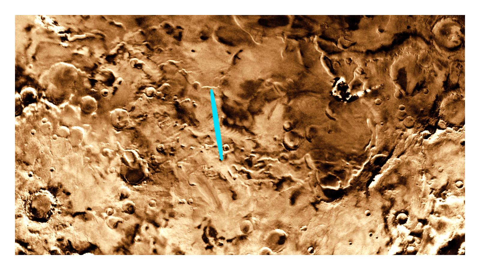
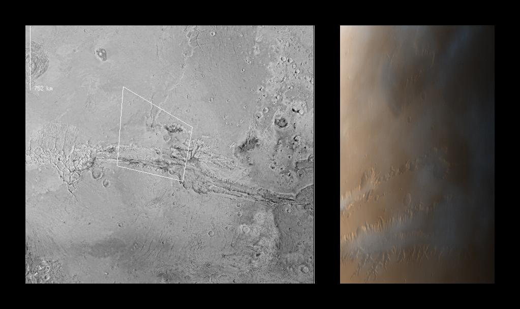
MGS Views of Nirgal Vallis
Full Resolution:
TIFF
(2.573 MB)
JPEG
(722.7 kB)
1997-10-02
Mars
Mars Global Surveyor (MGS)
Mars Orbiter Camera (MOC)
630x504x1
PIA00943:
Subsection of Nirgal Vallis Image
Full Resolution:
TIFF
(325.3 kB)
JPEG
(101.6 kB)
1997-10-02
Mars
Mars Global Surveyor (MGS)
Mars Orbiter Camera (MOC)
1024x768x1
PIA00944:
Rotated Perspective View of Nirgal Vallis
Full Resolution:
TIFF
(625.1 kB)
JPEG
(193.6 kB)
1997-10-02
Mars
Mars Global Surveyor (MGS)
Mars Orbiter Camera (MOC)
1024x1024x1
PIA00945:
MGS Views of Labyrinthus Noctis
Full Resolution:
TIFF
(588.8 kB)
JPEG
(124.5 kB)
1997-10-15
Mars
Mars Global Surveyor (MGS)
Mars Orbiter Camera (MOC)
928x1552x3
PIA00991:
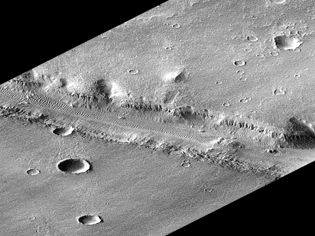
Valles Marineris
Full Resolution:
TIFF
(3.993 MB)
JPEG
(82.71 kB)
1997-10-15
Mars
Mars Global Surveyor (MGS)
Mars Orbiter Camera (MOC)
1023x608x3
PIA00992:
Valles Marineris
Full Resolution:
TIFF
(956.1 kB)
JPEG
(68.46 kB)
1998-04-23
Mars
Mars Global Surveyor (MGS)
Mars Orbiter Camera (MOC)
834x834x3
PIA00993:
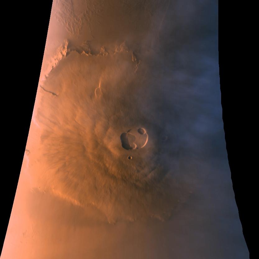
Olympus Mons in Color
Full Resolution:
TIFF
(1.23 MB)
JPEG
(35.04 kB)
1997-11-10
Mars
Mars Global Surveyor (MGS)
Mars Orbiter Camera (MOC)
2880x2880x1
PIA01021:
Western Tithonium Chasma/Ius Chasma, Valles Marineris
Full Resolution:
TIFF
(5.33 MB)
JPEG
(771.9 kB)
1997-11-10
Mars
Mars Global Surveyor (MGS)
Mars Orbiter Camera (MOC)
1024x1728x1
PIA01022:
Western Tithonium Chasma/Ius Chasma, Valles Marineris - High Resolution Image
Full Resolution:
TIFF
(1.698 MB)
JPEG
(268.3 kB)
1997-11-10
Mars
Mars Global Surveyor (MGS)
Mars Orbiter Camera (MOC)
1706x1280x1
PIA01023:
Western Tithonium Chasma/Ius Chasma, Valles Marineris - High Resolution Image
Full Resolution:
TIFF
(1.89 MB)
JPEG
(259.4 kB)
1997-11-10
Mars
Mars Global Surveyor (MGS)
Mars Orbiter Camera (MOC)
2023x996x1
PIA01024:
Valley and Surrounding Terrain Adjacent to Schiaparelli Crater
Full Resolution:
TIFF
(1.266 MB)
JPEG
(185.7 kB)
1997-11-10
Mars
Mars Global Surveyor (MGS)
Mars Orbiter Camera (MOC)
1024x2688x1
PIA01025:
Valley and Surrounding Terrain Adjacent to Schiaparelli Crater - High Resolution Image
Full Resolution:
TIFF
(1.424 MB)
JPEG
(197 kB)
1997-11-10
Mars
Mars Global Surveyor (MGS)
Mars Orbiter Camera (MOC)
2048x2048x1
PIA01026:
Valley and Surrounding Terrain Adjacent to Schiaparelli Crater - High Resolution Image
Full Resolution:
TIFF
(2.249 MB)
JPEG
(297.8 kB)
1997-11-10
Mars
Mars Global Surveyor (MGS)
Mars Orbiter Camera (MOC)
1640x900x1
PIA01027:
Complex Floor Deposits Within Western Ganges Chasma, Valles Marineris
Full Resolution:
TIFF
(1.183 MB)
JPEG
(230.3 kB)
1997-11-10
Mars
Mars Global Surveyor (MGS)
Mars Orbiter Camera (MOC)
512x1280x1
PIA01028:
Complex Floor Deposits Within Western Ganges Chasma, Valles Marineris - High Resolution Image
Full Resolution:
TIFF
(635.6 kB)
JPEG
(139 kB)
1997-11-10
Mars
Mars Global Surveyor (MGS)
Mars Orbiter Camera (MOC)
512x1280x1
PIA01029:
Complex Floor Deposits Within Western Ganges Chasma, Valles Marineris - High Resolution Image
Full Resolution:
TIFF
(738.5 kB)
JPEG
(174.5 kB)
1997-11-10
Mars
Mars Global Surveyor (MGS)
Mars Orbiter Camera (MOC)
1280x960x1
PIA01030:
Mars Orbiter Camera High Resolution Images: Some Results From The First 6 Weeks In Orbit
Full Resolution:
TIFF
(1.248 MB)
JPEG
(298.2 kB)
2000-06-22
Mars
Mars Global Surveyor (MGS)
Mars Orbiter Camera (MOC)
892x668x3
PIA01031:
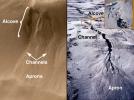
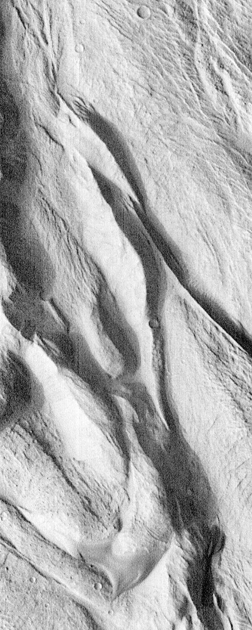
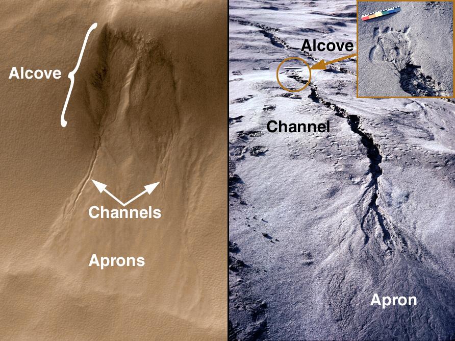
Evidence for Recent Liquid Water on Mars: Basic Features of Martian Gullies
Full Resolution:
TIFF
(1.896 MB)
JPEG
(136.2 kB)
2000-06-22
Mars
Mars Global Surveyor (MGS)
Mars Orbiter Camera (MOC)
712x534x1
PIA01032:
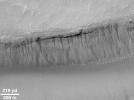
Evidence for Recent Liquid Water on Mars:"Weeping" Layer in Gorgonum Chaos
Full Resolution:
TIFF
(301.9 kB)
JPEG
(51.97 kB)
2000-06-22
Mars
Mars Global Surveyor (MGS)
Mars Orbiter Camera (MOC)
1424x1233x3
PIA01033:
Evidence for Recent Liquid Water on Mars: Gullies in Gorgonum Chaos
Full Resolution:
TIFF
(3.675 MB)
JPEG
(186.3 kB)
1-100
101-200
201-300
301-400
401-500
501-600
601-700
701-800
801-900
901-1000
Currently displaying images:
1 - 100
of 1894


