Your search criteria found 561 images
Feature Name
Go to PIAxxxxx:
Refine this list of images by:
Target:
Mission:
Spacecraft:
Instrument:
Click on an image for detailed information
Click on a column heading to sort in ascending or descending order
My
List
Addition Date Target MissionSort Descending Instrument Size
Add Image to Favorite List 2007-04-27 Sol (our sun) Solar TErrestrial RElations Observatory (STEREO)
SECCHI/Extreme Ultraviolet Imaging Telescope
1920x1080x3
NASA's Solar TErrestrial RElations Observatory satellites have provided the first 3-dimensional images of the Sun. This view will aid scientists' ability to understand solar physics to improve space weather forecasting. 3D glasses are necessary.
PIA09325:
Closer View of the Equatorial Region of the Sun, March 24, 2007 (Anaglyph)
Full Resolution:     TIFF (6.23 MB)     JPEG (169.6 kB)
Add Image to Favorite List 2007-04-27 Sol (our sun) Solar TErrestrial RElations Observatory (STEREO)
SECCHI/Extreme Ultraviolet Imaging Telescope
1920x1080x3
NASA's Solar TErrestrial RElations Observatory satellites have provided the first 3-dimensional images of the Sun. This view will aid scientists' ability to understand solar physics to improve space weather forecasting. 3D glasses are necessary.
PIA09327:
Right Limb of the South Pole of the Sun, March 18, 2007 (Anaglyph)
Full Resolution:     TIFF (6.23 MB)     JPEG (99.1 kB)
Add Image to Favorite List 2007-04-27 Sol (our sun) Solar TErrestrial RElations Observatory (STEREO)
SECCHI/Extreme Ultraviolet Imaging Telescope
1920x1080x3
NASA's Solar TErrestrial RElations Observatory satellites have provided the first 3-dimensional images of the Sun. This view will aid scientists' ability to understand solar physics to improve space weather forecasting. 3D glasses are necessary.
PIA09329:
North Pole of the Sun, March 20, 2007 (Anaglyph)
Full Resolution:     TIFF (6.23 MB)     JPEG (126.2 kB)
Add Image to Favorite List 2007-04-27 Sol (our sun) Solar TErrestrial RElations Observatory (STEREO)
SECCHI/Extreme Ultraviolet Imaging Telescope
1920x1080x3
NASA's Solar TErrestrial RElations Observatory satellites have provided the first 3-dimensional images of the Sun. This view will aid scientists' ability to understand solar physics to improve space weather forecasting. 3D glasses are necessary.
PIA09331:
South Pole of the Sun, March 20, 2007 (Anaglyph)
Full Resolution:     TIFF (6.23 MB)     JPEG (114.9 kB)
Add Image to Favorite List 2007-04-27 Sol (our sun) Solar TErrestrial RElations Observatory (STEREO)
SECCHI/Extreme Ultraviolet Imaging Telescope
1920x1080x3
NASA's Solar TErrestrial RElations Observatory satellites have provided the first 3-dimensional images of the Sun. This view will aid scientists' ability to understand solar physics to improve space weather forecasting. 3D glasses are necessary.
PIA09333:
Left Limb of North Pole of the Sun, March 20, 2007 (Anaglyph)
Full Resolution:     TIFF (6.23 MB)     JPEG (89.44 kB)
Add Image to Favorite List 2004-03-18 Wild 2 Stardust
Stardust Navigation Camera
2400x2400x3
NASA's	Stardust Navigation Camera captured this anaglyph of the comet Wild 2. 3-D glasses are necessary to view this image.
PIA05580:
Comet Wild 2 - Anaglyph
Full Resolution:     TIFF (6.111 MB)     JPEG (185 kB)
Add Image to Favorite List 2011-02-18 Tempel 1 StardustNExT
Stardust Navigation Camera
942x947x3
This anaglyph shows the region where NASA's Deep Impact mission sent a probe into the surface of comet Tempel 1 in 2005. 3D glasses are necessary to view this image.
PIA13872:
Deep Impact Site in 3-D
Full Resolution:     TIFF (2.68 MB)     JPEG (58.62 kB)
Add Image to Favorite List 2000-04-19 Earth Terra
MISR
1906x981x3
The stereo image at right is a downward-looking (nadir) view of the area around the San Cristobal volcano in Nicaragua taken by NASA's Terra satellite. 3D glasses are necessary to view this image.
PIA02600:
Nicaraguan Volcanoes, 26 February 2000
Full Resolution:     TIFF (4.239 MB)     JPEG (194.3 kB)
Add Image to Favorite List 2000-06-20 Earth Terra
MISR
2548x3800x3
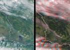
A plume from a large brush fire that burned about 15,000 acres in 2000 is visible at the western edge of the Big Cypress Swamp in southern Florida. NASA's Terra satellite captured acquired this image on April 9, 2000. 3D glasses are necessary.
PIA02610:
MISR Views Florida
Full Resolution:     TIFF (19.67 MB)     JPEG (1.364 MB)
Add Image to Favorite List 2000-07-08 Earth Terra
MISR
584x900x3
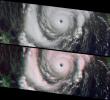
This anaglyph from NASA's Terra satellite's vertical (nadir) camera, shows Hurricane Carlotta's location in the eastern Pacific Ocean, about 500 km south of Puerto Vallarta, Mexico in 2000. 3D glasses are necessary to view this image.
PIA02611:
MISR Views Hurricane Carlotta
Full Resolution:     TIFF (1.25 MB)     JPEG (76.02 kB)
Add Image to Favorite List 2000-08-02 Earth Terra
MISR
959x861x3
This stereo image from NASA's Terra satellite show the Mauna Kea and Mauna Loa volcanoes in Hawaii; a southern face of a line of cumulus clouds off the north coast of Hawaii is also visible. 3D glasses are necessary to view this image.
PIA02616:
MISR Views the Big Island of Hawaii
Full Resolution:     TIFF (2.201 MB)     JPEG (145.4 kB)
Add Image to Favorite List 2000-09-27 Earth Terra
MISR
1148x819x3
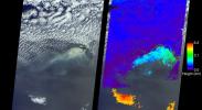
This stereo view of western Alaska was acquired by NASA's Terra satellite on June 25, 2000. 3D glasses are necessary to view this image.
PIA02625:
MISR Stereo Imaging Distinguishes Smoke from Cloud
Full Resolution:     TIFF (2.36 MB)     JPEG (142.6 kB)
Add Image to Favorite List 2000-10-18 Earth Terra
MISR
1728x1043x3
This stereo view of the Sierra Nevada mountains near the California-Nevada border was acquired on August 12, 2000 by NASA's Terra satellite. 3D glasses are necessary to view this image.
PIA02628:
MISR Sees the Sierra Nevadas in Stereo
Full Resolution:     TIFF (5.638 MB)     JPEG (299.3 kB)
Add Image to Favorite List 2000-12-13 Earth Terra
MISR
1600x1261x3
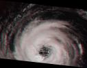
This stereoimage of Hurricane Alberto on August 19, 2000 was acquired by NASA's Terra satellite. At this time, the storm was located in the North Atlantic Ocean, west of the Azores. 3D glasses are necessary to view this image.
PIA02636:
Into the Eye of the Storm
Full Resolution:     TIFF (5.091 MB)     JPEG (173.1 kB)
Add Image to Favorite List 2001-05-16 Earth Terra
MISR
1536x1579x3
This anaglyph from the MISR instrument aboard NASA's Terra spacecraft include portions of southern Wyoming, central Colorado, and western Nebraska. 3D glasses are necessary to view this image.
PIA03406:
Front Range of the Rockies
Full Resolution:     TIFF (8.452 MB)     JPEG (541 kB)
Add Image to Favorite List 2001-05-23 Earth Terra
MISR
1300x1550x3
Several mountain ranges and a portion of the Amur River are visible in this set of stereo images of Russia's far east Khabarovsk region taken by the MISR instrument aboard NASA's Terra spacecraft. 3D glasses are necessary to view this image.
PIA03407:
Smoke and Clouds over Russia
Full Resolution:     TIFF (5.313 MB)     JPEG (386.1 kB)
Add Image to Favorite List 2001-06-20 Earth Terra
MISR
1356x1932x3
This anaglyph from the MISR instrument aboard NASA's Terra spacecraft shows the rugged Southern Alps extending some 650 kilometers along the western side of New Zealand's South Island. 3D glasses are necessary to view this image.
PIA03410:
New Zealand's Southern Alps
Full Resolution:     TIFF (7.269 MB)     JPEG (518.5 kB)
Add Image to Favorite List 2001-07-25 Earth Terra
MISR
1594x1444x3
This anaglyph from the MISR instrument aboard NASA's Terra spacecraft shows the eruption of Mt. Etna volcano located near the eastern coast of Sicily on July 22, 2001. 3D glasses are necessary to view this image.
PIA03415:
Eruption of Mt. Etna
Full Resolution:     TIFF (5.094 MB)     JPEG (282.1 kB)
Add Image to Favorite List 2001-08-01 Earth Terra
MISR
1736x1328x3
This anaglyph from the MISR instrument aboard NASA's Terra spacecraft shows the area around Jackson Hole, Wyoming, where the Green Knoll forest fire raged for many days in July, 2001. 3D glasses are necessary to view this image.
PIA03416:
Smoke over Jackson Hole, Wyoming
Full Resolution:     TIFF (7.261 MB)     JPEG (467.3 kB)
Add Image to Favorite List 2001-09-19 Earth Terra
MISR
1737x981x3
Spectacular canyons of the central Andes, in the Peruvian department of Arequipa, are seen in this anaglyph from the MISR instrument aboard NASA's Terra spacecraft. 3D glasses are necessary to view this image.
PIA03423:
Deepest Canyons of the Andes
Full Resolution:     TIFF (6.045 MB)     JPEG (413.2 kB)
Add Image to Favorite List 2001-10-10 Earth Terra
MISR
730x900x3
Two of Iceland's larger icecaps, Langjökull (located just below image center) and Hofsjökull (just above center) can be clearly seen in this anaglyph from the MISR instrument aboard NASA's Terra spacecraft. 3D glasses are necessary to view this image.
PIA03426:
The Land of Ice and Fire
Full Resolution:     TIFF (2.148 MB)     JPEG (141.7 kB)
Add Image to Favorite List 2001-11-28 Earth Terra
MISR
1698x2372x3
These images, taken by the MISR instrument aboard NASA's Terra spacecraft, are centered over the Pacific Ocean, about 1600 kilometers west of San Francisco. 3D glasses are necessary to view this image.
PIA03433:
Ship Tracks in a Stratiform Cloud Layer
Full Resolution:     TIFF (10.73 MB)     JPEG (839.9 kB)
Add Image to Favorite List 2002-01-16 Earth Terra
MISR
1728x1974x3
This anaglyph from the MISR instrument aboard NASA's Terra spacecraft shows the peaks of the Wasatch and Uinta Ranges in Utah. 3D glasses are necessary to view this image.
PIA03439:
Snow-Covered Peaks of the Wasatch and Uinta Mountains
Full Resolution:     TIFF (10.85 MB)     JPEG (649.6 kB)
Add Image to Favorite List 2002-03-13 Earth Terra
MISR
1328x1229x3
Marine stratocumulus clouds frequently form parallel rows, or 'cloud streets,' along the direction of wind flow. NASA's Terra spacecraft captured this stereo image of Jan Mayen island's Beerenberg volcano. 3D glasses are necessary to view this image.
PIA03448:
A Vortex Street in the Arctic
Full Resolution:     TIFF (4.249 MB)     JPEG (272 kB)
Add Image to Favorite List 2002-05-22 Earth Terra
MISR
1063x1565x3
Large smoke plumes were produced by the Blackjack complex fire in southeastern Georgia's Okefenokee Swamp as seen by the MISR instrument aboard NASA's Terra spacecraft May 8, 2002. 3D glasses are necessary to view this image.
PIA03709:
Okefenokee Swamp Fire, Georgia
Full Resolution:     TIFF (4.625 MB)     JPEG (247.1 kB)
Add Image to Favorite List 2002-06-12 Earth Terra
MISR
1660x933x3
The mountains and desert plateaus of northwest Colorado are shown in this anaglyph from the MISR instrument aboard NASA's Terra spacecraft. 3D glasses are necessary to view this image.
PIA03711:
Spectacular Mountain Views of Northwest Colorado
Full Resolution:     TIFF (5.47 MB)     JPEG (442.1 kB)
Add Image to Favorite List 2002-10-09 Earth Terra
MISR
3584x3252x3
This anaglyph from the MISR instrument aboard NASA's Terra spacecraft shows Hurricane Lili headed for Louisiana on October 2, 2002. 3D glasses are necessary to view this image.
PIA03728:
Hurricane Lili Heads for Louisiana Landfall
Full Resolution:     TIFF (24.35 MB)     JPEG (921.7 kB)
Add Image to Favorite List 2002-11-13 Earth Terra
MISR
1079x984x3
This anaglyph from the MISR instrument aboard NASA's Terra spacecraft captured the energetic eruption of Sicily's Mount Etna volcano on October 29, 2002. 3D glasses are necessary to view this image.
PIA03733:
Multi-angle Portrayals of Mt. Etna's Plume
Full Resolution:     TIFF (2.551 MB)     JPEG (138.7 kB)
Add Image to Favorite List 2003-01-02 Earth Terra
MISR
1522x1789x3
Stratus clouds are common in the Arctic during the summer months, and are important modulators of the arctic climate as seen in this anaglyph from the MISR instrument aboard NASA's Terra spacecraft. 3D glasses are necessary to view this image.
PIA03748:
Stratified Arctic Clouds
Full Resolution:     TIFF (8.183 MB)     JPEG (436.8 kB)
Add Image to Favorite List 2003-03-26 Earth Terra
MISR
1344x2219x3
This anaglyph from the MISR instrument aboard NASA's Terra spacecraft portrays the Little Aral and the eastern Large Aral at the onset of winter. 3D glasses are necessary to view this image.
PIA04324:
Windswept Shores of the Aral Sea
Full Resolution:     TIFF (8.956 MB)     JPEG (470.1 kB)
Add Image to Favorite List 2003-04-09 Earth Terra
MISR
1362x1824x3
Dark smoke from oil fires extend for about 60 kilometers south of Iraq's capital city of Baghdad in this anaglyph acquired by the MISR instrument aboard NASA's Terra spacecraft on April 2, 2003. 3D glasses are necessary to view this image.
PIA04326:
Oil Fire Plumes Over Baghdad
Full Resolution:     TIFF (7.24 MB)     JPEG (331.6 kB)
Add Image to Favorite List 2003-12-10 Earth Terra
MISR
1062x860x3
This anaglyph from the MISR instrument aboard NASA's Terra spacecraft shows Santa Ana winds swept large amounts of dust and ash across the skies of San Diego and over the Pacific Ocean. 3D glasses are necessary to view this image.
PIA04348:
Airborne Dust and Ash over Southern California
Full Resolution:     TIFF (2.744 MB)     JPEG (148.8 kB)
Add Image to Favorite List 2005-08-31 Earth Terra
MISR
3008x3164x3
This anaglyph from the MISR instrument aboard NASA's Terra spacecraft shows the strong convective development of Hurricane Katrina as it moved west through the Gulf of Mexico. 3D glasses are necessary to view this image.
PIA04383:
The Roiling Clouds of Katrina Animation Icon
Full Resolution:     TIFF (28.55 MB)     JPEG (525 kB)
Add Image to Favorite List 2005-10-12 Earth Terra
ASTER
2496x1523x3
This 3D image was acquired by NASA's Terra spacecraft on October 11, 2005 with digital topography from the Shuttle Radar Topography Mission. It depicts a large landslide which occurred in Kashmir, Pakistan.
PIA03030:
Landslide in Kashmir (3-D Perspective)
Full Resolution:     TIFF (11.42 MB)     JPEG (461.1 kB)
Add Image to Favorite List 2001-10-22 Earth Terra
ASTER
1200x1354x3
NASA's Terra spacecraft captured this anaglyph image of Mt. St. Helens volcano in the Cascade Range of southwestern Washington; it erupted on 18 May 1980. 3D glasses are necessary to view this image.
PIA11160:
Mt. St. Helens Animation Icon
Full Resolution:     TIFF (4.88 MB)     JPEG (460.2 kB)
Add Image to Favorite List 2009-09-04 Earth Terra
MISR
1014x810x3
NASA's Terra satellite took this anaglyph of several pyrocumulus clouds, created by the Station Fire, visible above the smoke plumes rising from the San Gabriel Mountains north of Los Angeles. 3D glasses are necessary to view this image.
PIA12196:
Smoke from Station Fire Blankets Southern California (Anaglyph)
Full Resolution:     TIFF (2.467 MB)     JPEG (90.65 kB)
Add Image to Favorite List 2010-04-20 Earth Terra
MISR
1500x1015x3
NASA's Terra satellite flew directly over Iceland on April 19, 2010, to capture this stereo anaglyph generated from the nadir and 46-degree forward-viewing cameras of the Eyjafjallajökull volcano and its erupting ash plume. 3D glasses are necessary to vie
PIA13051:
Heights of the Eyjafjallajökull Eruption Plume - April 19, 2010 (Anaglyph)
Full Resolution:     TIFF (4.576 MB)     JPEG (188.7 kB)
Add Image to Favorite List 2010-04-20 Earth Terra
MISR
1500x1015x3
NASA's Terra satellite flew directly over Iceland on April 19, 2010 and captured this image of the Eyjafjallajökull volcano and its erupting ash plume. 3D glasses are necessary to view this image.
PIA13052:
Heights of the Eyjafjallajökull Eruption Plume - April 19, 2010
Full Resolution:     TIFF (4.576 MB)     JPEG (192.9 kB)
Add Image to Favorite List 2010-07-07 Earth Terra
MISR
1656x1182x3
This view of Hurricane Alex in the western Gulf of Mexico was acquired by the Multi-angle Imaging SpectroRadiometer instrument aboard NASA's Terra satellite just after noon Central Daylight Time on June 30, 2010. 3D glasses are necessary.
PIA13242:
Hurricane Alex Disrupts Gulf Cleanup
Full Resolution:     TIFF (5.882 MB)     JPEG (120.5 kB)
Add Image to Favorite List 2011-03-13 Earth Terra
MISR
1245x835x3
This images, acquired on March 12, 2011 by NASA's Terra spacecraft, shows a large smoke plume that appears to be associated either with the Shiogama incident or Sendai port fires. 3D glasses are necessary to view this image.
PIA13914:
Large Smoke Plume from Industrial Fires in Miyagi Prefecture, Japan
Full Resolution:     TIFF (3.122 MB)     JPEG (132 kB)
Add Image to Favorite List 2013-06-14 Earth Terra
MISR
803x432x3
NASA's Terra satellite passed over the Silver Fire in New Mexico June 12, 2013. By combining information from different MISR cameras, scientists have produced a 3D image of the smoke plume associated with the Silver Fire.
PIA17287:
Pyrocumulus Clouds Tower Over Silver Fire in New Mexico
Full Resolution:     TIFF (1.041 MB)     JPEG (27.54 kB)
Add Image to Favorite List 2013-07-20 Earth Terra
MISR
752x904x3
NASA's MISR instrument onbard NASA's Terra spacecraft captured a stereo view of Mountain Fire near Idyllwild, Calif. in July, 2013.
PIA17384:
NASA's MISR Instrument Captures Stereo View of Mountain Fire Near Idyllwild, Calif.
Full Resolution:     TIFF (2.04 MB)     JPEG (94.13 kB)
Add Image to Favorite List 2013-10-24 Earth Terra
MISR
1013x795x3
NASA's Terra spacecraft passed over the Blue Mountains to the west and north of Sydney, A mild winter and an extremely hot September in Australia have led to an early start to the fire season.
PIA17577:
MISR Stereo Imagery of Blue Mountain Fires in New South Wales, Australia
Full Resolution:     TIFF (2.417 MB)     JPEG (114.4 kB)
Add Image to Favorite List 2014-01-18 Earth Terra
MISR
901x721x3
On Jan. 16, 2014, NASA's Terra satellite passed over Glendora, Calif., where a large wildfire has claimed several homes, causing mandatory evacuations and prompting an air quality alert by public health officials.
PIA17883:
NASA Spacecraft Sees Dispersion of Smoke and Ash Across LA Basin from Colby Fire
Full Resolution:     TIFF (1.95 MB)     JPEG (74.68 kB)
Add Image to Favorite List 2016-08-12 Earth Terra
MISR
2048x2240x3
NASA's Terra satellite passed directly over the island of Madeira on Wednesday, Aug. 10, 2016, where a wildfire spread to the capital city of Funchal.
PIA20886:
Deadly Fires Engulfing Madeira seen by NASA's MISR (Anaglyph)
Full Resolution:     TIFF (7.375 MB)     JPEG (477.1 kB)
Add Image to Favorite List 2016-08-12 Earth Terra
MISR
3743x2048x3
NASA's Terra satellite passed directly over the island of Madeira on Wednesday, Aug. 10, 2016, where a wildfire spread to the capital city of Funchal.
PIA20887:
Deadly Fires Engulfing Madeira seen by NASA's MISR
Full Resolution:     TIFF (15.73 MB)     JPEG (743.9 kB)
Add Image to Favorite List 2016-08-17 Earth Terra
MISR
1872x2714x3
On Aug. 16, 2016, at around 10:30 a.m., NASA's Terra spacecraft spotted a brush fire ignited in the Cajon Pass east of Los Angeles, just to the west of Interstate 15 known as the Blue Cut Fire.
PIA20888:
Long Smoke Plumes from California's Destructive Blue Cut Fire Spotted by NASA's MISR
Full Resolution:     TIFF (13.21 MB)     JPEG (578.8 kB)
Add Image to Favorite List 2016-08-25 Earth Terra
MISR
1936x1503x3
NASA's Terra satellite viewed America's National Momuments and Parks in this 3D image.
PIA20889:
America's National Parks Viewed in 3D by NASA's MISR (Anaglyph 1)
Full Resolution:     TIFF (8.342 MB)     JPEG (370.6 kB)
Add Image to Favorite List 2016-08-25 Earth Terra
MISR
1656x1498x3
NASA's Terra satellite viewed America's National Momuments and Parks in this 3D image.
PIA20890:
America's National Parks Viewed in 3D by NASA's MISR (Anaglyph 2)
Full Resolution:     TIFF (6.698 MB)     JPEG (370.7 kB)
Add Image to Favorite List 2016-08-25 Earth Terra
MISR
1652x1496x3
NASA's Terra satellite viewed America's National Momuments and Parks in this 3D image.
PIA20891:
America's National Parks Viewed in 3D by NASA's MISR (Anaglyph 3)
Full Resolution:     TIFF (6.972 MB)     JPEG (421 kB)
Add Image to Favorite List 2016-08-25 Earth Terra
MISR
1672x1752x3
NASA's Terra satellite viewed America's National Momuments and Parks in this 3D image.
PIA20892:
America's National Parks Viewed in 3D by NASA's MISR (Anaglyph 4)
Full Resolution:     TIFF (8.792 MB)     JPEG (502.7 kB)
Add Image to Favorite List 2016-09-01 Earth Terra
MISR
2031x3584x3
On the afternoon of Sept. 1, 2016, NASA's Terra spacecraft passed over Tropical Storm Hermine as it strengthened into a Category 1 hurricane approaching the coast of Florida.
PIA20898:
NASA's MISR Spots Hurricane Hermine Approaching Florida
Full Resolution:     TIFF (11.2 MB)     JPEG (331.2 kB)
Add Image to Favorite List 2017-09-08 Earth Terra
MISR
5484x1331x3
On Sept. 7, the Multi-angle Imaging SpectroRadiometer (MISR) instrument on NASA's Terra satellite passed over Hurricane Irma at approximately 11:20 am local time.
PIA21945:
New NASA Images of Irma's Towering Clouds (Anaglyph)
Full Resolution:     TIFF (21.91 MB)     JPEG (884.3 kB)
Add Image to Favorite List 2018-05-02 Earth Terra
MISR
792x1019x3
On April 30, 2018, NASA's Multi-angle Imaging SpectroRadiometer (MISR) captured imagery of the plume top over the active Tinder Fire as it passed overhead on NASA's Terra satellite. The fires ignited in eastern Arizona near the Blue Ridge Reservoir.
PIA00698:
Tinder Fire in Arizona Viewed by NASA's MISR
Full Resolution:     TIFF (2.422 MB)     JPEG (134.7 kB)
Add Image to Favorite List 2018-07-31 Earth Terra
MISR
1629x1019x3
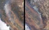
NASA's Terra satellite took these images of the Carr Fire (left) and the Ferguson Fire (right) on July 27 and July 29, respectively.
PIA22488:
California Wildfires Captured by NASA Satellite
Full Resolution:     TIFF (4.982 MB)     JPEG (290.4 kB)
Add Image to Favorite List 2018-08-25 Earth Terra
MISR
1963x2502x1
Hurricane Lane as viewed by the MISR instrument onboard NASA's Terra satellite on Aug. 24, 2018. The length of the arrows is proportional to the wind speed, while their color shows the altitude of the cloud tops in kilometers.
PIA22494:
MISR Hurricane Lane
Full Resolution:     TIFF (2.337 MB)     JPEG (213.7 kB)
Add Image to Favorite List 2018-09-14 Earth Terra
MISR
3966x1349x3
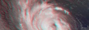
NASA's Terra spacecraft passed over Hurricane Florence as it approached the eastern coast of the United States on Thursday, Sept. 13, 2018. At the time the image was acquired, Florence was a large Category 2 storm.
PIA22701:
NASA's MISR captures Hurricane Florence in 3D
Full Resolution:     TIFF (14.61 MB)     JPEG (386.3 kB)
Add Image to Favorite List 2018-10-10 Earth Terra
MISR
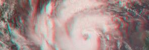
3957x1343x3
NASA's Terra spacecraft shows a three-dimensional view of Hurricane Michael and combines two of MISR's nine camera angles.
PIA22748:
MISR Captures Hurricane Michael's Eye in 3D
Full Resolution:     TIFF (15.95 MB)     JPEG (502.6 kB)
Add Image to Favorite List 2018-11-12 Earth Terra
MISR
4499x1423x3
NASA's Terra spacecraft shows a three-dimensional view of the Woolsey Fire in southern California on Nov. 11, 2018.
PIA22817:
NASA's MISR Captures 3D Image of Smoke from California's Woolsey Fire
Full Resolution:     TIFF (17.19 MB)     JPEG (574.8 kB)
Add Image to Favorite List 2019-03-21 Earth Terra
MISR
1429x1354x3
This stereo anaglyph combines two views from the MISR instrument, aboard NASA's Terra satellite, which captured a bright meteor explosion over the Bering Sea on December 18, 2018.
PIA23050:
MISR Images Fireball Over Bering Sea (Anaglyph)
Full Resolution:     TIFF (5.807 MB)     JPEG (178.9 kB)
Add Image to Favorite List 2022-09-30 Earth Terra
MISR
5504x6001x3
NASA's MISR instrument captured an optical image of Hurricane Ian, as well as measurements of the storm's wind speed, at noon local time Sept. 27, 2022.
PIA24909:
MISR Captures Hurricane Ian
Full Resolution:     TIFF (34.94 MB)     JPEG (1.738 MB)
Retrieve Previous Set  Jump to a Previous Set   Jump to a Previous Set   Jump to a Previous Set   Jump to a Previous Set   Jump to a Previous Set   Current Set 
 1-100   101-200   201-300   301-400   401-500   501-600 
Currently displaying images: 501 - 561 of 561