PIA10651: How Thick is the North Polar Ice Cap on Mars?
 Target Name:  Mars
 Is a satellite of:  Sol (our sun)
 Mission:  Mars Reconnaissance Orbiter (MRO)
 Spacecraft:  Mars Reconnaissance Orbiter (MRO)
 Instrument:  Shallow Subsurface Radar (SHARAD)
 Product Size:  1152 x 1056 pixels (w x h)
 Produced By:  University of Rome 
 Full-Res TIFF:  PIA10651.tif (3.654 MB)
 Full-Res JPEG:  PIA10651.jpg (319.4 kB)

Click on the image above to download a moderately sized image in JPEG format (possibly reduced in size from original)

Original Caption Released with Image:

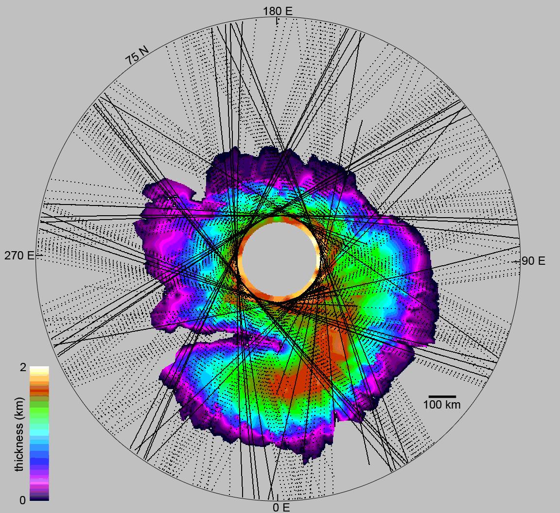
This map shows the thickness of the north polar layered deposits on Mars as measured by the Shallow Radar instrument on NASA's Mars Reconnaissance Orbiter.

The Shallow Radar instrument was provided by the Italian Space Agency. Its operations are led by the University of Rome and its data are analyzed by a joint U.S.-Italian science team. JPL, a division of the California Institute of Technology, Pasadena, manages the Mars Reconnaissance Orbiter for the NASA Science Mission Directorate, Washington

Image Credit:
NASA/JPL-Caltech/University of Rome/SwRI

Image Addition Date:
2008-05-15