- Original Caption Released with Image:
-
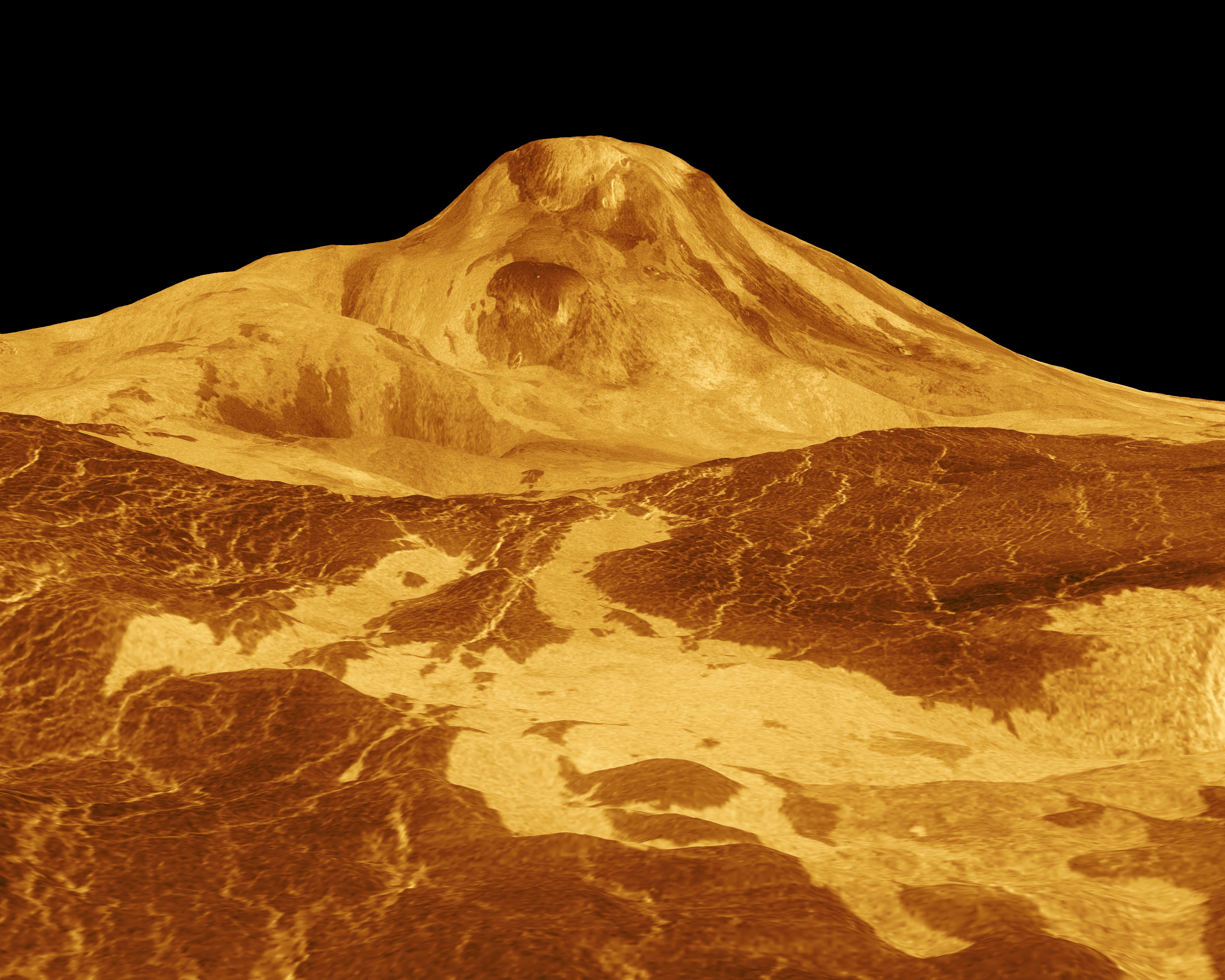
Maat Mons is displayed in this three-dimensional perspective view of the surface of Venus. The viewpoint is located 560 kilometers (347 miles) north of Maat Mons at an elevation of 1.7 kilometers (1 mile) above the terrain. Lava flows extend for hundreds of kilometers across the fractured plains shown in the foreground, to the base of Maat Mons. The view is to the south with Maat Mons appearing at the center of the image on the horizon. Maat Mons, an 8-kilometer (5 mile) high volcano, is located at approximately 0.9 degrees north latitude, 194.5 degrees east longitude. Maat Mons is named for an Egyptian goddess of truth and justice. Magellan synthetic aperture radar data is combined with radar altimetry to develop a three-dimensional map of the surface. The vertical scale in this perspective has been exaggerated 22.5 times. Rays cast in a computer intersect the surface to create a three-dimensional perspective view. Simulated color and a digital elevation map developed by the U.S. Geological Survey, are used to enhance small-scale structure. The simulated hues are based on color images recorded by the Soviet Venera 13 and 14 spacecraft. The image was produced at the JPL Multimission Image Processing Laboratory.
- Image Credit:
-
NASA/JPL
Image Addition Date: -
1996-03-14
|
