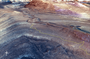
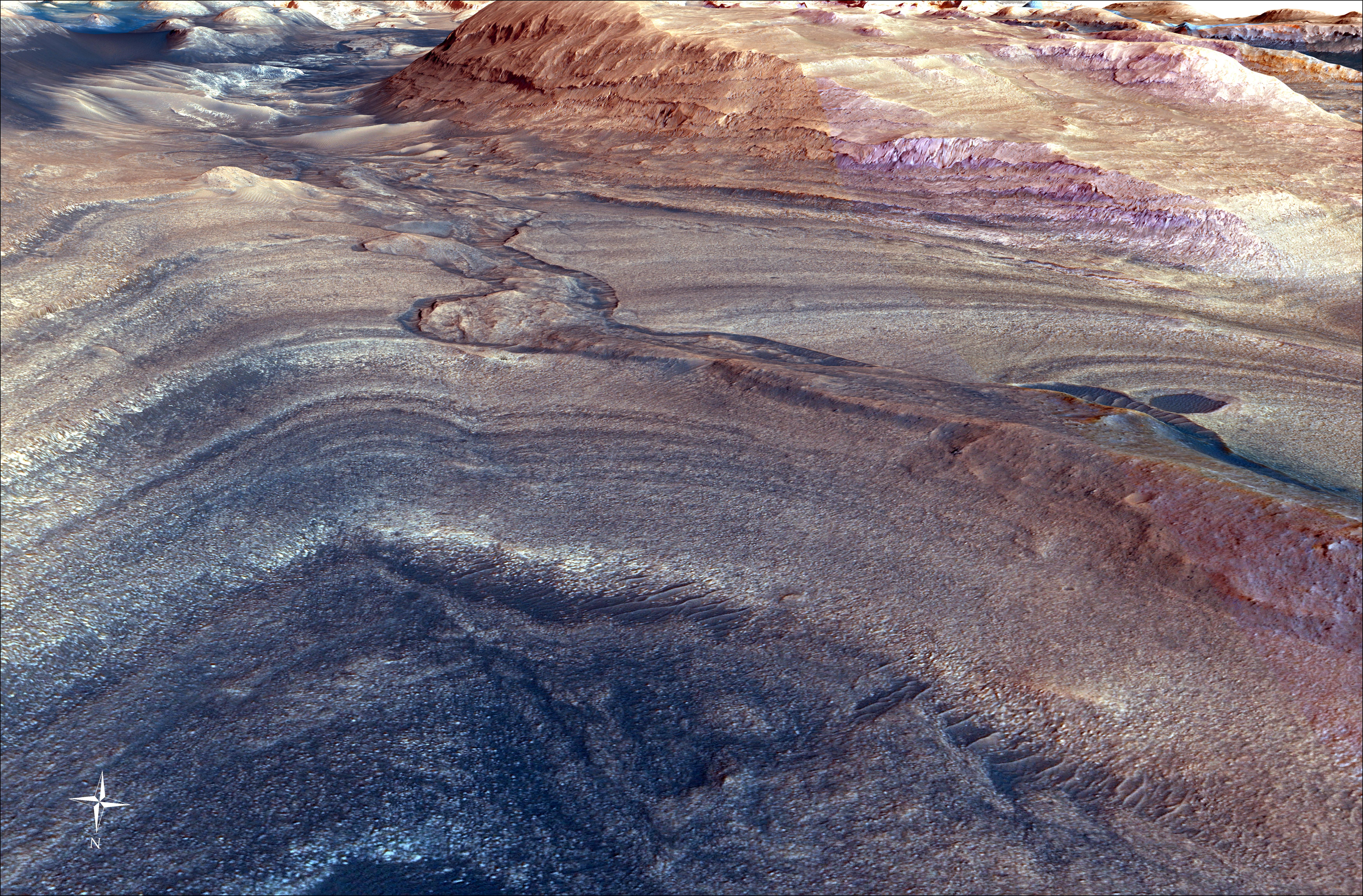
Figure AThis rendering shows the area where NASA's Curiosity Mars rover climbed a steep slope to reach a location called Gediz Vallis channel, which it began exploring for several months starting in February 2024. Imagery captured by the High-Resolution Imaging Experiment (HiRISE) camera on NASA's Mars Reconnaissance Orbiter, along with other instruments, were used to make the visualization.
Figure A is the same image with Curiosity's route indicated in yellow.
Since 2014, Curiosity has been ascending the foothills of Mount Sharp, which stands 3 miles (5 kilometers) above the floor of Gale Crater. The layers in this lower part of the mountain formed over millions of years under a changing Martian climate, providing scientists with a way to study how the presence of both water and the chemical ingredients required for life changed over time.
This image covers part of a region on Mount Sharp enriched in sulfates, salty minerals that often form as water evaporates. At the bottom of the image is the slope Curiosity climbed to get here, which includes alternating dark and light bands of sedimentary material that scientists are still puzzling over. Above those bands is the roughly 300-foot-wide (91-meter-wide) Gediz Vallis channel. The formation's sides are filled with dark sand while its center is filled with mounds of boulders and other debris. Scientists aren't entirely sure how the channel was formed; it could have been carved into the surrounding bedrock by an ancient river or debris flows (rapid, wet landslides). The debris currently filling the channel could have been carried down the channel as debris flows or in dry avalanches.
On the right side of the image, the mounds of debris form a large ridge that continues farther down Mount Sharp. The route in Figure A shows how Curiosity veered off to study the ridge up close.
Curiosity was built by NASA's Jet Propulsion Laboratory, which is managed by Caltech in Pasadena, California. JPL leads the mission on behalf of NASA's Science Mission Directorate in Washington.
For more about Curiosity, visit: http://mars.nasa.gov/msl

