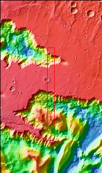
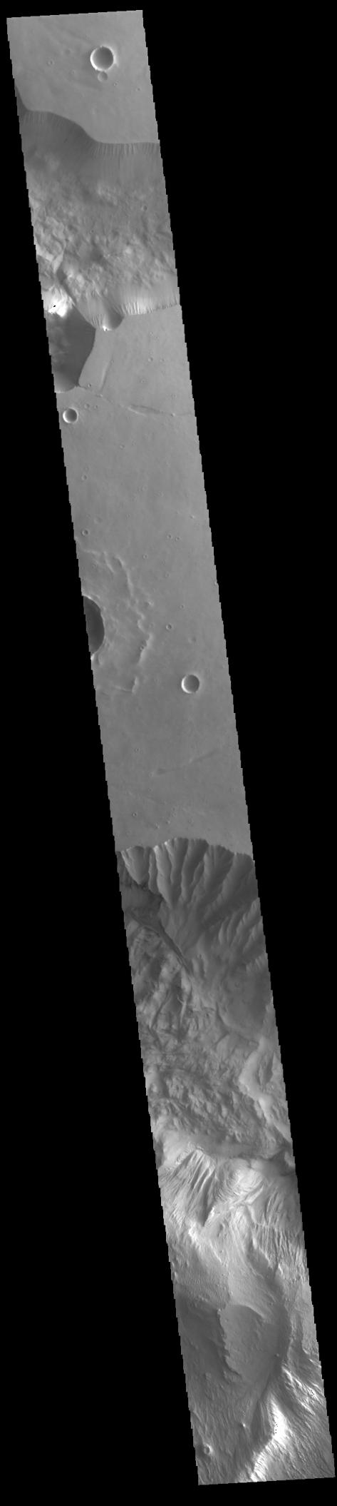
Context imageToday's VIS image shows part of two chasmatas – Hebes Chasma at the top of the image and Ophir Chasma at the bottom. Both chasmata have large landslide deposits. Ophir Chasma has a large layered deposit, which has subsequently been eroded by wind and fluvial processes (bottom of image). Hebes Chasma is an inclosed basin not connected to Valles Marineris. It is 319 km long (east/west, 198 miles), 130 km wide (north/south, 81miles) and up to 8km (5 miles) deep. Ophir Chasma is approximately 317km long (197 miles) and is part of the Valles Marineris system of canyons.
Orbit Number: 94365 Latitude: -2.67943 Longitude: 286.449 Instrument: VIS Captured: 2023-03-24 07:37
Please see the THEMIS Data Citation Note for details on crediting THEMIS images.
NASA's Jet Propulsion Laboratory manages the 2001 Mars Odyssey mission for NASA's Science Mission Directorate, Washington, D.C. The Thermal Emission Imaging System (THEMIS) was developed by Arizona State University, Tempe, in collaboration with Raytheon Santa Barbara Remote Sensing. The THEMIS investigation is led by Dr. Philip Christensen at Arizona State University. Lockheed Martin Astronautics, Denver, is the prime contractor for the Odyssey project, and developed and built the orbiter. Mission operations are conducted jointly from Lockheed Martin and from JPL, a division of the California Institute of Technology in Pasadena.