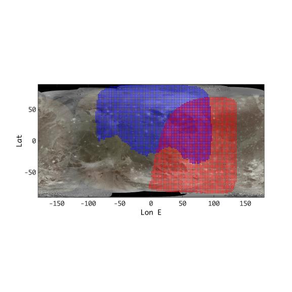
This annotated map of depicts the areas on the surface of Jupiter's moon Ganymede that were imaged by the Jovian Infrared Auroral Mapper (JIRAM) instrument aboard NASA's Juno spacecraft during two close approaches of the moon.
The region shaded in blue depicts the area JIRAM covered as Juno flew past at a distance of 62,000 miles (100,000 kilometers) on Dec. 26, 2019. The infrared camera took 40 images during the encounter. The region shaded in red illustrates JIRAM coverage during the July 20, 2021, flyby, when Juno came within 31,000 miles (50,000 kilometers) of Ganymede's surface and JIRAM took 14 infrared images.
The different observational geometry of the flybys provided an opportunity to see the north polar region for the first time as well as compare the diversity in composition between Ganymede's low and high latitudes.
JIRAM "sees" in infrared light not visible to the human eye, providing information on Ganymede's icy shell and the composition of the ocean of liquid water beneath. It was designed to capture the infrared light emerging from deep inside Jupiter, probing the weather layer down to 30 to 45 miles (50 to 70 kilometers) below Jupiter's cloud tops.
More information about Juno is at https://www.nasa.gov/juno and https://missionjuno.swri.edu.