Map Projected Browse Image
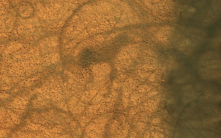
Click on image for larger versionDune fields in the high southern latitudes of Mars tell a mostly similar story during local summer. The dark dunes grow warmer than the surrounding bright plains because they absorb more sunlight.
Dust devils form over the warm dunes but then dance out over the plains, spinning and performing pirouettes and leaving conspicuous dark tracks as bright dust is lifted from the surface. Loops in the tracks can often be used to discern the direction traveled by the dust devils, where in some cases, one track clearly overprints the other.
The map is projected here at a scale of 25 centimeters (9.8 inches) per pixel. (The original image scale is 24.9 centimeters [9.8 inches] per pixel [with 1 x 1 binning]; objects on the order of 75 centimeters [29.5 inches] across are resolved.) North is up.
The University of Arizona, in Tucson, operates HiRISE, which was built by Ball Aerospace & Technologies Corp., in Boulder, Colorado. NASA's Jet Propulsion Laboratory, a division of Caltech in Pasadena, California, manages the Mars Reconnaissance Orbiter Project for NASA's Science Mission Directorate, Washington.
