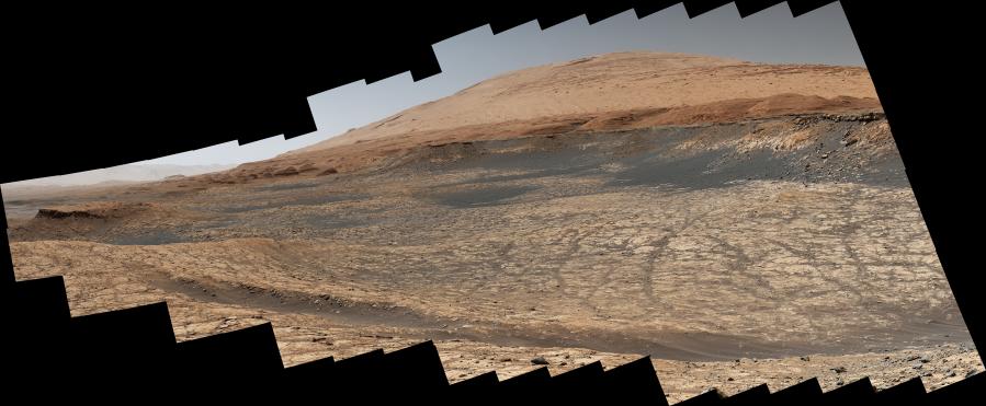
Stitched together from 116 images, this view captured by NASA's Curiosity Mars rover shows the path it will take in the summer of 2020 as it drives to the "sulfate-bearing unit," the next layer it will be investigating on the 3-mile-tall (5-kilometer-tall) Mount Sharp. Curiosity has to drive around a large sand patch in order to reach a place where it can ascend to the sulfate-rich region. The upper part of the mountain looms at the top image. The images were taken by the rover's Mast Camera, or Mastcam, on Jan. 10, 2020, the 2,641st Martian day, or sol, of the mission.
The panorama has been white-balanced so that the colors of the rock materials resemble how they would appear under daytime lighting conditions on Earth.
Malin Space Science Systems in San Diego built and operates Mastcam. A division of Caltech, NASA's Jet Propulsion Laboratory in Southern California built the Curiosity rover and manages the Mars Science Laboratory mission for the agency's Science Mission Directorate in Washington.
For more information about Curiosity, visit http://mars.jpl.nasa.gov/msl or https://www.nasa.gov/mission_pages/msl/index.html.