June 30, 2000
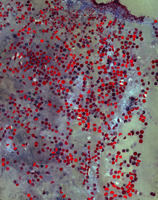
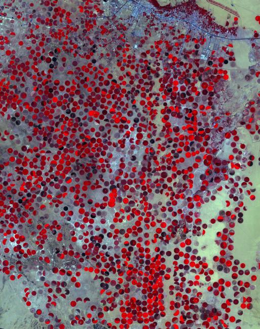
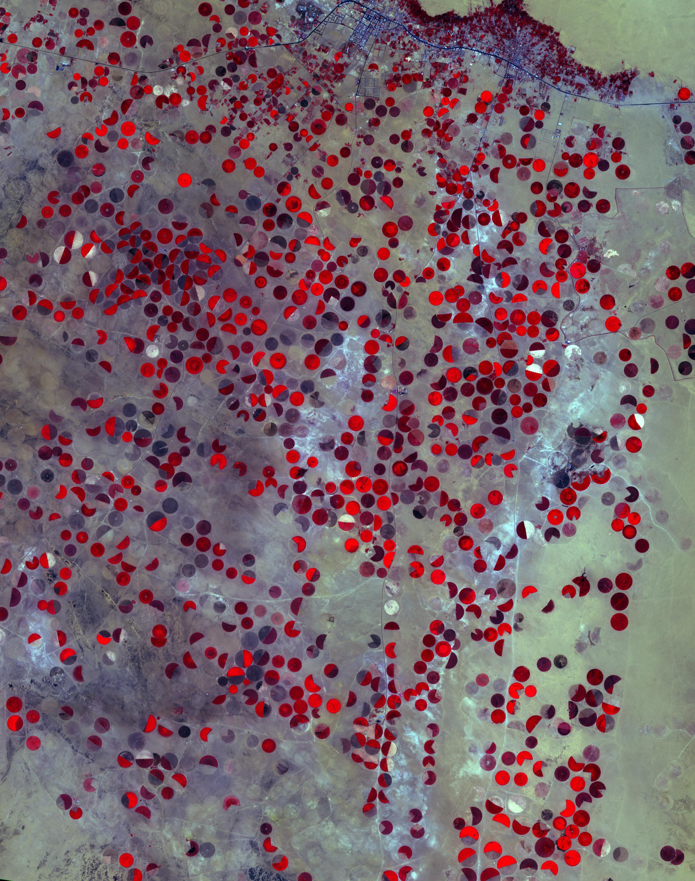
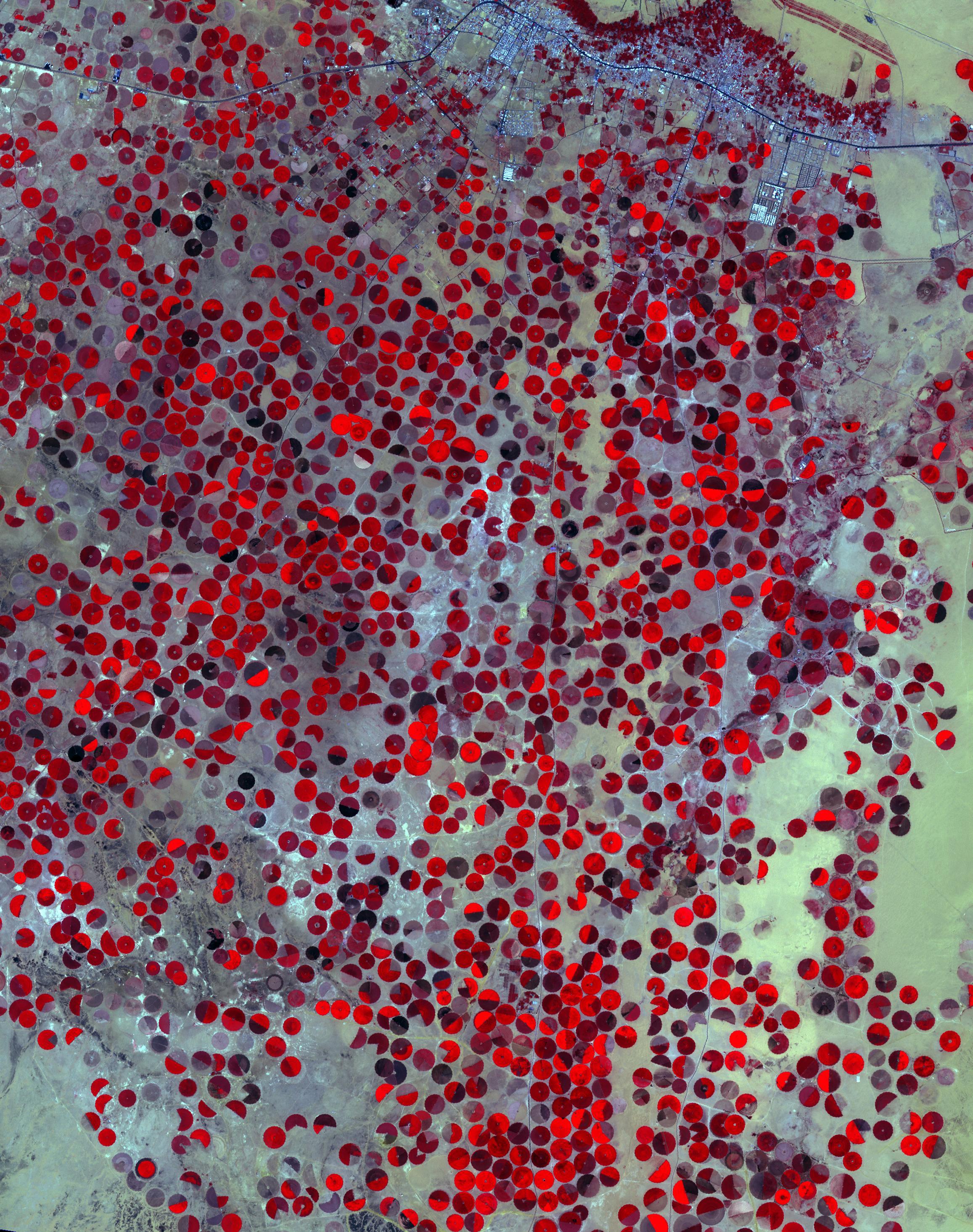
Click on the image for larger versionThe Wajid Aquifer in Saudi Arabia underlies about 450,000 square kilometers in Saudi Arabia and Yemen. The area around Wadi Al Dawasir, Saudi Arabia, relies on the aquifer to provide water for the extensive development of agriculture. As a result the water level in the aquifer system has dropped 6m/yr for the past 20 to 30 years. Heavy use of water has led to the exhaustion of the aquifer in some areas (Inventory of Shared Water Resources in Western Asia. DOI: https://dx.doi.org/10.18356/d8517580-en). The images were acquired June 30, 2000, and April 26, 2017, cover an area of 34.6 by 43.9 kilometers, and are located at 20.1 degrees north, 44.7 degrees east.
With its 14 spectral bands from the visible to the thermal infrared wavelength region and its high spatial resolution of about 50 to 300 feet (15 to 90 meters), ASTER images Earth to map and monitor the changing surface of our planet. ASTER is one of five Earth-observing instruments launched Dec. 18, 1999, on Terra. The instrument was built by Japan's Ministry of Economy, Trade and Industry. A joint U.S./Japan science team is responsible for validation and calibration of the instrument and data products.
The broad spectral coverage and high spectral resolution of ASTER provides scientists in numerous disciplines with critical information for surface mapping and monitoring of dynamic conditions and temporal change. Example applications are monitoring glacial advances and retreats; monitoring potentially active volcanoes; identifying crop stress; determining cloud morphology and physical properties; wetlands evaluation; thermal pollution monitoring; coral reef degradation; surface temperature mapping of soils and geology; and measuring surface heat balance.
The U.S. science team is located at NASA's Jet Propulsion Laboratory in Pasadena, Calif. The Terra mission is part of NASA's Science Mission Directorate, Washington.
More information about ASTER is available at http://asterweb.jpl.nasa.gov/.