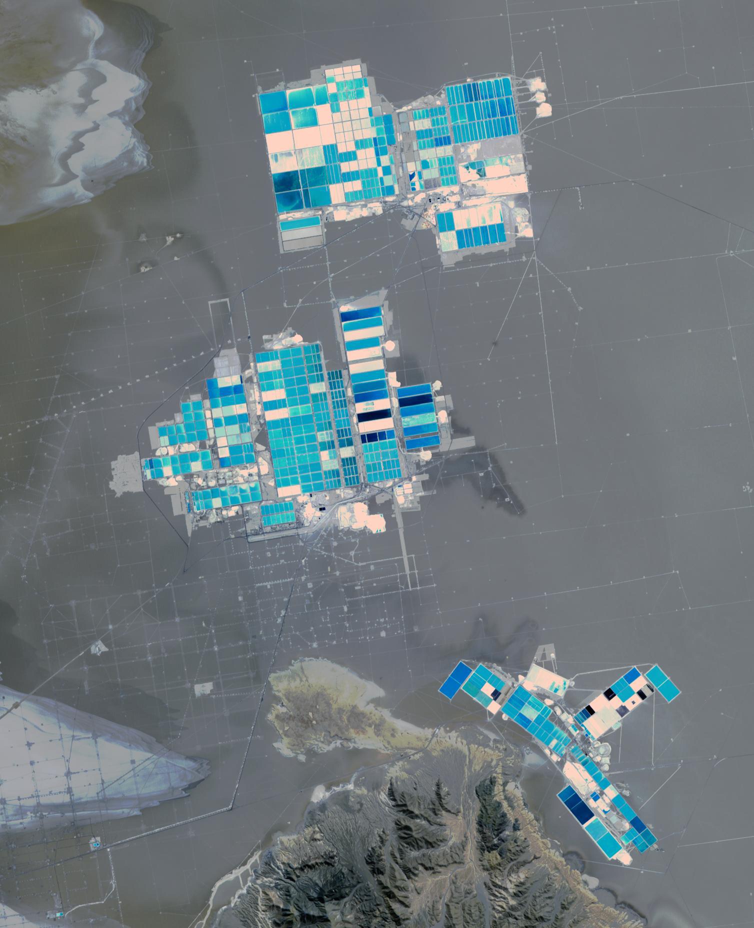
Salar de Atacama (Atacama salt flats) in Chile's Atacama Desert receives 2 mm rain per year. Its attraction are the brines 40 m below ground. They are pumped to the surface into large evaporation pans. After the water has vanished, a yellowish greasy solution is left behind that contains lithium. In fact, Salar de Atacama produces 27% of the world's annual supply. Mining lithium here is less expensive to produce than from neighboring Salar de Uyuni, which is estimated to have half of the lithium reserves in the world. The image was acquired August 21, 2017, covers an area of 22.5 by 27.8 km, and is located at 23.5 degrees south, 68.3 degrees west.
With its 14 spectral bands from the visible to the thermal infrared wavelength region and its high spatial resolution of about 50 to 300 feet (15 to 90 meters), ASTER images Earth to map and monitor the changing surface of our planet. ASTER is one of five Earth-observing instruments launched Dec. 18, 1999, on Terra. The instrument was built by Japan's Ministry of Economy, Trade and Industry. A joint U.S./Japan science team is responsible for validation and calibration of the instrument and data products.
The broad spectral coverage and high spectral resolution of ASTER provides scientists in numerous disciplines with critical information for surface mapping and monitoring of dynamic conditions and temporal change. Example applications are monitoring glacial advances and retreats; monitoring potentially active volcanoes; identifying crop stress; determining cloud morphology and physical properties; wetlands evaluation; thermal pollution monitoring; coral reef degradation; surface temperature mapping of soils and geology; and measuring surface heat balance.
The U.S. science team is located at NASA's Jet Propulsion Laboratory in Pasadena, Calif. The Terra mission is part of NASA's Science Mission Directorate, Washington.
More information about ASTER is available at http://asterweb.jpl.nasa.gov/.
