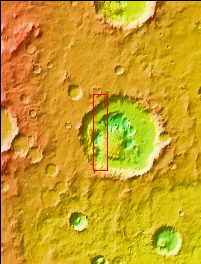
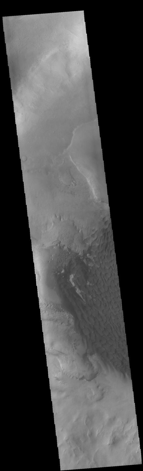
Context imageToday's VIS image shows part of the dune field on the floor and within the pits of Rabe Crater. This crater, and a handful of others in Noachis Terra, have unique floors. At some point after the initial formation of the crater there was an influx of fill material. The later erosion of this material formed a series of large, deep pits in the crater floor. The continued erosion of the floor fill as well as the influx of wind driven sand and dust particles provided the raw materials for the formation of the dunes. The prevailing winds blow from the lower right to the upper left of the image.
Orbit Number: 75307 Latitude: -43.5769 Longitude: 34.3041 Instrument: VIS Captured: 2018-12-06 01:11
Please see the THEMIS Data Citation Note for details on crediting THEMIS images.
NASA's Jet Propulsion Laboratory manages the 2001 Mars Odyssey mission for NASA's Science Mission Directorate, Washington, D.C. The Thermal Emission Imaging System (THEMIS) was developed by Arizona State University, Tempe, in collaboration with Raytheon Santa Barbara Remote Sensing. The THEMIS investigation is led by Dr. Philip Christensen at Arizona State University. Lockheed Martin Astronautics, Denver, is the prime contractor for the Odyssey project, and developed and built the orbiter. Mission operations are conducted jointly from Lockheed Martin and from JPL, a division of the California Institute of Technology in Pasadena.