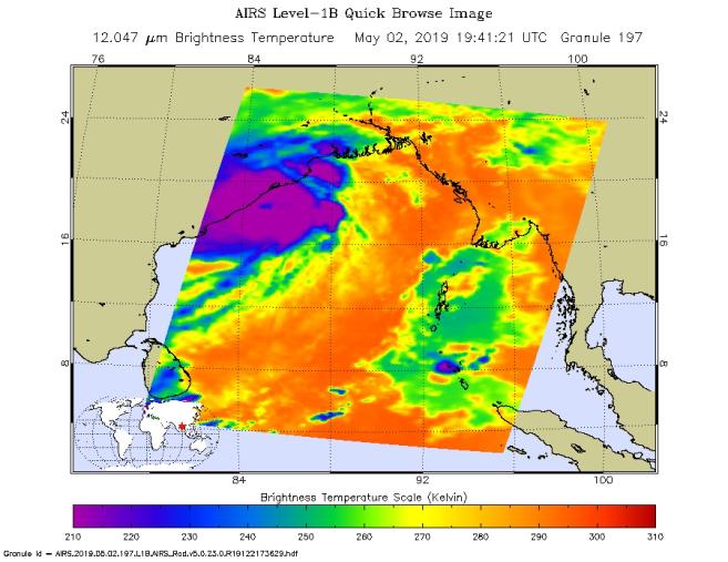
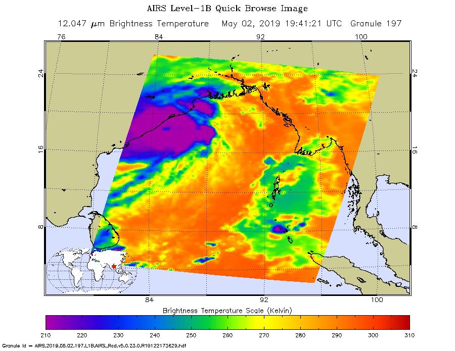
This image shows Tropical Cyclone Fani just off the east coast of India in the Bay of Bengal. NASA's Atmospheric Infrared Sounder (AIRS) collected the image at about 1 p.m. PDT (4 p.m. EDT) today, May 2. At the time, the cyclone's wind speeds were equivalent to a Category 4 hurricane, with maximum sustained winds of 155 mph (249 kph) and gusts of up to 190 mph (306 kph), according to the Joint Typhoon Warning Center. The cyclone is expected to make landfall on Friday, May 3.
AIRS, in conjunction with the Advanced Microwave Sounding Unit (AMSU), senses emitted infrared and microwave radiation from Earth to provide a 3D look at weather and climate.
The infrared image shows temperatures of the clouds or surface. The large purple area indicates very cold clouds carried high into the atmosphere by deep thunderstorms. Warmer areas, including the eye of the cyclone, are shown in blue. Shallower rain clouds appear green, while the orange areas represent mostly cloud-free air moving away from the storm.
Launched into orbit in 2002, the AIRS and AMSU instruments fly onboard NASA's Aqua spacecraft and are managed by the agency's Jet Propulsion Laboratory in Pasadena, California, under contract with NASA. JPL is a division of Caltech in Pasadena.
More information about AIRS can be found at https://airs.jpl.nasa.gov.