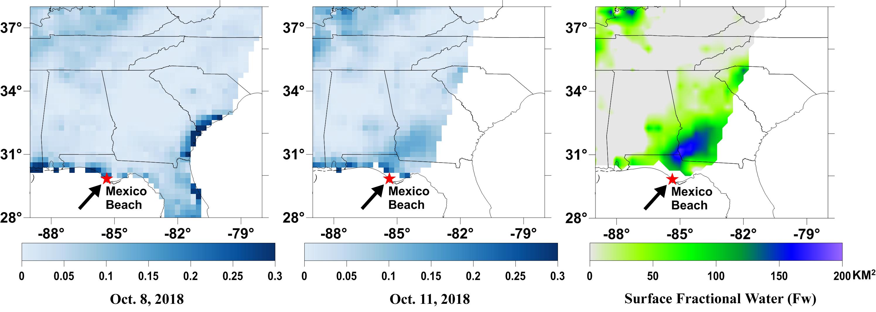
A new series of images generated with data from NASA's Soil Moisture Active Passive (SMAP) satellite reveal surface flooding from Hurricane Michael, which made landfall near Mexico Beach, FL on October 10, 2018. The sequence of images depicts successive satellite orbital swath observations showing surface water conditions on Oct. 8, before Michael's landfall, and then at 6:00 AM on Oct. 11 approximately 16 hours after Michael made landfall as a category 4 hurricane. The resulting increase in surface flooding from the initial 16-hours of intense rainfall depicts regionally heavy flooding as the storm system moved inland.
The SMAP surface fractional water (Fw) observation represents the spatial proportion of surface water cover within a 36-km resolution SMAP grid cell. SMAP's low-frequency (L-band) microwave radiometer features enhanced capabilities for detecting surface water changes in nearly all weather conditions and under low-to-moderate vegetation cover. The satellite provides global coverage with one to three-day repeat sampling, which is well suited for monitoring dynamic inland waters around the world. The SMAP Fw retrieval is aided by the use of overlapping higher frequency satellite microwave land parameter retrievals from the JAXA AMSR2 sensor, which are used to reduce potential influence of vegetation and soil moisture on the SMAP surface water signal.
SMAP is managed for NASA's Science Mission Directorate by NASA's Jet Propulsion Laboratory in Pasadena, California, and NASA's Goddard Space Flight Center in Greenbelt, Maryland. JPL is managed for NASA by Caltech. A consortium of researchers from other universities participate on the SMAP mission science team, including the Massachusetts Institute of Technology, Princeton University and the University of Montana, which provided the SMAP surface water imagery.
For more information about SMAP, visit http://smap.jpl.nasa.gov.
